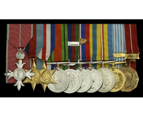

A Korean War M.B.E. group of ten awarded to Captain G. S. Blake, Royal Canadian Ordnance Corps The Most Excellent Order of the British Empire, M.B.E. (Military) Member’s 2nd type breast badge; 1939-45 Star; France and Germany Star; Defence Medal, Canadian issue in silver; Canadian Volunteer Service Medal, with overseas clasp; War Medal 1939-45, Canadian issue in silver, with M.I.D. oakleaf; Korea 1950-53, Canadian issue, silver (ZC 705 G. S. Blake); Canadian Volunteer Service Medal for Korea 1950-54; U.N. Korea 1950-54 (ZC 705 G. S. Blake); Canadian Forces Decoration, G.VI.R. (Capt. G. S. Blake), the silver awards all rhodium-plated, the others gilded, mounted court-style as worn, very fine (10) £300-£400 --- M.B.E. (Military) London Gazette 2 October 1953: ‘In recognition of gallant and distinguished services in Korea during the period 1st January to 30th June, 1953.’ M.I.D. London Gazette 9 March 1946. C.D. CAO 313 of 15 December 1952. Captain George Stewart Blake was a native of Ottawa and received his M.B.E. at an investiture given by Governor-General Vincent Massey at Government House on 26 January 1954. He died on 16 October 2006. Sold with original news cutting with group photograph of investiture, together with copied research and related cloth and metal uniform insignia.
We found 12130 price guide item(s) matching your search
There are 12130 lots that match your search criteria. Subscribe now to get instant access to the full price guide service.
Click here to subscribe- List
- Grid
-
12130 item(s)/page
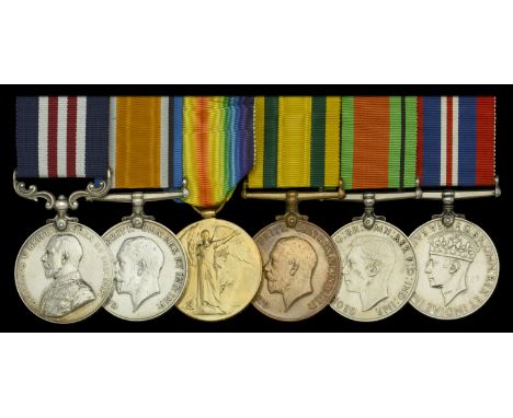
A Great War ‘St. Julien 1917’ M.M. group of six awarded to Sergeant H. O. Wilderspin, 2/4th (City of London) Battalion (Royal Fusiliers), London Regiment, who was later commissioned into the Yorkshire Regiment and served in the Second World War with the Royal Army Ordnance Corps Military Medal, G.V.R. (2955248 Sjt. H. O. Wilderspin. 2/4 Lond. R.); British War and Victory Medals (295248 Sjt. H. O. Wilderspin. 4-Lond. R.); Territorial Force War Medal 1914-19 (295248 Sjt. H. O. Wilderspin. 4-Lond. R.); Defence and War Medals 1939-45, very fine and better (6) £500-£700 --- M.M. London Gazette 12 December 1917. The original Recommendation, signed by Lieutenant-Colonel W. R. S. Dann, 2/4th Battalion, London Regiment, states: ‘Operations at St. Julien 20 September 1917. This N.C.O. was in charge of a Platoon, He was wounded whilst on the Assembly tapes, but carried on and moved forward, leading his Platoon. He was again wounded but still pushed on, consolidating a position over the ridge beyond Winnipeg Farm, during which operation he was wounded a third time. The wonderful courage and endurance displayed by this N.C.O. inspired all ranks.’ Harry Oliver Wilderspin attested for the 4h Battalion, London Regiment, and served with them during the Great War on the Western Front, before being commissioned Second Lieutenant in the 5th Battalion, Yorkshire Regiment, on 4 February 1919. Relinquishing his commission, he was re-commissioned Second Lieutenant in the East Yorkshire Regiment on 16 July 1940, and transferred to the Royal Army Ordnance Corps, to be War Substantive Lieutenant (Administration Branch) on 18 August 1941. Sold with original carbon copy regimental recommendation for the award of the M.M., this fragile with tear to fold and old sticky tape stain, and a rare surviving fighting citation for the award of the Military Medal during the Great War.
Regimental Prize Medals (33), Machine Gun Corps; Royal Army Medical Corps (3); Royal Army Service Corps (4); Royal Army Ordnance Corps (11); Corps of Royal Electrical and Mechanical Engineers (2); Royal Corps of Signals (4); Royal Army Pay Corps (4); Army Education Corps; 191st Division; Skill At Arms (2), silver, some with enamelling, some missing suspension rings, generally very fine (33) £80-£100
Four: Acting Warrant Officer First Class C. Gibson, Royal Army Ordnance Corps 1914-15 Star (01328 2.Cpl. C. Gibson. A.O.C.); British War and Victory Medals, with M.I.D. oak leaves (01328 A.W.O. Cl.1. C. Gibson. A.O.C.); Army Meritorious Service Medal, G.V.R., 1st issue (01328 T.Sub-Condr: C. Gibson. A.O.C.) nearly extremely fine (4) £160-£200 --- M.S.M. London Gazette 17 June 1918: ‘In recognition of valuable services rendered with the Forces in France during the present war.’ M.I.D. London Gazette 29 May 1917. Charles Gibson, a native of Ashington, Northumberland, served with the Army Ordnance Corps on the Western Front and was Mentioned in Sir Douglas Haig’s Despatch of 15 May 1917 whilst serving as Acting Sub Conductor.
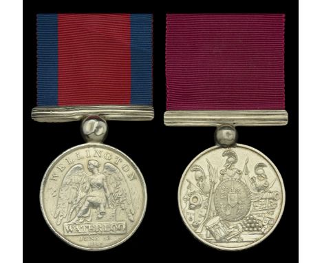
A Waterloo and William IV L.S. & G.C. pair awarded to Repository Sergeant James Millar, Royal Foot Artillery Waterloo 1815 (James Mill.r, Bombadier (sic) Royal Foot Artillery) originally named ‘Miller’ and ‘E’ now scratched out; Army L.S. & G.C., W.IV.R. (J. Millar, Reposit. Serjt. Royal Artillery. 1835.) both with contemporary replacement large silver ball and bar suspension, the first with edge bruising and contact wear, fine, the second nearly very fine (2) £1,600-£2,000 --- L.S. & G.C. medal sent to Ordnance 12 May 1835. James Millar/Miller was born in the Parish of Woolwich, Kent, and attested for the Royal Artillery at Greenwich on 29 September 1803, at just 10 years of age, and served as a Drummer Boy until 1 November 1808, when he was appointed a Gunner and Driver. He reached the age of 18 on 1 July 1811, and was promoted to Bombardier & Corporal on 1 January 1814, later to Sergeant on 1 December 1824. He served abroad in the expedition to Hanover in 1805, and in the expedition to Holland in 1815, and was present at the battle of Waterloo where he served in the detachment of Captain Ibert’s Company (Miller on Royal Mint roll). He was finally discharged from the 5th Battalion R.A. at Woolwich on 13 January 1835, in consequence of chronic rheumatism and indigestion, his conduct ‘exemplary’. ‘Produces written testimonials from Colonel Williamson, C.B. (under whom he has been employed in the Royal Military Repository for the last eight years) and Captain Maule, both describing him as a most excellent Drill Sergeant, and in every way as a most efficient Non Comd. Officer.’ Sold with copied discharge papers.

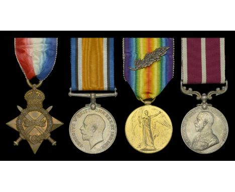
An extremely rare ‘Northern Kurdistan’ group of six awarded to Major Duncan Brown, Royal Field Artillery 1914-15 Star (2. Lieut. D. Brown. R.F.A.); British War and Victory Medals, with M.I.D. oak leaves (Major D. Brown.); General Service 1918-62, 2 clasps, Iraq, Northern Kurdistan (Lieut. D. Brown.); Iraq, Kingdom, Order of the Two Rivers, Fourth Class breast badge, Military Division, silver-gilt and enamels, with rosette on ribbon, complete but badge detached from suspension ring; Iraq Active Service Medal, 1 clasp ‘Barzan 1932’, mounted as worn, minor enamel chips to the Iraqi Order, otherwise nearly extremely fine (6) £900-£1,200 --- M.I.D. London Gazette 23 December 1918 (Major, 211th (East Lancashire) Brigade, R.F.A.). Iraq, Order of the Two Rivers, 4th Class (Military) London Gazette 20 January 1933 (Captain Duncan Brown, Royal Army Ordnance Corps). Duncan Brown was one of 5 sons of Colonel O. Brown, Chief Inspector of Ordnance Machinery, R.A. Second Lieutenant Duncan Brown served with 21st A.A. Battery R.F.A., B.E.F. from September 1915 to October 1916. His Medal Index Card confirms 1914-15 Trio, G.S.M. for Iraq and clasp for ‘Northern Kurdistan’, and ‘Iraq Active Service Medal for operations against Sheik Ahmed of Barzan 1932’.
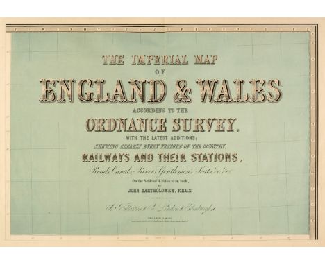
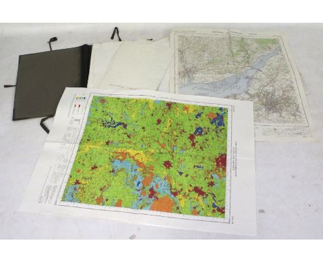
England & Wales. Lewis (Samuel), A Map of England & Wales Divided into Counties, Parliamentary Divisions and Dioceses, Shewing the Principal Roads, Railways, Rivers & Canals and the Seats of the Nobility and Gentry, with the distance of each town from the General Post Office London..., published S. Lewis & Co., 1841, large map engraved by J. Dower with contemporary outline colouring, sectionalised and laid on linen, in four parts (as published), inset map of the Scilly Isles, calligraphic cartouche, compass rose, table of explanation and large uncoloured engraved vignette of the Post Office in London, slight spotting and offsetting, each sheet approx. 1050 x 850 mm, each section bound in contemporary morocco gilt, worn and frayed, size when folded 225 x 145 mm, together with Cary (John). [Cary's New Map of England and Wales with part of Scotland on which are carefully laid down all the Direct and Principal Cross Roads, the Course of the Rivers and Navigable Canals..., 1794], lacking title, but retaining dedication and the general map of England & Wales with contemporary hand colouring, table of explanation, 77 engraved maps with contemporary outline colouring (numbered to 81), tipped in printed addendum of the 'Measured Distances in the Neighbourhood of Plumpton', slight offsetting and dust soiling, 'list of places' and subscriber's list bound at rear, first few leaves detached, some splitting and cracking along the gutter, slight dust soiling and spotting throughout, contemporary half calf, spine partially lacking, upper board detached, heavily rubbed and worn, 4to, with Bartholomew (John). The Imperial Map of England & Wales According to the Ordnance Survey, with the Latest Additions; Shewing clearly every Feature of the Country, Railways and their Stations, Roads, Canals, Rivers, Gentlemen's Seats &c. &c., On a Scale of 4 Miles to an Inch, A. Fullarton & Co., [1866], index and a double-page calligraphic title, sixteen double-page colour lithographic maps, sheet 16 divided into three separate maps, text block detached, contemporary half calf gilt, boards detached, lacking spine, slim folio, plus Bell (James). A New and Comprehensive Gazetteer of England and Wales..., 8 volumes, A. Fullarton & Co. 1837, frontispiece of an 'Extracts of Reviews', title pages with dated contemporary ownership signature to each volume, folding engraved map of England & Wales with contemporary wash colouring and 44 uncoloured engraved county maps by Archibald Fullarton, some spotting throughout, some hinges and joints partially split, publishers green cloth with contrasting paper labels to the spines, bumped, faded and worn, 8vo, together with Cox [Thomas]. Magna Britannia et Hibernia Antiqua & Nova..., volume 3 only, 1724, title page and 3 only (Middlesex, Northamptonshire & Northumberland, lacking Norfolk)) uncoloured engraved folding maps by Robert Morden, each with a triangular mileage table, bookplates of John Basil Tolhurst to the front pastedown and of Prinknash Abbey to the front blank, contemporary vellum with manuscript title to the spine, 8vo, with Capper (Benjamin Pitts). A Topographical Dictionary of the United Kingdom..., Sir Richard Phillips and Co. 1829, frontispiece of an uncoloured engraved folding map of the British Isles, title page, introduction and index, 43 uncoloured engraved maps, preliminaries detached, contemporary quarter sheep, lacking spine, upper board detached rear board near detached, heavily rubbed and worn, 8voQTY: (16)
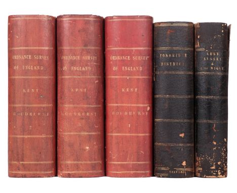
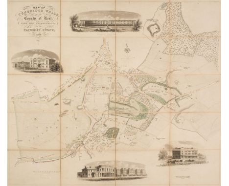
South East England. Ordnance Survey (publishers), on a scale of 1 inch to the mile, 1885, including East Sussex and West Sussex. Two untitled maps, Edward Stanford, 1885, engraved maps with contemporary outline colouring, sectionalised and laid on linen, on two sheets, each sheet approximately 920 x 1360 mm, marbled endpapers, together with Isle of Wight. Edward Stanford, 1885, engraved map with contemporary outline colouring, sectionalised and laid on linen, slight offsetting, 695 x 970 mm, marbled endpapers, with East Kent & West Kent. Two untitled maps, Edward Stanford, 1885, engraved maps with contemporary outline colouring, sectionalised and laid on linen, on two sheets, each sheet approximately 1045 mm, all contained within a contemporary morocco gilt book box, the box heavily worn and frayed, plus Environs of Tunbridge Wells. Ordnance Survey (publishers), on a scale of 25 inches to the mile, Edward Stanford, 1883, seven zincographic maps, coloured in outline, sectionalised and laid on linen, each sheet approximately 690 x 1000 mm, marbled endpapers, all contained within a contemporary morocco gilt book box, the box heavily worn and frayed (the two book boxes are uniform), and Kent. Ordnance Survey (publishers) on a scale of 25 inches to the mile, Thomas Letts, circa 1870, seventeen zincographic maps, coloured in outline, sectionalised and laid on linen, each sheet approximately 680 x 1020 mm, contained in three red half morocco gilt book boxes with marbled sidings and edges, each with 'hook & eye' clasps, one box with the upper board broken with loss QTY: (5)
Folding Maps. A collection of twenty-one British & foreign maps, 18th & 19th century, British county maps, regions and foreign countries, including examples by or after Henshall, Smith, Dix, Ordnance Survey, Wallis, Faden, Cruchley, Cary, Bowles and Stanford, various sizes and conditionQTY: (21)
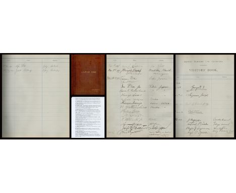
King George V and Japanese Military signed Alfred Herbert Ltd, Coventry Visitors Book. Leather bound. 10¾ wide x 12½ tall x 1 thick. Royal signatures. Important Japanese signatures. Research carried out by Trevor Baker on 5 May 2021. 22 Jul 1915. George V. 1 Sep 1915. Seymour Joseph. This is probably Seymour Percy Joseph, b. 31 Mar 1877 (Birmingham), who was a 2nd Lt in the Royal Flying Corps. 7 Jun 1916. George Loveden William Henry Parker, 7th Earl of Macclesfield. Born 24 May 1888; g s of 6th Earl, and o c of Viscount Parker (d 1895) and Carine Agnes (d 1919), d of late Pryse Loveden, Gogerddan, Cardigan (she m 2nd, 1897, Capt. L. W. Matthews, 5th Dragoon Guards); m 1909, Lilian Joanna Vere (d 1974), d of Major Charles Boyle, The Priory, Great Milton, Oxon; two s; died 20 Sept. 1975. Lord Lieutenant of County of Oxford, 1954 63. 29 Jun 1916. G Whitehouse. This is probably George Whitehouse. 1 Feb 1917. Japanese military officers: Colonel Junshiro Nagano. Osaka Arsenal. Colonel Kijir? Nambu, Tokyo Arsenal. Major Koichi Suzumura, War Office. Major O Ogawa, Army Ordnance Dept, Tokyo. Major Ohno. War Office. 2 Mar 1917. James Broughton Dugdale. Wroxall Abbey, Warwick. Born 19 Sept. 1855; e s of late James Dugdale, of Wroxall, and Mary Louisa, d of John Plummer; m 1878, Laura Jane, e d of J. T. Arkwright, of Hatton House, Co. Warwick; died 15 Jan. 1927. JP, DL. Harrow; Trinity College, Oxford. Captain and Hon. Major late Warwickshire Yeomanry Cavalry; Alderman Warwickshire County Council; High Sheriff Warwickshire, 1907. 3 Jan 1922. Japanese Trade Mission. Most signatures identified. Good condition. Good condition. All autographs are genuine hand signed and come with a Certificate of Authenticity. We combine postage on multiple winning lots and can ship worldwide. UK postage from £5.99, EU from £7.99, Rest of World from £10.
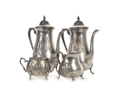
SADDAM HUSSEIN INTEREST (IRAQI, 1937–2006), SILVER PLATED FOUR-PIECE COFFEE SERVICE, CIRCA 1990-2004 comprising two coffee pots, a sugar bowl and cream jug, each piece engraved and embossed with scroll and foliate decoration, with scroll handle, on four bracket feet, stamped Persian marks to baseProvenance: Formerly the property of George Willmer, a highly esteemened Explosive Ordnance Disposal consultant (land and sea), who was employed in many locations throughout the world, including Iraq. His work in Iraq would involve assisting the US Military to secure Saddam Hussein's palace. These were recovered from Hussein's palace. Additional images now available.
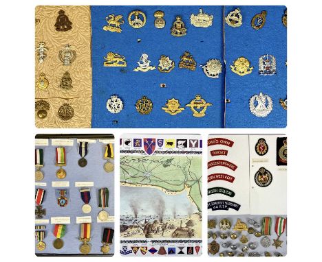
BRITISH MILITARY & OTHER WAR MEDALS, REGIMENTAL CAP BADGES, TUNIC BUTTONS AND ASSOCIATED ITEMS COLLECTION, lot includes an unnamed group of three British WWII medals comprising 1939-1945 Defence medal, Victory medal and Italy star, other medals include a believed copy of a German iron cross (non magnetic), Russian Chernobyl Nuclear Station Disaster, 50th Anniversary Independence Pakistan, Pakistan Nuclear Test medal and other Pakistan medals, cap badges include East Lancashire, South Staffordshire, RAF, Army Ordnance and various others, buttons include military and others including Flintshire Constabulary, GWR, some blank display boards and a 1994 50th Anniversary of the D-Day landings poster ETC Provenance: private collection Conwy
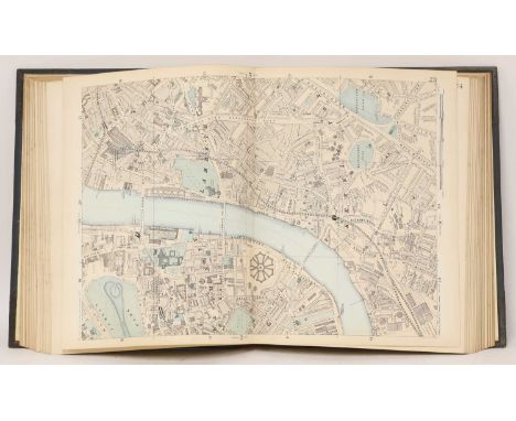
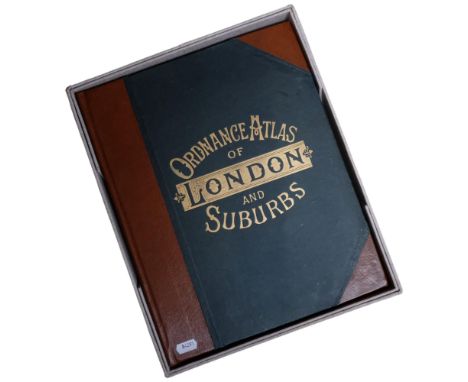
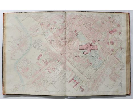
LONDON ATLAS: BACON, George: New Large-Scale Ordnance Atlas of London & Suburbs with Supplementary Maps..., No date, C.1888. Large 4to/Folio. With two index maps (one for nine-inch scale and the other four-inch scale maps), 34 double-page maps at nine-inch scale, 25 double-page maps at four-inch scale, four double-page maps of the environs of London, and 10 further supplementary maps, lithographs with some hand-colouring, In all 75 maps. Original pictorial half leather gilt and all edges gilt. Covers rubbed; otherwise Very Good.From the Paul Bentley collection of maps and atlases.
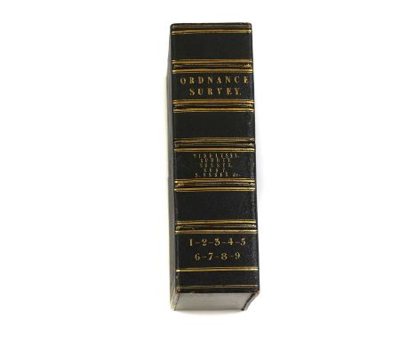
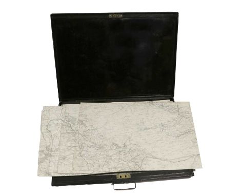
MAPS: Ordnance Survey Maps: 1- # 41 (4 sheets), 42 (4 sheets), & 57 (3 sheets), all linen backed, folding, with grey paper ends, and housed in one slipcase with leather label; 2- # 56 (4 sheets) & 59 (2 sheets), all linen backed, folding, with grey paper ends, and housed in one slipcase with leather label; 3- Two full sheets Nos. 42 & 43, Electrotyped 1878. Linen backed, folding into marbled paper ends, each: 102 x 68 cm (4)From the Paul Bentley collection of maps and atlases.
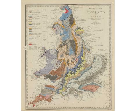
MAPS: BARTHOLOMEW, J: The Imperial Map of England & Wales, according to the ordnance survey with the latest additions, shewing clearly every feature of roads, canals, rivers, gentlemen's seats, & c. Scale 4 miles to an inch, published by A Fullarton & Co, No date. 18 sections, 1-15 measuring 74 x 54 cm, and 16 a,b,&c 74 x 27 cm. Hand coloured, linen backed and folding; plus a folded index sheet (tears to folds). Housed in the original slipcase, rubbed and with tears. The map is clean; Blofeld & Co: Map of Great Britain, with "Continuation of Scotland". Hand coloured, linen backed & folding, with cloth ends and matching slipcase, (120 x 92 cm); MALBY'S Map of the stars visible in Great Britain and Ireland, reduced to the year 1850, compiled from the globes under superintendence of Diffusion of Useful knowledge. Hand coloured, linen backed and folding into the original fold-around boards, spine of covers torn (49 x 48 cm); SDUK MAP: Geological Map of England and Wales. Chapman & Hall, 1843 (40 x 34 cm). (4)From the Paul Bentley collection of maps and atlases.
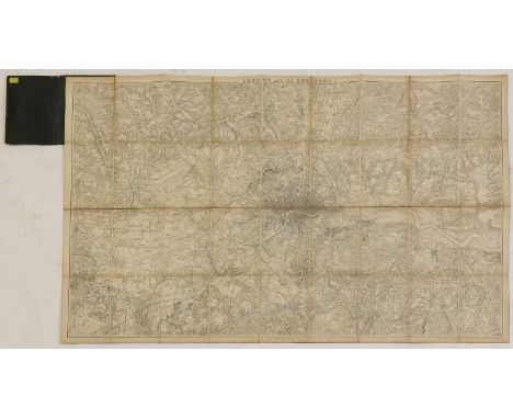
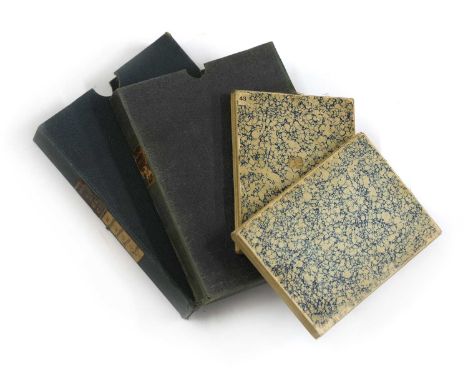
MAPS: Ordnance Survey Map of London & its environs, 1861. Linen backed and folding into cloth covers (114 x 68 cm); Two Ordnance survey maps: 1- #57, Tiegaron, electrotyped 1864 (96 x 60 cm); 2- North West sheet, electrotyped, 1853 (96 x 60 cm), both in one slipcase. (3)From the Paul Bentley collection of maps and atlases.

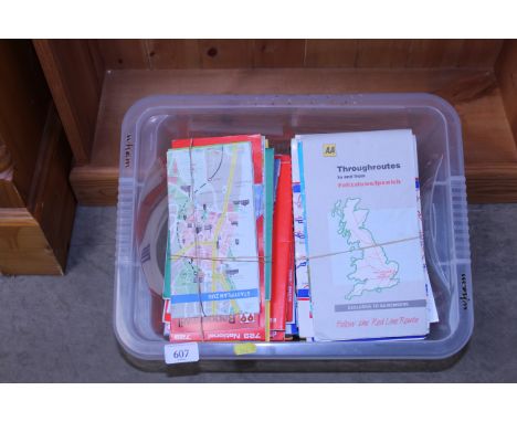


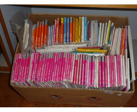
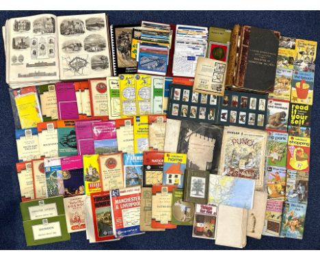
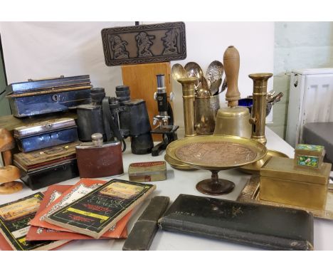
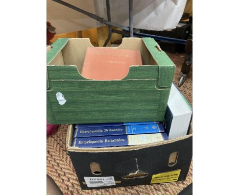
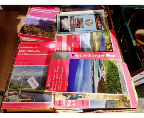
FOUR BOXES AND LOOSE MISCELLANEOUS SUNDRIES, to include two metal cash/deed boxes, two vintage brown suitcases, twelve volumes of Harmsworth's Universal Encyclopaedia, a brass candle snuffer, a collection of vintage ordnance survey maps, 1920's and 1960's, a modern desk globe, vintage tobacco and biscuit tins, two university cap and gowns, etc. (s.d) (4 boxes + loose)
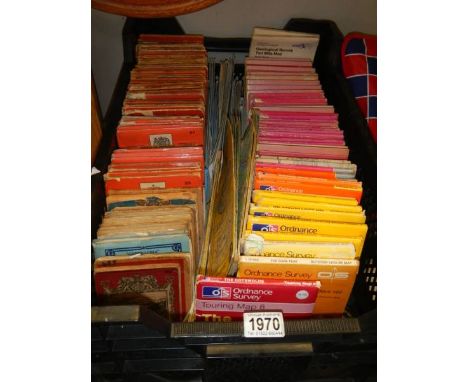
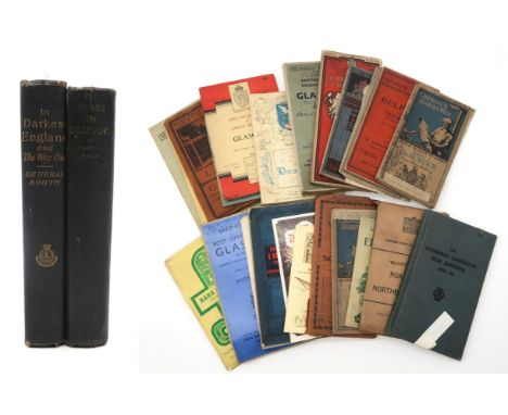
Dodd, Martha My Years in Germany Victor Gollancz Ltd., London, 1939, 1st edition, 8th impression Booth, General William In darkest England and the Way Out International Headquarters of the Salvation Army, London, 1890 Together with a collection of assorted Ordnance Survey and Bartholomew's pocket maps (Scotland and Northern Ireland), an Automobile Association Irish Handbook 1938-39 etc. Condition Report:Available upon request
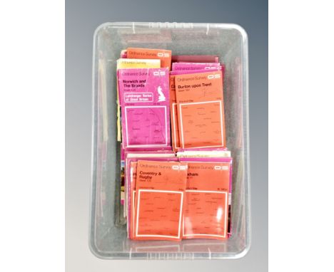
THREE BOXES OF BOOKS, MAPS & A TYPEWRITER, containing over ninety miscellaneous book titles in hardback and paperback formats, subjects include bibles, Guiness Book of Records, a Repair Manual, health, photography, book-keeping, and classic or contemporary novels, a small selection of ordnance survey maps and an Adler typewriter (3 boxes+ loose)
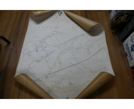
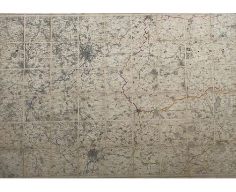
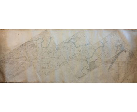
Ordnance Survey of Yorkshire.The County of Yorkshire on forty-five numbered sheets.Each sheet 303mm x 455mm, card backed, no scales, titles or borders present to allow larger maps to be composed. Complete with large folding index map titled ‘…Combined Index shewing Civil Parishes and the Ordnance Survey Maps of the North Riding of Yorkshire, 1 inch, 3 inch and 25 inch scales, resurveyed 1888-93 … published 1897’. This linen-backed index map has been neatly extended to cover the whole of Yorkshire and all 45 maps are shown. Clean maps preserved in metal case.
Skaife (Robert H.). Plan of the Roman, Mediaeval & Modern York. York: John Sampson, 1864, hand-coloured, linen-backed folding map, lithographed by Day & Son, 730mm x 950mm, nine sections, linen splitting at folds, roan gilt boards (worn and detached); Ordnance Survey, Ordnance Survey of York. Southampton: 1852, twenty-one large hand-coloured double-page sheets, 666mm x 980mm, dust marked, worn half calf. (2) [Hugh Murray Collection]
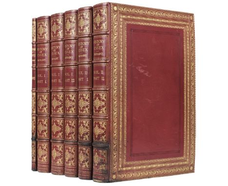
Morant (Philip). The History and Antiquities of the County of Essex, 2 volumes, (incorporating the second edition of The History and Antiquities of the most ancient Town and Borough of Colchester), London: T. Osborne et al., 1768, EXTRA ILLUSTRATED AND EXTENDED TO 5 VOLUMES, plus a Manuscript Index, 1908, the contents mounted on large paper, the whole being lavishly extended with hundreds of extra illustrations of varying sizes, containing approximately 36 maps, some coloured, including examples by or after Christopher Saxton, Johannes Blaeu, Jan Jannson, John Chapman and Peter Andre, Philip Lea, Thomas Dix, Ordnance Survey, Richard Blome and Robert Morden, plus approximately 20 watercolours and drawings and 750 prints including portraits and views, coloured aquatints by Havell and Merigot, other coloured plates by Alken and Daniell, mezzotints by J. Smith, C. Turner, J. Faber and McArdell, lithographs, stipple etchings, line engravings, india proofs, woodcuts, facsimiles, etc., the five text volumes with additional printed title-pages for this unique copy dated 1908, the manuscript Index volume comprising 24 leaves (plus 18 blank), completed alphabetically in a very neat hand on rectos only, burgundy morocco gilt bookplate of W. A. Foyle, Beeleigh Abbey to all front pastedowns, early 20th-century red crushed levant full morocco gilt by Morrell, inner dentelles gilt, wide and richly roll-tooled panels in gold and blind, gilt-decorated spines with raised bands, Index volume bound in red crushed levant half morocco gilt to match, all with some slight rubbing and a few scuff marks, some darkening from old scorch marks to lowest raised bands and foot of spines and board edges, a little wear and some strengthening to tailcaps, folio (560 x 385 mm)QTY: (6)NOTE:Provenance: W. A. Foyle, Beeleigh Abbey (bookplates).A truly sumptuous and very handsome imperial folio set of this major county history. The contents are largely in very clean and good condition and the whole has been assembled with fastidious care. Sadly, there is no evidence as to who it was done by or who owned it before William Foyle.The maps include those by Christopher Saxton, Johannes Blaeu, Jan Jannson, Emanuel Bowen (7), John Norden and W. Kip, C & J Greenwood, Philip Lea, John Rocque, Henry Overton, Robert Morden, Richard Blome, Thomas Kitchin, John Cary, James Pigot, J. Roper and Thomas Dix, plus a large-scale 25-sheet map by John Chapman & Peter Andre (220 x 285 cm), and a 4-sheet county map by Colonel Mudge (OS maps), and a large-scale county map by C. & J. Greenwood.There are watercolour views of Woodford by W. H. Bartlett, 1832, (330 x 495 mm); St Botolph's Priory by G. F. Phillips, 1807; Mr Trott's Farm near Romford by J. C. Nattes; Great Canfield by A. Barfield, 1844; large sepia wash drawing of Nether Hall [by Laporte]; large plan of Colchester Barracks by J. Parkyns, 1806; unsigned views of Waltham Abbey, Tilty Abbey, Thaxted (pencil), Southend (2), South Bemfleet (sepia), House of Mrs Masson at Hornchurch; plus portraits of Lady Anne Lucas by T. Athow, Thomas Littleton and Sir Thomas Hervey (fine copy).Among the numerous portraits are approximately 14 mezzotints of Oliver Cromwell (trimmed to oval), George Capel, Earl of Essex, James I, Duke of Albemarle, Admiral Sir George Pocock, Samuel Bosanquet (relined; not in Index), Bishop Compton, Lady Fairfax (small), John Knight and family, Thomas Wood, Edward Bright, Henry Vane, John Morley and Thomas Lane.
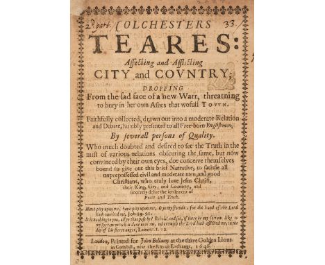
Essex. Colchesters Teares: Affecting and Afflicting City and Country; Dropping from the sad face of a new Warr, threatning to bury in her own Ashes that wofull Town. Faithfully collected, drawn out into a moderate Relation and Debate, humbly presented to all Free-born Englishmen by severall persons of Quality. Who much doubted and desired to see the Truth in the mist of various relations obscuring the same, but now convinced by their own eyes, doe conceive themselves bound to give out this brief Narrative, to satisfie all unprepossessed civil and moderate men, and good Christians, who truly love Jesus Christ, their King, city, and Countrey, and sincerely desire the settlement of Peace and Truth, London: John Bellamy, 1648, [1], 15 pp., title-page with tissue repair at head of gutter margin, page number to verso of A1 slightly shaved, some browning and scattered spotting, together with:[Rushworth, John]. A Letter sent to the Honorable William Lenthal Esq; Speaker of the Honorable House of Commons, of the late Fight at Colchester, and, how the Suburbs of the said Town were fired by the Lord Goring, Lord Capel, Sir Charls [sic] Lucas, and the rest of the Enemy. Printed by the Command of the Honorable William Lenthal Esq; Speaker of the Honorable House of Commons, London: Printer for Edward Husband, printer to the Honorable House of Commons, July 17. 1648, 7, [1] pp., ornamental border to title, page number '3' to upper margin of A2 slightly shaved, slight spotting, plusS. (T.). A True and Exact Relation of the taking of Colchester, sent in a Letter from an Officer of the Army, (who was present during the siege in that service) to a Member of the House of Commons. With a List of the Ordnance, Arms, and of 3076. private souldiers there taken…, London: Printed by Robert White for John Partrige, 1648, [2], 6 pp., ornamental border to title, upper margin of A2 slightly shaved at head lightly toughing few words to first line on verso of leaf, slight toning and minor spotting, all volumes with top edges gilt, burgundy morocco gilt bookplates of W. A. Foyle, Beeleigh Abbey to front pastedowns, 20th-century maroon half morocco by Sangorski & Sutcliffe, slim 4toQTY: (3)NOTE:Provenance: W. A. Foyle, Beeleigh Abbey (bookplate to each).1. ESTC R205022; Thomason, E.455[16]; Wing C5018.A plea for the townspeople of Colchester from a Royalist position. In 1648 Colchester underwent a long and bitterly contested siege by the parliamentary forces under Fairfax and was punished by Parliament for its occupation by the Royalists, probably against the citizens’ wishes.2. ESTC R203404; Thomason E.452[42]; Wing R2325. A vivid account of the intensity of the fighting at the Siege of Colchester, written from a Parliamentary viewpoint.3. ESTC R203705, Thomason E.461[24], Wing S186. One of two variant issues of the same year, Wing says 'var.' In CSmH and Thomason copies the 'A' of 'A3' is under the second 'c' of 'accompt' as seen in this example.
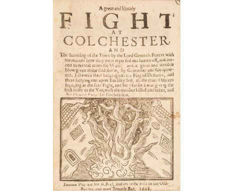
Essex. A sammelband of 27 English Civil War pamphlets mostly relating to the siege of Colchester, Essex, 1648, comprising:1. A Great Fight at Colchester upon Tuesday night last, being the 25. of this instant July, and the advancing of General Lucas and his Forces to the very Guards of the Parliamenteers, with the particulars of the Fight, and the number that were killed and taken prisoners on both sides, and the springing of a Mine to blow up part of the Leaguer. Likewise a letter from Colchester concerning the marching of an Army to London, and a message from Prince Charles to Gen. Lucas. And a bloudy fight at Deal Castle in Kent, London: R. Woodus, 1648, [2], 6 pp., woodcut to title,2. C. (W.). The Prince of Wales his coming to Yarmouth, with 19. Saile of Shipping, & Landing an Armie for the Relief of Colchester. Also a Fight between them and the Parliaments Forces; some of the Princes men taken Prisoners, and rescued again by the town of Yarmouth, who joyne with the Prince, and keep out the Parliaments Forces. With a list of the Lords, Knights, and other Commanders come over with the Prince. And Sir Charles Lucas his men roasting a whole horse, for joy of the Prince his coming. Certified in a Letter from a Gentleman of Quality in the Army, London: Printed by Robert Austin, July 27, 1647, [2], 6 pp., upper outer blank corner of final leaf repaired, 3. A great and bloudy Fight at Colchester, and the storming of the Town by the Lord Generals forces, with the manner how they were repulsed and beaten off, and forced to retreat from the Walls, and a great and terrible blow given at the said storm, by Granadoes and Gunpowder. Likewise their hanging out the Flag of Defiance, and their sallying out upon Tuesday last, all the chief Officers ingaging in the said Fight, and Sir Charles Lucas giving the first onset in the Van, with the number killed and taken, and Sir Charles Lucas his Declaration, London: G. Beal, 1648, [2], 6 pp., woodcut to title, imprint slightly cropped,4. The Resolution and most faithfull expression of the Gentry and Commonalty of the Countie of Essex. Presented to the House of Parliament Jun. 20. 1642. Wherein is declared their certaine and reall intentions to maintaine the Priviledges of the Crowne and Parliament. Also the true Relation of an Opposition and Disturbance given to the Earle of Stamford at the Training of the Traine Bands at Leicester. Which Disturbance was given by Mr. Hen. Hastings, sonne to the Earle of Huntington. With the Order from the House concerning Mr. Hastings, as a Delinquent and occasioner of the same Disturbance. As also an Order to send for the Maior, for proclaiming the Kings Proclamation. Hen. Elsyng. Cler. Parl., [London]: Printed for William Arding, June 25, 1642, [8] pp.,5. A Great Fight between his Excellencies Forces, and the Enemy, neer the Island of Mersey, Goring beaten into Colchester, the Army within pistoll-shot of the Walls, and their resolution to give no man quatter; certified in a Letter upon Thursday night last, being the 22 of this instant June, 1648. With a list of the number that were slain and taken prisoners, 22 Pieces of Ordnance taken, with all their Arms, Powder, Match, and Bullet. Also another Fight at Wivener, within two miles of Coulchester, 16 slain, 40 taken prisoners, and the surprizing of Lieut. Col. Gardener, and a Party of Walloons, by Capt. Fisher, with his Suffolk Horse. With their Examination before the Generall, and their Consession, touching their marching up to the Walls of London, and joyning with a Party to plunder the City. Likewise the Lord Generals Proclamation touching the proceedings of his Army, and his Directions to every Colonell and Commander, touching their respective Troops and Companies. Signed, T. Fairfax, London: Printed for R. W., 1648, [2], 6 pp., neatly repaired worm trail at foot of leaves (with no loss of text),6. Another Fight at Colchester, and the storming of the Town on Fryday night last, by the Parliaments Forces, and the successe thereof. Together, with the proceedings of His Majesties loyall subjects; in the Counties Northampton, Liecester, and Rutland, touching their raising of sixe Regiments for the defence of King, Parliament, and Kingdome. Likewise, a great Fight in Scotland, between Duke Hamiltons Forces commanded by the Earle of Kalendar Lieutenant Generall, and the Marquesse of Argyles party, with the number slain and taken prisoners, the Lord Chancellours escape, and hundreds fled to the Mountains. Also, Duke Hamiltons Speech to the Estates of Scotland, concerning the advancing with his Army into England, London: Printed for G. W., 1648, [2], 6 pp., leaf A2 remargined at gutter, For a full listing of all the titles in this work, please go to the Dominic Winter websiteQTY: (1)NOTE:Provenance: Willis and Sotheran, Catalogue of Superior Second-Hand Books, 25 October 1862, item 282, £4. 10s.; Sotheby, Wilkinson & Hodge, Catalogue of a Valuable Assemblage of Books, 21 February 1865, item 244; From the collection formed by Sir Thomas Phillipps Bt. (1792-1872); Purchased by private treaty by William H. Robinson Ltd., Pall Mall, London; Purchased by W. A. Foyle (bookplate).1. ESTC R202343; Thomason E.454[15]; Wing G1693.2. ESTC R205003; Thomason E.454[18]; Wing C163.3. ESTC R202335; Thomason E.453[18]; Wing G1633.4. ESTC R26988; Wing R1138.5. No institutional location found. Not traced in ESTC or Wing.6. ESTC R205037; Thomason E.449[29]; Wing A3260.7. ESTC R203404; Thomason E.452[42]; Wing R2325.8. ESTC R205134; Thomason E.460[34]; Wing A3252.9. ESTC R204978; Thomason E.457[15], Wing A3266.10. ESTC R9153; Thomason E.450[10]; Wing L56A.11. ESTC R205056; Thomason E.454[8]; Wing C2973.12. ESTC R202094; Thomason E.461[35]; Wing F181.13. ESTC R204969; Thomason E.448[6]; Wing N1334.14. ESTC R204984; Thomason E.448[15]; Wing I2.15. ESTC R205133; Thomason E.460[33]; Wing C3601A.16. ESTC R205005; Thomason E.454[21]; Wing G1811A.17. ESTC R204986; Thomason E.448[21]; Wing L383.18. ESTC R203059; Thomason E.448[10]; Wing N1336.19. ESTC R203401; Thomason E.448[11]; Wing R2328.20. ESTC R204995; Thomason E.457[20]; Wing L382.21. ESTC R204912; Thomason E.447[2]; Wing B3242. 22. ESTC P1344; Thomason E.449[31]; Not recorded in Wing.23 ESTC R204988; Thomason E.448[23]; Wing H90.24. ESTC R201945; Thomason E.448[18]; Wing E3663.25. ESTC R204973; Thomason E.448[7]; Wing R2329.26. ESTC R204947; Thomason E.447[22], Wing F903.27. ESTC R203705; Thomason E.461[24]; Wing (CD-ROM, 1996), S186. Wing says 'var.' In CSmH and Thomason copies the 'A' of 'A3' is under the second 'c' of 'accompt', as seen in this example. Also signed at end 'T.S.' rather than being signed at foot of p. 5 'S.T.' as seen in the other variant.This volume comprises 27 rare pamphlets recording the events during the English Civil War, particularly in Colchester, Essex, and also referring to related military movements and events during that time. Many relate to the Siege of Colchester which occurred in the summer of 1648 (12 June - 28 August) when the Second English Civil War reignited in several areas of Britain. Colchester became embroiled in the unrest when a Royalist army on its way through East Anglia to raise support for the King, was attacked by Lord-General Thomas Fairfax at the head of a Parliamentary force. The Parliamentarians' initial attack forced the Royalist army to retreat behind the town's walls, but they were unable to bring about victory, and as a result, they settled down to a siege. The Royalists resisted the siege for eleven weeks and only surrendered following the defeat of the Royalist army in the North of England at the Battle of Preston, Lancashire (17-19 August 1648).
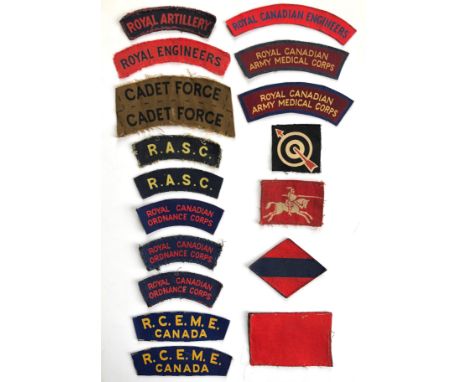
18 WW2 British & Canadian printed shoulder titles & formation signs. Titles : ROYAL ARTILLERY ... ROYAL ENGINEERS ... CADET FORCE (uncut pair) ... 2 x R.A.S.C. ... 3 x ROYAL CANADIAN ORDNANCE CORPS ... 2 x R.C.E.M.E./ CANADA ... ROYAL CANADIAN ENGINEERS ... 2 x ROYAL CANADIAN / ARMY MEDICAL CORPS. Formation signs : 6th Anti-Aircraft Division (painted) ... 8th Corps (2nd pattern) ... 1st Canadian Army ... 5th Canadian Armoured Division.

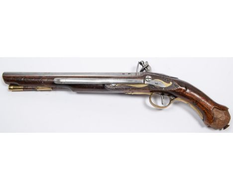
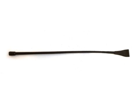
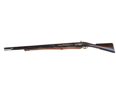
A .56" Tower Flintlock Long Sea Service pistol, barrel 12" with ordnance proofs, the lock marked with crown over "GR", "TOWER" and inspection stamp, fullstocked, the butt marked with crown over broad arrow and "1806", with regulation brass mounts, belt hook, and original brass tipped wooden ramrod. GWO & generally GC for age (butt cap and part of the ramrod missing, ramrod tip dented). £1000-1200
-
12130 item(s)/page