We found 12129 price guide item(s) matching your search
There are 12129 lots that match your search criteria. Subscribe now to get instant access to the full price guide service.
Click here to subscribe- List
- Grid
-
12129 item(s)/page

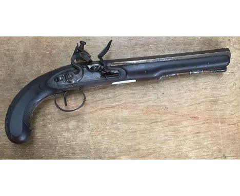
Lot 109
Well made late 18th - early 19th century flintlock gentleman’s travelling pistol or duelling pistol in 22bore by Dawes, overall length 14” with heavy 9” octagonal barrel. The lock is signed ‘DAWES’ and the l/h of barrel is stamped with pre 1810 London Ordnance Proof House marks for privately made civilian guns but no barrel makers mark evident. Top flat of barrel is engraved ’LONDON’ with a small silver blade foresight and notched rear. Full walnut stock with fine chequered grip, bore measures .600 & is clean and smooth. Plane bevelled stepped-tail lock with slide safety catch, roller frizzen and raised ‘waterproof’ pan in mechanically crisp working order with strong springs. “DAWES” appears to be a well-known Birmingham maker between 1799 and 1822 with sellers in London.

Lot 339
WW2 British Lincolnshire Home Guard Cloth Formation Sign, being the printed Lincolnshire Imp insignia which was worn by the 1st 2nd & 3rd battalions City of Lincoln Home Guard. Accompanied by a Royal Ordnance Factories printed insignia, Wiltshire ACF formation sign, 57th Surrey (Mitcham) Home Guard 2nd phase miniature rifle competition plaque won by Major E C Mallett, plus other insignia.
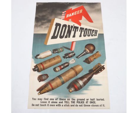
Lot 437
Rare British Home Front Warning Poster for Unexploded Bombs, fine large coloured poster ‘DANGER – DON’T TOUCH’ with images of various bombs and ordnance and then ‘You may find one of these on the ground or half buried. Leave it alone and TELL THE POLICE AT ONCE. Do not touch it even with a stick and do not throw stones at it’. Printed for HM Stationary Office by Johnson Riddle & Co Ltd. Some small tears to the top edge. Measures 101 x 63 ½ cms approx.
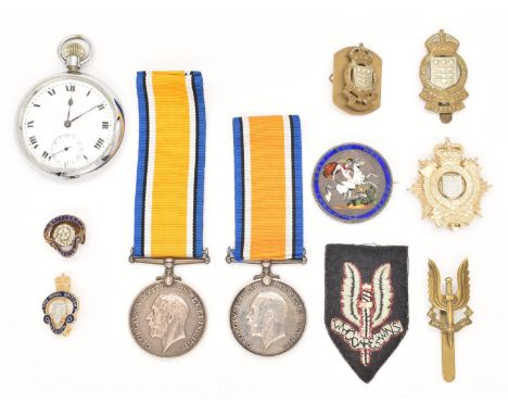
Lot 211
Two WW1 War Medals named to 41814 Pte G Pegler, Somerset Light Infantry and J17694 FC Pegler, A.B Royal Navy together with cap badges including SAS and Ordnance Corps, pocket watch stamped with broad arrow HD No2 and an 1819 George III Crown fashioned as an enamel brooch depicting George and the Dragon
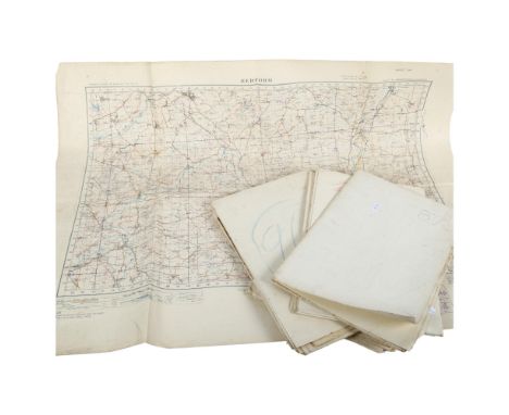
Lot 2
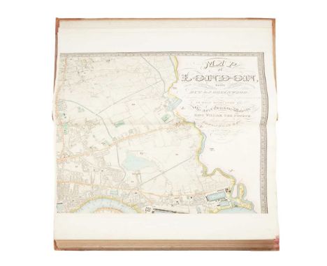
Greenwood, C. & J. Map of London made from an Actual Survey in the Years 1824, 1825 & 1826 Extended and Comprising the Various Improvements to 1830. London: Greenwood & Co., 1830. Wall-size engraved map on 6 sheets (each 65 x 80cm), with contemporary hand-colour, large calligraphic title including dedication to William IV, inset views of St Paul's Cathedral and Westminster Abbey, each sheet folded once and mounted on guard. Bound in at the front of a copy of C. & J. Greenwood's Atlas of the Counties of England, from Actual Surveys made from the Years 1817 to 1833, London: Greenwood & Co., 1834. Large folio, contemporary half morocco, engraved title-page incorporating general map, 46 engraved county maps each with inset view, contemporary hand-colour throughout, all folding and mounted on guards, similarly opening to 65 x 80cm, binding rubbed and marked, spotting to Anglesey [etc.] and Monmouth maps, Northumberland browned [Chubb 458a]Note: Note: Greenwood's landmark map of London was first published in 1827, his only venture outside county map making. His Atlas of the Counties of England and Wales was published in parts between 1829 and 1834. 'It was an astonishing achievement for a private surveyor in so short a time. The majority of these surveys anticipated publication of the sheets of the Ordnance Survey. Even in the south of England and in Lincolnshire, where the Ordnance Survey published their maps first, Greenwood did not slavishly copy the work, but offered a distinctive style and some additional information; not least of the attractions of his maps was the high standard of the engraving ... The enduring popularity of its plates came partly from the beautifully engraved vignettes of cathedrals, castles, or town views that graced each one' (ODNB).

Lot 82
Urdu lithographic printing Ru-numa'i futagrafi ma'ruf bi Usul-i musawwiri [The Unveiling of Photography, or Principles of Photography]. Aligarh: Matba' Faiz-i 'Am. c.1895. 8vo, original pictorial wrappers, [2] 4 185 pp., illustration of a lady in British dress operating a camera to front cover, illustrations of photographic apparatus in text, Urdu-English glossary and 5 pp. advertisements to rear, authorial ink-stamp ('H. M. Ibrahim, Aligarh') incorporating possible autograph signature to rear wrapper, browning, marginal worming very occasionally encroaching on text-panel to minimal effect on text, stitching partially perished but binding remaining sound, remnants of paper spine-covering (with red linen webbing remaining), wrappers marked, purchase ink-stamp dated 1945 to front wrapper, pp. 103/4 with transverse closed tear, paper erosion to foot of gutter of last 9 leaves not affecting text. Together with 2 similar works, both in Urdu, lithographically printed: Mirza Rahim Beg, Naghmat Sitar [Melody of the Sitar], Lahore, c.1880 (8vo, stitched in contemporary marbled wrappers, [2] 181 [1] pp., full-page illustrations of sitars throughout);[Gunnery], Armourer Trainees Notes. [No place, no date but c. 1935] (10 parts in 1 volume, numbered 1-7 but including duplicates of parts 2, 4 and 7, 8vo, contemporary half cloth, text in Urdu and English, 37, 25, 25, 29, 32, 32, 68, 18, 28, 28 pp. (headings comprise: Rifle No. 1 Mk III; Ordnance M. L. 3-Inch Mortar; ditto; Pistol Signal No. 1 MK. III; Mounting Tripod 30'3 M.G. MK IV; ditto; Gun Machine [sic] Lewis 303 MKI; Definition of Military Small Arms; Gun Machine Vickers 303-in Mk. I; ditto)Note: Note: A remarkable artefact of the spread of photography as a popular pastime in 19th-century India. To judge from the cover illustration (and a further illustration on page 63) photography was imagined at least in some circles as an especially female pursuit. The author is named on the title-page as one Hafiz Muhammad Ibrahim. No other copy traced.
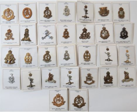
Lot 44
Corps Cap Badgesincluding brass, KC Army Pay Corps ... Chrome KC Physical Training Corps ... Brass KC Pioneer Corps ... Brass KC Military Provost Staff Corps ... Brass KC Royal Military Police ... Brass QC RHA ... White metal QC RHA ... Brass KC RAMC ... Brass KC Corps of Military Accountants ... Brass Army Ordnance Corps ... Bi-metal RAOC ... Bi-metal KC Royal Corps of Signals. 30 items.

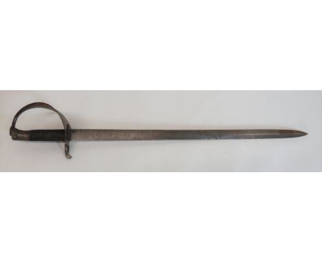
Lot 142
A Victorian English Formal Dress or smallsword by Moore, Late Bicknell & Moore, 1 Old Street., Londonmid-19th centurywith VR Royal Cypher to the clamshell guard, the brass hilt with a coronet finial, the 78cm blade nicely etched with foliage and acorns together with the crown above VR Cypher and manufacturers details 'Moore & Co, Sword Cutlers & Army Accoutrement Makers to Her Majesty And Board of Ordnance', overall length 91cm, housed in the original scabbard (now in two pieces)PLEASE NOTE ALL BLADED ITEMS ARE SUBJECT TO OVER 18 CHECKS ON COLLECTION OR DELIVERY. If you require delivery, please contact us for details of an appropriate courier.
Lot 93
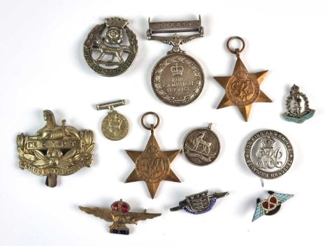
An assorted collection of medals and badges to include General Service Medal 1962-2007 awarded to "23887314 Pte. J. Bailey DLI" with Borneo clasp; World War II 1939 and Africa Star; World War I silver war badge numbered 'B135650'; two cap badges - 'York and Lancaster' and 'Gloucestershire', three brooches - two silver/enamel, "Army Ordnance Corps & RAMC", gilt RAF brooch; a miniature 1939-45 War Medal, silver & enamel collar badge and a silver athletic medal (qty)


Lot 393
A PAIR OF TABLE LAMPS, DENBY TEA CUPS AND CUTLERY, to include a pair of cream and blue gilt ceramic table lamps in the form of ginger jars, height 30cm with cream shades, a pair of Denby 'Boston' trios, two early 20th Century blue and white 'Willow' pattern dishes (both have wall hanging stickers glues on the back), a collection of silverplate serving spoons, five 1950s folding cloth Ordnance Survey maps covering Yorkshire, a ladies 'Limit' wristwatch, a small silver mustard spoon hall marked Sheffield 1912, small collection of coins and a gentleman's Seiko quartz stainless steel watch (s.d) (1 box + 2 lamps)
Lot 294
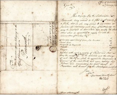
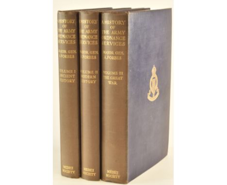
ARCHITECTURAL HISTORY ROYAL ORDNANCE BUILDINGS etc: a larger collection of reports (a full carton) and associated material on buildings used for the storage of ordnance/gunpowder etc, together with NAVAL MILITARY INTEREST: A large box of papers, photographs and other materials relevant to the architecture of NAVAL DOCKYARDS (Plymouth, Gosport, Sheerness etc.). Many of the items from The National Maritime Museum, English Heritage, Public Record Office etc. etc.
Lot 285
ASSORTED COLLECTABLES comprising an R.A.F. Air Gunner flying badge; a Stratton R.A.F.A. compact; a Second World War service issue whistle by J. Hudson, Birmingham, dated 1941 and with Ordnance arrow mark; a silver and enamel R.E.M.E. tie-pin or sweetheart bar brooch; a silver rowing medal, 1883; a silver athletics medal; two other sporting medals; and a Red Cross badge.
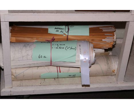
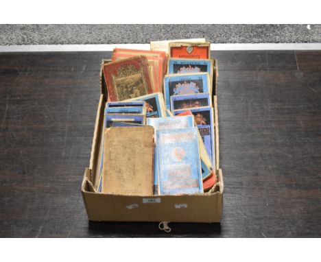
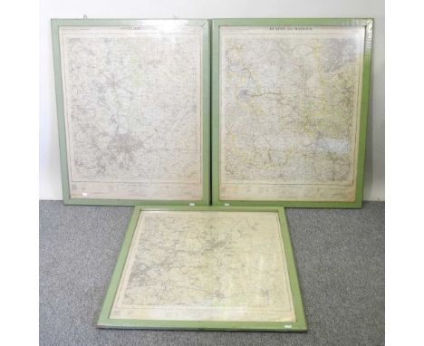
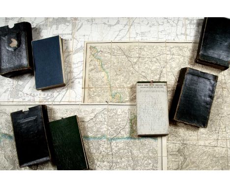
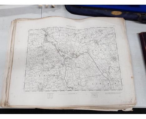
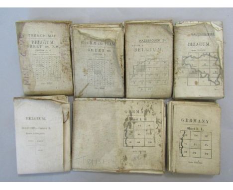
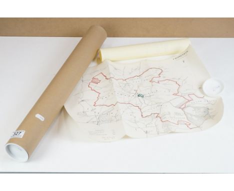
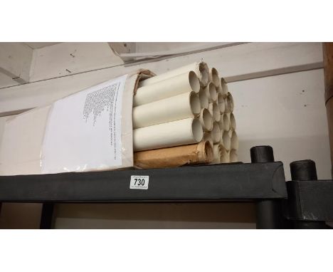
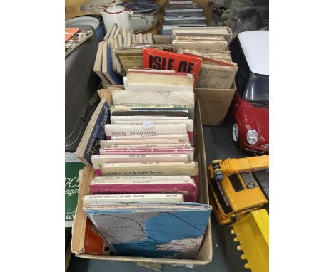
![[MAPS] Seventy-nine Ordnance Survey New Popular Edition One-Inch Folding Maps, many of West Country interest, variable condi](https://cdn.globalauctionplatform.com/9d179714-97fe-4408-b7c4-af3c00b882ab/d49d53ab-5767-4f67-96b2-af97011ab123/468x382.jpg)

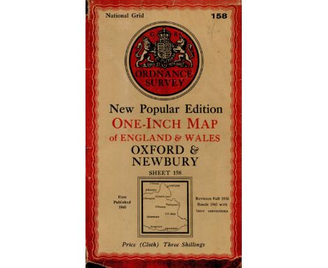
Lot 600
National Grid Ordnance Survey Map No. 158. New popular edition. One inch map of England and Wales, Oxford and Newbury. Revision full 1935, Roads 1947 with later corrections. Folding map. Large cloth map, measuring 31 x 27. Contained in a wallet. Published by The Authority of the Ministry of Agriculture and Fisheries. 1947. We combine shipping on all lots. Single book £5.99 UK, £7.99 Europe, £9.99 ROW. We can ship a parcel up to 20kg which will take approx. 40 books in UK £12, EUROPE £39.99, ROW, £59.99
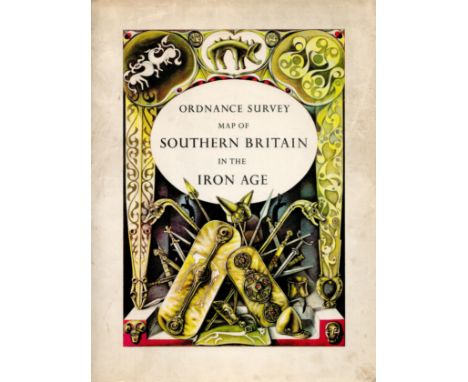
Lot 615
Ordnance Survey map of Southern Britain In the Iron Age. Scale 1:625,000. About ten miles to one inch. Made and published by the Director General of The Ordnance Survey. Chessington. Surrey. 1962. Reprinted 1967. Fine copy in fine D/W. 1967. We combine shipping on all lots. Single book £5.99 UK, £7.99 Europe, £9.99 ROW. We can ship a parcel up to 20kg which will take approx. 40 books in UK £12, EUROPE £39.99, ROW, £59.99
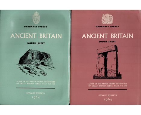
Lot 616
Ordnance Survey maps of Ancient Britain. Blue = North Sheet - Second edition 1964 Red = South Sheet - Second edition 1964 Two maps of the major visible antiquities of Great Britain older than A. D. 1066. Two separate folded maps (very large). These two maps sold as one lot. Both in fine condition. Comprises 2 separate maps of North and South Britain respectively. 1964. We combine shipping on all lots. Single book £5.99 UK, £7.99 Europe, £9.99 ROW. We can ship a parcel up to 20kg which will take approx. 40 books in UK £12, EUROPE £39.99, ROW, £59.99
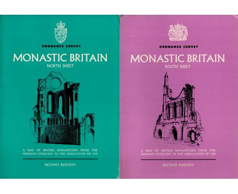
Lot 617
Ordnance Survey maps. Two large, folding maps of Monastic Britain. Blue = North Sheet - Second edition 1954 Red = South Sheet - Second edition 1954 Two large maps offered in one lot of British Monasticism from the Norman Conquest to the Dissolution of 1539. This lot comprises of two separate maps of North and South Britain respectively. In fine condition. 1954. We combine shipping on all lots. Single book £5.99 UK, £7.99 Europe, £9.99 ROW. We can ship a parcel up to 20kg which will take approx. 40 books in UK £12, EUROPE £39.99, ROW, £59.99
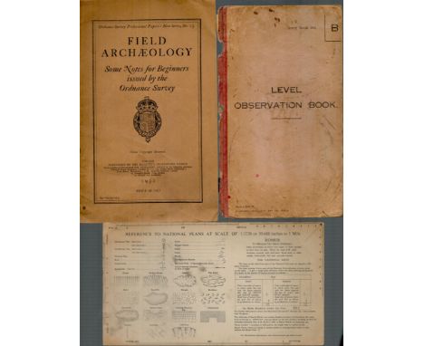
Lot 619
Ordnance Professional Paper: New Series No. 13. Field Archaeology. Some notes for beginners issued by the Ordnance Survey. Crown Copy reversed. London. Published by His Majesty's Stationery Office 1932. 34 pages. Inserted in this volume is a card 9½ x 5¼ with a key to all references, marks, designations on Ordnance Survey National Plans. Also included in this volume is the cover of The Level of Observation Book, Army Book 328 dated 1937 ,1932. We combine shipping on all lots. Single book £5.99 UK, £7.99 Europe, £9.99 ROW. We can ship a parcel up to 20kg which will take approx. 40 books in UK £12, EUROPE £39.99, ROW, £59.99
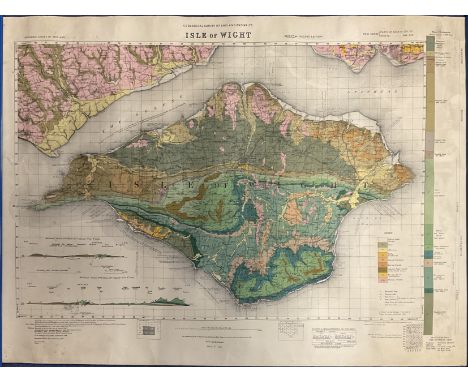
Lot 621
A rolled-up Ordnance Survey map of The Geological Survey of the Isle of Wight. Dated 1885. Printed for Ordnance Survey in 1926. Reprinted in colour with amendments in 1935. Reprinted again in 1947. Rolled map of approximately 29 x 21 in excellent condition. Now considered RARE. We combine shipping on all lots. Single book £5.99 UK, £7.99 Europe, £9.99 ROW. We can ship a parcel up to 20kg which will take approx. 40 books in UK £12, EUROPE £39.99, ROW, £59.99
-
12129 item(s)/page