We found 12129 price guide item(s) matching your search

Refine your search

Year

Filter by Price Range
  • List
  • Grid
  • 12129 item(s)
    /page

Lot 287

Major, John (ed) "The Complete Angler ...", J C Nimmo & Bain 1883, two frontis portraits, various ills throughout, vellum backstrip with gilt titles and gilt decs of fish and a fish motif to the front boardVarious paperback 'Harry Potter' including The Philosopher's Stone ISBN 0747532745, Prisoner of Azkaban, The Chamber of Secrets, etcRowling, J K "The Casual Vacancy"Volumes on collecting, paperbacks, various modern first editions and a collection of Ordnance Survey maps (3 boxes)

Lot 626

A cast iron trough, dated 1849 and with War Department arrow and 'BO' for Board of Ordnance, 99cm wide, 51cm deep, 52cm high, See a similar one at Spit Sand Fort, Southsea, Portsmouth

Lot 370

3 boxes containing a large number of early 20th century Ordnance Survey maps of Lincolnshire including Louth

Lot 342

52 CLASSIC COMPOSERS CD's WITH RELATED CONTENTS, BIOGRAPHY LISTENERS GUIDE, 17 ORDNANCE SURVEY MAPS AND FOUR VARIOUS CRICKET BOOKS, LANCASHIRE AND MANCHESTER CRICKET CLUBS 1955 AND 1956

Lot 130

A selection of vintage maps and ordnance survey guides

Lot 246

QUANTITY OF ORDNANCE SURVEY LINEN LINED AND OTHER MAPS, BARTHOLOMEW'S, BACON'S MOTORING AND CYCLING, WH SMITH & SONS PEGAMOID WATERPROOF PLAN AND GUIDE LONDON AND OTHER MAPS, ETC. [148 INC. 48 LINEN LINED]

Lot 502

Thirteen Ward Lock & Co Illustrated Guide Books together with Folded Ordnance Survey Maps, etc

Lot 413A

MAP: A COLLECTION OF VINTAGE MAPS OF ENGLAND, IRELAND AND SCOTLAND TO INCLUDE A FOLDING MAP, JOHNSTON'S ENVIRONS OF EDINBURGH, EDWARDS STANFORD'S ENGLAND AND WALES c.1877, SEVERAL W.H.SMITH& SON'S REDUCED ORDNANCE MAPS, A HODGES & SMITH MAP OF COUNTY MAYO, VARIOUS ATLASES,ETC.

Lot 65

Five late 19th century ordnance survey maps, mainly of Maer hills Unfortunately we are not doing condition reports for this sale.

Lot 268

Ten Support Services cap badges: the Army Ordnance Corps, five Royal Army Ordnance Corps (one small bimetal), two REME all-brass, two REME bimetal; together with A REME proficiency arm-badge and a RAOC collar badge (12)

Lot 32

A World War Two group of six medals awarded to 5124597 RQMS Warrant Officer Robert Gerald Brown 1 Corps District Ordnance Company, The Royal Army Ordnance Corps to include 1939-45 Star, France and Germany Star, Defence Medal, War Medal 1939-45, Army Long Service and Good Conduct Medal Elizabeth II with Regular Army bar and Efficiency Medal George VI Territorial, together with the soldier's release leave certificate dated 9 Nov 1946 and three unofficial medals to include British Forces Germany Medal, Normandy Campaign Medal and Border Service Medal, together with another World War Two pair of medals to include Defence Medal and War Medal 1939-45 and an Elizabeth II Gibraltar 2005 Trafalgar five pound coin.

Lot 594

MAPS: A collection of 26 pre-war U.K. Ordnance Survey maps (26)

Lot 162

Folding maps. A mixed collection of approximately sixty-five maps, mostly 19th century, folding regional British and foreign maps, road and touring maps, many in slipcases, including examples by Ordnance Survey, Bacon, Stanford, Blackwood, Burr, D'Anville, Cruchley, W H Smith and Palairet, various sizes and condition (approx.65)

Lot 191

Map Collector's Circle. Volumes 1 - XI numbers 1 - 110, 1963 - 1975, eleven volumes, numerous black & white illustrations throughout, uniform red cloth gilt, 4to, with another sixteen loose parts, occasional duplicates, together with a broken run of approximately fifty volumes of 'The Map Collector', some duplicates, with a broken run of approximately fifty volumes of 'Mercator's World', some duplicates, plus approximately one hundred dealer's map catalogues, including examples by Barry Ruderman, Richard Arkway, Martayan Lan, Cohen & Taliaferro, Donald Heald and The Shapero Gallery, and a box of approximately 150 mid 20th century Ordnance Survey maps, various sizes and condition (approx. 300)

Lot 340

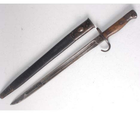
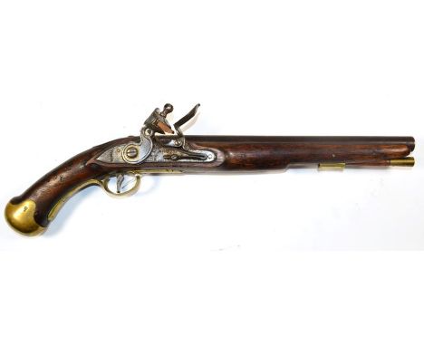
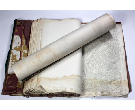
Fielding (Henry). Pasquin. A Dramatick Satire on the Times, 1st edition, for J. Watts, 1736, title page in red and black, spotting to last few leaves, modern wrappers, 8vo, together with: [Stillingfleet, Benjamin], An Essay on Conversation, 1st edition, for L. Gilliver and J. Clarke, 1737, woodcut head- and tailpieces, title page and final leaf spotted and slightly creased, with a few nicks in lower margins, a few other marks, pagination trimmed in pp. 3-4, disbound, folio; Board of Ordnance, A Description of the Machine for the Fireworks, with all its Ornaments, and a detail of the manner in which they are to be exhibited in St. James's Park, Thursday, April 27, 1749, on account of the General Peace, signed at Aix La Chapelle, October 7, 1748, 1st edition, W. Bowyer, 1749, woodcut title device and tailpiece, small ink-stain to title page, modern wrappers, 4to; Brady (Nicholas), A Sermon preach'd at the Chapel-Royal at White-Hall: on Sunday the 19th of January, 1701, 1st edition, for Joseph Wild, 1701, half-title, browning,ink-stamp of the Mercantile Library, Philadelphia on p. 15, modern marbled wrappers, 4to; and 1 other Rothschild 210 for Stillingfleet and 810 for Fielding; Foxon S757 for Stillingfleet. ESTC traces three copies only for Brady's work. (5)
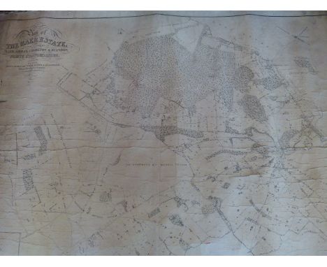
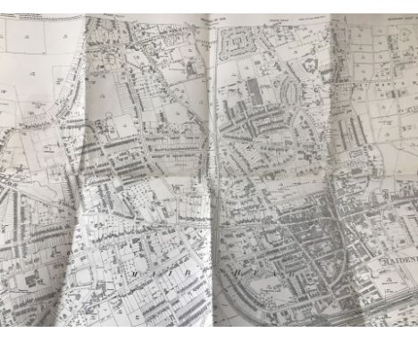
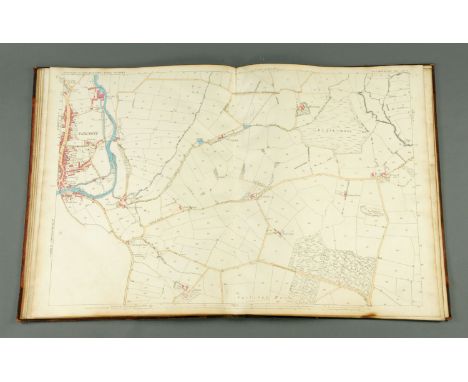
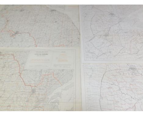
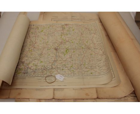
Lot 2002

20th Century British Ordnance Survey maps mostly linen backed approximately 500.

Lot 2003

Early 20th century Ordnance Survey Atlas of Great Britain, x 3, and Ordnance Survey 1 maps with pictorial covers.

Lot 326

Ordnance Survey Map of Eden Valley

Lot 1024

A framed and glazed Ordnance Survey map depicting Coddenham, Great Blakenham etc.; together with a 19th Century coloured engraving

Lot 105

A selection of road maps and ordnance survey maps by Michelin 40 maps approx

Lot 76

A selection of vintage road maps atlas and ordnance survey AA michelin

Lot 94

A selection of vintage local interest maps and ordnance survey for lake district area etc

Lot 187

A Newland flintlock service pistol model 1802-15 with clear proof and inspectors marking to the lock and stock marked TB (possibly Thomas Barnett Supplier to Ordnance 1793-1818), the underside of the 9 inch barrel retains its original browning finish circa 1814-15, the lock with crowned GR tower marks

Lot 1065

A quantity of old Ordnance Survey Maps of Herefordshire including: Moreton-on-Lugg, Aylestone Hill, Rotherwas, Whitecross, etc

Lot 1066

A quantity of old Ordnance Survey Maps of Herefordshire including: Tillington, Burghill, etc

Lot 199

A Georgian infantry short sword / hanger, bearing an Ordnance Inspector's struck view mark to blade, (a/f)

Lot 1262

A 1907 pattern bayonet, the 43cm single edged fullered blade stamped to the ricasso 1907 Sanderson and further numbered 12 '08 with various ordnance marks, having a hooked quillon and two piece walnut grip, stamped to the pommel IEL 468, in a leather covered scabbard, 56cm.

Lot 1409

A British 1908 pattern Cavalry Trooper's sword, the 89cm single edged fullered blade, stamped to the forte EFD for Enfield with War Department and various Ordnance marks, having a steel bowl guard with chequered rubber grips, 108cm.

Lot 121

NO RESERVE Hampshire.- Ordnance Survey.- A group of 40 detailed plans in South West England, Hampshire, including one of Southampton, Dorset, Somerset, Gloucestershire, Devon and Cornwall, on a scale of 1:2500, zincographed maps, some with contemporary hand-colouring, each sheet apprx. 730 x 1050 mm. (28 3/4 x 41 1/4 in), occasional surface dirt, marginal tears and losses, unframed and rolled, circa 1897-1933 (40)

Lot 4223

A quantity of maps, ordnance survey popular edition 1 inch and Bartholomew ½ inch, coloured, many on cloth (one box)

Lot 224

Box of Assorted Maps and Books including Ordnance Survey, Motoring & Touring Map, Holiday Haunts in Southern England, The Shire of the Sea Kings and others.

Lot 400U

A set of four 1880 Ordnance Survey Office maps in 1/2500 scale, Truro and area, each folding and mounted on linen and each labelled 'Cornwall Library, Presented by Reverend C.S.S. Warren, March 22nd 1887', coloured.

Lot 1255

Ordnance Survey Map, 1:2500 showing Maidenhead GWR station and branch junction for Wycombe trains. Printed 1933, originally surveyed 1874.

Lot 110

A First World War Canadian Ordnance Corps Cap Badge and Pair of Collar Badges, in brass; a Royal Canadian Ordnance Corps Officer's Bronze Cap Badge, three brass examples, two pairs of gilt collar badges and four various cloth insignia; a Pre-1947 Indian Army Ordnance Corps Cap Badge and Pair of Collar Badges, in brass, two similar copy badges, an Indian Army Ordnance Corps bronze collar badge and shoulder title, and five similar badges from Canada x2, Pakistan, New Zealand and South Africa (27)

Lot 113

Royal Army Ordnance Corps:- a collection of approximately forty two various cap and collar badges, five brass shoulder titles, buttons, sweetheart brooches etc.; a Small Quantity of Royal Army Service Corps Cap and Collar Badges, buttons etc.

Lot 141

Assorted Militaria and Related Items, comprising two pigskin double ammunition belt pouches, probably First World War vintage; a Kelvin type KAB - 1401 K airspeed indicator; two items deactivated ordnance; two ships plaques, Shalford & Wilton, and three vintage shooting sticks, two stamped, ''Walter Paul, Hameln'' and ''Richard Lorang, Armes et Munitions, Mersch'' respectively

Lot 280

Operation Sea Lion (The Proposed German Invasion of England) - Three Folders of Rare Second World War German Secret Documents Produced by the German General Staff:- Folder 'No.1 The Border', 1942, containing a photo book of targets, including Berwick and other road and railway bridges, numerous important railway and road viaducts, the ports of Tynemouth, Hartlepool, Gateshead, Sunderland, Wallsend and South Shields, Newcastle armaments factory, Garew steel works, Spiller's factory Newcastle; a German reprint of the Ordnance Survey map for the area between Berwick and Hartlepool with suitable targets marked; large scale Ordnance Survey town plans of Carlisle, three of Newcastle as well as Sunderland and South Shields; Folder 'No.3 Nordost-England', 1942, containing a photo book of targets, including Northallerton and other railway bridges, numerous important railway and road viaducts, the ports of Middlesbrough, Hartlepool, Goole and Hull, Billingham chemical works, Leeds steel works, Rochdale machine factory; a German reprint of the Ordnance Survey map for the area between Hartlepool and Hull with suitable targets marked; large scale Ordnance Survey town plans of York, Hull and four of Middlesbrough; Folder 'No.7 Sud-Wales' 1941, containing a photo book of targets, including dams at Craig Goch and Cabab Coch, road and railway bridges, numerous important railway and road viaducts, the ports of Swansea, Cardiff, Newport and Avonmouth, Swansea nickel works, Ebbw Vale steel works, Newport machine factory; a German reprint of the Ordnance Survey map for the area between Church Stretton and Bristol with suitable targets marked; large scale Ordnance Survey town plans of Swansea, Newport, two of Aberavon-Port Talbot and three of Cardiff ***Three of twelve, these highly secret documents were originally prepared for Operation Sea Lion, the German Invasion of England, and then later for German agents and saboteurs who would be dropped by parachute or U-boat to destroy important industrial and communication targets all over England

Lot 421

An Early 19th Century Flintlock Sea Service Pistol, possibly of Belgian contract manufacture, the 30cm steel barrel with Tower Ordnance marks, the lock plate stamped TOWER with crowned GR and crowned arrow, the beech stock with numerous inspection stamps, brass ramrod pipes, trigger guard, side plate and pommel, with steel belt clip and brass tipped wood ramrod

Lot 422

An Early 19th Century Flintlock Sea Service Pistol, possibly of Belgian contract manufacture, the 30cm steel barrel with Tower Ordnance marks, the lock plate stamped TOWER with crowned GR and crowned arrow, the beech stock with numerous inspection stamps, brass ramrod pipes, trigger guard, side plate and pommel, with steel belt clip and brass tipped wood ramrod

Lot 423

A Remington Rolling Block Pistol, of 11.7mm obsolete calibre, the 11cm cut-down rifled steel barrel stamped I./E.B. over an anchor and with later brass bead sight, the left side of the receiver stamped REMINGTONS ILION.N.Y. U.S.A./PAT. MAY 3D NOV. 15TH 1864. APRIL 17TH 1866, the right side stamped P/F.C.W., with walnut fore-end and grip **These pistols were recalled by the American Ordnance Department who had the barrels cut-down and changed the trigger and foresight at a charge of $4Action works. Pitting to right side of the barrel and back strap, with all-over black patching. Small crack to right fore-end.

Lot 134

A pair of Third Reich period 7 x 50 Kriegsmarine binoculars by Ernst Leitz GmbH, Wetzlar recovered from U-3008:, stamped to back plates with alphabetic ordnance code 'BEH' and numbered '459863', rubberised eye caps and black crackle finish , together with black leather case stamped with Kriegsmarine mark to cover, 23cm high.*Notes- The binoculars and their original case were 'liberated' by Lieutenant-Colonel Norman Tailyour, Royal Marines, then Commanding Officer of 27 Battalion RM, part of the Canadian First Army that captured Wilhelmshaven on 28th April 1945. On 13th May 1945 about 200 German warships and submarines surrendered. Norman Tailyour was in command of the Royal Marines guarding the surrendered fleet and he acquired these binoculars on 13th May 1945 from U-3008: a Type XXI U-boat that then served in the United States Navy for several years. Her final German Commanding Officer had been Kapitäleutenant Helmut Manseck. Norman Tailyour used these binoculars at sea in his motor yacht (ex Royal Navy ML 286) and carried them when the Commanding Officer of 45 Commando throughout the Eoka campaign in Cyprus and then at Suez in November 1956 when his commando conducted the first ever opposed helicopter assault from the sea. He carried them,also, when commanding the 3rd Commando Brigade, Royal Marines, in the Far East in 1961-62. He retired from the Royal Marines as General Sir Norman Tailyour KCB, DSO and bar, Commandant General 1984-1988. Before that he gave them to his son Major Ewen Southby-Tailyour (later Lieutenant-Colonel, RM, OBE, Sultan of Muscat's Bravery Medal for gallantry during the Dhofar War) who used them in 1978-1979 while carrying out his surveys of the Falklands beaches; surveys which were then used to plan and conduct the re-invasion following the Argentinean invasion in 1982. Ewen Southby-Tailyour was eventually appointed OBE and was voted the 1982 British Yachtsman of the Year for this work. The Royal Navy's ML 286 was purchased direct from the government by the Tailyour family in 1952. ML 286 was a Fairmile B Class motor launch in the 21st Coastal Motor Launch Flotilla when, under the command of Temporary Sub-Lieutenant GW Haworth RNVR, she operated as an inshore hospital ship on D-Day (6th June 1944) for the Assault and Post-Assault phases of Operation Neptune. She was later sold into the civilian market when the Tailyour family bought her with all her ancillary equipment.*Provenance- By direct family descent.

Lot 1219

One volume "Ordnance Plan Parish of Egremont", bearing label "Callander & Dixon Stationers, Whitehaven" and as surveyed by Captain James R.E. February 1863, scale 1/2500.

Lot 641

An extensive collection of Ordnance Survey maps relating to the County of Lincoln, 1904 onwards, some acetates, Scale 1:2500, (qty).

Lot 1314

Maps & plans. A quantity of large plans & ordnance survey maps of London, circa 19th to early 20th century

Lot 1327

Philip (G. & Son). Philips' Reduced Ordnance Map of London, circa mid to late 19th century, hand coloured folding map, 75cm x 99.5cm approx., original cloth with label to upper cover

Lot 1373

Whitbread (J., pub.). Whitbread's Reduced Ordnance Map of London, circa late 19th century, hand coloured folding map, 72cm x 83cm approx., original cloth

Lot 304

A Collection of Hand Coloured Ordnance Maps of Wellington, Hadley, Shropshire etc Most AF

Lot 523

Ordnance Survey of Great Britain, Second War Revision 1941 sheet twelve, England, South East and London, Military Edition 76 x 100cm, together with approximately two dozen other circa 1940s Military Edition O.S maps, various

Lot 607

A Third Reich ordnance issue sabel, plated blade 33½” with post 1941 Eickhorn mark, the plain brass hilt with leather finger loop and wire bound black grip, the upper side of the quillon stamped “PZ.R./1/N.7”, in its black painted scabbard. GC (no waffenamt marks, scabbard paint crazed). Plate 9

Lot 639

6 Ordnance/R Ordnance Corps cap badges: large shield puggaree, small shield officer’s gilt (blades missing) and OR’s, RAOC large brass, bi-metal KC and ERII. GC Part III of the Collection of the late Eric Illingworth

Lot 640

7 officer’s gilt/ silver plated cap badges: ERII RA, RE, RASC enamelled and WRAC, Geo VI RASC enamelled, KC Ordnance enamelled with title (lugs missing) and with motto, and R Corps Signals. GC to VGC Part III of the Collection of the late Eric Illingworth

Lot 682

9 Australian corps etc hat badges, including Australian Engineers, crowned star, Medical Corps red painted (worn) cross to centre, Ordnance, AAMC, RAAMC, Survey Corps, enamelled Staff Corps, etc. GC to VGC Part III of the Collection of the late Eric Illingworth

Lot 783

A 10 bore India pattern Brown Bess flintlock musket, 54½” overall, barrel 39” with traces of ordnance proofs, the almost flat lock stamped with crowned “GR” and “Tower”, fullstocked with regulation brass mounts, sling swivels, and original iron ramrod, the butt with rectangular brass plate engraved “Waterloo 1815”. FC (cock missing, steel parts heavily pitted).

Lot 80

Two boxes of miscellaneous including Beswick, Royal Doulton, glassware, ordnance survey maps and weighing scales.

Lot 595

Two Trays of mainly Vintage Folded Ordnance Survey Maps including approx. 35 New Popular Edition and One -Inch Maps of England & Wales, Bartholomews, etc

Lot 31

Tray of vintage Ordnance Survey & other Maps, mainly 19th Century

Lot 386

Collection of Ordnance Survey Maps and Road Map Books

Lot 304

A collection of British stamps and letters mainly George VFurther examples from the reign of Edward VIII and George VI, race cards, ordnance survey maps, loose stamps, 1907-1908 member ticket for the O.U.A.C. etc.

Lot 77

Geological Survey of England and Wales Sheet 94 [Scarborough to Filey], 1878, hand-coloured folding map in 21 sections, 6 inches to the mile, linen-backed, marbled end papers; idem, Sheet 77 [Hackness to Scalby], 1878, hand-coloured folding map in 21 sections, 6 inches to the mile, some later colouring, linen-backed, marbled endpapers, housed together in slipcase; Ordnance Map Office, nine folding maps from the one inch series, 1839, from the 'Alfred S. Mitchell collection' in manuscript, one map signed by Mitchell, some colouring to three of the maps, line-backed, marbled endpapers (numbered 11-15, 18, 20, 33, 34) (11)

Lot 1625

LOT OF MID-20TH CENTURY ORDNANCE SURVEY 'MILITARY EDITION - WAR REVISION' MAPS comprising a number of maps from Ordnance Survey Scotland, featuring locations such as Hawick & Eskdale, Nithsdale & Moffat, Loch Doon and Wigtown, rolled

Loading...Loading...
  • 12129 item(s)
    /page

Recently Viewed Lots