We found 12130 price guide item(s) matching your search
There are 12130 lots that match your search criteria. Subscribe now to get instant access to the full price guide service.
Click here to subscribe- List
- Grid
-
12130 item(s)/page
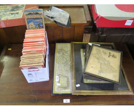

Lot 491
British Military Infantryman’s Hanger, late 18th century, slightly curved single edge blade cut with a single fuller and deeply stamped THOS CRAVEN, crowned 2 government inspector’s mark, and struck twice with the running wolf, regulation brass hilt with twin side bars and spiral twist brass grip. Blade 25”. Good condition and patina. Thomas Craven, Birmingham, recorded as a contractor to the Board of Ordnance supplying bayonets, swords and spears.

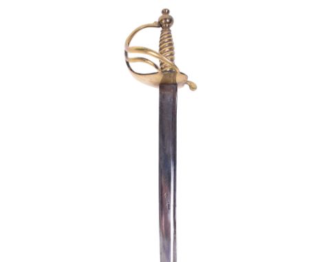
Lot 520
1796 Pattern Light Cavalry Officers Sword, gilt brass strap and knuckle bow with central shield style langet, gilded pommel and fluted back strap. Leather covered grip with copper wire binding. Curved single edged blade with large partial fuller. Remains of the gilt tooled etched decoration to the blade, early Ordnance / Engineers three cannon badge and order of the Thistle is etched along with trophy of arms and the makers details of Thomas Gills. Originally the sword would have been blue and gilt but none of the blueing remains and only outlines of the gilt remains to the etching. Blade measures 82 ½cms in length. No scabbard.
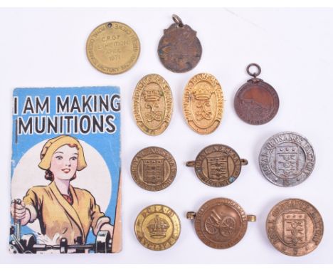
Lot 125
Collection of War Munitions Factory Badges, consisting of Royal Ordnance Factory 13 workers pin back badge, Royal Ordnance Factory 3 workers lapel badge, Royal Arsenal Woolwich workers numbered lapel badge, similar example with brooch pin fitting, D.C.I.A (3) Aycliffe lapel badge with stamped number to reverse, Coventry Ordnance Works Special War Service badge with brooch bar fitting, 2x Munition Makers Canteen brooch badges, Great War Speed Up Munitions fob, 1899 Royal Gun Factory swimming club medal, Royal Ordnance Factory Radway Green Crewe fob and “I AM MAKING MUNITIONS” small booklet. Various conditions. (12 items)
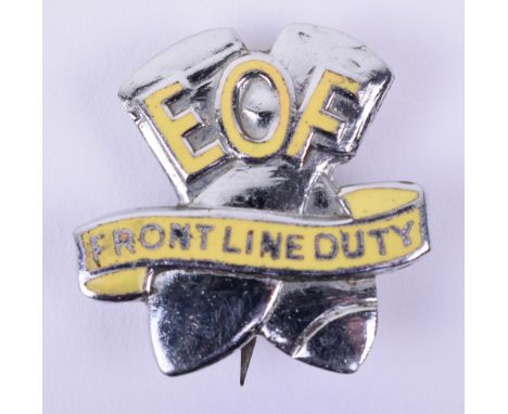
Lot 132
WW2 Elstow Ordnance Factory Lapel Badge, chrome and enamel example in the form of two crossed bombs with EOF and scroll “FORNT LINE DUTY”. Reverse is numbered 1872 and has Thomas Fattorini makers mark. Pin and catch fixing also to the reverse. Ex Jon Mills Collection, see page 69 “Doing Their Bit – Home Front Lapel Badges 1939-1945”.

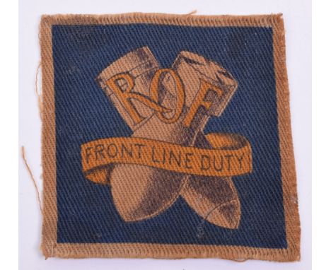
Lot 136
WW2 Home Front Royal Ordnance Factories Lapel Badge, brass and enamel example in the form of crossed bombs, red white and blue RAF style roundel and FRONT LINE DUTY around the edge, to the centre is ROF with the O forming part of the roundel. Lapel fitting to the reverse, numbered 1193. Ex Jon Mills Collection, see page 69 “Doing Their Bit – Home Front Lapel Badges 1939-1945”.
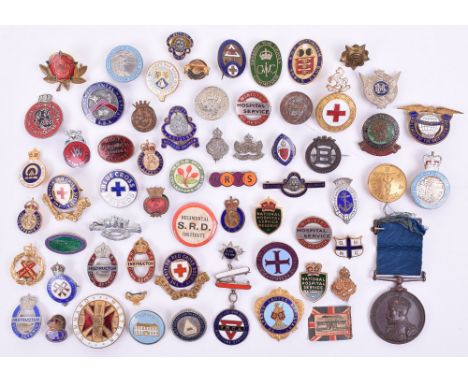
Lot 284
Quantity of Military & Civilian Organisations Lapel Badges, mostly with enamel, various organisations including Ne London Ladies Auxiliary, National Savings Movement – Lend to Defend, WW2 Fire Watcher, Birmingham Dental Hospital, celluloid button type Regimental S.R.D Institute, Air League of the British Empire, Kent VAD TF cap badge, EIIR Royal Observer Corps, hallmarked silver and enamel Soldiers & Sailors Families Association, Blue Cross Friends, M & H Womens War Work Guild, Ministry of Health Hospital Service, Royal Ordnance Factories Aycliffe Mechanical Services, ARPS Civil Defence Instructor (damaged pin), LARP Civil Defence Instructor, Western Command, plus others. Various conditions and fittings, mostly all in good condition. (61 items)

Lot 65
Selection of Military Collar Badges, of mostly corps, including pair of officers silver gilt Royal Army Ordnance Corps with “TONANTI” scroll, pair of OSD bronze Pioneer Corps, officers Intelligence Corps silvered single collar badge, pair of officers silver gilt Royal Army Education Corps, Victorian RAMC, blackened brass Chaplains, plus many more. Various styles of fittings to the reverse. (68 items)

Lot 771
A 19th century oil painting on canvas of a river scene with figure and cottage, signed bottom right Francis, 51 x 77 cm approx, unframed together with a further unframed oil painting on canvas of a mountainous lake scene, a mid-20th century coloured print of a floral still life after Barbara Shaw, dated 1951, in swept gilt frame, a 1921 Ordnance Survey map of the Synwell area of Wotton under Edge and another of the Bournstream area, both unframed

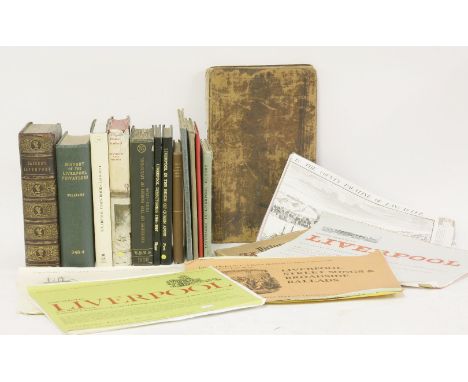
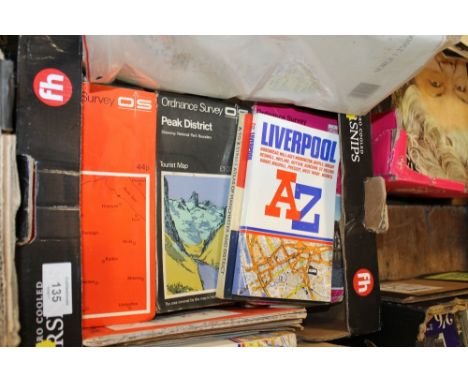
Lot 66
LIVERPOOL:1. Liverpool Town Books: Proceedings of Assemblies, Common Councils, Portmoot Courts Etc, 1550-1862, IN 2 Volumes. For University of Liverpool, 1918 & 1935. With plates (many folding); original cloth; VG; 2. Picton, J A: City of Liverpool. Selections from the Municipal Archives and Records, from the 13th to the 17th Century inclusive. Liverpool, G G Walmsley, 1883. PP356 + Frontis & List of subscribers. Leather backed boards and gilt emblem to upper cover; spine worn and hinges cracked; 3. Peet, H: Liverpool in the Reign of Queen Anne: 1705 and 1708. Liverpool, 1907; with frontis, 2 folding maps and another plate. VG; 4. Stewart-Brown, R: The inhabitants of Liverpool from the 14th to the 18th century. Liverpool, 1930, Privately printed Limited edition of 150 copies; presentation slip from author tipped-in. Original cloth backed paper boards; little blotched; o/w VG; 5. Williams, G: History of the Liverpool Privateers and Letters of Marque with an Account of the Liverpool Slave Trade. Heinemann, 1897, 1st. with 4 facsimile plates; Ex-Libra, with library cloth and usual stamps; 6. Baines, T: History of the Commerce and Town of Liverpool. Longman…, 1852. With one large folding map (Only), plus 8 plates?? PP544,12, 13(list of subscribers). Rebound preserving the original gilt pictorial leather; damp staining; A/F; PLUS 10 Others: Enfield: Essay towards the history of Liverpool, 1774, 2nd. edn. Defective copy; A/F; Harrison: Place-Names of the Liverpool district, 1898; Peet: Earliest Registers of Parish of Liverpool. 1909; Kelly’s Directory of Liverpool. 1930, no map, damp staining; Harries: Landmarks in Liverpool History. 1949, dw; Liverpool Burgess Rolls during C16. Facsimile; Ordnance Map of Liverpool. Linen backed folding, vg; Birrell: Some early recollections of Liverpool. 1924; Power: Liverpool town books, 1649-1671. 1999 rep.; & Chandler: Liverpool under Charles I. 1965, 1st. dw. Vg. (20)
Lot 939
LARGE LOT OF WWII CAP AND SHOULDER BADGESincluding the Royal Canadian Corps of Signals, 2 Royal Canadian Artillery (shoulder), Royal Marines, K.O.S.B. Association, Major Rank shoulder badge, Royal Artillery lapel badge, Artist's Rifles, Royal Engineers, Royal Army Medical Corps, Royal Army Ordnance Corps, Royal Army Service Corps, Army Service Corps, Nederland Dutch Army Exile Forces, Royal Corps of Signals, Rifle Brigade (Prince Consort's Own), Auxiliary Military Pioneer Corps, Maltese Cross CLB, Maltese Cross CLB Junior Training Corps, Catering Corps, Saskatoon Light Infantry, Royal Artillery Ubique, XXII Dragoons, Royal Canadian Engineers (23); together with a collection of patches relating to WWII Canadian military, to including the Canadian 1st Division RCCS Patch Royal Canadian Corps of Signals, Royal Canadian Artillery patch, etc (13) and some loose buttons and badges


Lot 1334
PAUL SANDBY, RA (1725-1809) LLANGOLLEN IN THE COUNTY OF DENBIGH FROM THE TURNPIKE ROAD ABOVE THE RIVER DEE Bears inscription as title on the backboard, watercolour and bodycolour heightened with varnish or gum arabic 45.5 x 60.5cm. Provenance: W. Angerstein; Mrs Norman (c.1843, label verso); D. M. Eccles MP; London, with P. & D. Colnaghi & Co. Ltd (label verso) Exhibited: London, The Arts Council of Great Britain, no date, no.36, from the Bradfer-Lawrence Collection (label verso) This may date to the late 1770's: between 1775 and 1777, Sandby published a series of aquatint views in Wales which were grounded in his solid understanding of topography from his diligent training with the Board of Ordnance. Without any infusion of sentimentality or the lyrical Classicism of artists like Richard Wilson, Sandby's views have the feel of immediate accuracy and truth that would have caught his eye as he worked. A 1776 print exists with the title of this watercolour but it differs in too many respects to be derived directly from it. ++ Some scattered retouching, principally within the sky, over flaked losses
Lot 425
Medals - George V pair comprising: 1914-18 War Medal and Long Service And Good Conduct Medal awarded to Sapper S.F. Munford, Royal Engineers, together with two 1914-18 War Medals awarded to Staff Sergeant A.E. Flook, Army Ordnance Corps and Private P. Devitt, East Yorkshire Regiment Condition:
Lot 337
Three WWII medals comprising a War Medal, Pacific Star and 1939-45 Star, issued to Private George Ritson of Bolton who was a member of the Royal Army Ordnance Corps, and died in 1943 as a prisoner of war in Japanese hands, with a collection of paperwork relating to Private Ritson including the notification of his death to his wife, other official papers, his commemorative scroll, photographs of Private Ritson and his grave etc.
Lot 754
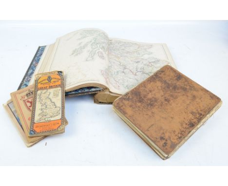
A Picturesque Tour of the English Lakes, illustrated with forty-eight coloured views by Fielding and Walton, published for R Ackerman of London in 1821, appears complete but binding is damaged and pages are loose, some dog eared, also Blackie's Imperial Atlas of Modern Geography, published by Blackie & Son in 1860, containing maps of Britain and the world, appears complete, faux leather boarded cover separate from spine and ordnance survey maps of the Lake District, Castle Douglas, and Kirkcudbright and an AA 1/4" motoring map of Dumfries and Stranraer (5). CONDITION REPORT: A Picturesque Tour of the English Lakes: in poor condition with detached boards, staining and foxing throughout, no spine. Imperial Atlas: poor condition with detached boards, foxing and discolouration throughout. Three maps are in poor condition.
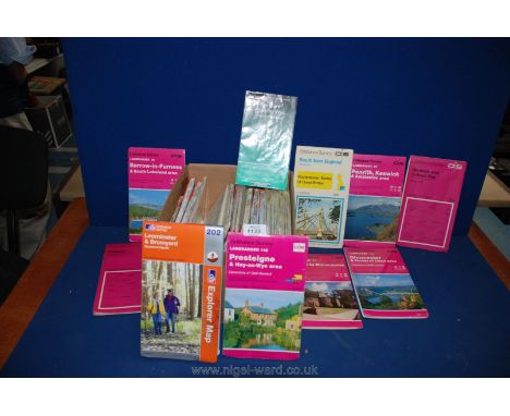
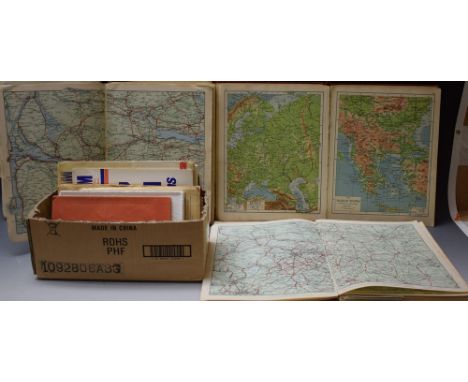
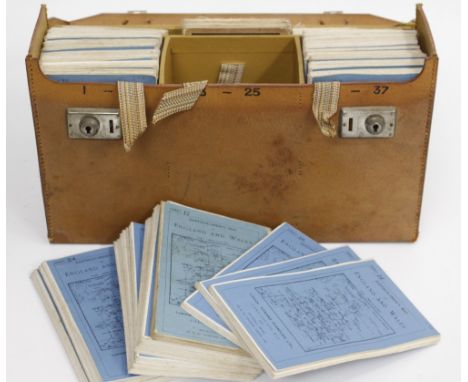
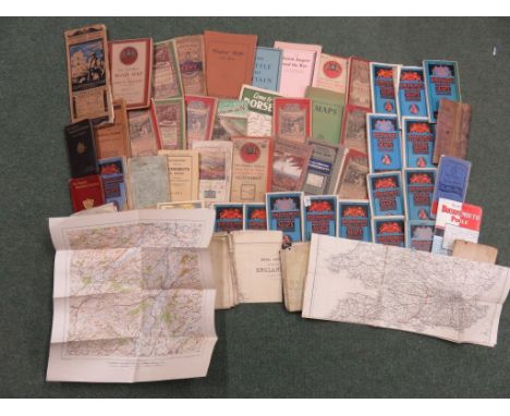
![[MAPS] Forty-nine Ordnance Survey folding maps, comprising thirty-eight Landranger, six Explorer and five Outdoor Leisure se](https://cdn.globalauctionplatform.com/15054e45-5697-4412-a62b-a73e0096c25e/31f7e711-0fb6-482c-c938-f7d0e6749d21/468x382.jpg)
Lot 111
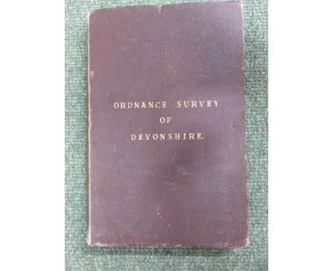
Lewis (William, publisher). Lewis's New Traveller's Guide and Panorama of England and Wales containing forty-four superior maps..., 1836, forty-four uncoloured engraved maps (complete) including a folding map of Yorkshire, light dampstaining throughout, original green cloth with publisher's printed paper label to upper cover, rubbed and marked with upper board and first few leaves near-detached, 8vo, together with Carington Bowles (publisher),Bowles's Post-Chaise Companion; or Travellers Directory through England and Wales..., volume 2 (only of two), 2nd edition, published 1782, printed title, 100 uncoloured engraved strip road maps printed on fifty sheets, list of fairs bound at rear, contemporary sheep, worn and frayed, 8vo, with Bartholomew (J.), Pocket Atlas of England & Wales, published John Walker & Co., 1887, printed, title, contents and tables, sixteen (complete as list) colour lithographic double page maps, hinges cracked, publisher's decorative blue cloth gilt, spine faded, small 8vo, plus Bacon (G. W. & Co. Ltd., publishers), Bacon's Road Atlas of England & Wales in three parts, North Section (only), circa 1925 twenty-four double page colour lithographic maps, some soiling and spotting to verso of upper cover, limp printed blue cloth wrappers, creased and soiled, 8vo, and Ordnance Survey (publishers), Ordnance Survey Atlas of England & Wales, Quarter Inch to the Mile, published Southampton, 1922, errata slip bound in before title, title page with library stamps, twenty-four double page photolithographic colour maps, each laid on linen, index bound at rear, ink library annotations to front pastedown, front endpaper and title page, hinges and joints weak, publisher's red cloth gilt, faded, worn and frayed, oblong folio, with Pinnock (W., editor), The Guide to Knowledge, volume 1 (only), 1833, title page and first first three pages torn with loss to margins and text, crudely repaired with tape, numerous wood engraved vignettes and maps to text throughout, fifty-three 'white on black' wood engraved maps of British counties, town plans. foreign countries, world and celestial charts, one plan torn with loss, contemporary cloth, rebacked, 4to Sold as a collection of maps, not subject to return. (6)
Lot 205
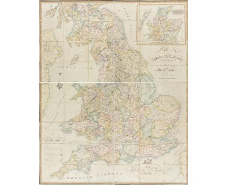
England & Wales. Walker (John), Map of the Inland Navigation, Canals, and Rail Roads, with the Situations of the various Mineral Productions throughout Great Britain, from actual surveys projected on the basis of the trigonometrical Survey made by order of The Honourable The Board of Ordnance..., published Richard Nichols, Wakefield, 1830, very large engraved map with contemporary hand colouring, sectionalised and laid on linen, inset map of Scotland, calligraphic title and dedication, table of explanation, edged in green silk, marbled endpapers, 1885 x 1540 mm A large and impressive map giving the location of mineral and rock deposits with each mine identified by the mineral it produces. It probably owes much to William Smith's ground breaking geological map of 1815. (1)
Lot 289
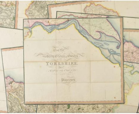
Yorkshire. Greenwood (C.), Map of the County of York, made on the Basis of Triangles in the County, determined by Lieut. Col. Wm. Mudge, Royal Art. F.R.S. and Captn. Thos. Colby, Royal Eng. in the Trigonometrical Survey of England by order of the Honourable Board of Ordnance and Surveyed in the Years 1815, 1816 & 1817, published Robinson Son & Holdsworth, Leeds [and] John Hurst & C.Greenwood, Wakefield, June 4th 1817, large scale engraved map with bright contemporary hand colouring, sectionalised and laid on linen on nine sheets, calligraphic title and dedication, table of the altitudes of the principal mountains, compass rose and table of explanation, very slight dust soiling, each sheet approximately 615 x 720, all edged in green silk, contained in a modern calf book box with gilt decorated spine (1)

Lot 714
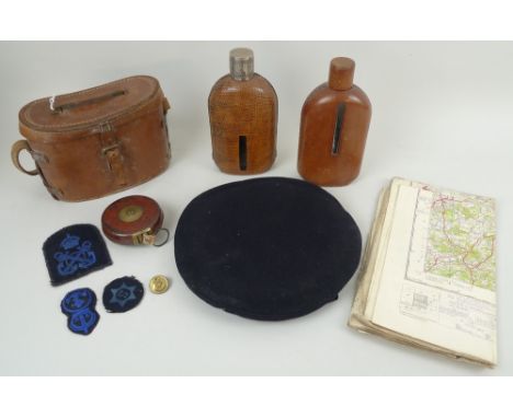
A WWII Ordnance Survey map of Greater London, Military Edition 'Not to be published' Special District (Relief) Map, First Pub. 1935, together with a pair of binoculars, a Chestermans tape measure, a WWII Wren's dark blue felt cap, button and three badges, and two leather and snake skin covered flasks, circa 1940's, one with cast white metal lid, 20cm. (10)

Lot 307
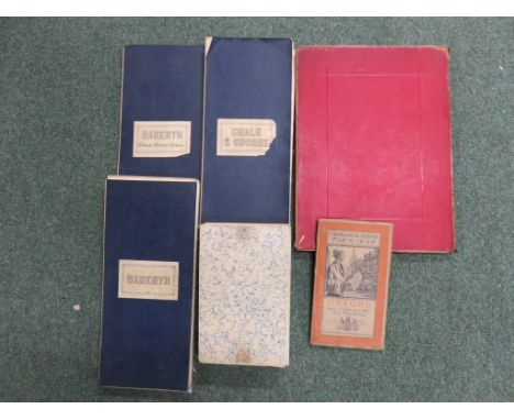
Collection of six maps to include: an Ordnance Survey Map Town Map of Oxford - 1919, coloured, folded, 70cm x 77cm tog. w. a linen backed folded map, titled Darenth - Green Street Green, 164cm x 100cm; another titled 'Darenth' - linen backed, folded, 163cm x 115cm; and one titled, Chalk & Shorne - linen backed, folded, 131cm x 199cm; another map showing parts of Hampshire, Middlesex and Surrey - linen backed, folded, coloured, 133xm x 148cm and another showing Leicestershire and Warwickshire - linen backed, folded, 104cm x 107cm (6)
Lot 328
Collection of framed and unframed maps to include a plan of Bridgewater from the Ordnance Survey - framed, 32xm x 19cm; BOWEN, Emanuel - Dorsetshire divided into the Hundreds - and another of Somersetshire - each unframed, coloured, 24cm x 34cm, and four other maps, and the information regarding the town of Bridgwater (8)
Lot 1441
Bacon's Excelsior Commerival & Industrial Map of Lancashire, Showing Railways, Roads, Elevations & Distances, Also Local Government Divisions Including Parishes with Acreages, Revised according to the latest Ordnance Survey, index to margin, twenty-four fold hand-coloured copperplate engraving laid on linen, maroon buckram boards, marbled endpapers, 8vo
Lot 735
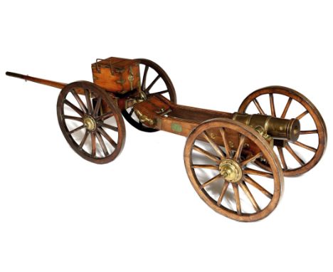
A fine 1:4 scale model of a 5 1/2 inch Howitzer, the carriage and limber built as a template at the Bombay Artillery's Gun Carriage Manufactory, Colaba Island, in 1822; brass ordnance 11 inches including cascobel, brass mounted carriage and limber with iron rimmed spoked wheels, the trail bearing brass plaque inscribed 'Captain Thew/ Agent/ 1822 Bombay', further plaque inscribed 'Carriage Howitzer/ brass with Limber/ Heavy 5 1/2 Inch/ Scale 3 inch to a foot', brass number plate 'No 118', ammunition box with partitioned interior, length when assembled approximately 5.5 feet. The British East India Company maintained factories for the local production of the materials of war. In the case of the Bombay Presidency this included a gun carriage manufactory on Old Woman's Island (later Colaba). Captain Robert Thew (a soldier with a distinguished career including action in the battle of Kirkee during the Third Anglo Maratha War) was the company's agent for gun carriages from 1821 to 1827. Like other men in his role he built models of this sort to provide a template to aid India craftsmen in building full sized gun carriages. The origin of the ordnance itself is uncertain, since the carriage factory was not also a foundry, but it's form complies closely to that of contemporary examples of the full sized version, for example: that which may be seen at the Royal Armouries collection, Fort Nelson, Portsmouth. Reference: Brigadier General H.A. Young, C.I.E., C.B.E., 'The East India Company's Arsenals & Manufactories'
-
12130 item(s)/page