We found 12129 price guide item(s) matching your search

Refine your search

Year

Filter by Price Range
  • List
  • Grid
  • 12129 item(s)
    /page

Lot 1428

Bachmann 31-650W DCC Ready Technical Services red/grey Class 47 Diesel 47 972 "The Royal Army Ordnance Corps" - Good Plus (missing some bogie detail parts, buffers crudely repainted silver and jumper cables glued onto nose in incorrect positions) complete with limited edition certificate showing this to be No.330 of only 512 models produced for Modelzone in Fair box and 2 x unboxed Heljan Class 14 type 1 Diesel Shunters both D9526 in weathered Blue Circle livery, missing some sanding apparatus & brake blocks, one model has damaged buffer beam & cab steps - Fair & Good Plus unboxed. (3)

Lot 851

A late 20th century coloured 'The Berkeley Hunt' showing the hunting territory and coverts map based on the 1921 Berkeley Hunt, Ordnance Survey Maps. Framed & glazed. It measures approx. 55 x 63cm. 

Lot 41

Collection of Ordnance Survey and road maps

Lot 235

Ordnance Survey Quarter Inch Atlas of Great Britain, 17 folding sheet maps.

Lot 150

A Siebe Gorman & Co. chrome divers torch, numbered 6230-99-942-7885 with four feet to protect the lens, 28cm; pair of WWII binoculars in canvas carrier; cloth and metal badges and buttons; War Office 1940 Ordnance Survey Map, Belgrad (Belgrade) / Fiume, 80 x 60cm; silks of flags.

Lot 655

Box of assorted books and Ordnance Survey maps

Lot 174

Australian and Canadian Military Shoulder Titles: A good selection mixed ages pairs and singles to include R.A.E.M.E. , Royal Australian Army Ordnance Corps, C.W.A.C. , Three Rivers Regt and many more. 39 items

Lot 132

Trench Art - ordnance shell-case brass vase to/w various vintage glass bottles, scales, copperware etc (box)

Lot 43

An Ordnance Survey map of Camelford and Heartland Point - framed and glazed, overall size 83 x 106cm.

Lot 1416

A XIX Century Old Sheffield Plate Tankard, stamped Smith Co near the rim, XIX Century pewter tankards, vintage Barholomew's ordnance survey maps, Ronson table lighter, Butterfield Bradford Brass magnifier, etc:- One Tray.

Lot 917

A collection of assorted maps to include Ordnance Survey of Great Britain 'Buckingham' sheet 146, Ordnance Survey 'Chilterns' sheet 159, etc.

Lot 923

ORDNANCE SURVEY; a map of the Isle of Man, a second impression from 1982 from the original of 1873, 102.5 x 77cm, framed.Condition Report: Generally good condition, the map was originally folded so there are visible fold and crease lines.

Lot 117

BOX WITH MISC ORDNANCE MAPS OF THE CITY OF EXETER & SURROUNDING AREAS

Lot 1751

AN ASSORTMENT OF MAPS TO INCLUDE SEVERAL ORDNANCE SURVEY MAPS

Lot 1018

Quantity of mixed Ordnance Survey maps to include Yeovil and Stratford-Upon-Avon etc. P&P Group 2 (£18+VAT for the first lot and £3+VAT for subsequent lots)

Lot 184

Various soapstone trinket pots and others, leather wallets and purses, assorted table linen, a linen-backed Ordnance Survey map, Famous Families, The Percys of Northumberland, a Mongolian sheepskin white hat, etc (2 boxes) 

Lot 5257

(Atlases, Great Britain), J. & C. Walker (published): 'British Atlas, comprising separate maps of every county in England, each Riding in Yorkshire and North & South Wales, showing the roads, railways, canals, parks, boundaries of boroughs &c. compiled from the maps of the Board of Ordnance and other trigonometrical surveys', London, Longman Rees & Co and J & C Walker, 1874, double page copper engraved title page/dedication page, 5 double page tables of populations of market towns in each county etc, 49 double page engraved hand coloured maps as called for (comprising England, Scotland, Ireland, plus 46 county maps), folio, contemporary half calf gilt (worn), gilt leather title label with gilt Coat of Arms of Queen Victoria above title mounted to front cover

Lot 458

A box containing Ordnance Survey maps.

Lot 854

A box containing various maps, Ordnance Survey of London and South East England etc.

Lot 468

BOOKS & EPHEMERA, four boxes containing approximately eighty titles, mostly historical from authors including Winston S. Churchill (four volumes of A History of the English Speaking Peoples, published by Cassell) and Antonia Fraser, works on Nelson, Napoleon & Hitler, the English civil war, 1066, the gunpowder plot and encyclopaedic treaties, together with approximately twenty-one audio cassettes from Miss Read, Rosamunde Pilcher, Pam Ayres and Alan Titchmarsh and approximately thirty-two maps from the Ordnance Survey, Michelin, an autograph book containing drawings and a signature 'Billie Whitelaw' B.B.C 1953, etc (4 boxes)

Lot 28

A King's South Africa medal to 504 Staff Armourer Serjeant W King, Ordnance Corps

Lot 586

A vintage wooden apple crate with advertising on one end for Occidental Canadian A1 Apples. Lot also includes three vintage boxes, a metal one stamped "Compact Primus Outfit", a wooden box marked Cycle bolts with a metal stamp marked Ordnance, Woolwich, London and a wooden box with label stating "Millenery - to be kept dry, a clients address and from Brandons, London".

Lot 473

5 large scale Ordnance Survey parts of London maps 1919 (1) 1920 (3) 1940 (1) (5)

Lot 482

ORDNANCE SURVEY: NORWICH, engraved hand coloured map 1910, folding, backed onto linen, approx 410 x 110mm, f/g

Lot 314

Qty of Ordnance survey maps t/w 5 Geographical books

Lot 81

Ordnance Gazeteer Scotland in 6 volumes 

Lot 331

A NICE SELECTION OF BADGES, to include WWII ARP, WWII Loyal Service badges, British Legion, an imperial service badge, a war munitions volunteers badge, Civil Defence instructor, Great War Comrades badge, various sweetheart badges to include RE, Army Catering Corps, Army Ordnance Corps and RA (19)

Lot 166

A Collection of Royal Amy Ordnance Corps Badges Etc

Lot 178

A Collection of Items Relating to the Royal Army Ordnance Cops

Lot 851

A box containing an eight track cassette; various games and Ordnance Survey maps

Lot 451

MAPS, GUIDES, POSTERS & CALENDARS three boxes and loose containing over 150 Maps, and Guides from the Uk, Europe, Africa and Asia, a large proportion of Ordnance Survey publications included, a box of modern Film Posters and six Pirelli Calendars from the 1980's (three from 1988)

Lot 598

Ordnance Survey map of Dorking and Leith Hill. Scale 1 to a mile. Coloured map. Large, folded map contained in card covers. 1929. Fair condition 1919. We combine shipping on all lots. Single book £5.99 UK, £7.99 Europe, £9.99 ROW. We can ship a parcel up to 20kg which will take approx. 40 books in UK £12, EUROPE £39.99, ROW, £59.99

Lot 229

A selection of ordnance survey guides and maps including Collins and Michelin

Lot 80

An early 20th century oak chest containing aprox 100 ordnance survey guides and maps,

Lot 427

An antique Edward Stanford Ordnance survey map of England and Wales in two sections and mounted to cloth, contained within folder.

Lot 1126

A case and two boxes of Ordnance Survey OS maps including vintage **PLEASE NOTE THIS LOT IS NOT ELIGIBLE FOR POSTING AND PACKING**

Lot 3018

WW1 British 1907 pattern bayonet, the 43cm single edged fullered blade stamped to the ricasso with a crown GR cypher 1907 8 15 Sanderson, with various ordnance marks verso, two piece walnut grip, pommel stamped 1HLI 354; in steel mounted leather scabbard stamped 140 to the throat L57cm overallCondition Report:Surface pitting to hilt and scabbard fittings.Leather to scabbard well rubbed and a little mouldy.

Lot 1018

The Contour Road Book of England by Harry Inglis 1913 - 14, Collection of Explorer Ordnance Survey Maps, Ordnance Survey The Lake District 1920, other Ordnance Survey maps, a map of London, framed map of London showing offices in the Midland Bank:- One Box.

Lot 683

Collection of twenty three horse brasses incl. heart, star, crescent, etc. on four leather straps with Ordnance, Armoured Corps, Engineers and East Yorks Regt. cap badges (qty)

Lot 288

First 1907 pattern bayonet, 'Ordnance' marked in leather scabbard, end tip missing, together with a 1913 pattern bayonet made by Remington, in its leather scabbard with frog

Lot 291

Two pattern 1888 bayonets, with double ended 12" blades with ordnance markings, one by Mole, in their leather scabbards with iron mounts

Lot 201

Five: Captain E. O. King, Hampshire Regiment, later Royal Army Ordnance Corps Queen’s South Africa 1899-1902, 4 clasps, Cape Colony, Orange Free State, Transvaal, South Africa 1901, unofficial rivets between state and date clasps (190 Pte. E. O. King, 2nd. Hampshire Regt.); Defence Medal; Army Meritorious Service Medal, G.V.R., 1st issue (380802 S. Mjr. E. O. King. 17/Hamps: R.); Imperial Service Medal, G.V.R., Circular issue, 2nd ‘Coronation robes’ issue (Ernest Otto King); Territorial Force Efficiency Medal, G.V.R. (284 C. Sjt: E. O. King. 5/Hants: Regt.) mounted court-style for display in this order, generally good very fine and better (5) £300-£400 --- Ernest Otto King was born in Southampton on 6 July 1876 and joined the Post Office as a temporary Postman on 30 August 1896, being confirmed as Town Postman on 4 November of that year. He attested for the Hampshire Regiment for the duration of hostilities at Winchester on 24 January 1900, having previously served in the Regiment’s 2nd Volunteer Battalion, and served with the 2nd Battalion in South Africa during the Boer War from 11 May 1900 to 17 May 1901. He was one of the Volunteers who received the Freedom of the Borough of Southampton on 10 October 1900, and was discharged on 24 May 1901, resuming his employment as a Postman. King was awarded his Territorial Force Efficiency Medal per Army Order 8 of January 1914, whilst serving with the 5th Battalion, Hampshire Regiment, and served with the Hampshire Regiment throughout the Great War, from 4 August 1914 to 14 February 1919. Advanced Warrant Officer Class II in 1915, and Warrant Officer Class I in 1917, for his services at home with the 17th Battalion was awarded the Meritorious Service Medal (London Gazette 22 February 1919). King joined the Royal Army Ordnance Corps in November 1920, and as promoted Lieutenant in 1922. Advanced Captain, he was awarded the Imperial Service Medal upon his retirement from the Post Office on his 60th birthday (London Gazette 4 September 1936). Sold with copied research and medal roll extracts.

Lot 281

Four: Squadron Quartermaster Sergeant W. M. Beasley, Royal Army Ordnance Corps War Medal 1939-45; Korea 1950-53, 1st issue (22225452 Sjt. W. M. Beasley. R.A.O.C.); General Service 1918-62, 1 clasp, Arabian Peninsula (22225452 Sjt. W. M. Beasley. R.A.O.C.); U.N. Korea 1950-54, unnamed as issued, mounted court-style in this order, nearly extremely fine (4) £160-£200 --- William M. Beasley was an ammunition technician, who served in the Korean War, twice in Aden, and in Northern Ireland for nearly 2 years from 1965 to 1967 in Ballykinlar and Kinnegar. By 1967 he had been advanced to Squadron Quartermaster Sergeant, and he was finally discharged in August 1970.

Lot 301

Pair: Warrant Officer Class 2 P. D. Erwin, Royal Army Ordnance Corps General Service 1918-62, 1 clasp, Arabian Peninsula (23228689 Sgt. P. D. Erwin. R.A.O.C.); Army L.S. & G.C., E.II.R., 2nd issue, Regular Army (23228689 W.O. Cl.2 P. D. Erwin RAOC.) mounted as worn; together with the related miniatre awards, these similarly mounted, nearly extremely fine (2) £100-£140 --- Provenance: Dix Noonan Webb, June 2014. Peter Erwin took part in the Guard of Honour in 1956 as a Corporal whilst serving with the 3rd Infantry Division, and by late 1961 was with the 111th Guided Weapons Company, Royal Army Service Corps, in Germany. He was awarded his Long Service and Good Conduct Medal on 2 January 1973. Sold with the named card box of issue for the Long Service and Good Conduct Medal.

Lot 343

China 1857-60, no clasp (Wang Ti Ting Civn. Interpreter M.S.) engraved naming; together with a silver Army Ordnance Corps Chinese Service badge, good very fine, rare £400-£500

Lot 439

General Service 1918-62, 1 clasp, Arabian Peninsula (2) (S/22264925 Cpl. A. R. J. Dennington. R.A.S.C.; 22995492 Cpl. A. Moore RASC.) minor official correction to unit on first, very fine and better (2) £100-£140 --- Albert Robert Dennington was born in Wandsworth, London, on 5 October 1924 and joined the Royal Artillery in 1939, transferring to the Royal Army Ordnance Corps 29 November 1941. He later transferred to the Royal Army Service Corps and in 1949 he was in the 641 Motor Transport Company in Scotland where he was in the winning football team in the Scottish Command Cup. He died in Nottingham on 12 November 1982.

Lot 515

Lapel Badges: A group of 17 lapel badges and Sweetheart Brooches, including 15th Hussars, Lothian and Border Horse; Royal Warwickshire Regiment; Royal Lincolnshire Regiment; Lancashire Fusiliers; Hampshire Regiment; Middlesex Regiment; Royal Army Medical Corps; Army Ordnance Corps; and Royal National Lifeboat Institution, generally good condition (17) £80-£100

Lot 2

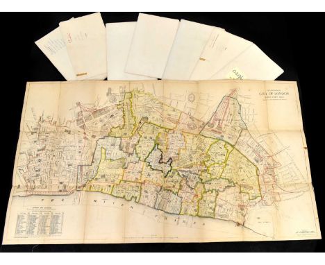
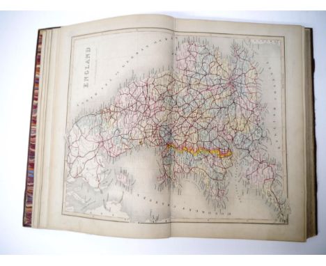
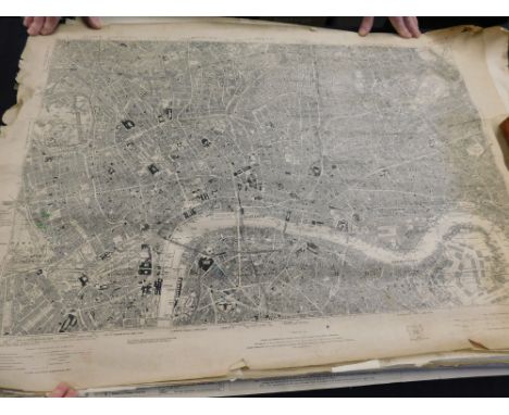
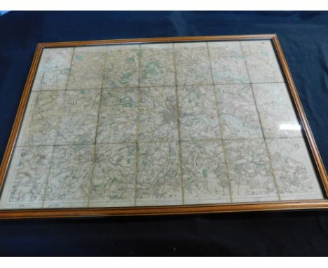
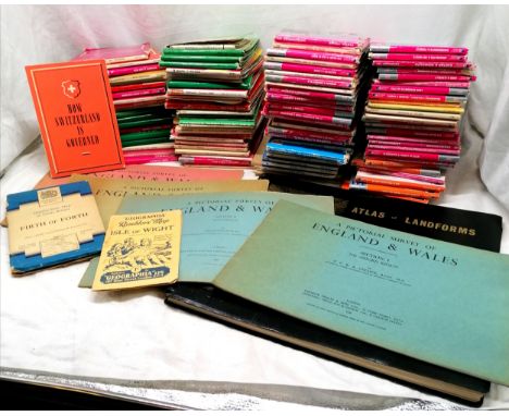
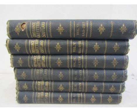
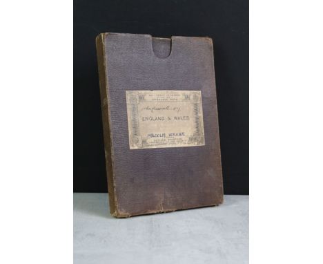
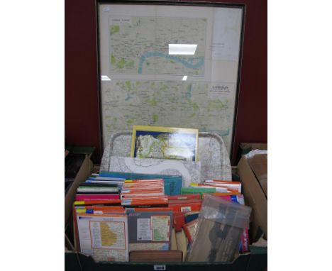
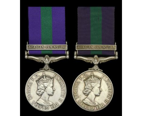
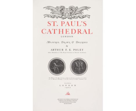
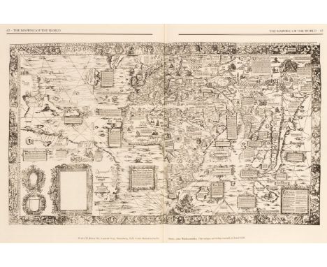
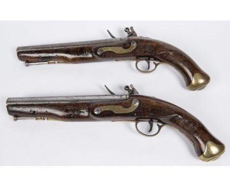
Facsimile Atlas. Ptolemy (Claudio), Geographia Ptolemaeus Auctus Restitutus Emaculatus, cum tabulis veteribus ac nobis, West of England Press Ltd. Tavistock, 1975, printed title and introduction, 47 double-page uncoloured maps, limited edition 61/250, signed by the Lord Mayor of Plymouth, publisher's morocco gilt, folio, contained in the publisher's red cloth slipcase, together with Rocque (John). An Exact Survey of the Cities of London and Westminster, The Borough of Southwark..., Harry Margary, Lympne Castle, Kent, 1971, double-page title and introduction by James Howgego, 41 uncoloured double-page maps, publisher's red cloth, with title label to the upper siding, folio, plus a separately bound index, with Morgan (William). London &c. Actually Surveyed and a Prospect of London and Westminster..., Harry Margary, Lympne Castle, Kent, in Association with the Guildhall Library, 1977, double-page title and introduction by Ralph Hyde, 12 uncoloured double-page maps, publisher's red cloth, with title label to the upper siding, folio, with Ogilby (John). A Large and Accurate Map of the City of London..., Harry Margary, Lympne Castle, Kent, in Association with the Guildhall Library, 1976, double-page title and introduction by Ralph Hyde, 21 uncoloured double-page maps, publisher's red cloth, with title label to the upper siding, folio, plus Stanford (Edward). Stanford's Library Map of London and its Suburbs, Harry Margary, Lympne Castle, Kent, in Association with the Guildhall Library, 1980, calligraphic title, introduction by Ralph Hyde, key plate and 24 uncoloured map sheets, publisher's red cloth, with title label to the upper siding, oblong folio, with another unbound copy, loose and rolled, and Poley (Arthur F. E.). St. Paul's Cathedral London, Measured, Drawn & Described, Archive facsimile edition, Barracuda Books, 1984, black & white plates and plans, limited edition, number 58, top edge gilt, publisher's half morocco gilt, slight dust soiling to the boards, large folio, together with:Cellarius (C.). Geographia Antiqua: Being a Complete Set of Maps of Antient Geography..., C & J Rivington, Longman, Hurst, Rees, Orme, Brown and Green, 1824, double-page calligraphic title page, contents list, 33 (complete as list) uncoloured double-page maps engraved by R. W. Seale and W. H. Toms, very slight spotting, near contemporary ownership signature to the verso of the title page, later endpapers, modern half calf gilt, 4to, plus:The Times Atlas. 1896, title and index, 116 colour printed lithographic maps (complete as list), index bound at rear, presentation inscription to the rear of the front endpaper, all edges gilt, contemporary half morocco gilt, worn and frayed, folio, George Philip & Son Ltd (publishers). Philips' International Atlas, 1931, title, preface and contents list, double-page frontispiece of the flags of all nations, 158 maps (complete as list) index bound at rear, presentation inscription to the front endpaper, contemporary cloth with gilt title to upper siding, spine faded, folio, with Ordnance Survey Office (publishers). Ordnance Survey Atlas of England & Wales, 1922, printed title, 24 double-page colour lithographic maps, laid on linen, index bound at rear, bookplate of the Flyfishers' Club, pastedowns stained, hinges and joints broken, preliminaries and first few leaves detached, text block and boards near detached, lacking spine, heavily worn and frayed, oblong folio, plus Yriarte (Charles). Venise. Histoire - Art - Industrie - La Ville - La Vu, Paris, 1878, additional half-title, numerous wood engravings throughout, top edge gilt, contemporary half morocco gilt, worn and frayed at extremities, spine faded, folioQTY: (13)

Lot 37

Folding Maps. Greenwood (C. & J.), Map of the County of Warwick from actual Survey, made in the years 1820 & 1821, Dedicated to the Nobility, Clergy & Gentry of the County by the Proprietors and Published for them by George Pringle Junr. C. & J. Greenwood..., 1822, large-scale engraved map with contemporary wash colouring, sectionalised and laid on linen, calligraphic title, table of explanation, compass rose and uncoloured vignette of Warwick castle, stained and toned, occasional splits along old linen, slight wear causing small holes where old folds cross, the map edged in blue silk, 1320 x 1050 mm, together with Kitchin (Thomas). A New Improved map of Oxfordshire from the Best Surveys and Intelligences..., J & C Bowles & Robert Sayer, circa 1767, engraved map with contemporary outline colouring, sectionalised and laid on linen, large uncoloured cartouche, some overall dust soiling, 715 x 525 mm, with Hodskinson (Joseph). The County of Suffolk, reduced from the large map in Six Sheets..., William Faden, Jany. 1st. 1787, engraved map with contemporary wash colouring, sectionalised and laid on linen, toned and stained overall, some marginal fraying with slight loss to the printed surface, slight insect damage, 585 x 780 mm, plus Bowen (Emanuel). An Accurate Map of the Counties of Leicester and Rutland, Divided into Hundreds..., circa 1767, engraved map with contemporary outline colouring, sectionalised and laid on linen, large uncoloured cartouche, some overall dust soiling, small holes where old folds cross, margins painted black, 550 x 690 mm, contained in a contemporary marbled card slipcase, worn and frayed, and Cary (John). A New Map of Derbyshire, Divided into Hundreds Exhibiting its Roads, Rivers, Parks &c. 1823, engraved map with contemporary wash colouring, sectionalised and laid on linen, some dust soiling and slight staining, 550 x 485 mm, marbled endpapers, with another 20 maps similar, including examples by or after Ordnance Survey, Bartholomew, Smith, Wyld, Cruchley, Geographia, Couchman, Bailey and Morden, various sizes and condition QTY: (26)

Lot 43

Map Reference & Facsimile Atlases. A collection of 30 volumes, mostly 20th-century, including Shirley (Rodney W.). The Mapping of the World, Early Printed World Maps, 1472 - 1700, The Holland Press, 1983, additional half-title, numerous colour and black and white illustrations throughout, publisher's cloth gilt, dust jacket, folio, together with Dekker (Elly). Globes at Greenwich. A Catalogue of the Globes and Armillary Spheres in the National Maritime Museum, Greenwich, Oxford University Press and the National Maritime Museum, 1999, additional half-title, numerous colour and black and white illustrations throughout, publisher's cloth gilt, dust jacket, folio, contained in a contemporary card slipcase, with Burden (Philip D.). The Mapping of North America. A List of Printed Maps 1511 - 1670, Raleigh Publications, 1996, additional half-title (signed by the author), numerous colour and black and white illustrations throughout, publisher's cloth gilt, dust jacket, folio, plus other reference books including Joan Blaeu's Atlas Major in two volumes published by Taschen, folio, and volumes by Hyde, Howgego, Skelton, Baynton-Willimas and Barron, with Stanford (Edward, publisher). The Ordnance Survey Atlas of England and Wales, circa 1920, printed title, tipped in errata slip, 24 double-page colour lithographic maps, laid on linen, index bound at rear, bound with The Ordnance Survey Atlas of Scotland, printed title, tipped in errata slip, 18 double-page colour lithographic maps, laid on linen, index bound at rear, publisher's cloth gilt, oblong folio, and Bartholomew (John & Co. publisher). Plan of the City of Edinburgh with Leith and Suburbs, 1891, 12 folding colour lithographic maps, several crudely repaired long closed tears throughout, publisher's cloth gilt, worn, slim upright folio, with others similarQTY: (30)

Lot 47

Maps. Smith (Charles). Smith's New Map of England and Wales and part of Scotland including the Turnpike and principal Cross Roads..., 1821, engraved map with contemporary outline colouring, sectionalised and laid on linen, calligraphic cartouche, compass rose, mileage scale and table of explanation, slight staining, marbled endpapers, 1145 x 940 mm, contained in a contemporary reverse calf slipcase with 'envelope style' lid, case heavily worn and rubbed, together with Cox (Thomas). A Topographical, Ecclesiastical and Natural History of [Surrey], circa 1720, folding uncoloured engraved map of Surrey by Robert Morden, map size 175 x 210 mm, 127 pages of descriptive text, modern endpapers, modern half calf over marbled boards, 4to, with Hinton (John, publisher). The Universal Magazine of Knowledge and Pleasure..., volume XL, 1767, engraved allegorical frontispiece, 7 engraved plates and three folding strip road maps, upper hinge and joint weak and cracked, contemporary calf, rubbed and worn, 8vo, plus Royal Commission on London Traffic (publishers). Report of the Royal Commission Appointed to Inquire Into and Report upon the Means of Locomotion and Transport in London, 1905, four large folding lithographic maps, descriptive text, publishers printed paper wrappers, lacking rear cover, upper cover frayed and torn with loss, folio, with another 12 folding maps, including examples by or after Ordnance Survey, Atkin & Co. Geographia, Walker and Brown & Co., various sizes and conditionQTY: (16)

Lot 1349

Vintage Ordnance Survey maps. P&P Group 1 (£14+VAT for the first lot and £1+VAT for subsequent lots)

Lot 380A

Four 30mm ordnance shells with brass bodies and blue tips 3Z/SWN 

Lot 395

A 19th century bamboo cavalry lance, 108" (9') overall, the shoe bearing ordnance marks "9.L", serial number "599" and other indistinct marks, with leather grip and buckskin sling. GC (head and shoe slightly pitted). £80-120

Lot 396

A 19th century wooden cavalry lance, 109" (9'1") overall, with small flattened diamond section head, the socket with indistinct ordnance inspector's mark and key hole slots for pennant bar, the shoe having one long tang terminating in an iron loop handle, with white buckskin sling. GC £100-120

Lot 417

A brace of 10 bore military pattern flintlock merchant ship's pistols, by Williams & Powell (Liverpool 1833-1870), barrels 9¾", with B'ham proofs, signed flat locks, walnut fullstocks, ordnance pattern brass mounts, and original steel ramrods. GC (rather worn overall, both butts scratched, one action fails to hold on half cock). £500-800

Lot 291

16 Corps cap badges, including Corps of Military Accountants, Army Physical Training Staff/Corps (large crossed swords and small crossed swords in brass, white metal, chrome KC and chrome QC), large APC cypher, pre 1920 Army Pay Corps, pre 1946 Army Dental Corps, Army Ordnance Corps etc; also 14 APTC brass buttons. Average GC £60-80

Loading...Loading...
  • 12129 item(s)
    /page

Recently Viewed Lots