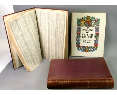
We found 12130 price guide item(s) matching your search

Refine your search

Year

Filter by Price Range
  • List
  • Grid
  • 12130 item(s)
    /page

Lot 1123

Madge's large scale Ordnance Survey of Essex 1805. "Part the First of the General Survey of Essex and a portion of the Adjoining Counties done by the Surveyor of His Majesty's Ordnance under the direction of Lt. Col. Mudge of The Royal Artillery. FRD". Essex was the second county to be surveyed, Kent being the first. Together with the titled wooden case and roller, 4ft x 6ft

Lot 95

QTY OF VINTAGE ORDNANCE MAPS

Lot 247

Bartholomew's revised 'Half-Inch' contoured maps, S.Yorks & Humber, Teesdale, Warfedale etc, 1950s and later Ordnance Survey maps and other similar maps in one box Condition Report Click here for further images, condition, auction times & delivery costs

Lot 464

Ordnance Trigonometrical Survey, Account of the Observations and Calculations of the Principal Triangulation

Lot 558

An Ordnance Survey Atlas of England and Wales

Lot 2080

Set of six numbered Victorian Ordnance Survey Coloured Maps of Hutton Bushel &c. Yorks, 1/25000 scale, surveyed in 1890, pub.1892, covering Hackness, Suffield, Hutton Bushel, West Ayton, etc, numbered land parcels with areas, with original index and gilt leather folder label, each 71cm x 102cm Condition Report Professionally cleaned Click here for further images, condition, auction times & delivery costs

Lot 2443

Cruchley's County Maps of England, Surrey & Kent, Railway's of England & Scotland, Railway and Telegraphic County Map of Somerset, Reduced Ordnance Map No.34, Phillips' Cyclists Maps of Suffolk & Hampshire, Bacon's similar GB & Nottingham, Bartholomew's Parliametary Map of the British Isles for the General Election of 1880 Condition Report Click here for further images, condition, auction times & delivery costs

Lot 554

Collection of vintage ordnance survey maps

Lot 568

Collection of various vintage ordnance survey maps together with a box of vintage postcards

Lot 597

Ordnance survey maps, framed ordnance survey map & reproduction Barry postcards

Lot 649

A parcel of items including old ordnance survey maps, tape measure, tin of dominoes

Lot 325

SELECTION OF VINTAGE ORDNANCE SURVEY MAPSof central Glasgow and surrounding areas, Perth and Edinburgh, together with a pair of turned pine map hangers, a vintage map measurer marked 'W.G. Blackwood', two vintage set squares, an architects rule and a slide ruler

Lot 332

Quantity of 19th/20thC Estate and Ordnance Survey maps - Yorkshire, Staffordshire etc

Lot 333

Quantity of Ordnance Survey one inch maps

Lot 584

A quantity of Ordnance Survey maps, some dating from 1930s and 1960s.

Lot 681

A small quantity of Bartholemews and Ordnance Survey maps.

Lot 4215

Ordnance survey quarter inch atlas of Great Britain

Lot 1359

The Pageant of Empire Souvenir volume, 1924, illustrated Frank Brangwyn and others, a Mid Summer - Night's Dream, 1914, illustrated W. Heath Robinson, Venice & Oxford, A & C Black, The Times Survey atlas of the world, 1922, and others, also a collection of ordnance survey and other maps (qty).

Lot 138

Quantity of Ordnance Survey maps

Lot 192

Canadian Royal Canadian Ordnance Corps Cloth Shoulder title, officers type

Lot 199

Australian Royal Army Ordnance Corps cloth shoulder title, blue on red

Lot 226

British Cloth Shoulder titles (5) Including: The Royal Army Ordnance Corps, The Life Guards, Coldstream Guards, Royal Army Medical Corps and Foresters.

Lot 286

Indian Army Ordnance Corps WWII Cap badge (Brass, brooch fitting)

Lot 339

Indian Shoulder Titles (3) Artillery, Army Ordnance Corps and Royal Indian Army Service Corps

Lot 206

A yellow metal sweetheart brooch, 50m winged brooch marked 9ct having a blue enamel "RAF" centre with red enamel crown surmount, approximate weight 3.7gms, fitted box named "Howells Tenby & Llandil" another 50mm bar brooch marked Sterling with enamel centre "Royal Army Ordnance Corps". (2)

Lot 76

A box of ordnance survey maps to include some local interest.

Lot 2047

Two boxes of ordnance survey maps.

Lot 2062

Two boxes of ordnance survey maps etc.

Lot 379

A Mixed Collection Of Militaria To Include A WW2 Gas Mask With Original Bag (Dated 1940), Water Flask With Webbing Straps, Map Readers Pouch Dated 1943, A Cap And Various Items Of Inert Ordnance.

Lot 393

A Collection Of Approx 40 x R.A.F. / War Office Ordnance Survey Maps.

Lot 402

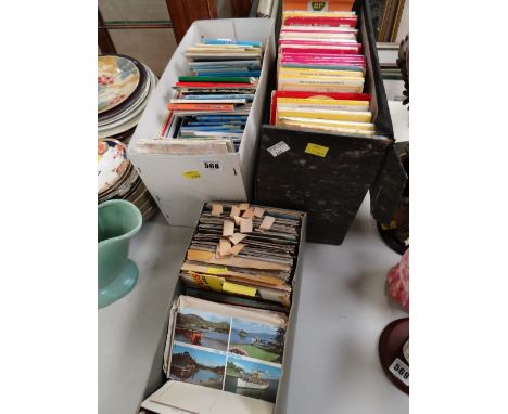
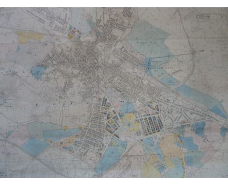
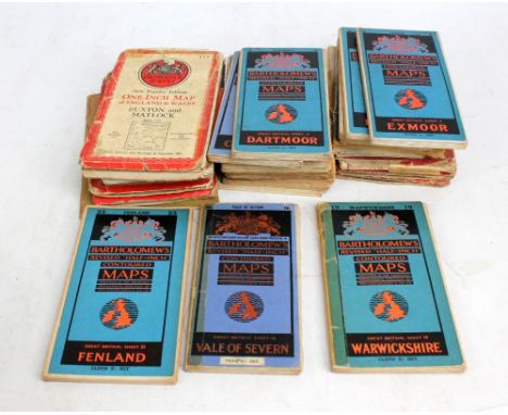
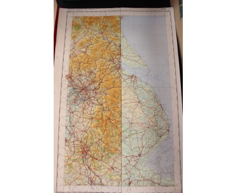
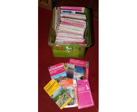
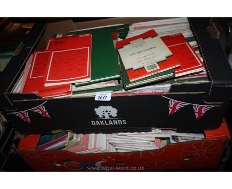
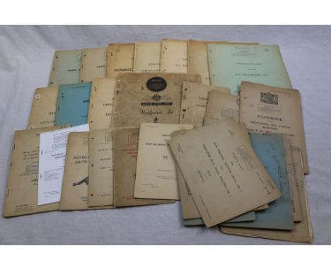
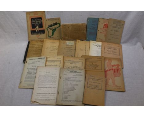
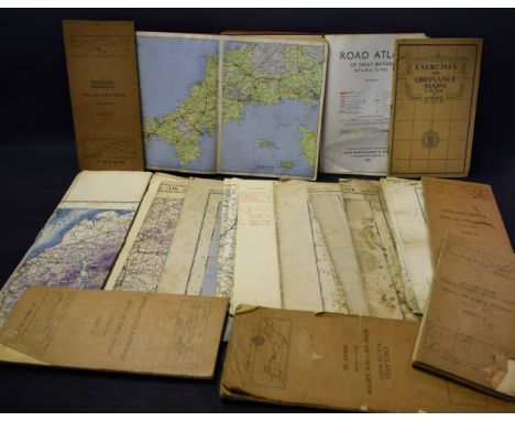
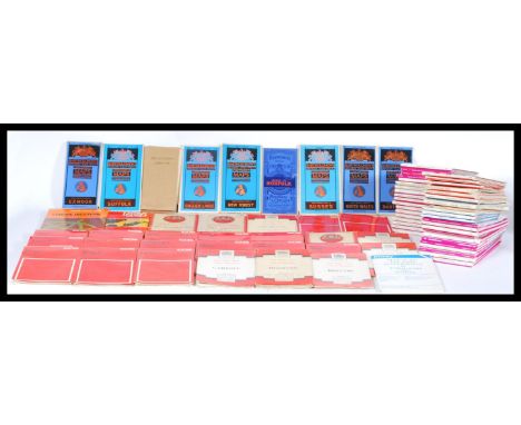
A Collection Of World War Two Era & Post WW2 Military Training Manuals & Lists To Include : Identification List Austen 9mm Sub Machine Gun, Identification List For 3 Inch Mortar Mk4 & 5, Identification List For .38 Webley Pistol Revolver Mk4, Identification List For BESA 7.92mm Machine Gun, Identification List For The .22 Rifle Bracket No.4, Handbook For The F.T. Portable, No.2, Mk2, Identification List For F.T. Portable, No.5, Mk1, Identification List For Ordnance 2 Inch Mortar, Parts List For Ordnance 2 Inch Mortar MK2, Handbook For Tank Guns And Mountings, Handbook For Tank Guns & Mountings 6-PR Co-Axial Mountings, Owen Gun Instruction Book, Handbook For The 2.5 Inch Projector, Handbook For The 2 Inch Mortar, Vickers .303 Gas Operated Mk.1 Gun, Notes On The Smith & Wesson .38 Pistol Revolver, Royal Armoured Corps Weapons No.35 3 Inch Howitzer, Instructions #on #the .300 Inch Browning Machine Gun, Hints On Map Reading Instruction, Parts List For Polsten 20mm Machine Gun, Identification List For No.4 Rifles, Parts List Boys Rifle Mk.1, Identification List 9mm Sten Machine Gun, Identification List .303 Bren Machine Gun x2 And Parts List For Rifle No.5 Mk1.

Lot 476

A Large Collection Of World War Two Era Military Training Manuals To Include : Browning Machine Gun Cal.50, Small Arms Accidentd, Malfunctions And Their Causes, Bren Machine Gun .303 ID List, Transportable Flame Thrower No.2 Handbook, Handbook For The Transportable No.2 Mk.1, Browning F.N. 9mm No.2 Mk.1 Pistol, Small Arms, Light Field Mortars And 20mm Aircraft Guns Technical Manual, Flame Thrower Portable No.5 Mark 1 User Handbook, F.T. Portable No.5 Mark.1 Text Book , Small Arms Accidents And Their Causes Technical Manual, Ordnance Maintenance Pistols And Revolvers Technical Manual, Browning Machine Gun Cal.30 M2 Aircraft Fixed And Flexible Technical Manual, Revolver Colt .38 Special Ordnance Supply Catalog, Ordnance Manual Browning Machine Gun Cal.50, Basic Field Manual Browning Machine Gun Caliber .50 HB M2, Small Arms Training Infantry Anti Tank, Tactical Training For Platoon Comanders, Fire Control And Theory Of Small Arms Fire & Others...

Lot 405

BARTHOLOMEW (J), MAP SHOWING THE SURFACE GEOLOGY OF IRELAND, reduced chiefly from the ordnance and geological surveys under the direction of Sir Archibald Geikie, twenty sections laid on linen, with hand colouring , original blue cover with gilt lettering (1)

Lot 411

A set of ten Ordnance Survey folding linen backed maps of England and Wales, dated 1912-1914, in an official leather box - the lid with gilt King George V cipher, the back titled in gilt 'Ordnance survey maps of England & Wales and Channel Islands'

Lot 1173

A quantity of Ordnance Survey Maps and Bartholomew Maps

Lot 234

A large bound Ordnance Survey quarter inch atlas of Great Britain

Lot 427

An extremely detailed folding survey map, of a small part of Yorkshire, 6ins to the mile, in own slip case, in 21 segments, 26ins x 38ins, published 1853 Ordnance Survey Office SouthamptonCondition Report: Good condition

Lot 89

WW1 RAF Station Malta Officer’s Pair of Medals.Awarded to Major Herbert Alfred Whelen, who originally served in the ranks of the HAC, before being commissioned into the Army Ordnance Corps and later served with the RFC and RAF. Comprising: 1914/15 Star “2619 PTE H.A. WHELEN H.A.C” (small letters), Victory Medal “Major”. Major Herbert Alfred Whelen was born in 1877, originally volunteering for service with the HAC he landed in France on the 18th April 1915. He was commissioned into the AOC August 1916 and later seconded to the RFC as an Equipment Officer. His records show that in September / November 1918 he was serving at the Seaplane Base Malta. His medals were issued in 1923.

Lot 1361

Framed Ordnance Survey map of Kings Lynn. Seventh Series 1963. Encapsulated in resin, mounted on board. 85cm x 71cm approx.

Lot 95

Of significant historical interest - twenty-six large-scale Ordnance Survey maps of Guernsey, 1938 Revision, 1:2500 scale, 25 inch to the mile scale, the maps showing Civil Parish boundaries, Canton boundaries, Barrieres boundaries, Change of Boundaries, Field & Land Parcel Sizes, fields, buildings, glasshouses, roads, paths, antiquities, etc., printed at the Ordnance Survey Office Southampton in 1939, each map approximately 28½ x 40½in. (72.4 x 103cm.). (26)

Lot 121

Greenwood, Christopher Map of the County of York, Made on the Basis of Triangles in the County...by Order of the Board of Ordnance, and Surveyed in the Years 1815, 1816, & 1817. Published by the Proprietors, Robson, Son & Holdsworth Leeds, John Hurst & C. Greenwood, Wakefield, Publication date: June 4th, 1817 (one sheet with Published August 10 1818 by Robinson & Co. Leeds at margin). Dissected and laid down on linen as four folded sheets, in faux-book case, full calf with marbled boards.

Lot 3570

A set of 14 1/4in to 1 mile WWII RAF navigator's OS maps of England, linen backed, folded and overstamped, five with original covers: Nos. 5 (Sctoland E highlands), 8, Midlands South), 10 (England SW) 11 (England S) & 12 (England SE & London), nie without covers: 3 Forth, Clyde & Tay), 4 (N. Wales & Man-chester), 6 (Eastern Counties N), 7 (S. wales), 9 (Eastern Counties S), 10 (England SW), & two copies of 12 (England SE & London). Also Cox and Maggs 'Exercises on Ordnance Maps' (1955) and two bound road atlases (qty)

Lot 59

A white chest of drawers, oversailing top above two short and three long, each applied with varnished Ordnance maps of the West Midlands, glass handles

Lot 1948

Box of maps mainly Ordnance Survey

Lot 432

A George V silver calling card case, with engine turned decoration, Birmingham 1935, 4.47oz, together with a cigarette box, with mother of pearl inlay in white metal, and a silver and blue enamel Royal Army Ordnance Corps badge, together with two Chinese hardwood urn stands. (5)

Lot 625

Ordnance Survey Maps of various parts of Lincolnshire, scale 1:2500, acetates. (qty).

Lot 631

Ordnance Survey Maps of Lincolnshire, various parts of the County, scale 1:2500. (qty)

Lot 104

Good quantity of mostly modern books with a quantity of Ordnance Survey maps contained in eight boxes

Lot 256

Collection of Geology and Mining books including; 'Limestone and its Products, their nature, production and uses' by Alfred B. Searle with green cloth cover, mining pamphlets and vintage ordnance survey maps Condition Report Click here for further images, condition, auction times & delivery costs

Lot 469

A large collection of Ordnance Survey Maps relating to Shropshire circa 1900Individual maps with field plans, some coloured.

Lot 293

Two old maps, one Ordnance survey for Suffolk published 1908, and one Bacons Atlas and Guide to London dated 1928

Lot 266

Selection of Ordnance Survey Maps

Lot 331

MOORSOM ROBERT: (1760-1835) British Admiral, one of Nelson's captains at the Battle of Trafalgar, 1805. A.L.S., R Moorsom, one page, 8vo, Office of Ordnance 4th July 1818, to a Gentleman. Moorsom requests that his correspondent reads an application for a position at the Woolwich Dockyard, adding, 'I am sure you will give it such favourable consideration as circumstances will permit you to do.' Neatly laid down at the edges to a small card border and a very small puncture hole to the page, otherwise G

Lot 342

MILITARY: A miscellaneous selection of military medals, cap badges, insignia, souvenir coins and gifts etc., some vintage, including bronze medal for 175th Anniversary of the Battle of Waterloo (issued by the Royal Mint, cased with certificate), Royal Flying Corps cap badges (5, including officers issue), Royal Scots Greys cap badge, Hendon silver medallion, RAF sleeve badges (3), German World War I Cross of Honour medal, Fleet Air Arm and Canadian Fleet Air Arm cloth badges, silver RFC/ RAF dog tags (engraved for Lt. J. R. Barrett), Civil Ordnance workers badge 1915, Balloon School Royal Engineers Coronation medallion 1902, German Aviation medallion 1928, Old Contemptibles Association badge, Duke of Wellington white metal medallion, 'Blue Max' medal (replica) in case etc. Generally VG to EX, 54

Lot 574

A large collection of vintage early 20th century ordnance and survey maps to include early canvas backed examples. Please see images. Measures: 21.5cm high x 12.5cm wide average size.

Lot 547

1950’s Ordnance Survey Map of the Dublin suburbs of Sandyford to Leopardstown and Walters Land, 78cm x 100cm, 1.25 scale, framed (provenance: I H Dudgeon)

Lot 964

Nine Victorian Ordnance Survey maps of the Lake District, Cumberland and Westmorland, one cloth backed and with hand coloured decoration 67 cm x 101 cm and a plan of the Brathay Estate dated 1973

Lot 1

A Leigh Enfield 1888 Mark I second pattern bayonet30cm straight double edged blade, with ordnance marks, Queen Victoria cipher surmounted by a crown, with wooden grips and brass rivets, French Lebel bayonet, 51.5cm cruciform blade, with aluminium grip, British 1853 socket bayonet, 47cm blade (3)

Lot 659

A cast iron trough, dated 1849 and with War Department arrow and 'BO' for Board of Ordnance, 99cm wide, 51cm deep, 52cm high, See a similar one at Spit Sand Fort, Southsea, Portsmouth

Loading...Loading...
  • 12130 item(s)
    /page

Recently Viewed Lots