We found 12129 price guide item(s) matching your search
There are 12129 lots that match your search criteria. Subscribe now to get instant access to the full price guide service.
Click here to subscribe- List
- Grid
-
12129 item(s)/page


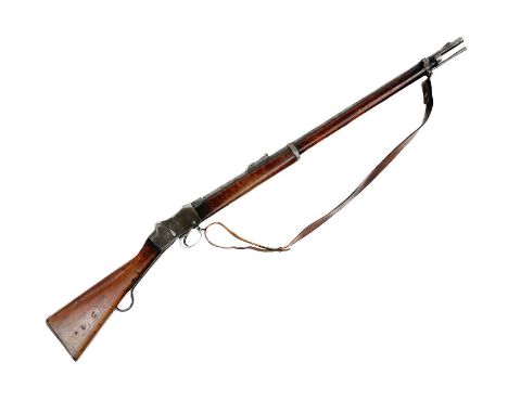
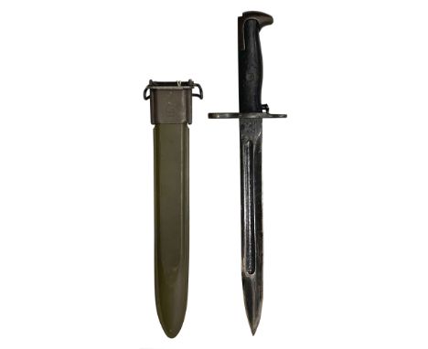
Lot 273
An Enfield Martini-Henry Mark IV Class I Long Lever Single Shot Service Rifle. The 82.5cm round steel barrel with blade and block fore-sight and hinged ladder rear sight, numbered PAK 233, and dated 1888, with various ordnance, proof, and inspector's marks, and WD marks, the walnut stock with further stamps and marks, with leather sling, total length 126cm.The bore appears in good order, and the action works well.
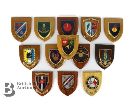
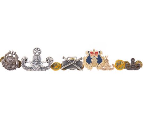
Lot 85
Thirteen military and civilian enamel shields including: 33 Squadron RCT Centenary, 104 Transportgroep Nil Nobis Absurdum, Belize Central America 24th Squadron R.C.T, 'D' Troop 8th Regiment R.C.T, British Commanders-in-Chief Mission - The Soviet Forces in Germany, 201 (n) General Hospital, Army School of Mechanical Transport, 12th Ordnance Company, 8 Squadron RCT, 38 Squadron R.C.T, 12th Squadron Royal Corps of Transport, 3 Tank Transporter Squadron RCT, 4 Armoured Div TPT Regt RCT.
Lot 307
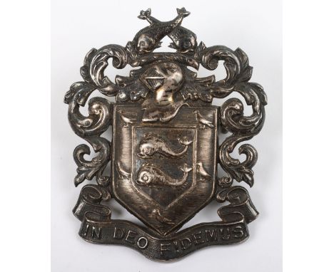
Very Scarce Brighton Borough Police Officers Hallmarked Silver Cap Badge, on reverse, with two lug fittings, complete with a picture of ‘Brighton Borough Police Tug-of-War Team’ winners of open tug of war competition Preston Park 17th June 1916 ‘Inspector Bridle’ coach wearing officers peak cap with badge, plus a Royal Naval-Military-and Air Force Tournament Tug-Of -War medal awarded to P.C. James Beadle, who also was in the 1916 picture, Brighton Police V Metropolitan Police 1919-‘2nd prize won by Brighton Police’ inscribed on back of medal, two enamel National Association retired police officers lapel badges, Royal Army Ordnance Corps silver sweetheart badge, Sussex brass medal, Sussex Division R.N.V.R Physical and Recreational Training Display competition for “Brodrick” cup programme August 8th 1925 and two other items (10 items)
Lot 182
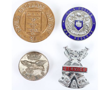
WW2 British Home Front Lapel Badges, including brass Royal Ordnance Factory 21 lapel badge with fittings to the reverse, Port of London Authority Police War Reserve chrome and enamel lapel badge, chrome and enamel EOF Passive Air Defence Service lapel badge numbered 283 (see page 238 & 240 of “Doing Their Bit” by Jon Mills) and a RAF Transport Command tunic button. (4 items)
Lot 33
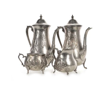
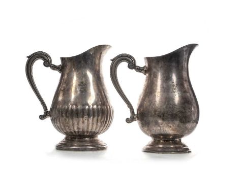
SADDAM HUSSEIN INTEREST (IRAQI, 1937–2006), SILVER PLATED FOUR-PIECE COFFEE SERVICE CIRCA 1990-2004 comprising two coffee pots, a sugar bowl and cream jug, each piece engraved and embossed with scroll and foliate decoration, with scroll handle, on four bracket feet, stamped Persian marks to baseProvenance: Formerly the property of George Willmer, a highly esteemened Explosive Ordnance Disposal consultant (land and sea), who was employed in many locations throughout the world, including Iraq. His work in Iraq would involve assisting the US Military to secure Saddam Hussein's palace.These were recovered from Hussein's palace. Additional images now available.
Lot 34
EXPLOSIVE ORDNANCE DEACTIVATION, BADGES AND PENDANT comprising a yellow metal pendant marked 14K, three white metal pin badges, also a silver First Class Diver badge, another OED badge of crossed bayonets and landmine, and others (9)Provenance: Formerly the property of George Willmer, a highly esteemened Explosive Ordnance Disposal consultant (land and sea), who was employed in many locations throughout the world, including Iraq. His work in Iraq would involve assisting the US Military to secure Saddam Hussein's palace.
Lot 32
SADDAM HUSSEIN INTEREST (IRAQI, 1937–2006), TWO SILVER PLATED WATER JUGS CIRCA 1990-2004 the baluster jugs by Christophle of Paris (stamped marks to base), each body engraved with the 1965-91 Emblem of Iraq (the Eagle of Saladin), with scrolling acanthus handle, one with gadrooned decoration.Provenance: Formerly the property of George Willmer, a highly esteemened Explosive Ordnance Disposal consultant (land and sea), who was employed in many locations throughout the world, including Iraq. His work in Iraq would involve assisting the US Military to secure Saddam Hussein's palace.23.2cm highImages of marks now available.
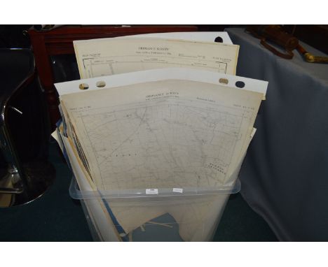
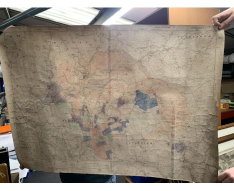
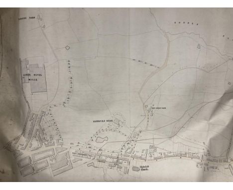
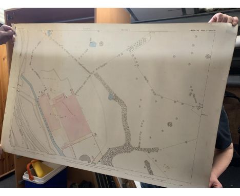
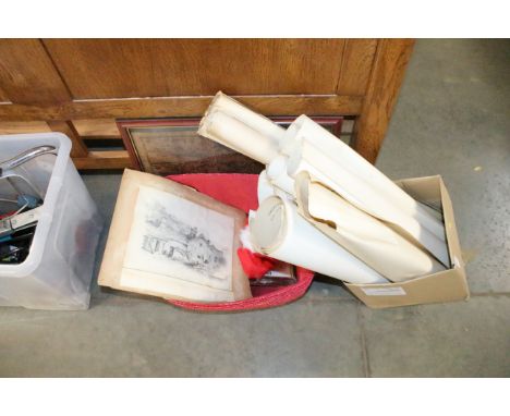
Lot 316
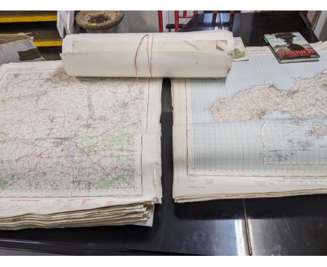
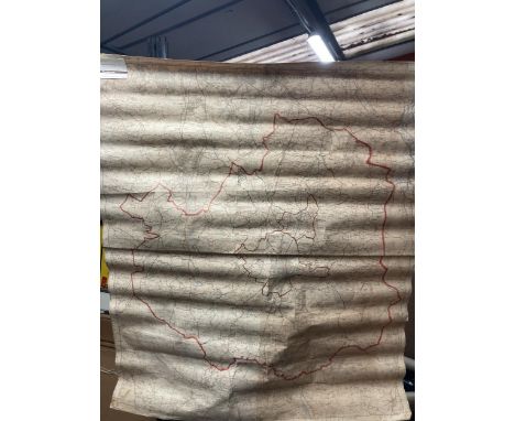
Collection of British First World War Trench Maps, the maps are attributed to Brigadier General Herbert Cecil Potter (10/10/1875-11/6/1964) Officer Commanding the 9th Infantry Brigade, 3rd Division, during the Battle of the Somme and 3rd Battle of Ypres, the maps, detailed below, are of areas in which Potter served throughout the war from 1914 and include detailed information of enemy trenches marked in red on each map, some are particularly evocative, the map of Hebuterne containing the village of Serre with 'Matthew', 'Mark', 'Luke', 'John' Copses, all clearly marked and bring to mind the tragic first day of the Battle of the Somme, a map of Delville Wood is annotated in pencil with 'Delville Wood and Guillemont, 9 Bde attack 16/8/1916' , another map gives the 'German Order of Battle, Cambrai 1 Dec 1917', a map of the 'Seine, Meuse, and Rhine Basins Showing Areas of Occupation of the Allied Armies Jan 1919' is marked with the ink stamp of 'HQ 9th Infantry Brigade', the maps were given to the vendor when a young man by General Potter's son Major Cecil Potter, a family friend in Somerset, some are heavily used and stained with the mud of the front line, many of the annotations on the maps are believed to have been made by General Potter contemperaneously, while some, particularly on the French made maps, are believed to have been done by Major Cecil Potter post warBrigadier General Herbert Cecil Potter CB, CMG, DSO was born in Nagasaki, Japan, educated at Bedford Modern School and Sandhurst, joined the Kings (Liverpool) Regiment as 2nd Lieutenant 29/2/1896, promoted Lieutenant, March 1899, then Captain, December 1900, seconded to a Mounted Infantry Column in South Africa 1901-02 (2nd Boer War) served in the Sudan in 1908 and the Western Front throughout the First World War, wounded through both legs in August 1914, he returned to the front line and given command of 9th Infantry Brigade in April 1916, during the Battle of the Somme General Potters recce of High Wood with two other officers, and the realisation that it was clear of Germans and could be occupied easily is detailed on Page 137/138 of 'Somme' by Lyn MacDonald, '...There was not a German to be seen. The commanders decided to look for themselves. General Potter of the 9th Brigade of the 3rd Division, with Lieutenant Colonel Elliot and Major General Watts Commander of the 7th Division were not so foolhardy as to expose themselves by walking along the track at the top of the slope but, hugging the the shelter immediatley below, clambered along to the ruined windmill, a hundred yards or so to the right.... looking across the gentlest of valleys, where the ridge on which they stood sloped down to a hollow and rose almost imperceptibly to the dark mass of High Wood itself,...Nothing stirred in the cornfields. High Wood was silent...Then they crossed the cornfield almost to the edge of High Wood. Not a shot was fired. High Wood was empty. Jubilant, excited, and anxious to push ahead, they almost ran back to the line. The troops were fresh and ready to go...', tragically, the information was not acted on in time, the Germans reoccupied the wood and High Wood was not taken until September after heavy fighting and many casualties, Potter was twice wounded at the Somme in August 1916, the second time by a 'large shell which sat down beside me and made me stone deaf for some days', Potter also served at the Battle of Arras April-May 1917, and the 3rd Battle of Ypres (Passchendaele) July-November 1917, as well as the Queens South Africa Medal with three clasps Potter was awarded a medal and clasp, 4th Class Osmanieh, 3rd Class Mejidieh in Sudan (1908),mentioned in depatches in WW1, decorated with the Legion of Honour by Sir Douglas Haig in November 1915, made DSO in 1917 and CMG in 1918, he retired from the army in 1927, the maps included in the lot are;Delville Wood Map, large scale, trench lines/road names marked in red (Fleet Street, High Holborn, Bond Street, Regents Street, etc) with reverse marked in pencil (believed by Major Cecil Potter) 'Delville wood and Guillemont, 9 Bde attack 16/8/1916'Trench Map - Hebuterne, Ordnance Survey 1916, scale 1:10,000 , 'Trenches corrected to 19:8:16', trench lines printed in red, additional markings in pencil (Bounderies, Pendant Alley, etc),'Matthew Copse', 'Mark Copse', 'Luke Copse', 'John Copse', which formed part of the British front line and forming up points for some of the Pals battalions are clearly marked, front of map marked 'Brigadier, Serre, Aug 1916''Seine, Meuse, and Rhine Basin Showing Areas of Occupation of the Allied Armies Jan. 1919', 1:1,000,000 scale map, showing Belgian, British, American, and French zones outlined in red, marked in pencil 'Occupation zones of the Rhineland 1919' bears stamps of 'HQ 9th Infantry Brigade' and 'General Staff 3rd Division' dated 7th February 1919French issue map of Melun, 1:80,000 scale, bottom left corner marked 'Revisee 1888', marked in pencil 'France, 1/80,000 map of Melun area (SE of Paris) probably issued in case of further retreat by BEF in August 1914'Map of Cambrai, 1:100,000 scale, British intelligence map showing German Order of Battle, Army Groups, Armies, Corps, Divisions, down to Regiments, including rest billets, all printed in red, marked to reverse 'German Order of Battle, Cambrai, 1 Dec 1917'Trench map, Ordnance Survey 1915, sheet 36c N.W. 3 and part of 1, scale 1:10,000, shows town of Loos, trench lines in red including 'Loos Road Redoubt', marked to the front in pen '**** 1915'Trench Map, scale 1:10,000, France, La Bassee, trenches marked in red including Holenzollern Redoubt, units marked in pen (19th Bde, Kings, 2nd South Staffords), marked to the front in pencil '1915'Trench Map, France, Sheet 57c S.W., scale 1:20,000, trench lines marked in red, Bazentin, Longueville, Guillemont, High Wood, Delville Wood, Flatiron Copse, Sabot Copse, Arrow Head copse, etc all shown, mud stained, marked in pencil to front 'Bazentin/High Wood'French issue map, Provins, marked bottom left corner 'Revisee 1888', marked in pencil 'Large scale map of Provins area (SE of Paris) probably issued in case of further retreat by BEF in August 1914', (qty)
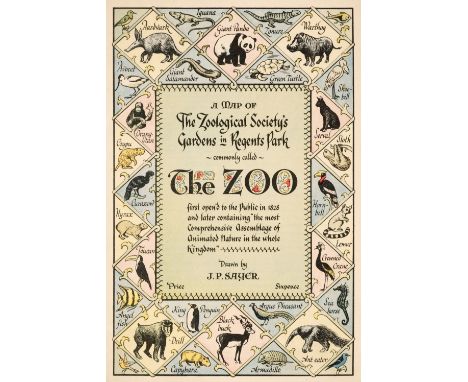
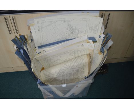
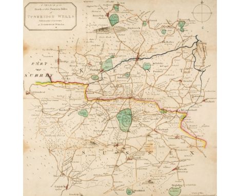
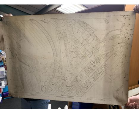
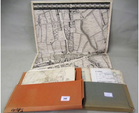
Lot 120
London & its Environs. A Collection of 30 maps, 18th - early 20th century, including Sayer (J. P.). Five (only) pictorial maps of London districts, originally published in 'Original Lithographic Prints Comprising the First Twelve up to October 1947, of the Series of Picture Maps of London...,' first published in the Strand Magazine, George Newnes Ltd. circa 1948, five colour lithographic pictorial maps of districts within London, A Map of the Strand, A Map of Blackfriars and New Bridge Street, A Birds-eye View of Hyde Park Corner, A Map of the Zoological Society's Gardens in Regents Park commonly called the Zoo [and] The Tower of London) each with an illustrated description to the verso, publisher's printed paper wrappers, each approximately 190 x 260 mm, together with Basire (J.). Plan of the River Thames with the Proposed Docks at Rotherhithe and in the Isle of Dogs for 814 Ships with Room for Shifting & Lighters,, Luke Hansard & Sons, 1803, engraved map with contemporary hand-colouring, old folds, some off-setting, 400 x 325 mm, with Seale (R. W.). A New Map of the Countries Ten Miles round the Cities of London & Westminster & Borough of Southwark, circa 1780, uncoloured engraved map, slight tape staining, 215 x 305 mm, plus three uncoloured engraved 18th-century ward plans from Noorthouck's 'History of London', each approximately 190 x 245 mm, with two county maps of Middlesex by Thomas Moule and J. Archer, plus other maps and plans including folding maps, with examples by or after Ordnance Survey, George Philip & Son, Imray Laurie Norie & Wilson, Beck and 'The Gentleman's Magazine', various sizes and conditionQTY: (30)
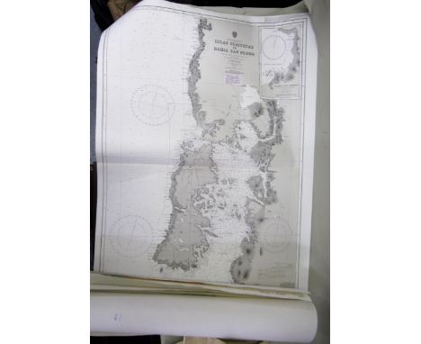
Lot 145
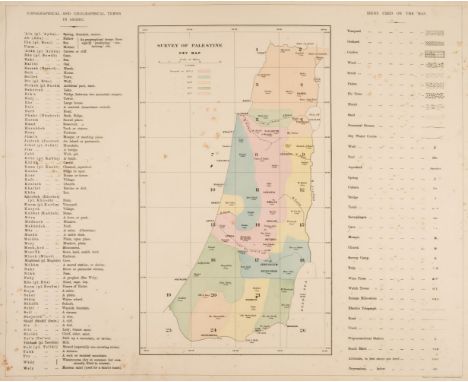
Palestine. Conder (Lieutenants C. R. & Kitchener H. H.), Map of Western Palestine in 26 Sheets, from Surveys Conducted for the Committee of the Palestine Exploration Fund..., During the Years 1872 - 1877 Ordnance Survey Office, 1880, key map and 26 coloured zincographic maps (complete), slight spotting, lacking boards, large oblong folio sheet size 495 x 620 mmQTY: (1)
Lot 158
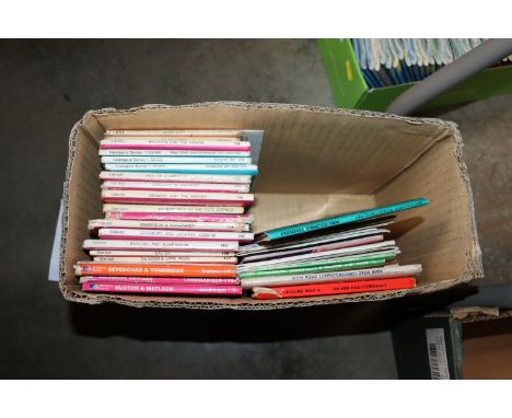
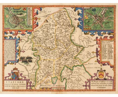
Staffordshire & Shropshire. A collection of approximately 32 maps, 17th - 19th century, engraved county maps and city plans, including examples by or after Speed, Wallis, Greenwood, Saxton/Kip (1610 & 1637 edition), Blaeu, Moll, Smith, Duncan, Hermannides, Bowen (Royal English Atlas & Large English Atlas), Bowles, Kitchin, Stockdale, Morden, Moule, Owen & Bowen, Cary, Ordnance Survey, Faden and Philips, occasional duplicates, various sizes and conditionQTY: (approx.32)
Lot 101
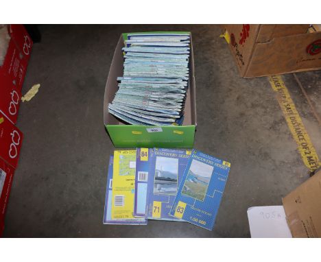
Folding Maps. A collection of approximately 45 maps, 18th - early 20th century, engraved and lithographic folding maps of British counties, regions, towns and cities, including examples by or after Clifford, Greenwood, Ordnance Survey, Swiss, Coltman, Harrison, Newnes, Bacon, Bartholomew, Cruchley, C. Smith & Son, Reynolds, Stanford, W. Wood & Son, Bowen, Darton/Dix, Ebden, Cary, Laurie & Whittle, Faden and Cooke, various sizes and conditionQTY: (approx. 40)
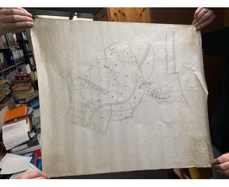
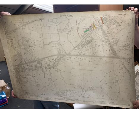
Lot 340
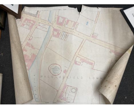
A VINTAGE PLAN FOR HIGHER FENCE FARM TOGETHER WITH RELATED EPHEMERA, A PART OF A VINTAGE ORDNANCE SURVEY MAP OF MACCLESFIELD, A PLAN OF LAND SITUATE ON LINDOW COMMON IN THE TOWNSHIP OF POWNALL GEE AND THE PARISH OF WIMSLOW PURCHASED BY MR RATHBONE FROM MR JAMES HUNNSFIELD, A PLAN OF ESTATES IN FLECKOR, NETHERROTE AND SAWBRIDGE IN THE COUNTY OF WARWICK PLUS A PLAN OF RALPH FOLD ESTATE AT GEE CROSS IN THE TOWNSHIP OF HYDE AND PARISH OF STOCKPORT.
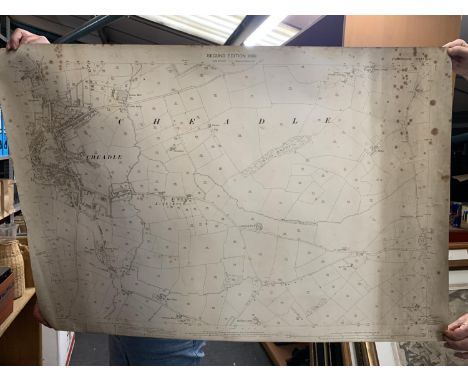
Lot 334
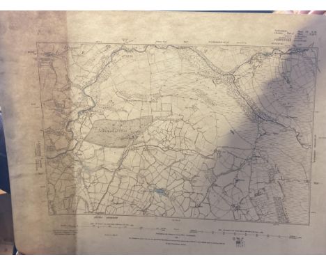
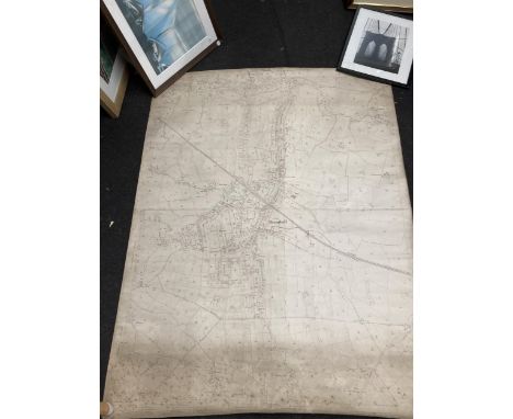
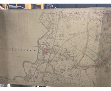
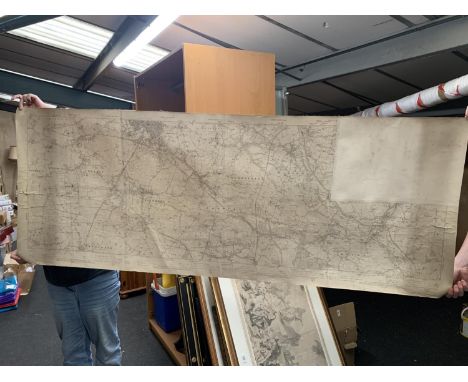
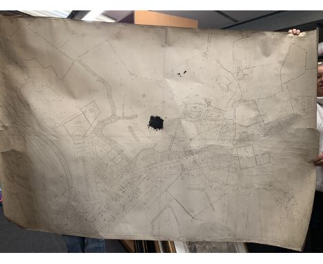
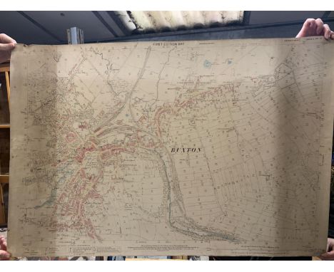
AN ANTIQUARIAN 1874 ORDNANCE SURVEY MAP OF MACCLESFIELD DIVISON, CHESHIRE, A REVISION OF 1907 WITH ADDITIONS OF 1938 PART MAP OF KNUTSFORD DIVISON, AN 1873 MAP OF KNUTSFORD DIVISON (TYTHERINGTON), CHESHIRE. A 1874 MACCLESFIELD, CHESHIRE DIVISON MAP AND A 1874 MACCLESFIELD DIVISON AND PRESTBURY, CHESHIRE MAP
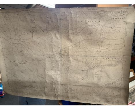
Lot 327
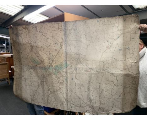
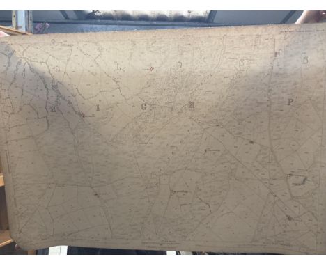
AN ANTIQUARAIN ORDNANCE SURVEY 1921 MAP OF HORWICH END, A 1910 EDITION OF STRETFORD DIVISON, HEATON NORRIS U.D., CHESHIRE AND LANCASHIRE, A SECOND EDITION 1898 HIGH PEAK DIVISON AND HAYFIELD UNION, DERYSHIRE, A 1910 EDITION ALTRINCHAM DIVISON AND STOCKPORT UNION CHESHIRE AND 1909 EDITION KNUTSFORD DIVISON, MACCLESFIELD UNION, CHESHIRE
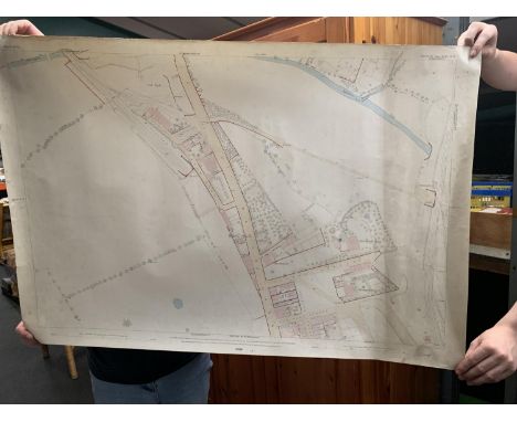
Lot 330
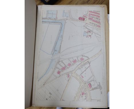
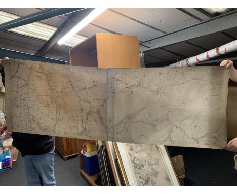
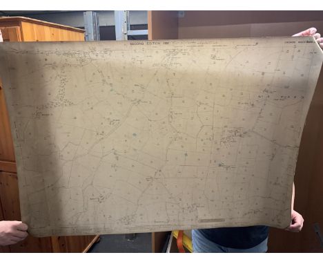
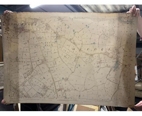
AN ANTIQUARIAN SECOND EDITION 1897 ORDNANCE SURVEY MAP OF MACCLESFIELD, CHESHIRE, A SECOND EDITION 1897 MAP OF KNUTSFORD DIVISON CHESHIRE. A PLAN OF PROPERTY SITUATE IN THE BORUGH OF MACCLESFIELD BELONGING TO THE TRUSTEES OF THE LATE THOMAS BULLOCK AND SAM BARTON AND A PART ORDNANCE SURVEY MAP 1910 OF STOCKPORT
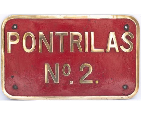
Lot 690
Nameplate PONTRILAS No 2 ex standard gauge 150HP 0-4-0 diesel mechanical locomotive built by John Fowler & Co. Ltd. Leeds in 1941 as works number 22940. New to the Royal Ordnance Factory, Pontrilas, Herefordshire. Later renumbered WD 8301. Sold in 1969 to the British Steel Corporation for use at their Trostre Works, Llanelly, Carmarthenshire and scrapped by T.J. Davies of Llanelly around 1976. Rectangular cast brass face lightly restored measures 20.5in x 12.5in.
Lot 1263
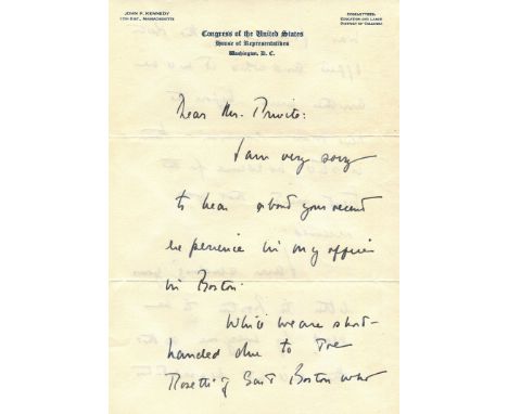
‘I am very sorry to hear about your recent experience in my office in Boston’ KENNEDY JOHN F.: (1917-1963) American President 1961-63. A rare A.L.S., John Kennedy, four pages (two separate leaves), 8vo, Washington DC, 15th February (1951), to Frank F. Previte Jr., on Kennedy's printed stationery from the Congress of the United States, House of Representatives. Kennedy commences his letter stating 'I am very sorry to hear about your recent experience in my office in Boston' and continues 'While we are short-handed due to Joe Rosetti of South Boston who was formerly in the Boston office and while it will be another week before the new man comes in - there is still no excuse for the treatment you received', further adding 'I am sending your letter to Boston to be read by everyone so that there will not be a repetition of this' and explaining 'I will be in Boston this Saturday about 5.00 pm at 122 Bowdoin St., if you can come around I would like to discuss your case with you. If you cannot would you write me directly in Washington and I will see that some action is taken', before concluding 'I hope that you will accept my apology for what happened'. Accompanied by the original envelope bearing a facsimile franking signature. Together with a T.L.S., John F. Kennedy (secretarial signature), one page, 4to, Boston, Massachusetts, 8th February 1951, to Mrs. P. F. Young at the Office of Supervisor of Shipbuilding, USN and Naval Inspector of Ordnance. Kennedy writes a letter of recommendation on behalf of Frank Previte Jr., stating, in part, 'Mr. Previte informs me that he has been interviewed for a position of Storekeeper with your Agency. He is a very good friend of mine, is a capable and conscientious worker, and am sure he could fill this position with satisfaction to the Navy Department. He is out of the job at the present time and any assistance that can be rendered him will be deeply appreciated by me.' Accompanied by the original envelope bearing a facsimile franking signature. Autograph letters of Kennedy are rare (particularly those containing sincere apologies) and sought after, and the present example demonstrates the future President's sharp political disposition in sending a personal message to an upset constituent. VG, 2The present lot is accompanied by a photocopy of a handwritten statement by an unidentified individual providing some background to Kennedy's apology and stating, in part, 'Frank Previte undoubtedly was a campaign worker for Kennedy….(and)….sought an audience with Kennedy at his Boston office somewhere between Feb 9-14. The request was granted and Previte showed up and was told to wait in the outer office, He did so, and literally spent the entire day waiting for Kennedy who never appeared and possibly, if there, left by the rear entrance. Previte was incensed and he wrote a scathing letter to Kennedy, who responded immediately with the…..hand written letter of apology'.

Lot 399
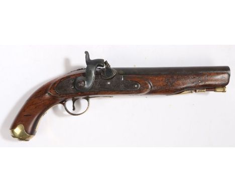
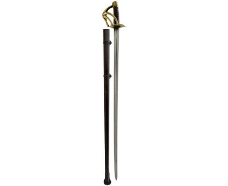
A WATERLOO PERIOD FRENCH CUIRASSIER'S SWORD, 95.5cm double fullered blade, slightly curving towards the spear point, etched to the back edge and dated 1814, various Ordnance stamps at the forte, regulation brass three bar hilt with various Ordnance stamps, wire bound leather grip, contained in its black painted steel scabbard.
-
12129 item(s)/page