We found 12130 price guide item(s) matching your search

Refine your search

Year

Filter by Price Range
  • List
  • Grid
  • 12130 item(s)
    /page

Lot 25

Michelin Guide to the British Isles 1912, Royal Automobile Club Guide and Handbook 1934/1935, an unused diary for 1919, pages of advertisements and a trades and professional directory, blue cloth, "How to Drive a Motorcycle", Percival Marshall & Co., illus., advertisements, paper covers, a quantity of ordnance survey maps circa 1950s including Bartholemews, National Grid etc.

Lot 253

"H Williamson Ltd London WWI military nickel pocket watch, serial number to dial 25631F ordnance mark and 25631F to back of case, Roman numerals with subsidery seconds dial, and a brass wall case (2)"

Lot 78

A WWI trio named 4977 Private W G Rumble, Army Ordnance Corp, together with a cased LSGC medal, a George VI Faithful Service medal, a group of miniatures, the soldier`s small book, three identification tags and an Army Ordnance Corp cane with white metal mount.

Lot 488

A number of Ordnance Survey and other folding maps.

Lot 368

A selection of maps including Ordnance Survey and photocopies

Lot 1320

Wallace, HelenTABLE MOUNTAIN FROM GREEN POINT COMMON 1900n.p.: n.p., [circa 1900]50 by 24,5cmOil painting appropriately framed, showing tents etc. of Green Point Camp with various obsolete items of ordnance in the foreground, with a British sentry. Painting in clean bright condition. Comments: Helen Wallace, a little known South African artist, sold this oil painting of Green Point Military Camp to a Sea Point resident, Mrs Spilhaus for 2 guineas in 1902. (See Greenwall, R. - "Artists and Illustrators of the Anglo-Boer War", where the painting is illustrated on page 31 with biographical details of Wallace on page 227). Provenance: The Greenwall Collection (1)

Lot 155

20th Century: Irish ordnance survey maps collectionA collection of Irish ordnance survey maps and Bartholomew`s Road Maps from different periods. Locations covered include, Longford, Mullingar, Derry, Sligo, Clare, Cork, Kerry, Waterford, Donegal, Roscommon etc. (25 items)

Lot 590

Collection of World War One Mentioned in Despatches Certificates to Include: MID Certificate British Army S/21600 Sgt G J Walter: Army Service Corps despatch from Field Marshall Sir John D P French 30th November 1915 in original frame. MID Certificate British Army S/19238 S/QMS R Clayton: Army Service Corps despatch from General Sir Ian Hamilton 11th December 1915 for the Dardanelles (Clayton won the DCM and the French Medal of Honour (comes with copy papers). MID Certificate British Army 16140 L/Cpl R W Compton: Oxfordshire and Buckinghamshire Light Infantry despatch from Lieutenant General Sir Percy H N Lake 24th August 1916 for defence of Kut-al-Amarah (Compton won the DCM) (comes with copy papers) note Has split in half. MID Certificate British Army 128135 Cpl R Webster : 76th A Bde RFA despatch from General Sir H C O Plummer 18th April 1918 British forces in Italy (Webster won the DCM) comes with original Envelop and copy papers. MID Certificate British Army 01023 S/Sgt E A Allen: Royal Army Ordnance Corps despatch from General F R Earl of Cavan 26th October 1918 British Forces in Italy comes in original frame with copy papers. MID Certificate British Army A/Capt S A Dearing attd Indian Army: Royal Engineers despatch from Lieutenant General W R Marshall 11th November 1918 Mesopotamian Expeditionary Force with copy papers. MID Certificate British Army 514599 Cpl J Batten: Royal Engineers 569th (Devon) Army Troop Coy despatch from General Sir E H H Allenby 5th March 1919 Egyptian Expeditionary Force in original frame with copy papers. Rare MID Certificate British Army 205470 Sgt F N Lewis: 2nd Garrison Bn Bedfordshire and Hertfordshire Regt despatch from His Excellency General Sir C C Monro 1st November 1919 Afghan War. MID Certificate Indian Army A/Maj R C Knight O.B.E.: Att Assyrian Btn despatch from Major General Sir G Mac Munn 12th November 1919 for Mesopotamian Expeditionary Force come with copy papers (9 in Total)

Lot 276

BARTHOLOMEW, John, The Imperial Map of England and Wales according to Ordnance Survey, showing clearly every feature of the Country, Railways and their Stations, Rivers, Canals, Gentleman`s Seats, etc, scale 4 miles to 1 inch, 16 sheets and 4 page index, folio, leather spine (1)

Lot 348

BACON, G.W., edit, Commercial and Library Atlas of the British Isles from the Ordnance Survey, with Index-Gazetteer, pub London 1898, red cloth, worn (1)

Lot 355

Box of assorted Maps including Ordnance Survey, folding Bus Maps for London

Lot 126

A Set of Seven Books - South Africa and the Transvaal War by Louis Creswicke, volumes I to VI and Supplementary volume VII, published Edinburgh 1900; a Set of Three Books - Japan`s Fight For Freedom, the story of the war between Russia and Japan, by H W Wilson; a User Handbook for the Ordnance Marks on Carriage and Mounting, 1957 (11)

Lot 487

A Victorian 1873 Tower Percussion Cap Musket, the 92cm steel barrel stamped with Ordnance markings, the lock plate stamped with a crown over 1873 and IMPROVED TOWER GUN, walnut full stock with brass fore-end tip, three brass ramrod pipes, trigger guard and butt plate, with one steel sling swivel (one missing) and steel ramrod

Lot 183

A quantity of old Ordnance Survey maps, and others

Lot 1049

A Box of Ordnance Survey Maps, etc.

Lot 1316

Two Linen Ordnance Survey Maps, Wales and England and Wales and an official souvenir programme of the Investiture of The Prince of Wales.

Lot 1392

A Mrs Beeton`s Book of Household Management, a selection of Ordnance Survey Maps incl. Kington, Wye Valley, North Wales, etc., a Scrabble Game, turntable, small Embroidery, etc.

Lot 626

A SELECTION OF MAPS to include Ordnance Surveys 1910 Sheet 62, sheet, 62 and Ludlow, sheet 71, Bacons Motor Map "Midlands", Motor and Cycling Map, Mid Wales, and Motor and Cycling Map, North Wales, together with an undated (but to include Israel & Kuwait) Bartholomew coloured map of Middle and Near East "Persia, Arabia, Turkey & Egypt"

Lot 207

A box containing two bottle carriers, assorted early 20th Century Ordnance survey maps and a woven pith style hat, etc

Lot 996

B A F PIGOTT: FLOWERS AND FERNS OF CROMER AND ITS NEIGHBOURHOOD, [1885], 1st edn, orig decor cl gt + C M HOARE: SHORT HISTORY OF THE PARISH OF MUNDESLEY ….., 1914, 1st edn, orig card wraps + ORDNANCE SURVEY CONTOURED ROAD MAP OF CROMER, 1922, No 58, 1” map, Popular Edition, 21” x 30” + D MAXWELL: UNKNOWN NORFOLK, 1925, 1st edn, orig cl gt, d/w + A C SAVIN: HISTORY OF CROMER, 1950 reprint, orig card wraps + WHO’S WHO IN NORWICH, 1961, orig limp rexine (6)

Lot 399

MAPS … Ordnance Maps, Guides books, etc, in a small box.

Lot 400

MARGARY, Harry ... publisher. The Old Series Ordnance Survey Maps of England and Wales ... Vol 11, Devon, Cornwall and West Somerset, cloth in d/w large 4to, 1977. With 4 other atlases. (5)

Lot 427

ORDNANCE SURVEY ... folding maps, guide books etc. (box)

Lot 456

Two 1920`s cloth back Ordnance Survey maps including Windermere

Lot 488

A collection of Ordnance Survey maps etc

Lot 734

GEORGE III: (1738-1820) King of the United Kingdom 1760-1820. D.S., George R, as King, at the head, one page (vellum), oblong folio, Court at St. James`s, 30th March 1802. The partially printed document is a military commission appointing Thomas Cunningham to be a First Lieutenant in the Corps of Royal Engineers. Countersigned at the foot by John Pitt, 2nd Earl of Chatham (1756-1835) British Peer and Soldier, son of William Pitt the Elder and elder brother of William Pitt the Younger. Master-General of the Ordnance 1801-06 & 1807-10. Some light age wear, otherwise VG

Lot 988

KITCHENER EARL: (1850-1916) British Field Marshal. A.L.S., H H Kitchener, Lieut R E, one page, folio, Kensington Museum, 11th December 1878, to Corporal Brophy. Kitchener informs his correspondent that at a meeting of the Committee of the Palestine Exploration Fund it was decided that Brophy should receive `a special present of any instrument you may choose to the value of £10.10 or the money to spend as you like if you prefer it in recognition of your valuable service…during the period of 5 ½ years that you have been employed on the Survey of Palestine`. With blank integral leaf. Some very light, minor age wear, otherwise VG. . . . In 1874 Kitchener was assigned by the Palestine Exploration Fund to a mapping survey of the Holy Land and over the next three years he surveyed what is today Israel, the West Bank and Gaza. Kitchener`s survey had a lasting effect on the Middle East and the ordnance survey serves as the basis for the grid system used in modern maps of Israel and Palestine.

Lot 332

Dr. Butler`s Atlas of Modern Geography and Atlas of Ancient Geography, two volumes, one dated 1826 five modern books on maps and four Ordnance Survey maps; Antique Maps by P.J. Radford, 1965 Map of Roman Britain, Ordnance Survey, 1956 Old Maps by P.J. Radford Maps and Map-makers by R.V. Tooley ,1962 Meiklejohn`s Intermediate School Atlas by John Bartholomew, 1953 Military Maps of Marseille - Nice 1944 East Anglia 1940 War map of Europe, Western South Wales 1940

Lot 272

A box containing a large collection of vintage Ordnance Survey and other maps, to include Stratford on Avon, Chichester, Bolton & Manchester, etc., an Edward Stanford Ltd. map of Burma, etc.

Lot 608

AFTER FREDERICK FORD "View of the Dyke", a set of four coloured lithographs by H Vizetelly, published by W Grant, Brighton, contained within birdseye maple frames and a black and white ordnance survey map

Lot 504

3 Miniature pieces of brass barrelled ordnance comprising Field Cannon; Static Cannon and Ships cannon on trunnionsupport

Lot 116

A group of ordnance survey maps

Lot 128

A tray inc. a group of 19th century green glazed leaf plates tog. with a group of vintage Ordnance Survey maps.

Lot 213

A set of four Ordnance Survey Series 1, Hertfordshire, in original case, "Church Life, St Albans", one vol, and one other vol

Lot 444

India and the Punjab A rare cast miniature model of the famous Sikh Cannon Zamzama Inscription reads – ‘MINIATURE MODEL OF ZAMZAMA CAST AT LAHORE FOR KING AHMAD SHAH DURRANI IN 1757 AD IN COMMISSION TILL 1870 AD’ Length 23cm. Known as the BHANGIAN DI TOPH or the gun belonging to the Bhangi Misl, known as Zamzama, is a massive, heavyweight gun, an 80 pounder, 14 feet, 4 1/2 inches in length, with a bore aperture of 9 1/2 inches, cast in Lahore in copper and brass by Shah Nazir at the orders of Shah Wali Khan, the wazir of Ahmad Shah Durrani. It is perhaps the largest specimen of Indian cannon casting, and is celebrated in Sikh historical annals more as a marvel of ordnance than for its efficiency in the battlefield. In 1762, Hari Singh went into battle with Khawaja Ubed. Bhangi attacked the then-village of Khawaja Said two miles from Lahore (now part of the city of Lahore), where the Mughal governor Khawaja Ubed had his arsenal, and seized his artillery, arms and ammunition. Amongst the guns captured was the Zamzama Gun itself. It was renamed by its Sikh captors Bhangi Toap. In 1802, Maharajah Ranjit Singh, after defeating the Bhangis, captured the famed gun. He used it in the battles of Daska, Kasur, Sujanpur, Wazirabad and Multan. In the siege of Multan, the gun was badly damaged.

Lot 61

Bacon (George W., pub.). New large Scale Ordnance Atlas of the British Isles, n.d., c.1890, title page and front end papers with some foxing, 102 colour litho. maps and town plans (complete as list), a.e.g., upper joint weak, gilt inner dentelles, contemp. gilt dec. brown morocco, rubbed and frayed at extrems., folio, together with Bartholomew (John & Son Ltd), The Survey Atlas of England & Wales, 1939, eighty-one colour printed maps, several library labels to doublures, contemp. qtr. morocco gilt, library label at base of spine, rubbed and worn at extrems., folio. (2)

Lot 98

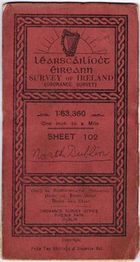
Ordnance Survey. Report on the Ordnance Survey of the United Kingdom for 1855-56, 27 pp., twenty-nine plates including maps that depict the progress of six-inch to a mile map coverage in Ireland, England/Wales and Scotland, plus numerous specimen plates demonstrating the effectivness of electrotype and photographic reductions, bound with Report on the Ordnance Survey Commission; together with Minutes of Evidence, 1858, five engraved plates incl. four folding, bound with Report of the Progress of the Ordnance Survey and Topographical Depot, to the 31st December 1858, and similar reports for the years ending 1860-1872, all reports containing folding engraved maps showing the progress of work in Ireland, England/Wales and Scotland, all works bound into two volumes, contemp. cloth, one cover detached, folio (340 x 210 mm). Rare on the market. In 1855 the Ordnance Survey had just emerged from a state of transition having been newly placed under War Office administration and with a new Inspector-General of Fortifications in Lieutenant-Colonel Henry James. The introduction to the first report in this lot, which was the very first detailed report on the Ordnance Survey presented to Parliament, lists the recent achievements of the Ordnance Survey including the six-inch to a mile mapping of Ireland completed in 1846. The Irish maps Ôhaving proved to be of such great value to the public for such numerous purposes not originally contemplated` led to the continuation of the six-inch project to Scotland and Northern England which, together with the production of one-inch maps and 1/2500 (just over 25 inches to a mile) scale maps for urban areas, meant that the Ordnance Survey was fully stretched at this time. Much of the first report therefore proposes a number of recommendations to save time and labour including a new process for producing photographically reduced one-inch maps from six-inch maps, the production of electrotypes which were exact copies of the original copper plates produced to preserve the original, and developments in printed colour (hand colouring was done by boys of 13 and 14 years old for between sixpence and a shilling a day). There are specimens of many of these proposed production methods contained within the first report and the subsequent reports each contain maps depicting the growing level of coverage. (2)

Lot 58

An Enfield Percussion Cavalry Carbine, Dated 1857.67, of regulation specification, with a 53cm sighted barrel, stamped with ordnance marks at the breech, the dated lock with VR crown, figured walnut full-stock, brass mounts, steel stirrup ramrod, and steel saddle bar with ring.

Lot 267

An Ordnance Survey map of Truro and St Austell for the D-Day Landings, published by the War Office 1941 with various hand drawn official markings and references for the operation, 58 x 93cm.

Lot 122

A LARGE GROUP OF ORDNANCE SURVEY MAPS, The Land Ranger Series and others, approx 70 in all

Lot 1933

A box containing a large collection Bartholomew`s and other fold up ordnance survey maps View on staceyauction.com

Lot 670

A group of old Ordnance Survey maps including may local ones

Lot 362

Ordnance Survey Maps, Great Britain, two bound volumes, Sheets 1-95 and 96-190, complete, 1960`s.

Lot 365

Ordnance Survey: Lt. Colonel William Mudge, two engraved and coloured maps of parts of Dorset and Hampshire, pub. 1810 and 1811, linen backed, in a cardboard sleeve with label for James Wyld, Geographer to Her Majesty.

Lot 378

Ordnance Survey Atlas of England & Wales, quarter inch to the mile, pub. Southampton 1922

Lot 376

Six military Medallions: R.A.F 50th Anniversary, Wembley Tatoo, 1927, R.A.F Support Command, Indian Army Ordnance Corps, Pistol Team, 1932, Rifle Association, Commemoration of the Great War

Lot 261

Large box of ordnance survey and other maps 1920`s onwards including cloth backed.

Lot 413B

A Swaine "Sabson" crop with silver capped finial engraved "Riding House Department of His Majesty`s Ordnance", a silver ferrule engraved "R.W.S.", and plaited leather shaft

Lot 448

India – A rare cast model of the famous Sikh Cannon Zamzama. An early 20th Century vintage cast model of the famous Sikh Cannon the Zamzama. Inscription reads – ‘WHO HOLD ZAM-ZAMMAH THAT ‘FIRE BREATHING DRAGON’ HOLD THE PUNJAB’ The base also has images of Sikh soldiers. Length 30cm. Known as the BHANGIAN DI TOPH or the gun belonging to the Bhangi Misl known as Zamzama is a massive heavyweight gun an 80 pounder 14 feet 4 1/2 inches in length with a bore aperture of 9 1/2 inches cast in Lahore in copper and brass by Shah Nazir at the orders of Shah Wali Khan the wazir of Ahmad Shah Durrani. It is perhaps the largest specimen of Indian cannon casting and is celebrated in Sikh historical annals more as a marvel of ordnance than for its efficiency in the battlefield. In 1762 Hari Singh went into battle with Khawaja Ubed. Bhangi attacked the then-village of Khawaja Said two miles from Lahore (now part of the city of Lahore) where the Mughal governor Khawaja Ubed had his arsenal and seized his artillery arms and ammunition. Amongst the guns captured was the Zamzama Gun itself. It was renamed by its Sikh captors Bhangi Toap. In 1802 Maharajah Ranjit Singh after defeating the Bhangis captured the famed gun. He used it in the battles of Daska Kasur Sujanpur Wazirabad and Multan. In the siege of Multan the gun was badly damaged.

Lot 1150

A quantity of Ordnance Survey Maps including: Local, Wales etc., plus a Reading Glass.

Lot 506

Militaria: a tin of military badges to include Royal Army Ordnance Corp, Royal Signals, and Warrant Officers wrist straps; a silver double photograph frame; various framed photographs of Henry Davy; a copy of the RAOC Gazette from September 1975; a presentation certificate to the Officers and Cadets of the Royal Military Academy; and a Unites States proof coin set. (q)

Lot 508

A Royal Navy cap with `Fleet Air Arm` tally ribbon, together with a Royal Army Ordnance Corps cap.

Lot 330

PRESTWOOD ESTATE, WORCESTERSHIRE A SET OF FIVE HAND-COLOURED AUCTION SALE ORDNANCE SURVEY MAPS, showing lots 1-101 “to be sold Friday 18th July 1913 by Edward Son & Bigwood”, each 82cm x 56cm in black glazed frames

Lot 683

A Pembrokeshire geological Ordnance Survey map 1839 mounted on linen

Lot 1380

A quantity of ordnance survey maps, various postcards and some lace making bobbins

Lot 773

A small collection of fifteen Ordnance survey maps, 1940 war issue of Norfolk and Suffolk air fields and flight paths.

Lot 524

A NUMBER OF VARIOUS ORDNANCE SURVEY MAPS

Lot 1556

G PHILIP: PHILIPS’ CYCLIST MAP OF THE COUNTY OF KENT, nd, + ORDNANCE SURVEY: PARTS OF SUFFOLK, engrd Map, folding backed onto Linen, some added hand colouring, 1911, soiled in parts

Lot 1560

ORDNANCE SURVEY UNTITLED MAP ENGLAND AND WALES WITH PARTS OF SCOTLAND, 1913, added manuscript and colouring “Direction of Timber Supplies”, fdg bkd onto linen, approximately 45” x 41”, s-c

Lot 1561

SMALL BOX: Assorted Ordnance Survey and other fdg maps

Loading...Loading...
  • 12130 item(s)
    /page

Recently Viewed Lots