We found 12129 price guide item(s) matching your search
There are 12129 lots that match your search criteria. Subscribe now to get instant access to the full price guide service.
Click here to subscribe- List
- Grid
-
12129 item(s)/page

Lot 936
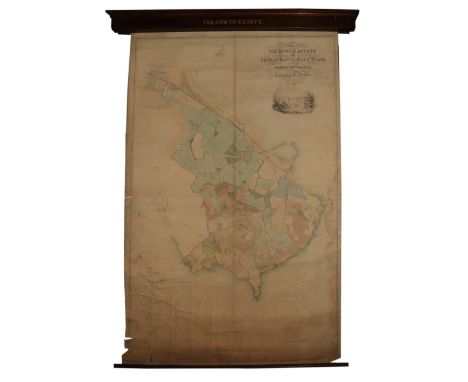
Irish Map: Map of the Howth Estate of the Right Honorable the Earl of Howth, situate in the Barony of Coolock and County of Dublin, made on the basis of the Ordnance Survey by Hodges and Smith, Map Agency office, 104 Grafton Street, 1853, engd. and hand painted, with Howth Castle vignette, approx. 203cms x 130cms (80" x 51") reference key at base, as a map, w.a.f. in custom mahogany wall container. (1)

Lot 116
12 pp., 20.5 x 32cm, a manuscript copy dated 1755 of the 1742 Valuation Book "Fixt by a Committee of the Commissioners of Supply of the said Shire, in Consequence of an Ordnance of the said Commissioners at their Meeting at Tain 8th July 1742", covering lands in [as described in the document] Tarbat, Kincardine, Fearn, Tain, Edderstoun, Nig, Loggie Easter, Kilmuir Easter, Roskeen, Alnas, Kiltearn, Dingwall, Rosemarkie, Avoch, Suddie, Kilmuir Wester, Kilurnan, Ursay, Kirkmichael & Cullicudden, Fotterlie, Conton, Lochbroom, Garloch, Lochcarron, Kintaill & Lewis, copied by Pat. Spark at Edinburgh, some dampstaining, tape repairs
Lot 400
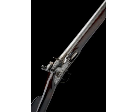
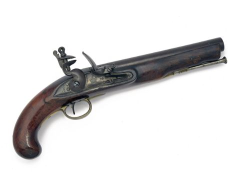
WOOD, LONDON A RARE .760 FLINTLOCK MUSKET, MODEL 'BRIGHT SEA-SERVICE', gun number 15, dated for 1748, with brushed bright round iron 42in. barrel (some staining), block fore-sight, carved and moulded bands at breech, the top of barrel engraved '15' and with Tower proofs and ordnance marks, early style radiused borderline engraved lock marked 'WOOD' together with the date at the tail (refreshed), traces of a crown 'G.R.' device forwards of cock, bridled frizzen, walnut handrail full-stock with flat-topped comb, brass furniture including flat 'Sea Service' heel-plate and 'Land Service Pattern' sideplate, iron stirrup swivels and working replacement ramrod.
Lot 463
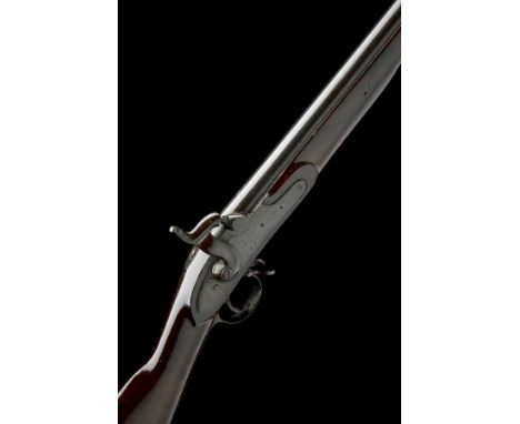
TOWER ARMOURIES, LONDON A .750 FLINTLOCK HORSE-PISTOL, MODEL 'HEAVY DRAGOON PISTOL', no visible serial number, circa 1806, with round iron 9in. barrel, Tower private proofs at breech, solid top-tang, radiused lock signed on the pointed tail and marked with a crown and 'G.R.' device below pan, walnut full-stock with a '1908' Board of Ordnance stamp to right of wrist and traces of a 'W.T.' gunsmiths stamp to cheek, brass furniture and iron button-head ramrod.
Lot 510
TOWER ARMOURIES, LONDON A .760 PERCUSSION MUSKET, MODEL 'PATTERN 1839', no visible serial number, dated for 1848, with blued 39in. barrel, block fore-sight, Tower proofs and ordnance stamps at breech, borderline engraved lock of India Pattern flint form with plugged pan and spring holes and signed and dated forwards of the hammer together with a 'V.R.' crown device, walnut full-stock with Pimlico refurbishment roundel stamped in the right hand side of butt, brass furniture, iron swivels, Lovells bayonet catch and button-headed iron ramrod, much original finish remaining.
Lot 542
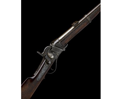
SHARPS, USA A SCARCE .577 PERCUSSION CAPPING BREECH-LOADING CARBINE, MODEL '1855 BRITISH CARBINE', serial no. 25303, circa 1855, with 19in. tapering round British Ordnance marked barrel, block and blade fore-sight, rear-sight with one standing and four folding leaves, receiver with slanted breech-block (one screw absent from left side), Maynard's tape-primer mechanism on the right hand side of action, the trapdoor marked 'EDWARD MAYNARD PATENTEE 1845', plain back-action lock and external hammer, walnut butt-stock, brass patch-box and heel-plate, saddle-ring mounted to left hand side, walnut splinter fore-end and iron barrel-band, traces of finish.
Lot 89
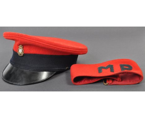
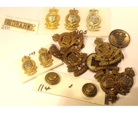
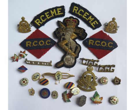
An original British post war 1962 dated Royal Army Ordnance Corps Officer's peaked dress uniform hat and a British Military Police armband. The red felt hat with blue band, ROAC metal badge and black patent peak. Retaining an inner brown leather headband, dated 1962 with broad arrow marks. The Military Police armband also of red felt construction with buckle and Velcro fastening.

Lot 176
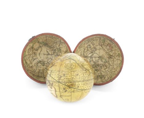
A George Adams 2 ½-inch pocket globe in case, English, circa 1770,the cartouche printed A Terrestrial GLOBE G: Adams No.60, Fleet Street, London, the paper-mâché sphere applied with twelve printed gores, hand coloured with California as a peninsula, Australia- named New Holland- drawn according to Dutch discoveries with a hypothetical eastern coastline, New Zealand with only a small section of coastline, in fish-skin covered case, the celestial inner hemispheres with printed and hand coloured engraving of the heavens, 3in (7.5cm) diameter Footnotes:Provenance:The Stephen Edell Collection.Literature:John R. Millburn, Adams of Fleet Street, Instrument Makers to King George III, London, 2000.George Adams (1709-1772) was one of the most celebrated instrument makers of his day, becoming mathematical instrument-maker to the Office of Ordnance in 1748, and in 1760 he was appointed to the court of King George III. The Cook expedition to the South Seas used instruments supplied by Adams.For further information on this lot please visit Bonhams.com

Lot 134
WW2 US Thompson .45 cal SMG 20 round magazines, both maker marked "Auto Ordnance Corp, Bridgport, Connecticut, Reg. in US Pat. Off" both in unissued condition along with a Walther P38/Walther P1 9mm Pistol magazine, unmarked, issued but in very good condition. Please note not for sale to EU members states. (3)

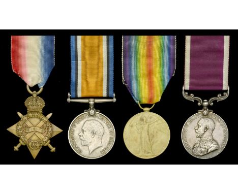
Lot 181
Four: Chief Ordnance Artificer C. S. Old, Royal Navy, who was killed during an enemy air raid on Plymouth on 21 April 1941 1914-15 Star (M.3868, C. S. Old, Ar. Mte., R.N.); British War and Victory Medals (M.3868 C. S. Old. Act. Armr. R.N.); Royal Navy L.S. & G.C., G.V.R., 2nd issue, fixed suspension (M.3868 C. S. Old. C.O.A. 2. H.M.S. Ramillies.) edge bruising and contact marks, nearly very fine (4) £100-£140 --- Charles Seymour Old was born on 14 December 1889, at Truro, Cornwall, and commenced naval service as an Armourer’s Crewman, H.M.S. Vivid III, on 4 December 1911. He was advanced to Armourer, H.M.S. Glorious, on 1 April 1919, and Chief Ordnance Artificer Second Class, H.M.S. Ramillies, on 1 May 1925. He was awarded his Long Service and Good Conduct Medal in 1926, and was shore pensioned on 3 December 1933. In civilian life he became the popular landlord of the Crown Inn at Penzance. He was recalled for War service in September 1939, and was killed in an enemy air raid on Plymouth on 21 April 1941, when serving in H.M.S. Boscawen.
Lot 292
Five: Private C. W. G. Doe, 5th Battalion, Essex Regiment 1914-15 Star (2282 Pte. C. W. G. Doe. Essex R.); British War and Victory Medals (2262 Pte. C. W. G. Doe. Essex R.); 1939-45 Star; War Medal 1939-45, mounted as worn, traces of verdigris to VM, the Great War awards polished, therefore good fine, the Second War awards better (5) £60-£80 --- Caius William George Doe was born in Sulhamsptead, Berkshire, on 4 July 1894 and attested for the 5th Battalion, Essex Regiment in early August 1914 (2208 enlisted on 7 August 1914, and 2297 on 9 August 1914). He served with them during the Great War in the Gallipoli theatre of War from 9 August 1915, and was subsequently re-numbered 250395. He later transferred to the Royal Army Ordnance Corps, and was re-numbered 7586023. His Second War medals are indicative of service in the early part of the war - he has not been traced in the 1939 Register, taken on 29 September, so perhaps he was already overseas by then. He died in Reading in 1972.
Lot 320
South Africa 1834-53 (Asst. Surgn. E. D. Allinson. Rl. Arty.) fitted with silver ribbon buckle, good very fine £300-£400 --- Edward Dawson Allinson was born on 25 December 1825, and was appointed Assistant Surgeon in the Ordnance Medical Department on 31 May 1847; Staff Surgeon, 2nd Class, 2 October 1857. He died at Dharwar, Bombay, on 3 December 1859. Not shown on Everson’s roll for South Africa medal under either Royal Artillery or Ordnance Medical Department but is on roll for Indian Mutiny medal as Staff Surgeon serving with 8/14 R.A. He is commemorated on a memorial stone in St Andrew’s Churchyard, Dacre, Cumbria, “Edward Dawson Allinson, Staff Surgeon, Royal Artillery”.
Lot 4
Four: Staff Sergeant L. Hunt, Oxfordshire and Buckinghamshire Light Infantry, later Indian Army Ordnance Corps 1914-15 Star (8179 Sjt. L. Hunt. Oxf: & Bucks: L.I.); British War and Victory Medals (8179 Sjt. L. Hunt. Oxf. & Bucks. L.I.) rank officially corrected on VM; Army L.S. & G.C., G.V.R., 1st issue (S-Sgt. L. Hunt, I.A.O.C.) good very fine (4) £70-£90 --- Lewis Hunt attested for the Oxfordshire and Buckinghamshire Light Infantry in early 1906 and served with the 1st Battalion during the Great War in the Asiatic theatre of War from 5 December 1914. He subsequently served in both the the Worcestershire Regiment and the Indian Army Ordnance Corps. Sold together with an original portrait photograph of the recipient
Lot 498
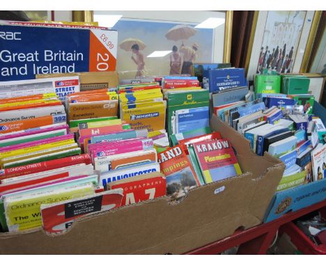
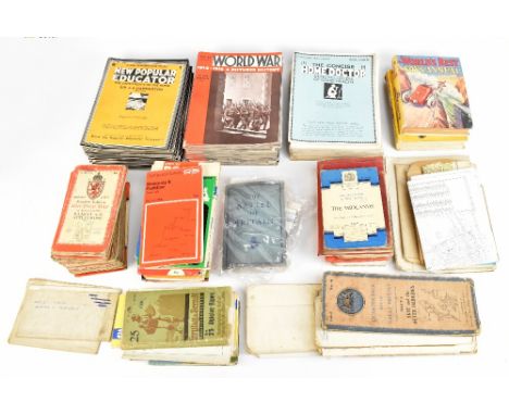
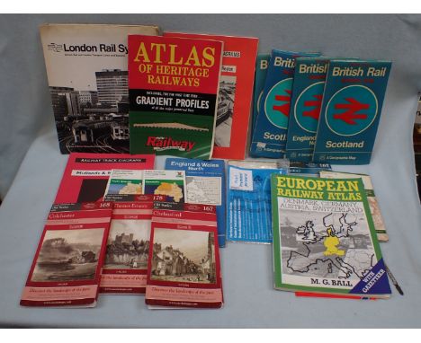
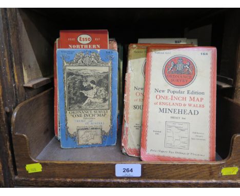
A collection of printed ephemera and maps including Atlantic Bridge, the official account of RAF Transport Commands Ocean Ferry, The Air Battle of Malta, three profile publications booklets, comprising The Bristol Blenheim I, The Avro Lancaster I, and The Vickers Wellington I & II, number 63, 65 and 125, Merchantmen at War, a selection of Ordnance Survey maps, a copy of The Oojah Annual, The World's Best Boys Annual and a selection of World War 1914-1918, a pictured history magazines, New Popular Educator magazines, a Concise Home Doctor magazine, and a copy of Achievement printed by Rolls Royce (qty).

Lot 399
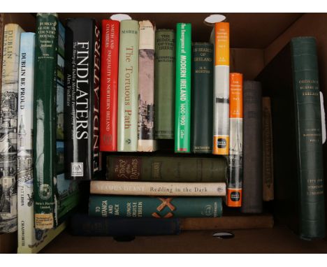
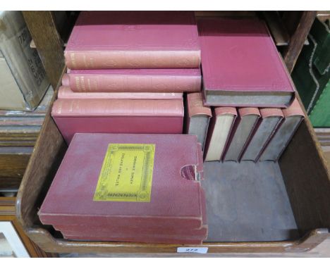
Box of books of general Irish interest. Collection of 20 books including, Burke's Guide to Country Houses. Mark Bence-Jones; Irish Passange Steamship Services, DB McNeill, 2 vols. The Mystery Solved or Ireland's Miseries, Rev, Marcus Dill; Ordnance Survey, County of Londonderry, Co. Colby. (20)
Lot 201
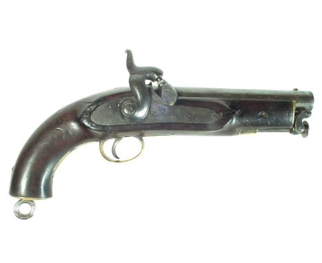
Percussion Coast guard or Constabulary pistol, 6 inch 28 bore sighted barrel with swivel ramrod, crown VR tower stamped lock dated 1849, brass furniture with steel lanyard ring and belt hook, the stock stamped with Board of Ordnance mark and W. Scott.Section 58(2) antique/ obsolete calibre no licence required to buy this lot, purchaser must be over the age of 18. 29cm long Condition report: Action works correctly.
Lot 453
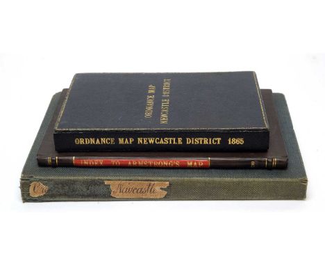
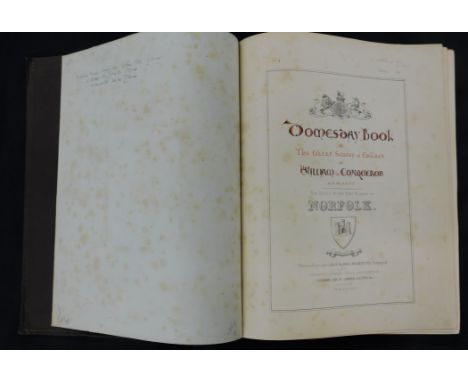
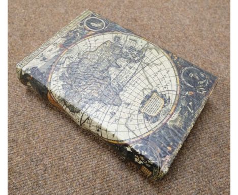
DOOMSDAY BOOK... FAC-SIMILE OF THE PART RELATING TO NORFOLK, Southampton, Ordnance Survey Office 1862, photo-zincographed by Her Majesty's Command, 4to, original blind stamped cloth gilt, rebacked preserving original spine, all edges stained red, armorial bookplate of William Carr, from the collection of the late Ron Fiske of Morningthorpe Manor
Lot 517
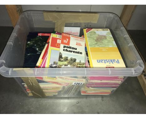
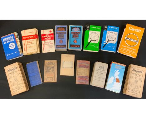
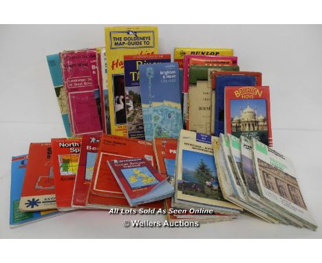
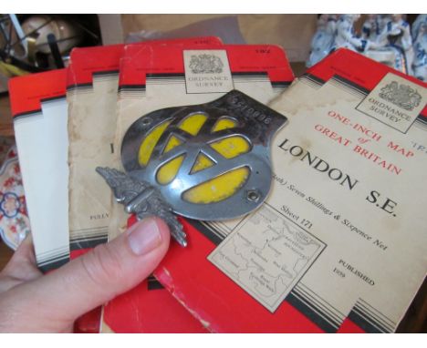
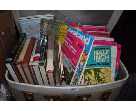
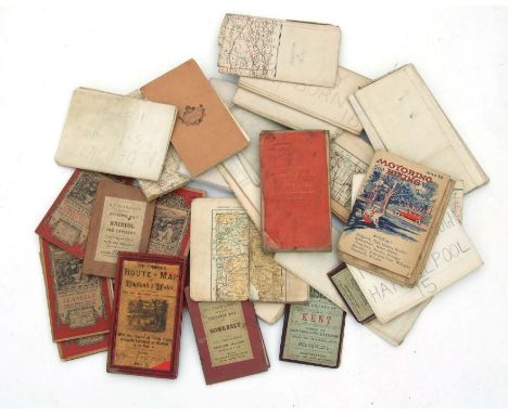
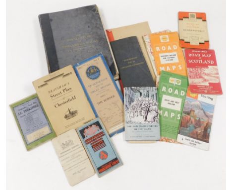
A group of maps and ephemera, to include Bartholomew's Revised Half Inch Contoured map, The Geographica Road Map of South East Yorkshire and North Lincolnshire, The Old Hand Knitters of The Dales by Mary Hartley and Joan Ingoldby, The Shell Touring Map for Scotland, Bradshaw's Street Plan of Sheffield, various other Ordnance Survey, Shell and other road maps for Great Britain and The Royal Atlas of England and Wales by J G Bartholomew. (a quantity)
Lot 205
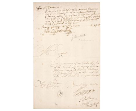
* Flamsteed (John, 1646-1719). English Astronomer and the first Astronomer Royal. Autograph document signed, 'John Flamsteed MR', certifying that 'James Hodgson has been employed as an extraordinary laborer under me from ye last day of December past to ye last day of March of this present year 1702 at ye Observatory in Greenwich Park', and requesting a payment of £6 15 shillings 'being 90 days at 18d. per dm', written and signed at the head of a folio leaf with a manuscript order from the Office of Ordnance for the payment of the money due inscribed beneath with three official signatures, autograph signed receipt for the money by James Hodgson at head of verso, dated 27 April 1702, folio (28 x 17.5 cm)Qty: (1)NOTESFlamsteed was appointed by Royal Warrant 'The King's Astronomical Observator' on 4 March 1675, becoming the first English Astronomer Royal, with an allowance of £100 a year. In June of the same year another Royal Warrant provided for the founding of the Royal Greenwich Observatory, and Flamsteed laid the foundation stone on 10 August. James Hodgson (1672-1755) was an English astronomer, mathematical teacher, lecturer and writer. He was the nephew of Christopher Wren and became assistant to Flamsteed at the Royal Observatory, Greenwich, between 1695 and 1702. Hodgson married Flamsteed's niece in 1702, took part in the controversies in which Flamsteed was engaged and helped bring his works to posthumous publication.

Lot 358
Bartholomew (John). The Imperial Map of England & Wales According to the Ordnance Survey..., A. Fullarton & Co. London & Edinburgh, circa 1870, index and 18 colour lithographic double-page map sheets, slight spotting throughout, all maps re-guarded, later endpapers, contemporary cloth gilt, rebacked with modern repairs to the corners, boards, stained and scuffed, folio, together with Weller (Edward). [Cassells's British Atlas...,] Cassell, Petter & Galpin, circa 1870, lacking title and preliminaries, 100 uncoloured lithographic map sheets of British counties, regions, town plans and railway maps, slight dust soiling throughout, slight water staining, later endpapers, modern blue cloth, folio, with Bartholomew (John, publisher). The Royal Atlas of England and Wales, George Newnes Limited, circa 1900, numerous colour lithographic maps with index bound at rear, contemporary cloth, spine faded, bumped and worn at extremities, folio, plus George Philip & Son (publishers). Philip's Atlas of the Counties of England, 1889, 48 colour lithographic county maps, contemporary half morocco gilt, spine partially lacking, upper board detached, rear board near detached, rubbed and worn, folio, and Letts Son & Co [publishers]. Letts's Popular County Atlas, 1884, title page excised and laid on front blank, preface and index tipped in, 47 colour lithographic maps, text block detached, lacking spine and upper board, rear board detached, folio and Ward Lock & Co (publishers). Nine Motoring & Touring Maps of England and Wales, circa 1930, nine regional colour lithographic maps, each laid on linen, occasional near-contemporary marginalia, a few with crude tape repairs, each approximately 750 x 500 mm, bound in publisher's colour printed wrappersQty: (14)NOTESSold as a collection of maps, not subject to return.
Lot 391
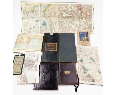
Folding Maps. A collection of seven maps, mostly 19th century, including Cruchley (G. F.). Cruchley's (Late Cary's) New Map of Ireland, showing Railways and all the Turnpike Roads with the Rivers and Canals..., circa 1845, engraved map with contemporary outline colouring, sectionalised and laid on linen, calligraphic title and table of explanation, 760 x 640 mm, tartan endpapers with the bookplate of J. Stewart Robertson, contained in a contemporary cloth slipcase with publishers' printed label to upper cover, slipcase a little faded and worn at extremities, together with Cary (John). Cary's New Map of Ireland Exhibiting the whole of the Turnpike Roads with the Rivers and Canals..., 1832, engraved map with contemporary outline colouring, sectionalised and laid on linen, slight offsetting, 760 x 640 mm, chalk endpapers, contained in a contemporary card slipcase with publisher's printed label to the upper cover, slight wear at extremities, with Walker (J. & A.). To Lieut. General The Most Honble. the Marquis of Anglesey, K. G. G. C. B..., This Map of North Wales is with his Lordship's permission most respectfully dedicated..., circa 1845, engraved map with contemporary outline colouring, sectionalised and laid on linen, calligraphic title, engraved vignette of the Menai Bridge, slight staining and dust soiling, near-contemporary ink ownership signature to the upper margin, 625 x 770 mm, cloth endpapers, blind-stamped cloth binding with gilt publisher's stamp (Letts Son & Co.) to upper cover, faded and frayed along the spine, plus Cary (John). Cary's Reduction of his Larger Map of England and Wales with Part of Scotland..., 1805, engraved map with contemporary outline colouring, sectionalised and laid on linen, 760 x 630 mm, contained in a card slipcase with circular publisher's label to upper cover, slipcase heavily worn and frayed, and Laurie (Robert & Whittle James). A New Map of Scotland or North Britain, Drawn from the most approved Surveys..., 1794, engraved map with contemporary outline colouring, sectionalised and laid on linen, inset map of the Shetland and Orkney Islands, slight staining, 570 x 525 mm, with Ordnance Survey (publishers). Map of Neath, Edward Stanford, circa 1860, engraved map with contemporary outline colouring, sectionalised and laid on linen, scale 1 inch to the mile, 970 x 1430 mm, contained in a contemporary cloth slipcase with publisher's printed label to upper cover, slipcase stained and a little frayed, and plus a folding map of Argyleshire by John Johnstone and W. & A. K. Johnston and House of Commons Commissioners (publishers). Sixth Report of the Commissioners for Roads and Bridges in the Highlands of Scotland, 24th February 1813, title page and 45 pages of text, including an engraved plate of an elevation and plans of the Bonar Bridge and an engraved folding map of Scotland by A. Arrowsmith, contemporary outline colouring, map size 610 x 500 mm, contemporary blue paper wrappers with printed titles to both sidings, and a 20th-century book box, the covers decorated with a reproduction of H. Hondius's map of the word, 255 x 175 mmQty: (9)
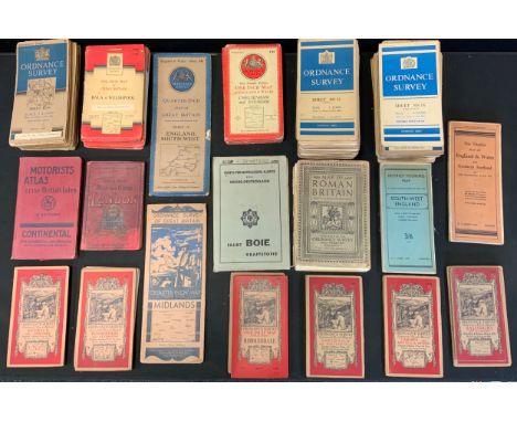
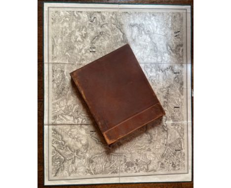
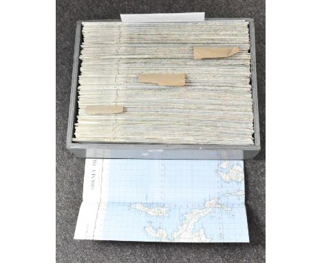
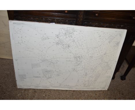
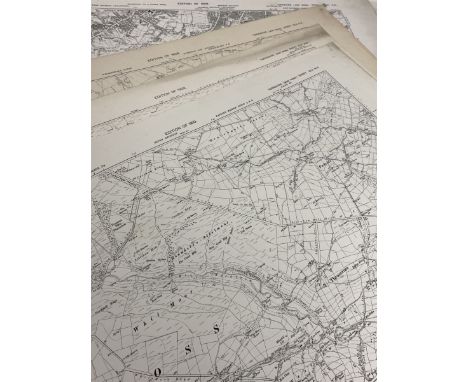
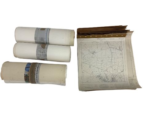
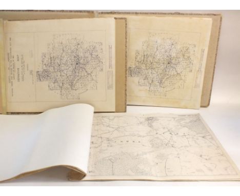
Lot 436
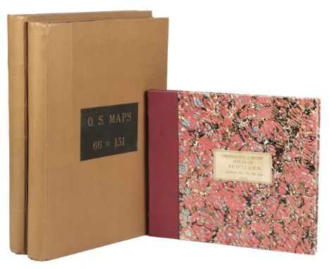
Scotland. Ordnance Survey, Maps nos. 1 - 131 (complete), bound in 2 volumes, Ordnance Survey Office, circa 1900, tipped in key plate to volume 1, 131 uncoloured photo-lithograph maps on a scale of 1 inch to a mile, occasional marginalia and later crude outline colouring, some dust and finger soiling throughout, key plate to the front pastedown of each volume, some maps trimmed at the base, a few with an Ordnance Survey office blind stamp to the lower right corner, a few maps split along central fold, a few maps with marginal fraying and tears, seven index maps bound at the rear, later endpapers, modern cloth with gilt cloth labels to the upper sidings, a little bumped, large folio, together with Ordnance Survey (publishers). Ordnance Survey Atlas of Scotland, Quarter Inch to the Mile, Southampton, 1924, title, index and table of explanation, 18 colour printed double-page maps, each laid on linen, index bound at rear, later endpapers, modern red quarter morocco gilt over marbled boards with a gilt vellum title label to the upper cover, oblong folio, (355 x 400 mm)Qty: (3)
Lot 933
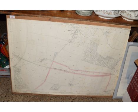
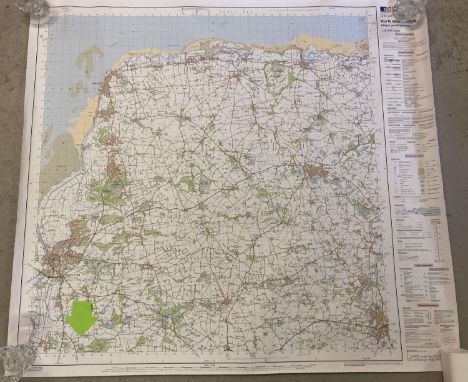
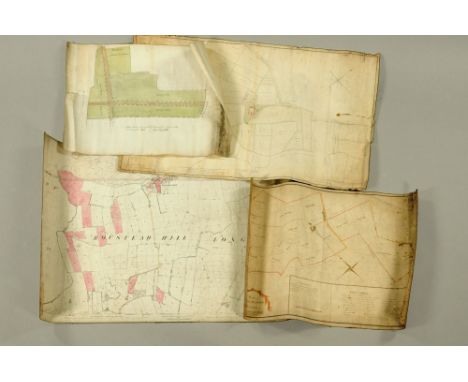
A collection of five maps, coloured field map, plan of Mr John Blamire's Estate at Hill House Dash Nook. Surveyed and drawn April 1796 by I Norman, a map laying out of ground for proposed villas at Knowefield 29/1/76 (near Carlisle). Field map Priest Hill (Earl of Lonsdale). Map plan of Morton Estate surveyed 1822 for John Foster. Ordnance Survey map Boustead Hill 1880 coloured. (5)
-
12129 item(s)/page