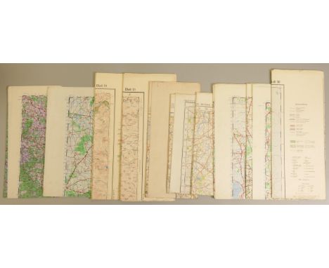
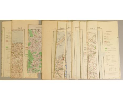
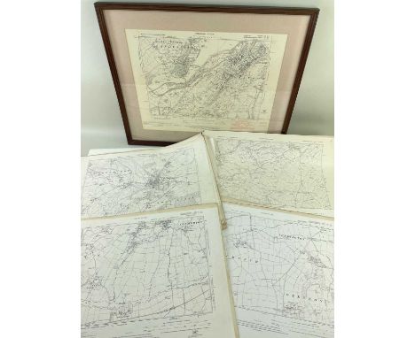
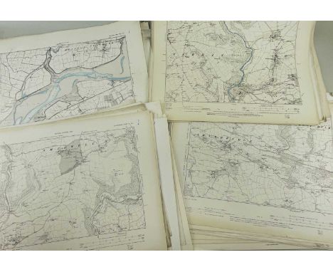
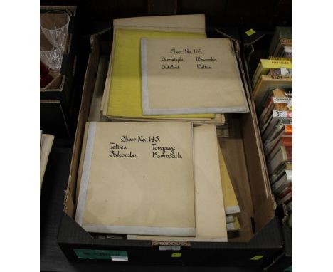
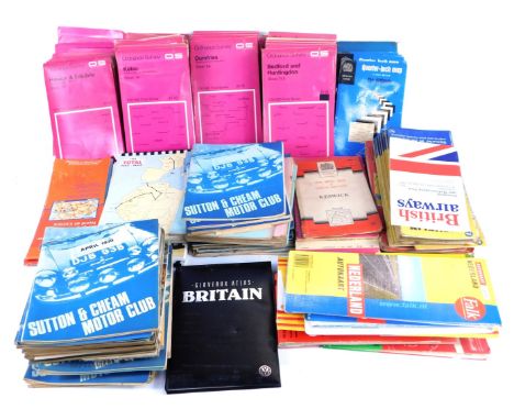
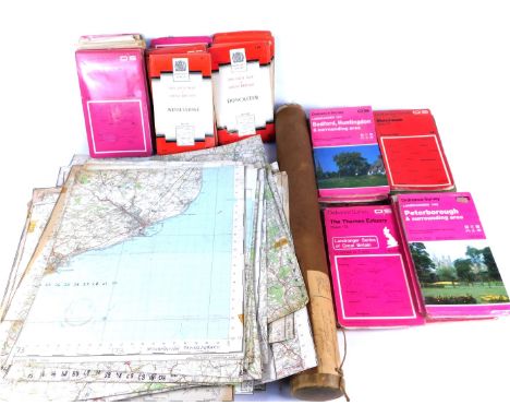
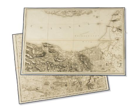
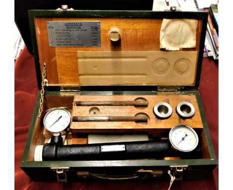
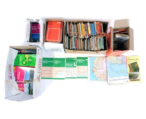
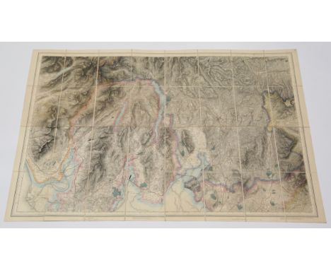
We found 12130 price guide item(s) matching your search

Refine your search

Year

Filter by Price Range
  • List
  • Grid
  • 12130 item(s)
    /page

Lot 122

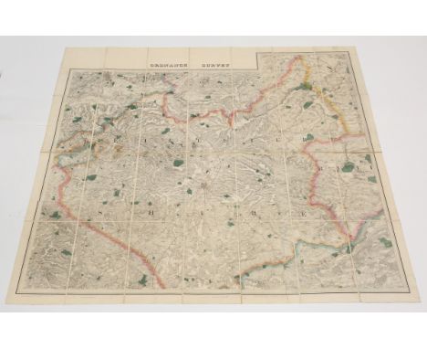
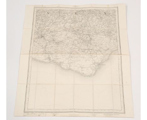
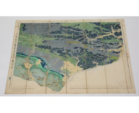
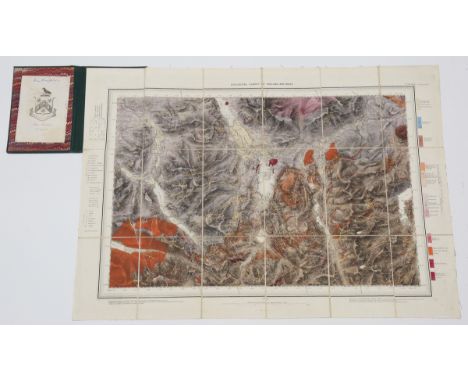
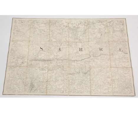
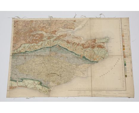
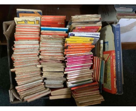
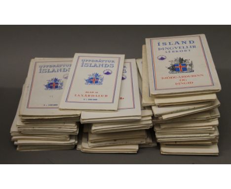
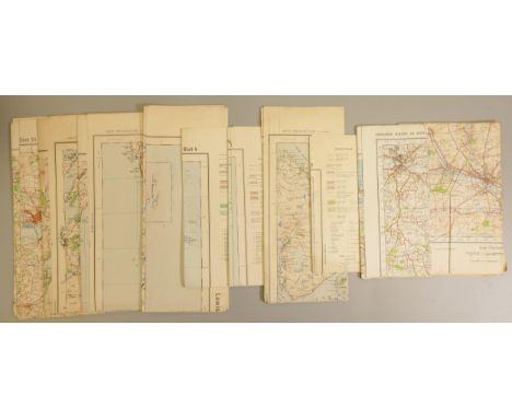
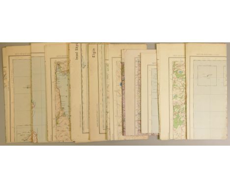
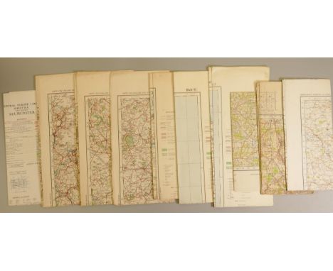
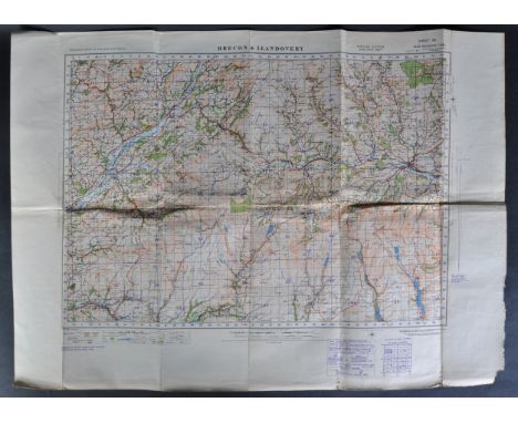
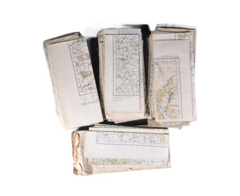
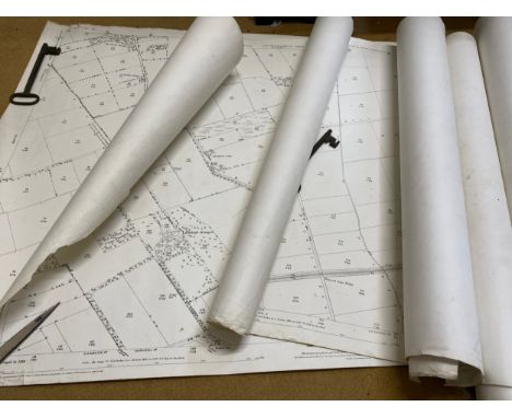
Edward Stanford (publisher) - Ordnance Survey of England and Wales, a part set of eighty-six 19th century engravings, the majority hand-coloured, folding in sections and backed onto linen, various sizes, within cloth covered cases 17cm x 13.5cm, with original paper labels. Note: includes nos. 1-7, 9-27, 30-31, 33-35, 43-48, 50-56, 59-66, 70-75, 77-83, 86-89, 92-98 and 101-108, which includes the counties of Kent, Sussex, Hampshire, Wiltshire, Oxfordshire and Yorkshire.This lot is subject to a Buyer’s Premium of 24.5% (including VAT @ 0%) of the hammer price. Purchased online via the-saleroom.com, this lot will attract an additional premium of 5% (including VAT @ 0%) of the hammer price.

Lot 132

Benjamin Baker (engraver) - Ordnance Survey Map of Leicester, engraving in 28 sections with hand-colouring in outline, folding and backed onto linen, published by the Ordnance Map Office, London 1835, overall 106cm x 115cm, within a tooled leather covered cardboard case with gilt title, together with seventeen other 19th century Ordnance Survey maps.This lot is subject to a Buyer’s Premium of 24.5% (including VAT @ 0%) of the hammer price. Purchased online via the-saleroom.com, this lot will attract an additional premium of 5% (including VAT @ 0%) of the hammer price.

Lot 127

Edward Stanford (publisher) - New 1 inch Ordnance Survey of England and Wales, Sussex, a part set of twelve 19th century engravings, folding in sections and backed onto linen, various sizes, within cloth covered cases 17.5cm x 11cm, with original paper labels. Note: includes nos. 187, 300, 301, 302, 331, 316, 317, 318, 319, 332, 334.This lot is subject to a Buyer’s Premium of 24.5% (including VAT @ 0%) of the hammer price. Purchased online via the-saleroom.com, this lot will attract an additional premium of 5% (including VAT @ 0%) of the hammer price.

Lot 135

Ordnance Survey of England and Wales (publishers) - 'Geological Survey of Great Britain, Sussex', electrotype lithograph in 15 sections with near period hand-colouring, folding and backed onto linen, published circa 1893, overall 69cm x 102.5cm, within cloth covered boards, together with 38 similar geological maps, the majority of Home Counties interest.This lot is subject to a Buyer’s Premium of 24.5% (including VAT @ 0%) of the hammer price. Purchased online via the-saleroom.com, this lot will attract an additional premium of 5% (including VAT @ 0%) of the hammer price.

Lot 133

Ordnance Survey (publishers) - 'Geological Survey of England and Wales, Cockermouth', engraving in 18 sections with near period hand-colouring, folding and backed onto linen, published 1868, overall 40cm x 57cm, within cloth covered boards, together with eighteen other folding maps, the majority of geological interest.This lot is subject to a Buyer’s Premium of 24.5% (including VAT @ 0%) of the hammer price. Purchased online via the-saleroom.com, this lot will attract an additional premium of 5% (including VAT @ 0%) of the hammer price.

Lot 126

Wiliam Mudge (publisher) - Ordnance Survey Maps of Southeast England, six engravings in 18 sections, folding and backed onto linen, published circa 1813-1816, each overall 62cm x 93cm, within cloth covered boards with original paper labels and a cloth covered case.This lot is subject to a Buyer’s Premium of 24.5% (including VAT @ 0%) of the hammer price. Purchased online via the-saleroom.com, this lot will attract an additional premium of 5% (including VAT @ 0%) of the hammer price.

Lot 134

Ordnance Survey (publishers) - Middlesex, London, Kent, Sussex (Geological Map of South East England), electrotype lithograph in 6 sections with near period hand-colouring, folding and backed onto linen, published by the Ordnance Survey Office, Southampton 1907, overall 44cm x 63.5cm, together with thirty other Ordnance Survey folding maps.This lot is subject to a Buyer’s Premium of 24.5% (including VAT @ 0%) of the hammer price. Purchased online via the-saleroom.com, this lot will attract an additional premium of 5% (including VAT @ 0%) of the hammer price.

Lot 131

Ordnance Survey (publishers) - Contoured Road Maps, fifteen lithographic folding maps including Whitby and Saltburn, Yeovil and Blandford, Wimborne and Ringwood, Hertford and Bishop's Stortford, Ipswich, Guildford and Horsham, S.E. London and Sevenoaks, Brighton and Eastbourne, Norwich and Great Yarmouth, Thetford, Chichester and Worthing, Cambridge, Pickering and Thirsk, together with five other folding maps.This lot is subject to a Buyer’s Premium of 24.5% (including VAT @ 0%) of the hammer price. Purchased online via the-saleroom.com, this lot will attract an additional premium of 5% (including VAT @ 0%) of the hammer price.

Lot 374

LARGE CARTON OF ORDNANCE SURVEY & OF BARTHOLOMEW MAPS ETC

Lot 1802

AN ASSORTMENT OF ITEMS TO INCLUDE ORDNANCE SURVEY MAPS AND WADE STYLE CERAMIC ANIMALS ETC

Lot 321

An English 10 bore full stock flintlock sporting rifle, William Turvey, London, mid 18th c, the barrel slightly flared at the muzzle and engraved with a 'fish', octagonal at the breech where inscribed W TURVEY LONDON, chiselled tang and carved shell, the lock also engraved W Turvey, having three brass ramrod pipes, trigger guard engraved with rosette, pierced rococo side plate, crested cartouche, the butt plate engraved with a shell and other ornament, the stock of fine colour and patina, barrel 86.5cm l, the ramrod perhaps contemporary William Turvey was elected Master of the Gunmakers' Company in 1733. He was contracted to supply guns to the Board of Ordnance in the 1720's and the Honourable East India Company from 1741. A particularly fine sporting gun, re-mounted by Turvey in 1731-2, is in the Royal Collection (RCIN 61114) The collection of C. W. Briggs (1906-1971) (lots 1-429) Good unrestored condition

Lot 96

An assortment of military belts and other accessories. Including: a Royal Irish Regiment cap, a Royal Logistics Corps fabric belt, a Royal Army Ordnance Corps fabric belt, a jacket a Battledress Blouse jacket 1949 pattern, Size No. 10 (height 5ft 9"- 5ft 10") and other items

Lot 729

A set of Icelandic ordnance maps.

Lot 1033

10 Large Paper WWII Ordnance Survey maps of the UK & Central Europe, mostly dated 1940 printed in both English & German. (10)

Lot 1034

10 large paper WWII Ordnance Survey maps of the UK & Central Europe, mostly dated 1940 printed in both English & German. (10)

Lot 1035

10 large paper WWII Ordnance Survey maps of the UK & Central Europe, mostly dated 1940 printed in both English & German. (10)

Lot 1036

10 Large Paper WWII Ordnance Survey maps of the UK & Central Europe, mostly dated 1940 printed in both English & German. (10)

Lot 1037

10 large paper WWII Ordnance Survey Maps of the UK & Central Europe, mostly dated 1940 printed in both English & German. (10)

Lot 409

APPROX. 47 ORDNANCE SURVEY MAPS, scale 6inches to 1statute mile, published circa 1945, various Welsh and English border counties to include Carmarthen, Denbighshire, Flintshire, Hereford and Worcester ETC, all approx. 42 x 57cms, loose leafedComments: one example is mounted, framed and glazed

Lot 412

APPROX. 68 LOOSE ORDNANCE SURVEY MAPS, scale 6inches to 1 statute mile, published circa 1945, various locations including Devonshire, Cambridgeshire, Suffolk, South East of England ETC, all approx. 42 x 57cmsComments: loose leafed, some discolouration and tears to edges

Lot 78

Ordnance Survey Maps circa 1910 - mid 1920s

Lot 901

A COLLECTION OF ORDNANCE SURVEY MAPS later 20th century

Lot 113

A collection of ordnance survey maps - 1x tray (qty)

Lot 533

EPHEMERA, three boxes containing a miscellaneous collection of magazines, books, guides, stamps and maps to include approximately 100 Ordnance Survey Maps, T.V. Annuals from the 1970's and War Publications to include Commando, War Pictures Library, Picture Combat Library, Air Ace Library and others (22) (3 boxes)

Lot 623

One box of Ordnance Survey and other maps

Lot 1304

A box of assorted ordnance survey maps. Titles include Carlisle & Solway Firth, Appleby, Wenslydale, Barnard Castle and Richmond, Northern Scotland, Munro Map and many others.

Lot 301

A large collection of maps contained within six boxes, mainly ordnance survey, both paper and cloth examples dating from the 1920's

Lot 341

Assorted vintage maps, Ordnance Survey maps, deeds, etc.

Lot 1168

A quantity of Ordnance Survey maps (rolled) of Brecon Beacon National Park, Stratford-upon-Avon, Elan Valley, etc.

Lot 435

Henry John Temple Lord Palmerston 1784-1865 ALS signed Palmerston to My Dear Enfield permitting his regiment being clothed in the same dress as the Essex if you can get the consent of the ordnance. All autographs come with a Certificate of Authenticity. We combine postage on multiple winning lots and can ship worldwide. UK postage from £5.99, EU from £7.99, Rest of World from £9.99

Lot 379

Twelve military services cap badges to include Royal Corps of Signals, Royal Army Medical Corps, Royal Army Service, Army Pay, Army Educational, Army Dental, General Service, Army Catering, Army Cyclists and Army Ordnance (12).Qty: 12

Lot 989

A POSTCARD ALBUM OF AVERY HILL COLLEGE, ELTHAM, LONDON, VINTAGE POSTCARDS AND TWO ORDNANCE MAPS DATED 1912 BOLESWORTH, TATTENHALL, BROXTON

Lot 15

A group of road maps, Monte Carlo, Total Darkness, Ordnance Survey, etc. (1 box)

Lot 16

A group of Ordnance Survey Maps, for Thames Estuary, York, Leicester, mainly English regions. (1 box)

Lot 17

A group of Michelin Ordnance Survey and other road maps, to include Scotland, Wales, France and others. (1 box)

Lot 1651

A quantity of vintage ordnance survey maps

Lot 267

A Framed Ordnance Survey Map of Wellington, 1:2500 Scale, 102x72cms

Lot 2216

Three boxes containing ordnance survey maps; plastic bags; wall brackets etc

Lot 635

A box containing "On The Road" magazines; Haynes manual; Ordnance Survey maps etc

Lot 191

Three WWII Second World War British Ordnance Survey maps comprising; Tunisia (1942), Ismailia (Egypt 1942) and Bengasi (Libya 1942).

Lot 263

An original WWII Second World War Ordnance Survey Map. Brecon and Llandovery 1940. OS sheet 90. Scale one inch to the mile. On folding linen size 90 by 64 cm. Colour. Coded GSGS 3907. Measures approx 90x64cm.

Lot 330

A large collection of British War Office issue Ordnance Survey maps of British cities to include; Cromer, Wolverhampton, Preston, Southport and Blackpool, Newcastle Upon Tyne, Birmingham, Peterborough, Leicester, Norwich and Great Yarmouth, Salisbury, Stroud and Chepstow, Carlisle, Harrogate, Derby, Swansea, Wrexham, Chester, Northampton, Stratford on Avon, Watford, Bicester, Ipswich, East Kent, Isle Of White, Blackburn, Hull and many more. Dates ranging from 1932 - 1941. Folded examples.

Lot 450

Cap Badges - a large single-owner private collection of WWI First, WWII Second and earlier British Army related cap badges. Approx x100 items in total. Includes cap badges for the following regiments; Leicestershire, Middlesex Regiment, North Stafford, Somerset, East Surrey, The Wiltshire Regiment, East Yorkshire, RAF, Royal Artillery, Royal Army Ordnance Corps, RAF, Royal Corps Of Signals, Reconnaissance Corps, Tank Corps, ATS, AFS, large Royal Artillery helmet plate / pouch plate, Price Of Wales' Volunteers, Cameron Highlanders, Gloucestershire Regiment and many others. All original period cap badges. 

Lot 126

NO RESERVE Ordnance Survey Office. Four folding map sheets, including plate numbers XVII, XVIII, XIX, XX, detailed maps on a scale of 1 mile to the inch, engravings, each sheet approx. 635 x 800 mm (25 x30 3/4 in), dissected and mounted on linen with blue silk edges, each section with tab label, printed index label to case, folding neatly into original book-style slipcase, blue morocco, spine with five raised bands, gilt armorial device with three canons and canon balls [?Royal Artillery] to upper cover, rubbed and scuffed, 4to, [c.1811 or slightly later].

Lot 368

Box of magazines, pamphlets and ordnance survey maps

Lot 161

Collection of vintage tins along with Ordnance Survey maps and other items

Lot 139

HENRY WILLIAMSON: POSTERS & MAPS: a box of rolled posters and maps from the Williamson estate to include: 4 printed posters advertising whist drives and fancy dress balls at Filleigh Village Hall, all printed by Poole, South Molton, circa 1920s: poster for Henry Williamson exhibition at library lecture hall Catford, November 1972: ordnance survey sheet maps, several with Henry Williamson's manuscript markings, etc. (One box)

Lot 172

A Vintage Ordnance Survey Map Wiltshire District In A Glazed Simple Frame 170 x 90cm

Lot 55

AA , motoring books, tractors, railway, ordnance survey maps etc

Lot 143

Folding Maps. A collection of 12 maps, 19th & early 20th century, engraved and lithographic folding maps of British and European counties, regions and cities, including examples by or after Bacon, Ordnance Survey, Cumming, Cary, Stanford, Keller, Simoncourt and Logerot, various sizes and conditionQTY: (12)

Lot 23

British and Commonwealth Military Badges including Rhodesian Airforce, Grey and Simcoe Foresters, Army Ordnance Corps, Australian Commonwealth Military Forces, Hertfordshire, RAMC & Rank pips. Good lot

Lot 32

Royal Army Ordnance Corps W2/WB Critical Flow Nozzle, made by Alan Mutze & Co, PT 4-1-1309, produced 1961. An excellent piece of vehicle repair and maintenance equipment in used condition. With R.A.O.C label attached dated 1971.

Lot 76

Six Ordnance Survey Maps, two one inch examples and four quarter-inch maps, together with an Aveling & Porter catalogue of steam rollers 1920, and a small collection of first day covers including Nigel Mansell (qty)

Lot 328

A collection of Ordnance Survey maps, modern guides, and Ordnance Survey Sheet 8 Midland Guide from 1946, Routemaster guides, etc. (a large quantity)

Lot 1523A

Collection of military cap badges, buttons, etc, RAF, Gloucester Reg, The Kings, Worcestershire, Ordnance, Hampshire, etc

Lot 140

A collection of various Ordnance Survey and other maps. some on Velum

Lot 3307

WW2 Third Reich Luftwaffe Trade Qualification Badge collection comprising of 18 different trade badges: Armourer: Aircraft Equipment Admin: Air Signals: Searchlight equipment Admin: Motor Transport NCO: Signals: Teletype operator: Telephone operator: Motor Transport NCO: Aircraft warning service: Heavy bomb armourer: Fireman: Admin NCO: Motor Transport Equipment Admin: Sound Locator: Flak Ordnance: Signal equipment Admin: etc.

Lot 3387

British Military "Bar on Band" Enfield Short Percussion Cap Rifle. Working action. 83cm long barrel. Lock marked 1860 and Tower with Crown VR. Barrel with British military proof marks. Stock with Board of Ordnance roundel. Overall length 124cm. Production did not commence until 1859 and it was soon superseded the Pattern 1860 short rifle, only a few thousand of the "bar on band" variants were produced. A scarce British military service rifle with low production figures and a very limited service life. NOTE: Section 58 (2) No licence required in the UK.

Lot 1429

Local interest - A selection of 8 maps 'Photozincographed and Published at the Ordnance Survey Office Southampton' 1890 and 1891 showing areas to include Wallingfen, North Cave, Everthorpe, Gilberdike, Newport etc. together with a Hull and Barnsley Railway Plans & Sections. Session 1914 and a copy of 'A Map or Plan of Wallingfen 1778'. Metal tube included.

Lot 133

A 1913 pattern Remington bayonet, the 43cm single edged fullered blade stamped to the ricasso 1913, 9 17 Remington and US to the opposing side with crossed out Ordnance marks, housed in a leather clad scabbard with brown leather frog, 55cm.

Loading...Loading...
  • 12130 item(s)
    /page

Recently Viewed Lots