We found 12130 price guide item(s) matching your search
There are 12130 lots that match your search criteria. Subscribe now to get instant access to the full price guide service.
Click here to subscribe- List
- Grid
-
12130 item(s)/page

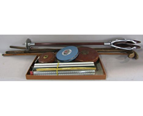
Lot 1250
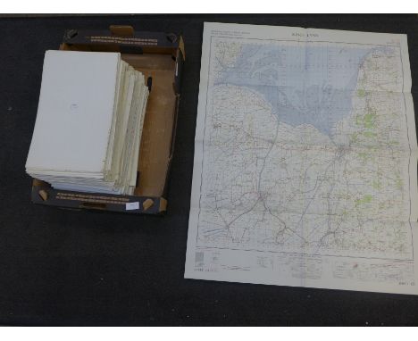
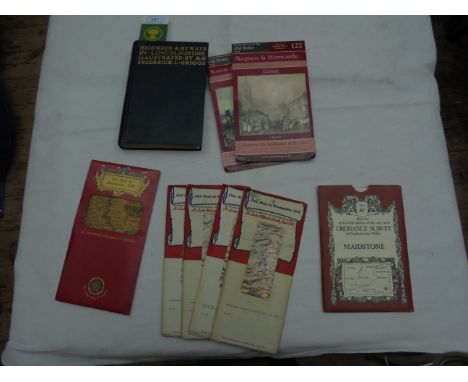
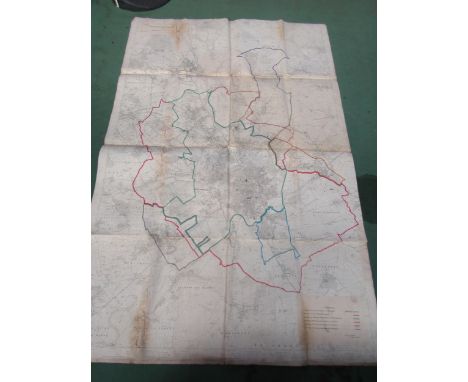
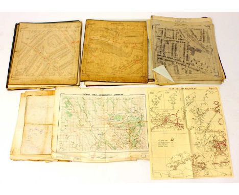
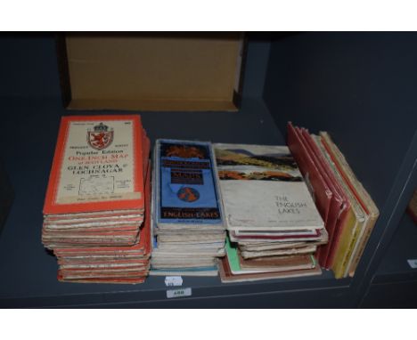
A quantity of ordnance survey maps including Batholomews, 'Wales and the Marches quarter inch cloth map etc and an illustrated leather bound book 'The complete Atlas consisting of one hundred and twenty maps of modern, historical, classical and physical geography', published by Williams Collins, sons & company.
Lot 232
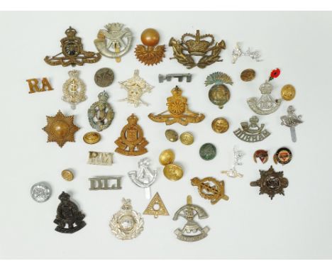
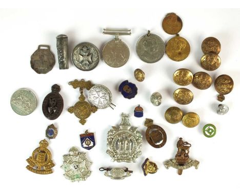
Cap and Shoulder Military Badges etc. - Durham Light Infantry, Duke of Cornwall's Light Infantry, Coldstream Guards, Royal Army Ordnance Corps, King Cetshawayo Artillary Regiment (Natal Field Artillery), Somerset 'Jelladad' Batallion, Royal Engineers, Royal Army Medical Corps, Royal Artillery, Royal Army Ordnance Corps, 'Dorsets', I.L.H. (Imperial Light Horse) South Africa shoulder title, Royal Electrical and Mechanical Engineers, assorted dress buttons, etc. (approx 40).

Lot 133
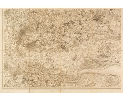
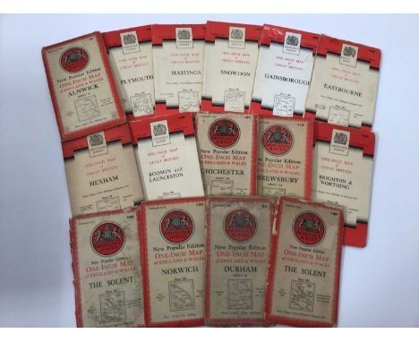
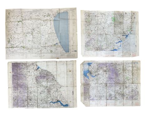
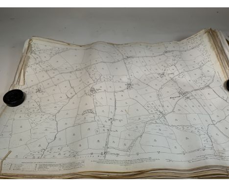
South East England. Ordnance Survey (publishers), Nine map sheets, numbered 1 - 9, 1st edition of the 'Old series', 1805 - 22, nine uncoloured engraved Ordnance Survey maps, sectionalised and laid on linen, covering Sussex, Kent, Surrey and Middlesex, on a scale of 1inch to the mile, each sheet approximately 640 x 930 mmQTY: (9)NOTE:When the Ordnance Survey decided to publish its maps itself, rather than having them published by a separate commercial business, it started to print its newly mapped sheets as they were surveyed and engraved. This was the original 1-inch 'Old Series' which would eventually cover the whole country. The so-called 'Mudge' map of Kent was published as a county map by William Faden in 1801. After that, the county format was abandoned in favour of a complete map of the area surveyed, irrespective of county boundaries. From then on the sheets were published as soon as they were ready, starting with four sheets covering Essex (all dated 1805). From then on, as the maps carried the date of publication e.g. 'Published April 18th 1805 by Lt.Col.Mudge, Tower. This collection is of the consecutive nine sheets of the South-East of the country which represent 9 of the first 11 sheets of the Old Series published. Thus, the publication dates vary, sheet 1 1805, sheet 2 1805, sheet 3 1819, sheet 4 1816, sheet 5 1813, sheet 6 1819, sheet 7 1822, sheet 8 1816 and sheet 9 1813.
Lot 411
A Bradshaw's Railway Map of England, Wales and Southern Scotland, published by Henry Blacklock and Company Limited, London, Geographia Map of Norfolk, two Ordnance Survey War Revision Maps 1940 of Potmadoc and Criccieth, an Officers Training Corps 1932 Map of North West Hampshire, and a War Office Manual of Map Reading, Photo Reading and Field Sketching 1929.
Lot 503
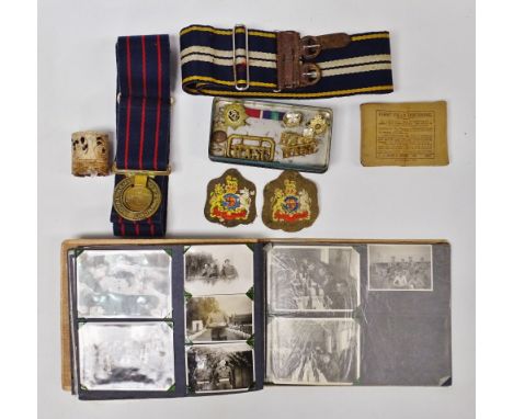
A collection of assorted medals to include a 1939-45 Defence Medal, an 11th Infantry Brigade Football Tournament medal awarded to the Winners 13th Battn Kings Rifle Corps, 9203 Rfm. J.C Pearson, May 1915, a 1939-45 War Medal, Edward VII Coronation Medal, June 1911 Coronation Medal; together with assorted badges including St John's Ambulance, Royal Artillery, chocolate brown bakelite Royal Corps of Signals economy badge, The Border Regiment, Scottish King's Own Borderers, Royal Army Ordnance Corps,1915 On War Service badge, silver and enamel ARP badge; Post Office Vancouver, B.C medal or badge; Crusader's Tent 1923 Fleetwood Jubilee enamel badge, 1960s Ross Group enamel shipping badge, Lancashire Fusiliers white metal swagger stick top and a small quantity of uniform buttons etc(qty)

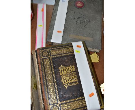
Lot 373
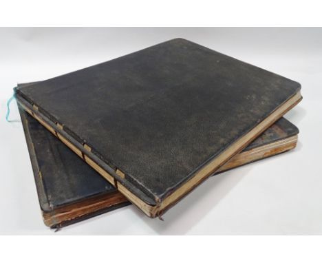
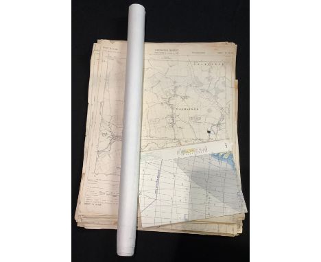
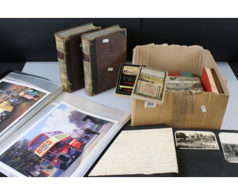
EPHEMERA, comprising two Folio's of Ordnance Survey sheets (some copies) specifically Devon, a scrapbook containing a series of early 20th century photographs, mostly of people, a part collection of 'Coronet Clothes' artwork and a leather bound, brass clasped, edition of Brown's Self-Interpreting Family Bible, in need of extensive restoration
Lot 145
Symons Alderman John: Kingstoniana. 1889 Hull. Folding map; other books and booklets of Hull interest; Victorian and later paper ephemera including newspapers, theatre programmes, letter headings and invoices, PDSA poster, sports programmes, social events, first day covers, Ordnance Survey maps, DVDs etcCondition Report:Condition varies dependent upon age but most in reasonable condition.Some rusting of staples to programmes etc
Lot 263
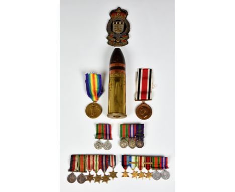
A small group of military collectables to include a Royal Army Ordnance Corps cloth badge; WWI Victory medal, issued to J.64707 J. MARTIN A.B R.N (Able Seaman Royal Navy); Special Constabulary Long Service medal; collection of miniature dress medals, together with a Karlsruhe Patronen Fabrik 1903 inert One Pounder Pom Pom shell. (quantity)
Lot 3052
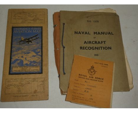
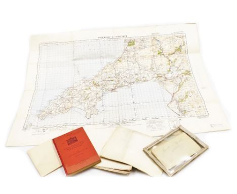
Three WW2 edition RAF quarter inch to one mile linen backed Ordnance Survey maps of England titled Midlands (N), Eastern Counties (S) and one with text removed showing NE England largest 62 x 81cm; and German O.S. map of East Yorkshire dated 1941 with manuscript Junkers 88 A-5 crew members details verso.Condition Report:Condition is consistent with being well used and folded with some damage to creases.One RAF map of N. E. England has had top and bottom text details removed.


Lot 262
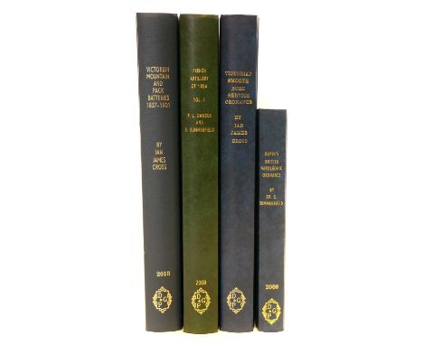
Artillery reference books Artillery reference books, to include Dupin's British Napoleonic Ordnance by Dr. S Summerfield, Victorian Smooth Bore Service Ordnance by Ian James Cross, French Artillery of 1824 Vol.1 by P.L. Dawson and S Summerfield, and Victorian Mounted and Pack Batteries 1837-1901 by Ian James Cross.
Lot 31
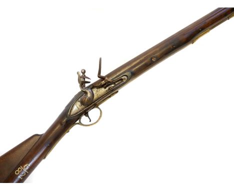
Flintlock .650 Elliot carbine Flintlock .650 Elliot carbine, 27inch barrel with Kings proof marks, the lock possibly replaced with Tower mark, the stock fitted with saddle ring and bar, carved with hand rail butt and stamped with Board of Ordnance marks and painted 6/82, brass furniture, the side plate etched with RXIILD (possibly spurious) Section 58 (2) Antique / obsolete calibre, can be owned without a licence. Buyer must be over the age of 18, age verification will be required if the lot is to be posted out.107cm long

Lot 328
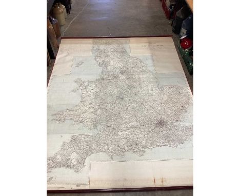
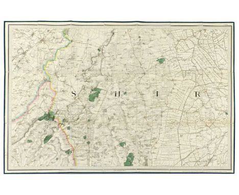
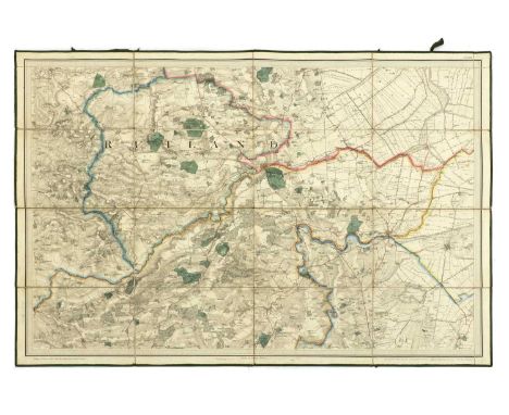
Ordnance Survey Maps: Cameron & James: Ordnance survey of England & Wales- Rivers & their catchment basins. Southampton, 1867; (1400 x 1080mm), 16 sections. Coloured, linen backed & folding, with the original full Morocco slipcase; King's Lynn, includes Wisbech. 1824, Large folding, linen backed & with Slipcase; Boston, 1824, folding linen backed (960 x 660mm); Louth, As above; Sleaford, As above; Parliamentary divisions of North Cambs. 1893, (1040 x 820mm), Coloured, linen backed & folding. (6)Provenance: The Peter and Pat Crofts Collection
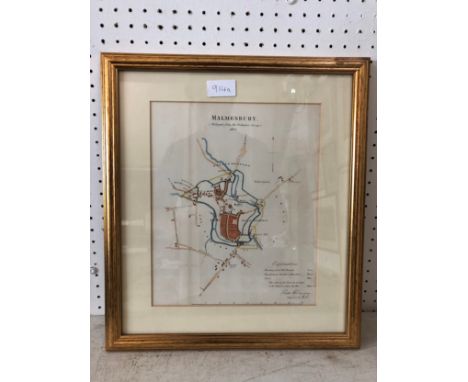
Lot 379
Major COLBY: Ordnance survey map of Lincolnshire, in 8 parts: 1- Sleaford, Spalding & Newark on Trent; 2- Lincoln, Market Rasen & Horncastle; 3- Hull & Barton on Humber; 4- Spurn Head; 5- Peterborough, Oundle, Melton Mowbray; 6- Downham market; 7- Holbeach, Castle Rising & Boston; 8- Loath. Published at the Tour of London, 1st. March 1827, by Major Colby. All eight maps are folding, hand coloured and linen backed, each measuring 950 x 650mm. Housed in the original full leather box, lid torn with loss; maps VGProvenance: The Peter and Pat Croft Collection
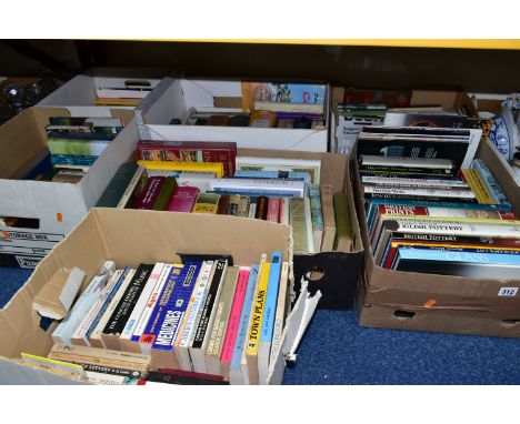
Lot 312
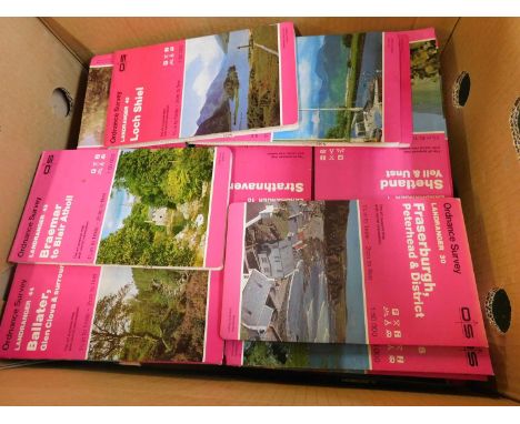
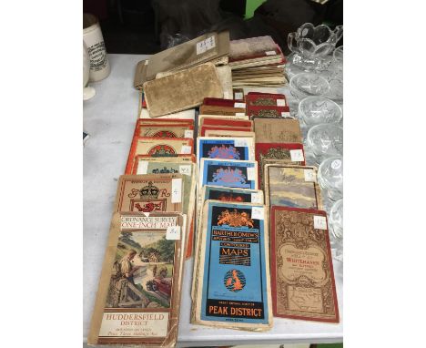
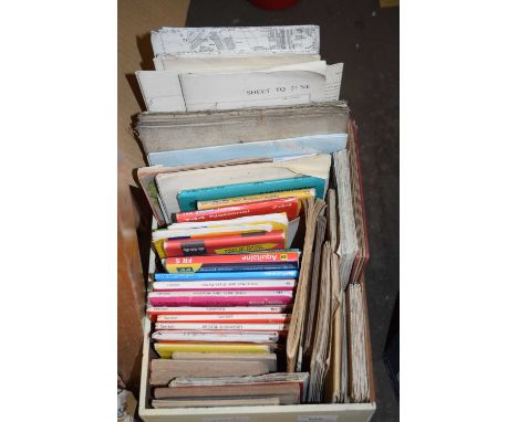
BOOKS & EPHEMERA, seven boxes containing approximately 180-190 titles in hardback and paperback formats, subject matter includes art and antiques, history, geography, lexical and encyclopaedic works, music, medicine, novels, twenty RSC/Royal Ballet programmes and three old Ordnance Survey maps (7 boxes)
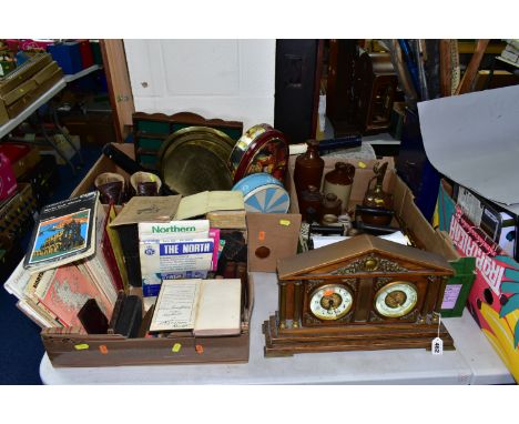
Lot 462
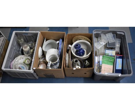
THREE BOXES OF METALWARE, BOOKS AND CAST FLAT IRONS, to include late 19th Century Bibles and prayer books, ordnance survey maps, a vintage Dunlop tennis racket, a wooden tea caddy with mother of pearl inlay flowers, seven cast flat irons, a cylindrical copper tea caddy, stoneware flagon, jars and inkwells, a pair of Vibram Montagna leather walking boots, a wooden Corinthian style clock/barometer, etc (s.d) (3 boxes + loose)
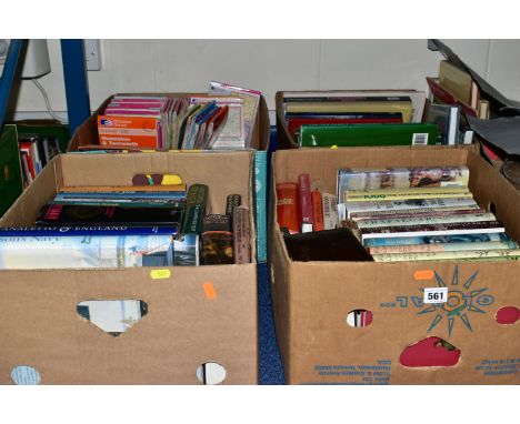
Lot 561
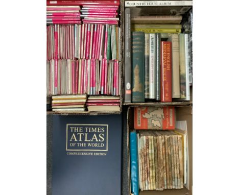
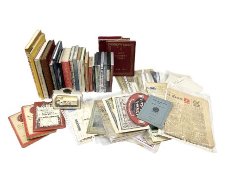
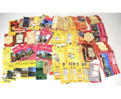
BOOKS & EPHEMERA, four boxes containing approximately eighty titles, mostly historical from authors including Winston S. Churchill (four volumes of A History of the English Speaking Peoples, published by Cassell) and Antonia Fraser, works on Nelson, Napoleon & Hitler, the English civil war, 1066, the gunpowder plot and encyclopaedic treaties, together with approximately twenty-one audio cassettes from Miss Read, Rosamunde Pilcher, Pam Ayres and Alan Titchmarsh and approximately thirty-two maps from the Ordnance Survey, Michelin, etc (4 boxes)

-
12130 item(s)/page