We found 12129 price guide item(s) matching your search
There are 12129 lots that match your search criteria. Subscribe now to get instant access to the full price guide service.
Click here to subscribe- List
- Grid
-
12129 item(s)/page


Lot 331
A Victorian 1887 pattern black powder percussion cavalry carbine rifle, possibly a M1856 Enfield, with a fixed steel swivel ramrod, unmarked lock but various markings to trigger guard, butt plate, and barrel. with imprints on the stock Fort William Arsenal, and Birmingham 1887 and WD Ordnance marks, barrel marked N.S,B, length 21 inches
Lot 50
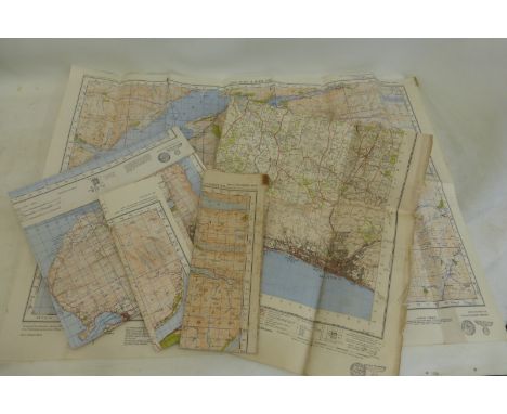
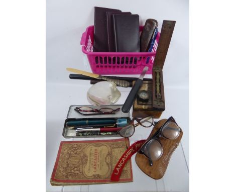
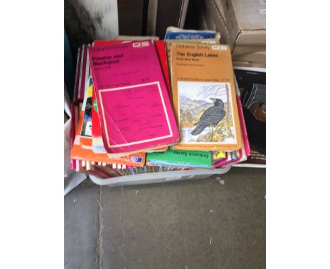
Gentleman's Lot, comprising rosewood and ebony rulers, ostrich skin glasses case, three pairs of tortoiseshell style glasses, compass, Coutts leatherette banking books, coin scales and Ordnance Survey map of Lancaster & District and four fountain pens and a French glass paperweight in the form of a toad.
Lot 653
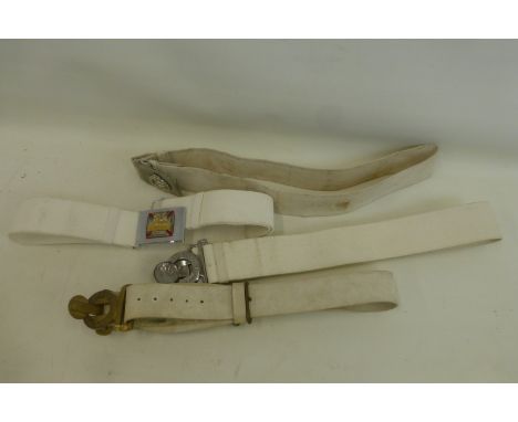
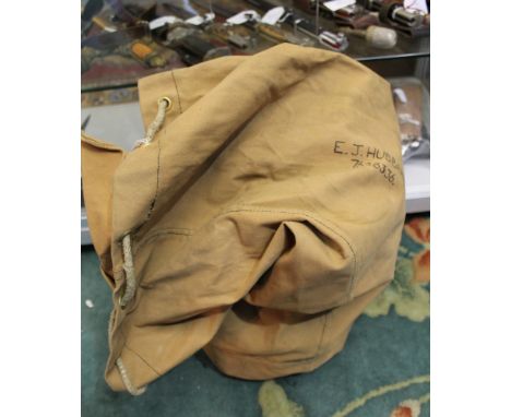
WW2 British Desert Rat Prisoner of War collection: these items were the personal effects and war souvenirs of 7628336 Hubbard E. Royal Army Ordnance Corps comprising of: PoW Dog Tag Stalag IVB 229728 (Cut down Heer tag) with string: British ID tags: German Gas / Minefield printed deathshead warning pennant: Heer Landschutz Battalion 369 slip on shoulder title: Pair RAOC collar dogs: Africa Star ribbon on orignial card: Service stripes for BD: three German coins: Bundestag badge: US Army issue wool em's shirt with gas flap size 16/33: British Army OR's wool shirt with attached collar by RRP: named and number 1944 dated and named kit bag: named and numbered 1941 dated Small Pack with two leather belts. Tooled leather handbag bought in Egypt for his wife.
Lot 642
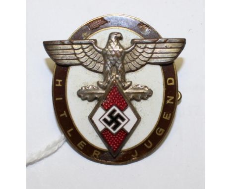
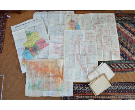
WW2 Third Reich Hitler Jugend badge for Distinguished Foreigners enamel a/f no makers mark, three uncut machine woven German Red Cross / Deutsches Rotes Kreuz sports vest insignias, ARP Board game (no tokens), three 1915 British Army maps of Gallipoli and a 1916 edition of the Daily Sketch Newspaper covering Zepplin raids on England, two WW2 British scrapbooks and four WW2 British Ordnance Survey Maps (East Anglia, Northants, North Central, The Borders) and a collection of sixteen HMSO booklets on various Campaigns of the War inc. "By Air to Battle" the official account of the British Airborne Divisions.

Lot 1544
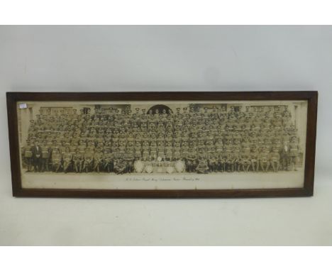
Group of items to Maj G Browne RAOC, Senior Ammunition Technical Officer: A Trench Art Shell case engraved with Queens Crown RAOC cap badge and "Presented to Major Geoff Browne and Family with thanks from Familt Turner-Frenken. Oct '84" and a Trench Art Table lamp made from a 105mm shell case engraved "Maj GJ Browne RAOC From SATO Dept 3 BAD Oct 1984" plus a Trench Art Ash Tray made from a 105mm shell engraved "Presented to Major GJ Browne by the Officers 3 BAD Oct. 84". Metal Eagle Desk trophy on Marble mount with brass plaque engraved to "Presented to Major GJ Browne MBE on departure by the Officers of Bracht Station October 1984".complete with a framed colour photo of Maj Brown and the men of SATO Dept 3 Base Ordnance Depot RAOC. (5)
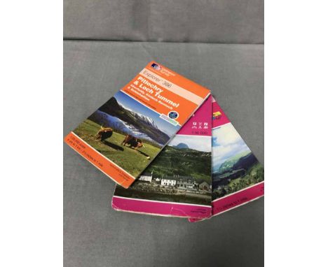
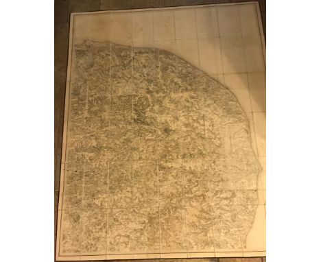
![Ordnance Survey of Ireland: Geological Survey of Ireland, Cushendall [County Antrim], Sheet 14, Engraved at the Ordnance Surv](https://cdn.globalauctionplatform.com/e71b8453-d5a5-4911-8785-a7ac010039d3/7029f244-9707-40a5-85d9-150764d882c6/468x382.jpg)
Lot 159
Ordnance Survey of Ireland: Geological Survey of Ireland, Cushendall [County Antrim], Sheet 14, Engraved at the Ordnance Survey Office, Dublin under the direction of Captain Wilkinson R.E., The Outline by Robert Mahony, the Writing by James Aikman, the Hills by John Duncan, Published by Colonel Sir H. James R.E., F.R.S., M.R.I.A. &c., Superintendent of the Ordnance Survey [...] 1886, four-fold map, hand-coloured engraving, 36cm x 54cm
Lot 158
Ordnance Survey of England and Wales: Geological Survey of England and Wales, Sheet 92 N.E. (New Series Sheet 61) [part, North Yorkshire Moors], Engraved at the Ordnance Survey Office Southampton, The Outline by J. Adkins, the Writing by J.A. Harrison, The Hills by H. Dixon, Published by Colonel James R.E., F.R.S., M.R.I.A. &c., Superintendent [..] 1889, map, hand-coloured engraving, 37cm x 57cm
Lot 126
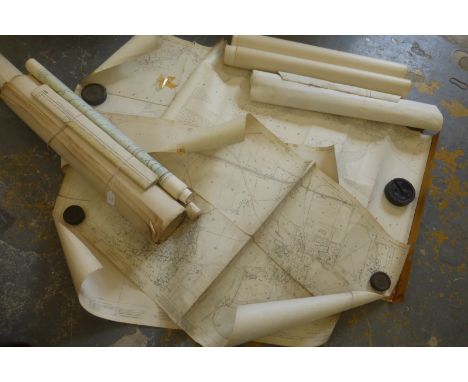
Folding maps. A mixed collection of five maps, 19th century, including Cary (John), Cary's New Map of Ireland exhibiting the whole of the Turnpike roads with the Rivers and Canals; The Market and Borough Towns and principal places adjoining the Road to which is added the distance..., 1834, engraved map with contemporary outline colouring, sectionalised and laid on linen, some staining, 750 x 625 mm, marbled endpapers, contained in a contemporary marbled card slipcase with publisher's label to upper board, slight wear to extremities, together with Cary (John), A New Map of Gloucestershire divided into Hundreds exhibiting its Roads, Rivers, Parks &c., 1823, engraved map with contemporary hand colouring, some staining and soiling, 575 x 510 mm, marbled endpapers, contained in a contemporary marbled card slipcase with publisher's label to upper board, slight wear to extremities, with Walker (J. & C.), Suffolk, published Longman, Rees, Orme, Brown & Co., 1845, engraved map with contemporary outline colouring, sectionalised and laid on linen, 335 x 405 mm, contemporary cloth boards with publisher's printed label to upper siding, plus Kemp (George), Graham's New Map of England and Wales with part of Scotland showing the Mail Coach, Turnpike & Railroads, Canals &c. circa 1850, engraved map with contemporary outline colouring, sectionalised and laid on linen, slight spotting and staining, 750 x 630 mm, contemporary cloth, lacking upper board, and Ordnance Survey (publishers), Untitled map of part of Surrey, 1878, uncoloured electrotype map, sectionalised and laid on linen, the map shows Wokingham in the north-west to Croydon in the north-east, and includes Reigate, Dorking, Kingston, Chertsey and Guildford, 625 x 940 mm, marbled endpapers, contained in a contemporary red cloth slipcase with publisher's label to upper board (5)
Lot 804
World War 1 maps: a hand-amended (cut and spliced) map of trenches and positions at the battle of the Somme, corrected to 16/9/16, two 1918 Ordnance Survey maps of the Western Front, showing the lines of battle - The Sea to Reims and Argonnes to Vosges, two German Order of Battle, 11.11.18 - one headed 'Confidential - Not to be Reproduced' and two post-war published maps of positions at the end of the conflict - 8 maps in total - to/w nine various 19th county map engravings by Pigot & Sons, Manchester

Lot 121
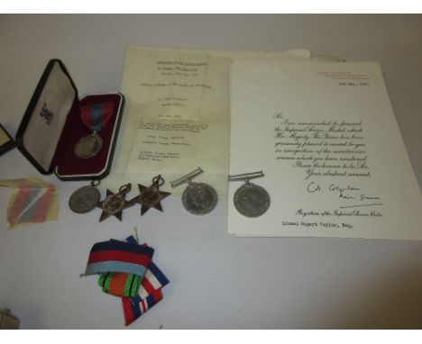
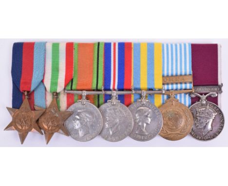
WW2 & Korean War Officers Medal Group of Seven Royal Army Ordnance Corps, consisting of 1939-45 star, Italy star, Defence medal, 1939-45 War medal, Queens Korea medal “CAPT T B HEATON R.A.O.C”, United Nations Korea medal and George VI Regular Army Long Service Good Conduct medal “LIEUT T B HEATON R.A.O.C”. The medals are court mounted for display. Thomas Heaton was born in York on 1st March 1912. Enlisted in the British Army as a private and raising through the ranks before being granted a commission in 1944. He was promoted to Captain in 1949. He was one of the advance party of 12 officers and 20 men who landed at Pusan, Korea, by plane on 27th August 1950. Two days later British troops of 27th Brigade arrived from Hong Kong. He was promoted to Major in 1955 and retired from the army in March 1962. This group was sold by Dix Noonan & Webb on 27th July 1995 with some newspaper cuttings confirming service, these are now absent from the group.

Lot 635
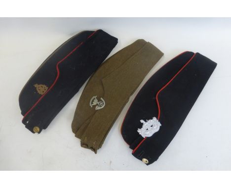
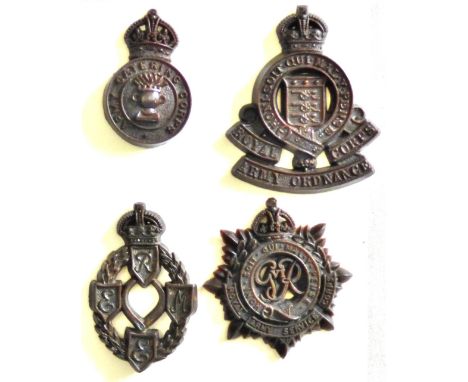
Royal Signals Officers Field Service Cap, of blue cloth body with bullion wire regimental badge, bullion wire piping to the side flap and crown. Brass regimental buttons to the front and sky blue coloured top. Black velvet cushioned band to the interior with the original size label. Cap shows minimal service wear; Royal Electrical & Mechanical Engineers Scottish Officers Glengarry cap with bullion embroidered regimental badge on tartan backing. Complete with the original tallies to the back of the cap and blue cloth ball to the top of the cap; WW2 period Royal Artillery officers coloured field service cap with bronze regimental flaming grenade badge, blue cloth bottom section with red cloth top having bullion wire edging, brass kings crown regimental buttons to the front. Officers quality lining to the interior which shows service wear; Royal Army Ordnance Corps dress side / field service cap of blue cloth body and red top section, gilt and enamel small type cap badge, bullion wire piped edges and brass regimental buttons to the front. Interior with inked name label. Evidence of service wear to the cap. (4 items)
Lot 137
London.- Philip (George, & Son) Philip's New Map of London and It's Environs, from the New Ordnance Survey including the area under the jurisdiction of the Metropolitan Board of Works, showing from Chiswick across to Abbeywood, and Tottenham to Wimbledon, lithograph, part printed in colours, 910 x 980 mm. (35 7/8 x 38 3/4 in), dissected and mounted on linen, minor surface dirt and handling creases, bears Law Society Library stamp upper right, folding with marbled endpapers into black cloth, printer's label on upper cover, spine slitting, 8vo, worn, circa 1885 § Stanford (Edward) Davies's New Map of the British Metropolis, The Boundaries of the Boroughs, County Court Districts, Railways, and Modern Improvements, showing Crystal Palace, engraved map with hand-colouring, 970 x 970 mm. (38 1/4 x 38 1/4 in), dissected and mounted on linen, some handling creases and surface dirt, minor damp-stains, with large repaired tear to upper section, folding with green cloth endpapers, without slipcase, [circa 1871 or later], (2).
-
12129 item(s)/page