We found 12129 price guide item(s) matching your search

Refine your search

Year

Filter by Price Range
  • List
  • Grid
  • 12129 item(s)
    /page

Lot 561

WW2 1940 Ordnance Survey Maps x 6. 2nd Word War issue, as such they do not have covers due to wartime paper shortages. Areas are:- Bedford sheet 84, Brighton & Eastbourne sheet 134, Oxford & Henley-on-Thames sheet 105, East Kent sheet 117A , Glasgow sheet 72 , Chatham & Maidstone sheet 116. , Glasgow sheet 72 , Chatham & Maidstone sheet 116.

Lot 196

Oriental vase converted to a table lamp and a tray of mixed collectables including ceiling lamp, Ordnance Survey maps, cameras etc

Lot 245

A PLATED 1899 PATTERN CAVALRY TROOPER'S SWORD, 85cm curved fullered plated blade with various Ordnance markings and dated 1900, regulation plated bowl guard, chequered two-piece leather grips, contained in its plated scabbard. Plating lifting generally.

Lot 246

A 1908 PATTERN CAVALRY TROOPER'S SWORD, 88.5cm blade by WILKINSON struck with various Ordnance markings and dated 1915, regulation steel bowl guard struck with the rack number 60, chequered ergonomic composition grip, contained in its steel scabbard also struck with various Ordnance markings and dated 1915.

Lot 356

(NOT ILLUSTRATED) A CHASSEPOT BAYONET, dated 1873, together with a 1907 Pattern bayonet with various Ordnance and RAF markings, both with scabbards, a worn Mauser bayonet, an 1856 pattern pioneer's sidearm, and a French sidearm. (5)

Lot 563

'NATURE DISPLAYED IN THE HEAVENS AND ON THE EARTH' by Simeon Shaw, 1823, volume six; 'The Works of Tobias Smollett', 1797, volume six; 'The Ancient Ordnance and Statute Laws, The Isle of Mann 1841' (3)

Lot 749

A LARGE COLLECTION OF ANTIQUE AND LATER ORDNANCE SURVEY MAPS and other maps to include G.W. Bacon & Co.

Lot 622

A large collection of printed transportation ephemera, including some Railway such as North Eastern Railway Regulations for Train Signalling by Block Telegraph, 26/9/1909, others automobile related such as The Modern Motor Car with fold out automobile components, London. Shell-Mex and B.P., Ltd, 1933, together with a quantity of mostly early to mid 20th century Ordnance Survey maps and other vintage printed ephemera and a group of bound copies of The Children's Newspaper, Vol. IV, circa 1922. (q)

Lot 30

Collection of 30 plus First Half 20th century Ordnance Survey Maps, also including Edward Stanford & G W Bacon

Lot 33

Collection of vintage Ordnance Survey Maps

Lot 707

Pair of Wooden Military RAF Lossiemouth Ordnance / Ammo / Flame Tube Cases Lidded Crates / Boxes

Lot 254

ORDNANCE GAZETTEER SCOTLAND: A SURVEY OF SCOTTISH TOPOGRAPHYedited by Francis H. Groome, in 6 vols and the Imperial Gazetteer of Scotland: Dictionary of Scottish Topography, edited by the Rev. John M. Wilson in 4 vols.; along with assorted books including Christie's Review of the Season 1990

Lot 307

COLLECTION OF VINTAGE ORDNANCE SURVEY MAPS OF SCOTLANDthe earlier examples mounted on cloth, period Motoring and Cycling maps, later touring maps, with a selection of British tourist brochures and booklets

Lot 313

COLLECTION OF SCOTTISH ORDNANCE SURVEY MAPSapproximately 70

Lot 1459

"The Cheapside Large-Scale Plan of Nottingham", vintage Ordnance Survey and other English and foreign maps.

Lot 1463

1950's, 60's and Later Ordnance Survey Maps, Bartholomew's, vintage Esso maps etc.

Lot 485

A Balloon View Of London circa 1851; 1953 Ordnance Survey Salisbury SU1429; two 18th century plans of London

Lot 1397

A collection of wristwatches to include a 9ct yellow gold small lady's Sekonda wristwatch on a leather strap, plus two further Sekonda lady's wristwatches, also four gentleman's wristwatches including examples by Sekonda, Lorus, Adec etc, and two chromes pocket watches, a black faced example with subsidiary dial with ordnance arrow and inscribed 'GS/TP P41743', the other by Ingersoll, and a collection of cufflinks and a tie pin.

Lot 352

A group of 9 plastic economy cap and collar badges comprising RAF, Royal Engineers (x2), Royal Corps of Signals, Royal Army Pioneer, Medical, Catering, Ordnance and Service corps (9).

Lot 909

A large collection of Ordnance Survey maps to include 1-500 hand coloured maps of Cheshire, 1:mile linen backed examples and a framed 'Ordnance Survey map centred on New Mills, Derbyshire'.

Lot 191

Boxes and Objects - a mother of pearl pilgrim shell, carved with Christ; a copper portrait roundel, embossed with Rubens; a silver brooch; a military pin dish, Army Ordnance Corps; coins; etc

Lot 605

Ephemera, mixed, including a selection of ordnance survey maps of varying ages mostly Hampshire, loose magazine/newspaper etched plates and cuttings, vintage cartoon booklets, 1889 "The Herald of Mercy" compendia, vintage movie star photographs, "Black and White" budget magazines, Illustrated London news magazine etc, Parcel (2)

Lot 181

Ordnance Survey maps, areas throughout the United Kingdom. (qty)

Lot 215

A large assortment of Ordnance Survey maps, to include: Wallsend; Gateshead; Sunderland; and others.

Lot 274

Quantity of ordnance survey maps

Lot 283

Box of Ordnance Survey and similar maps and guides etc

Lot 356

A Late 18th/Early 19th Century 16 Bore Flintlock Pistol by Sutherland, the 20cm octagonal steel barrel with Tower Ordnance markings, with signed lock plate, walnut stock with brass ramrod pipes, trigger guard with pineapple finial, with brass tipped wood ramrodAction works, holds at full and half cock. Repair to left side of stock along the barrel, with a sliver of wood missing near the right of the muzzle, and small chips around the lock plate. The front lock retaining screw is missing. Pitting to metalwork.

Lot 362

A George III Percussion New Land Service Pistol, converted from a flintlock, the 22.5cm steel barel with Board of Ordnance proof marks, the lock plate stamped TOWER, with crowned arrow and crowned GR, the walnut stock with brass fore-end tip, ramrod plate, trigger guard, side plate and butt cap, the left side of the stock stamped 10 WG 10 and with crowned P , the right side with crowned arrow, crowned 0 and crowned 9, with steel swivel ramrodAction works, but only holds at half cock. Barrel with orange rust pitting. Minor bruising to stock. Converted from a flintlock

Lot 1361

An early 20th century leather travelling case of folding maps, Ordnance Survey "Quarter Inch", including English regional, North Wales and some of Scotland, fourth editions (18), the monogrammed case, 32.5cm high, 18cm wide, c. 1930

Lot 216

A mid-20th century 'folio' map of Derby and its environs, 1 : 1250 or 50. 688 inches to 1 Mile, each page 53cm x 50cm, Printed and published by the Ordnance Survey Office, 1947, hinged wooden boards, 57.5cm x 54cm overall

Lot 124

A Collection of 9 Silver War Badges 'for Services Rendered'. All with brooch fittings and all with serial numbers. One brooch fitting absent. Plus one with lapel fitting and no serial number. Following regiments represented; 3rd Bn South Lancashire Regiment, Lancashire Fusiliers, King's Own Royal Lancaster Regiment, Gloucestershire Regiment, The Royal Scots, Cameronians (Scottish Rifles), Indian Army, Army Ordnance Corps & Labour Corps.

Lot 178

A ROYAL CORPS ARMY ORDNANCE BAR BROOCH, and a 'BABY' bar brooch (2)

Lot 259

A box containing vintage ordnance survey maps, together with one volume of 'Antique Maps A Collectors guide'

Lot 135

A collection of Royal Army Ordnance Corps Major's service and mess dress uniforms, comprising service greatcoat, three jackets and three pairs of trousers and mess jacket, trousers and waistcoat, etc.

Lot 1348

Fifteen vintage Devon and Cornwall West Country Ordnance Survey Maps including three Cornish blue cover fifth edition mounted on cloth, tourist map of Dartmoor on cloth, Tiverton contoured road map 1925 mounted on cloth, plus other later vintage 1970's O. S., one inch series maps, etc

Lot 769

A collection of Ordnance Survey maps of Nottingham and surrounding area

Lot 386

A bound volume of Ordnance Plans for the Lessendrum Estate dated 1902 and sepia-toned photographs of the house in common-mount and four other images of buildings on the estate Provenance: Bisset's of Lessendrum, and thence by descent

Lot 49

A WWll British tropical slouch hat, by Hall and Phillips Ltd date 1942, a machete, the leather scabbard marked Oliver Webb and Co 1940 with ordnance arrow and 38 and a sheath knife with leather scabbard (3)

Lot 70

A pair of WWl trench barbed wire cutters with ordnance arrow mark and indistinct date, probably 1918, 53cm long, and an early 20th century trench spade marked Gouvy 1906, 52cm long (2)

Lot 847

Derbyshire interest: 'The History, and Proceedings, of the Derbyshire Loyal True Blue Club; from its Origin in 1812, to its Seventeenth Anniversary in May, 1829', by the Editor of the 'Derbyshire Courier', London: sold by Hurst, Chance, and Co. [1829], original blue paper covered boards with title label to spine, club members listed at the end of the book (the club's foundation was based on anti-Jacobin principles following the consequences of the French Revolution); 'Pleasant Rambles around Derby', John Ward, Derby: Frank Murray, 1895, with folding map and notes for cyclists, green cloth & gilt; Derby Bank, Bellairs and Sons, £5 banknote, dated 15th November 1809, signed J. Bromley, Bellairs; Derby & Burton map, engraved at the Ordnance Survey Office, published by Colonel Farquharson, March 1895, hand-coloured, bearing label for Edward Stanford of London, complete with original slipcase featuring gilt title, 150cm x 135cm. (4)

Lot 918

Collection of approximately 20 Ordnance Survey maps, half of which are 1860s electrotypes with hand-coloured detail, nine housed within oxblood buckram Edward Stanford slipcases, including Cumberland, Montgomeryshire, Southampton, Salisbury.

Lot 589

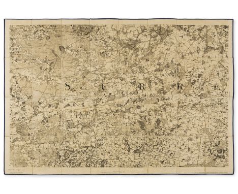
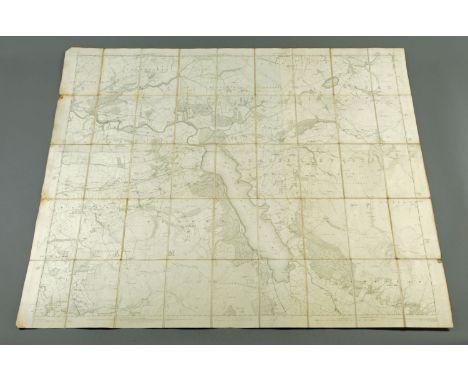
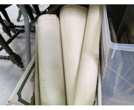
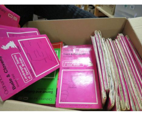
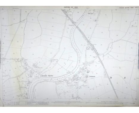
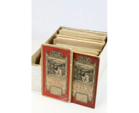
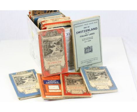
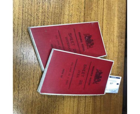
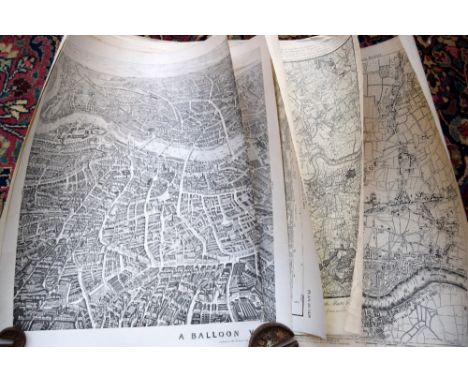
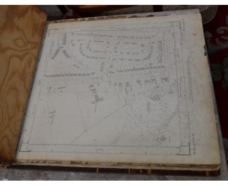
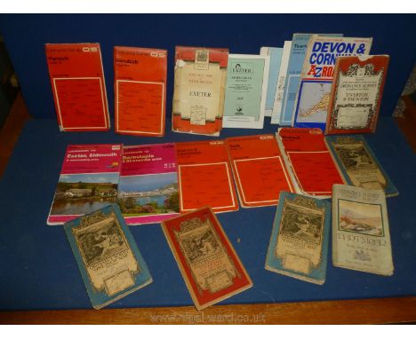
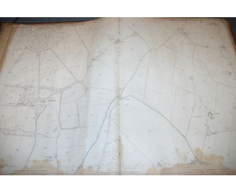
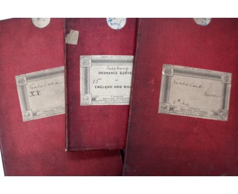
Cumberland and Midlands.- Geological maps.- Mudge (Lt. Col. William) [Geological Ordnance Survey Map of Cumberland], a composite map of single sheets from the 'Geological Survey of Great Britain' joined and presented in two parts, North and South, also showing part of Westmorland, with numerous keys and diagrams neatly trimmed and pasted on, engraving with extensive hand-colouring, with several sheets trimmed and joined, 'North' measures 975 x 1990 mm. (38 3/8 x 78 3/4 in), 'South' 980 x 1520 mm. (38 1/2 x 59 3/4 in), dissected and mounted on linen, minor surface dirt, folding with marbled endpapers, presented in red cloth slipcase with printed label, 4to, Edward Stanford, ca. 1850s; together with seven other single sheet maps from the 'Geological Survey of Great Britain', including three copies of sheet LXII (Lichfield), and one of LXIII (Leicester), and LXXI (Nottingham), and with 'Horizontal Sections Sheet No. 24', and 'Horizontal Sections Sheet No. 25', engravings with extensive hand-colouring, various sizes, majority between 670 x 495 mm. (26 1/2 x 19 1/2 in), and 675 x 1000 mm. (26 1/2 x 39 3/8 in, all dissected and mounted on linen, occasional minor surface dirt, all folding into various endpapers, several presented in slipcases, some loose, mainly 8vo, 1850s and later, (9 maps).

Lot 601

South East England.- Mudge (Lt. Col. William) Ordnance Survey maps covering Surrey, Sussex, and Kent, four sections, engraved maps, each approx. 635 x 920 mm. (25 x 36 1/4 in), dissected and mounted on linen, folding into blue morocco gilt-tooled and lettered book-style slipcase, rubbed, worn, 4to, [circa 1810-1820] § Mudge (Lt. Col. William) [An 'unfinished proof' ordnance survey map of Surrey, No. VIII], engraving, an excellent impression, 645 x 940 mm. (25 1/2 x 37 in), dissected and mount on linen, with blue silk edge, bears brown pen and ink inscription lower right that reads 'Unfinished Proof', some spotting and light browning, folding into contemporary blue morocco gilt-lettered book-style slipcase, rubbed, worn, 8vo, 1816, (2).

Lot 603

WWI group including war medal and victory medal to SS6379 W MCGUIGAN ABRN (Able Seaman? Royal Navy) and 1914-15 star to SS6379 W MCGUIGAN ORD RN (Ordnance Royal Navy).

Lot 653

Warwickshire Royal Horse Artillery cap badge, Royal Army Veterinary Corps cap badge, Army Ordnance Corps Cap badge, Army Catering Corps cap badge by Buttons of Birmingham, The Welsh, The King's, Royal Berkshire etc

Lot 355

A QUANTITY OF ORDNANCE SURVEY MAPS, THEATRE PROGRAMMES, ETC

Lot 195

Boxes and Objects - a mother of pearl pilgrim shell, carved with Christ; a copper portrait roundel, embossed with Rubens; a silver brooch; a military pin dish, Army Ordnance Corps; coins; etc

Lot 1137

One volume "Ordnance Plan Parish of Egremont", bearing label "Callander & Dixon Stationers, Whitehaven" and as surveyed by Captain James RE February 1863, scale 1/2500.

Lot 1147

An ordnance survey map covering Bassenthwaite Lake and Lorton, 1863, E.R. James, engraved 1865, published 1867, scale 6 inch-1 mile. CONDITION REPORT: The map is linen backed. There is a very small tear to the front right edge which should be noticeable on our web image. One quarter of the corners to the bottom right and top right are slightly folded, the remaining corners appear to be undamaged. Once the map is open, two thirds of the map are a uniform colour and just slightly over a third is a lighter cream colour. This is visible where it appears the map has been overlaid. There is an overshoot of the lettering at the top. There are holes in the linen joins at the corners but nothing too drastic. There appears to be mould and staining on two of the left hand side folds and bottom corner. The top left hand corner has a small fold. The backing is an off white clean uniform colour throughout but there is dark staining around the edges of each fold. There are a few dirt spots throughout but nothing that interferes with the map. This staining may be visible to see if you look at our website illustration.

Lot 225

A collection of postcards, mostly 1960s topographical and museum cards, also Ordnance Survey maps

Lot 158

READERS DIGEST 'Great World Atlas', and 'Complete Atlas of the British Isles', various 'A.A.', Publications including 'The Illustrated Road Book of England and Wales', second post war edition 1958, plus 'Ordnance Survey Maps and Guides, including BAEDECKERS 'Switzerland' 1885

Lot 175

A Third Reich Ordnance pattern sabel, plated blade 33” by A&C, the brass hilt lacking Waffenamt marks, with wirebound black grip, complete with knot. In its black painted scabbard. GC (scabbard has light surface rust, faint stains to blade).

Lot 464

An early Vic officer’s 1827 pattern sword of The Rifle Brigade, curved, pipe backed blade 32½”, by “Moore & Co. Sword Cutlers and Army Accoutrement Makers to Her Majesty and Board of Ordnance”, etched (faint) with scrolled panels including “Rifle” and “Brigade”, regulation steel hilt including crowned strung bugle, stepped pommel, plain backstrap, wirebound fishskin grip, in its black leather scabbard (worn and torn) with 3 steel mounts and 2 rings. QGC

Lot 753

A collection of military buttons and badges including Westmorland Volunteers Rifle Corps, on War Service 1916, Paddington Rifles, Mirrlees, Bickerton and Day War Service 1918, Coventry Ordnance Works War Service

Lot 475

Approximately Fifteen Ordnance Survey Maps, mainly Early 20th century scale six inches to one mile, together with Ten Coloured Ordnance Survey Geological Survey Maps scale six inches to one mile

Lot 557

Approximately 33 Folded Ordnance Survey Maps 1:50 000 plus approximately 8 other Folded Ordnance Survey Maps

Lot 2075

Collection of 20 1:2500 scale c1908 Ordnance Survey Maps of the York area including Naburn, Crockey Hill, Rowntrees Works etc & 14 c1966-68 period similar maps (34) Condition Report Click here for further images, condition, auction times & delivery costs

Lot 527

A leather box, stamped E.B. Canning, containing 14 Ordnance Survey 1/4" cloth maps of Great Britain, circa 1940.

Lot 149

1 BOX OF ORDNANCE SURVEY MAPS

Loading...Loading...
  • 12129 item(s)
    /page

Recently Viewed Lots