We found 12129 price guide item(s) matching your search
There are 12129 lots that match your search criteria. Subscribe now to get instant access to the full price guide service.
Click here to subscribe- List
- Grid
-
12129 item(s)/page


Lot 721
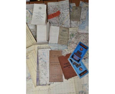
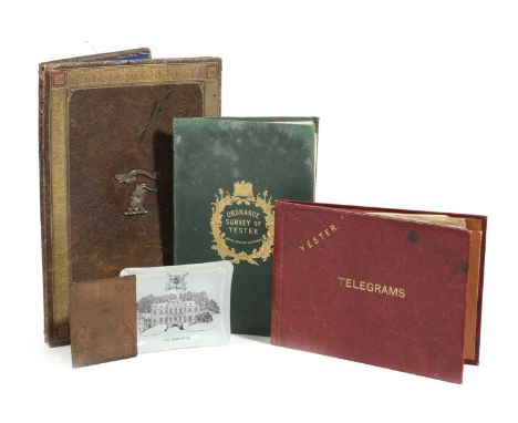
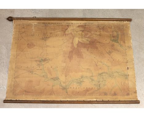
AN ORDNANCE SURVEY MAP OF YESTERC.1855paper on canvas, the green leather cover tooled with a crown and thistles and stamped 'W. & A.K. Johnstone, Edinburgh', together with an Edwardian gilt tooled leather stationery folder, the front applied with the Marquess of Tweeddale's crest and the motto 'Spare Nought', the back dated '1905', a Yester House Telegram folder, a Yester House glass ashtray and a copper bookplate engraved with the Marquess of Tweeddale's coat of arms (5)30cm (max)ProvenanceParker & Morris: The Art of Decorating.The Marquess of Tweeddale, Yester House, Gifford, East Lothian.PLEASE NOTE THAT THIS LOT IS TO BE OFFERED WITHOUT RESERVE.

Lot 337
The Conyngham Plunkett Collection of Estate Maps relating to land owned in County Monaghan. Map of Robert Black’s Holding in Claddagh, Dromore and other holdings in other locations. Hand drawn and coloured. Folded maps. Circa 1780-1808. Some with description of property. Surveyors Alexr. Fleming, John Dolan and W. Douglas. William Plunkett , Lord Chancellor and other members of the distinguished family. A wonderful and unique collection of 27 original pre-Ordnance survey estate maps


Lot 510
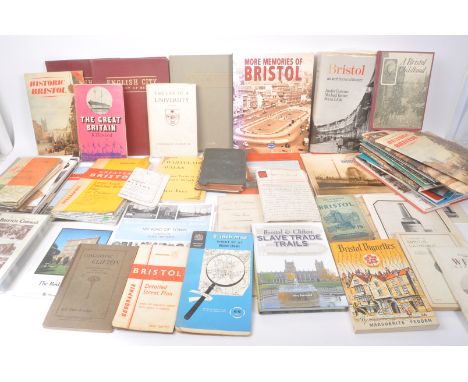
Local Bristol Interest - A large collection of 20th and 21st century Bristol related books and ephemera. The collection to include books surrounding local Bristol history, alongside local landmarks, as well as maps, newspapers, and guides. Included within lot; 'Bristol Review Christmas, 1952', 'Brunel, The Pitkin Guide', 'Trade and Transport in Old Bristol, by E.M Habgood', 'A History of Bristol Cathedral, Reginald James Fletcher, D.D', 'Geographia, Greater Bristol', and a selection of Ordnance survey maps of the area amongst other examples.
Lot 1458
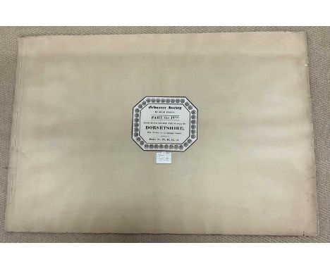
'Ordnance Survey of Great Britain, Part the IV, Containing nearly the whole of Dorsetshire, with the portions of the adjoining Counties, comprised in plates No 15, 16, 17, 18', published on 1st August, 1811, by Lt. Col. Mudge Tower, and engraved at the Drawing Room in the Tower by Benjamin Baker and Associates, the four maps, each 68 x 81cm, bound together with a paper binding
Lot 503
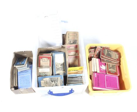
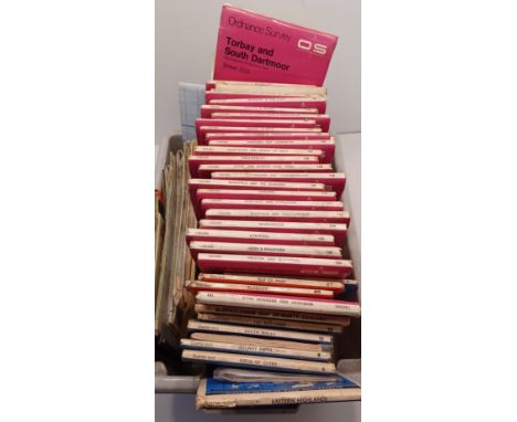
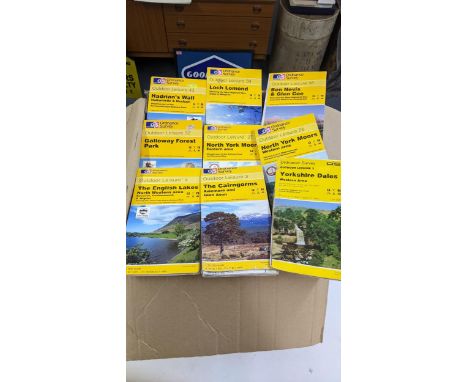
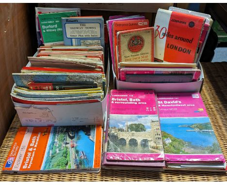
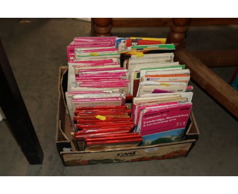
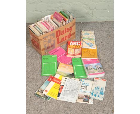
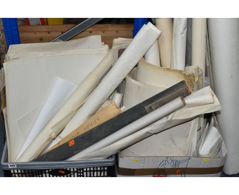
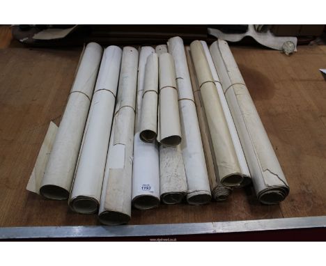
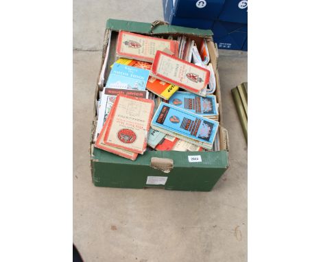
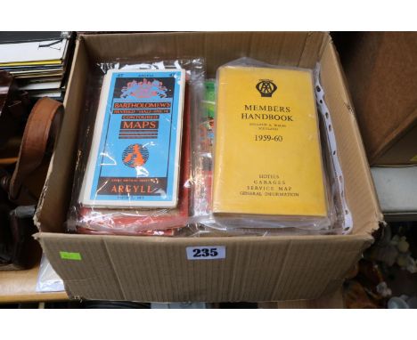
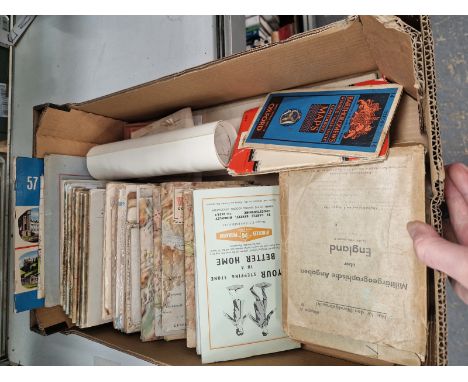
EIGHT BOXES comprising three boxes of books containing over eighty-five miscellaneous titles in hardback and paperback formats, subjects include geography, travel and guides, history, encyclopaedic and lexical works, psychology, etc, two crates of DVDs containing film and tv titles, and two boxes of maps, mostly Ordnance Survey
Lot 453
EIGHT BOXES OF BOOKS AND MAPS, over one hundred books in hardback and paperback formats, to include vintage, golf, fishing, travel, history and reference, two Folio Society titles: The History of the Great Rebellion, Edward Hyde: Earl of Clarendon and Izaak Walton's The Compleat Angler, with a selection of Ordnance Survey and other maps (8 boxes) (sd)

Lot 525
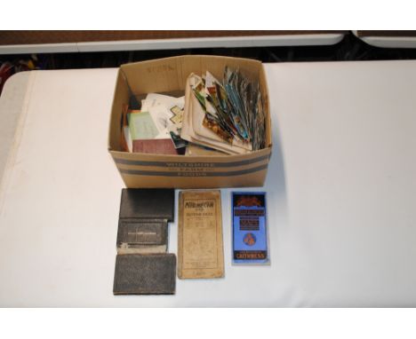
An early A3 Ordnance Map, J. E. Cornish, Little Lever and surrounding areas together with an interesting collection of ephemera relating to the sale of parts of the Alderley Park Estates, Cheshire in 1940. Also included is an Auction Catalouge for the 'Estate at Styal' (Parish of Wilmslow) 1877. (Qty) In good original antique and vintage condition.

Lot 103
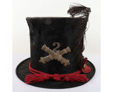
US CIVIL WAR PERIOD UNION “PORK PIE” ARTILLERY HAT, STYLE USED BY GENERAL PHIL SHERIDAN, made of a black seal skin, 4” tall w/ a 2” rim (has gray cloth trim & underside), a black polished cotton lining w/ a makers label “Lasell & Brothers Manufacturers, 20 North Fourth St. Philada.” Etc., has a red braded cloth issue Artillery hat cord, has a 3 ½” wide brass crossed cannons w/ the unit # “1” above, on the side is a brass ordnance bomb w/ a black plume (feather), lacks is leather sweatband, VG – VG+
Lot 102
US CIVIL WAR PERIOD UNION MILITA ARTILLEY TOP HAT, unusual, is made of a black beaver skin & stands 6” tall with a 1 ¾” brim, on front is a 3” wide brass crossed cannons w/ its Regimental # “2” attached, comes w/ an issue red cloth braded hat cord along w/ brass ordnance bomb on the side & a eagle “A” (artillery) button on a red cloth rosette & a black feather, its 1 ½” brown leather sweatband is damaged, inside embossed in gold is a US Army shield & its maker “F. Whiton / Boston 143 Hanover St.”, is very attractive & in overall great condition, VG++ - EXC.

Lot 353
Pair: Captain R. A. Maby, Gloucestershire Regiment, Parachute Regiment, and Royal Army Ordnance Corps Africa General Service 1902-56, 1 clasp, Kenya (2/Lt. R. A. Maby. Glosters.); General Service 1962-2007, 1 clasp, Malay Peninsula (Capt. R. A. Maby. RAOC.) mounted as worn, edge bruising to AGS, toned, good very fine (2) £300-£400 --- Provenance: Dix Noonan Webb, September 2015. Rene Alexis Maby was born in Headington, Oxford, on 22 July 1932, the son of the physicist Joseph Maby, the scientist who helped develop the early radar systems. Commissioned Second Lieutenant in the Gloucestershire Regiment on 22 July 1953, he was promoted Lieutenant on 22 July 1955, and served with the 1st Battalion in Kenya in 1955 as commander of the Anti-Tank Platoon. Undergoing parachute training, he transferred to the 2nd Battalion, Parachute Regiment in 1958, and was promoted Captain on 22 July 1959. He served with them in Cyprus from December 1959, before transferring to the Royal Army Ordnance Corps on 29 August 1961, and saw further service in Malaya. Sold with array of the recipient’s unit cloth badges ands patches, including his Pegasus patch and Parachute Wings; and three photographic images.
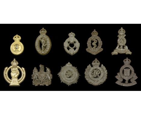
Lot 789
Miscellaneous Economy Plastic Cap Badges. A selection of 10 economy plastic cap badges, mostly to various Corps, including Royal Engineers, Royal Corps of Signals, Royal Army Ordnance Corps, Army Catering Corps &c., all complete with fold-over tangs, very good condition (10) £60-£80 --- Importation Duty This lot is subject to importation duty of 5% on the hammer price unless exported outside the UK ---

Lot 123
The ‘Maiwand survivor’ Abyssinia and Afghanistan pair awarded to Major-General C. M. Griffith, 1st Bombay Grenadiers, who took over command of his Regiment after Colonel Anderson was severely wounded; when the inexperienced Jacob’s Rifles broke and fled, Griffith was ‘Conspicuous in his Efforts to Steady his Men’ and motivate the Bombay Grenadiers to ‘Fight On’, saving his Regiment’s reputation and averting a total disaster; afterwards he reconstituted a fighting unit from the surviving Grenadiers and commanded it during the Defence of Kandahar City and the subsequent victory at the Battle of Kandahar Abyssinia 1867 (Captn. C. M. Griffith. Bombay Staff Corps); Afghanistan 1878-80, 1 clasp, Kandahar (Lieut. Col. C. M. Griffith. Bo. N.I.) both fitted with contemporary silver riband buckles, nearly extremely fine (2) £4,000-£5,000 --- Charles Matthew Griffith was born at Poona on 19 October 1834, the son of Colonel Julius George Griffith, later General and Colonel Commandant, Bombay Artillery. He was educated at Cheltenham College, nominated as an HEIC Cadet, and passed the Military Committee at East India House on 4 February 1852. After being twice rejected for his weak English and Latin, he was admitted to Addiscombe on 6 August 1852, and commissioned Ensign in the Bombay Infantry on 8 June 1854, at the age of 19. He arrived in Bombay on 23 September 1854 for regimental service with the 1st Bombay Native Infantry (Grenadiers). From June 1859 he was variously employed with the Irregular Cavalry, the Sind Judicial and Police departments, and as Superintendent of Police for the Great Indian Peninsular Railway. The March to Fortress Magdala By 1868, Griffith was a Captain in the Bombay Staff Corps. He was first sent on active service during the Abyssinia Campaign, the most logistically challenging but among the best executed of the British expeditionary wars up to that time. He was given responsibility for organising and commanding ‘A’ Division Highland Transport Train, 1st Brigade of the 1st Division, Abyssinian Field Force. He also commanded the stretcher-bearers who recovered the wounded on 10 and 13 April 1868 from the battlefields of Arogee and Magdala. He was created Brevet Major on 15 August 1868 and was four times Mentioned in Despatches: London Gazette 16 June 1868: ‘The bandsmen and a party of Punjab muleteers were also organised under command of Captain Griffith and furnished with stretchers for the removal of wounded men from the field.’ London Gazette 30 June 1868: ‘Captain Griffith [and other officers] have distinguished themselves by their zeal and activity and deserve special notice.’ London Gazette 10 July 1868: ‘Captain Griffith [and other officers], Land Transport Corps, commanded the first Divisions that were raised, are strongly recommended by the Director of Transport Corps for the extent and value of their assistance.’ London Gazette 7 August 1868: ‘The working of the Train next comes into consideration, which commenced with the arrival of Captain Griffith, with the advance Brigade... The Train was divided into four divisions... and Captain Griffith commenced the formation of “A” Mules... Difficulties and disasters met these officers at every step. Mules landed without equipment in hundreds, and with muleteers of the class already spoken of. At that time these officers having no subordinates had to look to everything themselves... The pleasing task now remains of bringing to the special notice of His Excellency the names of such officers more especially deserving of his kind consideration, and whose efforts came under the personal observation of the Director, who from first to last, never failed... Captain C. M. Griffith, Bombay Staff Corps.’ Griffith was granted furlough to England from 10 October 1868 to 22 November 1870. After marrying and returning to India, he was appointed Brigade Major, Aden in November 1871, promoted Major in June 1874, and Lieutenant-Colonel in July 1877. In August 1879, at the age of 44, he was appointed officiating Second in Command of 1st Bombay Grenadiers, considered to be an elite Indian regiment smartly turned out in a uniform of red jacket, khaki turban and dark blue trousers with white gaiters. Griffith accompanied his regiment to join the South Afghanistan Field Force via the Bolan and Khojak Passes in October 1879, experiencing the hostile, anti-British environment of the Kandahar region for many months. In July 1880 a column built around Brigadier Burrows’s 1st Brigade, which included the Bombay Grenadiers, was sent west to Girishk on the Helmand river. At the disastrous battle of Maiwand on 27 July 1880, Griffith initially commanded the Grenadier’s Right Wing, and then took command of the whole Regiment at around 3pm, after Colonel Anderson was severely wounded and evacuated. Maiwand Two months later, in mid-September 1880, the British, including some officers who had survived the massacre, revisited the battlefield. They found that the European and Indian bodies had been left to disintegrate where they fell, but, learning of the British return, local Afghan villagers had hastily buried them just days before in 40 separate shallow graves at the places where they had died. The battlefield was carefully surveyed and the graves plotted on the battle map, then opened and their contents recorded. The correlation of the battlefield survey with the unsatisfactory and evasive official despatches of the force commanders was so contradictory that each surviving officer was ordered to submit a written report outlining what he had directly witnessed. Lieutenant-Colonel Griffith’s official account is quoted below, slightly abridged, while extracts of accounts given by other officers mentioning Griffith are inserted in italics. ‘On the 26th July 1880, the force under Brigadier-General Burrows [personally brave but indecisive, cautious and totally inexperienced in commanding an all-arms force], which consisted of the following troops [2,600 men], were encamped at Khushk-i-Nakhud, which is on the road from Kandahar to Girishk on the Helmand and distant from the former place about fifty miles: E-B, Royal Horse Artillery [146 men]; Detachment [260 men], 3rd Sind Horse; Detachment [315 men] 3rd Light Cavalry; Detachment [46 men] Bombay Sappers and Miners; 66th Foot [473 men]; 1st Bombay Grenadiers [649 men, the largest infantry unit in the force]; and Jacob's Rifles [624 men]. It was generally believed… that an Afghan force, consisting of about 20,000 men and 36 guns, under Ayub Khan, was not far distant; but such was the enmity against us, that neither the political officers nor our own cavalry patrols were able to obtain reliable information either as to the correct numbers or the exact position of the Afghan force. However, information was received that a few ghazis and some cavalry of Ayub Khan’s advanced guard had occupied the village of Maiwand… and during the night orders were issued for our brigade to march on Maiwand the next morning [27 July] at 6:30 a.m. The position occupied by Ayub Khan’s army at this time was unknown. Owing to the large quantity of ordnance and commissariat stores which had been stowed away within walled enclosures at Khushk-i-Nakhud, and the loading of which took a considerable time, the force did not start punctually, and the sun was well up, and the heat considerable, before we were all off the ground. The force advanced with cavalry and two guns of E-B, Royal Horse Artillery, in advance; the infantry in line of columns at deploying distance; baggage on the right flank; and the whole brought up by a rear-guard of two guns and some cavalry, each regiment of infantry ...

Lot 336
Five: Private T. L. Fearn, Royal Army Ordnance Corps, attached 1st Docks Operating Group, Royal Engineers, who was killed in action when the S.S. Yoma was torpedoed and sunk off the Libyan coast on 17 June 1943 1939-45 Star; Africa Star; Italy Star; Defence and War Medals 1939-45, with named Army Council enclosure, in named card box of issue, addressed to ‘Mrs. H. Fearn, 10 Birley Rise Road, Birley Carr, Wadsley Bridge, Sheffield 6.’, mounted for display in a glazed display frame, extremely fine (5) £100-£140 --- Thomas Leslie Fearn was born in Ecclesfield, Sheffield, Yorkshire, on 22 January 1919. He attested for the Royal Army Ordnance Corps at Aldershot on 16 October 1939, and served with them during the Second World War in North Africa. He was killed in action, presumed drowned at sea, when his transport ship the S.S. Yoma was torpedoed and sunk off the port of Derna, Libya, on the morning of 17 June 1943, with the loss of 484 lives. He is commemorated on the Brookwood Memorial, Surrey. Sold with a silver cigarette case inscribed ‘T. L. Fearn, 21st Birthday, Jan: 22nd 1940’; the recipient’s Soldier’s Service and Pay Book; the recipient’s bed plate stamped ‘No. 8134 T. Fearn’; official notification of death; a postcard photograph of the recipient; various other postcards written to the recipient; and and a small framed photograph of the recipient.
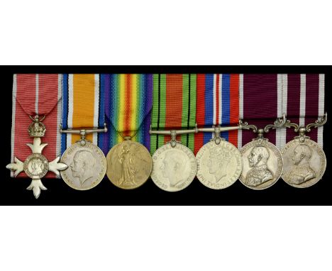
Lot 49
A Second War M.B.E. group of seven awarded to Acting Lieutenant-Colonel T. Redfearn, Royal Army Ordnance Corps, who had previously been awarded an Immediate M.S.M. during the Great War The Most Excellent Order of the British Empire, M.B.E. (Military) Member’s 2nd type breast badge, silver; British War and Victory Medals (S-6685 T.W.O. Cl. 1 T. Redfearn. A.O.C.); Defence and War Medals 1939-45; Army L.S. & G.C., G.V.R., 2nd issue with fixed suspension (7574412 W. O. Cl. II. T. Redfearn. R.A.O.C.); Army Meritorious Service Medal, G.V.R., 1st issue (S-6685 T. Sub-Condr: T. Redfearn. R.A.O.C.) mounted court-style for display purposes in this order, contact marks, very fine (7) £400-£500 --- M.B.E. London Gazette, 1 January 1941. M.S.M. London Gazette, 3 June 1919. Thomas Redfearn was born in Berwick on Tweed, Northumberland, on 17 October 1894 and attested into the Army Ordnance Corps on 28 June 1910 at the age of 15. He initially served at home during the Great War and was Advanced Squadron Quartermaster Sergeant on 24 June 1918, before serving on the Western Front from 6 July 1918. He continued to serve post-War, and was commissioned on 24 August 1936. He further served at home during the Second World War and was Advanced Acting Lieutenant-Colonel on 11 September 1944, before reverting back to the rank of Major on 4 October 1944. Sold together with copy service papers, copy Medal Index Card, copy London Gazette entries, named copy group photographs including the recipient, and copy Army Ordnance Corps Gazette entries, with reference to the recipient.
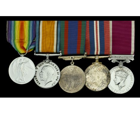
Lot 278
Five: Private E. Porter, Devonshire Regiment, later Royal Canadian Ordnance Corps British War and Victory Medals (3367 Pte. E. Porter. Devon. R.); Canadian Volunteer Service Medal; War Medal 1939-45, Canadian issue in silver; Army L.S. & G.C., G.VI.R., 1st issue, Canada (Pte. E. Porter. R.C.O.C.) mounted as worn, the Great War medals lacquered, and the VM silvered, nearly very fine and better (5) £80-£100 --- Importation Duty This lot is subject to importation duty of 5% on the hammer price unless exported outside the UK --- --- Edward Porter was born on 18 April 1894 and attested originally for the Northumberland Fusiliers. Transferring to the Devonshire Regiment, he served with them during the Great War, before transferring to the Royal Army Medical Corps. Emigrating to Canada, he served with various Canadian units, including the Royal Canadian Ordnance Corps from 1 June 1934, and was awarded his Long Service and Good Conduct Medal per General Order 98 of July 1939. He was discharged on 20 April 1947 and died in Toronto on 16 April 1971. Sold with copied service papers and other research.
Lot 114
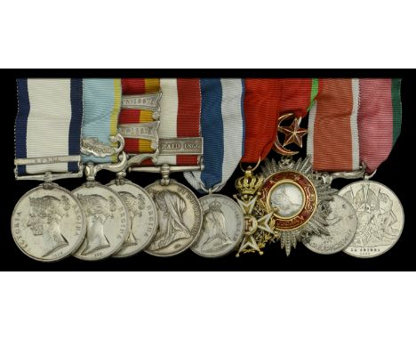
A superb campaign group of nine awarded to First Sea Lord, Admiral Lord Hood of Avalon, G.C.B., Royal Navy Naval General Service 1793-1840, 1 clasp, Syria (A. W. A. Hood, Midshipman.); Crimea 1854-55, 1 clasp, Sebastopol, unnamed as issued; China 1857-60, 2 clasps, Canton 1857, Fatshan 1857, unnamed as issued; Canada General Service 1866-70, 1 clasp, Fenian Raid 1866 (Captain Lord Hood of Avalon, H.M.S. Pylades) Canadian style impressed naming; Jubilee 1897, silver; Portugal, Kingdom, Military Order of Christ, breast badge, gold and enamels; Ottoman Empire, Order of the Medjidie, 5th class, silver, gold and enamel; St Jean d’Acre 1840, silver; Turkish Crimea 1855, Sardinian issue, light contact marks, otherwise good very fine or better (9) £4,000-£5,000 --- Importation Duty This lot is subject to importation duty of 5% on the hammer price unless exported outside the UK --- --- Arthur William Acland Hood was born on 14 July, 1824, the younger son of Sir Alexander Hood of St. Andries, Somerset, second baronet, and grandson of Captain Alexander Hood, who was mortally wounded when in command of the Mars, in her action with the French 74-gun ship l'Hercule, and died in the moment of victory, on 21 April, 1798. The baronetcy was conferred on Captain Hood's brother Samuel, who commanded the Zealous in the battle of the Nile, and died in 1815, whilst Commander-in-Chief in the East Indies. He had no issue, and the title, by special remainder, passed to his nephew. Belonging to a family so distinguished in our naval annals, Arthur Hood's career was almost naturally shaped out for him, and he entered the Navy in August, 1836. He saw some little fighting on the north coast of Spain, where the Civil War was then raging, and afterwards on the coast of Syria, where, in 1840, he was present at the reduction of Acre. In 1844-45 he went through a course of mathematics and gunnery on board the Excellent and at the college in Portsmouth Dockyard. He then was appointed to the President, flagship of Rear-Admiral Dacres at the Cape of Good Hope, and a few months later, on 9 January, 1846, was promoted to be one of her lieutenants. He remained in the President till she was paid off in January 1849, and after a year's holiday he was appointed, in January 1850, to the Arethusa, then commissioned for the Mediterranean by Captain Symonds, afterwards very well known as Admiral of the Fleet Sir Thomas Symonds. With Symonds, in the Arethusa, Hood continued for nearly five years, and was promoted to the rank of commander on 27 November 1854, for service with the naval brigade before Sebastopol. In 1856 he commissioned the Acorn brig for China, where he took part in the action with the junks in Fatshan Creek on 1 June 1857, and served with the naval brigade at the capture of Canton in the following December. For this he received his promotion to captain on 26 February 1858. He had now several years on shore, and it was not till December 1862, that he was appointed to the Pylades for the North America Station, where he remained for nearly four years, when he was recalled to England to take the command of the Excellent, then as now the headquarters of instruction in naval gunnery. He held this command for three years, and for the five following years was Director of Naval Ordnance, in which post he showed himself a careful, painstaking officer, though without the genius that was especially wanted at a period of great change. Irrespective of politics, Hood was by temperament a very old-fashioned conservative, and clung to the ideas of the past after they had ceased to be suitable for the present. The C.B. was conferred on him on 20 May 1871, and, in June 1874, he was appointed to command the turret ship Monarch in the Channel Fleet. On 22 March 1876, Hood was made a rear-admiral, and in January 1877, he accepted a seat at the Admiralty. From December 1879, to April 1882, he commanded the Channel Fleet, and in June 1885, he was appointed First Sea Lord of the Admiralty, in succession to Sir Cooper Key, and in the administration of Lord George Hamilton. The four years which followed were years of great change and great advance, but it was commonly supposed that Hood's efforts were mainly devoted to preventing the advance from becoming too rapid. Like his predecessor he scarcely understood the essential needs of England as a great naval Power, and several of his public declarations might be thought equivalent to an expression of belief that, useful as the Navy was, the country could get on very well without it. On 14 July 1889, having reached the age of 65, he was put on the Retired List, and at the same time resigned his post at the Admiralty. He continued, however, to take an active interest in naval affairs; and, somewhat curiously, showed in occasional letters in our columns and elsewhere a more correct appreciation of the problems of naval supremacy than he was supposed to have done during his official life. He had obtained the rank of vice-admiral on 23 July 1880, and of admiral on 18 January 1886. In December 1885, he was made a K.C.B., and a G.C.B. in September 1889. In February 1892, he was raised to the peerage as Lord Hood of Avalon. He married, in October 1855, Fanny Henrietta, third daughter of Sir Charles Fitzroy Maclean, and had issue two daughters.
Lot 109
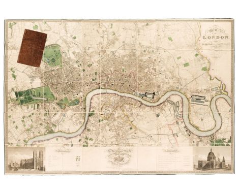
London. Greenwood (C & J), Map of London from an actual survey made in the years 1824, 1825 & 1826..., Greenwood & Co, 1st edition, August 21st, 1827, large scale map engraved by James & Josiah Neele with contemporary colouring, sectionalised and laid on linen, calligraphic title, inset views of St Pauls and Westminster, dedication to King George IV, reference to the parishes and table of explanation, some offsetting, edged in green silk with slight fraying, 1260 x 1855 mm, bookplate of L. C. Berger to verso, contained within contemporary tree calf book box (rubbed and slightly worn) QTY: (1)NOTE:Howgego 309. The largest and finest map of London to be printed in the 19th century. The Greenwood brothers spent three years preparing this remarkable new survey, illustrating for the first time the planned development of Belgravia by Thomas Cubitt, the completion of the Grand Surrey Canal and Regent's Park one year before it was finished in 1828. No map provided greater detail or accuracy until the Ordnance Survey.
Lot 95
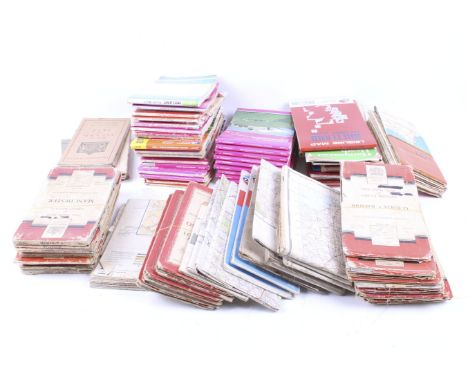
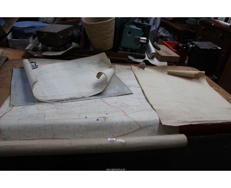
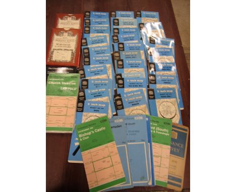
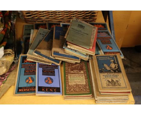
Folding Maps. A collection of 23 maps, 18th & 19th century, 23 engraved and lithographic map sheets of British county and regional maps and foreign maps and plans, all sectionalised and laid on linen, including examples by or after Walker, Philips, Wyld (including a four sheet map of Europe), Bowen, J & C Walker, 'The Times', Ordnance Survey, Hebner, Ebden, Assheton, Brué (map of France on four sheets) and Darton & Dix (county maps of Essex and Bedfordshire), various sizes and conditionQTY: (23)
Lot 76
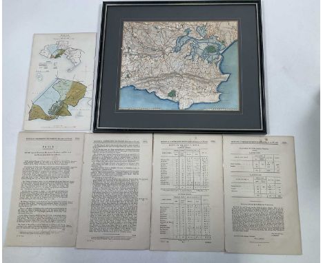
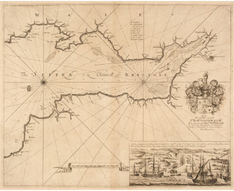
Bristol Channel. Collins (Captain Greenville). Untitled chart of the Bristol Channel, circa 1780, uncoloured engraved sea chart, inset view of the King Road, compass rose and numerous rhumb lines, slight spotting and toning, slight creasing, 440 x 545 mm, together with Walker (J. & C.). England West Coast Sheet II, Padstow to the Bristol Channel, 1839, corrected to 1842, uncoloured engraved sea chart, stamp of the Hydrographic Department, six inset horizon profiles, slight dust soiling, 635 x 480 mm, with Geological Survey of England and Wales. Exeter (Tiverton) & Teignmouth (Exeter), engraved at the Ordnance Survey Office, revised and published 1898, two engraved geological maps with contemporary hand-colouring, each with an index key and a blind stamp in the upper margin of the Board of Agriculture, slight dust soiling, each approximately 410 x 550 mmQTY: (4)
Lot 492
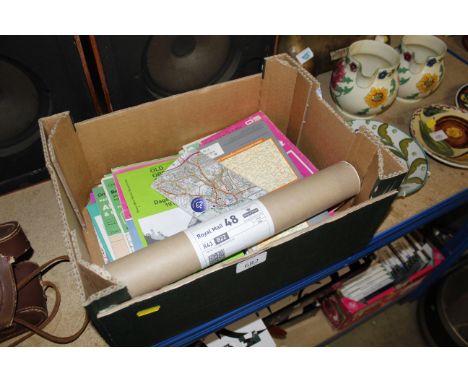
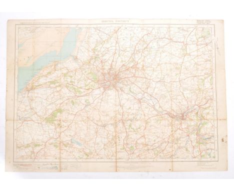
Map. 1922 Ordnance Survey One Inch of Bristol District. Special Sheet Popular Edition. Includes Glos, Wilts & Somerset. Redwick at NW then Avonmouth, Iron Acton, Chipping Sodbury, Colerne at East, Farleigh Hungerford at SE, West Harptree at South, SW with Winscombe and Clevedon at West on Bristol Channel. Cloth backed.
-
12129 item(s)/page