We found 12129 price guide item(s) matching your search
There are 12129 lots that match your search criteria. Subscribe now to get instant access to the full price guide service.
Click here to subscribe- List
- Grid
-
12129 item(s)/page

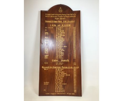
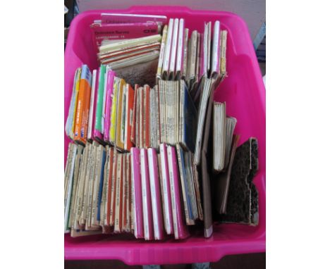
Lot 225
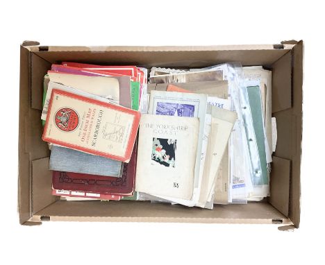
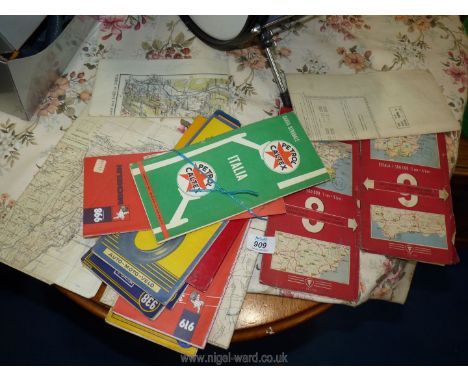
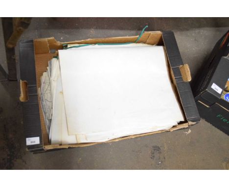
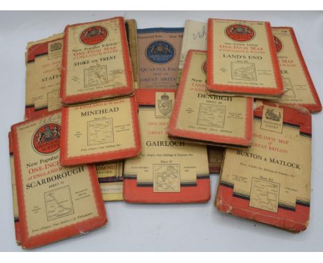
Miscellaneous ephemera, with some being local interest, including the official guide to Whitby printed and published by Horne & Son, Kelly's Tradefinder of Scarborough 1972 and 1975, the album of Scarborough views for R. Denham booksellers, highways & bryways in Yorkshire by Arthur H. Norway, various Ordnance Survey maps, theatre programmes etc, in one box
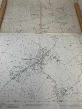
Lot 460
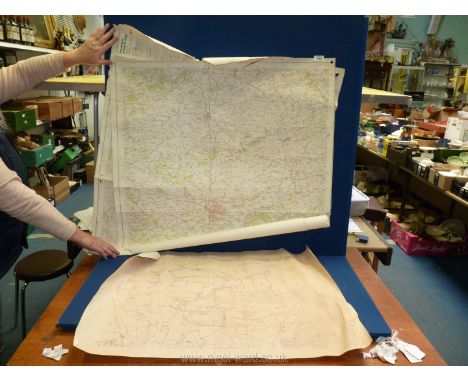
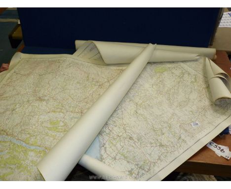
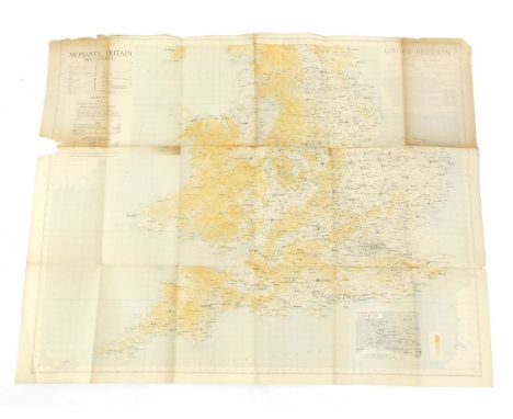
A collection of War Office Ordnance Survey of England & Wales maps - Second War Revision 1944 - together with Guernsey maps some maps linen backed, some stamped 'O. i/c INSPECTIONS (ART'Y. & F.C.I.) 4 A.A. GROUP, THE CAMP. ARROWE PARK RD. UPTON, WIRRAL', comprising Kirkby Stephen & Appleby sheet 13; Anglesey sheet 41; Llandudno & Denbigh sheet 42; Chester sheet 43; Portmadoc & Criccieth sheet 49; Dolgelley & Lake Vyrnwy sheet 59; Burton & Walsall sheet 62; Llanidloes sheet 69; Rugby sheet 73; Ely sheet 75; Cambridge sheet 85; llanelly sheet 100; Newport sheet 102, together with two Guernsey maps. (qty)
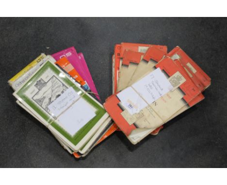
Lot 1315
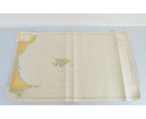
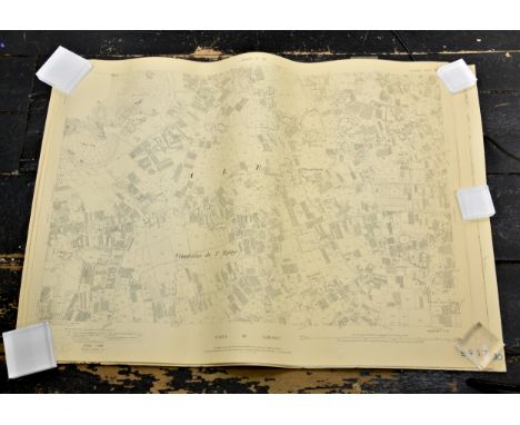
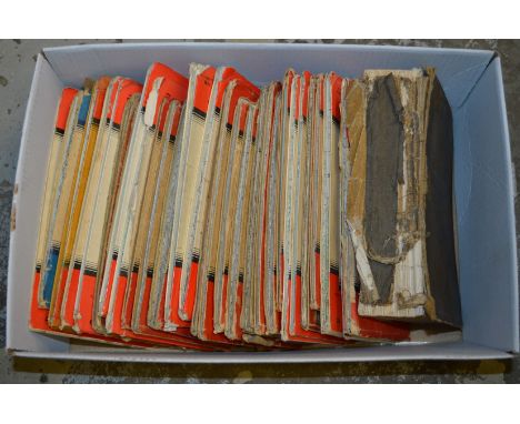
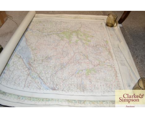
A large collection of 50+ large- scale Ordnance survey maps of Guernsey, 1963 Revision, 1;2500 scale, showing boundaries, fields, land, buildings, roads, paths, etc, revised drawn and printed by B.K.S Air Survey Ltd, Leatherhead, Surrey, England, from aerial photography March 1962, each map approximately 30 x 39in. (76.2 x 99cm.). some rips etc to edges.
Lot 59
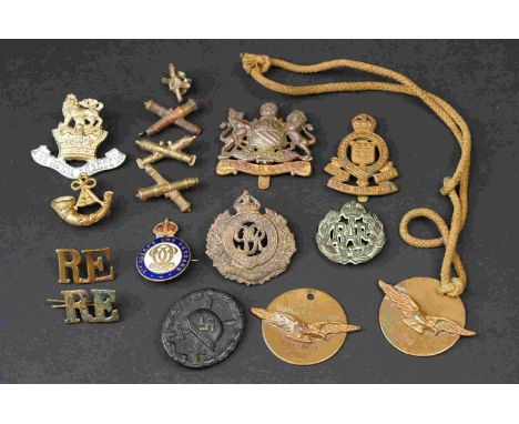
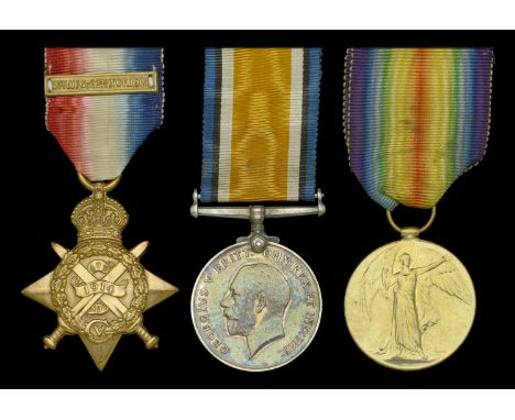
Three: Gunner A. E. Marston, Royal Field Artillery 1914 Star, with clasp (56979 Gnr: A. E. Marston. R.F.A.); British War and Victory Medals (56979 Gnr. A. E. Marston. R.A.) very fine (3) £100-£140 --- Alfred E. Marston served with 35 Brigade R.F.A. in France and Flanders from 6 October 1914. He transferred to the Army Ordnance Corps on 22 September 1917, and retransferred to the Royal Artillery on 27 February 1919. Also entitled to Silver War Badge (RA/3829). Sold with copied Medal Index Card.
Lot 623
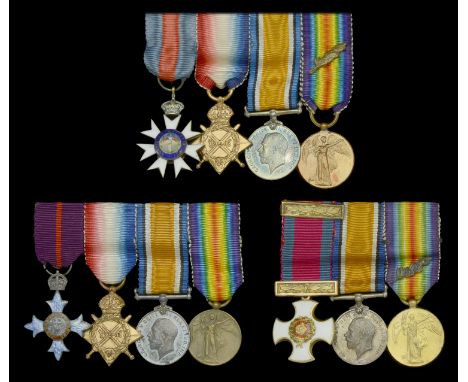
A C.M.G. mounted group of four miniature dress medals attributed to Brigadier-General C. W. Clark, Royal Garrison Artillery The Most Distinguished Order of St. Michael and St. George, C.M.G., Companion’s badge, silver-gilt and enamel; 1914-15 Star; British War and Victory Medals, with M.I.D. oak leaves, mounted as worn on a Spink, Piccadilly pin, extremely fine A C.B.E. mounted group of four miniature dress medals attributed to Colonel C. E. T. Rolland, Royal Artillery The Most Excellent Order of the British Empire, C.B.E. (Military) Commander’s 1st type badge, silver-gilt and enamel; 1914-15 Star; British War and Victory Medals, mounted as worn on a Spink, Piccadilly pin and housed in a contemporary fitted case, extremely fine A D.S.O. mounted group of three miniature dress medals attributed to Major G. R. de la C. Corbett, Royal Garrison Artillery Distinguished Service Order, G.V.R., gold (18ct) and enamel, with integral top riband bar; British War and Victory Medals, with M.I.D. oak leaves, mounted as worn, nearly extremely fine (11) £120-£160 --- C. W. Clark was born in Oxton, Birkenhead, and was educated at the Royal Military Academy, Woolwich. He was commissioned Second Lieutenant in the Royal Garrison Artillery in 1885 and served in India, Malta and Gibraltar, before being appointed Private Secretary and Aide de Camp to the Governor of Trinidad in 1893. Advanced Lieutenant-Colonel in 1913, he served during the Great War on the Western Front from 19 August 1915, and was Brigadier-General, Heavy Artillery, Headquarters, 15/Army Corps. For his services during the Great War he was twice Mentioned in Despatches (London Gazettes 4 January 1917 and 15 May 1917) and was appointed a Companion of the Order of St. Michael and St. George in 1917. He retired in 1922 and died on 21 November 1944. Charles Edward Tulloch Rolland was born on 28 November 1874 in Madras, India, the son of Colonel Alexander Tulloch Rolland of the Madras Staff Corps. Emulating his father, he was Commissioned on 16 December 1893 and promoted to full Colonel on 3 June 1921. Whilst serving as Brevet Lieutenant-Colonel during the Great War he was seconded to the Research Department on 19 June 1916, and for his services he was appointed a Commander of the Order of the British Empire (London Gazette 3 June 1919). He was appointed a Member of the Ordnance Committee on retirement on 1 January 1926. Garnet Robert de la Cour Corbett served with the 206th Siege Battery, Royal Garrison Artillery during the Great War, and for his services was awarded the Distinguished Service Order (London Gazette 3 June 1918).
Lot 72
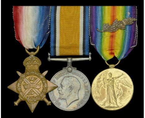
Three: Captain R. C. T. Hutchins, Army Ordnance Department, late Honourable Artillery Company 1914 Star (329 Sjt. R. C. T. Hutchins. H.A.C.); British War and Victory Medals, with M.I.D. oak leaves (Capt. R. C. T. Hutchins.) mounted as worn, good very fine (3) £200-£260 --- M.I.D. London Gazette 30 December 1918. Reginald Charles Tudor Hutchins served as a Sergeant with the 1st Battalion, Honourable Artillery Company in France from 18 September 1914. He was commissioned 2nd Lieutenant into the Army Ordnance Department on 19 July 1916, being promoted to Lieutenant on 19 October 1916, and to Captain on 1 June 1918. Sold with Army Book 439, named card box of issue for pair, and two H.A.C. badges.
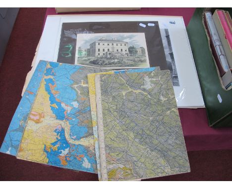
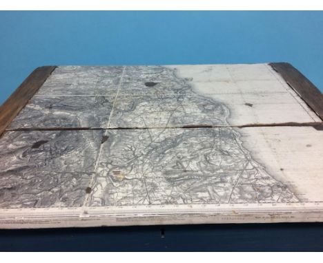
Lot 450
Pictures and Prints- by and after David Shepherd, a print, The Scavengers, signed in pencil, 49cm x 84cm; another print, Logging; a 19th century Ordnance Survey map, Hawes (Kirkby Stephen), Sheet 50 (formerly 97 SW), printed from electrotype taken in 1886, railways inserted to August 1879, 44cm x 61cm (3)
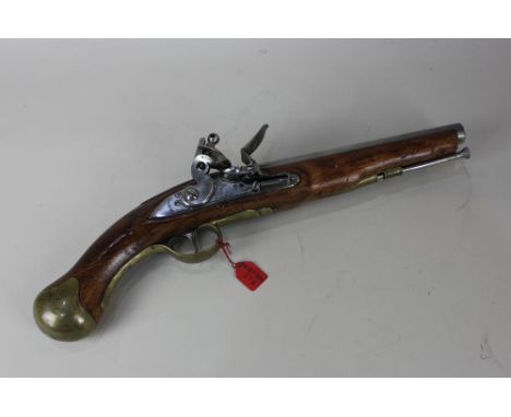
Lot 351
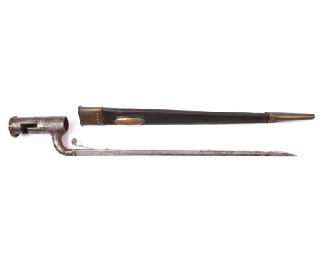
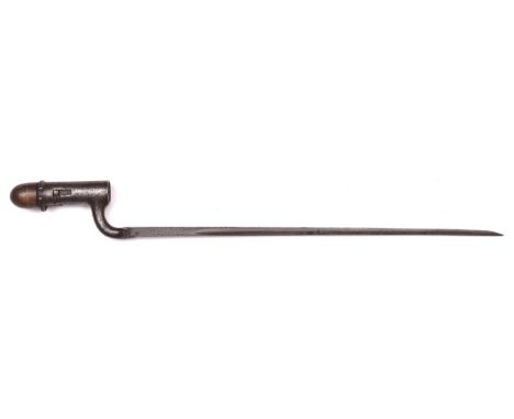
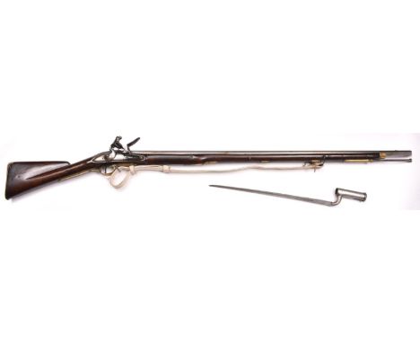
A .75" Short Land Pattern Brown Bess flintlock musket of the Glamorgan Militia, 57" overall, barrel 41½" with ordnance proofs and engraved "M GLAMORGAN"; round lock with swan neck cock, engraved with crown of "GR" and "Tower", and with ordnance inspector's mark; walnut fullstock with regulation brass mounts, the butt plate tang engraved "3/5"; with iron ramrod and white buckskin sling. GWO & C (rather worn and cleaned overall); with its triangular socket bayonet by Deakin, with 4" socket engraved "W/E.8". Clean Condition. £1500-1800
Lot 357
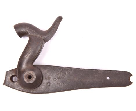
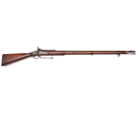
An above average .577" Snider Mark III ** 3 band rifle, 54" overall, barrel 36½" with ordnance proofs and Enfield inspector's marks; the lock marked with crowned "VR" and "1859 ENFIELD"; walnut fullstock, the butt stamped with "RM Enfield" mark and "DC" in lozenge; with regulation brass mounts, sling swivels, original cleaning rod, and striker protector on chain. GWO & C, the bore good. £500-700
Lot 160
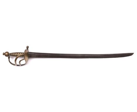
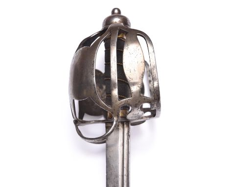
A mid 18th century British cavalry basket hilted backsword, straight single edged blade 34" with two narrow fullers, the riccasso bearing a crown ordnance mark partly obscured by the hilt, the plain 'military' hilt having a bun pommel, black ray skin grip, and traces of leather liner below the pommel, the lower crossguard stamped with the initials 'SG'. Good clean condition. See "British Basket Hilted Swords" by Mazanaky, page 95, fig. F1@ for an almost identical sword. £1000-1500
Lot 160
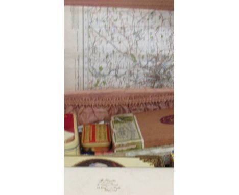
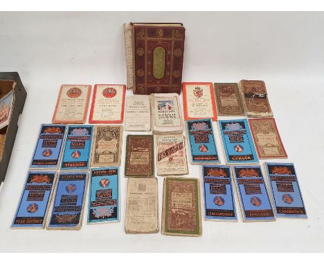
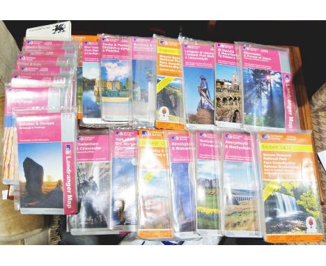
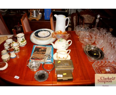
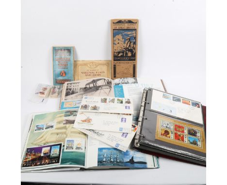
Victorian needlework and embroidery scrapbook of samples, quantity of UK Ordnance Survey Maps, quantity of Bartholomew's linen backed folding maps, 'Philip's Map of London' in pocket folder with "Guide to the Chief Places of Interest', cigarette cards and other books and ephemeraCondition ReportPlease see attached images of scrapbook

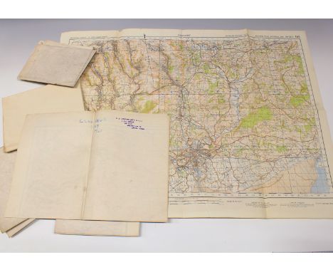
Lot 673
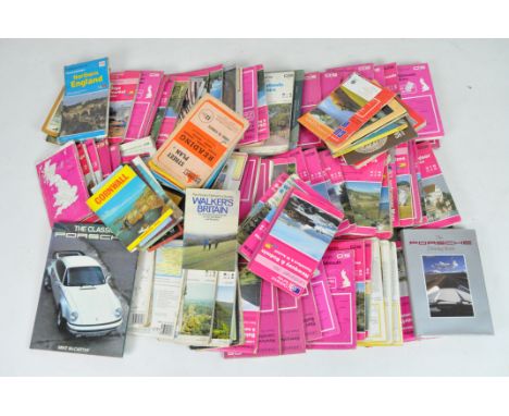
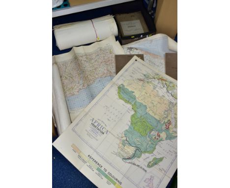
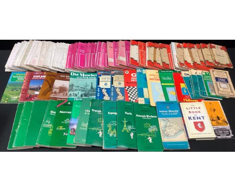
MAPS; a large quantity (140 - 160) to include Bacon's New Series of Physical Wall Atlases, Nineteen maps in total, seven of AFRICA covering Contours, Isotherms, Rainfall Mean Annual Isobars, Rainfall Seasonal Productions, Vegetation, Population, Political and Communications, seven of AUSTRALIA covering Contours, Isotherms January, Isotherms July, Rainfall Seasonal, Rainfall Mean Annual, Vegetations and Productions etc, NORTH AMERICA Contours, Isotherms, EUROPE, Rainfall (Mean Annual Isobars), vegetation and BRITISH ISLES, Communications together with a collection of forty-six NAUTICAL MAPS including those compiled by the Admiralty or the Admiralty Hydrographer, two Bacon's Excelsior Wall Maps (poor condition), large scale ORDNANCE SURVEY Maps to include Notts, Derbys, Leics, Warks, Lincs, Sussex, Ireland and others including publications from the War Office circa 1941 (2 boxes and a bundle)
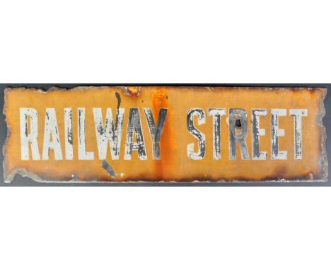
Lot 57
An original c1930s ' Railway Street ' enamel sign from an Air Raid shelter, in Chatham. The shelter was bombed in 1940 killing 24 people, the main damage was to Ordnance Street. This sign was kept by one Sidney Johns, an ARP Warden at the time. Heat damaged, and some rusting to the edges. AF. Measures approx; 61cm long.


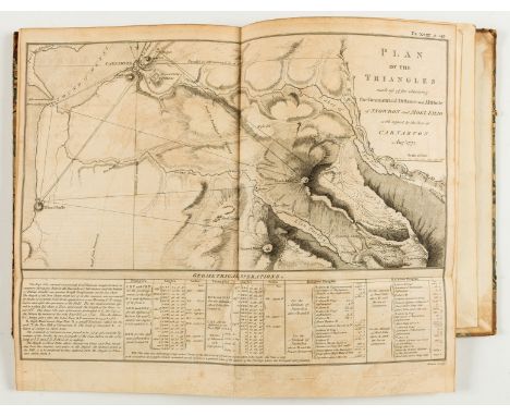
Lot 87
NO RESERVE Pioneer of Ordnance Survey.- Roy (William) Experiments and observations made in Britain, in order to obtain a rule for measuring heights with the barometer, half-title, 3 engraved plates (1 double-page), folding engraved plan of Snowdon, 12 double-page letterpress tables, directions to binder f. at end, occasional spotting, some light browning, contemporary half calf, sympathetically rebacked, corners worn, covers rubbed, 4to, Printed by J. Nichols (successor to Mr. Bowyer), 1778.⁂ First separate edition, having originally been published in the Phil. Trans. of the Royal Society. Roy's experiments were carried out from 1771 to 1776 and took him to Schiehallion in Scotland and Snowdon in Wales. He was assisted by David Dundas (later General; our copy descended from the family) and the landscape painter Paul Sandby. Provenance: Thomas Dundas, Upleatham, Yorks. (engraved armorial bookplate).


-
12129 item(s)/page