We found 12130 price guide item(s) matching your search

Refine your search

Year

Filter by Price Range
  • List
  • Grid
  • 12130 item(s)
    /page

Lot 746

Yorkshire and other maps - forty 6 inch to 1 mile Ordnance Survey maps, twenty seven 1 inch to 1 mile OS maps and a small quantity of assorted other maps unframed

Lot 368

A quantity of regimental cap badges etc to include The Royal Military Police, The Royal Ordnance Factories etc, framed, 46cm x 37cm.

Lot 215

Ordnance Survey maps, other maps, brochures, etc., (a box).

Lot 563A

Two boxes of assorted items to include a Bandmasters Logistics Corps belt, a Royal Army Ordnance Corporal`s belt, an Argyle Sutherland Highlanders belt, an assortment of military plumes, various military plaques, and other military items

Lot 680

A box of assorted Ordnance Survey maps

Lot 509

Various Ordnance Surveys in England and Wales, dating from 1950s and other books relating to Gloucester and Tewkesbury, (3 boxes) (library stamps)

Lot 525

A Victorian 1858 Tower Percussion Cap Three Band Musket, the 99cm steel barrel with Ordnance markings, hinged ladder rear sight, the lock plate stamped with crowned VR 1858 TOWER, walnut full stock, the butt stamped A.ARCHER, the brass fore-end tip stamped 278, with brass trigger guard and butt plate, steel sling swivels and ramrod

Lot 208

A Flintlock Holster Pistol by Thomas, Early 19th Century, with tapering barrel, struck with ordnance marks at the breech, the flat bevelled lock with roller, bearing maker’s name, figured walnut stock, brass mounts, including trigger-guard and butt-cap, complete with ram-rod, 41cm.View on dnfa.com

Lot 210

An Obsolete Calibre Swiss Produced 10.4mm Vertelli Model 1871 Rifle, retaining much of its original blue finish, numbered ‘32745’ to both the receiver and barrel and bearing W.V. Steiger of Thun, Swiss ordnance stamps to the wood stock. The Vertelli is a repeating rifle with the loading system based on the U.S. Winchester style, the rounds loaded through an open gate below the receiver with the rounds being fed into the tube.View on dnfa.com

Lot 1412

"*Old Ordnance Survey maps - Haddingtonshire 1907, Linlithgowshire 1916, and sheet NT36NE 1967 (4) (Lot subject to VAT)"

Lot 44A

BOX: Ordnance Survey Maps and Walking Maps (Box)

Lot 247

WYLD, James, Map of North Wales, coloured, linen folding in slip case, Geographia, Map of South West England, linen, A/F, Map of England (two parts), Chart Publishing Co, in slip case, Geographia Map of Surrey and Sussex, Ordnance Survey of Cheam, Ordnance Survey of South Devon, folding in slip case (6)

Lot 248

Ordnance Survey Maps of Northamptonshire (five folding) in slip case, 1892 Northants Ordnance Map, 1901 copy, Leicester 1904, 2nd edition, Ordnance Survey Minchinhampton/Newbury/Basingstoke (5)

Lot 172

Ward Lock`s Guide Books, Ordnance Survey and other maps, (3 boxes).

Lot 72

Badges 3x scarce KC/Geo.VI issues, Royal Ordnance Factories / Royal Military School / Small Arms School, GVF

Lot 84

Bayonet - French model 1866 Sabre Bayonet by St Etienne Ordnance Factory & dated February 1871 in its steel scabbard, overall a clean, tidy specimen

Lot 85

Bayonet - Patt 1888 MK I 2nd type Lee Metford bayonet, regimentally marked M (militia) 4 A & S H (4th Bn Argyll & Sutherland Highlanders) 581 (rifle no) in its steel mounted, ordnance marked, leather scabbard overall v.g.c.

Lot 572

A large quantity of assorted Ordnance Survey maps

Lot 1106

Ordnance Survey Maps, motoring guides, wall map, waste paper bin, etc.

Lot 1251

Ordnance Survey Maps, bygone photographs, stamp albums, books etc.

Lot 155

Colby (Major) of the Royal Engineers A large untitled folding map of Lincolnshire and Rutland with parts of Yorkshire, Nottinghamshire, Leicestershire, Northamptonshire, Cambridgeshire and Norfolk, 1st March 1824, engraved at the Ordnance Map Office, 1 inch to the mile, on 8 sheets, each with 8 sections, overall 2580mm x 1900mm, linen-backed, with hand-coloured index, railways added in red, morocco slipcase in book form (case worn with loss of upper `backstrip`)

Lot 770

A short naval hanger, c 1850, curved SE blade 17¾” with single narrow fuller and “K” over “4” ordnance mark, the brass mounted hilt with lion’s head pommel and recurved crosspiece with langets, the grip of ribbed bone. GC (see “Swords for Sea Service” by May and Annis, plate 6”, for a similar hanger). Plate 5

Lot 859

A French 12 bore Model 1853 rifled percussion musket, 49½” overall, barrel 34” with tall ladder rearsight, the breech tang engraved “Mle 1853”, the muzzle with bayonet lug and guide; back action lock engraved “Mre Impale de St Etienne”, walnut fullstock, the butt bearing 1865 ordnance store-keeper’s mark, steel mounts including sling swivels (one AF), and with replacement ramrod from an Enfield rifle. GWO & C (the nipple missing, metalwork with light to moderate pitting overall, some bruising to stock).

Lot 59

Assorted 1:2500 Ordnance Survey maps, mainly Derbyshire

Lot 70

Assorted 1:2500 Ordnance Survey maps, mainly Derbyshire

Lot 209

Two Ordnance Survey maps of St Ives and Mousehole, Cornwall 1/2500

Lot 210

A quantity of Ordnance Survey maps, mainly Derby 1/2500

Lot 250

A quantity of Ordnance Survey maps, mainly Derbyshire 1/2500

Lot 152

Ordnance Survey Atlas of Great Britain, Quarter Inch to mile, lined backed maps 1922, large 4to half Morocco

Lot 287

A quantity of Ordnance Survey maps, 1/2500 mainly Derbyshire

Lot 291

A quantity of Ordnance Survey maps, 1/2500 mainly Derbyshire

Lot 394

A BOX OF FOLDING MAPS PRINCIPALLY ORDNANCE SURVEY LANDRANGER AND SIMILAR

Lot 446A

Five unframed Ordnance Survey Maps, two depicting Cambridgeshire, Cumberland and Westmorland, Hertfordshire and Essex, 85cm x 37cm.

Lot 290

Small collection of Ordnance Survey 1" maps, and other vintage maps.

Lot 94

Ordnance Survey maps, 1:2500 scale, various English and Welsh counties, 1880-1923

Lot 225

Ordnance Survey maps, 1:2500 scale, Nottinghamshire and Derbyshire, 1880-1937

Lot 228

Ordnance Survey maps, 1:2500 scale, mainly North Derbyshire, 1879-1937

Lot 231

Ordnance Survey maps, 1:2500 scale, Nottinghamshire and Leicestershire, 1885-1961

Lot 100

Folding maps. A mixed collection of approx. 160 maps, mostly 19th & 20th century, including 20th century folding Ordnance Survey maps of various parts of the British Isles, "R.A.C.` touring maps, town maps, a hunting map by Swiss & Co., folding maps of London by Bacon and Baker, a "Geographia` folding road map of England & Wales, "Wincarnis` Motor & Cyclist map of England in sixteen sections (complete), a folding panoramic souvenir of New York and a guide book to Cornwall containing twenty-nine (only ?) uncoloured topographical engravings etc. (approx. 160)

Lot 130

Maps. A mixed collection of approx. forty maps, mostly 18th & 19th century, engraved and lithographic maps, including maps of France, Hungary, Italy, Portugal and North Africa, with examples by Homann, Faden, Neele, Johnston, D`Anville, S.D.U.K., Ordnance Survey, Morden and Rapin, various sizes and condition (approx.40)

Lot 754

A quantity of Ordnance Survey Maps

Lot 979

Assorted maps - approximately 35 including ordnance survey maps, c. 1950`s, motoring and hiking maps and a large scale school room map of North America, some linen backed

Lot 1531

A quantity of heavily corroded ordnance excavated on the Western Front, including 8½” , 6” and 4½” howitzer shells, (incomplete, no fuzes), wire cutters, trench axe/pick, roll of barbed wire, curly steel barbed wire pickets, etc.

Lot 1639

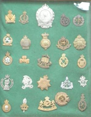
45 lapel, pin back, etc badges, including “sweethearts” Geo V and VI RE, Leinster Yeo, MGC, Gloucester, W Riding, Hants, Y&L, Artists Rifles, RAMC, RAF etc, lapels Women’s Land Army (2), Coventry Ordnance Works Ltd: Special War Service, Nat Reserve London HM 1912, War Service 1915, Nat Reserve Norfolk, etc. Average GC

Lot 1642

38 corps etc cap badges, RFC, Tanks, RAC, Signals, RAMC, Reconnaissance, Ordnance, etc. Generally GC (few slides/ lugs AF)

Lot 1643

10 corps cap badges: RFC, Ordnance (1024), Tanks 1st patt, Machine Gun (3), Cyclists 16 spokes, AAC, RM Academy with blades and Geo VI Mil. Police. GC

Lot 1777

A scarce brass mounted sword bayonet for the 1855 Lancaster Sappers and Miners carbine, the pipe backed blade with ordnance inspector’s marks at forte, first type spring secured by rivet and with unusual counter sunk hole for the release button. GC (slightly worn). Plate 5

Lot 1792

A scarce .577” Yeomanry pattern Snider Cavalry carbine, 37¾” overall, barrel 19¼” with 3 groove rifling and stamped at the breech with military proof and inspector’s marks and “Steel”, the frame bearing similar inspector’s marks and “III”, the lock marked with crowned “VR” and “LSA Co 1871”, halfstocked with plugged cleaning rod channel, brass mounts including sidenail cups, and butt trap for cleaning rod, the butt bearing faint ordnance markings including date “1881”, and with original rearsight cover. GWO & C (striker nipple chipped). Plate 7

Lot 301

An assortment of early 20th Century Ordnance Survey maps including Bartholomews.

Lot 2266

DUMONT, JEAN, Baron de Carlscroon and JEAN ROUSSET DE MISSY. The Military History of the late Prince Eugene of Savoy, and of the late John Duke of Marlborough. Vol 1 only, including Supplement, 1736. Folio, cont. calf with gilt stamp of Office of the Ordnance on upper cover (covers and spine worn). Stamp of Royal Military Academy on title and with similar bookplate dated 1807. 27 folding engraved maps and plans, and 10 plates by Claude du Bosc, (some tears and repairs). Sold not subject to return.

Lot 514

A framed and glazed Ordnance Survey map "The Cotswolds" from the revised edition circa 1915

Lot 527

A large quantity of old Ordnance Survey maps (Scale 1:2500), mostly Hereford and Worcestershire

Lot 966

A quantity of folding Ordnance Survey maps

Lot 967

Fifty Ordnance Survey maps of Yorkshire 1909-30 (1907 Survey). Sheets

Lot 331

Two Ordnance Corps swagger sticks

Lot 453

ORDNANCE SURVEY MAPS, A QUANTITY IN TWO BOXES

Lot 38

Large selection of ordnance survey maps and various paperback and hardback books relating to classical music and other subjects (1 box)

Lot 86

Folding dressing table mirror, an ordnance survey map of Gloucestershire, a small leather attaché case, a wooden lidded box etc.

Lot 36

Robert Cruikshank after W H Pyne, Jumping in Sacks, coloured etching with aquatint, 24 x 33cm (plate); together with An Ordnance Survey Atlas of England and Wales, E Stanford, 1922 (2)

Lot 83

A folder of coloured county maps, 19th century, of Ordnance Survey type with boroughs and boundaries, together with two Doncaster estate plans (quantity)

Loading...Loading...
  • 12130 item(s)
    /page

Recently Viewed Lots