We found 12129 price guide item(s) matching your search
There are 12129 lots that match your search criteria. Subscribe now to get instant access to the full price guide service.
Click here to subscribe- List
- Grid
-
12129 item(s)/page

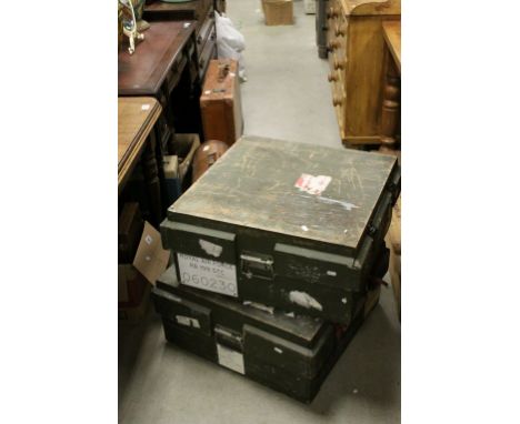
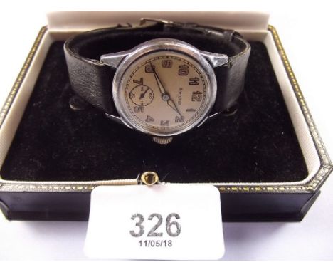
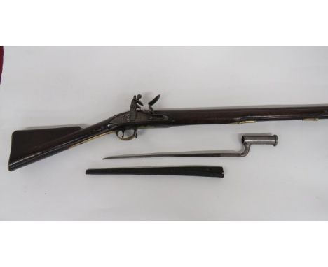
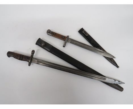
Lot 832
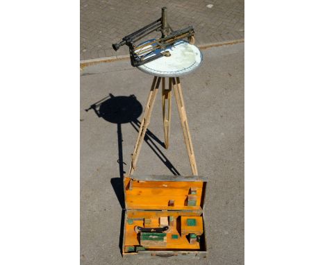
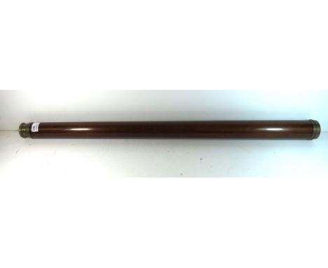
*Royal Observer Corps. Rare Post or Micklethwait Instrument, with accessories, together with tripod stand and original wooden box dated 1935 These were the standard optical sighting system used by the Royal Observer Corps to determine the location of aircraft. Used in service from the 1930s to 1950s, this example is dated 1935 and would have almost certainly been used during The Battle of Britain in 1940. The operator was required to estimate the altitude of the aircraft and enter that into the device, then point a mechanical indicator, or sight, at the aircraft. The motion of the sight moved an indicator on a small Ordnance Survey National Grid map. The grid indicated by the pointer was then telephoned to central control rooms, where several such reports were combines to produce a more accurate location estimate. Later models added the Micklethwait Height Corrector, which allows the posts to measure altitude with some accuracy and this improve the quality of the measurements. (1)

Lot 912
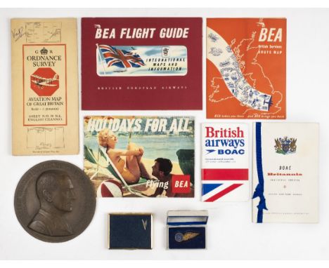
*Militaria. A mixed collection of militaria, including a WWII Iron Cross, 2nd Class breast Badge, the suspension ring stamped '55' (J.E. Hammer & Sohn), 45mm x 45mm, together with a Cross of Merit, with swords, 50mm x 50mm, WWI period biscuit inscribed 'From Ration biscuits, J.B. Taylor 1916, keep this & you will never be hard up for a meal', 7.5 x 10.5cm, plus approximately 100 regimental cap badges, buttons and shoulder badges and cloth badges, many line regiments and corps including Royal Canadian Ordnance Corps, Royal Berkshire Regiment, Tank Corps, 9 Lancers etc, (some restrikes) (a small carton)
Lot 179
Burma. Stanford (Edward, publisher), Burma and adjacent countries, circa 1900, lithographic map with contemporary colouring, sectionalised and laid on linen, 725 x 550 mm, publisher's red cloth boards with printed label to upper cover, slight staining, together with, Parker (Maude), Fisherman's map of the Salmon Pools on Lower River Tay, published John Bartholomew & Son Ltd, Edinburgh, 1933, illustrated folding map, some near contemporary manuscript annotations and outline colouring, old newspaper cutting (on fresh water pearls from the River Tay) tipped on to map, with another cutting relating to catches and prospects in 1935 tipped on to rear endpaper, 180 x 755 mm, publisher's cloth boards with printed label to upper board, the map has several loosely inserted letters, newspaper cuttings, receipts and manuscript notes of catches from the 1930's all relating to the River Tay, with Bartholomew (J.), A New map of North and South Wales together with a large part of England and the Railways in each county, published T. Catherall, Chester, circa 1860, engraved map with contemporary outline colouring, laid on linen, 375 x 395 mm, publisher's red cloth gilt boards, upper board near detached, plus Wyld (J., publisher), Untitled map of Southern England, circa 1860, engraved map on two sheets with contemporary hand colouring, sectionalised and laid on linen, the first sheet from Selsey Bill to Hastings and as far north as Newport Pagnall, 1450 x 940 mm, the second sheet from Portland Bill to Portsmouth and as far north as Banbury, 1450 x 940 mm, cloth endpapers, contained in a contemporary card slipcase with publisher's label to upper board, split, worn and frayed, with another fifty-five folding maps and guide books, touring, cycling and Ordnance Survey maps, including examples by Bartholomew, 'Geographia', Bacon, Black and Ordnance Survey, various sizes and condition, 19th & 20th century (59)
Lot 232
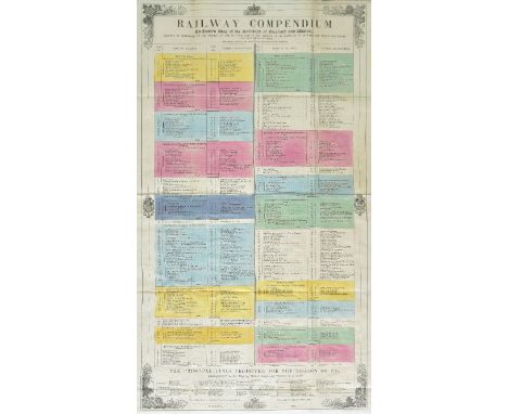
Railway Maps. Betts's new Map of England & Wales compiled from the latest parliamentary documents, published John Betts, 1847, engraved map with contemporary outline colouring, sectionalised and laid on linen, slight dust soiling, inset map of the Scilly Isles, 755 x 650 mm, publisher's promotional endpapers, contemporary cloth gilt boards, bumped and worn, with two further editions of the map from 1848 and 1864, the 1864 edition in poor condition with one section detached, heavily toned and upper board detached, with Cheffin (C. F.), Cheffins Map of the Railways of Great Britain from the Ordnance Survey..., published London & Liverpool, 1852, engraved map with contemporary hand colouring, sectionalised and laid on linen, some staining and browning, 1310 x 915 mm, marbled endpapers, publisher's cloth gilt boards, upper board and spine near detached, worn and faded, plus, Cheffins's Map of the English & Scotch Railways, sixth edition, circa 1856, lithographic map with contemporary outline colouring, sectionalised and laid on linen, inset map of the principal railways in Scotland, some dust soiling, 660 x 575 mm, publisher's promotional endpapers, contemporary cloth with printed label to upper board, label frayed with slight loss, boards a little warped, and Macaulay (Z.), Station map of the Railways of Great Britain, published Smith & Ebbs, circa 1888, lithographic map with contemporary outline hand colouring, sectionalised and laid on linen, inset map of Highland railways, slight overall toning, 1390 x 905 mm, publisher's cloth gilt, boards stained, with Black (A. & C., publisher), England and Wales, circa 1870, engraved map with contemporary hand colouring, sectionalised and laid on linen, some browning and spotting, 805 x 565 mm, publisher's promotional endpapers, contemporary cloth gilt boards, plus Tuck (Henry), Tuck's Map of the Railways of England & Wales, open for traffic, in course of construction and projected, published E. Wilson, 1847, lithographic map with contemporary outline colouring, sectionalised and laid on linen, date (1846) added in manuscript below title, 710 x 565 mm, bound with the 'Railway Compendium' listing existing and proposed railways, contemporay hand colouring, 700 x 395 mm, publisher's contemporary cloth gilt boards, stained (8)
Lot 896
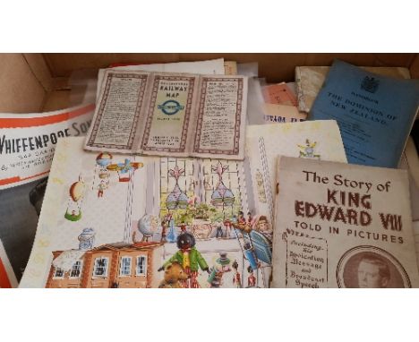
EPHEMERA, selection, inc. The Fantastic Voyage colour lobby cards; 1938 London underground railway map; 1907 ordnance survey map of Bucks Leighton Buzzard and Luton; sheet music for The Whiffenpoof Song; 1923 The Dominion of New Zealand handbook; Parkinsons Recipes and Home Hints leaflet; The Story of King Edward VIII told in pictures with abdication message; Manchester Tramways headed letter signed by Henry Mattinson (general manager) laid down to board; war leaflets, inc. Queensberry Club concert programme feat. American A.E.F Band conducted by Glenn Miller (second last performance); advertising film posters (12) inc. Jane Eyre, Jude, Larger than Life, Little Women, Much Ado About Nothing, Leo the Last, Long Live the Lady etc. all 40 x 30; FR to VG, 29*
![[SOUTH WALES] ORDNANCE SURVEY OF ENGLAND AND WALES Two large folding maps, sectionalised on linen, covering areas in South Wa](https://cdn.globalauctionplatform.com/ef9e6eaa-7d8b-4f64-8216-a8ce011940aa/48d5b21c-ab7a-46bc-92d4-25f00ffb13bd/468x382.jpg)
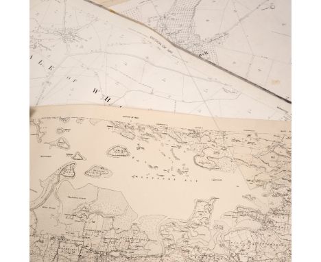
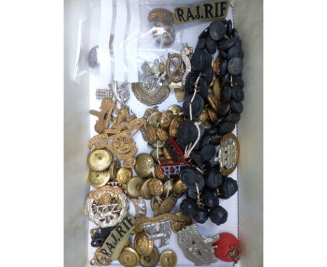
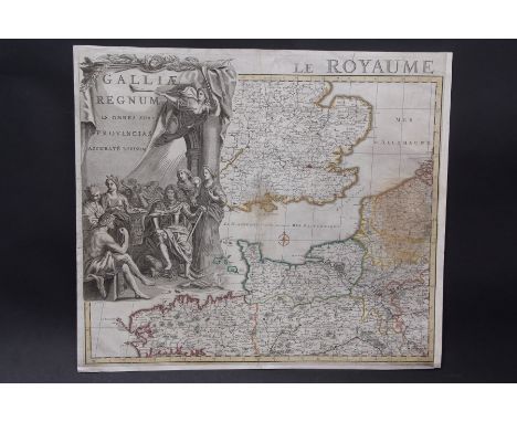
Lot 352
[SOUTH WALES] ORDNANCE SURVEY OF ENGLAND AND WALES Two large folding maps, sectionalised on linen, covering areas in South Wales (maps marked 'North' and 'South'), published by Edward Stanford at 6 Charing Cross London, maps part hand-coloured in outline, housed in the original green cloth slipcase with printed label. Undated, but circa 1852-1853 as Stanford extended his premises to 7 & 8 Charing Cross in 1853++Maps generally good, slipcase is worn at corners and some extremities
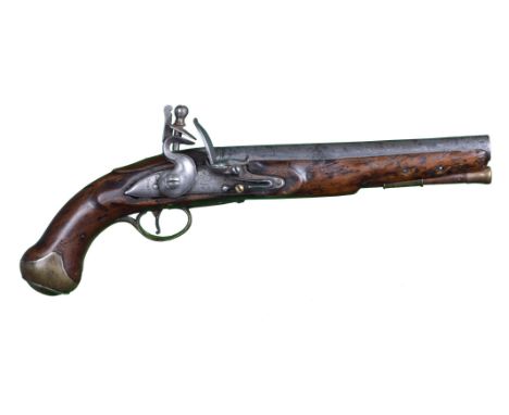
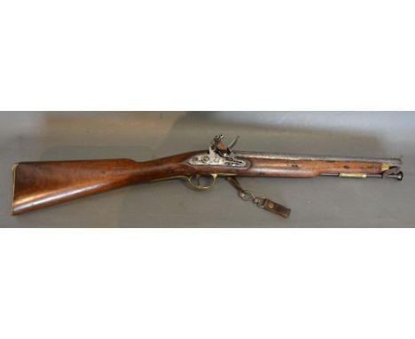
Lot 1211
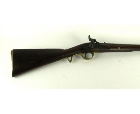
A British 18 bore flintlock pistol, of service type, barrel 9 in. and struck with private Ordnance proof marks; the lock marked 'TOWER 1760' and with crown over 'G.R.'; full stocked with brass furniture, brass tipped wooden ramrod. The date on the lock predates the period in which the Ordnance provided a proof service for private barrels, suggesting that this is a composite weapon.
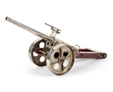
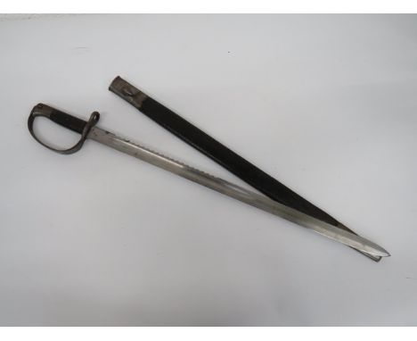
Lot 1263
A good model of a British QF 4.7 inch Naval gun on field carriage, the ordnance measuring 11.5 in. and with working interrupted-screw breech block, fitted with a sighting telescope, steel mounted wooden carriage with steel wheels conforming to the 'Percy Scott' type but incorporating a recoil buffer, overall length 42 cm (16.5 in.). The most famous application of this type of gun was during the Siege of Ladysmith, South Africa, 1988-1900, when the Royal Navy assisted the Army by providing long range guns on improvised carriages (giving rise to the Royal Navy's Field Gun Competition). The recoil buffer was a feature of later Woolwich type carriages.
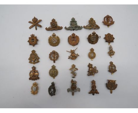
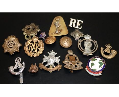
Lot 25
Selection of Corps Cap Badges including KC brass ERVII RE ... KC brass GRV RE ... KC brass GRVI RE ... KC brass MGC ... KC brass ATS ... KC brass GRV Military Police ... KC brass ADC ... KC brass Pioneer Corps ... KC brass RA ... KC brass ASC ... QC brass RASC ... Brass Army Ordnance Corps ... KC brass REME ... KC brass RAOC ... KC bi-metal REME. 25 items.
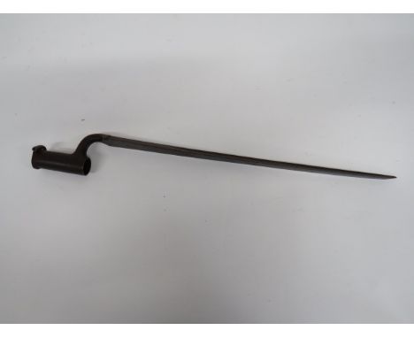
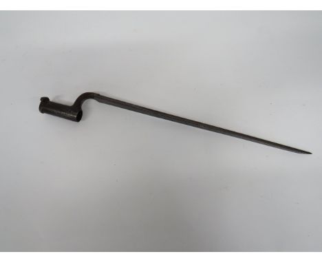
Lot 557
India Pattern Flintlock Brown Bess Marked 94th Reg (Connaught Rangers) .800, 39 1/2 inch smoothbore barrel. The breech with proof stamps and engraved '94 Regt'. Lock plate with crowned 'GR' cypher and tang stamped 'Tower'. Polished hand rail butt with Ordnance stamps and carved 'SEAGO.E.1'. Brass butt plate, side plate, trigger guard, ramrod pipes and end cap. Steel ramrod. Complete with correct pattern of socket bayonet. Triangular form 17 inch blade with hollow ground back edges. The forte with maker 'Wheeler' and Ordnance stamp. Steel socket. Complete in its early pattern leather scabbard.
Lot 580
Russian Model 1848 Percussion Military Pistol 9 1/2 inch, .700 smoothbore barrel. Brass foresight. Back action lock plate. Percussion angled head hammer. Polished half stock woodwork. Steel backstrap. Brass butt cap and end cap which is secured by a steel spring. Brass and steel trigger guard. Various Ordnance stamps. Old crack to grip.
Lot 604
1st Pattern M98 Quill Blade Bayonet With One Piece Grip 20 3/4 inch, narrow single edge quill point blade. The forte with crowned 'Erfurt'. Back edge dated '01'. Steel turn up quillon crossguard stamped '64. RE. 3. 193'. Steel pommel with German Ordnance stamps. Wooden one piece wrap around grip secured by two fixing bolts. Contained in its leather scabbard with steel mounts. Minor shrinkage to leather.
Lot 605
Imperial German G98 Early Pattern Butcher Bayonet 14 1/2 inch, single edged blade widening towards the point. Large fuller. No maker details or date. Steel turn up quillon crossguard with part muzzle ring. Steel pommel with German Ordnance stamp. Polished wooden grooved slab grips. Contained in its steel scabbard complete with brown leather frog. The rear with faint maker's details.
Lot 617
British P13 Sword Bayonet 17 1/4 inch, single edged blade with central fuller. Forte with maker 'Remington' and British Ordnance stamps. Steel crossguard, muzzle ring and pommel. Grooved wooden slab grips. Contained in its steel mounted leather scabbard. Together with an Austrian M1895 Mannlicher bayonet. 9 3/4 inch, single edged blade with narrow fuller. Steel muzzle ring, crossguard and pommel. Wooden slab grips. Contained in its blackened steel scabbard. 2 items.
Lot 632
British P1879 Martini Henry Artillery Sawback Bayonet 26 inch, single edged blade. Central fuller. Sawback rear edge. The forte with various Ordnance stamps and dates. Steel muzzle ring and D shape knuckle bow. Steel pommel. Black leather checkered slab grips. Contained in its steel mounted leather scabbard. The throat stamped 'M.3.RA'.
Lot 760
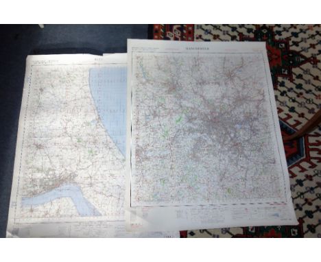
Atlas: Bacon (Geo. W.) New Ordnance Atlas of the British Isles, Lg. folio L. 1883. Printed title, 32 + 1 engd. dbl. page cold. maps & plans, all linen backed, the verso of some maps with small damp stains, not affecting map fronts, all edges gilt, orig. hf. mor. gilt lettered front cover. Good. (1)
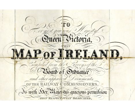
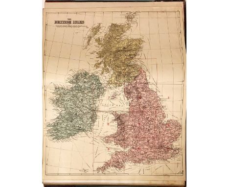
Lot 116
Map: Wyld (James) Map of Ireland, Compiled from the Surveys of the Board of Ordnance and other approved Documents of the Railway Commissioners.. Large engd. folding linen backed map in 4 Parts, approx. 163cms x 132cms (64" x 52") overall, finely hand coloured, in orig. cloth slip case. Very good example. (1)
![Co. Derry: Colby (Col. Thos.) Ordnance Survey of the County of Londonderry, Part I [All Published] D. 1837, First Edn., hd. c](https://cdn.globalauctionplatform.com/9a031618-5f56-4e03-b082-a8af00ef4ace/74090599-42b0-4986-d97c-9fa816bd7bd1/468x382.jpg)
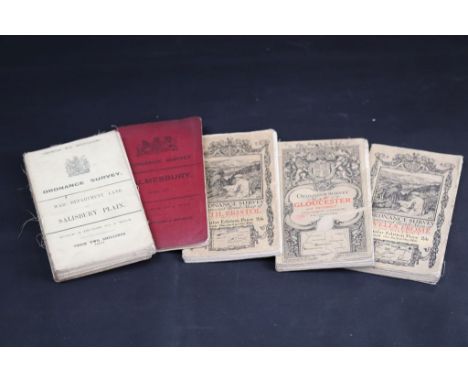
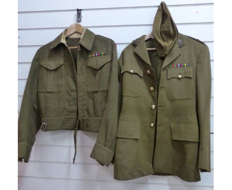
Lot 210
Co. Derry: Colby (Col. Thos.) Ordnance Survey of the County of Londonderry, Part I [All Published] D. 1837, First Edn., hd. cold. map & other fold. maps etc., also hd. cold. & other plts., text illus. etc. orig. cloth, v. good; [Phillips (Sir Thos.)] Londonderry and the London Companies 1609 -1629, sm. folio Belfast (H.M.S.O.) 1928. First Edn., cold. & other maps, orig. cloth, v. good. (2)
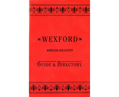
Lot 635
Wexford Interest: Dunne (Tom)ed. New Ross. Rosponte. Ros Mhic Treoin, An Anthology Celebrating 800 Years, 4to 2007; Parle (J.) The Mummers of Wexford, Wexford 2001; O'Muirithe (D.) & Nuttall (D.)eds. Folklore of Co. Wexford, D. 1999. Signed Copy ; Gahan (J.V.) The Secular Priests of the Diocese of Ferns, 2000; & 4 others include., Bassetts Wexford, & Ordnance Survey Letters Wexford, 4to D. 2014. As a lot. (8).
Lot 566
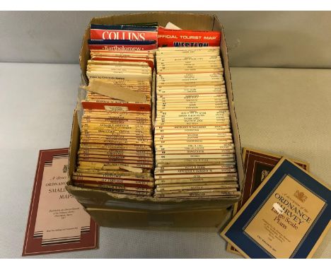
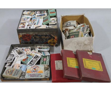
Various cigarette trade and other cards, part sets, etc., to include Wills, three Ordnance survey maps to include Lincoln, Williamson book binder mark in case, 2cm high, 13cm wide, 17cm deep, various other part set trade cards, Churchman's box, various other cigarette cards, Wild Flowers, etc., contained in a Christmas Assortment tin and others in a shoe box. (a quantity)
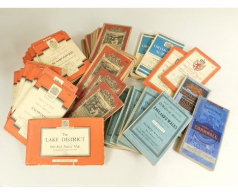
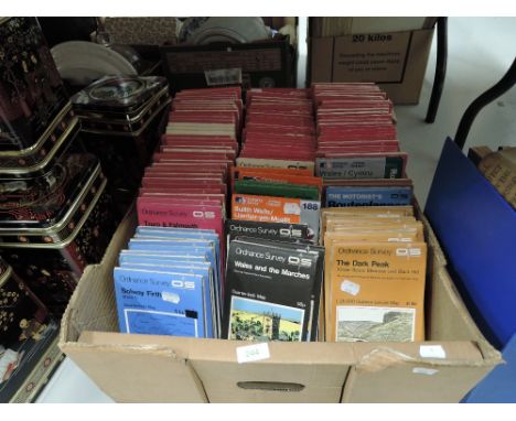
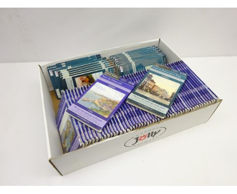
![SHELL GUIDES [18], TWO OTHERS, COUNTY BOOKS [7], THREE OTHERS AND 40 ORDNANCE SURVEY MAPS [A LOT]](https://cdn.globalauctionplatform.com/9703a9a8-dd5b-4062-aec5-a8cc011a9d1e/01d6f795-207d-47a9-b488-b13136caaa41/468x382.jpg)
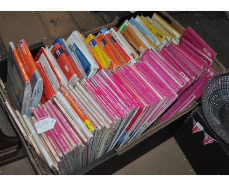
Lot 296
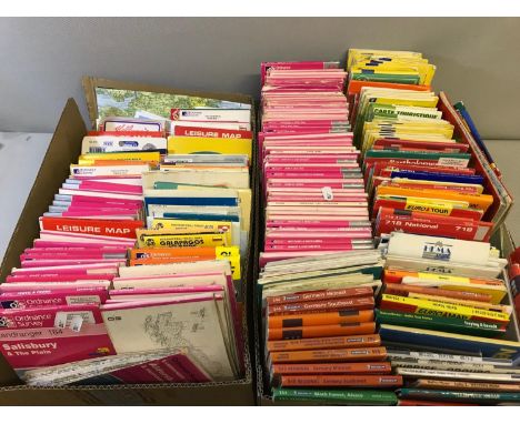
Cartography - seven maps to include The Provision of 1925 - 1926 provisional edition Lancashire sheet map of Glazebury printed and published by Director General of Ordnance Surveys Chessington Surrey 1947, Lancashire sheet edition of 1926 Culceth issued by the Ordnance Survey of Southampton, two divisional editions of Lancashire and Cheshire Rixton with Glazebrook issued by Ordnance Survey Office, a map of Lancashire Ince-in- Makerfield, Ashton-in-Makerfield and Ince issued by the Ordnance Survey Chessington Surrey 1965, a map of Lancashire and Chorley, Coppull, Wothington, Adlington issued by Ordnance Survey Chessington Surrey 1965, a map of Lancashire, Ashton-in-Makerfield, Haydock, Newton-le-Willows issued by Ordnance Survey Chessington Surrey 1956 and one further map of Helsington CP, Westmorland 1972 (qty)


-
12129 item(s)/page