315251 Preisdatenbank Los(e) gefunden, die Ihrer Suche entsprechen
315251 Lose gefunden, die zu Ihrer Suche passen. Abonnieren Sie die Preisdatenbank, um sofortigen Zugriff auf alle Dienstleistungen der Preisdatenbank zu haben.
Preisdatenbank abonnieren- Liste
- Galerie
-
315251 Los(e)/Seite
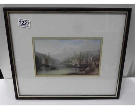


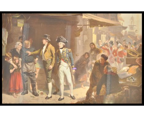
Los 129
PHILIP E. WEST (BRITISH, CONTEMPORARY) 'Safely Home', a Lancaster of 57 Squadron returning to East Kirkby, escorted by a Mosquito of 85 Squadron, colour print, presentation copy, signed by the artist, Sqn Ldr 'Branse' Birbridge, D.S.O., D.F.C., and Flt. Lt. Phil Ainley, D.F.C., 44.5cm x 67cm.
Los 112
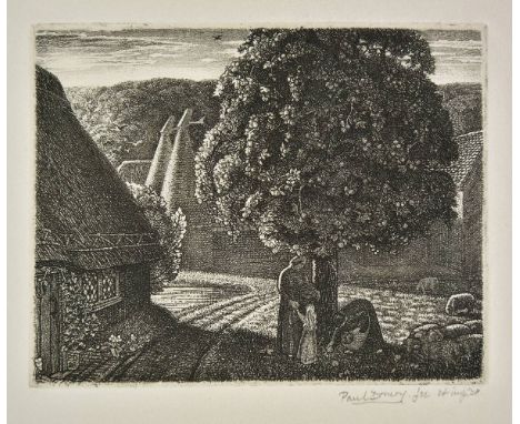
*@Drury (Paul, 1903-1987). September, 1928, etching on wove paper (with partial watermark to upper edge), signed and dated Paul Drury ' fec. et imp. 28, and additionally inscribed by the artist in pencil to lower margin 'Personal print 6/6. Turkey Mill. (Walker 25) Plate destroyed', a fine, rich impression, plate size 102 x 130mm (4 x 5.1ins), sheet size 17 x 23 cm (6.75 x 9 ins), hinge-mounted Garton 24. (1) Note: It appears that, despite the inscription by the artist on this print, that the plate for this work was not destroyed, as a second edition was issued by Garton & Cook in 1987, in an edition of 100.

Los 187
*Massie (Lorna, 1938-). October Garden, colour silkscreen print, from the edition of 150, signed and numbered 66/150, image size 40.5 x 54.8 cm (16 x 21.5 ins), with margins, framed and glazed, together with Mallinson (Pat, 1950-). Interior, St. Paul's, colour aquatint, signed, titled and numbered 61/100, plate size 49.5 x 32.5 cm (19.5 x 12.75 ins), with margins, framed and glazed, plus Earlom (Richard, 1743-1822). View of a Sea Port, with a Triumphal Arch, after Claude Lorrain, 1777, etching with mezzotint, printed in bistre, number 197 from the Liber Veritatis, plate size 17.7 x 22.7 cm (7 x 9 ins), framed and glazed (3)
Los 443
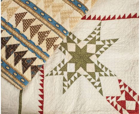
*Quilt. An American star pattern quilt, late 19th/early 20th century, white cotton patchwork quilt, with a star pattern in red and green print fabrics, backed in white cotton, hand-quilted overall in white thread, hand-sewn edging, generally lightly soiled and a few small marks, approximately 184 x 184cm (72.5 x 72.5ins), together with another American patchwork quilt, flying geese pattern, in shades of brown, green, blue, backed with linen, hand-quilted overall in white thread, hand-sewn edging, lightly soiled, wear to some fabrics, 227 x 209.5cm (89.5 x 82.5ins) (2)
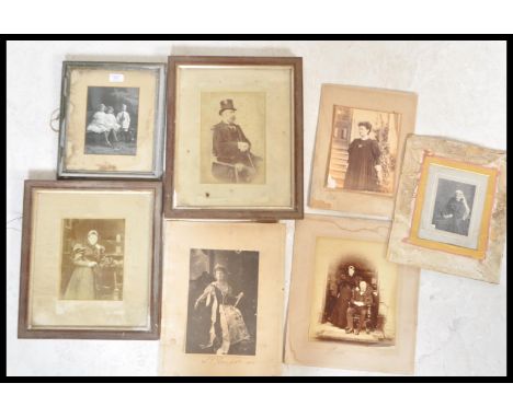
Los 291
Henry Somerset the 7th Duke of Beaufort - A selection of late 19th Century / early 20th Century photographs of the Beaufort family including two photographs of S. W. Beaufort signed to the corner, one photograph of the 7th Duke of Beaufort with S. W. Beaufort being signed by both to the bottom, a photograph of L. E. Beaufort signed to the bottom and dated 1902, a framed and glazed print of the Beaufort children and one unnamed photograph.


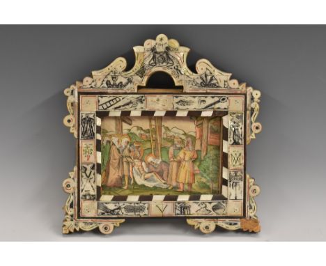
Los 3061
A 19th century mother-of-pearl and hardwood icon frame, from the Holy Land, crested by a bust-length profile of Jesus Christ, flanked sinister and dexter by his blood in a chalice and palms, the sides with New Testament rebuses, christograms and ecclesiastical devices, veneered throughout with square panels picked out in alternating tones of black and red, scrolling acanthus to angles, inset late Medieval South German hand-coloured woodblock print of the Deposition of Chrsit, 12cm x 17cm, c. 1500, the frame 23cm x 22.5cm overall
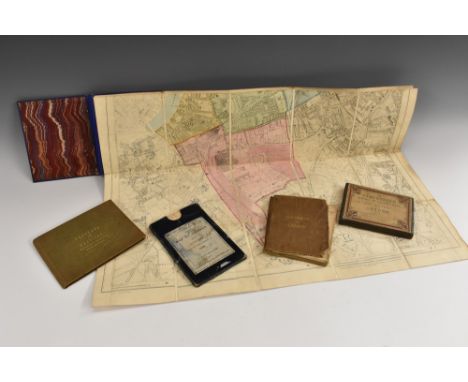
Los 3509
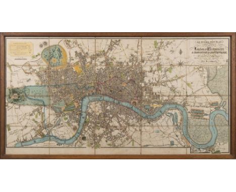
Coghlan's New of Map of London and Its Suburbs, with the Improvements to 1836, Published by H. Hughes, 15, St. Martin-le-Grand, ten-fold, hand-coloured engravings laid on canvas, 26.5cm x 41.5cm, contemporary blue card sleave applied with publisher's paper label; Railway Map of the Environs of London: Showing the Route of all the Lines of Railway Now Open, and in Progress, from the Metropolis to the Extent of Thirty Miles from the Post Office [...], Published by J.R. Robbins, 3, Warwick Court, Holborn and R. Tyas, 8, Paternoster Row, London 1840, steel engraving with some hand-coloured delineations, paper laid on canvas, fifteen-fold, 35.5cm x 48cm, contemporary cloth covers (upper detached); C. Graf (second-quarter, 19th century), by, The Circuiteer: A Series of Distance Maps, to serve as a guide for ascertaining Cab Fares, Porterage, &c., & c., No. 1: London, Published by J. Friedericks, 5, Nassau Street, Soho, London 1850, chromolithograph, forty-five fold, 55cm x 71.5cm, the fold prefixed by explanation and index - 8pp, contemporary black buckram wrap, applied with publisher's paper label; Stanford's Library Map of London and Its Suburbs, Sheet 14, Published by Edward Stanford, 55 Charing Cross, London 1877, hand-coloured engraving on card, laid on canvas, twenty-five fold, 65.5cm x 55.5cm, contemporary blue buckram covers as issued with publisher's paper label, marbled endpapers; Panorama of Hastings, Published by Rock & Co., London [n.d., c. 1840], ten fold-out engraved views and vignettes, within lithographic borders of foliage, each 9cm x 12cm, yellow endpapers, contemporary bookseller's ticket: W. Reid, Stationer, Print & Music Seller, Pelham Library, Hastings, contemporary buckram, gilt lettered upper cover within a blind tooled cartouche, [5]
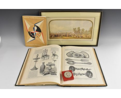
Los 3318
Exhibition History - The Great Exhibition, 1851, The Art Journal Illustrated Catalogue, The Industry of All Nations 1851, Published for the Proprietors, by George Vertue, London [n.d., 1851], illustrated throughout with wood engravings, contemporary green-stained half-calf and watered cloth boards, gilt lettered and tooled spine, marbled endpapers, Plain Armorial bookplate: William Thomson, small folio; a Baxter print of the Crystal Palace, 14.5cm x 32.5cm, Hogarth frame; Festival of Britain, 1951, South Bank Exhibition, London, guide; Yachting Regatta prize medal, boxed, [4]
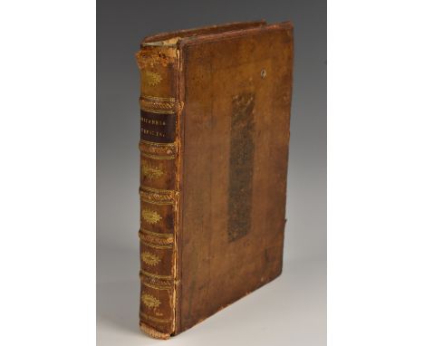
Los 3628
Ogilby (John) and Bowen (Emmanuel), Britannia Depicta (sic): or, Ogilby Improv'd; Being a Correct Coppy (sic) of Mr: Ogilby's Actual Survey of all ye Direct & Principal Crofs (sic) Roads in England And Wales [...] 1, A full & particular Defcription (sic) & Account of all the Cities, Borough-Towns, Towns-Corporate & their Arms [...] with fuitable (sic) Remarks on all places of Note drawn from the beft (sic) Historians and Antiquaries [...], 2, The Arms of the Peers of this Realm who derive their Titles from places lying on, or near the Roads, 3, The Arms of all ye Bishopricks (sic) and Deaneries, their foundation, Extent, Yearly-Value, Number of Parifhes (sic) [...], 4, The Arms, & a fuccint (sic) Account of both Universities & their refpective (sic) Colleges, their foundations, Fellowfhips (sic) [...], fourth edition, Printed & Sold by Tho: Bowles, Print & Map Seller, [London n.d. 1736], pp: engraved allegorical title-page, tables [viii], 273 engraved full-page road and county maps as called for, relaid contemporary calf boards blind, with early 19th century calf spine gilt with lettered red morocco title-label, small 8vo

-
315251 Los(e)/Seite