We found 33306 price guide item(s) matching your search
There are 33306 lots that match your search criteria. Subscribe now to get instant access to the full price guide service.
Click here to subscribe- List
- Grid
-
33306 item(s)/page


Lot 157
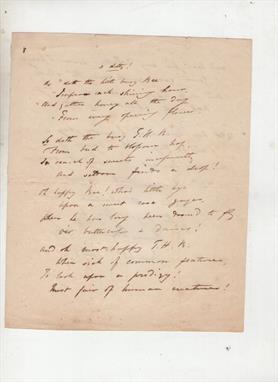
Literature - Thomas Haynes Bayly^ song writer^ novelist and dramatist autograph manuscript signed of a poem entitled `A Ditty!` dated June 22nd 1835. 2pp 4to in good condition. Apparently unpublished. Bayly was one of Britain`s most successful song writers in the early years of the 19th c but fell into financial difficulties following a series of financial misadventures.

Lot 302
Customs Teller`s Bills 1670 group of six manuscript teller`s bills issued in 1670 relating to customs seizures at Hull including whalebone^ loans to the crown charged on the sales of fee farm rents and customs revenue. Each is written on a strip of vellum and signed off by the Receiver General of Worcestershire W Doyly. Each strip is then sewn to form a single document.

Lot 109
Carte de la Nouvelle France, ou se Voit le Cours des Grandes Rivieres de S. Laurens & de Mississipi Aujour d`hui S. Louis... Derived from Nicholas de Fer`s important four-sheet map of 1718, this is the most informative map of the French possessions in North America in the early 18th century. It was issued to promote the recently established Compagnie Francoise Occident, which was formed to fund the debt of Louis XIV and offered inducements to encourage settlement in Louisiana. Louisiana and the Mississippi Valley are based on Delisle`s manuscript map of 1701, while the geography of New England and eastern Canada originates with Franquelin. Inset at top left is a large-scale map of the Mississippi Delta and Mobile Bay, based on the voyage of Pierre Le Moyne d`Iberville. This smaller version is found in atlases published by Ottens and other Dutch composite atlases. There is no engraver or publisher`s imprint. Bold original color with minor soiling at bottom right and one small crack caused by the oxidation of the green pigment, which has been professionally repaired on verso. 19.5 W x 21.6 H Ottens/De Fer, 1745

Lot 174
Geographical, Statistical, and Historical Map of Arkansas Territory For this commercial atlas version of the seminal Stephen Long report map, Carey & Lea chose a single sheet format at a reduced scale with the political boundaries highlighted in color. It carries the cartouche title Map of Arkansas and Other Territories of the United States Respectfully inscribed to the Hon. J.C. Calhoun Secretary of War by S.H. Long Major T. Engineers and appears on a full folio sheet with text measuring 20.5 x 16.6"". This is one of the most important maps of the American West, which Wheat calls the ""most interesting map in this Atlas."" It covers the Missouri River Basin north to the Mandan villages and west to the Rocky Mountains. Long`s map corrected a number of geographical inaccuracies, foremost the erroneous course of the Red River. As on Long`s manuscript map the ""Highest Peak,"" James Peak, and Spanish Peaks appear and the route of his expeditions are clearly delineated. Extraneous details, including Major Long`s astronomical notations, camp site locations, and elevation profile were eliminated, and information about Arkansas and surrounding territories was added in columns framing the map at the sides. South of the Republican Fork appears the significant legend that reads ""The Great Desert is frequented by roving bands of Indians who have no fixed place of residence but roam from place to place in quest of game""; this is a change from Long`s report map, where he famously referred to the ""Great American Desert."" A note refers to ""Pawnee villages deserted in 1810,"" whereas the Long map uses the date of 1820. Salt works, Potatoe Hills, a large number of Indian villages and lands, A Broad and extensive swell of Land called by the French Coteau de Prairie, and Say`s route are located, along. Thomas Say was the expedition`s naturalist and entomologist, and is considered to be the father of American entomology. Engraved by Young & Delleker.Claims are sometimes made that this first edition (1822) Carey & Lea map preceded the publication of the Long report map based on the report`s date of 1823. However, both were actually published in 1822, making the distinction impossible to tell from date alone. Even Wheat erroneously assigns an 1823 date to the Long report map. A mystery that deserves further study. Original hand color with toning concentrated mostly along the centerfold, light offsetting, and a couple of spots in the text columns. There is a centerfold separation at bottom that does not enter the map. 14.5 W x 14.7 H Carey & Lea, 1822

Lot 240
Map of the Bounty Lands in Illinois Territory According to Streeter, this seldomly seen map of Illinois Territory is the ""earliest Illinois Map."" It is also listed in Phillips A List of Maps of America as the first map under the Illinois header. The map itself covers the western portion of Illinois between the Mississippi River and the Illinois River, from just north of St. Louis to just south of Davenport, Iowa. Lake Peoria is here called Lake Peoire and the creek just to its west that flows into the Illinois River is labeled Kickaboo or Red Bud Cr. Below the map image is a printed grid with an area colored in green that corresponds to a tract in the map with the manuscript notation ""Gently rolling prairie good soil Spoon River in the SE 1/4 of this Section,"" signed by John Gardiner. Most, if not all, of these maps would have included similar notations regarding each tract of land that was being awarded. John Gardiner was the chief clerk of the General Land Office until 1821. Following the War of 1812, the GLO was tasked with surveying the frontier lands and quickly distributing them to war veterans as payment for their services. Issued folding with light toning and offsetting and a few minor spots of foxing. There are two small holes along the vertical fold with minute and insignificant loss or image: one to the left of the highlighted tract and one to the right of the fleur-de-lis. 18.6 W x 14.9 H Gardiner, John 1818

Lot 252
Map of Michigan Compiled from the Latest Authentic Sources This is an exceedingly rare, highly detailed, and richly colored map of the state printed on fine banknote paper. It shows the counties outlined in red and alternating color for townships. The map locates hundreds of place names, rivers, lakes and cities and depicts the rapidly growing railroad network in the state. In the upper right corner are insets of Isle Royale and the western portion of the upper peninsula. Map folds into black cloth covers (4 x 6"") with gilt-stamped title, ""Sectional Map of Michigan H.R. Page & Co. Chicago."" There are numerous manuscript ink notations mainly in the bottom portion of the image with some minor offsetting to the left of the title at top, otherwise a very good copy. Covers are worn with a number of small abrasions mainly on the back cover. 36.5 W x 24 H Page, H. R. 1880

Lot 260
Plan of the Encampment and Position of the Army under his Excelly. Lt. General Burgoyne at Braemus Heights on Hudson`s River near Stillwater... This detailed and uncommon battle plan shows the placement of British and American forces during the Battle of Saratoga, which took place during the months of September and October 1777. The two battles were fought nineteen days apart, and the interesting overlay at bottom left shows the change in positions of the two armies over that time period, with the Americans advancing north (with north oriented to the bottom). This was a key victory for the Americans. The map uses hand color to depict the troop positions and is from John Bourgoine`s A State of the Expedition from Canada..., published in London. Faden`s maps of the American Revolution are particularly well presented because he based them on manuscript maps supplied to him from the war zone. Issued folding with light toning and offsetting and a binding trim to the neatline at upper left. 13.3 W x 13.9 H Faden, William 1780

Lot 297
Plan of the Action at Huberton Under Brigadier Genl. Frazer, Supported by Major Genl. Reidesel, on the 7th July 1777 This detailed and uncommon battle plan depicts the only pitched battle fought in Vermont during the American Revolution. The positions of British Brigadier General Frazer`s men, the German mercenaries under General Reidesel, and Seth Warner`s Green Mountain men are clearly noted with red and blue hand coloring. An alphabetized index at left gives clarification to the battle lines displayed. The British eventually routed the Americans with a somewhat higher casualty count, but captured some 260 American prisoners. Published in John Bourgoyne`s A State of the Expedition from Canada... in London. Faden`s maps of the American Revolution are particularly well presented because he based them on manuscript maps supplied to him from the war zone. Issued folding on watermarked paper with moderate offsetting and a binding trim to the neatline at lower left. 10.8 W x 13.8 H Faden, William 1780

Lot 323
Carte de la Californie Suivant I. la Carte Manuscrite de l`Amerique de Mathieu Neron Pecci... This sheet has five depictions of California that present a fascinating cartographic history of the region. It was one of ten maps compiled by Robert de Vaugondy for Diderot`s important encyclopedia and depicts the mapping of California by five important cartographers. The earliest map reproduces Neron Pecci`s manuscript map of 1604 showing the peninsula with a ragged coastline and place names derived from Cabrillo`s voyage of 1542-3. The second map is a detail from Sanson`s 1656 map showing the island of California with place names from the voyage of Vizcaino. Map three is from Delisle`s map of America of 1700 with the question of California`s insularity left open to interpretation. Next is Fra. Eusebio Kino`s important map of 1705 that finally ended that cartographic myth. It is based on his overland expedition from the mainland to the Sea of Cortez. Finally, map five is a portion of a Spanish map, showing the Jesuit explorations, that first appeared in Miguel Venegas` Noticia de la California in 1757, which is the first published history of California. This is an essential map for any California map collection. Issued folding with a hint of offsetting and a short fold separation has been professionally closed on verso. 11.5 W x 15.2 H Robert de Vaugondy, Didier 1772
![[Lot of 2] Hollanda [and] Isole Selandie Two very fine copper-engraved charts in the Italian style with fully stippled seas,](http://lot-images.atgmedia.com/SR/36385/2906594/477-20145813835_468x382.jpg)
Lot 477
[Lot of 2] Hollanda [and] Isole Selandie Two very fine copper-engraved charts in the Italian style with fully stippled seas, depicting the Netherlands with the islands of Zeeland, and part of Flanders to the south. Cities are illustrated with miniature castles and include Rotterdam, Breda, Polder, and Brussels. Each map is adorned with a strapwork title cartouche and a compass rose. Engraved by Girolamo Porro and printed on full sheets (7 x 10.3"") of Italian text. Lovely color and minor soiling with manuscript writing in blank margins. Hollanda also has a couple of small manuscript marks in the map image. 4 W x 5.5 H Porcacchi, Tomaso 1590

Lot 570
A New Sea & Land Chart of the Sovereign Principality of Malta; Laid Down from the Best Authorities and the Different Manuscript Maps Communicated to the Chevr. Louis de Boisgelin... This rare, desirable and very detailed engraving depicts the islands of what is now called ""The Republic of Malta"", the southern-most of European countries. The map was published in Boisgelin`s definitive history ""Ancient and Modern Malta: Containing a Full and Accurate Account...."" published in 1805. The map displays the larger islands of Malta, Gozo and lesser isles with a large pictorial title cartouche depicting a Knight of Malta reaching for a sinking ship flying a flag with a Maltese Cross. The detail is fine enough to include roads as well as structures in the rural areas. Topography is shown through dense hachuring, and the coastline is marked with soundings and anchorages. The Malta Historical Society has stated that ""of all the printed maps of Malta, Boisgelins map is the second largest, coming only after the Carte Generale de la Principaute Souveraine des Isles de Malte et du Goze (53.1x 22.8""), made by Gervais de Palmeus and published in Paris in 1752."" First edition, published by G. & J. Robinson, Pater-noster Row. Printed on two sheets, joined as issued. Issued folding with moderate offsetting and a few extraneous creases. There are several short splits at fold intersections and some small tears along the sheet edges confined to the blank margins, all of which have been closed on verso with archival tape. 21.6 W x 50.8 H Neele, Samuel John 1804

Lot 585
Nova Persiae Armeniae Natoliae et Arabiae This splendid map of the Middle East covers the region from Turkey and Egypt to Afghanistan with the Arabian peninsula prominently shown. The detail in Arabia is based on Sanson`s map of 1654, one of the largest scaled and best detailed maps of the region until the mid-seventeenth century. The decorative title cartouche features several exotic figures, animals and a merchant ship. A mapmaker works atop the scale of miles cartouche using dividers and other tools of the trade. A fine impression with original color that has been partially refreshed and a professionally repaired tear that enters 3"" into map at bottom. There is a manuscript title in French in the top blank margin. 18.8 W x 22.1 H Wit, Frederick de 1680

Lot 637
Carte sur Laquelle est Trace la Route qu`a suivie l`Ambassade Anglaise, Depuis Zhe-Hol en Tartarie jusqu`a Pekin, et de Pekin Han-Choo-Foo, en Chine This very scarce map records the first attempt by the British to negotiate more favorable trade agreements with the Chinese emperor. The 1792 embassy of Lord Macartney was granted an audience with Emperor Qianlong, but failed to secure the agreements. The map follows the Grand Canal, the longest ancient canal in the world, from Hangzhou to Beijing. The official courier stations, each placed at intervals of 35 to 45 km, are noted along the route. Dissected and mounted on brown linen with the title in manuscript brown ink on a paper label. There is faint toning, minor soiling, and a hint of offsetting. 25.5 W x 17.9 H Tardieu, Jean Baptiste Pierre 1800
![[Illuminated Leaf] A nice vellum manuscript from a French Book of Hours, in the style of a Rouen scriptorium. Written in br](http://lot-images.atgmedia.com/SR/36385/2906594/715-201458131626_468x382.jpg)
Lot 715
[Illuminated Leaf] A nice vellum manuscript from a French Book of Hours, in the style of a Rouen scriptorium. Written in brown and red ink, the leaf has three large initials, five small initials, and six line fillers in red and blue and burnished gold leaf, as well as a decorative panel in the margins with ivy and flowers. The text is from the Litany of the Blessed Virgin Mary, also known as the Litany of Loretto. Beginning with the large initial ""C"" on the recto, the text translates as:Grant, we beseech Thee, O Lord God, unto us Thy servants,that we may rejoice in continual health of mind and body; and, by the gloriousintercession of blessed Mary ever Virgin, may be delivered form presentsadness, and enter into the joy of Thine eternal gladness. Through Christ our Lord. Moderate toning and soiling. 6 W x 4.4 H Anon., 1430
![[Vellum Manuscript Indenture] This indenture serves as testament to a one year lease of a messauage or burgage - a dwelling](http://lot-images.atgmedia.com/SR/36385/2906594/729-201458131652_468x382.jpg)
Lot 729
[Vellum Manuscript Indenture] This indenture serves as testament to a one year lease of a messauage or burgage - a dwelling on a small plot of land. The lessors are William Blakisten and Francis Corner of Sunderland in the County of Durham, and the lessee is John Fotherinham, who must pay 5 Shillings in return for the lease. Signed on August 30, 1774.The top of the indenture is cut in a jagged (""toothed"") line, as was the common practice with indentures. The legal contract was duplicated on a single sheet, and then the copies were separated by a jagged edge, so that the two pieces could be fit together again to verify authenticity. The indenture includes tax stamps and two red wax seals. Light soiling 13.8 W x 18.6 H 1774
![[Vellum Manuscript Indenture] This indenture serves as testament to a one year lease of a farmhold and a messauage. The les](http://lot-images.atgmedia.com/SR/36385/2906594/730-201458131655_468x382.jpg)
Lot 730
[Vellum Manuscript Indenture] This indenture serves as testament to a one year lease of a farmhold and a messauage. The lessors are Thomas Ayre and his wife, Mary Skipsey (maiden name Goodchild), of Tunstall in the County of Durham, and the lessee is John Carr, Esquire, of Ryhope, just south of Sunderland. The lease requires Ayre to pay 5 Shillings in return for the dwelling, farmland and a windmill that resides on the property. Signed on February 9, 1796.The top of the indenture is cut in a jagged (""toothed"") line, as was the common practice with indentures. The legal contract was duplicated on a single sheet, and then the copies were separated by a jagged edge, so that the two pieces could be fit together again to verify authenticity. The indenture includes tax stamps and five red wax seals. Bright and clean, with very minor soiling at top left. 16.4 W x 24.6 H 1796
![[Vellum Manuscript Indenture] This indenture serves as testament to a one year lease of a messauage - a dwelling on a small](http://lot-images.atgmedia.com/SR/36385/2906594/731-201458131656_468x382.jpg)
Lot 731
[Vellum Manuscript Indenture] This indenture serves as testament to a one year lease of a messauage - a dwelling on a small plot of land. The lessors are Michael Laws (a ""Gentleman"") of Sunderland near the Sea and Thomas Laws (a farmer) of Easington, both in the County of Durham, and the lessee is Robert Ayre (a Keelman), also of Sunderland. The lease requires Ayre to pay 5 Shillings in return for the dwelling on Lombard Street (also known as Pewterers Lane) that measures 15.5 feet from north to south and 23 feet from east to west, as well as an additional 7 feet of land in front of the dwelling. Signed on February 8, 1811.The top of the indenture is cut in a jagged (""toothed"") line, as was the common practice with indentures. The legal contract was duplicated on a single sheet, and then the copies were separated by a jagged edge, so that the two pieces could be fit together again to verify authenticity. The indenture includes tax stamps and two red wax seals. There is light soiling and some foxing. 16 W x 26.2 H 1811

Lot 763
The Southeast in Early Maps with an Annotated Check List of Printed and Manuscript Regional and Local Maps of Southeastern North America During the Colonial Period The definitive cartographic reference for maps of the Colonial Southeast. It is a comprehensive study of the historical cartography of the southeast region of the North American continent before the American Revolution. With an annotated checklist of printed and manuscript regional and local maps detailing 450 maps issued between 1507 and 1773. University of North Carolina Press, 1962. 284 pages. Contains 67 illustrations, descriptions of maps, a chronological title list of maps, an index, and a supplement with additional maps. Light tan cloth covered boards with gilt lettering on the spine. No dust jacket.See also lots 130, 131, 132, 157, 158, 164, 165, and 170 for maps referenced in Cumming`s excellent book. Contents fine with minor stains on the back cover. 11.3 W x 8.8 H Cumming, William P. 1962
![GLAISTER, W.M. Navigation. [N.p.: n.d. but paper watermarked 1820.] Vol. III only, 4to (254 x 199mm.) Manuscript throughout,](http://lot-images.atgmedia.com/SR/10123/2906286/3065-20145141830_468x382.jpg)

Lot 3153
SHIPPING. Abstracts of the Returns made to the Board of Trade of Wrecks, Casualties, and Collisions, which Occurred 1872. London: 1873. Folio (320 x 204mm.) 7 folding colour charts. (First few leaves tattered and torn with some loss of text to second leaf.) Contemporary calf-backed boards (spine lacking, upper cover detached, first few leaves now loosely inserted). And two other manuscript volumes titled War Shipping Casualties and dated 1941 and 1942 (3).

Lot 1049
(x) Great Britain1840 One Penny BlackPlate 4, UsedAH, good to large margins all round, tied to piece by practically complete and superb strike of the "camelford" undated circle in red with additional manuscript red cross in in the centre; fine and extremely rare. R.P.S. Certificate (1965) provenance:"Wills" , November 1989Subject to 5% tax on Hammer Price in addition to 20% VAT on Buyer’s Premium. For more information please view Terms and Conditions for Buyers.
Lot 93
Finden (William & Edward). Views of Ports and Harbours, Watering Places, Fishing Villages and other Picturesque Objects on the English Coast, 1839, engraved frontispiece, additional dec. eng, title and forty-eight (complete) engraved plates, very occ. marginal closed repaired tears, scattered spotting, near contemp. manuscript owners inscription to front and rear pastedowns, also a contemp. inscription stating the book was ÔPurchased at the late Revd. Js. LovettÕs Book sale, Dec. 17thÕ, gilt dec. turn-ins, gilt gauffered edges, contemporary full red morocco, with ornate gilt dec. sidings, spine a little rubbed and faded, lower joint splitting, 4to (1)

Lot 115
Bolton (James). Filices Britannicae; An History of the British Proper Ferns. With Plain and Accurate Descriptions and New Figures of all the Species and Varieties, part 1 only, John Binns, Leeds, [1785], 31 hand-coloured engraved plates, manuscript annotation to Latin Index, occasional light marginal soiling, contemporary half calf, spine defective, covers detached, 4to. Henrey 464. Part 2 was published in Huddersfield in 1790. (1)
Lot 120
Dickson (Adam). A Treatise of Agriculture. A New Edition, 2 vols., pub. A.Kincaid & J.Bell, Edinburgh, 1770, half titles discarded (?), two (complete) folding eng. plts. (one with small ink stain), pagination error vol.2, pps. 257 - 260 omitted in numbering, near contemp. ownership initials to front pastedown, contemp. speckled calf gilt with contrasting morocco label to spines, 8vo., together with, Sinclair (Sir John), The Code of Agriculture; Including Observations on Gardens, Orchards, Woods and Plantations....., 5th. ed., 1832, eng. portrait frontis., manuscript presentation inscription by the author on title, tipped in printed address by Sir John Sinclair to the Friends of Agricultural Improvement in the County of Caithness, six (correct as list) uncoloured engraved plts., slight spotting and occ. finger soiling, contemp. calf gilt, a little worn at extrems., 8vo., with, Owen (Rev. T., translator), M. Porcius Cato Concerning Agriculture, pub. J.White, 1803, title and corrigenda, pubs. advertisements bound at rear, bookplate of Woburn Abbey, a.e.g., contemp. gilt dec. red morocco, spine faded, joints and extrems. a little rubbed. 8vo., plus, Davy (Sir Humphry), Elements of Agricultural Chemistry in a Course of Lectures for the Board of Agriculture, 2nd. ed., 1814, title page with near contemp. ownership signature, ten (complete) uncoloured engraved folding plts. contemp. half calf, skillfully rebacked, 8vo. and, Youatt (William, ed.), The Complete Grazier; or FarmerÕs and Cattle BreederÕs and DealerÕs Assistant. A Compendium of Husbandry...., eighth ed., pub. Cradock and Co., 1846, dec. title, wood eng. frontis. of cattle, numerous uncoloured wood engs. throughout, modern qtr. calf gilt, 8vo., with another four vols. similar (10)
Lot 121
Downing (Joseph). A Treatise on the Disorders Incident to Horned Cattle, Comprising a Description of their Symptoms, and the most Rational Methods of Cure, Founded on Long Experience, to which are added Receipts for Curing The Gripes, Staggers, and Worms in Horses, and an Appendix, Containing Instructions for the Extracting of Calves, Stourbridge: printed & sold by J. Rollason, 1797, half-title, detailed manuscript notes to verso of final leaf and rear endpaper in a contemporary hand, contemp. ownership inscription to front free endpaper, dampstaining to initial leaves, some marks and dust-soiling, contemp. marbled boards with vellum corners and recent calf reback, 8vo, together with Parkinson (Richard), Treatise on the Breeding and Management of Live Stock..., 2 vols., 1810, seven (of 8) eng. plts., occasional light dampstaining, contemp. half calf gilt with green morocco labels to spines, 8vo, with Clater (Francis), Every Man His Own Cattle Doctor..., 10th ed., 1848, wood eng. frontis., modern half morocco gilt, 8vo, and Youatt (William), Cattle; their Breeds, Management, and Diseases, new ed., 1876, wood eng. illusts., minor spotting, modern green half morocco gilt, 8vo, plus seven others relating to the management of cattle (12)

Lot 2
Great BritainPostal History1674-1844, mail to or from England, to or through Holland, a well written up collection on leaves, fifty-five entires or entire letters, including 1674 entire letter from the Hague to London endorsed Couvert (sent under cover), 1709 (4 Aug.) entire letter from London (with "L.L." in circle handstamp) to the Hague, charged "12" on arrival, 1734 entire letter with script "S.H." in circle handstamp to Leyden, 1794 entire letter from the Hague to London with rare treble rate of 2/6 in manuscript, 1811 (3 Aug.) entire letter from Paris to London with oval "ship letter/(crown)/portsmouth", 1815 (1 June) entire letter from Sunderland to Schiedam with black oval "Brielle/Eng;Corrisp", 1822 entire letter from Boston to Schiedam, held in London for postage of 5/6d., 1829 entire letter from Amsterdam to London with framed "ship letter/gravesend" on reverse, 1832 (31 Aug.) entire letter from London to Schiedam sent on the first voyage of the Steamboat "Sir Edward Banks" with red script England/over Rotterdam across flap on reverse, 1832 entire letter from London to Schieden with red "gezuiverd" disinfection handstamp on front and script Engeland/over Brielle on the reverse, 1833 entire letter from Leith to Rotterdam with manuscript "Engeland Over Hellevoetsluis", etc., strikes and condition chiefly good to fine. A most interesting lot. Photo Subject to 20% VAT on Buyer’s Premium. For more information please view Terms and Conditions for Buyers.

Lot 9
Great BritainPostal History1789 (11 Feb.) entire letter from Belfast to London, rated "2" in manuscript and with "W" in circle handstamp denoting a Window Letter, datestamps on reverse; central vertical filing fold, fine Subject to 20% VAT on Buyer’s Premium. For more information please view Terms and Conditions for Buyers.

Lot 11
Great BritainPostal History1790-1812 five entire letters (three are redirected) each with red "belfast" handstamp in different sizes from 28mm. to 43mm., a variety of manuscript rate markings; fine Subject to 20% VAT on Buyer’s Premium. For more information please view Terms and Conditions for Buyers.

Lot 12
Great BritainPostal History1790 (1 May) entire letter Via Dublin to Cavendish Square with black "ireland" and red "belfast", both superb strikes, rated "4" (deleted) and "10" in manuscript, arrival datestamp (4.5) on reverse; light filing fold through the handstamps and small tear at the top, fine. A spectacular Irish rarity. Photo Subject to 20% VAT on Buyer’s Premium. For more information please view Terms and Conditions for Buyers.

Lot 16
Great BritainPostal History1795 (19 Jan.) entire letter from Ballymoney with manuscript "Missent to Kings Langley" and "Not Bromley", two strikes of an unrecorded "langley", a variety of rate markings on the front and datestamps on reverse; soiled and stained but a rare Berkshire cover Subject to 20% VAT on Buyer’s Premium. For more information please view Terms and Conditions for Buyers.

Lot 20
Great BritainPostal History1799 (16 Nov.) entire letter from Dublin to London with a fine and clear strike of the large red "s/ireland", rated in manuscript 1/4 (deleted) replaced by 8, on reverse small Dublin c.d.s.(18.11) and London "s/nov/21/99"; fine and with fascinating contents, being an appeal for payment for the supply of malt and spiritous liquors to officers of the West Yorkshire Regiment who made spurious promises of payment, the letter-writer now being faced with imprisonment for debt to his employer. Photo Subject to 20% VAT on Buyer’s Premium. For more information please view Terms and Conditions for Buyers.

Lot 23
Great BritainPostal History1801 (21 Jan.) entire letter endorsed "Via Holyhead", addressed to Brighton, with superb "s/ireland" (Sunday), rated "8" in manuscript, transit and arrival datestamps on reverse; a light vertical filing fold crosses the handstamp, but hardly detracts. Photo Subject to 20% VAT on Buyer’s Premium. For more information please view Terms and Conditions for Buyers.

Lot 25
Great BritainPostal History1801 (5 March) entire letter from Dublin to London, redirected to Uxbridge with a very fine red "ireland" handstamp, rated "8" in manuscript, arrival datestamps on reverse; fine. Photo Subject to 20% VAT on Buyer’s Premium. For more information please view Terms and Conditions for Buyers.

Lot 27A
Great BritainPostal History1804 (8 May) entire letter to London with "ballymena" and previously unrecorded "post/paid" in circle, both overstruck by red "paid" datestamp, endorsed P 1/6 in manuscript; vertical filing folds clear of the handstamps, fine and scarce Subject to 20% VAT on Buyer’s Premium. For more information please view Terms and Conditions for Buyers.

Lot 29
Great BritainPostal History1805 (6 April) entire letter to Brighton with "bristol/122" mileage, 1805 (12 April) entire letter to Uxbridge with "marlow/55" mileage mark, manuscript rate marks; both with filing folds clear of the handstamps Subject to 20% VAT on Buyer’s Premium. For more information please view Terms and Conditions for Buyers.

Lot 33
Great BritainPostal History1810 (15 Dec.) entire letter from Coleraine, endorsed By Dublin, to Langley Park, Bucks, with red "(Crown)/Free" overstruck by brown "Mermaid" datestamp (as usual, a poor impression), red manuscript Missent to Hayle" (?) and with Windsor/26 Mileage marking; light vertical filing fold, fine and an unusual combination Subject to 20% VAT on Buyer’s Premium. For more information please view Terms and Conditions for Buyers.

Lot 34
Great BritainPostal History1811 (14 Feb.) entire letter to London, redirected to Langley Park, Uxbridge with small red "belfast" and black Inspectors Crown on the front, on reverse red "Mermaid" datestamp (as usual, a poor impression); a variety on manuscript rate markings, two vertical filing folds, fine Subject to 20% VAT on Buyer’s Premium. For more information please view Terms and Conditions for Buyers.
Lot 36
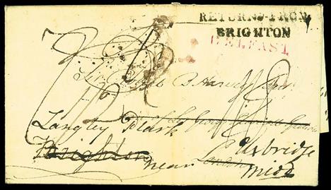
Great BritainPostal History1812 (11 April) entire letter from Belfast to London, redirected to Uxbridge, with red "belfast" and black "returned from/brighton" (Willcocks & Jay SX214) and a variety of manuscript rate markings on the front, datestamps of 15 and 20 April on the reverse; vertical filing fold clear of the handstamps, fine and attractive. Photo Subject to 20% VAT on Buyer’s Premium. For more information please view Terms and Conditions for Buyers.

Lot 41
Great BritainPostal History1815 (18 Dec.) entire letter, with two enclosures, from Belfast to London, redirected to Uxbridge, endorsed "1oz", deleted and replaced by "Above 1oz.", with red "belfast/80" mileage and "Above Privilege" handstamps in red, "Above Weight" handstamp in black, a variety of manuscript rate markings; some minor cover faults due to the enclosures, but a unique and important rarity. The "Above Privilege" marking only recorded in 1801, and the "Above Weight" not previously recorded in black, and both handstamps very rare on cover. Photo Subject to 20% VAT on Buyer’s Premium. For more information please view Terms and Conditions for Buyers.

Lot 49
Great BritainPostal History1820 (9 Oct.) entire letter to Roscrea, rated "8" in manuscript, with Dublin octagonal "paid" in red, partly overstruck by a fine and crisp strike of the rare Crowned Garter "taxes/ws" in red with day, month and year at the centre; fine and scarce. Photo Subject to 20% VAT on Buyer’s Premium. For more information please view Terms and Conditions for Buyers.

Lot 51
Great BritainPostal History1826 (27 May) entire letter from Bath to Dublin, redirected to Castlecomer and then back to Dublin, with manuscript Redirected to "castlecomer/53" mileage, a variety of rate markings, two "A" in Crown inspectors markings, red "t.off/postage to dublin/not paid", a range of transit markings on reverse, including "bath/***109***"; vertical filing fold, otherwise fine and an interesting entire. Photo Subject to 20% VAT on Buyer’s Premium. For more information please view Terms and Conditions for Buyers.

Lot 69
Great BritainPostal History1839 (Oct. 20) four page entire letter from W.J. Curtiss, a Civil Engineer of Blackfriars Road, London, addressed to the Secretary of the Stockton and Darlington Railway, referring to a tragic accident on the line, when a child was killed, because the train could not brake in time, and then explaining, in some detail, a new system of applying brakes to the train. With manuscript Mifsent to and double ring "stockton" c.d.s (31.10), unclear framed red handstamp alongside, on reverse London d.s. (29.10) and intact black seal; light and unobtrusive vertical filing folds, fine and a letter of considerable historical interest especially for the Railway enthusiast. Photo Subject to 20% VAT on Buyer’s Premium. For more information please view Terms and Conditions for Buyers.

Lot 70
Great BritainPostal History1840 (2 Jan.) entire letter from Rathfriland to Dublin, with manuscript "4" in black, backstamped with open Rathfriland d.s. (2.1) in dark green, and with double framed Dublin arrival in orange for the next day (across flap); slight stains but the only recorded example of the Uniform Fourpenny Post for Rathfriland. Photo Subject to 20% VAT on Buyer’s Premium. For more information please view Terms and Conditions for Buyers.

Lot 82
Great BritainPostal History1879 (3 Dec.) envelope from France to London, bearing 1858-79 1d. Plate 220 KF, LH, 1870 ½d. Plate 3 OS, initially uncancelled and with manuscript line and "O" to indicate invalidity (as per U.P.U. regulations), with Dunkerque/nord c.d.s. and "t" in triangle alongside, on arrival in London, the stamps cancelled by three strikes of handstruck "2" and with London "aa/f.b/.de 4/11879" c.d.s. alongside, subsequently charge 2½d. for the remainder of the deficiency; light vertical crease, clear of the adhesives and a trifle soiled; fine. An extraordinary cover, and a probably unique usage. Photo Subject to 20% VAT on Buyer’s Premium. For more information please view Terms and Conditions for Buyers.

Lot 84
Great BritainPostal HistoryValentines1807 two page entire letter with a fine coloured engraving of a man approaching a young lady, playing a lute, surrounded by loving messages; with "2" handstamp, on reverse red 12 O'Clock datestamp of 14 Feb. and with manuscript Refused. Believed to be the earliest recorded 'Refused' Valentine. Photo Subject to 20% VAT on Buyer’s Premium. For more information please view Terms and Conditions for Buyers.

Lot 89
Great BritainPostal HistoryValentines1829 (c.) two page entire letter addressed locally with manuscript 2 and on reverse undated "chippenham/96" mileage marking, containing a part printed and part manuscript Valentine; a few small splits around the folds, fine. Photo Subject to 20% VAT on Buyer’s Premium. For more information please view Terms and Conditions for Buyers.

Lot 163
(x) Great BritainLine Engraved Proofs and Trials"Rainbow" Colour Trials1d. state 2, in dark olive-green on thick, bluish laid paper, [1] with manuscript "Plain" written in the top margin; some trivial paper wrinkling in the corner margin does not detract from this stunning proof. Specialised DP20d. Photo Subject to 5% tax on Hammer Price in addition to 20% VAT on Buyer’s Premium. For more information please view Terms and Conditions for Buyers.

Lot 172
Great Britain1840 One Penny BlackPlate 1aFD, large to very large margins all round, tied by red Maltese Cross cancellation to entire, dated 22 May 1840, originally posted as a paid letter with manuscript "1", addressed to Suffolk and with double ring Cambridge d.s. on the front, redirected to London and the 1d. applied, with red Newmarket (23.5) d.s., London arrival (25.5) on reverse; fine and a stunning cover of exhibition quality. R.P.S. Certificate (2010). Photo Subject to 20% VAT on Buyer’s Premium. For more information please view Terms and Conditions for Buyers.

Lot 233
Great Britain1840 One Penny BlackPlate 1bRC, good to large margins, heavily cancelled by red Maltese Cross cancellation, on entire letter, dated 9 Nov. 1840, from Douglas, Scotland to London, endorsed in red "above the ½oz" and "Paid 1d.", red Paid Tombstone d.s. on the front and framed red "douglas" on the reverse; the cover with a closed tear and filing folds, clear of the adhesive. A rare 1d. black cover with a manuscript weight endorsement. Photo Subject to 20% VAT on Buyer’s Premium. For more information please view Terms and Conditions for Buyers.

Lot 295
Great Britain1840 One Penny BlackPlate 4BK-BL horizontal pair, good to very large margins all round, red Maltese Cross cancellations which leave BB with a clear profile, tiny trace of manuscript at lower right; fine. Photo Subject to 20% VAT on Buyer’s Premium. For more information please view Terms and Conditions for Buyers.

Lot 924
(x) Great BritainThe Crimean WarMail to the Crimea1855 (31 March) envelope to Ireland, inscribed "O.B.M., 77th Regt. Crimea" at lower left, franked watermark Small Crown, perf. 16 1d. strip of three cancelled on arrivalin London, on reverse "post office/british army" datestamp type 2 (code B) for 31 March; also 1855 (26 June) envelope from the same correspondence, similarly franked and endorsed with on reverse "post office/british army" type 2 (code B) datestamps; a few small faults Note: The manuscript initials on the address panels are those of Assistant Surgeon O.B. MillerSubject to 5% tax on Hammer Price in addition to 20% VAT on Buyer’s Premium. For more information please view Terms and Conditions for Buyers.

Lot 927
(x) Great BritainThe Crimean WarMail to the Crimea1856 (12 April) stampless envelope to Ireland, rated "3" in manuscript and inscribed "O.B.M., XI Hussars, Crimea" at lower left, the reverse showing a good strike of the "post office/british army" datestamp type 2 (code B) for 12 April; minor perimeter faults and a short filing note on front at right but otherwise fine. Also1855 (28 Aug.) envelope to the 77th. Regt. Sanatorium Balaclava franked watermark Small Crown perf. 16 1d. pair and single, indistinctly cancelled and 1855 (1 Dec.) envelope addressed to Constantinople franked 1847-54 1/- green, cut square, faults, tied by London barred oval cancellation Subject to 5% tax on Hammer Price in addition to 20% VAT on Buyer’s Premium. For more information please view Terms and Conditions for Buyers.
Lot 128
Hibberd (Shirley). Rustic Adornments for Homes of Taste and Recreations for Town Folk in the Study and Imitation of Nature, 1st ed., pub. Groombridge and Sons, 1856, addn. dec. chromolitho. title and half title, six (complete) col. litho. plts., a.e.g., pubs. dec. gilt cloth, spine faded, a little worn at extrems., 8vo, together with another copy dated 1857, together with, The Ivy. A Monograph; Comprising the History, Uses, Characteristics and Affinities of the Plant......, 1st. ed., pub. Grommbridge and Sons, 1872, add. dec. chromolitho. title and three chromolitho. plts., numerous wood eng. illusts. throughout, a.e.g., pubs. dec. gilt cloth, worn at extrems., 8vo., with, The AmateurÕs Flower Garden. A Handy Guide to the Formation and Management of the Flower Garden and the Cultivation of Garden Flowers, pub. Groombridge and Sons, 1875, title page with manuscript presentation, six folding col. litho. plts., numerous b & w wood engravings to text, occ. pencil marginalia, lacking rear blank, hinges weak, pubs. dec. gilt cloth, 8vo., with another copy dated 1871, plus, The Fern Garden, How to make, keep and enjoy it; or Fern Culture made easy, pub. Groombridge and Sons, 1869, advertisements bound at front and rear, f.e.p. with small hole, eight (complete) col. litho. plts., numerous wood engravings to text, a.e.g., pubs. dec. gilt cloth, with another copy dated 1877, with, The AmateurÕs Greenhouse and Conservatory, pub. Groombridge and Sons, 1873, title page with blindstamp stating ÔPresentation CopyÕ, six (complete) folding col. litho. plts, numerous b & w wood engravings throughout, pubs. dec. gilt cloth, together with another eight volumes similar, with examples by Hibberd, Loudon and Delamer, all 8vo (16)
Lot 135
Lawrence (Richard). An Inquiry into the Structure & Animal Oeconomy of the Horse, 1st ed., Birmingham: printed for the author, 1801, eighteen eng. plts. (including five folding), occasional spotting, contemporary detailed manuscript notes to rear endpaper, armorial bookplate of Bradford Wilmer to upper pastedown, hinges repaired, contemp. half calf, neat recent reback preserving orig. title label, 4to, together with [Youatt, William], The Horse; with a Treatise on Draught; and a Copious Index, 1831, wood eng. illusts., some spotting, contemp. half calf, 8vo, with The Horse, with a Treatise on Draught, edited by Walker Watson, new ed., 1894, wood eng. illusts., some spotting, modern morocco gilt, 8vo, plus one other related (4)
Lot 141
Lowe (E.J., assisted by W. Howard). Beautiful Leaved Plants; Being a Description of the Most Beautiful Leaved Plants in Cultivation in this Country...., pub. Groombridge & Sons, 1865, sixty (complete) col. litho. plts., book plate of Atterbury, pubs. gilt and blind dec. cloth, faded and worn, large 8vo, together with, A Natural History of New and Rare Ferns...., 1st. ed., 1864, seventy-two (complete) col. litho. plts. occ. spotting throughout, bookplate of Thomas Edmund Powell, pubs. gilt and blind dec. cloth, spine faded, sidings stained, bumped and worn at extrems., large 8vo., with, A Natural History of British Grasses, 1864, seventy-four (complete) col. litho. plts. near contemp. ink manuscript ownership signature to verso of frontis., modern gilt, cloth, large 8vo., plus Sowerby (John Edward), English Botany; or Coloured Figures of British Plants, vol.1 (only), pub. George Bell & Sons, 1877, title page detached, addn. half title, 161 col. plts., gutta percha perished, text block loose, hinges broken, a.e.g., pubs. gilt dec. cloth, bumped and worn at extrems., large 8vo., with another copy similar of vol.4, together with, Hendrick (U.P.), The Peaches of New York, pub. J.B.Lyon & Company, Albany, 1917, b & w portrait frontis., presentation stamp to f.e.p., ninety-two col. plts., pubs. gilt cloth, rubbed at extrems., large 4to., with, Kirby (W.F., Sharpe R.Bowdler, et al), LloydÕs Natural History, 18 vols.(mixed bindings), 1896 - 98, numerous col. plts., pubs. gilt cloth, some bindings worn and frayed, two bindings with spine and boards near detached, 8vo., plus four others similar (28)
Lot 172
White (James). A Compendium of the Veterinary Art, Containing Plain and Concise Rules for the Treatment of all the Disorders and Accidents to which the Horse is Liable, 3 vols. (of 4) mixed eds., 1825 - 26, later manuscript ownership signature to title, varying titles to each, numerous eng. plts. modern uniform half morocco gilt, 8vo., together with, Lawson (A.), The Modern Farrier; or The Art of Preserving the Health and Curing the Diseases of Horses, Dogs, Oxen, Cows, Sheep & Swine....., 7th. ed., pub. Newcastle-upon-Tyne, 1825, eng. frontis. and addn. dec. title, five (of 7) uncoloured eng. plts., modern qtr. calf, 8vo., with, Bracken (Henry), Farriery ImprovÕd or a Compleat Treatise upon the Art of Farriery, wherein is fully explainÕd the Nature, Structure and Mechanism of that Noble and Useful Creature, A Horse....., 2 vols., mixed eds. 1752 & 1749, addn. half title to vol. 2, contemp. sheep, rebacked, 12mo., plus, Brown (Thomas), The Complete Modern Farrier...., 31st. ed., pub. Edinburgh, 1900, fourteen (complete) col. litho. plts., modern half calf, gilt dec. spine., 8vo, with another twelve volumes on farriery (19)
Lot 233
Morden (Robert). A collection of twelve maps [1695 or later], twelve uncoloured engraved maps, one map (Somerset) with near contemp. manuscript to verso causing slight showthrough, one map (Cornwall), trimmed to neat line, each approx. 365 x 425mm, various condition. The maps comprise of:- Somerset, Cornwall, Britannia Saxonica, Herefordshire, Bedfordshire, East Riding of Yorkshire, West Riding of Yorkshire, North Riding of Yorkshire, Durham, Northumberland, Huntingdonshire [and] Cambridgeshire. (12)

Lot 237
North Pole. Cloppenburg (Johannes), Septentrionalium Terrarum descriptio, pub. Amsterdam, c.1630, hand coloured engraved map, four inset circular vignettes of sub-arctic islands, 185 x 250mm, French text on verso, together with, Wyld (James), Chart of the Arctic Regions from the Admiralty Surveys [1849], engraved hand coloured circular map, with a dedication to Lady Franklin (Sir John FranklinÕs widow), central fold split with slight loss, repaired on verso, old folds, several marginal repaired closed tears, near contemp. manuscript annotations to upper margin of map, 400 x 450mm. The first item described was based on MercatorÕs earlier map of 1595. The pole is shown as four islands bisected by rivers. Published in the ÔAtlas sive CosmographicaeÕ. P.Burden. The Mapping of North America. no. 225. (2)
-
33306 item(s)/page