We found 32020 price guide item(s) matching your search
There are 32020 lots that match your search criteria. Subscribe now to get instant access to the full price guide service.
Click here to subscribe- List
- Grid
-
32020 item(s)/page

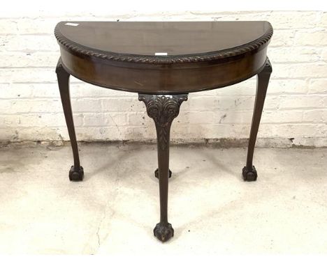
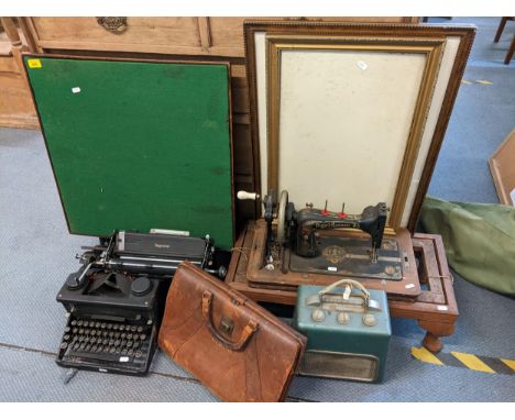
Lot 209
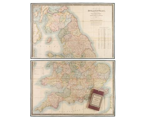
Folding Maps. A collection of nine folding maps, mostly 19th century, engraved and lithographic regional and touring maps, including Wyld (James). A New Map of England & Wales Projected upon the Trigonometrical Operations made for the General Survey of the Kingdom, James Wyld (Successor to Mr Faden), 1st. January 1830, large engraved map with bright contemporary hand colouring, sectionalised and laid on linen on two sheets, calligraphic title, table of the altitudes of the principal mountains and table of explanation, slight offsetting, edged in green silk, each sheet approximately 625 x 950 mm, paper endpapers, contained in a contemporary cloth slipcase with a publisher's printed label to the upper cover, together with Wallis (John). Wallis's New and Correct Map of the Post Roads of England & Wales, 1790, engraved map with contemporary outline colouring, sectionalised and laid on hessian, some staining, small holes where old folds cross, old manuscript ownership signature to the upper margin, 555 x 470 mm, contained in a contemporary marbled card slipcase with publisher's printed label to the upper cover with an additional manuscript ownership signature, heavily worn and frayed, with Cassell, Petter, Galpin & Co. (publishers). Map of Greater London, printed by Edward Stanford, circa 1890, folding lithographic map laid on linen, slight spotting and staining, 740 x 630 mm, contemporary cloth boards with the gilt letters 'J. H. L.' to the upper siding, plus Johnston (W. & A. K. publishers). Northern Part of Ross and Cromarty Shires, Compiled from Actual Surveys by John Craig, Glasgow, circa 1850, engraved map with contemporary outline colouring, sectionalised and laid on linen, inset map of Lewis, 1020 x 700 mm, contained in a contemporary blind-stamped cloth slipcase, and Brion de la Tour (Louis). Cartes des Postes D' Allemagne et des États Voisins..., Paris, 1791, engraved map with contemporary outline colouring, sectionalised and laid on linen, edged with pink linen, 730 x 1060 mm, two string ties in the upper corners, with another four folding maps, including examples by or after Ordnance Survey, Foley. Headley and Dufourcet, various sizes and condition, with Lewis (Samuel). A Topographical Dictionary of England..., 1831, folding engraved map of England and Wales and forty (only) uncoloured engraved county maps (including 10 folding), bookplate of Earl Granville, contemporary half gilt with gilt decorated spine, upper board detached, worn at extremities, 4to, plus Taylor (A. E.). Twenty-five City Plans, circa 1930, uncoloured photolithographic plans with English text below and on the verso of each map, map size approximately 120 x 180 mm, and Blomfield (Ezekiel). Lectures on the Philosophy of History..., 1819, printed title, advertisement and contents list, twelve (complete as list) engraved hemispherical maps with contemporary hand-colouring, partially uncut, slight spotting throughout, contemporary boards, 4to, together with Kent. Porcelain plate, possibly Coalport, circa 1880, colour transfer design featuring a map of the county of Kent, on a white background with a gilt and floriate rim, 225 mm diameter, and Treen. Spooled Length of Ribbon, circa 1880, yellow ribbon contained between two wooden circular discs, one disc painted, the other with an uncoloured circular lithographic map centred on Tunbridge Wells, diameter 55 mm, with a vellum indenture dated 1690, with one red wax seal and a small attached simple manuscript map, overall size 650 x 750 mmQTY: (39)
Lot 218
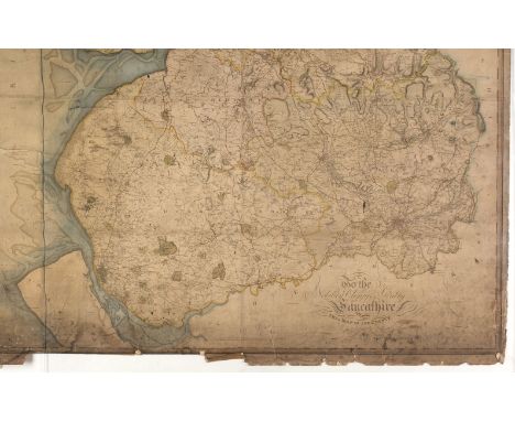
Lancashire. Greenwood (C. ), Map of the County Palatine of Lancaster from an Actual Survey, made in the Year 1818..., W, Fowler & C. Greenwood, December 1st. 1818, large-scale engraved map on six sheets, laid on linen, contemporary outline colouring, calligraphic cartouche and dedication, uncoloured engraved vignette of Liverpool, table of explanation and compass rose, heavily dust soiled, some staining and spotting, occasional small closed tears affecting the printed image, lower margin heavily frayed with slight loss and several closed tears, the upper margin attached to a wood roller, 1980 x 1360 mm, together with Burdett (P. L.). A Chart of the Harbour of Liverpool with the Soundings at Low Water Spring Tides, 1771, hand-coloured engraved chart, old folds, slight staining, some marginal chipping and fraying, several marginal closed tears affecting the printed image, 390 x 520 mm, with Yates (William & Perry George). A Map of the Environs of Liverpool, Drawn from an Actual Survey taken in the Year 1768, published August 29th 1769, uncoloured map, engraved by Thomas Kitchin, old folds, some staining and dust soiling, occasional small holes where old folds cross, appears to be laid on later card, 350 x 470 mm, framed and glazed, plus Murray (T. L.). Cheshire, 1830, engraved map with contemporary outline colouring, slight marginal staining, occasional marginal closed tears, 360 x 450 mm,QTY: (4)
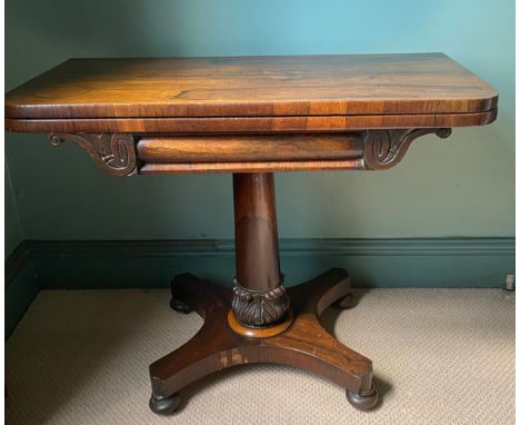
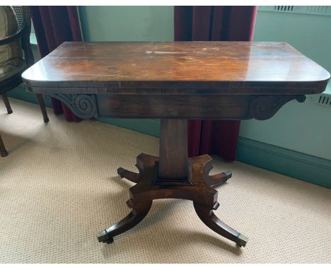
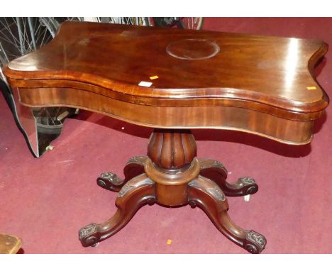
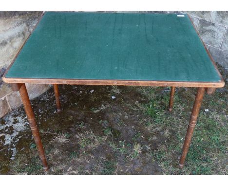
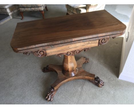
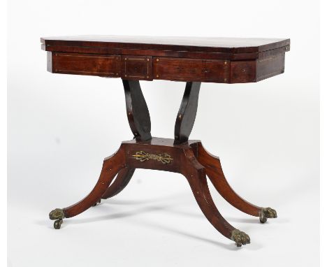
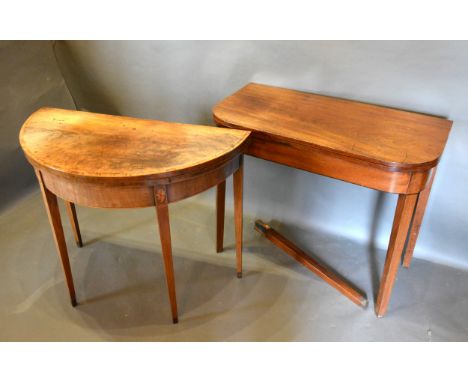
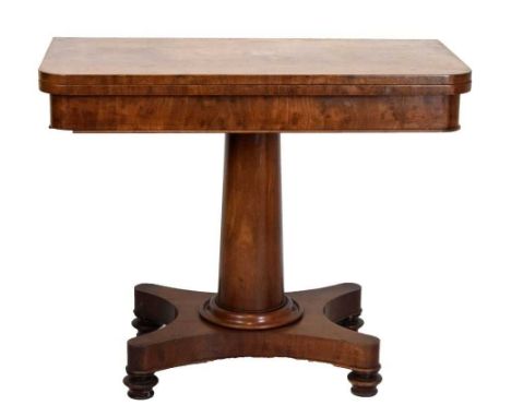
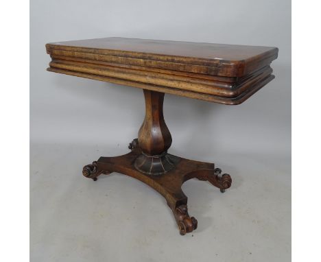
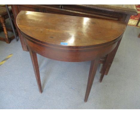
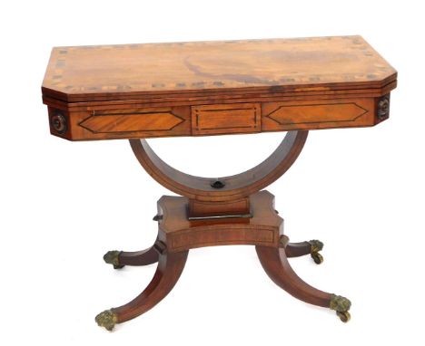
Lot 379
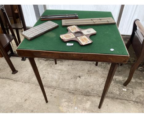
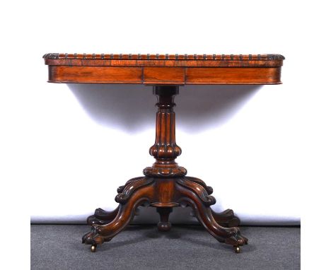
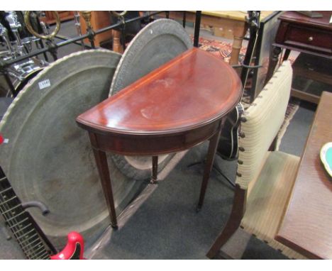
William IV rosewood card table, replaced baize, fluted swollen column and craved four-arm base, lion paw feet, on casters, width 92cm, depth 46cm, height 76cm.Condition report:There are old splits occurring to the top surface, mostly along grain lines, but the longest does stretch almost half the width. The front left and right corners have blistering and splitting to the veneer. The interior outline border also has some sections of veneer lifting. There is movement to the column, but the base section is sound.
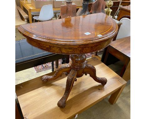
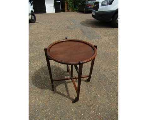
Lot 195
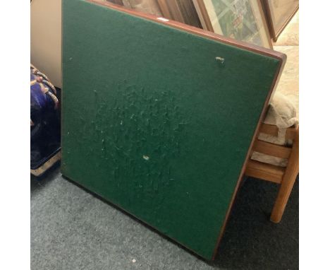
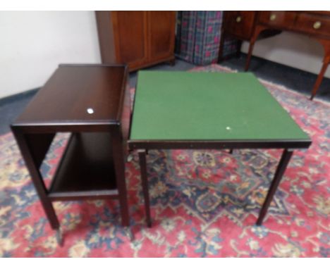
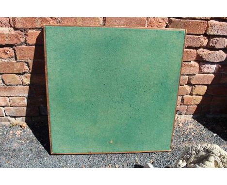
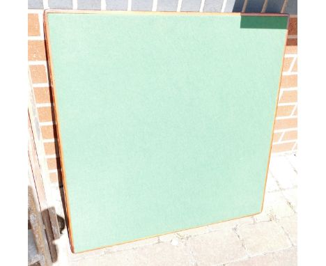
A late Victorian aesthetic-style ebonised & gilt card table inset green baize to the fold-over top, on four ring-turned tapered legs with ceramic castors, bears label “TRAPNELL & GANE, Upholsterers, 29 College Green, Bristol”, 37¾” wide x 29” high x 18½” deep (front castor requires restoration, split to top).

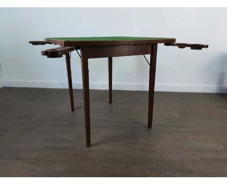
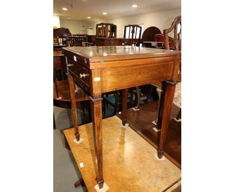
Lot 354
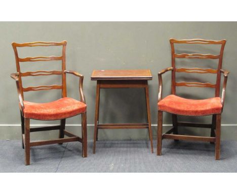
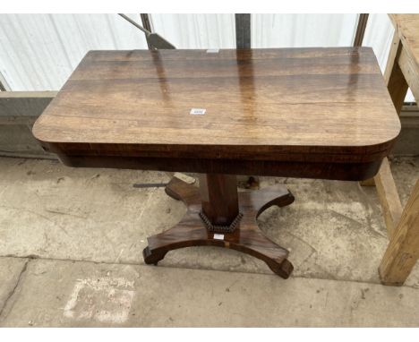
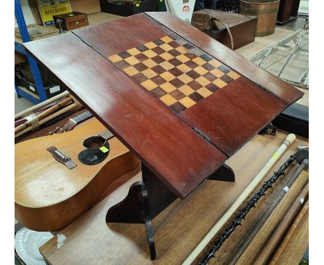
A small group of occasional furniture consisting of a circular table, a metamorphic travelling desk, a 19th century mahogany fold over card table, two Georgian style elbow chairs, a dining chair and a Windsor style chair (7)The circular occasional table with old repairs and damages to the top; the desk with minor marks, dents and scratches overall due to use but otherwise in good condition; the chairs all with some wear, mostly structurally sound, one elbow chair without stretchers with repaired front left leg
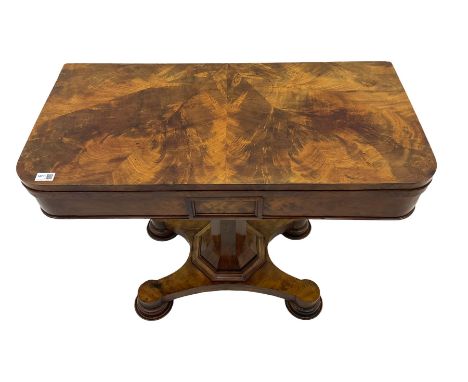
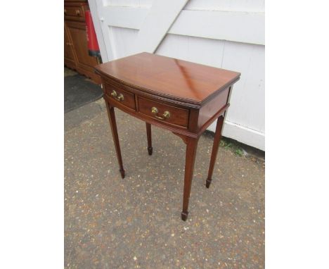
Lot 2337
An Edwardian mahogany 2-tier fold over card table, with inlaid floral decoration, W51cm, H68cm, D38cmThe fold over card table is in nice over all condition. The top has some surface scratches and marks. There is a burn mark also. Surface scratches and scuff marks to the legs, interior of the top is in good condition, with just some surface scratches through use only.
-
32020 item(s)/page