We found 1765 price guide item(s) matching your search
There are 1765 lots that match your search criteria. Subscribe now to get instant access to the full price guide service.
Click here to subscribe- List
- Grid
-
1765 item(s)/page


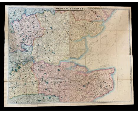
Lot 590
Map: Irish (Standford (E.)) Standford's New Map of Ireland in Countries and Baronies on the Basis of the Ordnance Survey and the Census, folding, hand coloured in outline, L. (Ed. Stanford) n.d. (c. 1860), approx. 99.5cms x 79cms (39" x 31"), linen backed, original cloth slip case (label worn), as a map, w.a.f. (1)

Lot 428
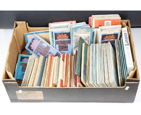
Victorian/Edwardian and Later Scrap Albums and Ephemera (Qty), two albums, one containing typical scraps and cuttings, mainly pictorial, includes Gamages 1909 Christmas advert, (album spine missing), the other Illustrated London News, mainly the War in Egypt 1882, (album G), later ephemera, magazines, practical Mechanics Wonders of the Queen Mary, The King's Navy, Straits Annual 1938, Lincolnshire Chronicle 1933, Blue Peter 1936, 1928, Illustrated 1940, Motorboat and Yachting 1938, Daily Deeds of Sammy The Scout, Illustrated London News 1960s (3), Bacons Motoring and Cycling map South Devon, Ordnance Survey IOW, both linen backed, National Benzole Passing The Milestones, and various other mainly postwar items of ephemera, P-VG, (Qty)


Lot 1708
A quantity 19th century Staffordshire Ordnance Survey Maps to include Staffs Sheet XVIII Trentham With Hall 1900, 13 Hall Demolished x6 1924, Staffs XVIII 10 Longton Hall of 1900 and 1924, 11 Longton / Meir 1900 and 2x 1924, Staffordshire XVIII Knowl Wall 1924, Estate Map Normacot & Lightwood possibly an auction map, a Fragile a/f Map of the City of Stoke-on-Trent, Staffs Stoke Road Schemes from the 1930's, Staffordshire Coal & Iron Co. Ltd. Survey Map of Light Railway Trentham Gardens 1934, Garden Survey Map of Spring Valley Trentham Gardens 1934 detailing the location of specific plantings, Hand-Drawn Plans of Trentham Dairy incl. First Floor, Proposed Farm Buildings at Yarnfield Stone for Evanson Esquire, Hand Drawn Plan of Trentham Institute x2 and an Arditt & Haunton Small Plan of the Trentham Estate etc.

Lot 420
Railwayana - a collection of assorted Railway maps and posters comprising; Alan Young illustrated railway map of the South West, Great Orme Tramway & Tours poster, Devon & Cornwall photocopied map, GWR City & County Borough of Bristol 1903 dated map, 1953 dated Ordnance Survey map of Torquay and x7 Cheffins prints of bridges and viaducts.

Lot 149
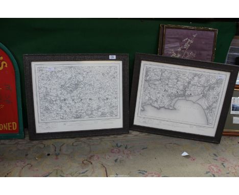
Cartography.- Cary (John) A New Map of England...1821, hand-coloured engraved map, dissected and mounted on linen, c.555 x 510mm., lightly soiled, folding into original paste-paper slip-case, names in ink to upper cover, a little worn, 1823 § Ministry of Finance, Egypt. Survey of Egypt. A List of Maps and Plans corrected to March 31, 1920, key plate and 2 folding colour maps, original cloth-backed printed green boards, Cairo, 1921 § Harley (J.B.) Ordnance Survey Maps; a Descriptive Manual, illustrations, original printed boards, Southampton, 1975; and c.30 others on cartography and some other folding maps including Walker's Suffolk and Warwickshire and some Blackwood's Scottish county maps, v.s. (c.40)


Lot 86
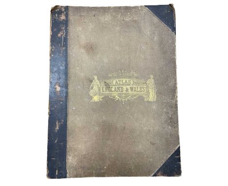
Bartholomew (John). The Imperial Map of England & Wales According to the Ordnance Survey, with the Latest Additions; Shewing clearly every Feature of the Country, Railways and their Stations, Roads, Canals, Rivers, Gentlemen's Seats &c. &c., On a Scale of 4 Miles to an Inch, A. Fullarton & Co., [1866], index and a double-page calligraphic title, sixteen double-page colour lithographic maps, sheet 16 divided into three separate maps, text block detached, contemporary half calf gilt, boards detached, lacking spine, slim folio.
Lot 163
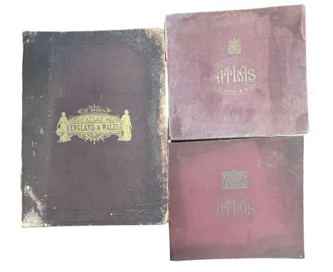
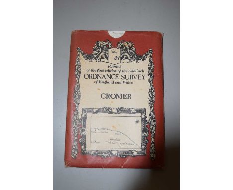
Ordnance Survey Atlas of Scotland 1924 and England & Wales 1922. 2 volumes, printed at the Ordnance Survey office Southampton, both bound in orig cloth, oblong folios. With linen backed colour maps. Spine defective to the England and Wales volume. With one other “The Imperial Map of England & Wales according to the Ordnance Survey.. John Bartholomew. Large slim folio, orig binding, front board detached, colour maps. [3] C1841.


Lot 564
A BOXED LIMITED EDITION ORDNANCE SURVEY ONE-INCH SEVENTH SERIES MAP SET, produced to commemorate the bi-centenary of Ordnance Survey, with certificate, number thirty nine from a limited edition of sixty five, contains one hundred and eighty nine maps, box measures 99.5cm x 81.5cm x 6.5cm (1) (Condition Report: appears ok, a little scuffing to corners of box, certificate has small creases to corners, maps individually unchecked but appears complete and in good condition)

Lot 488
THREE BOXES AND LOOSE MISCELLANEOUS SUNDRIES, to include a 1928 linen Ordnance Survey map of Bromsgrove and Alvechurch, a collection of five tobacco pipes, maker's names include K&P Peterson, Bentmore Junior, Claude Romain Jura, Falcon, etc. jewellery boxes, wall clock, a small vintage chrome 'Jet Extinguisher' car fire extinguisher, a chrome automobile fitting with five enamel automobile badges fitted comprising RAC, Circuit Van Zandvoort, Wallasey Rally 1956, RAC Internationale Tulpenrallye and an AA badge No. 7051604, etc. (s.d) (3 boxes + loose)
Lot 180
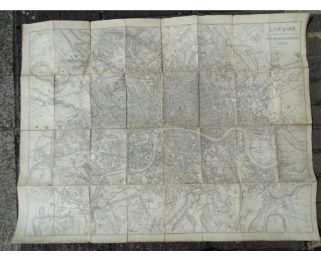
Davies (B R), London Post Office Directory 1870, printed by J M Johnson, (no slip case); Ordnance Survey Map of SE Environs of London, Sheet 271; The Illustrated Map of London Issued with Seven Days in London Apr 22nd 1900, a Reynolds' Large Coloured Map of London and Its Suburbs and a London Streets Directory, (5).

Lot 136
Pine (John). Two sea charts (on one sheet) originally published in 'The Tapestry Hangings of the House of Lords, Representing the Several Engagements between the English and Spanish Fleets, in the Ever Memorable Year MDLXXXVII ..., London: John Pine, 1739, two engraved sea charts (numbers VII & VIII) of the English Channel from the Isle of Wight to Dover, showing the progress of the Spanish Armada and the deployment of the English fleet, after H. Gravelot, each map displayed within highly decorative borders, the maps printed in blue, the borders in black, trimmed to the plate mark and laid on later paper, 380 x 60 mm, together with Weiland (C. F.). Ireland entworfen und geziechnet..., 1837, engraved map with contemporary outline colouring, slight staining, 615 x 495 mm, together with Von Reilly (Frans Johann Joseph). Das Konigreich Ireland Nro 89, Vienna, circa 1789, engraved map with contemporary wash colouring, orientated to the east, 225 x 295 mm, with Radefeld (H.). Neueste Karte von Ireland..., 1844, engraved map with contemporary outline colouring, very slight soiling, 380 x 310 mm, plus Ordnance Survey (publishers). Index to the Townland Survey of the County of Antrim and the County of the Town of Carrickfergus, 1833, engraved map with contemporary wash colouring, sectionalised and laid on linen, two inset tables, the map edged with red silk, 620 x 970 mm, with another three similar maps (including one duplicate) by or after Von Stülpnagel and Druck und Verlag, various sizes and condition, plus a plan of the siege of Kinsale, a map of Scotland by Stieler and a French lithograph of Edinburgh and Taylor (A. E.). Four 'Esso' Pictorial maps: Esso Pictorial Plan of the West Country, Esso Pictorial Plan of the Eastern Counties and the Midlands, Esso Pictorial Plan of the Roads of the South Coast [and] Esso Pictorial Plan of the Principal Islands of Northern Britain [on sheet with] Esso Pictorial Plan of the Principal Islands of Southern Britain, 1932, together four colour photolithographic pictorial maps, each sheet approximately 305 x 465 mm, together with Pratts High Test Plan of the Great North Road, Pratts High Test Plan of Scotland, Pratts High Test Plan of the West County [and] Pratts High Test Plan of the Bath Road, 1930 - 32, four uncoloured lithographic maps, old folds, various sizes, good condition, with three late 19th & early 20th-century geological charts, maps and booklets, plus Thomson (John). Northern part of Western Isles, part of Ross Shire [and] Middle part of Western Isles part of Inverness Sh: 1822, two engraved maps with contemporary outline colouring, some dust soiling and staining, each approximately 530 x 690 mm, and four duplicate mid to late 19th-century uncoloured engraved Ordnance Survey maps of Somerset, each approximately 650 x 800 mm, various condition, with a modern colour reproduction of the Mappa Mundi, sheet size 650 x 480 mm, plus approximately 55 engravings and colour lithographs of heraldry and flags, various sizes and condition, and a late 18th-century uncoloured engraving of Fountains Abbey, trimmed to the image, 175 x 345 mmQTY: (approx. 99)
Lot 75
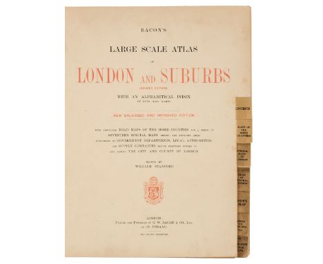
Bacon (G. W., publisher). Bacon's Large Scale Atlas of London and Suburbs (Revised Edition) with an Alphabetical Index, circa 1910, title page and contents list, 26 double-page and folding social, geographic and industrial maps and a 34-sheet map of Greater London, very slight spotting, endpapers and pastedowns with some water staining, publisher's half morocco gilt, a little stained and worn, folio, together with Wyld (James). Map of the County of Surrey from Trigonometrical Survey with the Roads, Parks and Railways, 2nd edition, circa 1860, engraved map with contemporary outline colouring, sectionalised and laid on linen, large uncoloured cartouche and table of explanation, some dust soiling and slight staining, marbled endpapers, 850 x 1130 mm, with Stark (J.). Stark's Geographical, Historical, Chronological, Biographical, Mineralogical and Railway Chart of the United Kingdom of Great Britain, published Glasgow, circa 1852, lithographic map with contemporary outline colouring, sectionalised and laid on linen, slight overall toning, frayed with slight loss to the printed image, edged in green silk, 1000 x 750 mm, contemporary blind-stamped morocco boards, lacking upper board, size when folded 265 x 175 mm, plus Ordnance Survey (publishers). Map of Putney, Wandsworth and Environs on a scale of 25 inches to the mile, circa 1870, large colour lithographic map, sectionalised and laid on linen, 1350 x 2040 mm, marbled endpapers, and Stanford (Edward, publishers). Stanford's Map of the River Thames from Richmond to Lechlade, circa 1950, folding colour lithographic map, slight spotting, publisher's paper wrappers, 210 x 3300 mm, with London Docks. Port of London Authority. Plan of the India & Millwall Docks [and] Port of London Authority. Plan of the Tilbury Docks, 1968 & 1969 respectively, the first map, colour printed, sectionalised and laid on linen, 655 x 620 mm, the second an uncoloured map, sectionalised and laid on linen, 890 x 725 mm, both with marbled endpapers and uniformly bound in envelope style blue boards with gilt title to the upper cover and secured with a steel 'popper' with one other map similarQTY: (8)
Lot 93
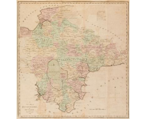
Devon. A collection of 25 county and road maps, mostly 18th & 19th-century, engraved and lithographic maps, including examples by or after Tunnicliff, Teesdale, Langley, Harrison, Owen & Bowen, Duncan, Ordnance Survey, Creighton/Lewis, Wallis, Laurie & Whittle, Hatchett, Kitchin, Van den Keere, Taylor/Blome, Paterson, Smith, Dawson, Archer, Weller and Pigot, various sizes and condition, together with a mileage triangle and descriptive text for Devonshire by Robert Morden, the descriptive text for Devon from 'The New and Complete British Traveller' and the county map, mileage table and descriptive text from James Pigot's 'Pocket Topography and GazetteerQTY: (28)
Lot 99
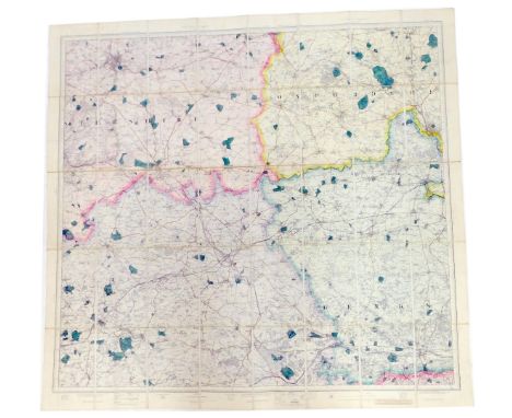
Doncaster. Ordnance Survey, 8 sheets on a scale of 1:500 (10.56 feet to the mile) 1901-02, lithographic map sections, each sheet split into 4 sections and re-mounted on to 8 sheets, sectionalised and laid on linen and if conjoined comprising the entirety of Doncaster, some red and blue ink annotations, some dust soiling and slight staining, if conjoined the overall size would be approximately 3880 x 3270 mm, contained in a contemporary cloth 'envelope style fold-over' case, some flaps detached, heavily worn and rubbed, size of folder 345 x 500 mmQTY: (1)NOTE:Formed from a complete set of 19 large-scale sheets. The sheet numbers are CCLXXVII 13.17, CCLXXVII 13.18, CCLXXVII 13. 19, CCLXXVII 13.21, CCLXXVII 13.22, CCLXXVII 13.23, CCLXXXV 1.6, CCLXXXV 1.7, CCLXXXV1.8, CCLXXXV1.9, CCLXXXV1.11, CCLXXXV1.12 [and] CCLXXXV 1.13
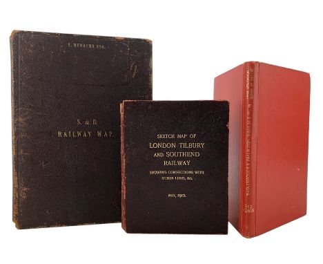
Lot 8613
Three folding cloth bound maps, including District Map Shewing the Stockton & Darlington Railway and Branches, 1858, M & M W. Lambert, Newcastle-on-Tyne; Ordnance Survey of England and Wales, Middlesbrough & Darlington Land Utilisation Survey of Britain, 1931-2; and Sketch Map of London Tilbury and Southend Railway, Showing Connections with Other Lines, May 1910 (3)
Lot 833
Six 19th and 20th century folding maps of Sussex; an Ordnance Survey (318), a W.H. Smith & Son map, a Smith & Son 172 Strand 1864, two Walker’s County Maps, and a Kelly’s Map***CONDITION REPORT***PLEASE NOTE:- Prospective buyers are strongly advised to examine personally any goods in which they are interested BEFORE the auction takes place. Whilst every care is taken in the accuracy of condition reports, Gorringes provide no other guarantee to the buyer other than in relation to forgeries. Many items are of an age or nature which precludes their being in perfect condition and some descriptions in the catalogue or given by way of condition report make reference to damage and/or restoration. We provide this information for guidance only and will not be held responsible for oversights concerning defects or restoration, nor does a reference to a particular defect imply the absence of any others. Prospective purchasers must accept these reports as genuine efforts by Gorringes or must take other steps to verify condition of lots. If you are unable to open the image file attached to this report, please let us know as soon as possible and we will re-send your images on a separate e-mail.
Lot 355
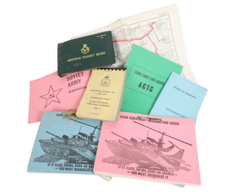
MILITARY INTEREST - a selection of military ephemera, associated with an RAF helicopter pilot, various instruction manuals, possibly relating to the Cold War conflick, including several FASB Equipment Recognition Guides, Soviet Army Organisation Tables, the UK Restricted Aircraft Recognition Booklet issued in 1979, various Recognition material for the Warsaw Pact Electronics, an Ordnance Survey map of West Berlin published by The Director Of Military Survey, Ministry of Defence UK 1975, etc
Lot 419
(Mining interest). A comprehensive study of geology and mining within Cornwall Mine Surveys, OS maps, facsimile prints of historic plans &c. &c, by Martin Mount, former geologist to Geevor Mine. An extremely large collection consisting of large Second Edition OS maps with annotations, copies of historic plans and acetate transparencies, mostly good to very good, with the larger works suffering nibbles and loss, the whole collection indexed and kept in order, with examples listed as follows;Cornwall Sheet LXXIII.1, Cape Cornwall, Second Edition 1908, detailed survey with copious hand annotations showing mines and loads &c; With printed transparency LXXIII.1, Cape Cornwall; With seventy four mostly second edition Ordnance Survey maps, covering West Cornwall, appox 76x 106cm, mostly vg, indexed and kept in order;OS maps of St Austell China Clay area, coloured with annotations by Pearce, Jenkin & Bawden of Redruth (amongst others), with a large number of unannotated OS maps, strictly of Cornwall and acetate transparencies, approx 50 +;Acetate transparency of Cornwall Sheet LXXIII:5, showing copious mine lode's for St. Just Amalgamated, WH Cunning, Goldens, and Bellan mines; Facsimile printed 'A Geological Map of Saint Just Mining District, Cornwall, 1867; 'Bocaswell United Tin & Copper Mines, Limited. Sketch Plan of Properties,' printed map with colour key, folded with repairs, no date but thought to be early 20th century; Acetate transparency of Cornwall Sheet LXXIII.2, showing copious mine lode's for Botallck Mine, Carnyorth Mine, Wheal Boys and Spearn Consols;Large collection (approx 50+) of mostly second edition OS maps, some with hand colouring, all areas within Cornwall, including, Lanivet, Pydar, Tawna Moor, Luxulian, Roche, Withiel, Bodmin Moor, Colliford Downs, Porquin Bay, &c.&c. indexed and in order;Acetate transparency showing lodes for Geevor Mine, North Levant Mine, Spearn Consols, Boscaswell Downs MineWheal Hearle &c, &c; Acetate transparency of Cornwall Sheet LXVII showing Morvah Consols, Morcah Unted and Zennor Mines; With five other acetates and their paper counterparts;'Plan of the Sett Belonging to Wheal Darby Mine....1841,' facsimile print; 'Map of the St. Agnes Mining District, Cornwall. 1870,' facsimile print, staining to bottom; 'Clowance Wood, Mining District, 1863,' facsimile print; 'Plan of Cosgarne Downs,' facsimile print; 'Polstain and Bosore in the parish of Kenwyn,' facsimile print; 'A Geological and Mining Map of the Parish of Gwennap....1845,' facsimile print; With acetate transparencies and paper counterparts;'Plan of the Town of Redruth in Cornwall, 1855,' facsimile print on 17 large sheets;Facsimile prints including, 'Map of the Chiverton Mining District, Perranzabuloe'; 'Geological Map of the Mining District of Cornwall, Between Camborne and Chasewater....1819'; 'Wheal Wentworth in the Parish of Redruth,' surveyed by R Thomas, Falmouth, 1825; 'Map of Towan Mines in Cornwall'; 'Penden-an-Drea and Wheal Sparnon Mine Sett in the Parishes of Redruth and Gwennap,' with a corresponding traced overlay showing adits and lodes; With numerous other facsimile prints.Facsimile prints including 'A Mineralogical Plan of the Manor of Treveneague and Penberthy....1791; 'Plan of Part of the Manor of Treveneague and Lands adjoining: Situate in the Parish of St Hilary, Cornwall'; Geological Mao of the Great Huel Vor...1863'; 'Plan of Treskerby, Wheal Busy, & Tolgus Mining District'; 'Map of Camborne, Illogan, Redruth & Gwennap Mines' by Robert Symons & Son, Mineral Surveyours, Truro'; &c. &c.With many more, too many to list.

Lot 517
SIX BOXES OF BOOKS AND EPHEMERA, to include a school exercise book belonging to a George Picker, who went to Leadenham School, dated October 26th 1846, with a short note about George inside, three photographs of an Edwardian gentleman, two Shakespeare Memorial Theatre/ The Royal Shakespeare Theatre season programmes from the early 1960s, an Ordnance Survey map of Ruthin and surrounding areas dated 1879, approximately one hundred and forty books in hardback and paperback formats, mainly fiction including antiquarian and vintage titles, authors to include Kathy Reichs, Lynda La Plante, Terry Pratchett and Patricia Cornwell, with some history and other titles (6 boxes) (sd)
Lot 42
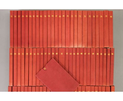
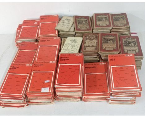
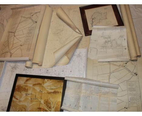
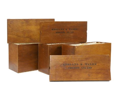
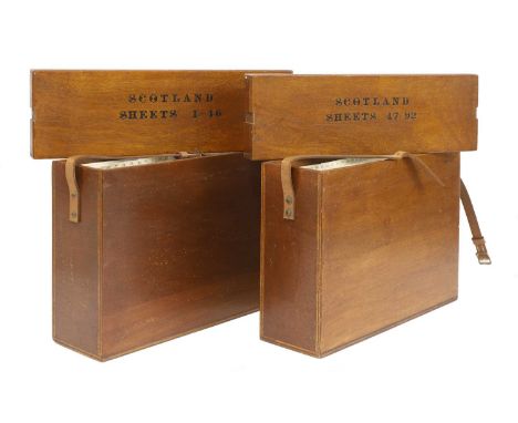
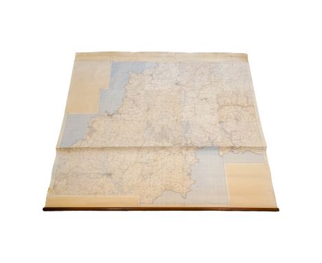
Ordnance Survey of England and Wales: Complete set of the 7th Series. 190 one-inch colour maps, each dissected into 6 sections laid on linen, with numbering tabs, preserved in the publisher’s three original purpose-made wooden map chests, each with the relevant index sheet pasted to the inside of the lid. Plus 3 index maps, plus a loosely inserted letter on 'Ordnance Survey' headed paper, dated 8 July 1959 and addressed to General R L Brown, CB. CBE. This set and the following set for Scotland, being retirement presents. A VERY GOOD/FINE SET (3)
Lot 227
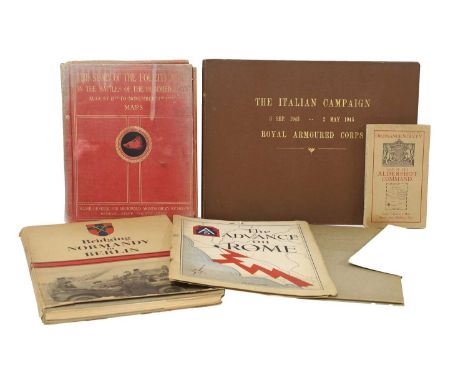
MILITARY, WW2: Bridging Normandy to Berlin, 1945, folio, DW, fully illustrated; Montgomery, Major General: The Story of the Fourth Army in the battles of the hundred days, August 8th to November 11th.1918. Map volume only, with 19 folding maps Plus 5 out of 7 folding Panoramic views; Letter from R L Brown, Brigadier director of Survey Allied forces Headquarters US Army, 16 Feb 1945. Presentation copy: enclosed, and present, a copy of 'the Advance on Rome'; A collection of General Montgomery’s personal messages to the Eight Army, 1944, in plain card boards; The Italian campaign 3 Sept 1943 – 2 May 1945 Royal Armoured Corps; Two ordnance survey maps: Aldershot Command; and Syria, Beirut section; 'Utah Beach to Cherbourg'. 1 October 1947, with the maps; 'Beachheads and Mountains'. Mediterranean Theatre of Operations, U.S. Army. June 1945; 'Fifteenth Air Force A Summary of its Operations and Results'. 1 November 1943 – 8 May 19. Classified Restricted; 'Goodbye to All This' 518 Field Survey Company. Royal Engineers. Inscribed by the men to Brigadier R.Ll.Brown OBE [Our client's Grandfather, he was head of survey for the 8th Army, and at AFHQ in Italy]; & 'History of AFHQ'. 9 paperback volumes. Volume 1 classified Confidential; remaining volumes classified Restricted (qty.)
Lot 721
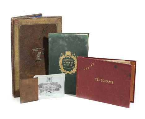
AN ORDNANCE SURVEY MAP OF YESTERC.1855paper on canvas, the green leather cover tooled with a crown and thistles and stamped 'W. & A.K. Johnstone, Edinburgh', together with an Edwardian gilt tooled leather stationery folder, the front applied with the Marquess of Tweeddale's crest and the motto 'Spare Nought', the back dated '1905', a Yester House Telegram folder, a Yester House glass ashtray and a copper bookplate engraved with the Marquess of Tweeddale's coat of arms (5)30cm (max)ProvenanceParker & Morris: The Art of Decorating.The Marquess of Tweeddale, Yester House, Gifford, East Lothian.PLEASE NOTE THAT THIS LOT IS TO BE OFFERED WITHOUT RESERVE.

Lot 337
The Conyngham Plunkett Collection of Estate Maps relating to land owned in County Monaghan. Map of Robert Black’s Holding in Claddagh, Dromore and other holdings in other locations. Hand drawn and coloured. Folded maps. Circa 1780-1808. Some with description of property. Surveyors Alexr. Fleming, John Dolan and W. Douglas. William Plunkett , Lord Chancellor and other members of the distinguished family. A wonderful and unique collection of 27 original pre-Ordnance survey estate maps

Lot 123
The ‘Maiwand survivor’ Abyssinia and Afghanistan pair awarded to Major-General C. M. Griffith, 1st Bombay Grenadiers, who took over command of his Regiment after Colonel Anderson was severely wounded; when the inexperienced Jacob’s Rifles broke and fled, Griffith was ‘Conspicuous in his Efforts to Steady his Men’ and motivate the Bombay Grenadiers to ‘Fight On’, saving his Regiment’s reputation and averting a total disaster; afterwards he reconstituted a fighting unit from the surviving Grenadiers and commanded it during the Defence of Kandahar City and the subsequent victory at the Battle of Kandahar Abyssinia 1867 (Captn. C. M. Griffith. Bombay Staff Corps); Afghanistan 1878-80, 1 clasp, Kandahar (Lieut. Col. C. M. Griffith. Bo. N.I.) both fitted with contemporary silver riband buckles, nearly extremely fine (2) £4,000-£5,000 --- Charles Matthew Griffith was born at Poona on 19 October 1834, the son of Colonel Julius George Griffith, later General and Colonel Commandant, Bombay Artillery. He was educated at Cheltenham College, nominated as an HEIC Cadet, and passed the Military Committee at East India House on 4 February 1852. After being twice rejected for his weak English and Latin, he was admitted to Addiscombe on 6 August 1852, and commissioned Ensign in the Bombay Infantry on 8 June 1854, at the age of 19. He arrived in Bombay on 23 September 1854 for regimental service with the 1st Bombay Native Infantry (Grenadiers). From June 1859 he was variously employed with the Irregular Cavalry, the Sind Judicial and Police departments, and as Superintendent of Police for the Great Indian Peninsular Railway. The March to Fortress Magdala By 1868, Griffith was a Captain in the Bombay Staff Corps. He was first sent on active service during the Abyssinia Campaign, the most logistically challenging but among the best executed of the British expeditionary wars up to that time. He was given responsibility for organising and commanding ‘A’ Division Highland Transport Train, 1st Brigade of the 1st Division, Abyssinian Field Force. He also commanded the stretcher-bearers who recovered the wounded on 10 and 13 April 1868 from the battlefields of Arogee and Magdala. He was created Brevet Major on 15 August 1868 and was four times Mentioned in Despatches: London Gazette 16 June 1868: ‘The bandsmen and a party of Punjab muleteers were also organised under command of Captain Griffith and furnished with stretchers for the removal of wounded men from the field.’ London Gazette 30 June 1868: ‘Captain Griffith [and other officers] have distinguished themselves by their zeal and activity and deserve special notice.’ London Gazette 10 July 1868: ‘Captain Griffith [and other officers], Land Transport Corps, commanded the first Divisions that were raised, are strongly recommended by the Director of Transport Corps for the extent and value of their assistance.’ London Gazette 7 August 1868: ‘The working of the Train next comes into consideration, which commenced with the arrival of Captain Griffith, with the advance Brigade... The Train was divided into four divisions... and Captain Griffith commenced the formation of “A” Mules... Difficulties and disasters met these officers at every step. Mules landed without equipment in hundreds, and with muleteers of the class already spoken of. At that time these officers having no subordinates had to look to everything themselves... The pleasing task now remains of bringing to the special notice of His Excellency the names of such officers more especially deserving of his kind consideration, and whose efforts came under the personal observation of the Director, who from first to last, never failed... Captain C. M. Griffith, Bombay Staff Corps.’ Griffith was granted furlough to England from 10 October 1868 to 22 November 1870. After marrying and returning to India, he was appointed Brigade Major, Aden in November 1871, promoted Major in June 1874, and Lieutenant-Colonel in July 1877. In August 1879, at the age of 44, he was appointed officiating Second in Command of 1st Bombay Grenadiers, considered to be an elite Indian regiment smartly turned out in a uniform of red jacket, khaki turban and dark blue trousers with white gaiters. Griffith accompanied his regiment to join the South Afghanistan Field Force via the Bolan and Khojak Passes in October 1879, experiencing the hostile, anti-British environment of the Kandahar region for many months. In July 1880 a column built around Brigadier Burrows’s 1st Brigade, which included the Bombay Grenadiers, was sent west to Girishk on the Helmand river. At the disastrous battle of Maiwand on 27 July 1880, Griffith initially commanded the Grenadier’s Right Wing, and then took command of the whole Regiment at around 3pm, after Colonel Anderson was severely wounded and evacuated. Maiwand Two months later, in mid-September 1880, the British, including some officers who had survived the massacre, revisited the battlefield. They found that the European and Indian bodies had been left to disintegrate where they fell, but, learning of the British return, local Afghan villagers had hastily buried them just days before in 40 separate shallow graves at the places where they had died. The battlefield was carefully surveyed and the graves plotted on the battle map, then opened and their contents recorded. The correlation of the battlefield survey with the unsatisfactory and evasive official despatches of the force commanders was so contradictory that each surviving officer was ordered to submit a written report outlining what he had directly witnessed. Lieutenant-Colonel Griffith’s official account is quoted below, slightly abridged, while extracts of accounts given by other officers mentioning Griffith are inserted in italics. ‘On the 26th July 1880, the force under Brigadier-General Burrows [personally brave but indecisive, cautious and totally inexperienced in commanding an all-arms force], which consisted of the following troops [2,600 men], were encamped at Khushk-i-Nakhud, which is on the road from Kandahar to Girishk on the Helmand and distant from the former place about fifty miles: E-B, Royal Horse Artillery [146 men]; Detachment [260 men], 3rd Sind Horse; Detachment [315 men] 3rd Light Cavalry; Detachment [46 men] Bombay Sappers and Miners; 66th Foot [473 men]; 1st Bombay Grenadiers [649 men, the largest infantry unit in the force]; and Jacob's Rifles [624 men]. It was generally believed… that an Afghan force, consisting of about 20,000 men and 36 guns, under Ayub Khan, was not far distant; but such was the enmity against us, that neither the political officers nor our own cavalry patrols were able to obtain reliable information either as to the correct numbers or the exact position of the Afghan force. However, information was received that a few ghazis and some cavalry of Ayub Khan’s advanced guard had occupied the village of Maiwand… and during the night orders were issued for our brigade to march on Maiwand the next morning [27 July] at 6:30 a.m. The position occupied by Ayub Khan’s army at this time was unknown. Owing to the large quantity of ordnance and commissariat stores which had been stowed away within walled enclosures at Khushk-i-Nakhud, and the loading of which took a considerable time, the force did not start punctually, and the sun was well up, and the heat considerable, before we were all off the ground. The force advanced with cavalry and two guns of E-B, Royal Horse Artillery, in advance; the infantry in line of columns at deploying distance; baggage on the right flank; and the whole brought up by a rear-guard of two guns and some cavalry, each regiment of infantry ...
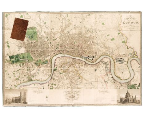
Lot 109
London. Greenwood (C & J), Map of London from an actual survey made in the years 1824, 1825 & 1826..., Greenwood & Co, 1st edition, August 21st, 1827, large scale map engraved by James & Josiah Neele with contemporary colouring, sectionalised and laid on linen, calligraphic title, inset views of St Pauls and Westminster, dedication to King George IV, reference to the parishes and table of explanation, some offsetting, edged in green silk with slight fraying, 1260 x 1855 mm, bookplate of L. C. Berger to verso, contained within contemporary tree calf book box (rubbed and slightly worn) QTY: (1)NOTE:Howgego 309. The largest and finest map of London to be printed in the 19th century. The Greenwood brothers spent three years preparing this remarkable new survey, illustrating for the first time the planned development of Belgravia by Thomas Cubitt, the completion of the Grand Surrey Canal and Regent's Park one year before it was finished in 1828. No map provided greater detail or accuracy until the Ordnance Survey.
Lot 95
Folding Maps. A collection of 23 maps, 18th & 19th century, 23 engraved and lithographic map sheets of British county and regional maps and foreign maps and plans, all sectionalised and laid on linen, including examples by or after Walker, Philips, Wyld (including a four sheet map of Europe), Bowen, J & C Walker, 'The Times', Ordnance Survey, Hebner, Ebden, Assheton, Brué (map of France on four sheets) and Darton & Dix (county maps of Essex and Bedfordshire), various sizes and conditionQTY: (23)
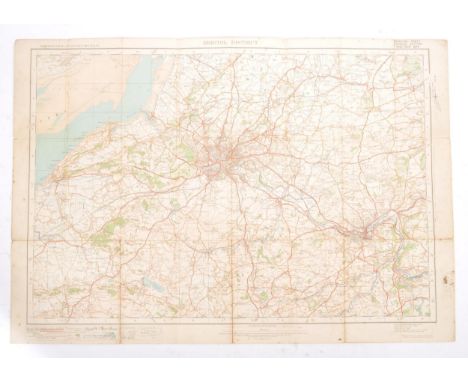
Lot 492
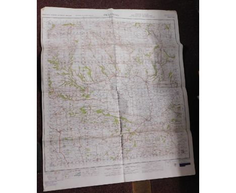
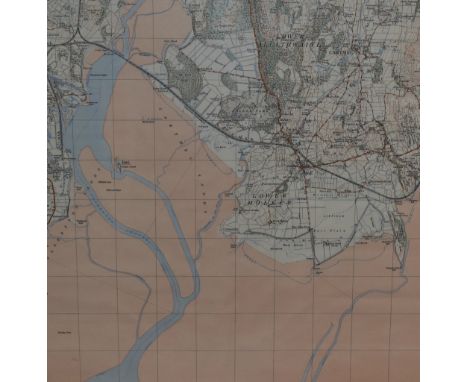
Map. 1922 Ordnance Survey One Inch of Bristol District. Special Sheet Popular Edition. Includes Glos, Wilts & Somerset. Redwick at NW then Avonmouth, Iron Acton, Chipping Sodbury, Colerne at East, Farleigh Hungerford at SE, West Harptree at South, SW with Winscombe and Clevedon at West on Bristol Channel. Cloth backed.
-
1765 item(s)/page