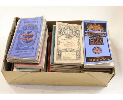
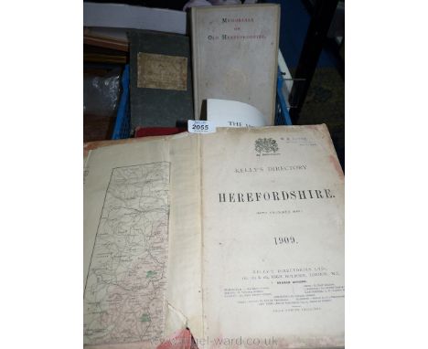
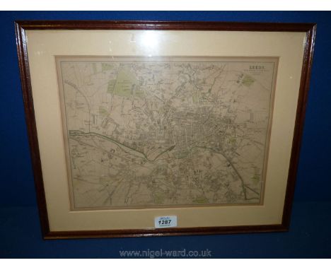
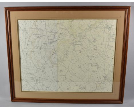
We found 1765 price guide item(s) matching your search
There are 1765 lots that match your search criteria. Subscribe now to get instant access to the full price guide service.
Click here to subscribe- List
- Grid
-
1765 item(s)/page
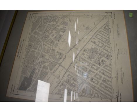

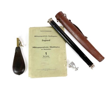
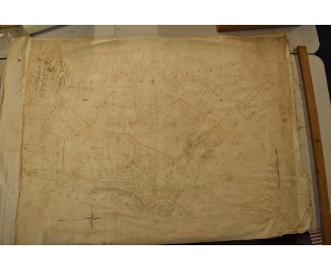
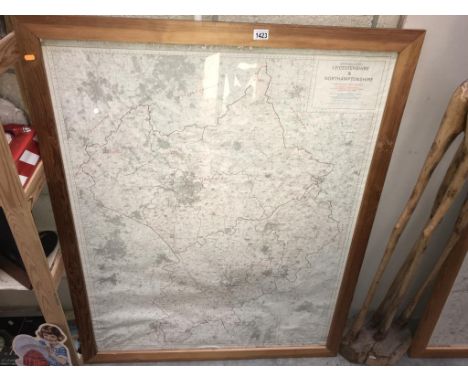
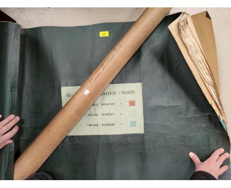
Lot 91
Operation Sea Lion (The Proposed German Invasion of England) - Folder 'No.1 The Border', 1942, containing a photo book of targets (Objektbilder), including Berwick and other road and railway bridges, numerous important railway and road viaducts, the ports of Tynemouth, Hartlepool, Gateshead, Sunderland, Wallsend and South Shields, Newcastle armaments factory, Garew steel works, Spiller's factory Newcastle; a German reprint of the Ordnance Survey map for the area between Berwick and Hartlepool with suitable targets marked; large scale Ordnance Survey town plans of Carlisle, Sunderland, South Shields and three of Newcastle Footnote:- One of twelve, these highly secret documents were originally prepared for Operation Sea Lion, the German Invasion of England, and then later for German agents and saboteurs who would be dropped by parachute or U-boat to destroy important industrial and communication targets all over England; a Bilora Camera Tripod in black enamelled and chromed steel, with telescopic legs, detachable aluminium tilt head and leather case; a Leather Shot Flask, with brass sprung charger (3)
Lot 889
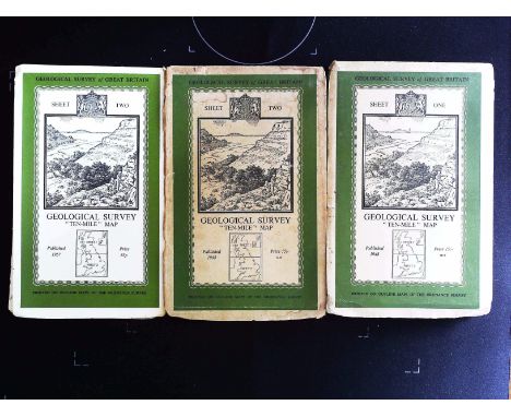
3 x Ordnance Survey Maps Geological Survey Ten Mile Map. 1 - Sheet One published 1948. 2 - Sheet Two published 1948. 3 - Sheet Two published 1957. Sold on behalf of the Michael Sobell Cancer Charity. Shipping at cost from £4. 99 in UK, we can ship a 30kg box for £10 so up to 10 books. Overseas shipping at cost from £7. 99
Lot 133
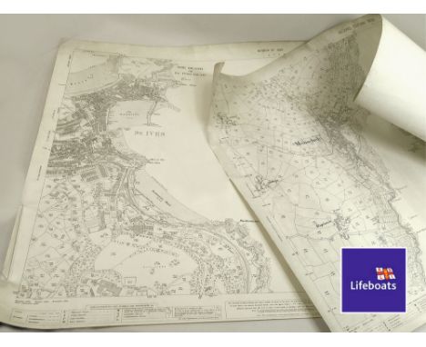
ORDNANCE SURVEY. An Ordnance Survey map of Mousehole Coast, 2nd Edition 1908 & an Ordnance Survey Map of the St. Ives Coast, revision of 1936. Please note that all items in this auction are previously owned & are offered on behalf of private vendors. If detail on condition is required on any lot(s) PLEASE ASK FOR A CONDITION REPORT BEFORE BIDDING. The absence of a condition report does not imply the lot is perfect.WE CAN SHIP THIS LOT, but NOT if part of a large, multiple lots purchase. Proceeds from this lot will be donated to the RNLI Penlee Crew Comfort Fund.
Lot 959
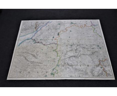
Benjamin Baker (act. circa 1880-1900)/Bristol, Cirencester, Bath, Warminster/coloured engraved map in fifty-five linen backed sections/published by Col. Mudge of the Royal Engineers, 14th August 1817, No XXXV and XXXIV, two leather panels in a gilt tooled slip, engraved Ordnance Survey and the Counties on the spine, 157cm x 126.5cm
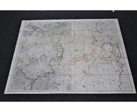
Lot 960
Benjamin Baker (act. circa 1880-1900)/Worcester, Hereford, Gloucester and Monmouth/coloured engraved map in fifty-five linen backed sections/published by Lieut. Col. Colby, 24th November 1829 and 29th September 1831, No. L and LIV, two leather panels in a gilt tooled slip engraved Ordnance Survey and the Counties on the spine, 157cm x 129cm CONDITION REPORT: Some discolouring to horizontal linen divisions, crayon triangle linking Hereford Worcester and Gloucester, boundary colours good, end boards with slight rubbing, gilt tooling to slip case rubbed in places, slip split at base in two places.
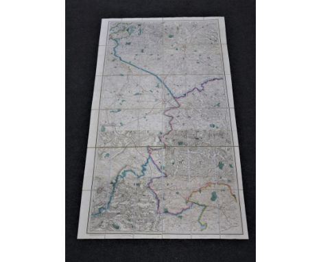
Lot 961
Benjamin Baker (act. circa 1880-1900)/Leicester, Warwick, Banbury, Buckingham/coloured engraved map in thirty-six linen backed sections/published by Lieut. Col. Colby, 1st October 1833, No. LXIII, two leather panels in a gilt tooled slip engraved Ordnance Survey and the Counties on the spine, 86cm x 157.5cm
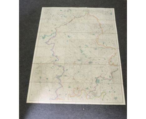
Lot 962
Benjamin Baker (act. circa 1880-1900)/Macclesfield, Stafford, Bridgeworth (sic), Birmingham/coloured engraved map in forty-eight linen backed sections/published by Lieut. Col. Colby, 9th January 1834, two leather panels in a gilt tooled slip engraved Ordnance Survey and the Counties on the spine, 114cm x 157.5cm
Lot 258
19th / early 20th century Ordnance Survey style maps to include a cloth version 'Map of the Parish of Stratton in the County of Dorset, Buxton and Matlock OS map sheet 111, Derbyshire sheet SK 16 NE, a Derbyshire County Council map and another similar item (5). Condition as you'd expect. Approx size 90 x 74cm. The cloth example is slightly bigger.

Lot 74
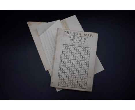
Two original WWI First World War period maps, comprising:- Trench Map: Bailleul-Kemmel area. Sheet 28 SW, edition 6. Belgium & France. Coded in bottom l/h corner GS GS (General Staff Geographical Section) 2742 and published by the Ordnance Survey December 1916. On folding linen. Scale 1:20,000. Size 89 by 65 cm. Detailed key. Original owner’s name to reverse. The owner served in the Durham Light Infantry and the Northumberland Fusiliers, and was wounded in France- British Army map of Amiens, published by the Ordnance Survey, Southampton for the Geographical Section General Staff 1916. Code 2364 to bottom left corner. On folding linen size 88 by 66 cm. Scale 1:100,000. Key gives information on many geographical features and has an explanation of French names for them. Soldier’s name in pencil above front cover.
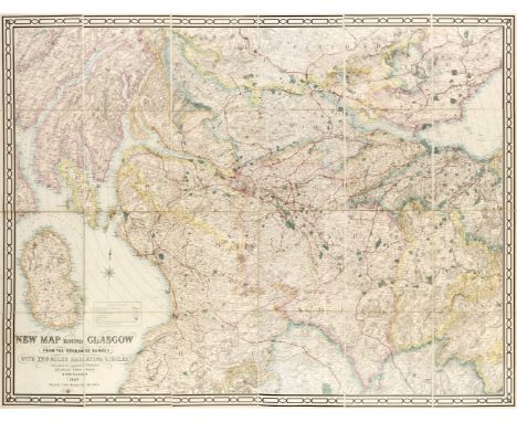
Lot 288
Glasgow. Richmond (George, publisher), New Map round Glasgow from the Ordnance Survey, with Two Miles Radiating Circles, Scale 2 Miles to an Inch, Birmingham, 1884, large scale lithographic map with bright contemporary outline colouring, sectionalised and laid on linen, 1020 x 1340 mm, marbled endpapers, contemporary cloth boards with red morocco gilt title label to upper coverQty: (1)
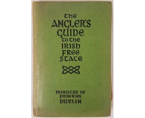
Lot 147
The Angler’s Guide to the Irish Free State. Compiled by the Department of Lands and Fisheries. Illustrated with four folding maps and a large linen-backed map of Ireland. Dublin: Stationery Office, 1937. Small 8vo. 1st edition. Original green cloth, title in black on upper cover and along spine. V.g. Rare first ed. The large folding Ordnance Survey map depicts rivers, lakes, and fishery districts. Railways shown in black. Irish-speaking districts are coloured yellow.
Lot 3
Bacon, George (ed. and published) " New Large-Scale Ordnance Survey Map of the British Isles" 1884, handcoloured lithographed maps and town plans, publisher's boards, rebacked and recornered, gilt titles and raised bands to backstrip, aegBOOKS NOT COLLATED UNLESS OTHERWISE STATED, PLEASE ENSURE YOU ARE SATISFIED BEFORE YOU BID

Lot 97
Assorted Vintage Car Spares, in a wicker basket, to include an instrument panel with speedo, a Lucas amp meter, a pair of chromed Lucas King of the Road 8'' headlamp casements, a pair of chromed wing mirrors, a 7in chromed lamp, a vintage car horn, a brass badge from an A7, a metal exhaust pipe, an Ordnance Survey map of Great Britain etc
Lot 7060
'Cruchley's Reduced Ordnance Map of England & Wales', large engraved hand coloured folding map depicting Norfolk, Suffolk, Cambridgeshire, parts of Lincs., Huntingdonshire, Bedfordshire etc, circa mid 19th Century, titled 'From the Ordnance Survey - No.40', sheets 33, 34, 39 & 40 together as one map and dissected and backed onto linen, approx 100 x 130cm, folding into original cloth binding; together with an Ordnance Survey folding map of Bungay, Harleston & Diss, circa 1912, sheet 77 large sheet series, approx 52 x 72cm (2)
Lot 556
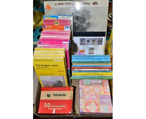
A QUANTITY OF ASSORTED ORDNANCE SURVEY MAPS, various maps from the Outside Leisure map, Landranger and Explorer series, mainly 1980's and later, small quantity of other road and street maps, boxed View-Master Lighted Viewer, Model F, with a quantity of assorted reels, small quantity of Ladybird books (mainly 1960's issues), 1960's Methwen paperbook Winnie-the-Pooh novels, ARGO Transcord Somerset and Dorset LP record, No DA8 (appears in good condition, wear to sleeve)
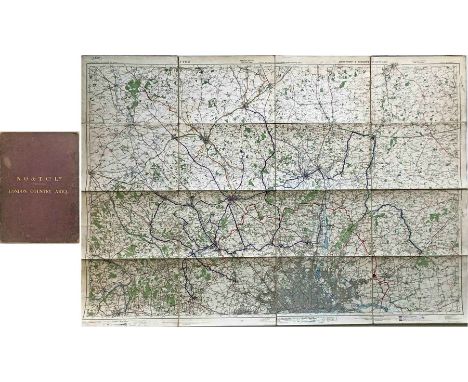
Lot 362
c1930 National Omnibus & Transport Co Ltd MAP of the LONDON COUNTRY AREA. Linen-backed inside board covers with gold-leaf titling, the map opens out to 57" x 40" (145cm x 102cm). Based on the Ordnance Survey and hand-coloured to show the Metropolitan Police Boundary, the London Country Area Boundary, Routes of the National Omnibus Co (route numbers are shown) and Routes of other Companies run in agreement with the National. This area became the northern Country Area of London Transport in 1933. Well-used with some wear but generally very good. [1]
Lot 49
Collection of loose British county maps, mainly Ordnance Survey sheets.Emanuel Bowen, Surrey, hand coloured, 62 x 79cm; John Greenwood, Surrey; four uncoloured maps by Morden; four 18th century strip road maps including London to Dover and London to Chester; and a large quantity of mainly OS map sheets post 1896, including of South London and East of England, and a few others including touring maps (quantity)
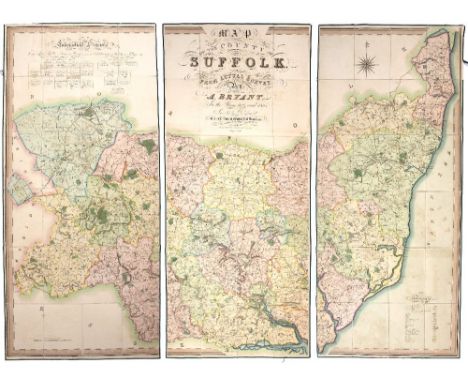
Lot 526
BRYANT, William Andrewes (Andrew) (1799-1878), Surveyor and Map Maker A large scale folding map in three sections of the County of Suffolk, 'from an actual survey by A Bryant in the Years 1824 and 1825, inscribed by permission to His Grace The Duke of Grafton, Lord Lieutenant and to the Nobility, Clergy and Gentry of the County, London March 1st 1826'. Hand coloured with calligraphic title, Ecclesiastical Divisions and table of Explanation, marbled backing labelled East, West and Centre with b/p for Rev. Chas. J. Steward. Somerleyton Rectory (Suffolk). Contained within a finely tooled full calf (two sectional) book box (280 x 195mm). Maps with some staining and splits on folds, box with bent corners, scuffs etc. plus Domesday Book, A facsimile of the part relating to Suffolk, Ordnance Survey, Southampton 1863, red and black print, tooled cloth boards (310 x 245mm). Bumped and worn.
![Canaan. Speed (John), Thomas Bassett & Richard Chiswell, 1651 [1676], hand-coloured engraved map, inset plan of Jerusalem](https://cdn.globalauctionplatform.com/c0cb1ef4-1c7a-45bd-b802-acf50116941e/1c7036aa-d7e7-47f5-99ab-ad0900f7b4d0/468x382.jpg)
Lot 75
Canaan. Speed (John), Thomas Bassett & Richard Chiswell, 1651 [1676], hand-coloured engraved map, inset plan of Jerusalem.41.5cm x 54.5cm (16.25in x 21.5in)Footnote: * Speede's maps usually showed the land as it was experienced. Even if not to the levels of accuracy of a modern ordnance survey map, they strove to show the locations as they related to each other and the land on which they were situated. From the first though, Canaan was different. Canaan is a land created in two places. The first is on the ground, in the towns, rivers, mountains and other features of geography, both natural and man-made. The other is in the mind, particularly of Christians, who will be comparing the land they see with that they first experienced through the words of the Bible. This was especially true for readers of the King James Version for whom this map was an integral part of their reading of the Bible. The map was first featured in the Geneva Bible as published by Robert Barker. Speede was still a tailor when he first became involved with this map - his first cartographic work. John More (credited on the map) did the first work on it whilst a Fellow of Christ's, Cambridge. After his death in 1592 it was passed to Speede who finished it and received a licence to print and insert it in the KJV for ten years from 1610. By the time the KJV was first published in 1611, Speede was already one of the most important cartographers in England, and busily working on his famous county maps, many of which feature in this sale. Interestingly, this map did not feature in the first issue of Speede's Prospect, but was added later. Despite current knowledge, Speede's map contains oddities to the modern eye. Most specifically the coastline follows the Ptolemaic slump, despite the actual coastline being known. This is part of the purpose of this map. The map is not the territory. The map does not even follow Ptolemy's desire to be accurate (within the limits of contemporary knowledge), but rather to use Ptolemy's coast as a short-hand to evoke the era. This map sets out to create a place that never existed, it is not a tool for explorers of anything but the words on a page. Speede's map shows events, places, people, and details from across Biblical history. The Dead Sea is the Lake of Sodom, Pharoah's armies (equipped as expected in Jacobean armour) drown even as Judas hangs himself. Ancient Kingdoms share space with Jewish settlements. The inset map of Jerusalem lists important places in the story of the Passion, but they are not a pilgrim map, rather a reminder, a positioning in a space not physical but mental. Despite all this, there are suggestions that the map inhabits a 'real' world and is not merely a fairytale realm. The new habit for framing the map in longitude and latitude is followed. Whilst a traveller could never hope to find a location using them, it reminds the reader that the place (and by extension the events depicted and remembered) is real. The leviathan frolics in the depths but this is not to say there are literal monsters beneath the waves (nor even to recall Jonah's whale) but rather to remind of the troubles of travel. Even the choice of name is suggestive. Whilst Christians today might accept 'The Holy Land', to a Protestant this would be redolent of Papistry, whilst other more accurate names might be overly Jewish in suggestion. Canaan is the ancient name, all other names (whether Israel or Outremer) are tranistory compared to the Biblical truth which underlies all. In Protestant eyes, the holy places had no intrinsic spiritual value and visiting them was unnecessary - as the map reminds us, ''Nether in Ierusalem, nor in this Mountaine shal ye worship''. The idea of pilgrimage was, if not anathema, highly suspicious. Whilst English ships crossed the seas, they did so for trade, and there was little to trade in Palestine - not even treacle in Gilead. For the strict Protestant Englishman, the critical thing was your relationship with God through Christ, the rest was confusing trappings which got in the way. This map was all you needed to give a context to your reading of the Bible, and the experience of the Word would open you to God's Grace.Condition report: The map is in good, original condition. There is some light time staining and browning around the edges of the paper near the mount board. There are one or two minor tears and holes around the edges of the paper and one small hole in the paper within the map. There is some creasing and cockling across the paper and some minor spots of foxing across the sheet. The map is framed and glazed.
Lot 482
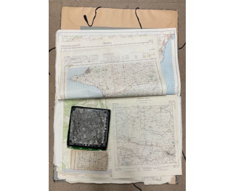
A set of seven Ordnance Survey quarter inch maps of Great Britain, fourth edition, including England Nort-East, Midlands, South Wales, etc; a Bartholomew's Tourist's Map of England & Wales; a Geographica large scale road map, Peak District and Derby Dales for motorists and ramblers; other maps, sheet music and ephemera; qty
![[MAPS] Sixteen assorted folding maps, mainly Ordnance Survey, including also Bartholomew's New Map of Central & South Af](https://cdn.globalauctionplatform.com/d457bba3-72fc-4604-b57a-ac9900d9453d/2431ba60-174b-4316-93b7-ace900a023f5/468x382.jpg)
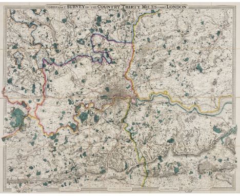
Lot 146
London.- Cruchley (George Frederick) From the Ordnance Survey of the Country Thirty Miles round London, map of the environs of London showing from Hertford to Godalming and Tunbridge, and from Maidenhead to Chatham, engraving with bold original hand-colouring, 1115 x 1380 mm (43 3/4 x 54 1/4 in), dissected and mounted on linen, folding without slipcase, 4to, [c.f. Howgego 333 for possible source], n.d., [circa 1850 or slightly later].
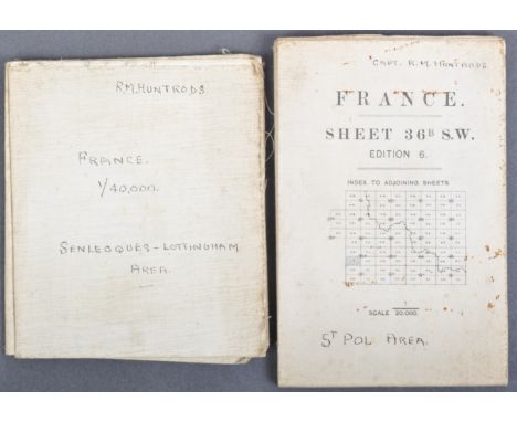
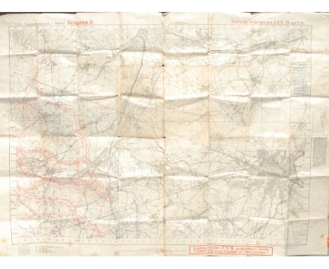
Lot 746
Two original WWI First World War period British Army issued maps of France, both named and owned by one Captain R. M. Huntrods of Durham Light Infantry. One 20,000 foot scale map and a second larger scale map: St. Pol area. France Sheet 36B SW, edition 6, published by the Ordnance Survey 1916. Coded in the bottom l/h corner GS GS 2742. On folding linen on a scale of 1:20,000. Size 90 by 68 cm. A key includes roads, railways, footpaths, churches, chimneys, windmills etc. The map does not show trenches but an area just to the west of Arras. An unusually clear and crisp map. Original owner’s name and rank to front of map. The owner served in the Durham Light Infantry and the Northumberland Fusiliers., and was wounded in France. The second map of part of France: Senleques-Lottinghem area. France Sheet 36D Western Half. Published by the Printing Section, Depot FSC., RE. GHQ (1701). No date. Information in the bottom l/h corner states: This map is an enlargement from the French 1:80,000 its accuracy cannot be guaranteed. Scale 1:40,000. Size 58 by 51 cm. On folding linen. Includes villages to the west of Arras including Bourthes and Zoteux. Original owner’s name in ink to front cover. The owner served in the Durham Light Infantry and the Northumberland Fusiliers and was wounded in France. Rare named maps.
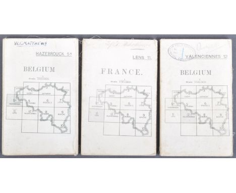
Lot 852
A collection of x3 original WWI First World War period British Army used maps of France and Belgium. Comprising:First World War British Officer’s map of part of France. France Sheet 11, Lens edition 2. Published by the Ordnance Survey in 1916. Coded in the bottom l/h corner GS GS 2364. On folding linen size 85 by 65 cm. Scale 1:100,000. A key includes details of roads, railways, mines, ruins, canals, churches, forts etc. In colour. Original owner’s name to the front cover. The owner served in the Durham Light Infantry and the Northumberland Fusiliers., and was wounded in France Area covered includes Arras and Bapaume.British Army map of Hazebrouck, published by the Ordnance Survey, Southampton for the Geographical Section General Staff 1915. Code 2364 to bottom left corner. On folding linen size 88 by 66 cm. Scale 1.100,000. Key gives information on many geographical features and has an explanation of French names for them. A very detailed map. VG condition.World War One Map British Army Map Belgium sheet 12: Valenciennes with Cambrai. Published for the British General Staff Geographical Section by the Ordnance Survey, Southampton May 1915. Scale 1:100,000. On folding linen. Name and stamp of the RE 73rd Field Company to the front of the map. Some annotations to the margins including details of the advance of the 21st Division from August to November 1918 and of the enemy captured. Good to VG condition.
Lot 527
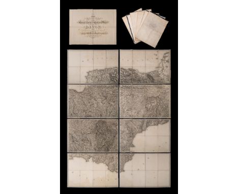
ORDNANCE SURVEY : The second part of the general survey of England and Wales. Containing the whole of DEVON and a proportion of the adjoining counties - large uncoloured map in eight parts folding in to 36 sections mounted on linen, slight water stain to lower part of the map, not offensive, no slipcase,1809. With the supplementary title sheet folding in 4 sections.
![Co. Derry: Colby (Col. Thos.) Ordnance Survey of the County of Londonderry, Part I [All Published] D. 1837, First E](https://cdn.globalauctionplatform.com/f4e1af99-2601-4c42-957a-acca00e9a9d6/4bee573e-5d56-4b93-bc14-accd00adf51d/468x382.jpg)
Lot 108
Co. Derry: Colby (Col. Thos.) Ordnance Survey of the County of Londonderry, Part I [All Published] D. 1837, First Edn., hd. cold. map & other fold. maps etc., also hd. cold. & other plts., text illus. etc. orig. cloth, v. good; [Phillips (Sir Thos.)] Londonderry and the London Companies 1609 - 1629, sm. folio Belfast (H.M.S.O.) 1928. First Edn., cold. & other maps, orig. cloth. V. good. (2)
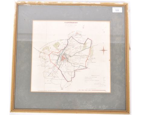
Lot 558
An early to mid 20th Century English lithograph hand coloured Ordnance Survey map for Canterbury and its borders. The map with hand coloured boundaries and further highlighted areas with a small summary to the bottom right. Printed by R. Cartwright Litho Printer and singed by Lieutenant Robert K. Dawson of the Royal Engineers. Framed and glazed. Measures approx 44cm x 46cm.

-
1765 item(s)/page