We found 1765 price guide item(s) matching your search
There are 1765 lots that match your search criteria. Subscribe now to get instant access to the full price guide service.
Click here to subscribe- List
- Grid
-
1765 item(s)/page
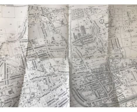

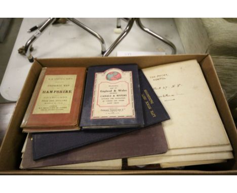
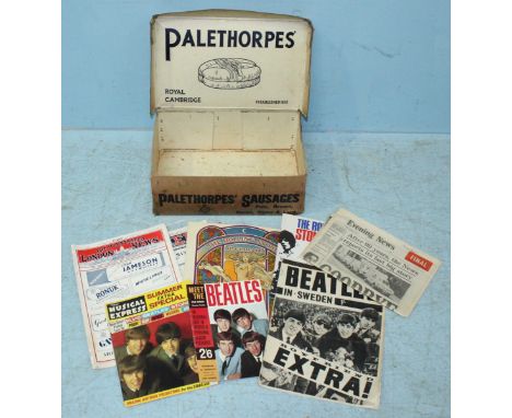
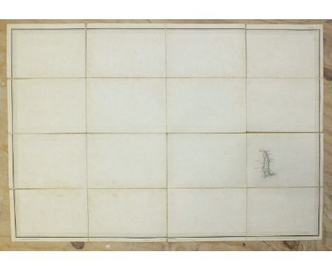
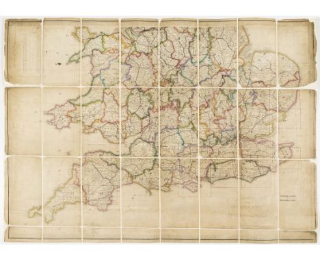
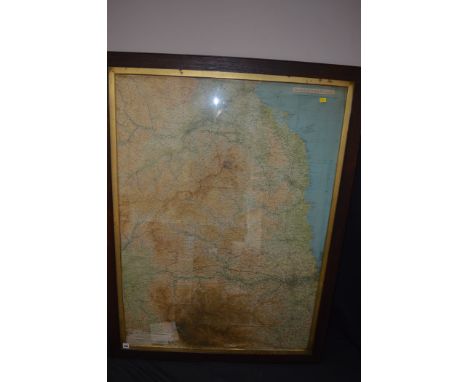
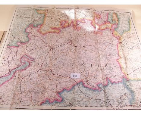
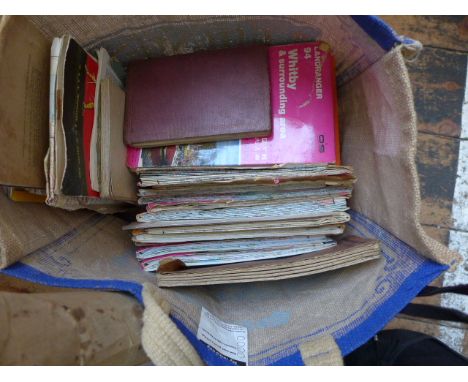
![Co. Derry: Colby (Col. Thos.) Ordnance Survey of the County of Londonderry, Part I [All Published] D. 1837, First Edn., hd. c](https://cdn.globalauctionplatform.com/9a031618-5f56-4e03-b082-a8af00ef4ace/74090599-42b0-4986-d97c-9fa816bd7bd1/468x382.jpg)
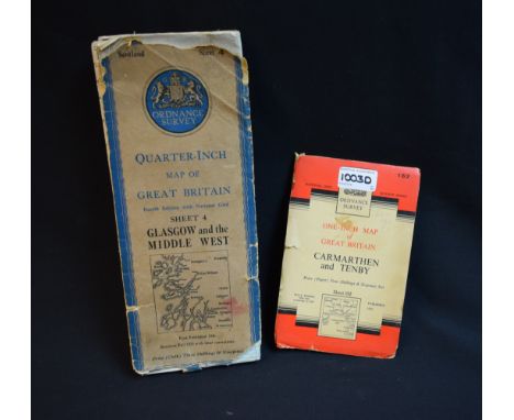
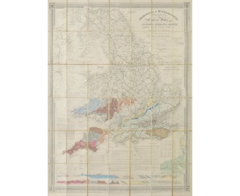
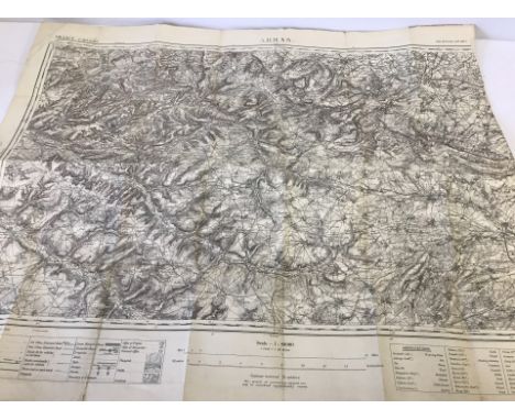
Lot 210
Co. Derry: Colby (Col. Thos.) Ordnance Survey of the County of Londonderry, Part I [All Published] D. 1837, First Edn., hd. cold. map & other fold. maps etc., also hd. cold. & other plts., text illus. etc. orig. cloth, v. good; [Phillips (Sir Thos.)] Londonderry and the London Companies 1609 -1629, sm. folio Belfast (H.M.S.O.) 1928. First Edn., cold. & other maps, orig. cloth, v. good. (2)
Lot 296
Cartography - seven maps to include The Provision of 1925 - 1926 provisional edition Lancashire sheet map of Glazebury printed and published by Director General of Ordnance Surveys Chessington Surrey 1947, Lancashire sheet edition of 1926 Culceth issued by the Ordnance Survey of Southampton, two divisional editions of Lancashire and Cheshire Rixton with Glazebrook issued by Ordnance Survey Office, a map of Lancashire Ince-in- Makerfield, Ashton-in-Makerfield and Ince issued by the Ordnance Survey Chessington Surrey 1965, a map of Lancashire and Chorley, Coppull, Wothington, Adlington issued by Ordnance Survey Chessington Surrey 1965, a map of Lancashire, Ashton-in-Makerfield, Haydock, Newton-le-Willows issued by Ordnance Survey Chessington Surrey 1956 and one further map of Helsington CP, Westmorland 1972 (qty)
Lot 584
Box of Various Vintage Folded Ordnance Survey Maps including Contoured Road Maps, 1920's edition of London, Quantity of 1903 Edition 1:2500 Scale, County of Surrey Map Live Stock Dept. Paddington, W H Smith's reduced Ordnance Survey Maps of Somerset and Hampshire, Stanford's Map of England & Wales showing Canals and Rivers
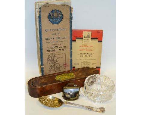
Lot 47A
Ordnance Survey - Quarter Inch Map of Great Britain, Sheet 4 Glasgow and the Middle West, first published 1946; another, One Inch, Carmarthen and Tenby 152; An E.P.N.S. Kings pattern table spoon, the gilt bowl embossed with flowers and grapes; a Swiss type goat bell, painted with Alpine scene, 6.5cm high; a mid 20th century treen rounded rectangular two section pencil case, the sliding cover with primrose transfer, 27cm long; a heavy clear glass bowl, engraved with flowerheads and foliage, star cut base, undulating rim, 10cm diam
Lot 847
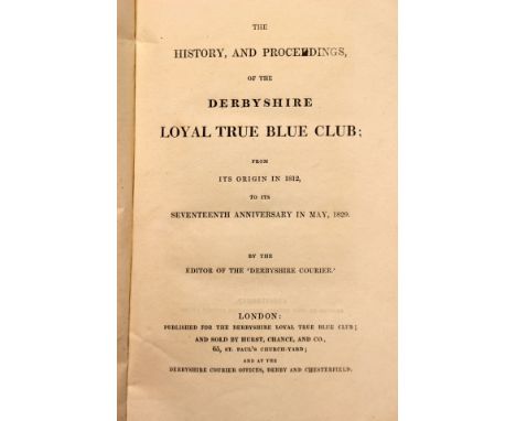
Derbyshire interest: 'The History, and Proceedings, of the Derbyshire Loyal True Blue Club; from its Origin in 1812, to its Seventeenth Anniversary in May, 1829', by the Editor of the 'Derbyshire Courier', London: sold by Hurst, Chance, and Co. [1829], original blue paper covered boards with title label to spine, club members listed at the end of the book (the club's foundation was based on anti-Jacobin principles following the consequences of the French Revolution); 'Pleasant Rambles around Derby', John Ward, Derby: Frank Murray, 1895, with folding map and notes for cyclists, green cloth & gilt; Derby Bank, Bellairs and Sons, £5 banknote, dated 15th November 1809, signed J. Bromley, Bellairs; Derby & Burton map, engraved at the Ordnance Survey Office, published by Colonel Farquharson, March 1895, hand-coloured, bearing label for Edward Stanford of London, complete with original slipcase featuring gilt title, 150cm x 135cm. (4)
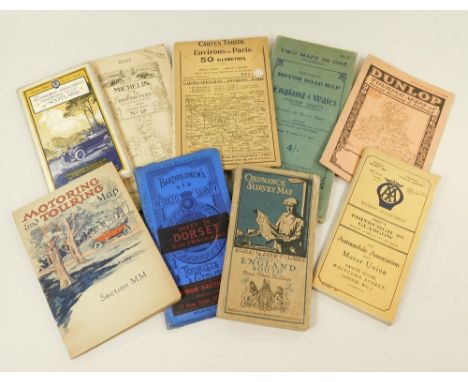
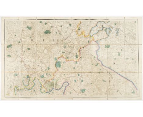
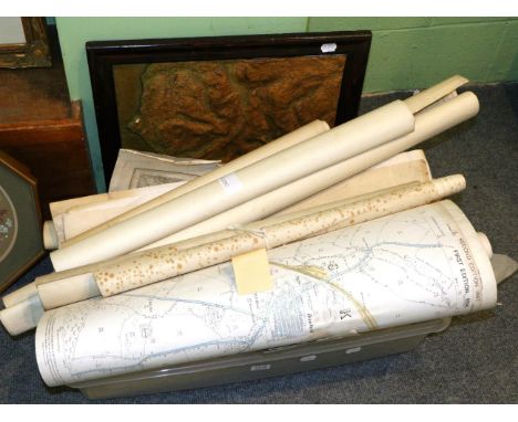
![Cumberland and Midlands.- Geological maps.- Mudge (Lt. Col. William) [Geological Ordnance Survey Map of Cumberland], a compos](https://cdn.globalauctionplatform.com/b6934ccb-7922-4e2b-a95a-a88f00e27afa/290b8653-807c-4832-d002-0430b65680d3/468x382.jpg)
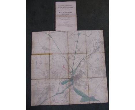
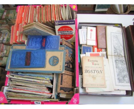
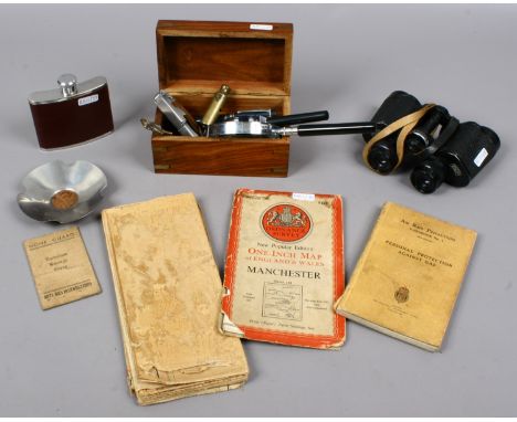
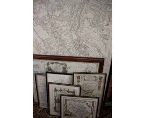
Lot 589
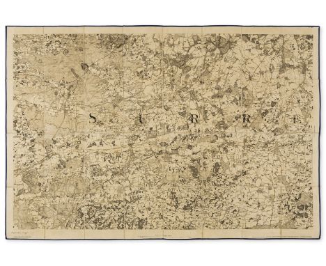
Cumberland and Midlands.- Geological maps.- Mudge (Lt. Col. William) [Geological Ordnance Survey Map of Cumberland], a composite map of single sheets from the 'Geological Survey of Great Britain' joined and presented in two parts, North and South, also showing part of Westmorland, with numerous keys and diagrams neatly trimmed and pasted on, engraving with extensive hand-colouring, with several sheets trimmed and joined, 'North' measures 975 x 1990 mm. (38 3/8 x 78 3/4 in), 'South' 980 x 1520 mm. (38 1/2 x 59 3/4 in), dissected and mounted on linen, minor surface dirt, folding with marbled endpapers, presented in red cloth slipcase with printed label, 4to, Edward Stanford, ca. 1850s; together with seven other single sheet maps from the 'Geological Survey of Great Britain', including three copies of sheet LXII (Lichfield), and one of LXIII (Leicester), and LXXI (Nottingham), and with 'Horizontal Sections Sheet No. 24', and 'Horizontal Sections Sheet No. 25', engravings with extensive hand-colouring, various sizes, majority between 670 x 495 mm. (26 1/2 x 19 1/2 in), and 675 x 1000 mm. (26 1/2 x 39 3/8 in, all dissected and mounted on linen, occasional minor surface dirt, all folding into various endpapers, several presented in slipcases, some loose, mainly 8vo, 1850s and later, (9 maps).
Lot 601
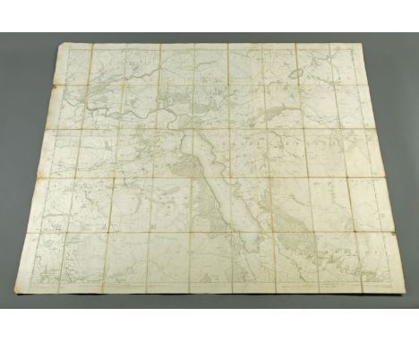
South East England.- Mudge (Lt. Col. William) Ordnance Survey maps covering Surrey, Sussex, and Kent, four sections, engraved maps, each approx. 635 x 920 mm. (25 x 36 1/4 in), dissected and mounted on linen, folding into blue morocco gilt-tooled and lettered book-style slipcase, rubbed, worn, 4to, [circa 1810-1820] § Mudge (Lt. Col. William) [An 'unfinished proof' ordnance survey map of Surrey, No. VIII], engraving, an excellent impression, 645 x 940 mm. (25 1/2 x 37 in), dissected and mount on linen, with blue silk edge, bears brown pen and ink inscription lower right that reads 'Unfinished Proof', some spotting and light browning, folding into contemporary blue morocco gilt-lettered book-style slipcase, rubbed, worn, 8vo, 1816, (2).
Lot 1147
An ordnance survey map covering Bassenthwaite Lake and Lorton, 1863, E.R. James, engraved 1865, published 1867, scale 6 inch-1 mile. CONDITION REPORT: The map is linen backed. There is a very small tear to the front right edge which should be noticeable on our web image. One quarter of the corners to the bottom right and top right are slightly folded, the remaining corners appear to be undamaged. Once the map is open, two thirds of the map are a uniform colour and just slightly over a third is a lighter cream colour. This is visible where it appears the map has been overlaid. There is an overshoot of the lettering at the top. There are holes in the linen joins at the corners but nothing too drastic. There appears to be mould and staining on two of the left hand side folds and bottom corner. The top left hand corner has a small fold. The backing is an off white clean uniform colour throughout but there is dark staining around the edges of each fold. There are a few dirt spots throughout but nothing that interferes with the map. This staining may be visible to see if you look at our website illustration.
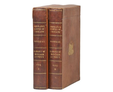
Lot 175
Ireland. Ordnance Survey of Ireland, Map of Donegal, Barony Of Boylagh, published Dublin 1835 - 36, twenty-one engraved maps with contemporary outline colouring, each map sectionalised and laid on linen, all maps initialled and dated by James Duncan, each sheet approximately 660 x 990 mm, contemporary canvas chemises and contained in two contemporary calf book boxes with 'envelope style' covers, decorated with gilt embossed arms of the Ordnance Survey to verso and recto of each box, contemporary book seller's label to inner cover, spines darkened, slightly rubbed at extremities, old chalk marks to boards, A fine, early and complete set of the enlarged six inches to the mile Ordnance Survey of Donegal. Sold Sotheby's, 10th October 2006. The Wardington Library sale of Important Atlases and Maps, part 2. Lot 332. (2)
Lot 45
Groome (Francis H., ed.). Ordnance Gazetteer of Scotland: A Survey of Scottish Topography, Statistical, Biographical, and Historical, 3 volumes, 1st edition, Edinburgh, Thomas C. Jack, 1882-3, 42 engraved or lithographic maps, all coloured and folding and including a large elevation map of Scotland, 6 steel-engraved views, extra-illustrated with numerous tipped-in additional engraved views on different paper stock, the large map with some splitting along folds but contents otherwise clean, marbled edges, contemporary reddish-brown half morocco, extremities and sides slightly rubbed, large 8vo, together with Fullarton (A. and Co., publishers), A Gazetteer of the World, or Dictionary of Geographical Knowledge ... 7 volumes, Edinburgh, 1871, numerous steel-engraved plates, mainly maps and views, the maps with outline colour, wood-engravings to the text, occasional offsetting, marbled edges, contemporary half calf, slightly rubbed, large 8vo Groome's Gazetteer is complete in 3 volumes; it was also issued in 6 volumes between 1882 and 1885. (10)
Lot 24
Birmingham.- Colby (Lt. Col. Thomas) Ordnance survey maps showing Birmingham and its environs, two sheets, numbers LXIII N.W. and LIII N.W., lithographs, with some hand-colouring, each sheet approx. 650 x 1130 mm. (25 1/2 x 44 1/2 in), both dissected and mounted on linen, folding with purple coloured endpapers and labelled 'North' and 'South' accordingly, presented in contemporary gilt-tooled slipcase, corners scuffed, worn, 8vo, 1831; Colby (Lt. Col. Thomas) Ordnance survey map centred on Birmingham, sheet no. LXII S.E., lithograph with hand-colouring, 650 x 810 mm. (25 1/2 x 31 7/8 in), dissected and mounted on linen, folding into mottled green envelope-style slipcase, rubbed, 8vo, 1831 § Richmond (George), publisher. Reduced Ordnance Survey around Bewdley, covering Worcestershire, Herefordshire, and parts of Radnorshire, Shropshire, Gloucestershire, and Warwickshire, lithographed map with some hand-colouring, 995 x 1305 mm. (39 1/4 x 51 1/4 in), dissected and mounted onto linen, some light surface dirt, folding with marbled endpaper into original cloth covered boards, gilt label on upper cover, worn, 4to, circa 1870s, (3).
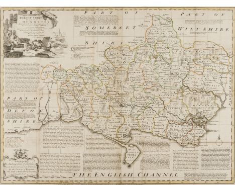
Lot 31
Bowen (Emanuel) An Accurate Map of Dorsetshire Divided into its Hundreds, title with vignette of fisherman upper left, engraving with outline hand-colouring, 545 x 710 mm. (21 1/2 x 28 in), central vertical folds, some surface dirt and light browning, Bowles & Sayer, [1756]; together with an Ordnance Survey Map by Mudge, showing part of Dorset and Somerset, numbered XVIII, engraved map, 645 x 800 mm. (25 3/8 x 31 1/2 in), central vertical fold, minor spotting and browning, unframed, 1811, (2).
Lot 35
England and Wales.- Ordnance Survey.- Index to the Ordnance Survey of England and Wales, engraved map with outline hand-colouring, 645 x 970 mm. (25 3/8 x 38 1/4 in), dissected and mounted on linen, some areas of loss, surface dirt and browning, circa 1805-1842; together with five assorted Ordnance Survey maps, including an 1885 map showing the Isle of Wight, one of Berkshire and the other three of the Midlands, lithographs, various sizes, 1820s and later, (6).
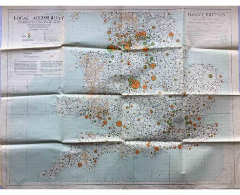
Lot 92
A fold-out MAP of England & Wales, c. early 1950s, entitled 'Local Accessibility - The hinterland of towns and other centres as determined by an analysis of bus services'. Produced by the Ministry of Housing & Local Government from information provided by bus operators etc and published by the Ordnance Survey. Undated but refers to bus services 1947/48 and population data 1951. Folds out to 42" x 33" (107cm x 84cm) and in very good condition. [1]
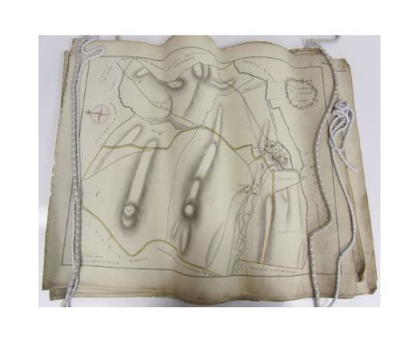
Lot 361
Fife: Kilmany, and the area; and Carntyne, GlasgowSeven manuscript plans, comprising: The East and West Farms of Kilmany and Cloughies; Cloughies; Muircraigs; Westerkilmany; Cloughies; East Farm of Kilmany; West Farm of Kilmany; each c. 44.5 x 57cm, hand-coloured, some creasing where the maps have been rolled, some soiling; a printed and rolled Ordnance Survey showing Kilmany; A Plan of Carntyne Estate for Registration of Ownership, hand-coloured printed map, some worming; Plan of the Estate of Carntyne, printed rolled map with manuscript additions (10)
Lot 118
England & Wales. Knipe (J.A.), Geological & Mineralogical Map of England & Wales, with Parts of Scotland, Ireland & France, showing also the Inland Navigation by Means of Rivers & Canals, with their Elevation in feet above the Sea, The Rail Roads & Principal Roads, published James Cox, September 1st. 1859, engraved map, sectionalised and laid on linen, contemporay hand colouring to southern half of map, northern half is uncoloured, two geological cross sections at base of map 1170 x 875 mm, marbled endpapers, together with Ordnance Survey (publishers), Three geological maps, circa 1875, three engraved maps with contemporary hand colouring, sectionalised and laid on linen, showing part of Kent, part of Rutland and part of East Sussex, some wear and small holes, some short splits along linen folds, each approximately 620 x 630 mm (4)
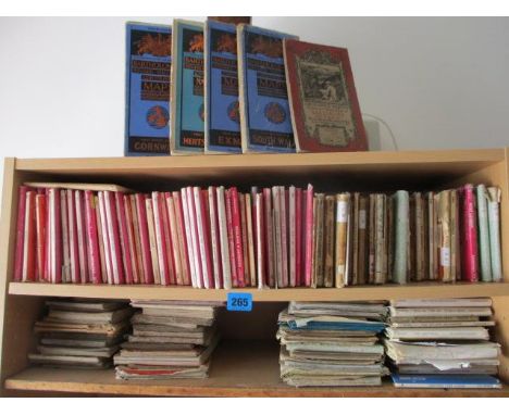
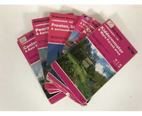
![Palmer [W.T.] - Penguin Guides - The Lake District, ed. L. Russell Muirhead, first edition 1939, paper bound, and nine Ordnan](https://cdn.globalauctionplatform.com/be38e52d-c8bd-4d40-ad89-a85f00ec7ebd/54ff990c-9575-49d0-a349-73f001bdc240/468x382.jpg)
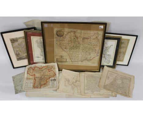
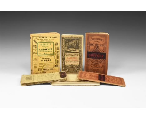
Lot 235
A QUANTITY OF 18TH & 19TH CENTURY MAPS to include framed and glazed Robert Morden of Leicestershire, Thomas Kitchin of Derbyshire, John Cary of Derbyshire, Thomas Moule of Worcestershire together with loose maps of Europe, various maps published by James Virtue and a 1932 Ordnance Survey War Revision 1940 one inch map of the Isle of Man
Lot 130
Folding maps. A mixed collection of 33 maps, mostly 19th & 20th century, maps of the British Isles, English Counties and overseas, including Wyld (James), New Map of the County of Suffolk, reduced from the large map in six sheets..., circa 1850, engraved map with contemporary outline colouring, sectionalised and laid on linen, marbled endpapers, 580 x 805 mm, contained in publisher's cloth slipcase with printed label to upper board, with Ferguson (A.), Wilson's plan of the City of Dublin, published Dublin, W. Wilson, 1796, engraved map with contemporary outline colouring, sectionalised and laid on linen, some staining, 295 x 375 mm, contained in a contemporary marbled card slipcase, plus Darton (William & Son, publishers), Warwickshire divided into Hundreds and the Parliamentary divisions, circa 1855, engraved map with contemporary outline colouring, engraved vignette of Warwick castle, table of explanation and list of market towns, sectionalised and laid on linen, 450 x 355 mm, publisher's cloth boards with gilt title to upper siding, and Shawe (W.), Philips' New Map of England and Wales compiled from the Ordnance Survey showing Canals, Navigable Rivers & Principal Railway Lines, circa 1870, colour lithograph map with sparse later outline colouring, sectionalised and laid on linen, 1050 x 86 mm, with others similar including examples by Ordnance Survey, Bradshaw, Cary and Cruchley, various sizes and condition (32)
Lot 581
A large collection of assorted loose maps, late 18th Century to 20th CenturyViews to include maps of Dorsetshire by M & E M A N Bowen dated 1777, further ordnance survey maps, map of the World published by Longman Reece and Crane, maps of Scotland, Dorsetshire, views of the Grand Durbar, coloured engravings of shipping scenes, Ireland etc. (qty)
Lot 299
20th century AD. A mixed group of travel documents comprising: an Ordnance Survey map sheet 38 (Solent, Isle of Wight), 1912 edition; Bartholomew's reduced survey map, sheet 20 (Suffolk); one similar, sheet 29 (Berkshire & Wiltshire); Ordnance Survey road map of Carlisle 1913 edition; Daily Telegraph wall map of Europe and the Mediterranean (no cover); Kelly's Directory of Andover, 1966. 6199 grams total, Kelly's: 12 x 18.5cm (4 3/4 x 7 1/4"). From an old Hampshire collection. [6, No Reserve]
Lot 1360
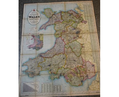
Bacon's Excelsior Map of Wales and Monmouthshire, Revised According To The Latest Ordnance Survey, With Railways, Roads, and Distances, [printed and published by] G.W. Bacon & Co. Ltd., London [c. 1900], twenty-five chromolithographic and hand-coloured folds laid on canvas, maroon buckram boards, marbled endpapers, square 4to
Lot 389
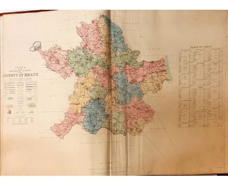
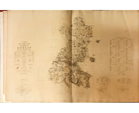
Atlas: Co. Meath: - Ordnance Survey, Atlas with Index to the Townland Survey of the County of Meath, lg. atlas folio D. May 1837. First Edn., cont. hand coloured double page index map & 53 other dbl. page maps, complete, all hd. coloured in outline, in full tooled gilt decorated calf, bound for, Gen. The Hon. Robert Taylor, inscribed in gild on front cover.* An exceptionally fine copy of this large & venerable volume. (1)
Lot 391
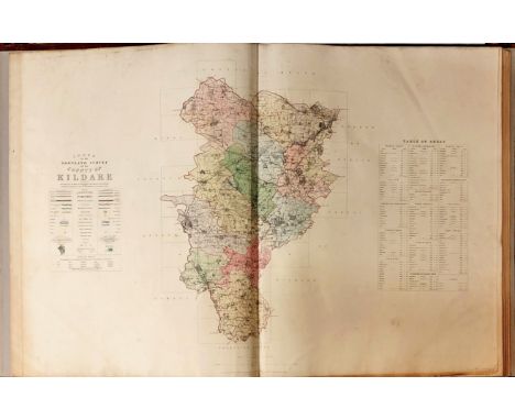
Atlas: Co. Kildare: - Ordnance Survey. Atlas, with Index to the Townland Survey of the County of Kildare, lg. atlas folio D. May 1839. First Edn., cont. hd.-coloured dble page index map, & 40 dbl. page maps, complete, all hd. coloured in outline, in full cont. tooled calf, gilt decorated, rebacked. A very good clean copy. As an atlas, w.a.f. (1)
Lot 2430
Collection of maps: J. Blaeu 17th-century map of Bedfordshire, copper engraving on laid/chain-lined paper with English & French text to verso; a pair of 19th-century Thomas Moule maps of Cambridgeshire and Yorkshire West Riding; a pair of 18th-century Robert Morden maps of Buckinghamshire and East Riding of Yorkshire; Robert de Vaugondy map of Normandie, 1751; and two large Ordnance Survey maps of Yorkshire West Riding, 'Revision of 1935'. (8)
-
1765 item(s)/page