We found 1765 price guide item(s) matching your search
There are 1765 lots that match your search criteria. Subscribe now to get instant access to the full price guide service.
Click here to subscribe- List
- Grid
-
1765 item(s)/page

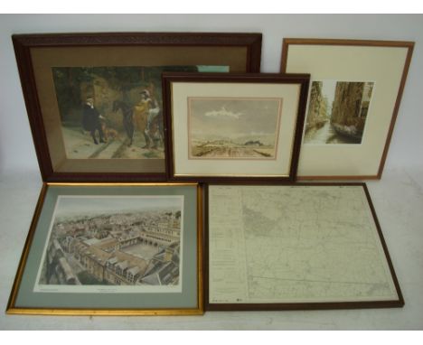
Lot 502
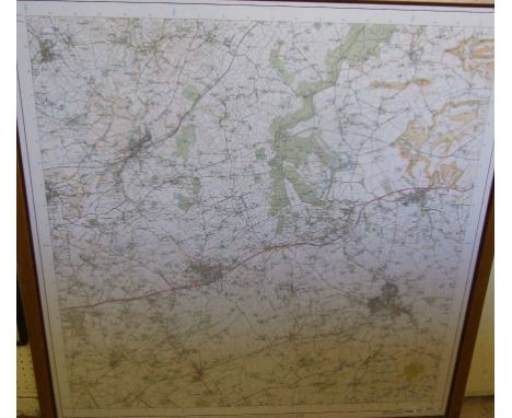
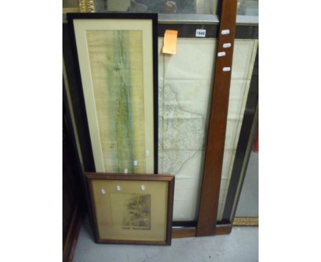
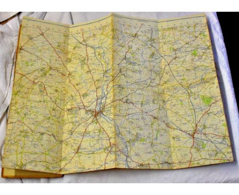
An Edwardian chromolithograph stipple print of riders in 17th Century dress, an etching with aquatint of a Venetian canal 40/70 signed Vgo Baracco watercolour landscape indistinctly signed, dated October 85, The School Cloister Oundle, limited edition colour print 774/1000, signed in pencil Jane Carpanini and a framed Ordnance Survey map of Tudeley Kent (5).
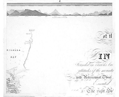
Lot 463A
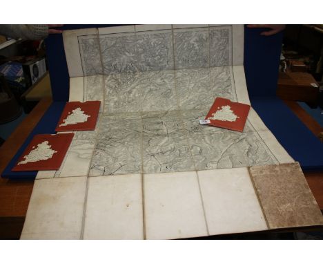
William BaldMayo, Map of the maritime County Mayo in Ireland.Founded on various bases and trigonometrical operations, exhibiting barometrical altitudes of the mountains, the levels and depths of the bogs and lakes; with Astronomical Observations, Physical Sections and Profiles of the Country; Executed by order of the Grand Jury. The Right Honourable Denis Brown M.P. and Member of the Dublin Society, and Royal Irish Academy, foreman; Commenced in 1809, and terminated in 1817, by William Bald F.R.S.E. Member of the Royal Geographical Society Paris, Member of the Geological Society London, Member of the Royal Irish Academy, Honorary Member of the Wernerian Natural History Society Edinburgh. Engraved by Pierre Tardieu, 1830. overall dimensions when joined. 3.11m x 2.57m average sheet size 620 x 510By William Bald, a massively detailed map of Mayo in 25 sections, each varying slightly in size; a little detail here and there of adjacent counties. Large title cartouche. Extensive table of mountain heights. Lake levels; bog levels and depths. Coastal soundings. Plan of trigonometrical base lines. Scale 1 inches to 1 mile. Published by the Mayo Grand Jury. Some edges frayed and some light foxing otherwise in very good condition. William Bald was born in Burntisland in 1789. He was employed as an apprentice under the celebrated Scottish surveyor, engraver and mapmaker, John Ainslie. Bald made a survey of Harris in 1805 when he was only 16, and was later responsible for surveys of ~Benbecula, south Ulst, Eriskey and Argyll, possibly because the tugged nature of the terrain would have been difficult for Ainslie, then in his 60s. These and other of his surveys were later incorporated into Aaron Arrowsmith's map of Scotland. By the time Bald arrived in Mayo in 1809 as county surveyor, he had been described by his teacher and mentor John Ainslie as a very big man... In the words of John Andrews, no ordinary tribute for a twenty-year-old. Bald's first commitment in Mayo was a Grand Jury map of the county. At the same time, he managed to work for the Bogs Commission on their brief for a survey of the bogs of Ireland. Both surveys were to degree of sophistication and meticulousness which far outstripped anything known in Ireland up to that time. His map of Mayo was unique in its scale and scholarship. The base measurement and triangulation were impeccable. Bald spent 18 years on the Mayo survey and engaged Pierre Tardieu in Paris, the foremost engraver of his day, to bring the map to fruition. This was done very slowly and at great expense, finally reaching the light of day in 1830. Bald was a familiar figure in Castlebar, much admired by some, yet disliked by others who through envy of his great expertise, carped at his efforts; or who, unused to the sheer cost of mapping on such a scale, complained at his lavish use of public money. Bald went on to plan surveys of Clare and Down. He even envisaged a general triangulation of Ireland and a new geological map. He still found time to attend to roads and bridges in his adopted county. The coming of the Ordnance Survey spelled the end of the era of the great land surveyors, Bald among them. In later life, he concentrated on roads, bridges, canals and harbours, and eventually railways. He was a principal adviser in the early deliberations of the Ordnance Survey. William Bald loved Mayo, as can be seen from his Map. The profusion of place names, particularly coastal place names, attests to his love of the Mayo landscape, so like his native Scotland. He was one of the ablest, most hard-working and most creative map-makers ever to practise in Ireland. He died in 1857; he is buried in Highgate Cemetery, London. His wife, Anne, pre-deceased him; she is buried in Straide, Co. Mayo.
Lot 40
Irish Maps: Co. Kerry - Index to the Townland Survey of the County of Kerry, Dublin c. 1840, hd. coloured, folding linen backed map, approx. 65cms x 97cms (25 1/2" x 38 1/4"0, in cloth slip case; Co. Mayo - Index to the Townland Survey of the County of Mayo, hand coloured linen backed folding map, approx. 65cms x 97cms, D. c. 1840; 2 Ordnance Survey folding linen backed maps, one hand coloured of Dublin Co. & Bay, the other of Co. Kildare, c. 1838. As maps, w.a.f. Good. (4)
Lot 503
Rolled Maps: Taylors Map of The Environs of Dublin, c. 1840; Index to the Townland Survey of the County of Meath, D. 1889, cold.; Stanford's Ireland, c. 1880; and Ordnance Survey of Ireland - Dublin & Co. & Parts of Co. Meath, c. 1870, all linen backed, & on mahogany rollers. as maps, w.a.f. (4)
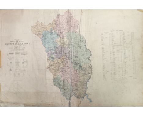
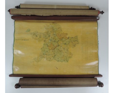
Lot 586
Kilkenny Ordnance Survey Atlas: Ordnance Survey of Ireland - Townland Survey of the County of Kilkenny and the County of the City of Kilkenny. Large Atlas folio D. 1842. With dbl. page hand coloured Index Map, & 47 lg. dbl. page maps, hd. cold. in outline, a.e.g., later hf. mor. As an Atlas, w.a.f. * M/ss note inside front cover by Mr. D. O'Neill Flanagan, dated 1980, states his father purchased this atlas at Duke of Ormonde's Sale at Kilkenny Castle, 1935. (1)
Lot 306
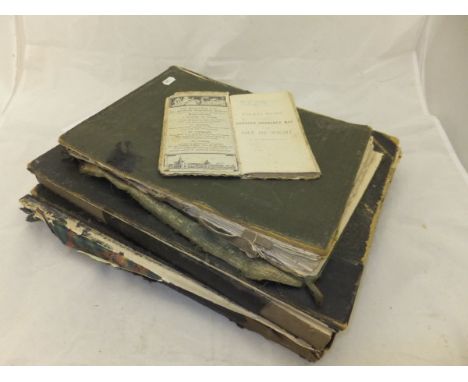
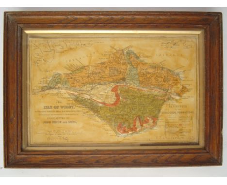
"Maps of the Society for the diffusion of useful knowledge Volume II", London, Chapman & Hall 1844, one further volume (possibly Volume I), plus "Cassells New Atlas", 2nd Edition. and an Ordnance Survey folding map of the Isle of Wight CONDITION REPORTS Cassells Atlas : in very poor condition, very damaged pages fallen out of spine and covers broken and with losses, stains, etc. - not known whether complete or not. "Maps of the Society ..." : covers separated, spine broken, various tears, stains, damage and losses, also yellowing, foxing and stains to pages and to most maps although maps generally appear in reasonable condition and include a lot of town plans, majority of town plans appear to be in reasonably good order (but all with various stains, yellowing, etc.), but there are some with damage including Turin which has a large hole to it and large tears, and some others with smaller tears. One of the volumes has burn marks to top and throughout, and various areas of damage, loss, stains, discolouration etc., both volumes have various areas which appear to have been reinforced and some large fabric areas so may have been re-bound at some stage in the past but now in need of restoration.
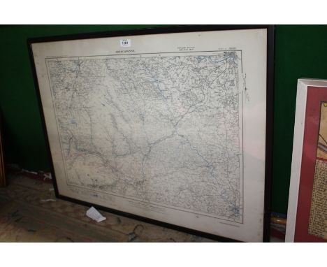
![DUBLIN IN PRINT: COLBY (Colonel T F):Ordnance Survey of the County of Londonderry,Volume the First [all published]. Dublin:](https://cdn.globalauctionplatform.com/6aa914bf-f418-4c2b-acd7-a52500e8224f/aec4cb4c-3f7f-4ae7-88b8-547dfcd89ac5/468x382.jpg)
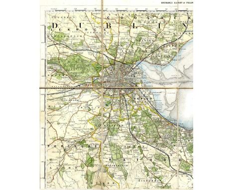
Lot 56
DUBLIN IN PRINT: COLBY (Colonel T F):Ordnance Survey of the County of Londonderry,Volume the First [all published]. Dublin: Published for Her Majestys Government; Hodges & Smith, 1837. First edn., 4to, hand-coloured geological map of the Parish of Templemore, folding plan of the City of Londonderry (foxed), 8 other plans, 1 view, 7 natural history plates (2 hand-coloured), plus illustrations in the text. Rebound in modern cloth; foxing (some heavy)
Lot 224
Folding maps. CARY (John) Map of England and Wales, 1813, hand coloured engraved folding map, dissected and linen backed (some general age browning); together with various early 20th century folding touring maps, mostly Ordnance Survey or Bartholomew, mainly of Britain, and including geological maps of London District 1927, and England and Wales by Stanford 10 miles to 1 inch, 1948 (quantity)
Lot 348
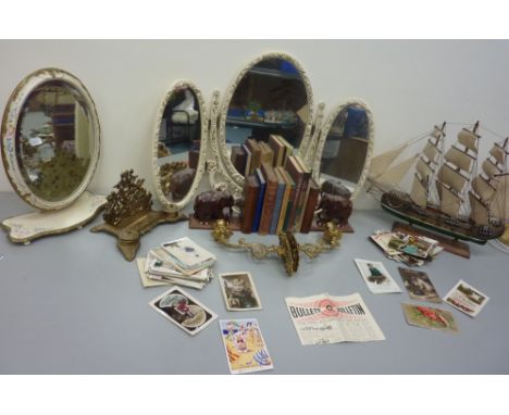
Vintage Ordnance Survey map of Scarborough, pair carved wood elephant bookends H17cm, 'The Story of the Life of George Stephenson Railway Engineer' by Samuel Smiles pub. 1862 and other books, pair brass wall sconces and a letter rack, model of a galleon, two dressing table mirrors and a collection of vintage cards
Lot 96
GNR tenancy agreement and maps for land at Hadley Wood station. 6 inch Ordnance map re GC and mid Joint Line Rotherham to Shereoaks railway, bound linen map 58 Survey of "Liverpool Street", Large linen bound map Post War Development Peterborough. Linen map diagram of MGN and GE Rly with New committees Lines Norfolk/Suffolk January 1904, etc
Lot 320
CANAL MAPS: SHAWE (W.): 'Philips' New Map of England & Wales. Compiled from the Ordnance Survey Showing Canals, Navigable Rivers, Principal Railway Lines..'; London & Liverpool, George Philip & Son, circa 1900, folding colour litho map, printed on paper and laid onto linen, dissected into forty sections and contained in orig. pub. purple cloth slip case, with printed label to one side; together with eighteen others, British and European folding canal maps, mostly later 19th/early 20th century. (19)
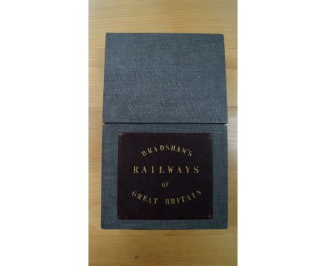
Lot 345
RAILWAY MAP: BRADSHAW (George): 'Bradshaw's Map of the Railways, Canals, Navigable Rivers & Mineral Districts of Great Britain, Reduced from the Ordnance Survey, Shewing All the Railway Junctions, Stations & c., also the Lines on which the Electric Telegraph is Laid Down..'; London, W. J. Adams, n.d. (circa 1860), folding engraved map hand-coloured in outline, printed onto paper and laid down on linen, two sheets dissected into forty two sections and measuring approx. 1660 x 980mm, contained in modern grey cloth-covered case preserving the original gilt titled burgundy morocco panel to one side, some light browning and offsetting to the map, otherwise good. (1) Condition Report: map very good, light toning and a few minor marks, a few smudges to reverse, case scuffed.
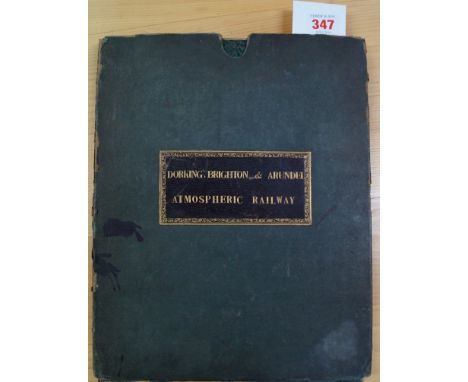
Lot 347
DORKING, BRIGHTON & ARUNDEL ATMOSPHERIC RAILWAY: A large folding twenty four sheet map from the Ordnance Survey printed by Ramshaw circa 1845-50, showing proposed route of the railway added by hand in red and blue ink. Large steel engraved map measuring approx. 1850 x 950mm, folding down into period green cloth slip case with burgundy morocco gilt label to one side titled 'Dorking, Brighton & Arundel Atmospheric Railway..', slip case scuffed and frayed with a few ink splats, some foxing and browning to map but condition otherwise generally sound. (1)
Lot 674
MAPS: Three large cartons of maps, largely later folding Ordnance Survey Maps but to include two sheets (of four) from a large format Stanford's Library Map of London & Suburbs; and some other earlier material; to also include a large framed sea chart of the approaches to the River Clyde. (Quantity: three cartons)
Lot 332
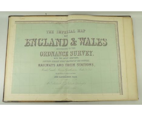
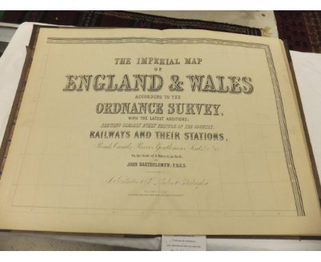
A copy of 'The Imperial Map of England & Wales according to the Ordnance Survey, with the latest additions; shewing clearly every feature of the country, railways and their stations, roads, canals, rivers, gentlemen's seats, &c. &c, on the scale of 4 miles to an inch, by John Bartholemew FRGS,' published by A Fullerton & Co, London & Edinburgh, half calf, folio.
Lot 203
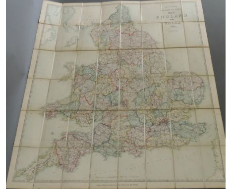
"The Imperial Map of England and Wales according to The Ordnance Survey with the latest additions showing clearly every feature of the country, railways and their stations, roads, canals", on the scale of 4 miles:1 inch, by John Bartholomew, FRGS, published by A Fullarton & Co. London and Edinburgh, folio size, cloth board bound with tooled and gilded leather spine CONDITION REPORTS Exterior very damaged and mouldy and warped. Pages have some wear, dirt yellowing, and some foxing and stains. Map plates appear to be complete. The atlas is not dated. Size is approx 56 x 40cm when closed.
Lot 250
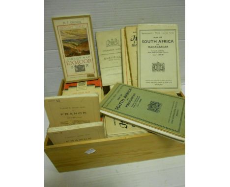
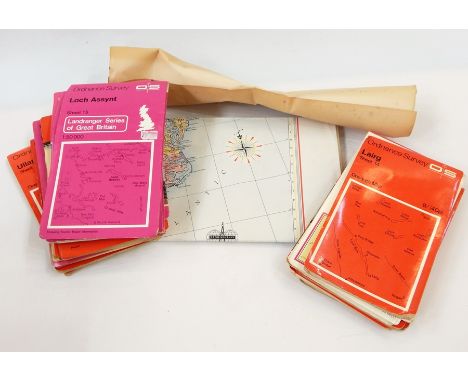
ASSORTED CIGARETTE CARDS including H.C. Lloyd & Son, 'Academy Gems', 1902, various (3, one creased); Edwards, Ringer & Bigg, 'War Map of the Western Front, Series 2', 1917, (2/54); and Carreras, 'Women on War Work', 1916, (2/50), contained in two albums; together with a quantity of folding Ordnance Survey, Bartholomew, and other maps, (approximately 65).
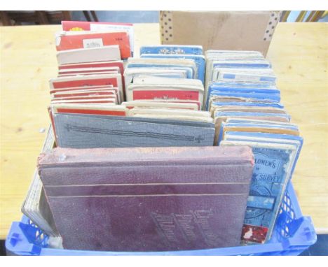
Lot 49
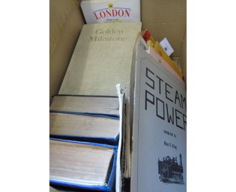
Irish Railways Today by Brendan Pender & Herbert Richards. Dublin: Transport Research Associates, 1967. The ABC of Irish Locomotives by R.N. Clements and J.M. Robbins. London: Ian Allan Ltd., 1949. Corus Iompair Eireann - Regulations for Train Signalling on Double and Single Lines (1952). And Silvermines Railtour, a souvenir brochure written by D. Donaldson. Also a Volume of Bradshaw's July 1922 Railway Guide (Published 1985), Handbook of Stuart Models, Two Volumes, October 1974 & July 1979. Both well-illustrated throughout. Both with fold-out Price List of Stuart Models. Locomotive Model Building & Similar Interest: Hornby Railways Magazine (no date, circa mid 20th century), Bassett-Lowke Model Railways and Their Equipment Catalogue (1938), Model Car Manual by G.H. Deason (1949), Model Equipment by W & H Models Catalogue, The Railroad Catalog From Microscale #10, Simple Cardboard Models by G.H. Deason (1969), Steam Power compiled by Alan King, Working Instructions & Price List of Spare Parts for Badmfords' Petrol Enginers, and Walthers 50th Anniversary Decal Catalog. Six Volumes of the Royal Automobile Club Guide & Handbook, The Earliest 1926-27, also 1949-50, 1950-51, 1953, 1958 & 1981. All containing advertisements, coloured and black & white scaled maps. Alao Golden Milestone - 50 Years of the AA, edited by David Keir and Bryan Morgan (London, 1955, first edition). The AA Conversation Handbook for Tourists, no date, circa 1950. Two Ordnance Survey (Scale 1/4 Incl to 1 Mile) Maps of Ireland - South East. A Shell Road Map of Ireland (Scale 1 Inch to 6 Miles). An iarnród éireann Distribution Fastrack Network Map of Ireland (Scale 1 to 350,000). And an AA Guide to London - What to See - Where to Stay.(Box)
Lot 445
Ordnance Survey, - No. XCIII, part of Yorkshire, map, one inch to the mile, hand-coloured, dissected and mounted on linen, morocco slip-case, gilt rules, worn and scuffed, c.1275 x 1485mm., Southampton, 1866 or later § No 101, part of Yorkshire, six inches to the mile, scorch hole to right margin, margins frayed or litle torn, some marking, c. 700 x 1070 mm., Southampton, 1856 § Jackson's Map of the Bramham Moor Hunt, colour map, dissected and mounted on linen, advertisments on part of verso, lower margin little torn, red morocco, gilt, worn, spine missing,, cover loose, Leeds, n.d ., with 23 other Yorkshire maps, many Ordnance Survey, (26)
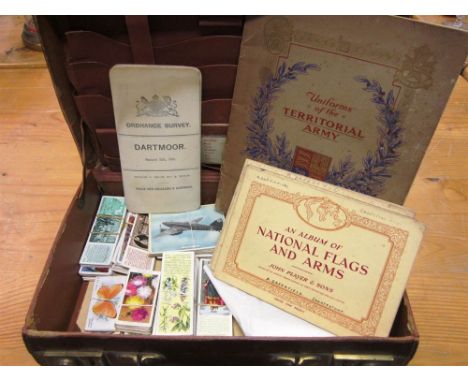
Lot 304
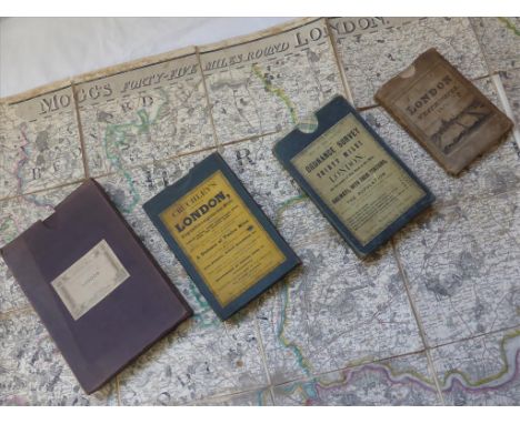
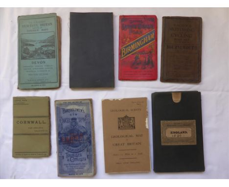
CIGARETTE & TRADE CARDS - ASSORTED including Wix ('Kensitas') woven silk flowers (sixty-six small size; two medium; two postcard), some duplication; Player, 'Uniforms of the Territorial Army', 1939, generally good (50/50), in adhesive album; and Player, 'National Flags and Arms', 1936, generally good (50/50), in adhesive album; also an Ordnance Survey one-inch folding map of Dartmoor (sheets 324, 338), circa 1900; all contained in a small leather case.
-
1765 item(s)/page