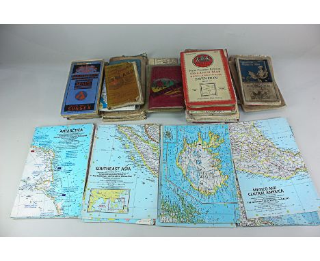
We found 1765 price guide item(s) matching your search
There are 1765 lots that match your search criteria. Subscribe now to get instant access to the full price guide service.
Click here to subscribe- List
- Grid
-
1765 item(s)/page

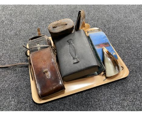
Lot 352
MAPS: 1- Urban District of Huyton with Roby. Large folding linen backed in 9 sections. Liverpool, Douglas & Walls, nd. (121x106 cms.); 2- Lancashire: Colonel Colby, 1872. 14 sheets, restored by Arthur W Johnson, with his receipt and clamshell box: 3- Letts & Son: OS Map of Hertfordshire. Colonel Colby, 1822-44. Hand coloured folding linen backed in 4 sections, each measures: 96x64 cms. with the original half leather box.; 4- Saffron Walden: 2 large folding Hand coloured linen backed OS Maps in Edward Stanford slipcases. Col. Farquharson, 1896; 5- House of Commons: Ordnance Survey Papers, 1857. Folio, with 28 plates; Plus: Report of the progress of the Ordnance survey, to Dec. 31, 1875. 1876, with 6 folding maps. (7)
Lot 602
Folding maps: a collection of folding maps including Ordnance Survey Tourist maps of the Isle of Wight and Snowden, OS Leisure map of the Peak District (with illustrated covers), Cruchley’s County Map of Surrey, Cary’s Reduced Ordnance Map of Wiltshire, Bacon’s map of the Environs of Brighton, Philips’ Railway map of the British Isles, 3 OS maps from the the 4th Popular Edition and others
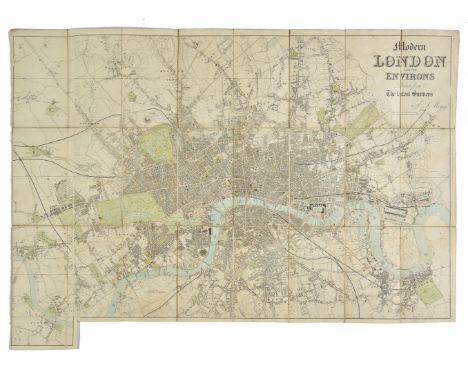
Lot 113
London. Mogg (E. S.), Modern London and its Environs, circa 1846, engraved map with contemporary outline colouring, sectionalised and laid on linen, 530 x 820 mm, together with Stanford (Edward, publisher). A Map of the Environs of London extending Twenty-five Miles fr. the Metropolis, circa 1870, lithographic map with contemporary outline colouring, sectionalised and laid on linen, slight overall toning, 910 x 930 mm, retaining one cloth board, with D avies (Benjamin Rees). Davies's New Map of the British Metropolis. The Boundaries of the Boroughs, County Court Districts Railways, and Modern Improvements, published Edward Stanford, 1889, lithographic map with contemporary outline colouring, dust soiled and torn horizontally in half along old linen, overall size 660 x 940 mm, retaining one cloth board, plus an early 20th century Ordnance Survey map of part of Shropshire on a scale of six inches to the mile, heavily stained, marbled endpapers, plus a mid 20th century colour printed map on silk of the coastline of Japan, 1200 x 1300 (Qty: 5)NOTESThe first item described. Howgego number 390, state 2 (a).
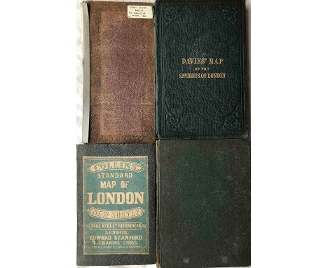
Lot 471
Selection (4) of 19th-century London MAPS comprising 1833 James Wyld's Map of the Vicinity of London (sectioned on card-backed pages) plus linen-backed fold-out maps inside hard covers: 1861 Ordnance Survey 1" London & Environs, 1863 Davies' Map of the Environs of London and 1871 Collins' Standard Map of London. All are in generally good, used condition with varying degrees of wear. [4]
Lot 1
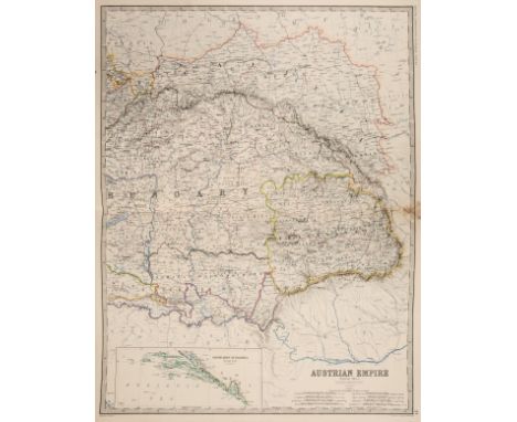
Atlases. Johnston (W. & A. K. Ltd. publishers), Johnston's Royal Atlas of Modern Geography, 1910, title page with old library stamp, numerous colour printed maps, including many double page, partially disbound with contents shaken and loose, slight spotting throughout, all edges gilt, boards and spine covered in later velvet, heavily worn and frayed, folio, together with an earlier edition of 1861, with Bartholomew (John). The Imperial Map of |England & Wales According to the Ordnance Survey..., published A. Fullarton & Co., circa 1870, sixteen (only) colour printed double page maps, some staining and spotting, text block detached, contemporary half calf gilt, heavily worn and frayed, spine crudely repaired, folio (Qty: 3)NOTESSold as a collection of maps, not subject to return.
Lot 699
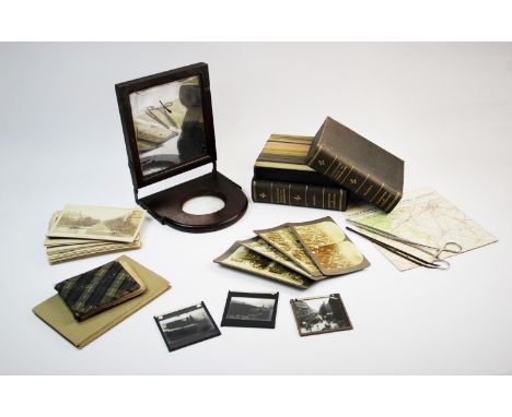
A mixed collection of stereoscopic viewing cards, to include 'Palestine Through The Stereoscope', French architectural landmarks, two photograph tongs, a folding mahogany framed mirrored magnifier, an ordnance survey map of North Wales, two other maps, early 20th century autograph album etc (Qty)
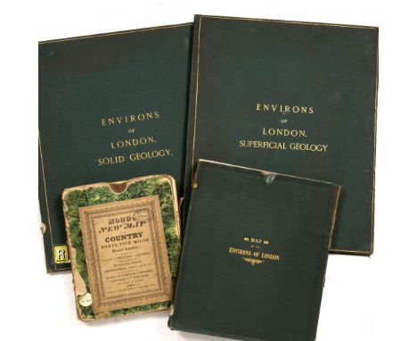
Lot 791
ORDNANCE SURVEY OFFICE, Colonel, Sir H James, Superintendent 1861, Environs of London Superficial Geology and Solid Geology, two 8 panel on linen coloured maps, 116 x 71cm folding into green cloth boards with gilt lettering and marbled end paper plus a large folding map 'Bacon's Library Map of the Environs of London' c.1850-1870. 28 coloured panels on linen with key and marbled end papers, 150 x 100cm approx. in green cloth slip case, ex Wimbledon Library stamps throughout, plus MOGG ‘New Map of Country 45 miles round London’ (4 in lot)
Lot 82
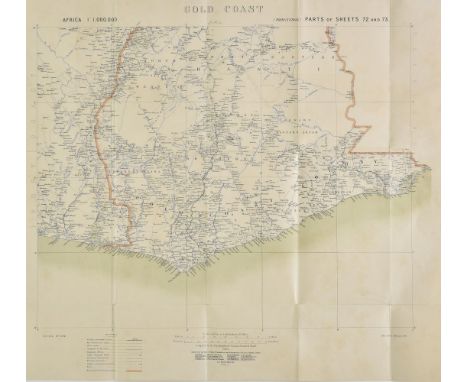
Africa. A mixed collection of maps of the Gold Coast and German East Africa, mostly 19th & early 20th century, engraved, lithographic and manuscript maps, including Ordnance Survey (publishers). German East Africa Mahenge, German East Africa Massassi, German East Africa Ikoma and another four regional maps similar, circa 1916, together seven colour printed maps, some marginal fraying caused by rodent damage, each approximately 670 x 770 mm, together with War Office (publisher), Gold Coast, 1907, colour lithographic map, old folds, 540 x 590 mm, with another similar but published by Ordnance Survey in 1906, with Wallach (Henry, surveyor). A Map of the Gold Coast with part of Ashanti showing the positions and Areas of Mining Properties, 1901, two large lithographic maps, sectionalised and laid on linen, some spotting, each approximately 1040 x 780 mm, with another nine printed and manuscript maps similar, various sizes and condition (Qty: 20)
Lot 133
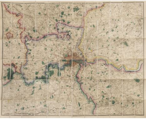
London. Wyld James, publisher), A New Map of the Country Twenty-five Miles round London, circa 1860. engraved map with bright contemporary hand colouring, sectionalised and laid on linen, 1040 x 1315 mm, marbled endpapers, contained in a contemporary cloth slipcase with publisher's printed label to upper cover, case partially split along joints, together with: Cary (John). Cary's New Pocket Plan of London Westminster and Southwark with all the adjacent Buildings in St. George's Fields &c. &c., 1825, engraved map with contemporary hand colouring, sectionalised and laid on linen, slight staining, 420 x 605 mm, marbled endpapers, contained in a contemporary card slipcase with printed title label to upper cover, case worn, Bacon (G. W., publisher). Bacon's Map of the Environs of London 12 Miles around Charing Cross, circa 1880, folding lithographic map with contemporary outline colouring, 640 x 795 mm, bound in contemporary cloth boards with decorative title label to upper cover, boards worn and faded, plus 1 0 other folding maps of London, The Thames Estuary and The River Thames, with examples by Stanford, Ravenstein, Reynolds, Ward and Ordnance survey, various sizes and condition (Qty: 13)
Lot 764
An album containing a quantity of early 20th century onwards British and worldwide topographical postcards including a number from Australia, a tin containing further postcards, an album containing family portraits, a late 19th century Ordnance Survey map of Bristol and the mouth of the river Severn, various autographs including Kevin Keegan, etc (4)
Lot 191
Victorian to 1930s Maps and Guides, various maps many on cloth including Ordnance Survey, Manoeuvre Map Aldershot District, Country Round Aldershot (2) one with illustrated covers, 1934 Quarter Inch map fourth edition South east and London, 1922 Tourist Map Chichester, Bartholomew, Environs of Aldershot pocket series, Quarter Inch map London District and half inch maps (12) all with blue covers and three 1930s Ward Lock guides, together with Souvenir De Paris dated 1896 and Palais De Fontainebleau dated 1918, F, (27)

Lot 246
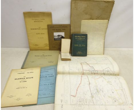
Yorkshire, collection of twenty-seven Ordnance Survey maps, scale six inches to one statute mile, Farndale folding map, 1930's & later Yorkshire land sale catalogues: The Brawby Park Estate, The Kilnwick Estate, Park House Farm, The Barmston Estate & others, The Land Valuer's Assistant by R. Hudson 1811, Illustrated Guide to Hull, pub. A Brown & Sons 1890 etc
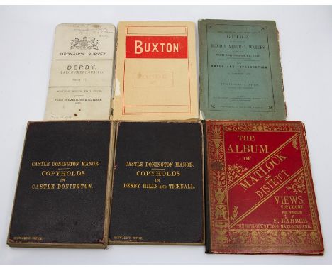
Lot 160
Derbyshire History Interest. Collection of maps and guides comprising: Derby Corporation town planning map, Ordnance Survey, extensively hand-coloured with manuscript key, signed by the surveyor and dated January 1920, sectional, linen-backed; two sectional linen-backed folding maps for Castle Donington Manor (Copyholds in Derby Hills & Ticknall; Copyholds in Castle Donington); linen-backed folding Ordnance Survey map of Darley Abbey, marbled paper ends, slipcase bearing Stanford label; OS map of Derby dated in black ink (16 January 1912); three late-Victorian/Edwardian guides to Buxton; two albums of printed views depicting Buxton and Matlock (10)
Lot 36
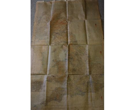
England and Wales. Wyld (James), Railway Map of England, Wales and Scotland, Drawn from the Triangulation of the Ordnance Survey, the Survey of the Railway Companies, and Other Information..., circa 1855, very large engraved map with contemporary outline colouring on four sheets and laid on linen, heavily dust soiled and stained at base with numerous closed tears, mostly at base, presented on a contemporary wooden batten with gilt manuscript title 'England' on a separate panel affixed to batten, with large spring loaded roller at top of map, 1970 x 1310 mm, contained in a contemporary painted pine box, together with Wyld (James, publisher). An untitled Ordnance Survey map of most of Staffordshire and Warwickshire, circa 1845, large engraved map with contemporary outline colouring on twenty-eight conjoined sheets and laid on linen, heavily dust soiled and stained at base with several closed tears, mostly at base, presented on a contemporary wooden batten with a gilt manuscript title 'Staffordshire' on a separate panel affixed to batten with a large spring loaded roller at top of map, 1820 x 1460 mm (Qty: 2)
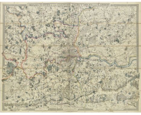
Lot 51
London. Froggett (John Walter), From the Ordnance Survey of the Country Thirty Miles round London, published G. F. Cruchley, with additions to 1855, large engraved map with bright contemporary outline colouring, sectionalised and laid on linen, marbled endpapers, cancelled library stamps to verso, 1085 x 1380 mm, contained in a contemporary cloth slipcase with printed label to upper cover, (Qty: 1)NOTESHowgego. no. 333. A later and unrecorded state as the last dated example (state 4) is 1841.
Lot 504
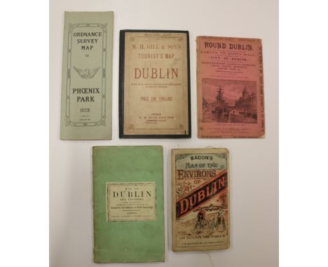
Dublin Guide & Maps: Longley (F.E.) Round Dublin, Being a Short Account of the Express Route from Euston to North Wall, A Concise and Comprehensive Survey of the City of Dublin, and a Short Description of the Angling Resorts of Blanchardstown, Clonsilla, Dunboyne, Lucan, Leixlip, Maynooth, Carton, Trim etc. 8vo L. n.d. c. 1870 Sole Edn., illus., pict. wrappers; Stanford (Ed.) Map of Dublin and Environs, c. 1860, Soc. for the Diffusion of Useful Knowledge, 2 fold. sections; M.H. Gill & Son's Tourist's Map of Dublin, 8vo D. c. 1890, lg. fold. map, with straight tears; Bacon's Map of the Environs of Dublin, L.c. 1875, lg. fold. cold. linen backed map; Ordnance Survey Map of Phoenix Park, for Catholic Emancipation Celebrations 1929. As a lot, w.a.f. (1)
Lot 650
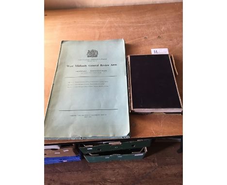
Geological Survey of England and Wales, hand-coloured map, sectional, linen-backed, manuscript title with Ordnance Survey blind-stamp at centre of top border (February 1879), 129cm by 104cm. Good, clean, bright; thin strip of discolouration at centre; comes with remnants of contemporary slipcase. Together with a folded printed map in paper folder, West Midlands General Review Area, Report No. 2, London: Her Majesty's Stationery Office, May 1961 (2)
Lot 115
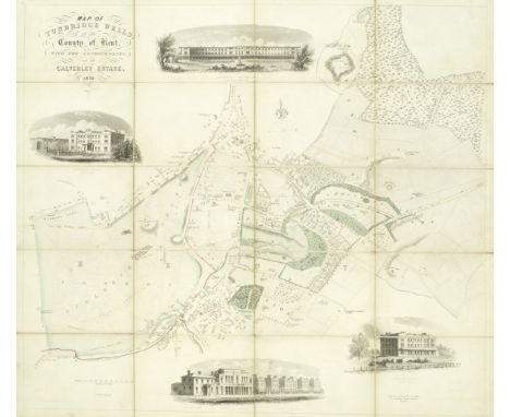
MAPSMap of Tunbridge Wells, in the County of Kent, with the improvements, on the Calverley Estate, hand-coloured engraved folding map, 4 uncoloured vignettes, dissected into 16 sections and mounted on linen, original gilt-titled slipcase, 555 x 640mm., J. Henshall, 1838--LOWER (JOSEPH RICHARD) Colbran's Visitors' Map of Tunbridge wells, hand-coloured lithographed map in 18 sections, mounted on linen, folding into publisher's cloth with printed label, 500 x 620mm., J. Colbran, n.d.--DAVIES (B.B.) Map of the Environs of London, hand-coloured engraved map, dissected into 36 sections and laid on linen, folding into publisher's cloth, 785 x 1100mm., Edward Stanford, 1859--CARY (JOHN) Six sheet Map of England and Wales with Part of Scotland, large hand-coloured engraved folding map on three sheets, dissected into 72 sections and mounted on linen, publisher's slipcase with printed label, each sheet 465 x 1040mm., G & J Cary, 1833--Reduced Ordnance Survey Around Tunbridge Wells, large hand-coloured engraved map, dissected and mounted on linen, folding into publisher's cloth with red morocco label, 905 x 1300mm., Birmingham, George Richmond, [c.1860]; and 17 others, mostly folding maps by Colbran, Sprange, Wyld and others (22)This lot is subject to the following lot symbols: •

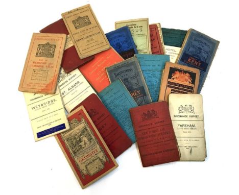
Lot 188
Cartography interest: A large selection of approx. 20 linen backed maps, to include a Daily Mail Road Map of London, a Ravensteins map of Taunus, seven Bartholomews maps of Fife, Sheffield, Surrey, York, Kent, Germany and Bedford, a W.H Smith map of Hampshire, and ten Ordnance survey maps of Weybridge, Colchester, Marlborough, East Kent, Rugby, St.Albans, New Forest, Fareham, Rickmansworth and Maidstone; together with a set of eight postcards of the Bull Hotel, Burford in the Cotswolds
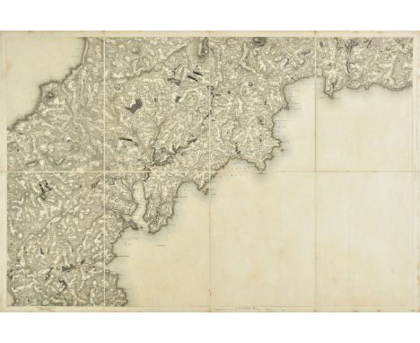
Lot 28
Cornwall. Mudge (Lt Col.), Ordnance Survey map of Cornwall, 1813, five engraved sheets with sparse contemporary outline colouring, sectionalised and laid on linen, slight dust soiling, each sheet approximately 610 x 910 mm, contained in a contemporary calf book-box with the crest of the Ordnance Survey on the upper siding, the box, worn and frayed (Qty: 1)NOTESThe map has a smaller calligraphic title sheet but this is erroneously the title sheet for Devonshire and not Cornwall.
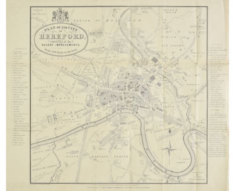
Lot 60
Herefordshire. A collection of thirty-seven maps, mostly 19th century, engraved county maps and town plans of Hereford and Leominster, with examples by Dawson, Lewis, James, Cole & Roper, Seller/Grose, Conder, Ordnance Survey, Weller, Collins, Bacon, J & C Walker, Hughes, Becker, Duncan, Moule, Archer, Fullarton, Hall, Pigot, Murray, Phillips, Smith and Harrison, including a reproduction map by Bickham and a reproduction road map by John Ogilby, various sizes and condition (Qty: 37)
Lot 456
Greenwood & Co map of the East Riding of Yorkshire, pub 1834 59cm x 74cm an Ordnance survey sheet for part of the East Riding, 1911 edition 39 x 50cm and a reproduction Speed map of Yorkshire Condition Report & Further Details Click here for further images, condition, auction times & delivery costs
Lot 1492
An Ordnance Survey map of theEngland, by John Bartholomew, scale inch-mile, fitted with five interchangable rolls, in an ebonised rotary scroll, in original leather case inscribed 'Lady Armstrong, Cragside, Rothbury' retailed by Mawson Swan and Morgan, Newcastle upon Tyne, the scroll 43cms wide.
Lot 978
A collection of 19th century pocket county maps engraved by Sidney Hall, published by Chapman Hall, Worcester Herefordshire, Oxfordshire, Warwickshire, Monmouthshire, Dorsetshire, James Wyld - Devonshire, J & C Walker, Gloucestershire, together with a 1904 Cotswold Hunt map - Ordnance Survey 1 inch = 1 mile (9)
Lot 998
Map. Ordnance Survey of Great Britain: Lancashire. 1 inch scale. 1852. In 3 parts. South, Central and North divisions. Published by Lieut. Col. Hall. Folding, linen-backed, with outline colouring. Sold by Letts, Son & Co. London. Housed in original purpose leather bound case designed as a book, rubbed and worn.
Lot 1144
J WALKER OF WAKEFIELD; 'Map of the Inland Navigation, Canals and Rail Roads with the Situations of the Various Mineral Productions Throughout Great Britain, from Actual Surveys Projected on the Basis of the Trigonometrical Survey Made by Order of the Honourable Board of Ordnance [...] Published by Richard Nichols, Bookseller, Wakefield [...] January 1st 1830 [...] to the King's Most Excellent Majesty this Map (With His Gracious Permission) is most Respectfully Dedicated by His Majesty's Most Obedient and Devoted Subjects, Nichols, Priestley and Walker', large coloured linen backed folding map, approx 190 x 156cm, housed in apparently original calf bound book form case with gilt tooled title to spine 'Map of Inland Navigation and Rail Roads'.Additional InformationOuter case worn, map with some discolouration, some surface marks, scuffs, small areas of loss, some spotting, please refer to illustrations and request additional if necessary.
![Speede, John; More, John Canaan. Thomas Basset and Richard Chiswell, 1651 [1676]. Framed and glazed double-sided, hand-colour](https://cdn.globalauctionplatform.com/34f3d4a9-9654-4e9b-9c4c-aa8900bb1226/0a060264-c139-4285-8ec1-aab700dde6a5/468x382.jpg)
Lot 96
Speede, John; More, John Canaan. Thomas Basset and Richard Chiswell, 1651 [1676]. Framed and glazed double-sided, hand-coloured, English text on verso. Speede's maps usually showed the land as it was experienced. Even if not to the levels of accuracy of a modern ordnance survey map, they strove to show the locations as they related to each other and the land on which they were situated. From the first though, Canaan was different. Canaan is a land created in two places. The first is on the ground, in the towns, rivers, mountains and other features of geography, both natural and man-made. The other is in the mind, particularly of Christians, who will be comparing the land they see with that they first experienced through the words of the Bible. This was especially true for readers of the King James Version for whom this map was an integral part of their reading of the Bible. The map was first featured in the Geneva Bible as published by Robert Barker. Speede was still a tailor when he first became involved with this map - his first cartographic work. John More (credited on the map) did the first work on it whilst a Fellow of Christ's, Cambridge. After his death in 1592 it was passed to Speede who finished it and received a licence to print and insert it in the KJV for ten years from 1610. By the time the KJV was first published in 1611, Speede was already one of the most important cartographers in England, and busily working on his famous county maps, many of which feature in this sale. Interestingly, this map did not feature in the first issue of Speede's Prospect, but was added later. Despite current knowledge, Speede's map contains oddities to the modern eye. Most specifically the coastline follows the Ptolemaic slump, despite the actual coastline being known. This is part of the purpose of this map. The map is not the territory. The map does not even follow Ptolemy's desire to be accurate (within the limits of contemporary knowledge), but rather to use Ptolemy's coast as a short-hand to evoke the era. This map sets out to create a place that never existed, it is not a tool for explorers of anything but the words on a page. Speede's map shows events, places, people, and details from across Biblical history. The Dead Sea is the Lake of Sodom, Pharoah's armies (equipped as expected in Jacobean armour) drown even as Judas hangs himself. Ancient Kingdoms share space with Jewish settlements. The inset map of Jerusalem lists important places in the story of the Passion, but they are not a pilgrim map, rather a reminder, a positioning in a space not physical but mental. Despite all this, there are suggestions that the map inhabits a 'real' world and is not merely a fairytale realm. The new habit for framing the map in longitude and latitude is followed. Whilst a traveller could never hope to find a location using them, it reminds the reader that the place (and by extension the events depicted and remembered) is real. The leviathan frolics in the depths but this is not to say there are literal monsters beneath the waves (nor even to recall Jonah's whale) but rather to remind of the troubles of travel. Even the choice of name is suggestive. Whilst Christians today might accept 'The Holy Land', to a Protestant this would be redolent of Papistry, whilst other more accurate names might be overly Jewish in suggestion. Canaan is the ancient name, all other names (whether Israel or Outremer) are tranistory compared to the Biblical truth which underlies all. In Protestant eyes, the holy places had no intrinsic spiritual value and visiting them was unnecessary - as the map reminds us, ''Nether in Ierusalem, nor in this Mountaine shal ye worship''. The idea of pilgrimage was, if not anathema, highly suspicious. Whilst English ships crossed the seas, they did so for trade, and there was little to trade in Palestine - not even treacle in Gilead. For the strict Protestant Englishman, the critical thing was your relationship with God through Christ, the rest was confusing trappings which got in the way. This map was all you needed to give a context to your reading of the Bible, and the experience of the Word would open you to God's Grace.
-
1765 item(s)/page