We found 1765 price guide item(s) matching your search
There are 1765 lots that match your search criteria. Subscribe now to get instant access to the full price guide service.
Click here to subscribe- List
- Grid
-
1765 item(s)/page

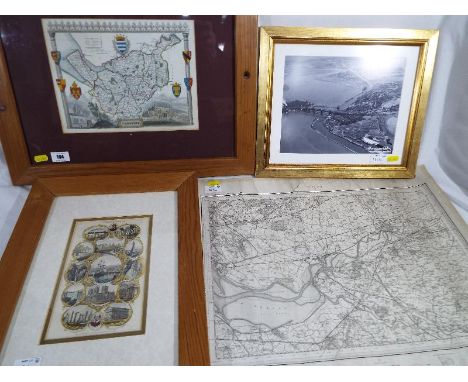
Lot 117
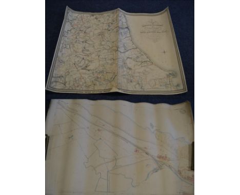
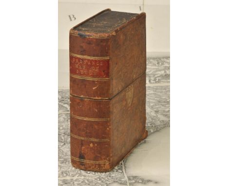
Kent. Faden (William, publisher), General Survey of England and Wales. An entirely new and accurate Survey of the County of Kent with part of the County of Essex, Done by the Surveying Draughtsmen ofHis Majesty's Board of Ordnance..., under the Direction of Capt. W. Mudge of the Royal Artillery F.R.S., 1801, large map, engraved by Thomas Foot, sparse near contemporary colouring highlighting the roads, sectionalised and laid on linen, slight dust soiling and staining, 1185 x 1765 mm, publisher's label to rear of upper siding, contained in a contemporary morocco book box with the gilt arms of Ordnance Survey, scuffed and worn The first map published by Ordnance Survey. (1)
Lot 48
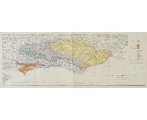
Dixon (Frederick). The Geology of Sussex; or The Geology & Fossils of the Tertiary and Cretaceous Formations of Sussex, new edition, revised and augmented by T. Rupert Jones, 2nd edition, Brighton, William J. Smith, 1878, colour lithograph frontispiece, folding coloured geological map of Sussex, 63 uncoloured photolithographed plates (numbered 1-64, including frontispiece) at end, some light spotting to map, final leaf of text and first plate, original yellow chalk-glazed endpapers, original quarter plum morocco gilt, rubbed and scuffed, 4to, together with Geological Map of Sussex by W. Topley, [1878], folding colour lithographic map with table of explanation and cross section of the geology of the English Channel from Seaford to the Isle of Sheppy, 260 x 715 mm, bound in original green cloth with gilt title to upper cover, rubbed and slight wear to spine, slim 4to The geological map was first drawn by Frederick Dixon, a surgeon who practised in Worthing and died in the cholera epidemic of 1849. William Topley was a geologist by profession, who surveyed the Weald between 1863 and 1873 and was Superintendent of the publication of the Ordnance Geological Survey from 1880. (2)
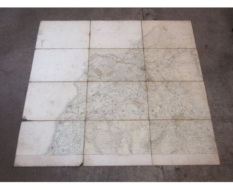
Lot 166
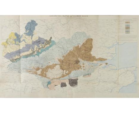
Water supply. Royal Commission on Water Supply. Plans & Diagrams, circa 1870, title printed in gilt on upper board, eight lithographed folding maps with contemporary outline colouring, showing geological formations, maps of rivers and river basins and contour maps, each backed with linen, occasional short splits along old folds, later endpapers, slight dust soiling, upper hinge strengthened with tape, contemporary half morocco gilt, rubbed, worn and stained, old paper stuck to upper board, folio The map titles and their individual sizes are:- Geological Map of the Thames Basin. 600 x 990 mm, Contoured Map of the Thames Basin. 590 x 955 mm, Royal Commission on Water Supply Geological Sections of the Thames Basin. 570 x 945 mm, Map of the Lake District of Cumberland and Westmorland shewing the General Geological Features of the Ground. 340 x 340 mm, Map of Part of the Lake District of Cumberland and Westmorland shewing the Reservoirs and Main Conduits proposed by Messrs Hemans and Hassard in their project for Supplying Water to the Metropolis. 740 x 790 mm, Map of the District at the Head of the River Severn in North Wales shewing the General Geological Features of the Ground. 430 x 430 mm, Map of the District at the Head of the River Severn in North Wales shewing the Reservoirs and Main Conduits proposed by Mr Bateman in his project for Supplying Water to the Metropolis. 940 x 815 mm [and] Ordnance Survey of England and Wales Rivers and their Catchment Basins. 1020 x 965 mm (1)
Lot 487
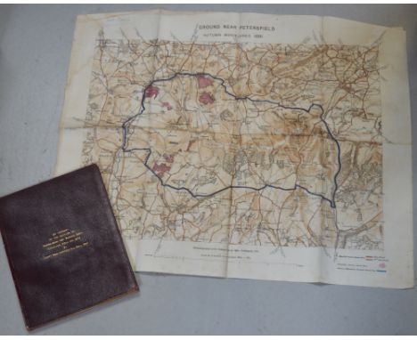
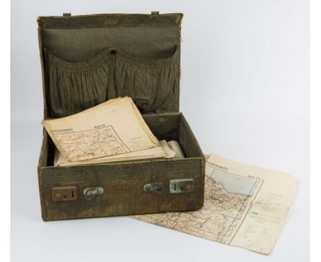
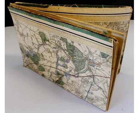
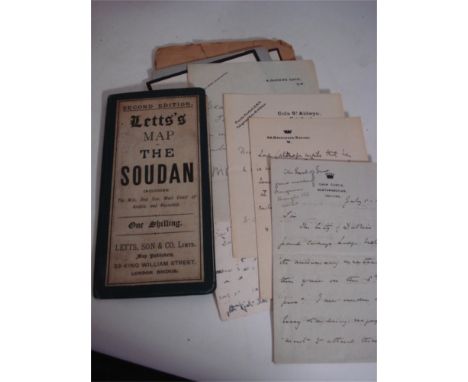
A leather bound account of the battles of Isandlwana and Rorke's Drift, Zululand, 22nd January 1879, by Captn. Penn Symons, 2nd 24th Regt. The account details the battles of Isandlwana and Rorke's Drift from a first hand perspective and subsequently from the few remaining survivors of both battles who are included in the list of survivors of 1/24th Regt; Pte. Williams, groom to Col. Glynn, Pte. Bickley, band member, Pte. Wilson, band member, Pte. Trainer, rocket battery, Pte. Johnson, rocket battery, Pte. Grant, mounted infantry and officers who escaped to include; Capt. Essex 75 Regt., Capt. Gardener, 14th Hussars, Lieut. Cachrane 32 Regt. Lieut. Smith Dorrien, 95th Regt and Lieut. Curling R.A. William Penn Symons (July 1843- October 1899) was a British army officer who lost his life at the battle of Talana Hill during the second Boer war. His first combat was in South Africa during the 9th Xhosa war (1877-78). In 1879 he took part in the Zulu wars which this book documents, the merest chance saved him form death at Isandlwana, also a linen map 'Ground near Petersfield Autumn Maneuvers 1891'. As photozincographed at the Ordnance Survey Office Southampton, 1891. CONDITION REPORT This is a private publication, there are 63 pages.
Lot 90
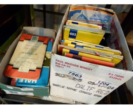
Folding maps. Dower (John), Ireland shewing the Roads, Railways &c. Constructed since the Ordnance Survey of 1839, by Charles Saunderson, published London, Dublin & Edinburgh, circa 1860, engraved map with contemporary outline colouring, sectionalised and laid on linen, near contemporary ownership signatures on verso, 990 x 815 mm, contained in contemporary gilt cloth slipcase, a little stained and worn, together with, Collins (H.G., publisher), Collins' Railway Map of England & Wales and part of Scotland, shewing the Inland Navigation by means of Rivers and Canals together with the Rail and principal Turnpike Roads, from the most recent surveys, circa 1860, lithographic map with contemporary outline colouring, sectionalised and laid on linen, slight staining, 940 x 670 mm, contemporary cloth boards, faded and worn, with, Cary (John), A New Map of Shropshire, divided into Hundreds, exhibiting its Roads, Rivers, Parks &c., 1828, engraved map, sectionalised and laid on linen, bright contemporary outline colouring, oval cartouche, 555 x 490 mm, contained in a contemporary card slipcase with printed label to upper board, worn and rubbed, plus, Walker (J & C), Somersetshire [and] Northamptonshire, 1846 & 1836 respectively, two engraved maps sectionalised and laid on linen, contemporary outline colouring, some dust soiling to Northamptonshire, each approximately 335 x 395 mm, contemporary cloth boards with printed labels to upper boards (5)
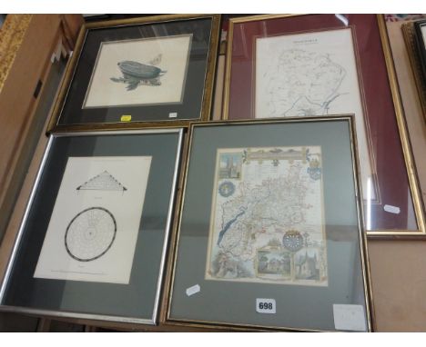
Lot 698
A collection of 19th century maps including example showing Gloucestershire with vignettes of Gloucester Cathedral, New Spa Cheltenham and Tewkesbury Abbey, 26 x 20 cm in gilt frame, a mounted map of Gloucestershire from Lewis's topographical dictionary, Glastonbury, Honiton and Bridgnorth from the Ordnance Survey (one framed and two mounted), a framed engraved design for a circular skylight, and an early 19th century coloured engraving of a butterfly on a cucumber, both framed, also together with A Century of Punch, edited by R E Williams
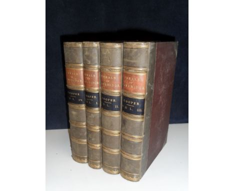
Lot 459A
COOPER (Charles Henry), Annals of Cambridge, four volumes, Cambridge: Warwick and Co. 1842-1852, 8vo, half calf (rubbed); together with JOHNSON (Samuel), Works, volume VI, London 1806; Johnson's Pocket Dictionary of the English Language, 1831; Selections from the British Poets, volume II, 1858; The Book of Poets, London: Darton & Co, no date, plates, cloth gilt, a.e.g.; with Ordnance Survey Map of Kendal and District (9)
Lot 1161
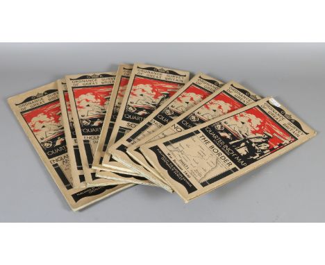
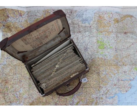
A near complete set of WW2 Luftwaffe 1:100,000 Invasion maps of Great Britain, (lacks no. 20 - Pembrokeshire - and 34 - London), each map with the text 'Sonderausgabe! Nur fur den Diensigebrauch!' (Special Edition For Official Use Only!), all folded, contained in a period crocodile effect carrying case., * These maps were produced just before the outbreak of war and were based on the Ordnance Survey ½in scale maps, enlarged to a scale of 1:100,000
Lot 274
A vintage post office directory wall hanging ordnance survey map for Edinburgh & Leith, approx 65cm long, also with seven vintage framed prints, to include old Carlton Hill at Edinburgh (8) CONDITION REPORT: Lot 274 - Edinburgh map appears to be original, various small tears and creases to all edges, small holes to base and top coming away from wooden scroll, fraying to material backing at edges, discoloured, central main part of map is in ok condition
Lot 130
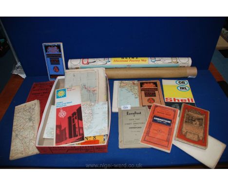
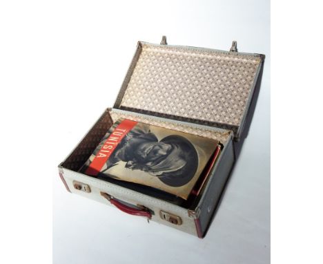
"Geographia" large scale street plan of the city of Bristol, on cloth, Ordnance Survey district map of Bristol bearing date 1929, picture post commemorating the Coronation 1953, The Army at War magazine "Tunisia" and "The Battle of Egypt", London Illustrated News of Coronation 1937, other magazines and Royal ephemera (1 case)

Lot 525
An Edwardian chromolithograph stipple print of riders in 17th Century dress, an etching with aquatint of a Venetian canal 40/70 signed Vgo Baracco watercolour landscape indistinctly signed, dated October 85, The School Cloister Oundle, limited edition colour print 774/1000, signed in pencil Jane Carpanini and a framed Ordnance Survey map of Tudeley Kent (5).
Lot 2131
Bell (John Thomas William) Plan of the Hartlepool Coal District in the County of Durham including part of the Wear District in the Same County, being the First of a Series of Plans of the Great Northern Coal Field..., 1843, Castle Eden, large hand coloured map, linen-backed, (wear to lower edge); with four Ordnance Survey maps of Hartlepool, 1/2500 scale c.1859, coloured, rolled sheets (5)
Lot 224
Warwickshire. Saxton (Christopher & Kip William), Warwici comitatus a Cornauiis olim inhabitus, [1637], uncoloured engraved map, strapwork cartouche and mileage scale, 295 x 350 mm, bound with eleven pages of descriptive text, 20th century cloth boards, slim 4to, together with, Kitchin (Thomas), A New and Accurate Map of Warwickshire drawn from the best Surveys and Intelligence..., published R.Sayer, T. & J. Bowles, circa 1760, engraved map with contemporary outline colouring, sectionalised and laid on linen, slight staining, 670 x 530 mm, contained in contemporary card slipcase with printed label to upper cover, with, Richmond (George, publisher), New Map round Birminham from the Ordnance Survey, circa 1870, large engraved map with contemporary outline colouring, sectionalised and laid on linen, 1040 x 1270 mm, publisher's cloth boards, upper board detached, with another seven maps and part volumes similar, various sizes and condition (10)
Lot 96
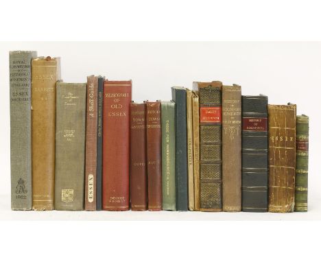
ESSEX:1. Dale, Samuel: History and Antiquities of Harwich and Dovercourt in the County of Essex. C Davis, 1732, 2nd edn., frontis plus 14 plates; ppxxiv, 464. Contemporary full leather. Rebacked with original spine; occasional foxing;2. History and Description of Colchester. Two volumes in one. Colchester, W. Keymer, 1803, 1st edn. with 6 plates; rebound in the last 50 years in half leather. VG;3. White, W: History, Gazetteer and Directory of the County of Essex. Robert Le, 1848. pp732(including adverts). Contemporary full leather. Spine detached; o/w G;4. Benton, P: History of Rochford Hundred. Rochford, Harrington, 1867. Inscribed and signed by author (two other volumes were published later);5. Plus thirteen others. Including: Excursions in Essex (vol.1) with folding map and many plates; Maldon & the River Blackwater; (1894), with maps and illustrations; Two Ordnance survey Town and Map of: Colchester and Ipswich; both folding linen backed, coloured and with o
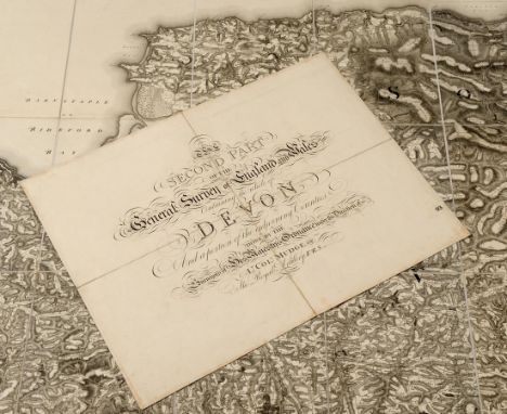
Lot 589
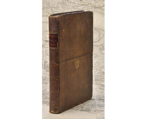
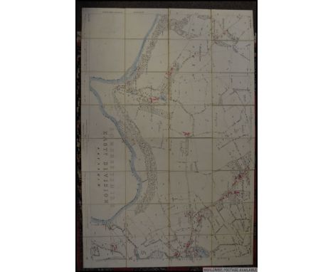
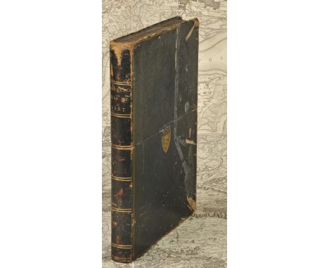
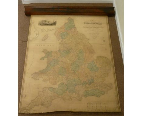
The Second Part of the General Survey of England and Wales Containing the Whole of Devon and a portion of the adjoining Counties Done By The Surveyors of His Majesty's Ordnance under the Direction of Lt Col Mudge of The Royal Artillery, FRS, linen backed, the map in two halves, each 123 x 184 cm, with a separate linen backed title sheet, 47 x 61 cm, contained in a contemp. calf book box with gilt crest of the Ordnance Board to the front panel See illustration

Lot 216
Lincolnshire & Rutland. Ordnance Survey (publishers), Untitled map, 1824, large uncoloured engraved map on eight sheets (complete), sectionalised and laid on linen, very slight offsetting, each sheet approximately 640 x 940 mm, contained in a contemporary gilt morocco book box with the crest of the Ordnance department to upper siding, rubbed and a little worn at extremities (1)
Lot 219
Midland counties. Ordnance Survey (publishers), eight maps of parts of Northmaptonshire, Worcestershire, Herefordshire, Shropshire, Staffordshire, Leicestershire, Nottinghamshire, Derbyshire and Cheshire, 1832 - 36, eight uncoloured engraved maps, sectionalised and laid on linen, each map approximately 630 x 785 mm, contained in a green gilt morocco book box, worn at extremities, spine faded, together with, Ordnance Survey (publishers),East Devon, West Dorset & Somerset, 1809 - 1811, six uncoloured engraved maps (nos. 17 - 22), sectionalised and laid on linen, 635 x 805 mm, contained in a green morocco book box with gilt decorated spine, envelope style lid partially lacking, worn at extremities, with, Johnston (A. Keith),Stanford's Library Map of Europe, 1873, large engraved map with contemporary outline colouring on four sheets, sectionalised and laid on linen, each sheet approximately 750 x 810 mm, together with another approximately thirty-five folding town, county and touring maps including examples by Bacon, Wyld, Ordnance Survey, Stanford and Bartholomew, with a Gazetteer of the British Isles, P.D. Harvey and Harry Thorpe's 'The Printed Maps of Warwickshire, plus six loose maps and engravings, with examples by Saxton/Kip, Ellis and Chapman/Hall, various sizes and condition (approx.40)

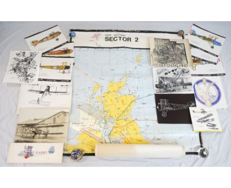
Lot 257
AERONAUTICAL INTEREST including photographic reproductions of biplanes, aerial photographs of Mount Everest, the insignia crest of the Royal Aeronautical Society, calendar prints of a 1918 Handley Page, two of a 1917 Sopwith Camel, 1917 S.E.5, 1917 SPAD S.13, 1917 Avro 504K and a 1919 Albatros D.V, a detailed map from the National Air Traffic Service of the West Scottish Sector 2 flying routes and four Ordnance Survey maps of Ayrshire
Lot 105
Devon. Untitled maps of Devon, published Ordnance Survey by Lt Col. Mudge, 1809, uncoloured engraved map on eight sheets, sectionalised and laid on linen, each sheet approximately 600 x 920 mm, contained in contemporary gilt calf book box with gilt crest of the Ordnance office to recto, worn and bumped at extremities and lacking base panel (1)
Lot 120
Hampshire. Untitled map of Hampshire, published by Ordnance Survey / Lt. Col. Mudge, 1810, three uncoloured engraved maps, sectionalised and laid on linen, each sheet approximately 635 x 945 mm, card chemise, contained in a contemporary gilt calf book box, worn and rubbed, together with another similar example of parts of Surrey and Sussex but appears to be lacking one sheet, contained in a matching book box, with another four sheets of Ordnance Survey maps of Hampshire, Surrey and Sussex, early 19th century, each sheet approximately 625 x 795 mm, some staining, contained in a morocco slip case, lacking lid, plus an Ordnance Survey map of central Wiltshire, dated 1817, toned overall, 635 x 775 mm, contained in contemporary morocco slip case with 'envelope style' lid, a little worn (4)
Lot 126
Kent. Faden (William, publisher), General Survey of England and Wales . An entirely new and accurate Survey of the County of Kent with part of the County of Essex, Done by the Surveying Draughtsmen of His Majesty's Board of Ordnance..., under the Direction of Capt. W. Mudge of the Royal Artillery F.R.S., 1801, large uncoloured map, engraved by Thomas Foot, sectionalised and laid on linen, 1185 x 1765 mm, publisher's label to rear of upper siding, contained in a contemporary morocco book box with the gilt arms of Ordnance Survey, scuffed and worn The first map published by Ordnance Survey. (1)
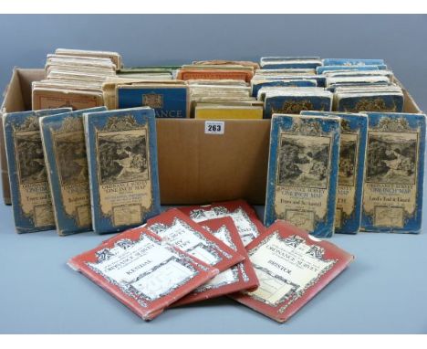
Lot 210
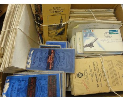
A collection of Military edition ordnance survey maps with cover sheet "Indices to military editions, G.S.G.S. 3957 Scale:One Inch to Four Miles, G.S.G.S. 3907 Scale: One Inch to a Mile, War Office 1941, contained in a carry case, missing numbers 2, 8, 12, 17,18,19, 24, 29,35, 36, 41, 42,43 and 44, the .last map is numbered 48
Lot 428
Bartholomew, John; The Imperial Map of England & Wales according to the Ordnance Survey with the latent additions, showing clearly every feature of the country, railways and their stations, roads, canals, rivers, gentlemens seats & C. Fullerton & Co (C. 1860) large folio, some foxing, creases, binding worn and with damage.
Lot 171
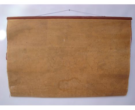
Large antique retractable Ordnance Survey map of England and Wales drawn by R. Creighton, engraved by J. Dower and published by S. Lewis and Co., dated 1839, in mahogany case H210cm x 173cm (W200cm overall) Condition Report Generally reasonable condition for age. Cloth 'seems' missing in places. Some deterioration and loss of canvas at the bottom of map (as illustrated) some creases at the bottom becoming open cracks. Otherwise good with colour you might expect from age.
Lot 225
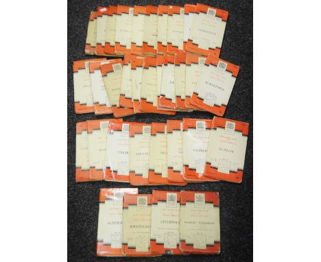
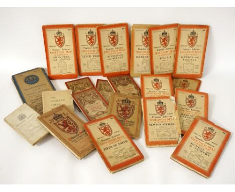
SELECTION OF ORDNANCE SURVEY MAPS OF SCOTLAND including thirty one from the National Grid Popular Edition One Inch Map of Scotland series in cloth, two cloth editions of the Tourist Map of The Trossach and Loch Lomond, and Lower Strath Spey, two quarter inch maps of The Eastern Highlands, and Glasgow and the Middle West, two Popular Edition maps of Thurso and Reay, and Lairg and Loch Shin, a cloth edition of Berwick, four Coloured Editions of Loch Eil and district, Cluanie and district, Tongue and District and Loch Carron and district, and a cloth edition of The Cuillin Hills Skye from the Scottish Mountaineering Club
-
1765 item(s)/page