Bacon's Excelsior Map of Wales and Monmouthshire, Revised According To The Latest Ordnance Survey, With Railways, Roads, and Distances, [printed and published by] G.W. Bacon & Co. Ltd., London [c. 1900], twenty-five chromolithographic and hand-coloured folds laid on canvas, maroon buckram boards, marbled endpapers, square 4to
We found 1765 price guide item(s) matching your search
There are 1765 lots that match your search criteria. Subscribe now to get instant access to the full price guide service.
Click here to subscribe- List
- Grid
-
1765 item(s)/page
Bacon (G W) New Chart of the British Isles, New Survey Map of South Scotland and sundry Ordnance Survey and two boxes in the form of bindings with gilt lettering for Ordnance Survey of Great Britain Condition Report: Lot 168 - the OS map boxes are full and include the following:1:25,000 scale : Chalford and Sapperton, Horsley and Kingscote and Tetbury.1” scale: Stroud and Chepstow, Gloucester and Cheltenham, Cheltenham Bacon's Cheltenham.1: 25,000 scale: Ordinance survey for Miserden and Painswick.
British Isles. Wyld (James), Railway map of England, Wales and Scotland, Drawn from the triangulation of the Ordnance Survey, the survey of the Railway Companies, and other information shewing the lines of Railways, the Inland Navigation, Great and Cross Roads, Cities, Market Towns & Villages, 1889, very large engraved map with contemporary outline colouring, sectionalised and laid on linen, on two sheets, numerous inset railway gradient profiles, marbled endpapers, each sheet approximately 1000 x 1365 mm, contained in a contemporary cloth slipcase with publisher's printed label to upper board, together with Arrowsmith (Aaron), Map of the Railways, showing the various stations with the Hills, Rivers, Canals and Principal Roads of England and Wales, also exhibiting most of the places whose situation has been ascertained by the stations and intersections of the Trigonometrical survey, sold by J. Gardner, 1840, large engraved map with contemporary outline colouring, sectionalised and laid on linen, on four sheets, slight offsetting, each sheet approximately 900 x 730 mm, marbled endpapers, contained in a contemporary green morocco slipcase with gilt title to spine, heavily rubbed and worn, lacking 'envelope style' cover (2)
England & Wales. Faden (William), The Roads of Great Britain, 3rd. edition, 1795, engraved map with contemporary outline colouring, sectionalised and laid on linen, inset map of Scotland, slight dust soiling, 735 x 580 mm, contained in a contemporary marbled card slipcase, worn and frayed, together with, Mogg (Edward), A New Travelling Map of England , Wales and Scotland; drawn from all the surveys which have hitherto been made of particular counties..., published Edward Mogg, March 1st. 1833, engraved map with contemporary hand colouring, sectionalised and laid on linen, inset map of Scotland, near contemporary ownership signature to verso of map and on the endpapers, 750 x 620 mm, contained in a contemporary marbled slipcase with publisher's printed label to upper board, label with two further manuscript ownership signatures, frayed and worn at extremities, with Smith (Charles), Smith's Map of England & Wales containing the whole of the Turnpike roads, Rivers and Canals..., 1836, engraved map with contemporary hand colouring, sectionalised and laid on linen, 785 x 620 mm, plus Coltman (Nathaniel), Laurie and Whittle's New Map of all the Coach Roads both direct and cross of England & Wales..., published Robt. Laurie & James Whittle, April 12th, 1809, engraved map with contemporary outline colouring, sectionalised and laid on linen, 780 x 625 mm, marbled endpapers, and Betts (John), Betts's New Map of England & Wales compiled from the latest Parliamentary documents, 1845, engraved map with contemporary outline colouring, sectionalised and laid on linen, slight staining and dust soiling, 770 x 655 mm, contained in a contemporary card slipcase, publisher's printed label torn and defective, with another fifteen folding maps of England & Wales similar, including examples by Mogg, Bartholomew, Walker, Lizars, Kitchin, Rock, Dower, Walker, Airey, Grant, Betts, Bacon and Ordnance Survey, various sizes and condition (20)
Johnston (Alexander Keith). The Royal Atlas of Modern Geography, new edition, published W. & A. K. Johnston, 1878, additional half title, dedication and preface, numerous engraved maps with contemporary outline colouring, endpapers and preliminaries, torn and frayed, slight dust soiling, hinges and joints weak, all edges gilt, contemporary half morocco gilt, worn and frayed, folio, together with Handy Royal Atlas of Modern Geography, 1889, title, dedication and preface, numerous engraved maps with contemporary outline colouring, all edges gilt, publisher's half morocco gilt, sidings stained, folio, with another copy similar, with, Bacon (G. W., editor), New large-scale atlas of the British Isles from the Ordnance Survey, 1892, title and preface, numerous double page colour lithographic county, regional and town plan maps, all edges gilt, publisher's half morocco gilt, worn and frayed, folio, plus Bartholomew (J. G.), The Royal Atlas of England and Wales, published George Newnes Limited, circa 1900, numerous colour lithographic maps, front endpaper detached, publisher's half morocco gilt, worn and frayed, folio, and Bevan (G. Philips), Royal Relief Atlas of all parts of the World, 3rd edition, published George Philip & Son, 1885, thirty-one (complete as list) colour printed maps, including twenty-five relief maps with raised surface to indicate mountains or hills, all with accompanying text on verso, each presented on a thick card frame, map of New Zealand with long closed tear affecting image, hinges and joints weak, publisher's half morocco gilt, spine chipped with loss at head and foot, worn, 4to, with another seven atlases similar, mixed bindings, mostly 4to and folio Sold as a collection of maps, not subject to return. (13)
Murchison (Roderick Impey). The Silurian Region and Adjacent Counties of England and Wales. Geographically Illustrated By Roderick Impey Murchison F.R.S. F.L.S. Vice President of the Geological Society. Late V.P. of the Royal Geographical Society. Memb. Geol. Society France. Hon. Memb. Royal Irish Acad. and of other Scientific Societies in France, Germany and America. From the Ordnance Survey Coloured in the Field during the Years 1831-8. Drawn and Engraved by J. Gardner, Regent Street, London, [1839], engraved map on three sheets (as published), mostly of Wales, with contemporary hand colouring, geological cross section at base of map, table of explanation, compass rose inset geological map of England & Wales, slight staining, central sheet with small area of rodent damage causing slight loss, each sheet approximately 960 x 510 mm An important and scarce geological map. (3)
Nottinghamshire. Speed (John), The Countie of Nottingham described, The Shire townes situation and the earls thereof described, published John Sudbury and George Humble, circa 1627, uncoloured engraved map, inset town plan of Nottingham, slight staining, one printer's fold, trimmed to plate mark along upper margin, 385 x 515 mm, English text on verso, together with thirty-eight Ordnance Survey maps of Nottingham and Nottinghamshire, all 20th century, various sizes and condition (39)
Maude (Aylmer). A Peculiar People, The Doukhobors, 1st edition, 1905, monochrome plates, occasional library blindstamps, and other marks, later blue cloth gilt, 8vo, together with Seligman (Adrian), No Stars to Guide, 1st edition, 1947, folding maps, plates, etc., original cloth, very slightly marked, in dust wrapper, a little rubbed and frayed to extremities, plus Sowerby (R.R.), Sowerby of China, Arthur de Carle Sowerby, Kendal, 1956, monochrome plates, original red cloth in dust wrapper, 8vo, and other miscellaneous travel, mostly later 19th and 20th century, including James Wyld, Ordnance Survey map of County Durham, June 1865, engraved map, sectionalised on linen, with coloured county border, 150 x 120 cm (60 x 48 ins), in partly worn slipcase, and 9 later 19th century city view books, of which 4 are illustrated with mounted photographs (Koln, Marken, Bruxelles & Heidelberg), the remainder with photo lithographed illustrations, all printed in original publisher's decorated cloth, 8vo (2 cartons)
Bacon's fldg. County Map & Guide for Cyclists & Tourists, C.1920; Philips' linen backed fldg. Cyclists' County Map of Bedford, C. 1910 and Bedfordshire from the Ordnance Survey (Weller) 1865; W.H. Smith's Reduced linen backed, fldg. Ordnance Map of Bedford & Environs, C1920. Walker's ( J. & C. ) : Fldg, Linen-backed County Map of Bedfordshire, 1843. All with original covers. CONDITION REPORT: VG
The London Passenger Transport MAP, 1933'. Officially hand-coloured onto 1" Ordnance Survey maps, linen-backed inside stiff leathercloth covers. Shows the London Transport 'Special Area' following the 1933 Act as well as County boundaries, the Metropolitan Police District, London & Metropolitan Traffic Areas, LT's Unrestricted & Restricted Operating Areas and main-line & LPTB railways. Opens out to 87" x 68" (221cm x173cm). VGC. [1]
Devon, Ordnance Survey, The Second Part of the General Survey of England and Wales Containing the Whole of Devon and a Portion of the Adjoining Counties, done by the Surveyors of His Majesties Ordnance under the Direction of Lt Col. Mudge of the Royal Artillery; 8 uncol engr map sheets, each 95 x 62cm and an additional calligraphic title sheet, 62 x 47.5cm, each sectionalised and linen-backed with contemp labels to verso, contained in red mor gt, book box.
MAPS AND PLANS. PLAN VON BERLIN scale 1:25,000m, lithograph in colour, 60 x 82cm, c1936, creased where folded, the British Grand Fleet in the Great War Complete Chart of North Sea Movements 1914-18, Ordnance Survey map London-Paris, second edition, published by the War Office, 1944 and an Admiralty chart of the River Tyne Jarrow Slake to Elswick, 1902 (4)
Britain.- Hall (Sidney) A Travelling County Atlas: with all the Railroads Accurately laid down, and the Boundaries Coloured, complete with 46 maps, 42 double-page, and 4 folding, including Ireland, Scotland, Wales, and Yorkshire, with title and list of maps, engravings, with outline hand-colouring, on wove paper, the double-pages each approx. 205 x 275 mm. (8 1/8 x 10 3/4 in), the folding maps each approx. 390 x 260 mm. (15 3/8 x 10 1/4 in), occasional offsetting, minor surface dirt and browning, some loose, in original limp green morocco wallet-style binding, rubbed, 8vo, [1848] § Cheffins (Charles F.) Cheffins's Map of the English & Scotch Railways, fourth edition, lithographed map with hand-colouring, 710 x 700 mm. (28 x 27 1/2 in), dissected and mounted on linen, folding with printed advertisement to endpanel into original cloth boards with printer's label, 8vo, [1844] § Cary (John) Cary's Six Sheet Map of England and Wales with Part of Scotland, engraved map, outline hand-colouring, dissected and not joined, each segment mounted on linen, each approx. 225 x 130 mm. (8 7/8 x 5 1/8 in), if joined total approx. 1140 x 930 mm. (44 7/8 x 36 5/8 in), spotting, surface dirt and staining, presented in slip-case, 1818 § Jackson (Frederick) Jackson's Plan of Nottingham, from Surveys made between the Years 1851 & 1861, lithographed map, with hand-colouring, 665 x 530 mm. (26 1/8 x 20 7/8 in), dissected and mounted on linen, folding with yellow endpanel into contemporary green boards, gilt title to upper cover, 8vo, rubbed, 1861; together with two Ordnance Survey maps, one of Cheshire showing Warrington, the other of North Shropshire covering the environs of Market Drayton, lithographed maps, each approx. 640 x 830 mm. (25 1/4 x 32 3/4 in), dissected and mounted on linen, surface dirt and browning, folding with green morocco endpanels, presented in original green morocco slip-case wallet, 8vo, 1833, (4).
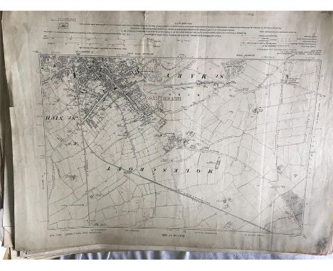
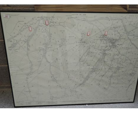
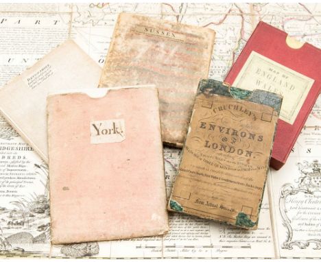
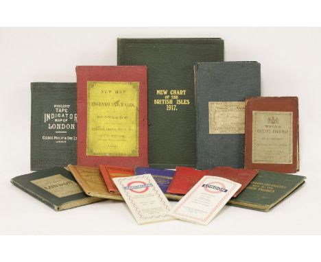
Yorkshire and County Durham, a very large collection including Hutton, W. The history of the Roman Wall. 1802. 8vo, folding map and 7 plates, 19th century calf, neatly rebacked; Watkins, William The fall of Carthage... first presented at The Theatre, Whitby. Whitby: T. Webster, 1802. First edition, 8vo, half-title, 4pp. list of subscribers, contemporary half calf; [Hegge, Robert] Saint Cuthbert, or the histories of his churches at Lindisfarne, Cunecastre and Dunholme. Sunderland: G. Garbutt, [1816], printed and woodcut title, contemporary boards, rebacked; Parson, William and William White History, directory and gazetteer of the counties of Durham and Northumberland. Printed for W. White & Co., 1827-28. 2 volumes, 12mo., original boards, uncut, without the maps (issued separately), boards covered in transparent adhesive material; Young, Rev. George A picture of Whitby and its environs. Whitby, 1840. 12mo. second edition, folding map, plates, some folding, contemporary cloth; Wellbeloved, D. Eburcum, or York under the Romans. York, 1842. 8vo, plates, maps, list of subscribers, original cloth, worn; Ornsby, George Sketches of Durham. Durham, 1846. 12mo, original cloth, worn; Gibson, W.S. Descriptive and historical notices of some remarkable Northumbrian castles, Churches and Antiquities. 1848. First Series only, frontispiece, original boards, some spotting, rebacked; [Abbatt, Richard] A history of the Picts or Romano-British Wall. 1849. 8vo, plates, original cloth; Richardson, George The annals of the Cleveland Richardsons and their descendants. Newcastle-upon-Tyne, 1850 "Not Published", presentation copy, original cloth, spine faded; [Rewcastle, James] A record of the Great Fire in Newcastle and Gateshead. 1855. 12mo, frontispiece, presentation copy from the writer, original cloth, repaired, new endpapers; Ordnance Survey Map of Hartlepool. 1861, hand-coloured folding map, backed on linen, morocco slipcase, worn; Heavisides, Henry The annals of Stockton-on-Tees. Stockton-on-Tees, 1865. First edition, frontispiece, original cloth, spine rubbed at head and base; Heavisides, Henry Courtship and matrimony. Stockton, 1864. 12mo, frontispiece, original cloth; [Mawr, Eta] Tributes to the Tees. Darlington, 1864, inscribed from the compiler, frontispiece, original boards; [Dresser, William, printer] The Tees in the olden time. Darlington, 1866, original green boards, worn; Baring-Gould, S. Notes on the folk lore of the Northern Counties of England. 1866, 8vo, coloured frontispiece, original cloth; Pickford, John A week in the Yorkshire Dales. Manchester, 1869, presentation copy from the author, original green cloth, title discoloured; Gordon, Samuel The watering places of Cleveland. Redcar, 1869. 8vo, original cloth, worn; Hamlyn, N.T. The Border ballad of Hedgley Moor. Durham, 1894. 4to., original cloth-backed boards; Palgreave, F.M.T. A List of the words and phrases in every-day use by the Natives of Hetton-le-Hole in the County of Durham. 1896, original cloth, title slightly discoloured; [Dixon, S.F.] History of the Saxon Royal Town of Corbridge-on-Tyne. Newcastle, 1912. folding map, plates, original cloth; and c.230 books and pamphlets (approximately half being books), on Yorkshire, County Durham and Northumberland, mostly later
British Isles. Walker (John), Map of the Inland Navigation, Canals, and Rail Roads with the Situations of the various Mineral Productions throughout Great Britain, from actual surveys projected on the basis of the trigonometrical Survey made by order of The Honourable The Board of Ordnance..., published Richard Nichols, Wakefield, January 1st, 1830, very large engraved map with contemporary hand colouring, sectionalised and laid on linen, large calligraphic title and dedication, compass rose and table of explanation, inset map of Scotland, slight overall toning, marbled endpapers, 1920 x 1560 mm, contained in a contemporary calf book box, worn and rubbed Published and intended to accompany Joseph Priestleys "Historical Account of the Navigable Rivers, Canals, and Railways, of Great Britain", The map contains and wealth of detail bringing together many aspects of the Industrial revolution, namely the mining industry and the canal and railway networks. (1)
Bristol Ashmead (G.C.), Ashmead's Map of the City and Borough of Bristol, Reduced from the Original Survey and Corrected to 1855, published G. C. Ashmead, Bristol and E. Mardon, Clifton, 1855, uncoloured engraved map, sectionalised and laid on linen, 935 x 855 mm, contained in a contemporary cloth slipcase with manuscript label to upper board, faded along spines, together with Shiercliff (E.), The Bristol & Hotwell Guide..., fourth edition, published Bristol, circa 1810, frontispiece of a folding engraved plan of Bristol, three engraved plates, including one with contemporary hand colouring, later endpapers, uncut, re-backed but retaining original printed boards, worn and scuffed, 8vo, with Evans (Rev. John), The Picture of Bristol or a guide to objects of curiosity and interest in Bristol, Clifton, The Hotwells and their vicinity..., published Bristol, 1814, frontispiece of a folding engraved plan of Bristol, three folding engraved plates, bookplate of B. M. H. Rogers, contemporary half calf, worn at extremities, 8vo, plus three other similar bound guides to Bristol, together with Ordnance Survey, (publisher), Untitled map of Bristol, 1887, engraved plan of Bristol, sparse hand colouring, sectionalised and laid on linen, 675 x 960 mm, marbled endpapers, plus Herapath (W.), The Hand Book for Visitors to the Bristol & Clifton Hotwells (Illustrated by Plates) containing a chemical analysis of the Spa, published Bristol, Clifton and Weston-Super-Mare, circa 1860, frontispiece of a folding engraved geological cross-section with contemporary hand colouring, two engraved plates, advertisements bound at rear, publisher's blue cloth with gilt title to upper board, slight wear to extremities, slim 8vo, with four loose 19th maps of Bristol and its environs, various sizes and condition (12)
Folding maps. Smith (Charles), A New Map of the County of Berks divided into Hundreds, 1801, A New Map of the County of Cambridge divided into Hundreds, 1801 [and] A New Map of the County of Buckingham divided into Hundreds, 1804, together three county maps with contemporary hand colouring, each sectionalised and laid on linen and edged with blue silk, each approximately 515 x 455 mm, together with Cary (John), A New Map of Dorsetshire divided into its hundreds and liberties exhibiting its roads, rivers, parks &c., 1818, engraved map with contemporary hand colouring, sectionalised and laid on linen, slight spotting, marbled endpapers, 485 x 540 mm, with another fourteen late 19th and early 20th century folding Ordnance Survey maps of parts of London, Surrey, Sussex and South east England, various sizes and condition, plus Stanford (Edward, publisher), A New Map of Metropolitan Railways, Tramways & Miscellaneous Improvements, 1904, colour lithographic map, sectionalised and laid on linen, 680 x 1040 mm, contemporary cloth boards with publisher's printed label to upper siding, a little frayed on spine (18)
Ordnance Survey: County of Meath - Index Map to the Townland Survey, together with Sheets No's 14, 16, 22 & 23, together 5 lg. fold. linen backed maps, all hand coloured c. 1839, in orig. gilt decor. calf box; also Index Map to the Townland Survey of County Westmeath, c. 1838, lg. linen backed map, cont. hand colouring, slip case. As maps, w.a.f. (6)
Ordnance Survey of Ireland: Province of Connaught with Index Maps to the Townland Surveys of County Leitrim & Sligo, and also Index Map to Londonderry, 3 lg. folding linen backed maps, all hand coloured, London c. 1833 & 1838, in leather & cloth cases. As maps, w.a.f. Pierce Mahony's Copy. (3)
A collection of antique maps: four 18th-century hand-coloured copper engraved maps by Emanuel Bowen (York, Devonshire, Sussex, Cambridgeshire), all linen-backed, two complete with slipcases; Cruchley's Environs of London, 1827, complete in four parts within original slipcase, hand-coloured; Edward Stanford Railway & Road Map of England and Wales, 1877, hand-coloured and linen backed with original slipcase bearing label; and a quantity of Ordnance Survey maps, 1912 and later, including an interesting geological map of Cambridgeshire, plus a few similar folded maps.
1- Wyld’s new plan of London and its vicinity. 1874, colour linen backed 40 sections folding (116 x 81.5 cms); small tear to fold; 2- Philip's Tape Indicator map of London. N.d. c1920, colour linen backed folding (62 X 90cms.); lacking tape; 3- Ravenstein, E G: The Oarsman's and Angler's Map of the River Thames. James Reynolds, nd, c1880; colour linen backed folding into 25 sections (244 X 16 cms.); 4- A New Map of England and Wales with part of Scotland.. T. Doody, Newport, Shropshire, 1855. Colour linen backed folding into 20 sections (78 X 64 cms.), with a vignette and in original covers; G+; Plus 8 other ordnance survey maps and 2 London Underground maps, 1947 & 1959. (14)
1- MUDGE, William: PART THE FIRST OF THE GENERAL SURVEY OF ENGLAND AND WALES CONTAINING THE WHOLE OF ESSEX AND A PORTION OF THE ADJOINING COUNTIES DONE BY THE SURVEYORS OF HIS MAJESTY'S ORDNANCE, UNDER THE DIRECTION OF Lt. Coll. MUDGE OF THE ROYAL ARTILLERY F.R.S. Four sections, linen backed and in the original leather box; n.d. C1805. Each section has its borders lined and sewn; 2- Kelly’s Directory of Essex, 1886. front cover and first few page detached; lacking the map? (2)
19TH CENTURY ORDINANCE SURVEY MAP OF KINROSS AND FIFEengraved at the Ordnance Survey Office - Southampton - under the direction of Lt. Col. Cameron, the outline by W. Newman, the writing by C. Smith, the hills by G. de Garlieb, published by Col. Sir Henry James, &c., March, 1861, approximately 53.5cm x 68.5cm; along with another reproduction 19th century Ordnance Survey map of Scotland and another (3)
Scotland. Ordnance Survey (publishers), Untitled map of the environs of Glasgow, 1872, large electrotype map with contemporary outline colouring, sectionalised and laid on linen, on a scale of one inch to the mile, slight staining, marbled endpapers, 1390 x 1260 mm, contained in a contemporary cloth slipcase, case stained and frayed (1)
Maps - E. Borne (early 19th century), The World from the Discoveries & Observations made in the Latest Voyages & Travels, Published by Hamilton, Adams & Co., London [c. 1810], two-fold map, hand-coloured engraving, 33cm x 52cm; Ordnance Survey Maps - Northumberland - Morpeth, Tynemouth, Bellingham, Brampton, Rothbury, Norham, Frome, Durham, Hexham, Elsdon, [c. 1900] four-fold, 45.5cm x 61.5cm (10); early 19th century two-fold maps of Continental countries, monochrome engravings; others, late 17th century and later, including United Kingdom, Russia, Holy Land; qty
AFTER ROBERT MORDEN; two 18th century hand coloured maps of Cumberland and the County Palatine of Lancaster, both hand coloured, plus a further map of Cumbria and a Bowles's map of Cumberland and Westmorland, and a map of the south part of Scotland and The Lake of Derwent, all six framed and glazed, two unframed maps and a small collection of ordnance survey maps and two Bartholomew's maps of the Lake District.
GEOLOGICAL MAPS No.XLIV [44, Worcestershire/Gloucestershire]; No.LV [55, Herefordshire/Worcestershire]; No.LXXIV [74, Llangollen/North Wales]; No.LXXXII [82, Nottinghamshire/Derbyshire/South Yorkshire], 1860s, Geological Survey of Great Britain; four hand-coloured engraved geological maps, sectionalized and mounted on linen (folding); nos. 44 and 82 printed borders 630 x 730mm, nos. 55 and 74 in frames 730 x 1030mm. Early issues in original colour, fault lines highlighted in white, based on the Ordnance Survey one inch to one mile map. Sheet 82 with (part of) official blindstamp for January 1863, three sheets with 'Price 2s' upper right, keys in the margins (4)
Gentleman's Lot, comprising rosewood and ebony rulers, ostrich skin glasses case, three pairs of tortoiseshell style glasses, compass, Coutts leatherette banking books, coin scales and Ordnance Survey map of Lancaster & District and four fountain pens and a French glass paperweight in the form of a toad.
Ordnance Survey of Ireland: Geological Survey of Ireland, Cushendall [County Antrim], Sheet 14, Engraved at the Ordnance Survey Office, Dublin under the direction of Captain Wilkinson R.E., The Outline by Robert Mahony, the Writing by James Aikman, the Hills by John Duncan, Published by Colonel Sir H. James R.E., F.R.S., M.R.I.A. &c., Superintendent of the Ordnance Survey [...] 1886, four-fold map, hand-coloured engraving, 36cm x 54cm
Ordnance Survey of England and Wales: Geological Survey of England and Wales, Sheet 92 N.E. (New Series Sheet 61) [part, North Yorkshire Moors], Engraved at the Ordnance Survey Office Southampton, The Outline by J. Adkins, the Writing by J.A. Harrison, The Hills by H. Dixon, Published by Colonel James R.E., F.R.S., M.R.I.A. &c., Superintendent [..] 1889, map, hand-coloured engraving, 37cm x 57cm
Folding maps. A mixed collection of five maps, 19th century, including Cary (John), Cary's New Map of Ireland exhibiting the whole of the Turnpike roads with the Rivers and Canals; The Market and Borough Towns and principal places adjoining the Road to which is added the distance..., 1834, engraved map with contemporary outline colouring, sectionalised and laid on linen, some staining, 750 x 625 mm, marbled endpapers, contained in a contemporary marbled card slipcase with publisher's label to upper board, slight wear to extremities, together with Cary (John), A New Map of Gloucestershire divided into Hundreds exhibiting its Roads, Rivers, Parks &c., 1823, engraved map with contemporary hand colouring, some staining and soiling, 575 x 510 mm, marbled endpapers, contained in a contemporary marbled card slipcase with publisher's label to upper board, slight wear to extremities, with Walker (J. & C.), Suffolk, published Longman, Rees, Orme, Brown & Co., 1845, engraved map with contemporary outline colouring, sectionalised and laid on linen, 335 x 405 mm, contemporary cloth boards with publisher's printed label to upper siding, plus Kemp (George), Graham's New Map of England and Wales with part of Scotland showing the Mail Coach, Turnpike & Railroads, Canals &c. circa 1850, engraved map with contemporary outline colouring, sectionalised and laid on linen, slight spotting and staining, 750 x 630 mm, contemporary cloth, lacking upper board, and Ordnance Survey (publishers), Untitled map of part of Surrey, 1878, uncoloured electrotype map, sectionalised and laid on linen, the map shows Wokingham in the north-west to Croydon in the north-east, and includes Reigate, Dorking, Kingston, Chertsey and Guildford, 625 x 940 mm, marbled endpapers, contained in a contemporary red cloth slipcase with publisher's label to upper board (5)

-
1765 item(s)/page