We found 1765 price guide item(s) matching your search
There are 1765 lots that match your search criteria. Subscribe now to get instant access to the full price guide service.
Click here to subscribe- List
- Grid
-
1765 item(s)/page


Lot 126
GOOD SELECTION OF MEDAL RIBBONS & MEDAL BROOCHES, small selection of CLOTH BADGES including The Cheshire Regiment gilt and silver bullion star, dog tags, a selection of APPROXIMATELY SEVENTY MAINLY BRASS MILITARY BUTTONS together with an ORDNANCE SURVEY FOLDED MAP `France and Part of Belgium` dated 1918 and TWO OTHER FOLDED MAPS
![MAP, KENT. – Edward STANFORD (publisher). Ordnance Survey [of the County of Kent.] London: [n.d. but circa 1865.] Hand-](http://lot-images.atgmedia.com/SR/10123/2902926/3009-2014219153837_468x382.jpg)
Lot 3009
MAP, KENT. – Edward STANFORD (publisher). Ordnance Survey [of the County of Kent.] London: [n.d. but circa 1865.] Hand-coloured engraved folding map on 2 sheets (each 1310 x 965mm.) each in 42 sections and backed onto linen. (Light browning.) Folding within a contemporary cloth case (defective).
![MAP, HAMPSHIRE. – [?ORDNANCE SURVEY (publishers). Map of the County of Hampshire. N.p.: n.d. but circa 1870.] Lithograp](http://lot-images.atgmedia.com/SR/10123/2902926/3022-201421915394_468x382.jpg)


Lot 770
An 18th century coloured map of Gloucestershire dated 1712, 36 x 43 cm in moulded gilt frame together with a facsimile of the 1900 second edition Ordnance Survey map of Tetbury, 42 x 60 cm in bronze coloured frame, a coloured 19th century hunting engraving and a black and white photograph of the hunt

Lot 307
9 linen backed Ordnance Survey Maps “Royal Air Force Special Edition” corrected to 1932 or 1934. A roll of nine Ordnance Survey (OS) maps at ¼ inch (1:253440) covering several parts of Great Britain. The aerial navigation information is overprinted in red on the basic OS map, and the supplementary key shows aerodromes and landing grounds, including specifically Airship Stations. By 1932 the RAF had ceased operating the airships that they had inherited from the RNAS, and RAF Cardington was probably the only remaining Airship Station in operation at the time these maps were produced.GC


![ORDNANCE SURVEY (publisher). [Plans of Brighton. N.p. but Southampton: ‘surveyed in 1875’.] Folio (690 x 510mm.)](http://lot-images.atgmedia.com/SR/10123/2887940/3193-2013103145815_468x382.jpg)
Lot 3193
ORDNANCE SURVEY (publisher). [Plans of Brighton. N.p. but Southampton: ‘surveyed in 1875’.] Folio (690 x 510mm.) 55 double-page plans backed onto linen, double-page manuscript alphabetical index, 1 key to the maps. (Somewhat soiled and frayed, torn with loss to edges, old creasing.) Modern cloth (extremities scuffed, covers blistered, 1 map bound inverted).


Lot 332
Ordnance Survey Map of part of East Anglia, published August 10th 1836, covering from East Coast to St Ives in the West and from King's Lynn in the North to Woodbridge in the South, linen backed map in 20 segments overall approx. 227 x 123cm, coloured in outline, split along some folds, with some lesser maps

Lot 170
Edward Stanford (publisher) - `Ordnance Survey of England and Wales` (Map of Part of Sussex from East Wittering to Brighton), mid-19th Century engraving, printed in 32 sections and backed onto linen, approx 66cm x 97cm, folding within original case, together with seven further folding maps and an incomplete `Dr Butler`s Atlas of Ancient Geography`.

Lot 650
Oarsman's and Angler's Map of the River Thames from its source to London Bridge, nd. C.1900. Folding linen backed strip map, coloured in outline,within a cloth-bound 12mo binding together with textual commentary. Length of map approx. 2.36m! x 16cm. Printed by Edward Stanford. Together with : Ordnance Survey Map of S.W. Environs of London, 1906. Folding, linen-backed map with marbled end papers. CONDITION REPORT: Angler's map showing some signs of use and wear at extremities but basically sound. London map with small stain in trhc o/w sound; lacks slip case.

Lot 694
London Passenger Transport Map : Watford, 1933. Bound in a maroon hb., red cloth A4 folder with marbled eps. Map linen-backed and folded into 8 panels. Together with a selection of early 20th.C Ordnance Survey and other maps. ( List available ). CONDITION REPORT: Passenger map vg; others in a range of conditions - please enquire.
Lot 1083
A WWI trench map of N France, in 32 sections laid on silk, double sided; ordnance Survey sheet 57c of France, d 1917; a framed list of awards, d 8th June 1918, under Army Orders of Gen Sir H S Rawlinson, coloured title, framed, 14” x 9” (creased); a coloured greetings card showing a drummer of the 3rd Hussars, and 2 other cards with regimental badge, mounted and framed 21” x 11”, all with ribbon to edge; a framed Temperance Society declaration, d 1913. GC


Lot 2
Ordnance Survey Office - `Ordnance Survey of England and Scotland (third edition)`, 146 early 20th Century colour folding maps of England and Wales, and 113 early 20th Century colour folding maps of Scotland, each approx 77cm x 52cm, and five folding indices, all contained within five original leather cases. Note: one map supplied from an earlier edition.


![Ordnance Survey. Thirty-nine ‘ Old Series’ one inch maps, nos. 1 - 12, 14 - 33, 38 - 40, 47 - 48 [and] 58, [1810](http://lot-images.atgmedia.com/SR/10729/2879609/196-201342112528_468x382.jpg)
Lot 196
Ordnance Survey. Thirty-nine ‘ Old Series’ one inch maps, nos. 1 - 12, 14 - 33, 38 - 40, 47 - 48 [and] 58, [1810 - 22], index map and thirty-eight engraved maps, sectionalised and laid on linen, some very sparse outline colouring, each map approx. 640 x 930mm, contained in ten contemp. blue morocco gilt solander boxes, rubbed and frayed. The maps cover all of Southern England from Kent to Cornwall and up to South Wales. (39).


Lot 101
LEWIS (SAMUEL), A TOPOGRAPHICAL DICTIONARY OF ENGLAND.... with Historical and Statistical Descriptions, 2nd edition, 1833, cloth; together with Bartholomew (John). The Imperial Map of England & Wales, according to the Ordnance Survey, London & Edinburgh (c.1860), Series of black and white double page maps, folio, half calf gilt (5)

Lot 123
Devon. Cary (John), A Topographical Map of Devonshire, Including Parts of the Adjacent Counties, Reduced from a Survey made by the Order of the Board of Ordnance under the Direction of Col. Mudge, 1813, uncoloured engraved map, sectionalised and laid on later linen, calligraphic title, some staining and scuffing, toned overall, marbled end papers, 1250 x 930mm, contained in contemp. red gilt morocco slip case, rubbed and worn at extrems., together with Faden (William, pubs.),Map of the County of Devon drawn from the Topographical Survey taken by Order of the Honourable Board of Ordnance under the Direction of Lt. Col. Mudge, F.R.S....., 1816, engraved map with sparse near contemp. outline colouring, sectionalised and laid on linen on two sheets, calligraphic title, inset map of Plymouth, slight off setting and light toning, each sheet approx. 615 x 915mm, contained in contemp. red morocco slip case with printers label to upper board, with another later copy similar, dated 1844, marbled end papers and contained in contemp. cloth slip case with printers label to upper board (3).
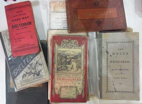
Lot 117
Quantity of ordnance survey maps, maps, guidebooks etc relating to Cheltenham and Gloucestershire, including:- Bath, Bristol, Swindon, Cirencester, Chipping Norton, Stow on the Wold, "Westley's New Cycling Road Map of Cheltenham", "Norman May's Guide to Cheltenham", folding map, "A New Guide to Cheltenham and its Environs", published by John Lee, linen back folding map frontis, original front boards, backstrip missing, front board detached, Williams, J.G.A. "A New Guide to Cheltenham...", printed for G.A. Williams, folding map frontis, folding plates, another map of Cheltenham, foxed, contemporary marbled boards, half leather with gilt titles, a folding map of the Great Western Railway and five other guides and maps, including:- Brighton, Isle of Wight and Oxford etc (27)


Lot 686
Ordnance Survey Map : S. Derby & Notts. Folding, linen-backed map with marbled paper at folded ends. Engraved physical features. Latest date indicated at the lower margin - " Railways inserted to May 1884 ". Part of embossed Ordnance Survey stamp with 'OCT 90' on upper margin. Engraved heraldic bookplate of Edward Matthey on one end. Maroon cloth slip case with Edward Stanford label. CONDITION REPORT: Condition; Vg


Lot 169
Devon. Ordnance Survey,The Second part of the General Survey of England and Wales Containing the whole of Devon and a Portion of the adjoining Counties, done by the Surveyors of His Majesties Ordnance under the Direction of Lt. Col. Mudge of the Royal Artillery, F.R.S., c.1809, eight uncoloured engraved map sheets and an additional calligraphic title sheet, each sectionalised and laid on linen, each sheet with contemp. printed labels to verso of maps, each sheet approx. 610 x 930mm, contained in contemp. red gilt morocco book box with gilt crest of the Ordnance Board to front panel, rubbed and frayed, bumped at extrems. (1)

Lot 355
A collection of Maps and Ordnance Survey Maps of Great Britain, late 18th century and later, including Maps of British Counties engraved by John Cary (1754-1835) and published by John Stockdale, from 1798 and later, including Suffolk, Hartfordshire, Surrey, Hampshire, Worcestershire, Wiltshire, Norfolk, South Wales, Nottinghamshire, Somersetshire, Lincolnshire, Warwickshire, Leicestershire, Rutlandshire, Gloucestershire, together with other maps engraved at the Ordnance Map Office in the Tower of London, and other 19th century and later county maps, some with hand colouring, (a lot), (a/f), (unframed)

Lot 81
Maps of Scotland, a quantity including Kitchin, T and Barber, J.The Western Isles, London: 1781, 18.5x24.5cm, hand-coloured, trimmed and laid-down; [Anonymous, possibly after Kitchin or Campbell] A new and accurate map of Scotland from the latest surveys, London[?]: 1794, 29.5x25.5cm, some slight offsetting onto engraved area; Keere, Pieter van den Scotia regnum, Amsterdam: 1673, 28x21.5cm, hand-coloured in outline; Vaugondy, Gilles Robert de Royaume d`Ecosse..., Paris: 1748, 32x21cm, hand-coloured in outline; Keere, Pieter van den Hebrides insulae, Amsterdam: ca.1630[?], 9.5x14.5cm, hand-coloured; Ortelius, Abraham Scotia, from Ortelus`s miniature Theatrum, Amsterdam: 1601, 17x12cm; Kitchin, T. Scotland from the best authorities, London: 1765[?], 35.5x22.5cm; Ordnance Survey Sutherland. London: 1896. Folding map, linen backed, 100x137cm, in slipcase; and others (quantity)
![Meikleham, EdwardMap of the country for ten miles round Glasgow. Glasgow: Maclure and MacDonald, [n.d., 1852?]. Hand-coloured](http://lot-images.atgmedia.com/SR/10121/2866691/82-201311511133_468x382.jpg)
Lot 82
Meikleham, EdwardMap of the country for ten miles round Glasgow. Glasgow: Maclure and MacDonald, [n.d., 1852?]. Hand-coloured engraved map, with engraved vignettes at the corners, dissected and backed on linen, 60.5 x 66cm., cloth covers with paper label on upper cover, paper label somewhat rubbed, covers a little soiled; Ordnance Survey Edinburghshire. Southampton: [n.d., blind stamp reading April 1861] Engraved map dissected and backed on linen, 36 panels each 17x11cm in maroon gilt case, case a little dust-soiled and faded (2)

Lot 539
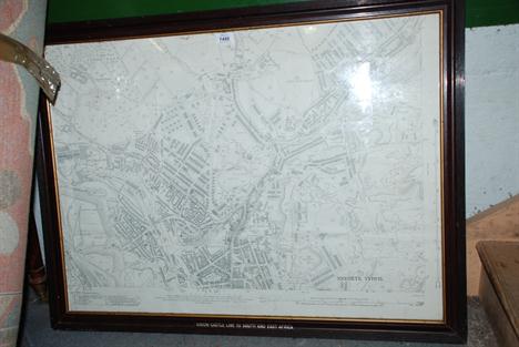
A collection of Ordnance Survey maps and others including a 1915 Ordnance Survey map of Filton, Bristol together with a plan of Bristol, Clifton and Hotwells in 1826 (Facsimile made in 1952), an Ordnance Survey map on Northville Bristol, one of North Bristol, a map of Hereford and an 1984 poster for Comus, Ludlow and a 1653 map (facsimile 1952) of Bristol.
Lot 599
Lewis (Samuel). A Map of England & Wales, Divided into Counties, Parliamentary Divisions & Dioceses, shewing the Principal Roads, Railways, Rivers & Canals, the Seats of the Nobility and Gentry, with the Distance of Each Town from the General Post Office, London, Reduced from the Survey made under the Direction of the Honourable the Board of Ordnance to a Scale of Five Miles to an Inch and Corrected to the Presented Time, 1839, four large map sheets (NE Division, SW Division, NW Division & SE Division), hand-col. in outline, sectionalised on linen, some minor scattered spotting, each division contained in contemp. gilt-dec. plum straight-grained morocco, rubbed on spines, 8vo, and other topography, including Lewis’s Topographical Dictionary of England, Wales, Scotland and Ireland (3 shelves)
Lot 146
Letts, Son & Co. (publishers). Letts’s Popular County Atlas being a Complete Series of Maps Delineating the whole Surface of England and Wales....., 1884, calligraphic title page, general col. litho. map of England & Wales and forty-six col. litho. county maps (complete as list), all laid on linen, index bound in at rear, a.e.g, contemp. half morocco gilt, a little water stained, folio, together with Ordnance Survey (pubs.), Ordnance Survey Atlas of England & Wales, 1922, calligraphic title page, index map of England & Wales and twenty-four double page col. printed maps (complete) all backed with linen, index bound in at rear, contemp. qtr. morocco, orig. cloth gilt sidings, rubbed and worn at extrems., oblong folio (2)


Lot 106
*WWII RAF - Navigational Charts etc. An original Pilot`s/Navigators In-flight Map-Case, c.1939-45, containing a quantity of Charts, Aerial Ordnance-Survey Maps and related documents etc, together with an Air Ministry Directional Calculator, and with an `Emergency Maps` original AM-issue pack (-)


Lot 247
WYLD, James, Map of North Wales, coloured, linen folding in slip case, Geographia, Map of South West England, linen, A/F, Map of England (two parts), Chart Publishing Co, in slip case, Geographia Map of Surrey and Sussex, Ordnance Survey of Cheam, Ordnance Survey of South Devon, folding in slip case (6)
Lot 100
Folding maps. A mixed collection of approx. 160 maps, mostly 19th & 20th century, including 20th century folding Ordnance Survey maps of various parts of the British Isles, "R.A.C.` touring maps, town maps, a hunting map by Swiss & Co., folding maps of London by Bacon and Baker, a "Geographia` folding road map of England & Wales, "Wincarnis` Motor & Cyclist map of England in sixteen sections (complete), a folding panoramic souvenir of New York and a guide book to Cornwall containing twenty-nine (only ?) uncoloured topographical engravings etc. (approx. 160)

-
1765 item(s)/page