We found 1765 price guide item(s) matching your search
There are 1765 lots that match your search criteria. Subscribe now to get instant access to the full price guide service.
Click here to subscribe- List
- Grid
-
1765 item(s)/page

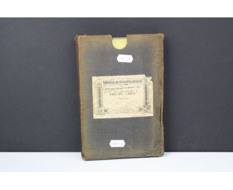
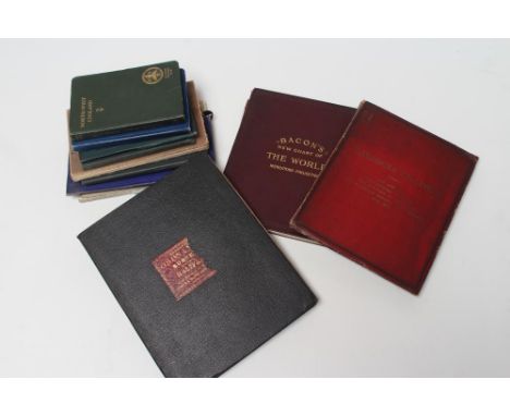
Lot 147
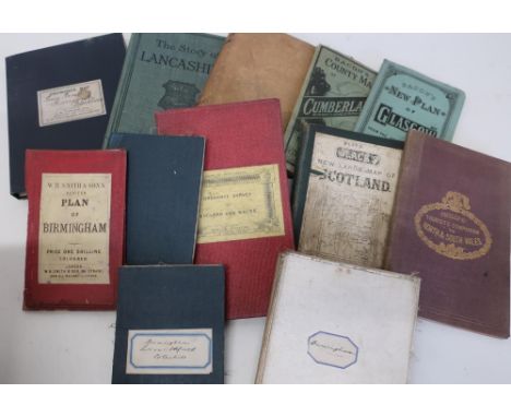
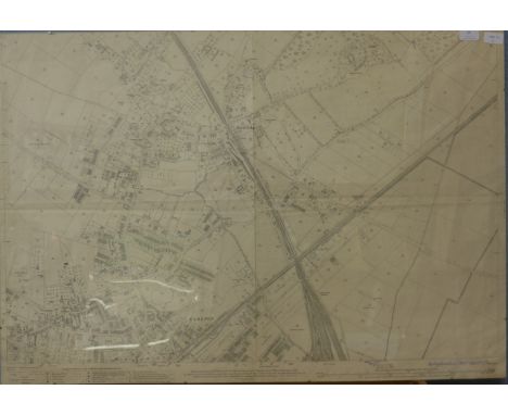
Bacon's County Map of Cumberland, similar new plan of Glasgow, The Story Of Lancashire by Pitman, The English Lakes by Baddeley, Blacks new large linen backed folding map of Scotland, sheet 5, Philip's Tourist's Companion To North And South Wales, 19th C Ordnance Survey Of England And Wales, Cambridge, Ordnance Survey map of Lewis Beard Icarsgarth, Blackburn and Ordnance Survey map of Birmingham and Surrounds cut into sections
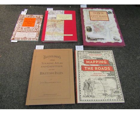
Lot 1066
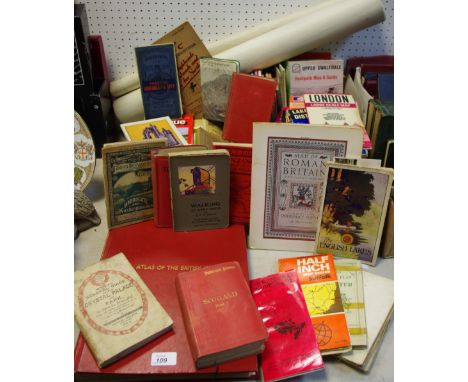
Five volumes on town, city and road maps: Bartholomew's Touring Atlas and Gazetteer of the British Isles 1900 (modern hardback), Mapping the Roads by Mike Parker, The South-West Highway Atlas for 1675, Tamar Books, Ordnance Survey Map Makers to Britain since 1971 by Owen and Pilbeam, and Town and City Maps of the British Isles 1800-1855 by Ahley Baynton-Williams
Lot 211
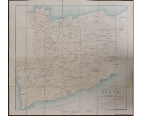
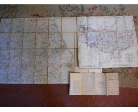
Folding Maps. A mixed collection of seventeen maps, mostly 19th century, including Nantiat (Jaspar). A New Map of Spain and Portugal Exhibiting the Chains of Mountains with their Passes, The Principal & Cross Roads with other details requisite for the Intelligence of Military Operations, W. Faden, Jany. 1st. 1810, engraved map with contemporary outline colouring, sectionalised and laid on linen on four sheets, calligraphic cartouche and advertisement, slight dust soiling and offsetting, ink manuscript on verso 'Lieut Griffiths, 94th Regt. DA2 M.G., each sheet approximately 560 x 780 mm, contained in a contemporary cloth gilt slipcase, case worn, frayed and split along seams, together with Simmons (J. L. A. Captain Royal Engineers). Map of England and Wales showing the Railways, Canals & Inland Navigation Compiled from the Ordnance Surveys and other sources. For the use of the Lords of the Committee of Privy Council for Trade &c., 1852, large engraved map with contemporary outline colouring, sectionalised and laid on linen, slight spotting, 1725 x 1450 mm, contemporary half calf, spine rebound in near-contemporary cloth with morocco gilt labels, brass clasp, heavily worn and frayed with upper board near detached, binding 335 x 210 mm, with Downes W. D. 2nd. Lieut. Royal Sussex Regt.). Map of the Herakleon District of Crete from a Plane Table Survey, Edward Stanford Ltd for the Geographical Section, General Staff War Office, May 1907, colour lithographic map, sectionalised and laid on linen, 635 x 665 mm, marbled endpapers and printed label with manuscript title to upper cover, with another fourteen folding maps, mostly of Egypt, North and Central Africa, various sizes and conditionQty: (17)
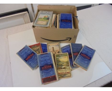
Lot 212
Folding maps. A mixed collection of ten folding maps, mostly 19th century, including Cruchley (G. F.). Cruchley's Improved Geographical Companion throughout England & Wales including part of Scotland, 1825, engraved map with contemporary outline colouring, sectionalised and laid on linen, three tables of reference and a table of explanation, slight off-setting, 940 x 650 mm, marbled endpapers, contemporary card slipcase with printed label to upper cover, case split and worn, together with Colton & Co. (Publisher). Colton's England and Wales, 1878, engraved map with contemporary outline colouring, laid on linen, inset map of the Scilly Isles, old folds, slight staining, 640 x 430 mm, bound in contemporary cloth boards with gilt title to upper cover, with Bacon (G. W., publisher). New Plan of Dublin and Suburbs, circa 1900, colour lithographic map, old folds, 785 x 690 mm, bound in publisher's decorative red cloth boards with a ten page alphabetical index bound in before the map, plus Wyld (James). Map of Europe Exhibiting its Principal States and Physical Features, circa 1850, engraved map with contemporary outline colouring, sectionalised and laid on linen, 535 x 680 mm, marbled endpapers, with an incomplete (lacking 1 section of 12) Blacks new large Map of Scotland and a Stanford large scale map of Ireland (lacking 1 sheet of 4) with four others similar including examples by Ordnance Survey and Ward Lock and Co. various sizes and condition
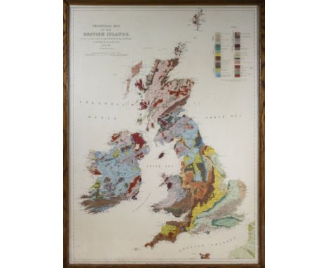
Lot 123
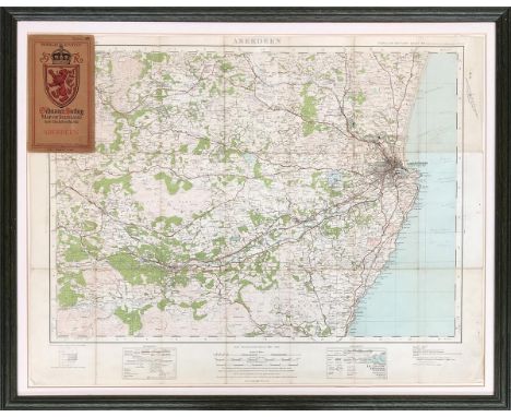
RARE GEOLOGICAL MAP of the British Isles, based on the works of the geological survey by J J H Teall, MA. Lld .SC. F.R.S director 2nd edition 1912 SCALE OF TWENTY FIVE STATUE MILES TO ONE INCH/1584000. Engraved at the ordnance survey office, Southampton, price uncoloured one shilling. coloured two shilling. Frame and glazed in original oak frame a good clean impression of this rare coloured map size 35" x 25"

Lot 46
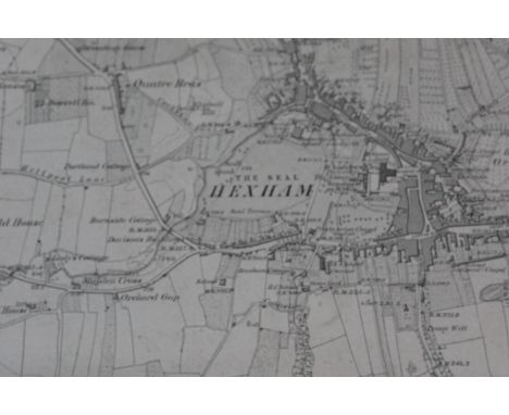
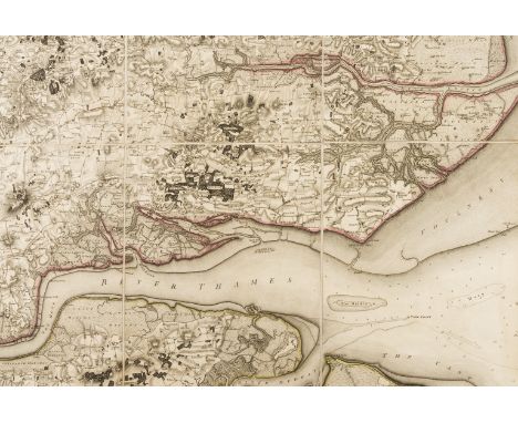
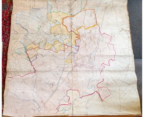
Essex.- Mudge (Lt. Col. William) Part the First of the General Survey of England and Wales, containing the whole of Essex, folding engraved map hand-coloured in outline, 1225 x 1830mm, dissected and mounted on linen, some very light offsetting, loose in contemporary russia slip-case with pull-off top, gilt arms to upper cover, rubbed, rather worn at edges, 4to, [1805].⁂ The second Ordnance Survey map to be published, following that of Kent in 1801.The illustration shows only a portion of the map.
Lot 336
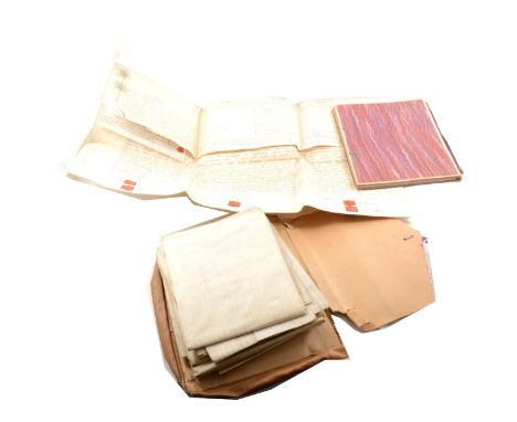
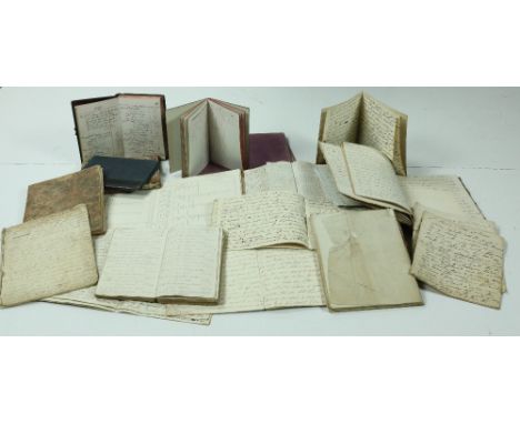
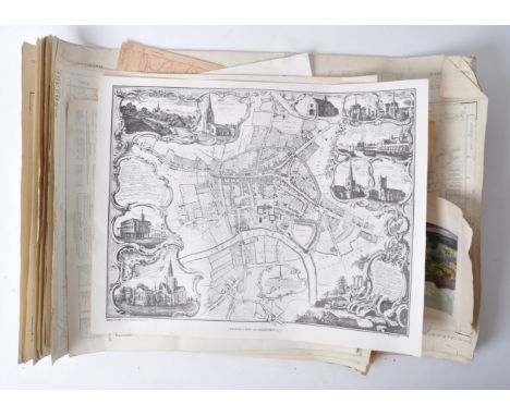
Crofton Archive A Collection of Architectural Drawings, Maps, Religious Manuscripts, and miscellaneous Estate Papers of the Crofton Family of Inchanappa House, Co. Wicklow, c. 1789 - 1900. The Inchanappa estate, together with lands in counties Cork and Monaghan, belonged in the 18th century to the Earbery family. Mathias Earbery (1734-1779), MP for Lanesborough 1768-76, married Elizabeth Barbara, daughter of Major Henry Crofton, and was father of Christopher Henry Earbery (1764-1818), who died leaving two daughters. The younger, Marcia Anastasia, married the Rev. Henry William Crofton (1795-1862), third son of Sir Hugh Crofton of Mohill, Co. Leitrim, 2nd Bart, who thus acquired the Earbery estates. The couple had no children and after her death Crofton married in 1840 Marianne Amelia Cazalet (died 1847) and thirdly in 1852 Frances, daughter of Robert Westropp of Fort Anne, Co. Cork. The Inchanappa line continued through Henry William's son by his second wife, Henry Morgan Earbery Crofton (1840-1878), and the latter's son Henry William George Crofton, a major in the East Surrey Regiment, who was killed in the South African war in 1902. Manuscript Books Folio Volume. Roll book of Inchanappa School for 1837 to 1841. Names 41 pupils, with comments on absences such as "picking potatoes", "gone to Arklow," "America" etc. Many blank pages. Folio Volume: Church Education Society for Ireland Report Book. Contains the rolls of Inchanappa School. 2 lists of pupils for 1841. Also numbers present and absent, with daily record of Bible passages read, from 15 Feb 1841 to 4 Feb 1843. The rest blank. Account Book of Rev Mr Crofton, 27 Upper Merrion St., Dublin, for 6 Feb 1835 to 25 June 1841. Contains: (1) accounts of goods sold at Inchanappa (mainly potatoes); (2) accounts of goods sold to workmen; (2) detailed accounts of work done by the blacksmith. Two Commonplace Books of the Rev Henry William Crofton, with religious and other notes, one containing many loose papers. Ten Exercise Books of Rev Henry William Crofton, each containing a Sermon. Scrap Book containing Christmas Cards, Sentimental Prints, etc. Some blank pages. Book titled "Norma". Contains expense accounts of the yacht "Norma" which was purchased by Henry M. Crofton of Inchanappa from Sir John Barrington for £525 on 5 March 1869. Continues to 8 Oct 1875. 33 pp, the rest blank. Small Notebook containing Workmen's Accounts, 1902-1903. Folio Volume. "Army Book 127." Blank. Miscellaneous Papers Indenture on Vellum dated 29 Oct 1789: lease of a house in Navan from Robert Ormsby of Grove, Co. Roscommon, to Anne, Elizabeth and Margaret Everard of Navan, spinsters. Four Folders of Accounts, Rev. William Henry Crofton in account with James Hunt, with rentals of lands in Co. Cork (Ballyvodane, Lackabane, Goalane, Knockaroorke, Garranredmond, Cork City, Ballingarry). Marked respectively as closed on 1 Sept 1849, 29 July 1850, 12 July 1851, and 28 Jan. 1853. Fair copy of the marriage settlement of Henry William Crofton of Inchanappa, Clerk, with Frances, daughter of the late Robert Westropp of Tinnekilly, 1852. Brief on behalf of the respondent, 17 Dec 1867, in the case of George Smith and his wife Frances (widow of Rev. Henry William Crofton), versus Henry Morgan Earbery Crofton (eldest son and successor of the Rev. H.W. and Frances Crofton), to determine what lands the petitioner was entitled to after his marriage. Rental of the estate of Henry Morgan Earbery Crofton in counties Monaghan and Cork, 1862. Bills, estimates etc for draining, repairs, building works at Inchanappa on the farm, farm buildings, and house: Guy Price, carpenter, James Sheil, architect, 1820-1821. A large quantity of miscellaneous vouchers, bills, receipts, etc., mid-19th century. Architectural Drawings Most of these are for work done at Inchanappa House c 1820 by the Dublin architect James Sheil (c1795-1840). Although so little is known about his life, Sheil was important in his day: he virtually doubled the size of Killeen Castle, succeeded Francis Johnston as architect for Tullynally, and designed seats for many of the Leinster gentry. "Plan of the window and dressings in front of Library, full size, for the Miss Earberys. Jas Sheil architect." 97 x 67 cm. "Entablature to the full size for the Library Columns. Soffite of the Corona and Modillions to the full size. Base and Capital of Columns full size for the Library. James Sheil Architect." 99 x 67 cm. "Plans for the Stucco Work at Inchanappa. James Sheil Architect." Design for a stucco ceiling rose for the drawing room. Badly torn and crumpled but the drawing and text are intact. "James Sheil. Plan of the additional farm offices at Inchanappa Co. Wicklow for the Miss Earberys. Elevation of the Cow House & c. Elevation of the Cart House and Piggery." 73 x 53 cm. "J. Sheil. Plans of the Additions & c to the House at Inchanappa Co Wicklow for the Miss Earberys. Plan of the Bedchamber Floor. Plan of the Principal Floor. Plan of the Basement Story." 96 x 66 cm. "Elevation of the Principal Floor for the Miss Earberys, Co. Wicklow. J. Sheil." 65 x 54 cm. Ground plan of Inchanappa House, by John McCurdy. 65 x 48 cm. Two copies of the bedroom plan, John McCurdy architect, 10 Leinster St., Dublin. 68 x 50 cm. Coloured plan of part of house, marking the entrance hall, dining room, housekeeper's room, study, etc. Unsigned (by McCurdy?) Manuscript Maps "Maps of part of the lands of Inchinappo … in tenure of Mr Samuel Sempill … Surveyed August 1757 by Jacob Nevill." Scale, 20 perches per inch. 59 x 48 cm. "A Survey of the Demesne and Lands of Inchanappa ….. done for Mrs Earberry, by Jno Longfield, 1806." 10 perches per inch. An attractive large-scale map, marking in colour the woods, lawn, house and gardens, besides other lands, and with a detailed reference section. 95 x 71 / 37 cm. "Map of C. Grumly's, E. Chapman's, Mrs Chapman's and Fitzsimons's Farm. Being part of the late Counsellor Earbery's Estate. Survey'd in February 1819 by J.S. Manning." 48 x 40 cm. Coloured green, yellow and brown. Marks houses. An attractive map, but unfortunately now torn in two and very fragile. "A Map of the Townlands of Inchinappa North, Inchinappa South and Broomfield; and of portions of the townlands of Ashford and Ballinahinch in the Union of Wicklow, Barony of Newcastle and County of Wicklow. Done for the Rev. H.W. Crofton A.D. 1833." Scale, 10 perches per inch. A fine large-scale coloured map of the Crofton estate. 96 x 67 cm. Printed Maps Ordnance Survey Maps of: · Co. Wicklow, 6", sheet 19, and 1/2500 sheets 19.4 and 25.2 · Co. Cork, 6", sheets 50, 51, 59, 61, 62 · Co. Wicklow index map Map of the South of England showing places marked out for military manoeuvres, 1898. (1)
Lot 152
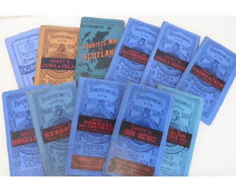
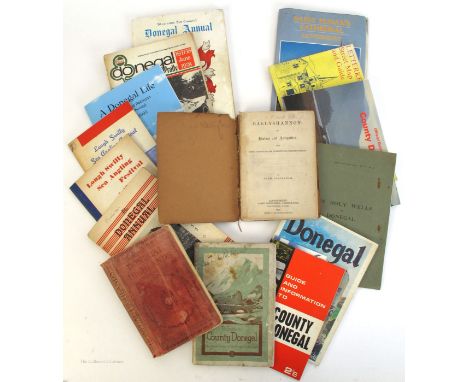
Donegal publications. 1879-2005, A collection of guidebooks, event programmes and society journals. Allingham, Hugh. Ballyshannon Its History and Antiquities, James Montgomery, Londonderry, 1879; Pictorial Guide to the Donegal Highlands, Ward, Lock & Co. 1911; A Guide to Donegal, Tirconnaill County Council, 1927; Guide and Information to County Donegal, Tradepress Belfast, 1966; Tohill, JJ. Donegal an Exploration, Ballyshannon, 1976; O Muirgheasa, E. The Holy Wells of Donegal. Official Guide to County Donegal. Condor Publishers (Ireland) Ltd. 1989; Letterkenny Street Map and Guide, Ordnance Survey, 1988. St. Eunan's Cathedral Letterkenny, Heritage Series, Eason and Sons Ltd. 1988; Donefgal Annuals, 1955 & 1974; Donegal Rally Official Programme, Donegal Motor Club, 1978; Lough Swilly Sea Angling Festival, 1967 & 1968; Robinson, Sylvia Margaret. A Donegal Life, 2005. (15)


Lot 243
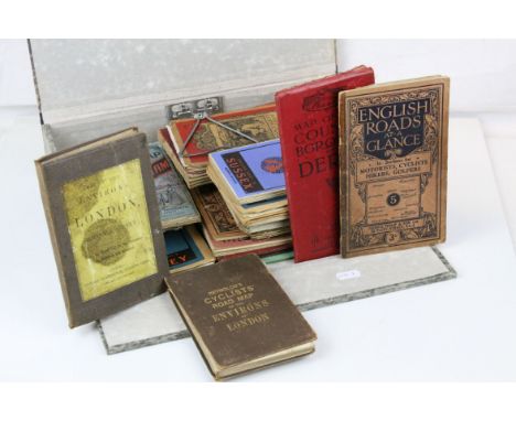
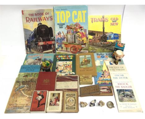
ASSORTED COLLECTABLES comprising an Ordnance Survey folding map of Windsor, circa 1900, red cloth covers; three packs of playing cards, including one of New Zealand and Federal Steamship Companies interest; three Wade ceramic figurines; pen nibs; various childrens books; a Fairylite 'Big Ears' egg cup, boxed; and other items.
Lot 69
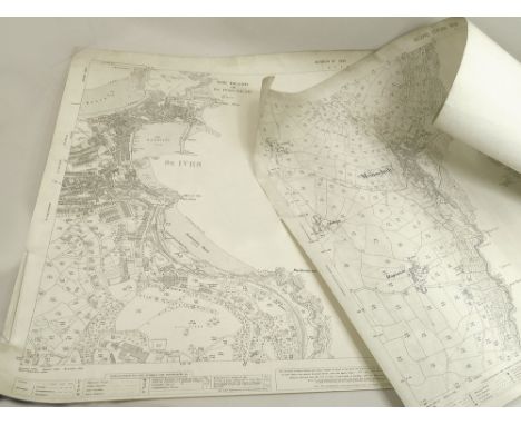
ORDNANCE SURVEY. A 1708, second edition of the OS Map of Mousehole & Mounts Bay. Also, a 1936 revised OS map of St. Ives & its Bay. (Rolled)WE CAN SHIP THIS LOT. PLEASE NOTE: Due to Covid-19 staff shielding, we are operating a queue system for dispatch based on payment completion. Therefore, our usual speed of dispatch will be slower than normal. Also there may be carrier delays beyond our control. : We reserve the right to not ship multiple lot purchases if they are too heavy or bulky.
Lot 192
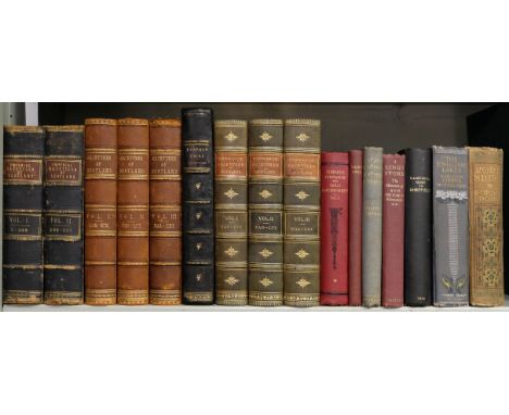
Wilson (John Marius). The Imperial Gazetteer of Scotland; or dictionary of Scottish topography ..., 2 volumes, Edinburgh: Fullarton, [1854], additional engraved title to each volume (that to volume 2 with dampstain), 19 engraved plates, 38 maps hand-coloured in outline, including 2 folding (with some closed tears), spotting mainly at fore-edges, frontispiece map to volume 2 with early ink manuscript ownership inscription to blank reverse, volume 1 lacking front free endpaper, hinges cracked, contemporary half calf, worn, large 8vo, together with: Groome (Francis H.) , Ordnance Gazetteer of Scotland: a survey of Scottish Topography ..., 3 volumes, 1st edition, Edinburgh: Jack, 1882-1883, numerous hand-coloured folding maps, numerous engraved plates, contemporary half morocco gilt, rubbed with some wear to extremities, large 8vo, plus other similar, mostly Scotland and Yorkshire related (Qty: 16)
Lot 213
A collection of assorted WWII Second World War and post-war related maps and ephemera, to include; Land Utilisation Survey Of Britain - London, Ordnance Survey map of Hertford, sketches of aircraft for recognition, a WWI 1914 Field Marshal Viscount French Of Ypres book, various real photographic postcards (many of Egypt based regiments), a VE Day cotton flag on stick and other items. Interesting collection.
Lot 419
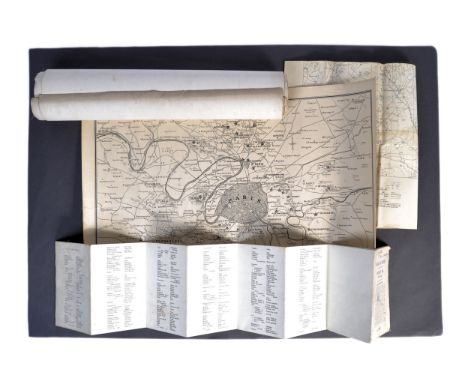
A collection of original WWI First World War Maps -.First World War Map: Belgium and France sheet 36, Lille and Armentieres, edition 6. published for the British Army by the Ordnance Survey 1915 with roads updated to January 1916. On folding linen. Size 89 by 68 cm. Scale 1:40,000. Colour. Coded GSGS 2743 to the bottom left corner. A detailed map. The front cover has the name W E Matthews of C Company, 10th Yorkshire Regiment in ink above the title. Trench Map: Watou and Houtkerque area. Belgium and France Sheet 27 NE, edition 3, published by the Ordnance Survey December 1917. Coded in bottom l/h corner GS GS 2742. On folding linen on a scale of 1:20,000. Size 89 by 65 cm. A detailed key includes information on British and enemy trenches, wire entanglements, dug-outs, huts, buried cables and pipelines etc. as well as railways, trench tramways and houses. Some wear to about 10 cm along one of the folds in the linen but no actual tear. Original owner’s name to reverse. The owner served in the Durham Light Infantry and the Northumberland Fusiliers and was wounded in France.The Times War Atlas. Published by the Times of London, no date but circa late 1914. Seven sheets of maps on linen, each 62 by 46 cm. Scales vary. They comprise: Northern France;Alsace Lorraine, Heligoland, Kiel Canal, Posen, the mouth of the Ems, and three other small maps;North Western France;Eastern Germany and Poland;Paris and environs;Western Germany;The Area of Fighting in Galicia, East and West Prussia, Posen and the Russian frontier, German South West Africa, German East Africa and Cameroon.The maps all feature various theatres of war but show no stages of the actual conflict, probably indicating that these preceded any larger bound publications by the Times during the war.
Lot 686
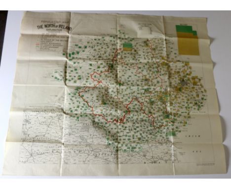
Pre-Boundary Commission MapIrish Map: Population Map of The North of Ireland, Lg. fold. cold. map, approx. 74cms X 88cms (29" x 34 1/2"). Published by N. Eastern Boundary Bureau, and printed by Ordnance Survey Phoenix Park, 1923. As a map, w.a.f. V. good. Ex. Scarce. (1)* Contains much information not available elsewhere.
-
1765 item(s)/page