We found 36558 price guide item(s) matching your search
There are 36558 lots that match your search criteria. Subscribe now to get instant access to the full price guide service.
Click here to subscribe- List
- Grid
-
36558 item(s)/page

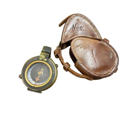
Lot 195
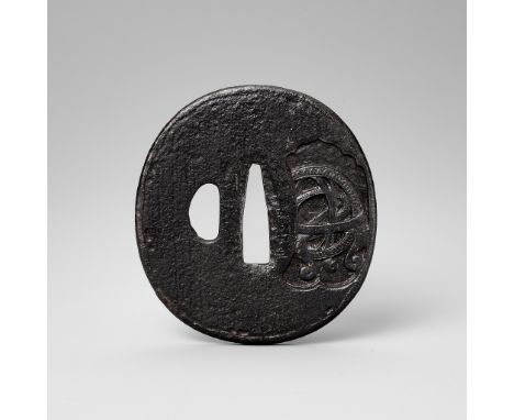
A RARE IRON UMETADA TSUBA WITH ASTROLOGICAL DESIGNSchool of Umetada, signed by UmetadaJapan, 17th-18th century, Edo period (1615-1868)Of marugata shape, with a kozuka hitsu-ana, engraved with an unusual design of an armillary sphere and a compass, the compass with highlights of gold, silver and shakudo.HEIGHT 7.6 cm, LENGTH 7.1 cmWEIGHT 131 gAuction comparison:Compare a related iron nanban tsuba, dated 17th century, at Bonhams, Arts of the Samurai, 27 October 2014, New York, lot 1187 (sold for 3,750 USD).
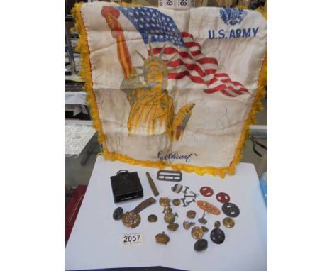
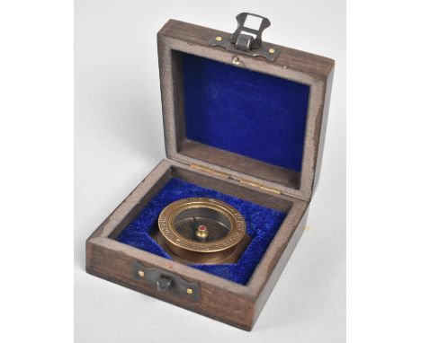
Lot 1143
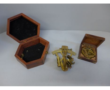
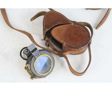
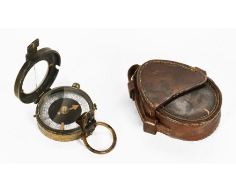
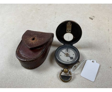
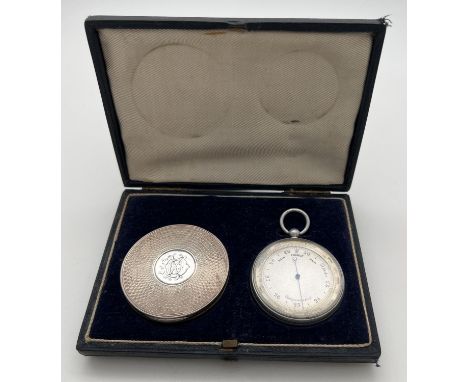
A Victorian silver cased compass from Jones, 23 Boulevart Des Capucines, in original blue velvet lined period case, together with a vintage pocket barometer with blue steel hand and rotating bezel. Compass case has engine turned decoration throughout and engraved monogram to centre of lid. Gilt interior hallmarked for 1911 with lion passant and Henry William Dee makers mark. Lid also engraved with Jones retailers name and address in Paris. Compass approx. 5.5cm diameter. Both items housed in a fitted case (approx. 10.5cm x 14.5cm).
Lot 282
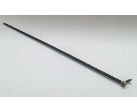
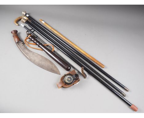
A scarce and unusual Victoria Cross / Masonic related inter war / WW2 period swagger stick with integrated compass to the pommel.The shaft would appear to be made from Bakelite and has a brass ferrule and pommel, the latter having a hinged lid, which when opened it reveals a small compass.The inside of the lid is engraved with a Masonic symbol, and the top of the lid has the makers mark of Lawrence & Mayo.The circumference of the pommel is engraved G.T.Lyall V.C which relates to Graham Thomas Lyall, who was a British born Canadian officer serving in the 102nd battalion.Lyall won his Victoria Cross in late September 1918, with the citation appearing in the London Gazette in December 1918.It reads as follows:On September 27th, 1918, when the leading company was halted near Boulon Wood by an enemy strong point Lt. G. T. Lyall executed a flank movement with his platoon and captured it together with prisoners and its guns. Later that day his much weakened platoon was held up by machine guns at the southern end of the wood. Lt. Lyall led forward his few remaining men, then rushed the position single-handed, killing the officer in charge, and took it with its machine guns, capturing numerous prisoners. Advancing, he secured his final objective and still more prisoners. On October 1st, near Blecourt, by skilful disposition of the weak company he then commanded, he overcame another strongly held position, seizing numerous guns and many prisoners. In these two days Lt. Lyall captured 3 officers, 182 other ranks, 26 machine guns and 1 field gun, and inflicted heavy losses on the enemy. He showed throughout most conspicuous bravery, high powers of command, and skilful leadership.Lyall also served during WW2 in the Royal Army Ordnance Corps where he attained the rank of Lt Col.Given the award date of his V.C it would date from the post WW1 era, but as no rank is given on the engraved pommel it’s impossible to say exactly when in dates from.He died from a heart attack in 1941 while on active service in Egypt.Approximately 69.7cm length.Condition: generally very good.Some light service wear to the shaft and brass mounts.The compass would seem to operate as it should.
Lot 303
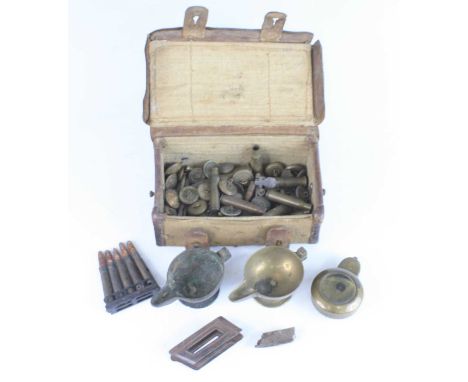
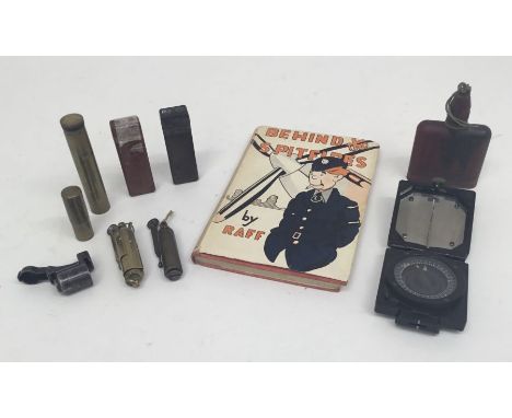
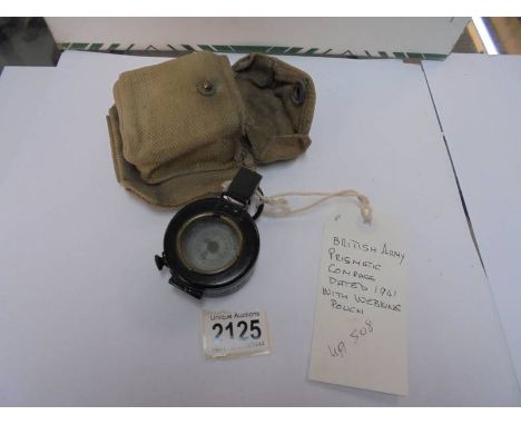
A collection of WW1 / WW2 British and German military related items.To include: a WW2 British Mark 1 magnetic marching compass with Bakelite casing, by T.G. Co Ltd, 3 WW1 brass trench lighter, a WW2 ‘Behind the Spitfires by Raff’ book, a WW1 Lee Enfield brass oil bottle by Harcourt, a WW2 muzzle cover believe to be for a German K98 rifle, 2 x Bakelite containers for gas mask powder (dated 1938 and 1944), a German skin decontamination ointment bottle, dated 1941, and a 1943 dated field dressing.11 items.Generally good condition to all items.Normal service and age related wear.
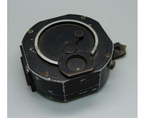
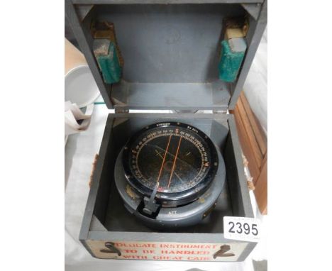
Lot 296
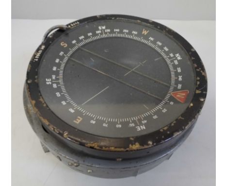
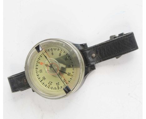
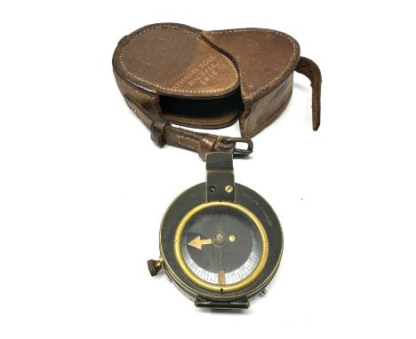
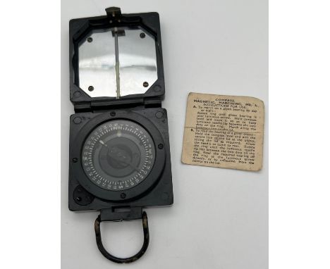
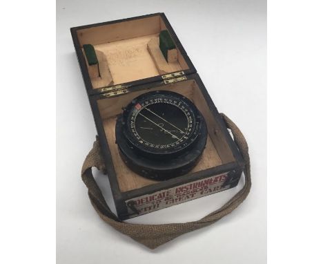
WW2 era type P8 flight compass, used in British aircraft such as the Spitfire, Hurricane and Mosquito.Black painted metal case with Air Ministry brass plaque stamped 6A/0.726.Sitting on a vibration mount with fluid still sealed within the unit.Complete with original wooden transit case, this being stamped June 1941 to the inside of the lid.Approximate compass size 14cm across and 7.5cm height.Wooden case size 18.2cm x 18.2cm 12cm.Condition: generally good, with normal service wear.Some paint losses and minor verdigris to the metal in places.Appears to be in operating condition.The wooden case shows normal service and age related wear.
Lot 358
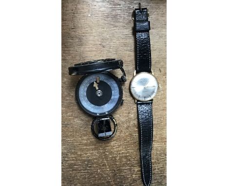
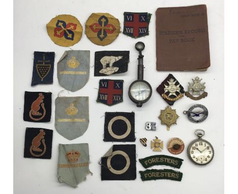
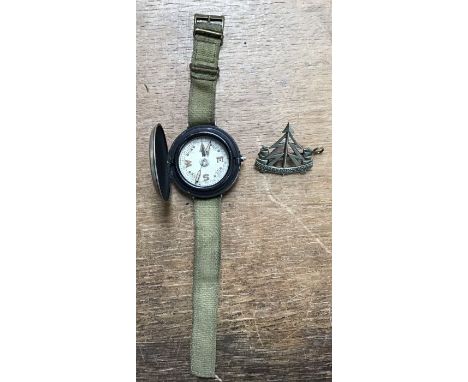
A selection of WW2 / Korean War era cloth divisional patches, to include among others a non matched pair of 7th Armoured Division (Desert Rats) formation signs, both right facing and having been uniform removed, a pair of (Sherwood) Foresters shoulder titles, 3 post war Commonwealth patches, a 49th West Riding Infantry Division patch, plus others.Plus, a military compass, a nickel military pocket watch (seems to be non-working), various cap badges, 2 vintage wristwatches, and a Korean War era soldiers service book.26 individual items.Generally good, with normal service wear.Many of the cloth patches have soiling from storage, with a few appearing to have never been on a uniform.The watches have some cosmetic wear, but their mechanical condition is unknown.The compass has service wear, and would appear to work as it should.
Lot 103
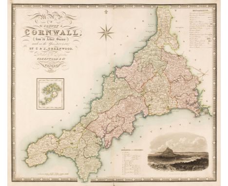
Greenwood (C. & J.). Eleven County Maps, Berkshire, Cornwall, Devon, Dorset, Kent, Middlesex, Somerset, Southampton, Surrey, Sussex [and] Wiltshire, circa 1829, contemporary manuscript index, eleven engraved county maps, all with contemporary outline colouring, calligraphic cartouche, reference of hundreds, compass rose, key chart and an uncoloured ecclesiastical or topographical vignette, slight offsetting, slight dust soiling and staining, each approximately 570 x 680 mm, joints weak and cracked, contemporary half calf, some wear, boards stained, upright folioQTY: (1)
Lot 86
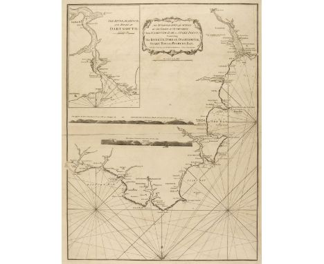
* Devon. Laurie (Robert & Whittle James), Two Sea Charts of South Devon, An Hydrographical Survey of the Coast of Devonshire from Exmouth Bar to Stoke Point; Containing the River Ex, Torbay, Dartmouth, Start Bay and Bigbury Bay, 12th May 1794 [and] Plymouth Sound, Homoaze and Catwater surveyed in 1797, Jany. 1st. 1798, two engraved sea charts, the first uncoloured with an inset map of the River Dart, two horizon profiles, compass rose and numerous rhumb lines, some offsetting, 700 x 530 mm, mounted, framed and glazed, the second chart with later outline colouring, compass rose and numerous rhumb line, some offsetting, 710 x 530 mm, framed and glazedQTY: (2)NOTE:From the First Edition of Sayer and Bennett's The Channel Pilot: comprehending the English and French Coasts ...; this was the first new English sea atlas of the Channel coasts for over eighty years, forming a substantial improvement on the Greenville Collins' Great Britains' Coasting Pilot and the English Pilot.
Lot 108
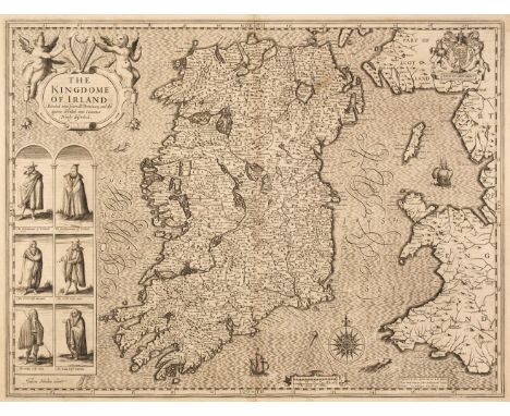
Ireland. Speed (John), The Kingdome of Irland Devided into Severall provinces and then againe into Counties newly described, 1st edition, John Sudbury & George Humble, [1611], uncoloured engraved 'carte-a-figure map, decorative cartouche, compass rose and six costumed figures, slight staining, short repaired splits at the head and foot of the central fold, 385 x 505 mm, English text on versoQTY: (1)
Lot 107
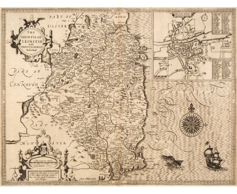
Ireland. Speed (John), The Countie of Leinster with the Citie of Dublin Described, 1st edition, John Sudbury & George Humble [1611], uncoloured engraved map, inset town plan of Dublin, strapwork cartouche, mileage scale and compass rose, 390 x 510 mm, English text on verso, together with The Province of Mounster, 1st edition, John Sudbury and George Humble [1611], uncoloured engraved map, inset town plans of Limerick and Cork, some staining, short split with slight loss to the strapwork margin to the foot of the central fold, crudely repaired on the verso, 390 x 510 mm, English text on versoQTY: (2)
Lot 76
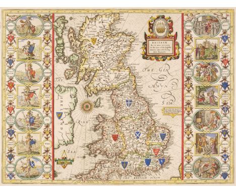
British Isles. Speed (John), Britain as it was devided in the tyme of the English Saxons especially during their Heptarchy, Thomas Bassett & Richard Chiswell [1676], hand coloured engraved map, large strapwork cartouche, compass rose and numerous rhumb lines, the vertical borders decorated with historical scenes, 385 x 510 mm, English text on versoQTY: (1)NOTE:R. W. Shirley. Early Printed Maps of the British Isles, 1477 - 1650, number 317.
Lot 150
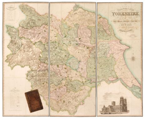
Yorkshire. Teesdale (Henry & Stocking C.), To the Nobility, Gentry & Clergy of Yorkshire, this map of the county constructed from a survey commenced in the year 1817 & corrected in the years 1827 & 1828 is respectfully dedicated by the proprietors, April 21st, 1818, Teesdale & Co. and C. Stocking, April 21, 1828, large scale engraved map with contemporary hand colouring, sectionalised and laid on linen on three sheets, calligraphic title, compass rose, table of explanation and a table of the altitudes of the principal mountains and an uncoloured engraved vignette of the North West View of York Cathedral, some offsetting from the title, slight spotting, marbled endpapers, edged in green silk, overall size 1840 x 2230 mm, contained in a contemporary blind-stamped gilt morocco book box, some wear and rubbing to the extremitiesQTY: (1)
Lot 84
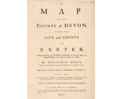
Devon. Donn (Benjamin), A Map of the County of Devon with the City & County of Exeter Delineated from an actual Survey on Twelve Sheets..., by Benjamin Donn. Engraved by Thos. Jefferys Geographer to His Majesty..., Printed for the Author, and sold by the Booksellers of Devon; by Mr Johnston, Mr Law & Mr Baldwin, 1765, printed title with a contemporary manuscript ownership signature, 8 index pages including the list of subscribers, key map with slight spotting and staining and 12 (complete) double-page engraved map sheets, all with contemporary wash colouring, elaborate cartouche and compass rose, table of explanation, inset town plans of Plymouth, Exeter, Lundy Island and Stoke Town, each sheet approx. 620 x 490 mm, some offsetting, later endpapers with an old library stamp, modern half morocco with gilt title to spine, slim upright folio, binding size 535 x 380QTY: (1)NOTE:Batten and Bennett. The Printed maps of Devon, number 44. Arguably the best known of all the large-scale county maps due to the 100 Guineas award from the Royal Society of Arts. Donn's map of Devon was the first map to receive the award which had been conceived by the society in 1762. Donn had taken five years to survey the county and claimed to have measured over 6000 miles of roads and rivers. Highly accurate and exhaustively detailed, the map clearly benefits from Donn's training as a mathematician, but the skill of Thomas Jefferys as an engraver cannot be understated. The map was sold in a simple twelve-sheet format for one and a half guineas and with an extra five shillings for colouring. It was also available (as in this example) in a de-luxe state with a title page, printed index, subscribers list and index map for two guineas plus extra for colouring.
Lot 139
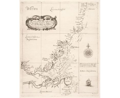
Southeast England. Dudley (Sir Robert), Carta Particolare della Bocca del Tamigi in Inghi:ta Finisce à Leystof nella Provincia di Suffoleh, [1646 - 61], an uncoloured engraved chart showing the east coast of England coast from the South Foreland in Kent to beyond Southwold in Suffolk including Rochester, London, Harwich and Ipswich, decorative strapwork cartouche and compass rose, long closed repaired tear affecting the printed image, skilfully repaired on verso, 450 x 370 mmQTY: (1)NOTE:An uncommon sea chart, engraved by Antonio Francesco Lucini for the 'Dell' Arcano del Mare'.The 'Arcano' was a monumental six-volume work which took Dudley thirty years to complete. Robert Dudley was the illegitimate son of the Earl of Leicester and he would eventually inherit the titles of the Duke of Northumberland and Earl of Warwick. Much travelled, he finally settled in Florence, where his skills brought him the patronage of the Grand Dukes of Tuscany, and it was in their service that he published the 'Dell' Arcano del Mare'. Although published in Italy, this was the first sea atlas by an Englishman and the first in which all the charts were drawn on a Mercator projection.

Lot 551
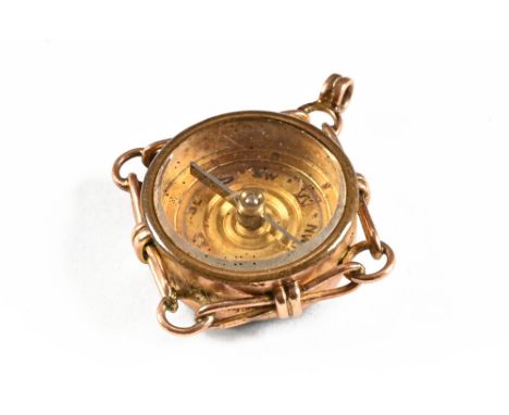
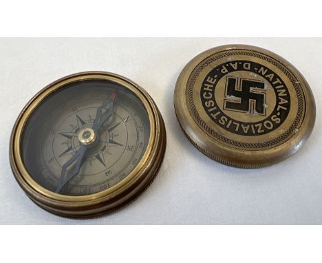
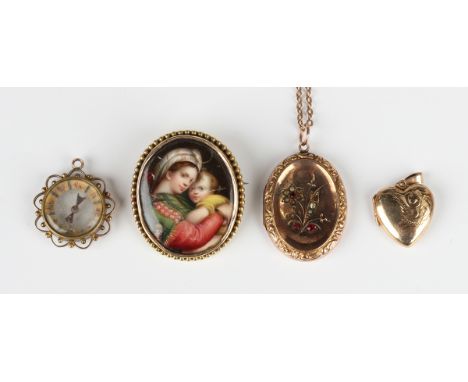
A 9ct gold heart shaped pendant locket, Chester 1956, weight 1.8g, length 2.5cm, a gold back and front and paste set oval pendant locket, weight 5.2g, with a gold neckchain on a boltring clasp, weight 2.9g, a Victorian oval ceramic brooch depicting the Madonna and Child, and a compass pendant fob.Buyer’s Premium 29.4% (including VAT @ 20%) of the hammer price. Lots purchased online via the-saleroom.com will attract an additional premium of 6% (including VAT @ 20%) of the hammer price.
Lot 328
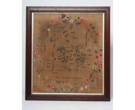
AN EARLY VICTORIAN WOOLWORK MAP OF ENGLAND AND WALES, 1840, worked by Mary Freeman, aged 14, in coloured wools in cross and chain stitch, with compass and scale within a foliate border, on a coarse linen ground, 19 1/2" x 17", framed and glazed (Est. plus 24% premium inc. VAT)Colours still generally bright, some discolouration to ground with brown spots at top. The frame covers some flowers
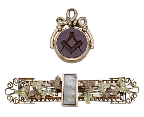
Lot 33
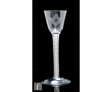
Of Masonic interest: A hardstone fob seal and a foliate brooch, the gold mounted swivel fob seal engraved with square and compass, within scrollwork surmount, together with a tricolour gilt metal bar brooch with ivy motif decoration and hardstone inset panel, brooch length 7cm. (2) £120-£150 --- Condition Report Both with general light surface wear commensurate with age and use. The polished agate seal with some minor nicks around the edges (Masonic side). Seal weight 11gm. Brooch weight 9.83gm

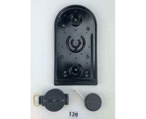
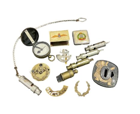
Lot 202
Yacht-Timer Sportex stopwatch, one other stopwatch by John J. Kingsley, two pocket compass and a Jovis 8 days pocket watch (5)Both compasses work, the yacht timer stop watch is working, there are some light marks to the case. The John J. Kingsley stop watch is working, there are some dents to the case and overall scratching and marks. The Jovis pocket watch appears to run although we cannot guarantee the accuracy of the time keeping. The crystal is discoloured and there are some cracks on the dial.
-
36558 item(s)/page