
* Maps. A mixed collection of seven maps, 17th - 19th century, including, Morden (Robert), Darbyshire [1695 or later], hand coloured engraved map, 365 x 425mm, framed and glazed, together with, Kitchin (Thomas & Bowen Emanuel), An Accurate Map of North Wales Divided into its Counties, pub. Carington Bowles, n.d. c.1765, engraved map with original outline colouring and some later enhancement, old folds, 530 x 690mm, framed and glazed, with, Morden (Robert), Cumberland [1695 or later], hand coloured engraved map, 375 x 435mm, framed and glazed, with, Owen (John & Bowen Emanuel), A Map of Darbyshire, [1720 or later], hand coloured engraved map, uncoloured strip road map to verso, 185 x 120mm, framed and double glazed, with three other framed maps similar. Not examined out of frames. (7)
We found 3964 price guide item(s) matching your search
There are 3964 lots that match your search criteria. Subscribe now to get instant access to the full price guide service.
Click here to subscribe- List
- Grid
-
3964 item(s)/page

Navigation.Act..Making..Navigation..Leicester to communicate with the River Nen in or near the Town of Northampton... 91pp drophead title folding engraved map title with ink signature at head (cropped) and browned a few markings in pink crayon; bound with 5 other acts on navigation mostly relating to Leicestershire some with folding engraved maps together 6 works in 1 vol. bookplate of William Firmadge on front pastedown modern half calf spine gilt red morocco label 1791-1800 § Act (An) for Repairing the Road from Market Harborough to Loughborough... modern boards 1726; and 14 other acts or maps relating to navigation roads and railways of Leicestershire folio etc.(16)

An interesting collection of local interest comprising six photograph albums of road and building work undertaken around the Congleton, Timperley areas by `Ashley construction` of Hartford, Northwich during the 1950s also an early 20th century fold out ordnance survey map with classification of roads in various colours, also in this lot are three cardboard boxes containing glass negatives dated 1895 of local interest including a farmyard scene with a horse and cart bearing the time trustees of the late Earl of Stanford and Warrington Ashton under Lyne, also scenes from Anglesey including the Menai Bridge and Amlwch

A collection of books, comprising Pratts Road Map, Motorists Pocket Boom 1928, Motor Racing (1st Edition 1935), Book of the Motor Car 1952, Hobby Annual 1933, showing old cars, Speed on Salt 1936 Practical Automobile Engineering, 1935 Achievements, Motorbikes, Cars, Jubilee Number 1953 The Motor, The Modern Motor Car 1930?, and the Motor Cycle Book for Boys 1933 (good illustrations)
Mogg (Edward). Paterson’s Roads; being an Entirely Original and Accurate Description of all the Direct and Principal Cross Roads in England and Wales, with Part of the Roads of Scotland, 18th ed., [1829], folding linen-backed eng. map frontis. and nine eng. maps (inc. 8 folding), blind embossed ownership stamp to title, edges untrimmed, near contemp. half calf gilt, large 8vo, together with Cox (Rev. Thomas), Magna Britannia; or Topographical, Historical, Ecclesiastical, and Natural History of Surrey..., 1720, folding eng. map by Robert Morden and eng. table to final leaf, pages numbered 327-461, later letterpress title, contemp. half sheep gilt, slight wear at head & foot of spine, 4to, with Acts of Parliament An Act for Repairing the Road from Highgate Gate-house in the County of Middlesex, to Barnet Block-house in the County of Hertford, 2 parts in one, pub. 1736,pp.64,[4], some dampstaining, orig. wrappers, lacks spine, small 8vo, together with An Act for repairing the Highways from several places therein mentioned, leading towards Highgate Gatehouse and Hampstead, in the County of Middlesex..., pub. 1758, contemp. calf, small 8vo, with An Act for repairing the Road from Highgate Gate-house in the County of Middlesex, to Block-house in the County of Hertford, 4 parts in one, pub. 1764, slight dampstaining, contemp. calf, small 8vo, with An Act... for repairing the Road from Saint Giles’s Pound to Kilbourne Bridge, and for paving Oxford Road..., [1782], folding eng. plan, some dampstaining, contemp. half calf, small 8vo, plus one other similar and Bartholomew (John), Philips” Handy Atlas of the Counties of England, 1873, forty double-page maps, orig. cloth gilt, spine torn, 8vo. (8)
Roscoe (Thomas). Summer Tour to The Isle of Wight Including Portsmouth, Southampton, Winchester, The South Western Railway &c., 1843, half title and title page with dec. topographical vignette, fifty-one steel engraved views (including 17 vignettes, complete as list), one engraved folding map with closed tears, spotted throughout, one plate detached, a.e.g., contemp. cloth gilt, worn, 8vo, together with,Ogilby (John),Britannia Volume the First: or an Illustration of the Kingdom of England and Dominion of Wales by a Geographical Description of the Principal Roads thereof, 1675, but facsimile ed. pub. Osprey, [1971],b & w portrait frontis., 100 strip road maps, the last eleven having been hand coloured, orig. pubs. cloth gilt, folio, together with, Robinson (Charles N. Commander R.N.),Britannia’s Bulwarks, The Achievements of our Seamen, The Honours of our Ships, 1901,title page printed in red & black, numerous b & w and coloured plates throughout, hinges weak, contemp. half morocco gilt, rubbed at extrems., oblong 4to., with,Lever (Darcy),The Young Sea Officer’s Sheet Anchor or a Key to the leading of Rigging and to Practical Seamanship, First Philadelphia from the second London Edition, pub. M.Carey & Sons, [1819],title page with large dec. vignette of warships but torn with loss and strenghtened on verso and recto with archival tissue, lacking all before p.vii (b1), numerous engraved plates, damp stained and spotted throughout, new end papers, modern cloth gilt, stained, 4to. (4)

Cole (Edward Maule). Notes on the Geology of the Hull, Barnsley & West Riding Junction Railway and Dock, privately printed by M.C. Peck, Hull, 1886, coloured folding map, b & w plates, one or two light spots, t.e.g., original green cloth, slightly rubbed, 8vo, presented to E.C. Swiss Esq., from George Bohn, together with Measom (George), The Official Illustrated Guide to the Great Northern Railway, Including all the Branch Lines and Continuations, [1857], folding engraved map (a little soiled and frayed), numerous advertisements and wood-engraved illustrations, a few light spots, a.e.g., original cloth, joints splitting at head and foot, rubbed, 8vo, plus Parsons (Edward), The Tourist’s Companion; Or, the History of the Scenes and Places on the Route by the Rail-Road and Steam-Packet from Leeds and Selby to Hull, 1835, additional engraved title, some spotting, bookplate and previous owner signature, front hinges broken, original cloth, spine defective, faded, 8vo, with other railway interest including Joseph Priestley’s Historical Account of the Navigable Rivers, Canals, and Railways, of Great Britain, 1831, J.S. Jeans’ Jubilee Memorial of the Railway System. A History of the Stockton and Darlington Railway, 1875, and George Bird’s The Locomotives of the Great Northern Railway 1847-1902, 1903 (19)
Turner (T.S.). History of Aldborough and Boroughbridge. Containing an Account of the Roman Antquities, Devil’s Arrows, Churches, Halls, and Other Curiosities, 1853, folding coloured lithographed frontispiece, plan and six tinted lithographed plates, dampstain, bookplate, original blindstamped cloth, spine faded, small splits to upper joint, 8vo, together with Royal Society of Yorkshire. Account of the Roman Station at Castleshaw, by Watson. Plans. Observations to Prove Filey Bay to be Portus Felix or Sinus Salutaris, and Flamborough Head, the Ocellum Promontorium of the Romans. By J. Walker... c. 1833, eight separate parts bound in, engraved map, four engraved plates (one folding), light spotting, original wrapper, bookplate, contemporary half calf, rubbed, 4to, plus The Roman Road from Manchester (Mancunium) to Aldborough (Isurium) by J. Norton Dickons (Read before the Society, 13th November, 1896), two folding linen-backed maps, half-tone plates, a few spots, contemporary half cloth, slightly rubbed, 8vo, with others on Yorkshire archaeology including George Frank’s Ryedale and North Yorkshire Antiquities, 1888, Thomas Sheppard’s The Lost Towns of the Yorkshire Coast, 1912, Proceedings of the Yorkshire Philosophical Society, vol. I, 1855, and some Yorkshire Archaeological and Topographical Association reports, 1870’s-80’s (37)


A Guide to Cockermouth, by John Askew, second corrected edition and enlarged, printed and published by Isaac Evening, 22 Station Street, together with a Daily Herald road map of Great Britain and Esso road map of Northern England and an ordnance survey map "Irish Sea" including Cumbria. NOTE - this lot is being sold on behalf of Cumbria Community Foundation for the benefit of flood victims.

Owen (John) and Emanuel Bowen road maps 24 strip road maps hand-coloured engravings each c.185 x 125mm. some with slight spotting all attached to support all neatly mounted and presented in a modern ring-bound folder c.1720; with a larger road map of London to Chester measur`d from the Royal Exchange and a mixed group of 7 others similar (32)


Ogilby (John). The Road from London to Portsmouth in com. Southhamp: Actually Surveyd & Delineated by John Ogilby Esq., [1675 or later], hand coloured engraved strip road map, toned overall, 330 x 440mm, together with Bowen (Emanuel),An Accurate Map of Cambridgeshire Divided into its Hundreds..., pub. J.Bowles, [1760 or later],engraved map with original outline colouring, engraved panorama of Ely, elaborate cartouche, slight water staining, 705 x 540mm, with three town plans by Thomas Moule each approx. 270 x 200mm (5)
Wiltshire. Greenwood, (C. & I.), Map of the County of Wilts, from an Actual Survey, 1829, engraved map with original hand colouring, calligraphic title, inset vignette of Salisbury Cathedral, 570 x 690mm, together with Bowen (Emanuel),An Improved Map of Wilt Shire, Divided into its Hundreds, pub. T.Bowles, [1760 or later],engraved map with original outline colouring, uncoloured cartouche, trimmed to plate mark at upper margin, marginal repaired tears, central fold strengthened on verso. 525 x 685mm, with Cary (John),A New Map of Wiltshire, Divided into Hundreds Exhibiting its Roads, Rivers, Parks &c., 1811,engraved map with original hand colouring, 580 x 520mm, and Ogilby (John),The Road from the City of Salisbury com. Wilts. to Campden com. Gloc. [1675 or later],hand coloured engraved strip road map, slight loss at central fold with strengthening to verso, 350 x 460mm, together with another four similar maps (8)
`Walkers North Wales` being a fold-out colour tinted map of the North Wales region by J N C Walker, printed by Longman & Co of Paternoster Row, London, the whole enclosed in a grey cloth bound booklet, also a quantity of other maps relating to North Wales, being the roads from Carmarthen to Cardigan (circa early 19th century), another of the map of the mail road from London to Holyhead, hand tinted map of Herefordshire, also maps of Anglesey, Monmouthshire, Carmarthenshire, Caernarvonshire etc, also a quantity of late 19th century black and white prints of actors and actresses comprising Juliette, Ophelia, Miranda, Anne Boleyn etc

An Victorian Board Game-The Great Centre-London and Surroundings, Published by D. Ogilvy, 17 Christ Church Road, Hampstead, comprising a pictorial map with fifty six engraved views of places within fifty miles of London (framed and glazed), instruction booklet, pleasure guide, compass board and card place names, size of playing board 57cm by 75cm

Ogilby (John), The Continuation of the Road from London to Flambrugh .., nd., hand-coloured map, 353mm x 444mm; Buck (Sam`l & Nath`l), The South Prospect of Scarborough, in the County of York, 1745, engraved view, 308mm x 800mm incl. text; Buck (S.), The South View of Burstal-Abbey, near Hull in York-shire 1721, nd., engraved view, 185mm x 348mm; with three other topographical engravings, all six individually framed and glazed (6)

Hobson, William Colling Map of the county palatine of Durham. London, 1840, approx 83.5 by 104cm, hand coloured, linen backed, slipcase; Black, A. & C. Road and railway travelling map of England. London, c.1870, approx 86.5 by 62cm, hand coloured in outline, linen backed, original cloth gilt, rebacked, lacking ties (2)
Railway books, guides and pamphlets: including The Official Guide to the Bristol and Exeter, N and S Devon, Cornwall and South Wales Railways, George Measom, Griffin, Bohn and Co, circa 1869, The Gloucester Diary, 1902, The Gloucester Railway Carriage and Wagon Co Ltd, The Story of Bradshaw`s Guide, 1890, A History of the Whitby & Pickering Railway, 1902, London and Ten Miles Around Map, 1902, Great Western Expresses, 1894, P J Vintner, Our Iron Road, F S Mason and Bradshaw`s Guide 1949 and 1954 (F-VG) (12)
A Lieberman & Siegel cream wool walking suit, American, circa 1917, labelled, in cream wool gabardine, embroidered detailing to belt, pleats to the skirt, bust 92cm, 36in (2) This collection was purchased in the 1970’s by Steven Gregory from a second hand shop in West Norwood. One of the pieces bore the unusual embroidered name tag ‘Mrs Trummer’. From this small lead Mr Gregory managed to amass a huge amount of information which places the clothes in context with their social history. Mrs Trummer was born in 1837 as Elizabeth Agnes Hodges and was twice married. Her second marriage certificate lists Elizabeth Agnes Coles (widow) marrying Otto Trummer (a Prussian merchant) on 28 March 1863 at Saint Mary, Edge Hill, Lancashire. Her father John James Hodges is listed as an artist. There is a record of Otto Trummer’s application for British Citizenship in The National Archives dated 30th November 1870. The Census of 1871 show them living at 23 Norland Square, Notting Hill. Some time after 1871 they moved to Morland Road, Norwood. Norwood was home of the future Frederick III, Emile Zola and Camille Pissarro. After Otto Trummer sold his business in New London Street, EC3 in the mid 1880’s they moved to 54 Lancaster Gate, Bayswater. The Opera Coat c.1896-7 is a glamorous testimony to visits to the grandest social events. Mrs Trummer died in 1904 aged 67. How the clothes came to arrive in West Norwood remains a mystery but a Miss Elizabeth A.I. Trummer (born in India c.1858) worked as a music teacher at Harcourt in Croydon and lived in West Norwood, she may have been a relation. Some of the later clothes in this collection (some of Indian silk) were presumably hers. These costumes map the rise and prosperity of an émigré and his wife at the end of the 19th century.


Family group: A fine Second World War O.B.E., Great War M.C. group of seven awarded to Captain C. H. Pigg, Worcestershire Regiment, afterwards R.A.F.V.R. and a Commandant in the Auxiliary Fire Service in the 1939-45 War: extensive extracts from his Great War diaries were published in the regimental journal 1949-50 and represent an important record of the 2nd and 10th Battalions in action on the Somme and elsewhere - and speak of the moving loss of his brother and of his experiences after being gassed The Most Excellent Order of the British Empire, O.B.E. (Civil) Officers 2nd type breast badge; Military Cross, G.V.R., unnamed as issued; 1914-15 Star (Lieut. C. H. Pigg, Worc. R.); British War and Victory Medals, M.I.D. oak leaf (Capt. C. H. Pigg); Defence and War Medals 1939-45, mounted as worn, together with a set of related miniature dress medals, rank corrected on the fourth, generally good very fine The Great War campaign group of three awarded to 2nd Lieutenant B. W. Pigg, Worcestershire Regiment, late Honourable Artillery Company, who was killed in action with the 10th Battalion on the Somme in July 1916 1914 Star, with clasp (753 Sjt. B. W. Pigg, H.A.C.); British War and Victory Medals (2 Lieut. B. W. Pigg), extremely fine (17) £2500-3000 O.B.E. London Gazette 3 January 1945. M.C. London Gazette 27 July 1916: For conspicuous gallantry. He has done excellent work throughout the operations, and organised his company with great skill. Charles Herbert Pigg was born in January 1887 and was educated at Cheltenham College, where he excelled at cricket, football and hockey, and at Jesus College, Cambridge. He later played for the the Cambridgeshire Cricket XI and played rugby for Blackheath. Pre-war, he was a master at his old school, but with the advent of hostilities was commissioned in the Worcestershire Regiment in October 1914 and first went out to France as a Lieutenant in the 10th Battalion in July 1915. But it was after being attached to the 2nd Battalion that he won his M.C., a typical example of his excellent work being a successful raid on Auchy on 1-2 July 1916, an action recorded in detail in his diary: The bombardment when it came was terrific, and after a minute a 60-pounder shell dropped short and just in front of our noses. For a few seconds when it exploded the men thought the mine had gone up for the advance; but we checked them, and then at last, after what seemed ages, up went the mine with a great shake of earth, and we were in the remains of the enemy wire and through it in a moment. Each man and officer knew his task to an inch and went straight to his post. The German trench, as I stood above it, seemed very deep and much more soundly constructed than ours. Jumping down, I found Private Raven with his bayonet at the throat of a German soldier. Raven was young, dark, devil-may care, up to anything when out of the line, though in the line he was a first rate soldier; the German was a good-looking boy, in appearance about sixteen, wearing a neat and new field grey uniform and cap. He looked like one of our own young cadets, and faced his death fearlessly with his hands at his side. But I told Raven to spare him and take him back safely as a prisoner. We soon fixed Company H.Q. at the point previously determined, and immediately I was speaking to Leman 200 or 300 yards away; the noise was deafening and only by shouting could we use the telephone at all. Our organisation worked perfectly, and at 1.15, after an hour had passed very rapidly, I gave the signal to withdraw. Our own firing ceased and the trenches were rapidly cleared. Presently a runner and I were left alone and we walked along the new empty lines to ensure no one had been left behind. It was a curious experience in the comparative silence; and the climb out of the deserted trench and the walk back across the open uncanny. Direction might have been easily lost, but to guide us we had German guns which were now slowly shelling No Mans Land. The shells rushed past us in the darkness and burst in front of us along the parapet, and we were relieved to pass our wire and drop into our lines. A week or two later, he was gassed at High Wood on the 21st, but managed to remain on duty until being evacuated by No. 1/3 Highland Field Ambulance 48 hours later, and thence to No. 45 Casualty Clearing Station, Rouen and England. Of this episode, his diary states: Now, as I gave orders for the Company to fall in by platoons on the road, I had some hope that the darkness would protect us. But it was not to be. Just as we formed up and were moving off, the Boche turned everything available on to us. I was in the rear of the Company, and with the high explosive came the soft thud of what at first seemed dud shells. One of these fell and burst gently in front of and to the right of the man marching before me; he paused and fell in his tracks, dead in a moment. I shouted gas, and our helmets were on in an instant; but, if gas, it was something new to us, not tear, shell, nor deadly chlorine. Soon the low valley through which we stumbled in the darkness was full of smoke and gas, nor was it easy to read a map and find our destination; to do this I had to make intervals to take a deep breath and pull up my helmet. It was the inferno of Dante made real ... He was subsequently employed as an instructor, being advanced to Staff Captain with command of an Officer Cadet unit and, in August 1918, was appointed Brigade Major. Returning to Cheltenham College after the War to resume his teaching career, he was a popular housemaster and member of staff in the 1920s and 1930s, prior to retiring in 1940, but quickly returned to duty with an appointment as a Flying Officer in the Royal Air Force Volunteer Reserve. Resigning his commission in late 1942, he next served as Commandant of the National Fire Services Officers Training School in London, in which capacity he was awarded the O.B.E. He died in February 1960; sold with research, including copied entries of his published wartime diary. Bernard William Pigg, brother of Charles, originally entered the French theatre of war as a Sergeant in the Honourable Artillery Company in September 1914, but was invalided home at the end of the year. Subsequently commissioned as a 2nd Lieutenant in his brothers battalion - the 10th - Worcestershire Regiment, in February 1915, he returned to active duty, and was killed in action leading his company into action at La Boiselle on the Somme on 3 July 1916. On that date, his unit launched an early morning attack in the face of formidable opposition, the regimental history noting that the German dug-outs were so deep and of such solid construction that even after the terrific bombardment of the previous week, many of them were still undamaged; and the defenders, troops of the German 13th, 23rd and 110th Reserve Regiments, had fought to the last. The 57th Brigade captured 153 prisoners, nearly all wounded. But their success had been dearly purchased. The Battalion had lost a third of its fighting strength, including the C.O. and Adjutant. A moving glimpse of Piggs conduct and fate is to be found in his brothers diary, which source also confirms, though only a 2nd Lieutenant, that he commanded B Company - the eye-witness account was written by the young subalterns Company Sergeant-Major, F. Yeates, D.C.M., a veteran of Mons, who received a bayonet wound but survived: It was during this period that the Company saw what a gentleman they had commanding them, for if ever a man proved himself a man he did that night. He himself and Mr. Hadley, his dear chum, also killed, simply walked up and down the Company during the hail of shrapnel, endeavouring to keep the men steady, which I am pleased to say they were successful in doing ... at 3.15 the signal came and we were off just like a lot of schoolboys and quite as happy, for we were all eager to get to close quarters. We had got to the first German line when a German officer jumped up and shouted in English, ôRetireö. Mr. Pigg at once shot him dead and at almost the same moment was shot himself. Mr. Hadley ran towards him but it was all over. After the assault, survivors of the Battalion were left out in No Mans Land for the rest of the day, and were only able to withdraw after dark - Private Turrall won the regiment a V.C. for his gallant deeds in attending to a mortally wounded officer. Bernard Pigg has no known grave and is commemorated on the Thiepval Memorial.
Freeling (Arthur) Lacey`s Railway Companion and Li new and improved edition folding frontispiece linen-backed original printed boards Liverpool [1836]; Freelings`s Grand Junction Railway Companion to Liverpool Manchester &Birmingham Guide folding table and illustration (loose) original cloth gilt slightly shaken [Ottley 6455] 1838 § Drake (J.) Drake`s Road Book of the Grand Junction Railway second edition hand-coloured foding map frontispiece original cloth gilt slightly worn bookplate to front pastedown hinge and joint splitting [Ottley 6453] [1838]; and 2 Bradshaw`s Railway Companions 1840 &1843 v.s. (5)


* Liege-Sofia-Leige Rally 1963. A good group of memorabilia relating to the entry of car number 7 the Reliant Sabre driven by Raymond Baxter and D Wilson-Spratt, comprising competitor`s original Rally Car Log-book, signed by both drivers with attached identification photographs, stamped and countersigned to stage at Pec. Hand-annotated on each page with any special details and stage-timings etc, car failed before they reached Titograd, together with road map and related correspondence relating to entry and participation in the event, and with subsequent correspondence from Baxter to Reliant Motor Co directors explaining his accident and preceding problems with the car "..lamps falling off, no brakes at all.." etc, included in his post-event drivers report. plus related expenses claims and explanation of problems of retrieving the car from a local garage behind the former "iron curtain" country (-)
Owen (John and Bowen, Emmanuel). Britannia Depicta or Ogilby Improv`d; Being a Correct Coppy of Mr. Ogilby`s Actual Survey of all the Direct & Principal Cross Roads in England and Wales, [1720 or later], lacking eng. title page, 4 pp. map index, 273 uncoloured eng. strip road and county maps, printed back-to-back, slight worming to first few leaves, occ. spotting and staining throughout, new end papers and paste downs, front paste down and first free end paper preserved and laid on modern paper, both with later pencil annotations, modern blind stamped calf gilt, contrasting morocco label to spine, 8vo. Chubb CXLVII. (1)
India. Stanford (Edward, pub.), Stanford`s Portable Map of India, Burmah and Adjacent Parts of Beluchistan, Afghanistan, Turkestan, The Chinese Empire and Siam, 1886, zincographic map with orig. outline colouring, sectionalised and laid on linen, 800 x 705 mm, orig. pubs. cloth gilt boards, with another copy in orig. marbled card slipcase, worn and frayed, together with Couchman (Col. H.J.),Calcutta & Howrah Guide Map, 1933,zincograph col. printed map, laid on linen, tape measure with brass mounting ferrule attached to map, alphabetical index in pocket on verso of upper board, orig. cloth gilt boards, stained and frayed, 900 x 660 mm, and Lewis (Brig. C.G.),Road Map of India, Calcutta, 1939,zincograph col. printed map, sectionalised and laid on linen, orig. pubs. cloth gilt boards, upper board detached, slightly rubbed and stained, 1050 x 770 mm (4)


Emanuel Bowen. Road map from Nottingham to Grimsby, c1751, 18cm x 12cm, together with John Rocque (1704-1762), a map of Lincolnshire c1746, 19cm x 16cm, four Baderslade county maps of Suffolk and Lincolnshire c1748; two county maps of Lincolnshire and a road map from London to Flanborough c1675, 16cm x 21cm. (7).


MCADAM (John L) Remarks on the Present System of Road Making, 5th edition, 1822, 8vo, untrimmed, boards; A New and Accurate Description of the Present Great Roads and the Principal Cross Roads of England and Wales, 1756, small 8vo, rather browned throughout, damaged binding; MOGG (E) Patterson`s Roads, 18th edition, 8vo, folding general map, half calf; CARY (J) New Itinerary... of the Great Roads throughout England and Wales..., 10th edition 1826, coloured folding maps, worn rebacked calf (4)


Robert Morden, Warwickshire, hand coloured engraved map sold by Abel Swale, Awnsham and John Churchil, 36 x 42cm (image); together with A French strip road map from Paris to Bordeaux and Toulouse, by Michel, 1766, 52 x 23cm (plate); and A Cary map of Gloucestershire (browned); and two others (various sizes) (5)

OGILBY (John) Britannia, Volume the First or a Illustration of the Kingdom of England and Dominion of Wales: by a Geographical and Historical Description of the Principal Roads thereof, London: by the author 1675, folio, frontispiece by Hollar, title in red and black, red ruled throughout, engraved ornaments to Preface, 28pp preliminaries without the dedication to Archbishop Gilbert, double page map of England and 100 double page Road Maps (one bound in upside down), generally fair to good with moderate finger soiling and light damp stain to some upper margins, few old repair strips, each map numbered neatly in an old hand in ink to the upper margins, last leaves a little tired, rebacked boards (worn) with trimmed portrait prints glued to first pastedown


`The Car` Case of Motor Maps, an early 20th century leather map case with carrying handle, stamped `V of H` (for Lord Vaux of Harrowden), containing seven fabric-backed Bartholomew`s road maps of Scotland, 13cm (5in) wide, together with a leather cartridge magazine, interior removed and fabric lined, 32cm (12 1/2in) wide (2)


Ogilby (John) Five Road Maps: Tinmouth to Carlisle; Ferrybridge to Boroughbridge and Barnard Castle; Tuxford to York; York to Chester le Street; Chester le Street to Berwick, each approx 320mm x 440mm, four hand-coloured, each framed and glazed; Greenwood (C.& I.), Map of the County Palatine of Durham, 1831, hand coloured, 610mm x 702mm, framed and glazed; The Newcastle Chronicle, 1774, with article on the Turnpike Road from Darlington to West Auckland, framed and glazed (7)
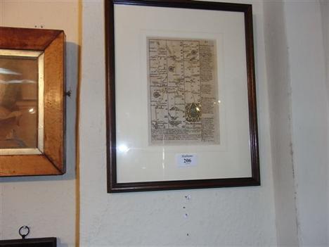
![Blome (Ric.) A Mapp of Ye Bishoprick of Durham, nd., [1673], hand coloured map, 260mm x 321mm, framed and glazed; Ogilby (Joh](http://lot-images.atgmedia.com/SR/10041/2776455/121_468x382.jpg)
Blome (Ric.) A Mapp of Ye Bishoprick of Durham, nd., [1673], hand coloured map, 260mm x 321mm, framed and glazed; Ogilby (John), The Road from Ferrybridge to Boroughbridge ..to Barnard Castle, nd., hand coloured road map, 344mm x 452mm, framed and glazed; An Accurate Map of Cleveland, 1803, hand coloured map, 232mm x 406mm, mounted, framed and glazed; with two other maps and two F.M. Sutcliffe photographs (7)
![Ogilby (John) The Road from London to Newhaven .. [with] London to Portsmouth .. (verso), nd.; The Road from London to the La](http://lot-images.atgmedia.com/SR/10041/2776455/131_468x382.jpg)
Ogilby (John) The Road from London to Newhaven .. [with] London to Portsmouth .. (verso), nd.; The Road from London to the Lands End, [with] Continuation .. (verso), nd., hand-coloured road maps, each approx 230mm x 220mm, individually framed and glazed front and rear; Gardner (Thos.), The Continuation of the Road from London to Bristol, .., nd., hand-coloured road map, 160mm x 263mm, framed and glazed; [Bowen (E.)], The Road from York to Lancaster .., nd., hand-coloured map, 184mm x 115mm, framed and glazed; with three others (7)


-
3964 item(s)/page