John Blaeu (1596-1673) - Original map of Cornwall inscribed with various heraldic coats of arms for notable families of the county also inscribed Cornubia-Cornwallia within a decorative cartouche, hand coloured engraving, unframed, 15.75" x 20" together with twenty three further maps depicting various counties including Somerset, Berkshire, Wiltshire, Dorsetshire, Devonshire, and other road maps and the environs of Bristol, various sizes (24)
We found 3964 price guide item(s) matching your search
There are 3964 lots that match your search criteria. Subscribe now to get instant access to the full price guide service.
Click here to subscribe- List
- Grid
-
3964 item(s)/page
INDIE/ ALT/ POP - 7" COLLECTION. A smashing collection of around 90 7" singles. Artists/ titles include Redskins inc Bring It Down, The Power Is Yours. The Men They Couldn't Hang inc A Map Of Morocco, The Crest, Rain Steam & Speed, A Place In The Sun. Tonight inc Drummer Man, Money That's Your Problem. Cheap And Nasty inc Beautiful Disaster, Mind Across The Ocean. Candy Flip inc Space, Redhills Road. The Trilobites inc Jennys Wake, Night Of The Many, Venus In Leather, American TV. The Trash Can Sinatras, They Might Be Giants, Jesus Jones, The Woodentops, The Wonder Stuff, Sheep On Drugs, The Blue Nile, Terrorvision, Cardiacs, One Thousand Violins. Condition is generally VG+ to Ex+, odd one may drop below.
Six: Lieutenant F. S. Maxwell, 30 Squadron, Royal Air Force, one of a handful of pilots to qualify for the General Service Medal 1918-62 with ‘S. Persia’ clasp, and who subsequently went on to serve in Kurdistan and then as a Major with the South African Forces during the Second War; for which he was awarded the Protea Emblem - a unique combination of awards to the Royal Air Force British War and Victory Medals (Lieut. F. S. Maxwell. R.A.F.); General Service 1918-62, 2 clasps, S. Persia, Kurdistan (Lieut. F. S. Maxwell. R.A.F.); War Medal 1939-45 (86175 F. S. Maxwell.); Africa Service Medal, with Protea Emblem (86175 F. S. Maxwell) officially re-impressed ; Efficiency Decoration, G.VI.R., 1st issue, Union of South Africa, the reverse engraved ‘T/Maj. F. S. Maxwell G.S.C.’, mounted for wear, lacking reverse pin, generally very fine or better (6) £2,000-£3,000 --- Approximately 30 General Service Medals for ‘S. Persia’ were awarded to Royal Air Force personnel, just five aircraft of No. 30 Squadron being present in the qualifying period November 1918 to June 1919. Francis Severn Maxwell was born in Natal, South Africa in December 1898. He was employed as a mechanic prior to attesting as a Driver in the S.A.S.C. at Pretoria in December 1915. Maxwell was discharged for service with the Royal Flying Corps in May 1917, and posted to Egypt for pilot training. He qualified as a pilot and advanced to Flying Officer in November 1917. Maxwell was posted for operational flying with 72 Squadron at Basrah, but he was subsequently transferred for service with 30 Squadron in March 1918. The following extracts from The History of No. 30 Squadron, Royal Air Force by Major J. Everidge, R.A.F., published in 1919, give a flavour of Maxwell’s operational flying against Turkish forces from March 1918 - March 1919: ‘Period March 17th to 23rd, inclusive... Reconnaissances - Fourteen, of which eight were photographic, have been carried out. A reconnaissance was carried out on the 18th by Lieut. Maxwell (Pilot) and Lieut. Lindop, M.C. (Observer), over Khaan Baghdadi, Hadithah, Anah. No change in camps and no new digging was observed.... On the 26th [April] three machines, with Lieuts. Anson, Campbell and Maxwell as pilots, dropped 20 25-pounders on scattered troops and transport on Kara Tepe - Kifri Road. The raid did not produce excellent results as the targets were too small. Lieut. Anson got two bombs in the camps at Talishan..... General - Orders have been received for one Flight to move immediately to North Persia. The disposition of the Squadron is now as follows: Headquarters and ‘C’ Flight, Baqubah; ‘B’ Flight and half Flight of ‘A’, Kifri; half Flight of ‘A’, Hamadan..... Period September 22nd to 28th, 1918, inclusive.... Reconnaissances - On the 27th inst. a reconnaissance over the Halaba area was done as under by detached Flight at Kifri. Lieut. Maxwell (Pilot), Lieut. Kinghorn (Observer), escorted by Lieut. Jenoure (Pilot) and Lieut. Yeates (Observer) report: - Reference map T.C. 230. Maidan, no movement and neither tents or shelters. Maidan Bani - Khalian Road. Nothing seen. Sheik Maidan, nothing seen. Halabja - What appeared to be about 12 shelters (rather less than the size of an E.P. tent) were seen on west side of town, and three white tents about half mile further out. No movement. Time taken, 2 hours 15 minutes..... On the 12th [October] over the Taza area by Lieut. Maxwell (Pilot) and Lieut. Yeates (Observer) escorted by Lieut. Jenoure (Pilot) and Lieut. McNab (Observer) reported the Tauq Bridge intact. 11 small tents were seen south of the town. At Tazah 18 large shelters were seen, also 10 small tents and 150 men. No movement of transport was observed on any roads. Time taken, 2 hours..... Five reconnaissances were carried out on the 25th and 26th [October]... Lieuts. Maxwell and McNab landed on Kirkuk Aerodrome one day too soon [it was captured by the British the following day] and were greeted by a hot fire from troops holding it. They were lucky enough to take off again, but not before the enemy had scored a large number of hits in their machine.... Bushire, January 9th to 25th, 1919.... On the 15th Major Everidge, with Corpl. Helps arrived. Lieuts. Fielden and Maxwell were detained at Ahwaz owing to the latter’s machine having magneto trouble. Lieuts. Fielden and Maxwell arrived with Corpls. Cagliari and Tidmarsh on the 16th... Bombing - On the 27th [January] five machines bombed Robatak. On arrival the machines were fired on by tribesmen from the village. Several large tents were seen pitched in the serais of the town. Twenty-nine Coopers 20 lb bombs were dropped, 17 direct hits being obtained in the village, the inhabitants ran out of the village and took cover in neighbouring hills and nullahs.... Information received that Nasir Diwan’s son was very badly wounded during the first bomb raid. Pilots on each occasion were Major Everidge, Capt. Adams, Lieuts. Hawkins, Maxwell and Carryer.... Resume of ‘C’ Flight, Bushire, March 2nd to 8th, 1919.... Whilst machine-gunning at a low height, Capt. Adams was seen to crash very badly. Lieut. Bull went down to help him and touched the ground 12 yards from the other machine. The ground was found very rough and impossible to land on and he was obliged to take off again. He was very heavily fired on by a number of Persians at point blank range and his machine was badly shot about. He reported the engine of Capt. Adam’s machine was buried in the ground and the under carriage and left planes were wiped off, and also that there was no possibility of Capt. Adams being alive. March 7th - Lieuts. Hawkins and Maxwell, with A/Ms. Porter and Judge, flew over the crash taking photos of it and saw the dead body of Capt. Adams lying close by it.’ After the cessation of air operations in Persia, Maxwell returned to Basrah, Mesopotamia and went on to take part in the Kurdistan operations. He later served with 63 Squadron in Iraq before travelling to the UK in July 1919 in order to be repatriated to South Africa. Maxwell transferred to the Unemployed List in December 1919, and volunteered for service with the outbreak of the Second World War. He was employed on recruiting duties, November 1939 - September 1945, having advanced to Temporary Major in November 1940 (the King’s Commendation Protea Emblem was authorised in the Government Gazette 31 December 1943, his Efficiency Decoration having been authorised in April of the same year). Sold with copied service papers.
An Important Leitz AM Petrological Microscope From the Geological Survey, With Provenance, German, c.1936, engraved to the front of the body tube 'Ernst Leitz Wetzlar' and 'GS 280' (Geological Society) and engraved on most parts, objectives and eyepieces 'GS280', numbered on the card in the door 323053 the microscope standing on a large and heavy black enameled base, with locking adjustment to the incline, with plano-concave mirror focusing substage condenser with polariser, focusing stage to be used in conjunction with the vertical illuminator so as not to displace the position of the illuminator in relation to an external light source, stage with large removable central section so the microscope can be used with a Universal Stage, body tube with Bertrand lens (along with a hand-drawn chart ) with rack and pinion focusing, analyser with adjustment and scale, in a large wooden case with 7 Leitz objectives 6 of which are engraved GS280, a Berek Compensator engraved GS280 and engraved 1914 along with a hand-drawn chart (damaged), a cased mechanical stage, another Berek compensator engraved GS619 The microscope was sold by the Geological Society back in 1984 to Peter Aubry Sabine for £115.00 and comes with all of the paperwork relating to the sale. According to the records held by the British Geological Society the microscope was bought in 1936 presumably for Dr Phemister, who was recorded as having it in 1937. Dr. Phemister was appointed Official Petrographer in 1935, a post he held until he became Assistant Director in 1946. Dr James Phemister was a renowned geologist whose contributions to the field of earth sciences were significant. He was born in Scotland in 1903 and spent most of his life working as a geologist in the UK. Dr Phemister's expertise in the field of geology earned him a high reputation among his peers and the scientific community. Dr Phemister's career began at the University of Edinburgh, where he earned a degree in geology. He then went on to study at the University of Cambridge, where he obtained a PhD in 1928. After completing his studies, Dr Phemister joined the British Geological Survey, where he worked for over 30 years. During this time, he made significant contributions to the study of geology in the UK. Dr Phemister's work was not limited to the UK, however. He also worked on geological surveys in Africa and South America. In Africa, he worked on a geological mapping project in the Congo, where he discovered the presence of copper deposits. In South America, he worked on a project to map the geology of the Andes mountains, which helped to improve our understanding of the tectonic processes that shape mountain ranges. Dr Phemister was also an active member of the Geological Society of London, where he played an important role in the development of the society. He was elected a Fellow of the society in 1939 and served as its President from 1953 to 1955. During his tenure as President, Dr Phemister worked to increase the society's membership and promote the study of geology. Apart from his work with the Geological Society, Dr Phemister was also an accomplished author. He published several books on geology, including "The Geology of Central England" and "The Geology of the South Wales Coalfield." These books were instrumental in advancing our understanding of the geological history of these regions. Dr Phemister's contributions to geology and earth sciences were recognized by many scientific societies in his lifetime. He was awarded the Wollaston Medal by the Geological Society of London in 1956 for his contributions to the study of geology. He was also awarded the Lyell Medal by the same society in 1966 for his contributions to geological mapping. In conclusion, Dr James Phemister was a pioneering geologist whose contributions to the field of earth sciences were immense. His work on geological mapping and his involvement in geological surveys in Africa and South America helped to improve our understanding of the geology of these regions. His tenure as President of the Geological Society of London was marked by his efforts to promote the study of geology and increase the society's membership. Dr Phemister's legacy lives on through his numerous publications and his lasting impact on the field of geology. Peter Aubrey Sabine, (b.1924 - d.2022) was as a prominent British petrologist and mineralogist born in London in 1924. He graduated with a geology degree from Imperial College London in 1945 and joined the Geological Survey and Museum (GSM) as a Geologist. Early in his career, he helped to reorganize the Geological Museum's specimens and showcases, sparking his interest in igneous petrology. In 1951, he received his PhD for investigating the minor intrusions of the Assynt district in N.W. Highlands. He was later promoted to Chief Petrographer and set about modernizing the Petrographical Department. He realized that the polarizing microscope for the optical characterization of rocks and minerals had been overtaken by more rapid and versatile techniques. He acquired the first X-ray diffraction (XRD) equipment by the late 1950s, followed by X-ray fluorescence (XRF) and differential thermal analysis (DTA) equipment. By the mid-1960s, modern X-ray diffractometer and image analysis equipment were installed, making the Petrographical Department the best equipped and staffed laboratory in the GSM. Sabine conducted various petrological studies, including contact metamorphism of chalk by Tertiary dolerite intrusions, resulting in several seminal publications. He provided the first detailed petrographical description of the granite found on Rockall, a tiny Atlantic island, after the first landing by the Royal Navy in 1955. Sabine was the longest-standing member of the Mineralogical Society at the time of his death, having joined in 1945 and becoming Vice President of the Geological Society in 1966. In 1977, he became Chief Geochemist at the Gray's Inn Road office of the renamed British Geological Survey (BGS) and later returned to the Exhibition Road as Deputy Director. However, he retired at the end of 1984 when the BGS relocated its headquarters to a site near Nottingham. Sabine's legacy includes groundbreaking research and modernization in petrology and mineralogy.
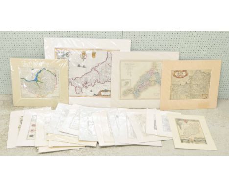
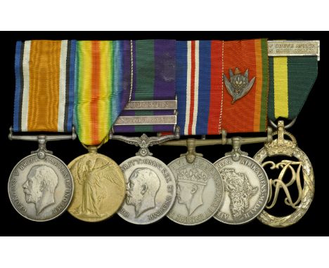
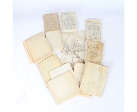
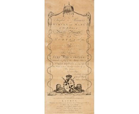
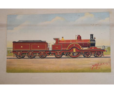
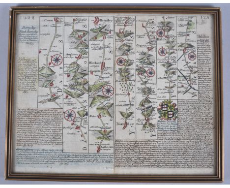
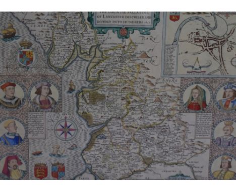
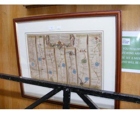
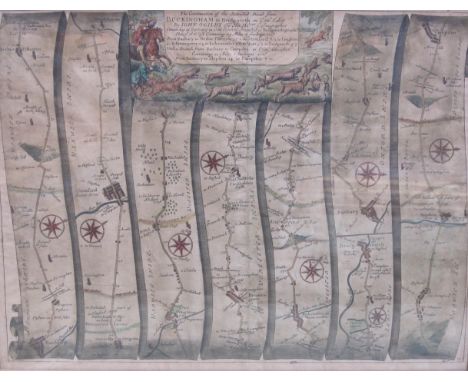
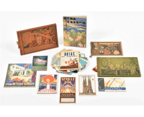
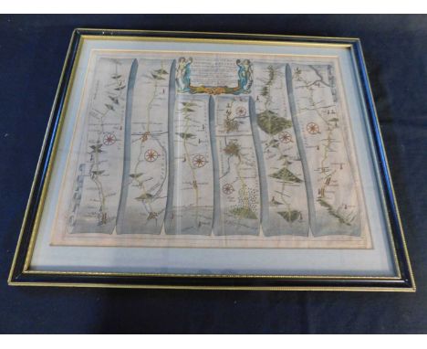
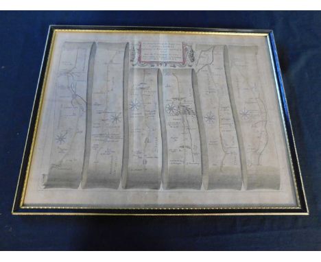
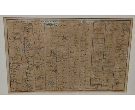
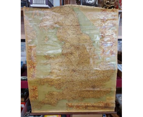
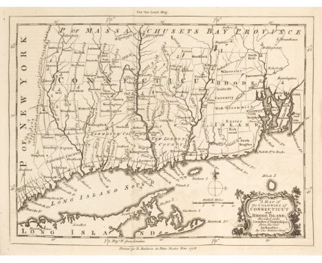
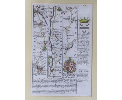
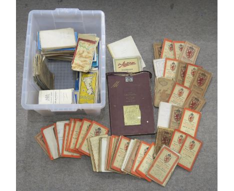
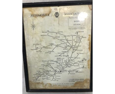
Collection of British First World War Trench Maps, the maps are attributed to Brigadier General Herbert Cecil Potter (10/10/1875-11/6/1964) Officer Commanding the 9th Infantry Brigade, 3rd Division, during the Battle of the Somme and 3rd Battle of Ypres, the maps, detailed below, are of areas in which Potter served throughout the war from 1914 and include detailed information of enemy trenches marked in red on each map, some are particularly evocative, the map of Hebuterne containing the village of Serre with 'Matthew', 'Mark', 'Luke', 'John' Copses, all clearly marked and bring to mind the tragic first day of the Battle of the Somme, a map of Delville Wood is annotated in pencil with 'Delville Wood and Guillemont, 9 Bde attack 16/8/1916' , another map gives the 'German Order of Battle, Cambrai 1 Dec 1917', a map of the 'Seine, Meuse, and Rhine Basins Showing Areas of Occupation of the Allied Armies Jan 1919' is marked with the ink stamp of 'HQ 9th Infantry Brigade', the maps were given to the vendor when a young man by General Potter's son Major Cecil Potter, a family friend in Somerset, some are heavily used and stained with the mud of the front line, many of the annotations on the maps are believed to have been made by General Potter contemperaneously, while some, particularly on the French made maps, are believed to have been done by Major Cecil Potter post warBrigadier General Herbert Cecil Potter CB, CMG, DSO was born in Nagasaki, Japan, educated at Bedford Modern School and Sandhurst, joined the Kings (Liverpool) Regiment as 2nd Lieutenant 29/2/1896, promoted Lieutenant, March 1899, then Captain, December 1900, seconded to a Mounted Infantry Column in South Africa 1901-02 (2nd Boer War) served in the Sudan in 1908 and the Western Front throughout the First World War, wounded through both legs in August 1914, he returned to the front line and given command of 9th Infantry Brigade in April 1916, during the Battle of the Somme General Potters recce of High Wood with two other officers, and the realisation that it was clear of Germans and could be occupied easily is detailed on Page 137/138 of 'Somme' by Lyn MacDonald, '...There was not a German to be seen. The commanders decided to look for themselves. General Potter of the 9th Brigade of the 3rd Division, with Lieutenant Colonel Elliot and Major General Watts Commander of the 7th Division were not so foolhardy as to expose themselves by walking along the track at the top of the slope but, hugging the the shelter immediatley below, clambered along to the ruined windmill, a hundred yards or so to the right.... looking across the gentlest of valleys, where the ridge on which they stood sloped down to a hollow and rose almost imperceptibly to the dark mass of High Wood itself,...Nothing stirred in the cornfields. High Wood was silent...Then they crossed the cornfield almost to the edge of High Wood. Not a shot was fired. High Wood was empty. Jubilant, excited, and anxious to push ahead, they almost ran back to the line. The troops were fresh and ready to go...', tragically, the information was not acted on in time, the Germans reoccupied the wood and High Wood was not taken until September after heavy fighting and many casualties, Potter was twice wounded at the Somme in August 1916, the second time by a 'large shell which sat down beside me and made me stone deaf for some days', Potter also served at the Battle of Arras April-May 1917, and the 3rd Battle of Ypres (Passchendaele) July-November 1917, as well as the Queens South Africa Medal with three clasps Potter was awarded a medal and clasp, 4th Class Osmanieh, 3rd Class Mejidieh in Sudan (1908),mentioned in depatches in WW1, decorated with the Legion of Honour by Sir Douglas Haig in November 1915, made DSO in 1917 and CMG in 1918, he retired from the army in 1927, the maps included in the lot are;Delville Wood Map, large scale, trench lines/road names marked in red (Fleet Street, High Holborn, Bond Street, Regents Street, etc) with reverse marked in pencil (believed by Major Cecil Potter) 'Delville wood and Guillemont, 9 Bde attack 16/8/1916'Trench Map - Hebuterne, Ordnance Survey 1916, scale 1:10,000 , 'Trenches corrected to 19:8:16', trench lines printed in red, additional markings in pencil (Bounderies, Pendant Alley, etc),'Matthew Copse', 'Mark Copse', 'Luke Copse', 'John Copse', which formed part of the British front line and forming up points for some of the Pals battalions are clearly marked, front of map marked 'Brigadier, Serre, Aug 1916''Seine, Meuse, and Rhine Basin Showing Areas of Occupation of the Allied Armies Jan. 1919', 1:1,000,000 scale map, showing Belgian, British, American, and French zones outlined in red, marked in pencil 'Occupation zones of the Rhineland 1919' bears stamps of 'HQ 9th Infantry Brigade' and 'General Staff 3rd Division' dated 7th February 1919French issue map of Melun, 1:80,000 scale, bottom left corner marked 'Revisee 1888', marked in pencil 'France, 1/80,000 map of Melun area (SE of Paris) probably issued in case of further retreat by BEF in August 1914'Map of Cambrai, 1:100,000 scale, British intelligence map showing German Order of Battle, Army Groups, Armies, Corps, Divisions, down to Regiments, including rest billets, all printed in red, marked to reverse 'German Order of Battle, Cambrai, 1 Dec 1917'Trench map, Ordnance Survey 1915, sheet 36c N.W. 3 and part of 1, scale 1:10,000, shows town of Loos, trench lines in red including 'Loos Road Redoubt', marked to the front in pen '**** 1915'Trench Map, scale 1:10,000, France, La Bassee, trenches marked in red including Holenzollern Redoubt, units marked in pen (19th Bde, Kings, 2nd South Staffords), marked to the front in pencil '1915'Trench Map, France, Sheet 57c S.W., scale 1:20,000, trench lines marked in red, Bazentin, Longueville, Guillemont, High Wood, Delville Wood, Flatiron Copse, Sabot Copse, Arrow Head copse, etc all shown, mud stained, marked in pencil to front 'Bazentin/High Wood'French issue map, Provins, marked bottom left corner 'Revisee 1888', marked in pencil 'Large scale map of Provins area (SE of Paris) probably issued in case of further retreat by BEF in August 1914', (qty)
Ogilby (John). The Road from Oxford to Coventry Continued to Darby, circa 1676, hand-coloured engraved strip road map, 340 x 450 mm, together with The Road from Herford to Leicester, circa 1676, hand-coloured engraved strip road map, 345 x 450 mm, with an uncoloured duplicate and supplied with a page of contemporary explanatory text, plus The Road from London to Darby, circa 1676, hand-coloured engraved strip road map, 345 x 450 mm, supplied with a page of contemporary explanatory text, and The Road from London to Oakham in com. Rutland, circa 1676, hand-coloured engraved strip road map, trimmed to the plate mark and with its margins extended, toned overall, backed with later paper, 325 x 435 mm, with The Extended Road from Oakham to Richmond in Yorkshire, circa 1676, hand-coloured engraved strip road map, 335 x 435 mmQTY: (6)NOTE:Sheet numbers 82, 72 (2 copies), 40, 47 & 48.
Murder Map. Radclyffe (W & T), Map of the Roads, near the spot where Mary Ashford was Murdered, Surveyed by Rowland Hill & George Moorcroft and published by Rowland Hunter, 1817, engraved broadside map with two insets, one of the 'Fields on an Enlarged Scale', the other 'A Section of the Pit', descriptive text below the map, old folds, slight staining, some marginal fraying closed tears, some tears crudely repaired on the verso, 440 x 370 mmQTY: (1)NOTE:Rare. Only two copies were found on COPAC (both in the British Library). The only known published map by Rowland Hill, the founder of the 'Penny Post'. A murder of a pretty young girl had taken place near his school, at Erdington, a few miles northeast of Birmingham. The circumstances had produced much newspaper coverage but no adequate map to inform the public of the all-important topographical context. Hill measured all the features that had been mentioned in the trial and produced the above map.Mary Ashford had gone dancing on the evening of 26 May at the ominously named Tyburn House (right of centre on Hill's map). There she met Abraham Thornton, the son of a local landowner, and left the dance in his company. Her battered body was discovered the following morning in the pit (shown in cross-section as an inset on the map). A post-mortem showed that she had been raped and that she had been a virgin. Thornton was immediately arrested and charged with Mary's murder. At his trial, several witnesses testified that they had seen Thorton walking along another road at the time of the murder and the prosecution had no witnesses to counter these testimonies. The jury acquitted him; however, local and national opinion regarded Thornton as the murderer and an old law was dug up to see him face justice again. It was the ancient custom of “appeal of murder,” which was evoked by Mary’s brother, William and Thornton once again found himself arrested. However, this old law of “appeal of murder” meant that, instead of a trial in front of a jury, Thornton would face a “trial by combat.” Thornton was by all accounts a large solidly built man, whereas William was small and slight and understandably, declined to fight, and Thornton was released again. Thornton was widely regarded by the general public as guilty, and in the face of increasing harassment, he left England and settled in America. The only positive to come out of the case was that parliament almost immediately abolished the law which allowed 'trial by combat' for the 'appeal of murder'.
* Moll (Herman). A Pocket Companion of Ireland Containing all the Cities, Market Towns, Boroughs..., A New and Correct Map of Scotland & the Isles..., [and] A General Map of Great Britain and Ireland with part of Germany, Holland, Flanders, France &c..., [1740], together three engraved maps, all with contemporary outline colouring, each approximately 305 x 280 mm, all mounted, framed and glazed, together with Saxton (Christopher & Kip Willem). Mongomery comitatus qui olim pars Ordovicum (3 copies) & Brecknoc comitatus pars olim Silurum [1610 - 37], together four hand-coloured engraved maps, some dust soiling, one map (Montgomery) torn with slight loss, some fraying to margins, each approximately 270 x 320 mm, with Morden (Robert). Glocestershire, circa 1701, hand-coloured engraved map, old folds, 160 x 205 mm, mounted, framed and glazed, plus Owen (John & Bowen (Emanuel). Glocestershire, A Map of Hampshire [and] Bedfordshire [1720 or later], together three hand-coloured engraved maps, each approximately 185 x 120 mm, mounted, framed and glazed, and five hand-coloured engraved strip road maps from the same source, all framed and glazedQTY: (16)NOTE:The first map described. Andrew Bonar Law. The Printed Maps of Ireland, number 67 state 5.
Taylor (George, & Skinner, Andrew). Taylor & Skinner's Survey and Maps of the Roads of North Britain, or Scotland, 1776, engraved calligraphic title with some staining and toning, index and a list of the 'Stages on the Great Road', general map of Scotland with a repaired handling tear, 61 (complete) uncoloured engraved strip road maps, each displayed in triple columns, all but one printed back to back, old soft folds, some staining and dust soiling, last map with several marginal closed tears, later cloth, some wear, spine frayed and partially lacking, oblong 4to, binding size 520 x 235 mmQTY: (1)
AN ANTIQUARIAN MAP OF LORD COURTOWNS LAND TO INCLUDE LOWER HEYES FACTORY AND PREMISES (PART MAP) A/F. A PLAN AND SECITION OF VALE STREET AND MINTON STREET G.X. FOR W.B. BROCKLEHURST ESQ., A MAP SHOWING THE DIVISON OF W AND J BROCKLEHURST ESQ LAND AND G.C.LEIGH ESQ LAND. A DIAGRAM OF THE WATER SUPPLY AND DRAINAGE SYTEM OF MILL COTTAGES, BOLLIN'GROVE, PRESTBURY, 1920,A COSTING INVOICE FOR THE PROPOSED ROAD AND SEWER FOR PUSS BANK PLUS A DIAGRAM FOR MILLER AND ALLEN ESTATE AGENTS FOR DWELLINGS ON KING EDWARD STREET, MACCLESFIELD DATED 1884
Holy Land.- Creighton (Robert) A New Historical Map of Palestine with Part of Egypt & Arabia..., map of the Holy Land including the mouth of the Nile River and part of Arabia, with inset plans and vignettes, and showing part of the old Roman road that leads to Mecca, engraving with vibrant original hand-colouring, 835 x 1055 mm (32 3/4 x 41 1/2 in), dissected and mounted on linen, light offsetting with very minor browning and surface dirt, folding with dark blue morocco ends and the book plate of Augustus Terry Clarke, map edged with blue linen, folding into slipcase, gilt title 'Palestine' to spine, rubbed and scuffed with with splitting to spine, 8vo, Henry Teesdale, 1838.
SOUTH WALES. Morden (Robert) South Wales, c.1695 or later, hand-coloured engraved map, 36.5 x 43.5cm; CARMARTHEN. Speed (John), Caermarden both Shyre and Town described, c. 1662 or later, hand-coloured engraved map, 38 x 50cm; CARMARTHEN TO ABERYSTWITH ROAD MAP. Ogilby (John) The road from Carmarthen to Cardigan, Cardigan to Llanbeder and Llanbeder to Aberistwith, late 17th Century, hand-coloured engraved map, 34 x 45cms SAINT VINCENT. Bellin (Jacques Nicolas), Carte de L'Isle de Saint Vincent, c. 1764, engraved map, 22.5 x 17.5cm; Edwards (Bryan), Map of the Island of St. Vincent for the History of the West Indies, c. 1794, engraved map, 23.5 x 18cm (5)
GARDNER, Thomas, 3 strip maps: The Roads from Shrewsbury and Chester to Holywell, 180mm x 280mm; The Road from York to West Chester; and The Continuation of the Road from Bristol to Chester, all c.1719. All hand coloured and in modern gilt frames. With a map of the roads from London to Aberistwith. Hand coloured, no cartographer named. (4)
A silver plated three piece tea set with plastic handles and a plated spirit kettle in the Arts & Crafts manner No'd 34738 to base together with a Victorian walnut and brass inlaid sewing box 29.5 cm wide x 21 cm deep x 15 cm high and a Pilot tin deed box containing various ephemera, including war time notebook relating to Private H F Cook, various photographs, mainly post war, a World War II bayonet, various maps including "Bacon's Large Print Motor Map of South West England", "Ordnance Survey Contoured Road Map of Tunbridge Wells", "Fireguard's Handbook No. 14", "Protection of Your Home Against Air Raids Manual", etc.
A framed and glazed print of an old road map, Oxfordshire to Bristol, printed on hand made paper, it is a page from what was the first of its kind, the engraver , John Ogilby was "cartographer to King Charles II", and the original plates were nearing completion , when destroyed in the Great Fire of London in 1666. This from a volume, and features local town of Highworth; and another Framed and glazed black and white lithograph of
NO RESERVE World.- Schliemann (Dr. Henry) Troja: results of the latest Researches and Discoveries on the Site of Homer's Troy, colour map frontispiece, 3 folding colour maps detached and loosely inserted at end, illustrations, some full-page, ex-library with usual labels and ink-stamps, modern cloth, 1884 § Brown (R. A.) The Road to Ulundi: the water-colour drawings of John North Crealock (the Zulu War of 1879), limited edition, illustrations, original flyer advertisement loosely inserted, remnants of dust-jacket loosely inserted, ex-library with label and ink-stamp to title verso, original cloth, fractional bumping to corners and extremities, Pietermaritzburg, 1969; and 2 others, 8vo & ob. folio, (4)
Quantity (10) of the c1965 special edition of the London Underground diagrammatic POCKET MAP, a paper version of the Garbutt design produced for distribution to arriving passengers at the British European Airways (BEA) West London Air Terminal in Cromwell Road with walking directions to Gloucester Road station. These copies have never been used and originated from LT stores. Excellent to mint condition, one or two may have minor storage marks. [10]
Early to mid 20th cent. Incl. a.o.: (1) 2 booklets advertising for Portugal's Costa do sol, 1 w. covers des. by "Luiza XXIX", the other publ. by the Sociedade Propaganda da Costa do sol. (2) A German booklet about Grand Canary Island w. fold. map. (3) A brochure w. map of the Spanish-American Exposition of 1929-30 w. a cover des. by Jimenez and w. a plan of the exposition. (4) A fold. tourist map of Lisbon. (5) A booklet advertising for "Spanish Road Houses. Run by the Spanish State Tourist Department". (total 25)
CECIL ALDIN: 2 Titles: THE ROMANCE OF THE ROAD, London, Eyre & Spottiswoode, 1928 first edition, plates and map collated complete as list, folio, original cloth worn, OLD INNS, London, William Heinemann, 1921 first edition, 14 plates including 8 coloured as list, 4to, original cloth gilt worn plus KENNETH HARE: ROADS AND VAGABONDS, London, Eyre & Spottiswoode [1930], plates collated complete, 4to original cloth gilt worn and soiled (3)
Two antique strip maps: hand-coloured, John Ogilby Road from London to Holyhead approx 45 x 33 cms and John Ogilby copper engraving (Britannia edition) circa 1698 Road from Hereford to Leicester approx 47 x 37 cms both framed and glazed. This lot includes two antique maps: hand coloured William Hole after Christopher Saxton Map of (Gloucestershire) Glocestriae approx 34 x 31 cms and a hand-coloured Robert Morden Map of Worcestershire approx 45 x 39 cms. (4)
The Gentleman's Magazine and Historical Chronicle. 7 volumes, a broken run, 1746 (2 copies), 1768, 1774, 1778, 1790 & 1793, numerous engraved plates of topographical views, natural history, portraits, antiquities and maps by Bowen and Kitchin, some folding, some internal fraying and occasional handling tears, some text blocks split and loose, some volumes partially excised, one duplicate (1746), mixed contemporary calf bindings, most boards detached and lacking spines, heavily worn and frayed, 8vo, together with The London Magazine. 2 volumes, 1758 & 1767, numerous engraved plates of topographical views, natural history and maps, some folding, some internal fraying and occasional handling tears, some text blocks split and loose, some volumes partially excised, 8vo, with The Universal Magazine of Knowledge and Pleasure, volume 93, 1793, allegorical frontispiece and one topographical plate, bound with The Lady's Magazine; or Entertaining Companion for the Fair Sex, volume XVIII, 1787, allegorical frontispiece with later hand-colouring, with a part of volume LXXII of the Univeral Magazine, no plates, contemporary vellum, 8voQTY: (10)NOTE:The Gentleman's Magazine consists of volume XVI (1746) containing a single-page map of Brittanny, the duplicate with folding maps of New England & Nova Scotia, a Plan of Carlisle and the plan of Brittanny, volume XXXVIII (1768) containing single and folding plates but no maps, volume XLIV (1774) with a simplistic outline map of Mr De Bourgainville's track around Africa, two folding canal maps in Yorkshire and a strip road map from Ferrybridge to Grimsby, volume XLVII (1768) contains a folding map of the Hudson River and folding maps of Dominica and Tobago, volume LX (1790) contains a folding map of the Lake Superior and the Slave Lake, volume LXIII (1793) has no maps. The London Magazine (1758) contains a folding plan of Schweidnitz, a folding map of the world on a Mercator projection (frayed with splits along old folds), a single-page map of Gibraltar, a folding plan of Zell, A folding map of the Colonies of Connecticut and Rhode Island, a Map of the Circle of Franconia (with contemporary wash colouring), a Map of the Marquisate of Moravia, a single page map of part of Brittany, a folding map of the River Sanaga or Senegal, two single-page maps of Louisburg, single page maps of Milford Haven and Normandy, a folding map of New England and Nova Scotia (frayed with slight loss to the right-hand vertical margin), four single-page battle plan of the environs of Cassel Meer, Anrat and Zorndorf, a single-page plan of Dunkirk, a folding map of the English Channel, a single page map of Port Royal Bay on the island of Martinico, a Map of the Seat of the War in the South part of Lusatia and two folding engraved maps of Martinico and Hispaniola, the 1767 volume contains four folding maps of London Wards and five folding strip road maps. Sold as a collection of maps and prints, not subject to return.
Lewis (William, publisher). Lewis's New Traveller's Guide, or a Pocket Edition of the English Counties, containing all the Direct & Cross Roads in England and Wales, with the Distance of each Principal Place from London, [1819], hand coloured engraved frontispiece of a map of England & Wales, calligraphic title page with a black & white engraved vignette of a coach and postillions, preface (dated 1819), contents list, list of mail coaches and cost of postage, forty-two (complete as list) engraved maps with contemporary hand colouring, including one folding (Yorkshire), each map with a page of descriptive text, some dust soiling and slight staining throughout, a few text pages with long closed tears, text block cracked an weak, several ownership inscriptions to pastedowns and front and rear endpapers, contemporary quarter morocco with morocco gilt title label to the upper siding, heavily worn and frayed, 8vo, together with Cary (John). Cary's Traveller's Companion, or a Delineation of the Turnpike Roads of England and Wales..., 1791, calligraphic title, advertisement and contents, 43 engraved maps including one folding (Yorkshire), all with contemporary outline colouring, index bound at rear, later endpapers, modern half calf gilt, small 8vo, with Leigh (Samuel). Leigh's New Pocket Road Book of England and Wales and part of Scotland..., 1826, frontispiece of the price of posting, additional decorative half-title and preface, 55 uncoloured engraved maps by Sidney Hall, additional half-title and a folding map of England & Wales (this map with contemporary hand-colouring, index and publisher's advertisement bound at rear, later pencil annotations to rear first blank, contemporary morocco gilt, re-backed, bumped with some wear to the extremities,12mo, plus Reynolds (James). Reynolds's Travelling Atlas of England: With all the Railways and Stations..., [1848], title page and 30 engraved maps with contemporary outline colouring, some spotting and dust soiling throughout, text block detached, broken and split, publisher's decorative gilt cloth, worn and rubbed, 8voQTY: (4)
Europe. Ten touring maps of European Cities and Regions, Bureau d'Industrie, Weimar, 1802, ten engraved maps, by Coxe, Gussefeld and others, four with contemporary outline colouring, four city maps (London, Paris, Vienna & St Petersburg), one general map of Europe, and one of Germany and Switzerland, a postal map and two road maps of central Europe, old folds, various sizes, good condition, all contained within a contemporary card slipcase, worn and rubbedQTY: (1)NOTE:A collection of maps, probably designed for an intrepid Georgian tourist, travelling to northern and central Europe.
Ogilby (John). The Road from London to Portsmouth in com. Southamp...., circa 1676, hand-coloured engraved strip road map, occasional repaired marginal closed tears, 330 x 430 mm, together with The Road from London to Newhaven com. Sussex..., circa 1676, hand-coloured engraved strip road map, occasional repaired marginal closed tears, old folds in the margins, remnants of 'red-ruling', slight spotting, 340 x 445 mmQTY: (2)
Greenwood (C. & J.)Map of the West Riding of the County of York; Map of the East Riding of the County of York; Map of the North Riding of the County of York. Walker, 1834, three hand-coloured engraved maps, tanned, framed and glazed;Bowen (Eman.), An Accurate Map of the West Riding of York Shire ....., Bowles and Sayer, no date, hand coloured engraved map, mounted framed and glazed. Ogilby (John), The Road from York to Lancaster, no date, hand-coloured engraved road map, mounted framed and glazed. (5)
SHANGHAI - AUTOMOBILE CLUB OF CHINAFABER (S.E.) Automobile Club of China. Official Road Map of Shanghai and District... Specially Drawn for A.C.C., map printed in red and blue, on paper, place names in English and Chinese, laid down, 635 x 560mm., [Shanghai], A.C.C., 1936This lot is subject to the following lot symbols: •• Zero rated for VAT, no VAT will be added to the Hammer Price or the Buyer's Premium.For further information on this lot please visit Bonhams.com
The Edition de Luxe 6 sheet Contour Road Map of Scotland together with The Autocar Folding Map of Scotland and a quantity of Ordinance Survey and Batholomews maps with some early examples mapping various regions, counties and cities in the British Isles Condition Report:Available upon request
Guide to Paris, by Roy Elston, author of The Traveller's Handbook to Normandy and Brittany. New and revised edition. With 13 maps and plans, including pictorial plans of Paris, detailed street plan and road and rail map of environs by Bartholomew Thos. Cook and Son Ltd, London 1939. 167 pages. Excellent condition in publisher's red boards titled in gilt. From single vendor Book and Magazine collection. We combine postage on multiple winning lots and can ship worldwide. UK postage from £5.99, EU from £7.99, Rest of World from £9.99
MORDEN Robert. A map of Hertfordshire, hand coloured map, 445 x 365mm, framed and glazed KEERE, Van Den, P - Hartforde Shire : hand coloured map, 120 X 85 mm, with the number 19 engraved in the plate, c1617. With - BOWEN, Emanuel & OWEN, John - Hertfordshire : hand col. map, 180 x 110mm, c1720. With - BADESLADE, Thomas & TOMS, W.H - A Map of Hertfordshire : hand coloured map, 145 x 150 mm, c1742,MOULE, Thomas - Hertfordshire : hand coloured decorative map with vignette views, 255 x 190mm, c1830s. F&G. With - OGILBY, John - London to Oakeham. Hand coloured strip road map. 420 x 314mm. F & G c1675. With - JANSSON, Jan : Middlesex & Hertfordshire. Hand coloured map. F & G. c1644.
Gregory Davies, oil on board, titled ' Appletree in Sunlight ', signed and dated 1980, bearing label verso, with purchase receipt, 33cms x 29cms, together with an antique map, ' The Road to Truro ', by E. Bowen, pen and ink drawing, titled ' She pulled the boat towards her ', framed, 16cms x 28cms, bearing label verso
A SMALL QUANTITY OF MAPS, PICTURES AND PRINTS ETC, to include a map of Staffordshire 'Staffordiensis comitatus vulgo Stafford shire' by J Blau circa 1646, framed with glass front and back, approximate size 44cm x 53cm, a John Ogilby London to Holyhead strip road map - Lichfield to Chester section, circa 1676 - some discolouration to the paper, together with four watercolour landscape miniatures by Marion Thornton, four 19th century silhouette portrait miniatures, two reproduction miniature portraits of Maria Mancini and Sofia Trubetzkoy, assorted prints etc (1 box + loose)
Lot of 4 old cards 1700, mortar.1- "Map of the Holy Land divided according to the twelve tribes of Israel". The map shows the holy land divided according to the twelve tribes, with the trips of Jesus Christ indicated by slightly dotted lines.2 - "Map of the situation of earthly paradise".Rare map of first edition trying to identify the final location of paradise.This card was published for the first time in 1700 as part of the "Treaty of the Land Paradise" by Pierre-Daniel Huet.3.4 - "Byzondere Kaart van de Landen Daar by Apostelen Het Evangelium Gepredikt Hebben". Former map of the Middle East/Holy Land representing the road to Rome from the Apostle Paul.Dimensions: leaf size: 19 "x 15.5", 48 x 40 cm

-
3964 item(s)/page