We found 3964 price guide item(s) matching your search
There are 3964 lots that match your search criteria. Subscribe now to get instant access to the full price guide service.
Click here to subscribe- List
- Grid
-
3964 item(s)/page

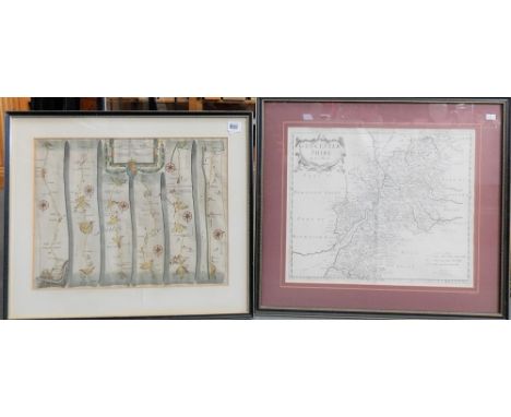
Lot 1258
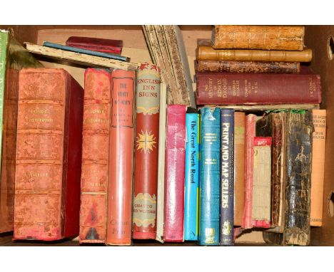
A BOX OF ASSORTED BOOKS to include 'English Inn Signs' by Jacob Larwood, 'The Beauties of Sterne' printed 1782, 'Pattersons English Itinerary', 'Picture of London' 27th edition, 'Shepherds International Directory of Print and Map Sellers', 'The Great North Road' by Norman Webster, together with a variety of other books
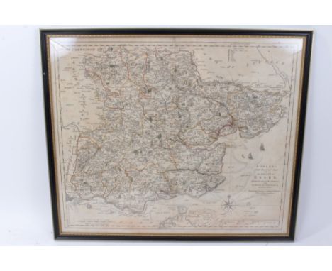
Lot 1027
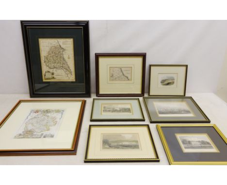
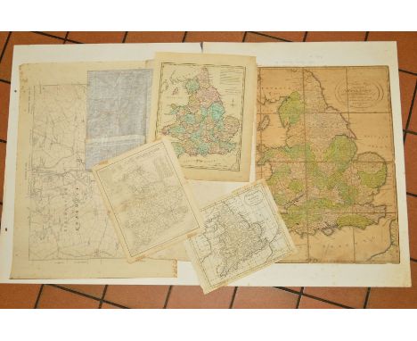
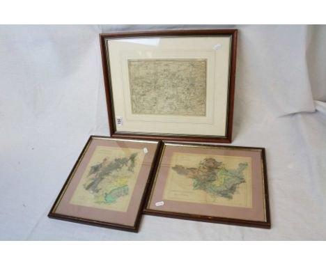
19th century maps and engravings including 'The East Riding of Yorkshire' by J. Ellis, 'Scarborough' Road map, Blenheim Terrace, Scarborough, 'Northumberland', 'Derbyshire', 'Durham', Norfolk' max 27cm x 21cm (14) Condition Report Click here for further images, condition, auction times & delivery costs
Lot 386
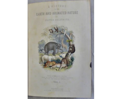
The Wonder book of Motors The Romance of the Road editor Harry Golding published Ward Lock & Co Ltd; 256 pp 12 colour plates 200 + illustrations VG-Goldsmith Oliver A History of the Earth and Animated Nature Vol. I published London 1868 Blackie and Son hardback; some illustrations water stains and some foxing fair-Smith Sidney Forensic Medicine published J & A Churchill 1931 third edition 631pp 170 illustrations; covers death by violence, poison etc some wear but fine-Kelly's Directory of Norfolk 1933 with coloured map some foxing fair
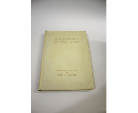
Lot 1786
CECIL ALDIN SIGNED BOOK - 'THE ROMANCE OF THE ROAD' the book published by Eyre and Spottiswoode in 1928, No 19 of 200 produced and signed by Cecil Aldin in pencil. With a gilt vellum binding and with a map in inside pocket. Also with other Sporting related books, British Racecourses by B W Curling (1951), Four Legged Friends and Acquaintances of Snaffles (1951), Peter Biegel's Racing Pictures (1983), Coming Home From The Races A Comic Diorama (Drawn by Leech), and various sporting and art related books.
Lot 740
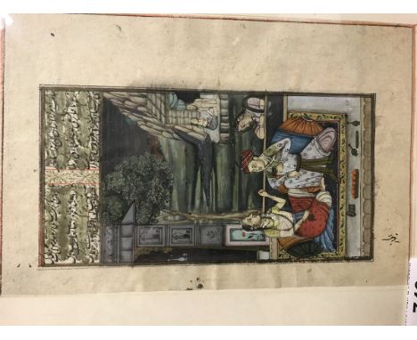
A 19th Century illustrated page depicting Persian scene of couples in landscape framed and glazed together with a double sided framed and glazed page of a strip map depicting the road from Bristol to South Newton together with six various vintage books to include "The Rubaiyat of Omar Khayyam" etc
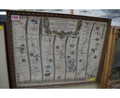
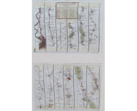
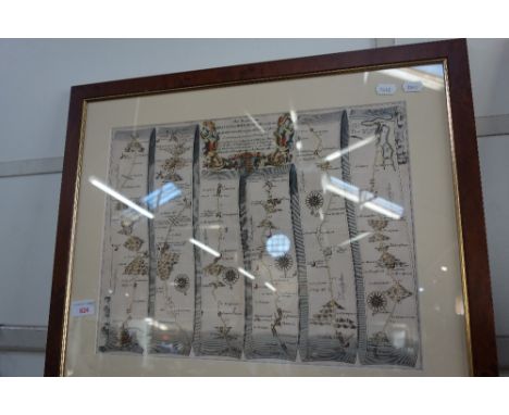
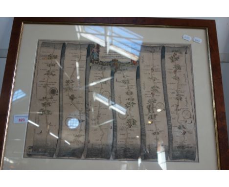
![[MAPS]. Ogilby, John (1600-1676). 'The Road from Dartmouth... to Minhead [Minehead]', engraved ribbon map, hand-coloured, 37](https://cdn.globalauctionplatform.com/f863d30b-b331-4d8c-8791-aaf600a3ea57/75d3bea9-b630-4ecc-a04f-aaf8016d1ed8/468x382.jpg)
![[MAPS]. Ogilby, John (1600-1676). 'The Road from London to St. Neotts... continued to Oakeham', engraved ribbon map, hand-co](https://cdn.globalauctionplatform.com/f863d30b-b331-4d8c-8791-aaf600a3ea57/33a609cc-886d-4191-b3af-aaf8016d2dcb/468x382.jpg)
![[MAPS]. Ogilby, John (1600-1676). 'The Road from Exeter to Truroe', engraved ribbon map, hand-coloured, 38.5cm x 49cm, frame](https://cdn.globalauctionplatform.com/f863d30b-b331-4d8c-8791-aaf600a3ea57/da19cbe5-ef7b-4676-bb3b-aafd009e61df/468x382.jpg)
Lot 188
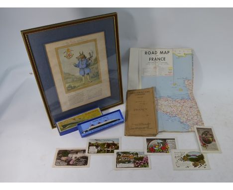
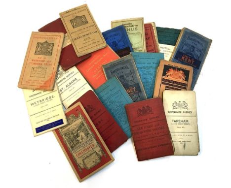
Cartography interest: A large selection of approx. 20 linen backed maps, to include a Daily Mail Road Map of London, a Ravensteins map of Taunus, seven Bartholomews maps of Fife, Sheffield, Surrey, York, Kent, Germany and Bedford, a W.H Smith map of Hampshire, and ten Ordnance survey maps of Weybridge, Colchester, Marlborough, East Kent, Rugby, St.Albans, New Forest, Fareham, Rickmansworth and Maidstone; together with a set of eight postcards of the Bull Hotel, Burford in the Cotswolds
Lot 196
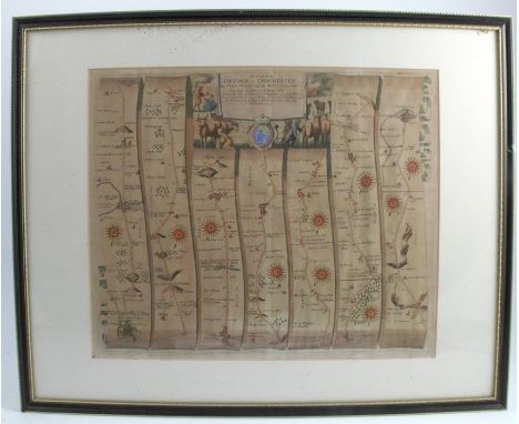
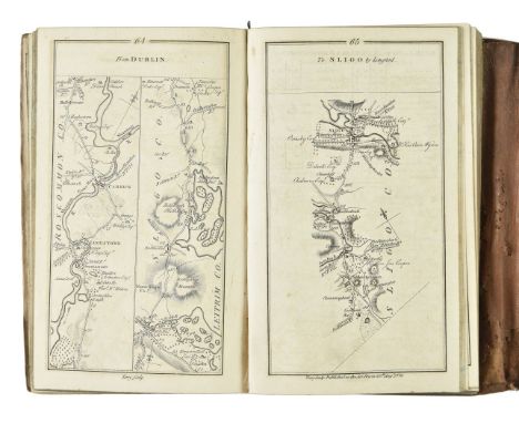
Taylor (George & Skinner, Andrew). Map of the Roads of Ireland, Surveyed 1777, 1st edition, published for the authors as the Acts direct 14th Novr. 1778, uncoloured folding engraved map of Ireland facing title (some soiling and marks, relined, with minor loss to one fold), engraved vignette title and engraved dedication leaf and 12 pages of printed index (pages numbered v-xvi), 288 engraved road maps printed back to back, list of subscribers at rear (one or two leaves close-trimmed to fore-edge, touching text), some browning due to water staining at front and rear, contemporary wallet-style calf, with tie, gilt spine label, rubbed and some minor wear, 8vo (Qty: 1)
Lot 50
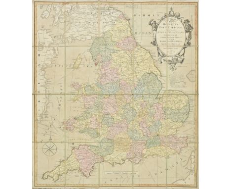
Folding maps. A collection of seven folding maps of England & Wales, 19th century, including Bowles & Carver (publishers). Bowles Road Director through England and Wales..., circa 1805, engraved map with contemporary hand colouring, sectionalised and laid on linen, large ornate cartouche, 600 x 530 mm, contained in a contemporary marbled slipcase with printed label to upper board, worn and frayed, together with Mogg (Edward). Mogg's New Map of England and Wales with part of Scotland..., 1831, large engraved map with contemporary hand colouring, sectionalised and laid on linen, large calligraphic title, table of explanation displayed in a 'curtain' cartouche, 1320 x 1050 mm, contained in a contemporary marbled card slipcase with a printed label to upper cover, worn and frayed at extremities, together with Cruchley (George Frederick). Cruchley's Improved Geographical Companion throughout England and Wales Including part of Scotland, 1825, engraved map with contemporary outline colouring, sectionalised and laid on linen, three extensive tables of explanation and reference, slight staining, 960 x 670 mm, printed title label as endpaper, contained in a contemporary card slipcase with duplicate label to upper cover, with Walker (John & Charles). England & Wales founded upon the Grand Trigonometrical Survey..., 1841, engraved map with contemporary hand colouring, sectionalised and laid on linen, calligraphic title, slight staining and offsetting, 1330 x 1010 mm, contained in a contemporary cloth slipcase with morocco gilt label to upper cover, lower corners crudely repaired with masking tape, with another copy similar, and two further folding maps by Wyld and Smith (Qty: 7)
Lot 60
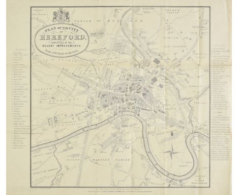
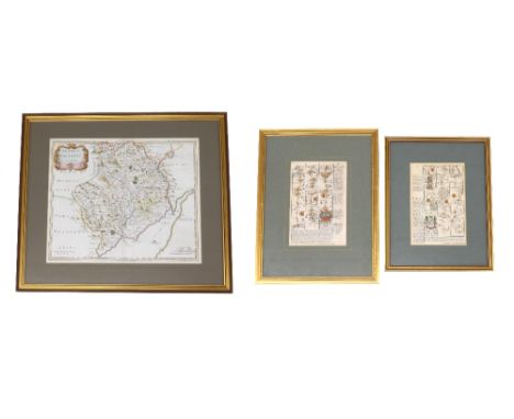
Herefordshire. A collection of thirty-seven maps, mostly 19th century, engraved county maps and town plans of Hereford and Leominster, with examples by Dawson, Lewis, James, Cole & Roper, Seller/Grose, Conder, Ordnance Survey, Weller, Collins, Bacon, J & C Walker, Hughes, Becker, Duncan, Moule, Archer, Fullarton, Hall, Pigot, Murray, Phillips, Smith and Harrison, including a reproduction map by Bickham and a reproduction road map by John Ogilby, various sizes and condition (Qty: 37)
Lot 1128
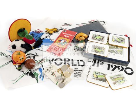
Football World Cup memorabilia and souvenirs,comprising of eight b & w photographs from the 1938 World Cup semi-final between Hungary and Sweden resulting in a Hungary 5-1 win in the Parc des Princes; a Sport Digest Coupe du Monde de Football June 1950 no.19 booklet; a 1954 Coupe Jules Rimet model of a football; a boxed set of 1966 England World Cup place mats and coasters, boxed and a 1966 England World Cup scrap book of French newspaper articles and a 1966 key ring coin; a Mexico 1970 Juanito World Cup mascot figure; 1978 Argentina La Coupe Deborde Uidela booklet and a 1978 Argentina World Cup medallion with chain; a collection of 1982 Spain World Cup cigar bands, some mounted and a 1982 Spain Naranjito World Cup ceramic mascot; 1986 Mexico Pique World Cup Mascot; an Italia '90 World Cup Supporter's flag and a Mascot proof coin in original packaging and another; 1998 France World Cup souvenir stamps with an official road map of the stadiums and a souvenir coin (qty)
Lot 460
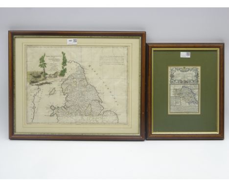
Antonio Zatta 18th Century hand coloured map of Northern England, North Wales and the Isle of Man, pub Venice 1778 31cm x 40cm and E Bowen map of the North and East Riding of Yorkshire with a mileage chart of the road from Carlisle to Rarwick 19cm x 12cm Condition Report & Further Details Click here for further images, condition, auction times & delivery costs
Lot 681
Rare 1911 Map and Mentioned in Dispatches Certificate from George Roy Hutton 1914 - 1919, Gallipoli Palestine and Mesopotamia. British War Office Lithographed Map printed in 1907 , and redone in 1911 of Mesopotamia and the Persian Gulf. Measures 29 x26 inches, 75 x 67cm. The map was the property of a Surveyor Soldier from the British Expeditionary Forces , who fought in several campaigns in that area of Arabia during WW1 often using that particular map as a reference point . George Hutton , the Surveyor , was mentioned in Dispatches certificate included with the Map for his rescue of a number of soldiers lost in the desert on one of their skirmishes against the Ottoman army there . He later went on after surviving the war, to become the Surveyor General of the County Of Oxfordshire until his retirement, also comes with his Surveyors Certificate . The Map in question, was carried throughout the region during all of the battles he fought during the Great War. On a scale of 1:1,0000, is in very good condition considering it's vintage and all that it went through during the war years . It has excellent detail of the area involved at the time , including the different Arab tribes and Railroad and road links present then plus details of the Anglo-Arabian Oil pipeline and telecommunication lines that was the reason for it all in WW1. Shows physical features, Turco-Persian frontier, ethnic and tribal affiliation, populated places, cultivated land, major ancient and modern roads, railways, waterways, and communication lines telephone runs along the Anglo-Persian Oil Company's pipe line. Covers south eastern Iraq, south western Iran, Kuwait, and upper Persian Gulf. Relief shown by hachures and spot heights. Lithographed at War Office, Nov. 1907.and seems to be a very accurate depiction of the state of things at the time in that part of the world. George Hutton RE served in the Royal Engineers from age 19 in Mesopotamia throughout the War years and fought at Gallipoli, in Palestine under the command of General Allenby fighting the Turks in the British Expeditionary Forces advance up the Euphrates River Valley. In 1920 graduated as a Surveyor and in 1924 qualified as an Architect. He later was appointed County Architect in 1937 of Oxfordshire, he died in 1975. Good Condition. All autographs are genuine hand signed and come with a Certificate of Authenticity. We combine postage on multiple winning lots and can ship worldwide. UK postage from £4.99, EU from £6.99, Rest of World from £8.99.
Lot 894
A LATE 18TH CENTURY FOLDED MAP BY J. MENZIES, 'A Correct Map of England With all The Principal and Cross Roads', published by Thomas Brown, Edinburgh 1792, paper backed on coarse linen, 51cm x 45cm, together with Bacon's Cycling Road Map of England and Wales, sheet No.2, printed on linen, 63cm x 85cm, a mid 18th Century Nicolao Sanson hand coloured map 'Britannicae Insulae', 52cm x 61cm and other unframed maps of the British Isles, etc (7)
Lot 1206
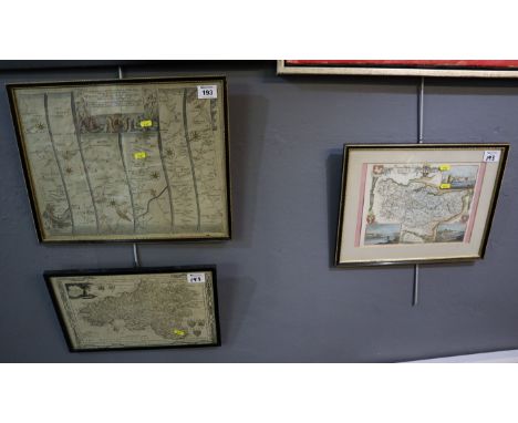
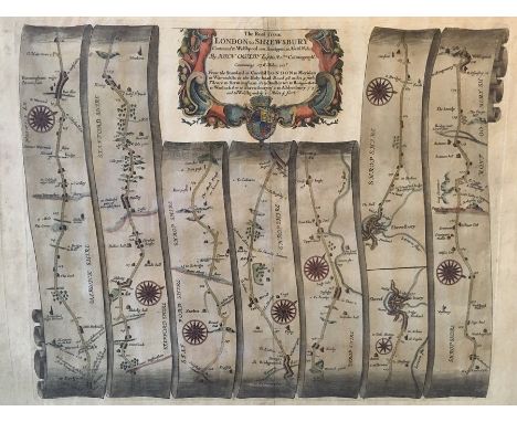
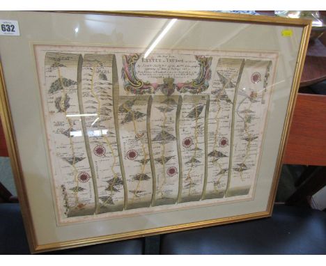
Collection of four framed antique maps, comprising: John Ogilby road map, London to Shrewsbury, hand-coloured copper engraving on laid/chain-lined paper, 1675 or later, 40cm by 52.5cm; two Robert Morden maps of Staffordshire, hand-coloured engravings on laid paper, largest measuring 48cm by 39.5cm; Robert Morden map of Lincolnshire, remnants of hand-colouring, 38cm by 41.5cm (4)
![Map. South Lancashire [East & West divisions]. 1842/43. Scale of one inch to a Statute Mile. Measures total: 159cm x 100c](https://cdn.globalauctionplatform.com/6e714572-a0db-419a-b3e2-aaa801060c4a/a067da6f-4995-439e-9d6c-aad200e78ef4/468x382.jpg)
Lot 993
Map. South Lancashire [East & West divisions]. 1842/43. Scale of one inch to a Statute Mile. Measures total: 159cm x 100cm. Presented in two parts, folding, linen-backed. Partial colouring for county borders, major rail and road routes, and green spaces/parks. Following printed at foot: Engraved in the Tower of London at the Ordnance Map Office, the Outline by G. Baker, the writing by J. A. Harrison, the hills by R. Tovey, published by Colonel Colby. Each cover bearing heraldic bookplate for 'Peter Rothwell'. [Peter Rothwell Esq. of Sunning Hill in Lancashire. Inventor of the variable blast pipe. His father had founded the Union Foundry in Bolton. Rothwell was one of the promoters of the Bolton & Leigh Railway which opened in 1838.] Housed in a contemporary leather covered slipcase, worn.
Lot 411
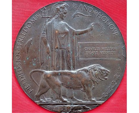
WW1 Australian Memorial Plaque to Pte Charles William Ewart Vernede 48th Battalion, A.I.F. ‘Killed in Action’ Poziers, 5th August 1916. Memorial Plaque named to Charles William Ewart VERNEDE. Comes with copies of British Army Service records & Australian Army WW1 service records. Charles William Ewart Vernede was born in 1880 in Madras, South India. He served with Ceylon Planters Rifle Corps, for the Boer War he enlisted in the Ceylon Volunteer Coy, Gloucestershire Regiment 19/4/1902. Served South Africa 22/4/1902 - 22/6/1902. For the Great War he enlisted 3/5/1915 in Perth, West Australia. 16/10/1915 at Blackboy Hill, appointed to 12th reinforcements, 16th Battalion. 17/12/1915 Departed Fremantle on H.M.A.T “Ajana”. 16/10/15 – 8/3/1916. 12th Reinforcements. 9/3/1916 to 48th Batt from 16th Batt at Tel- el-Kebir, Egypt. Killed in Action 5/8/1916 at Pozieres. His body not being recovered until 1927, being identified by dog tag. Map reference 57d R35 c54.05. N.B. Vernede Lane, off Cambridge Street in the Perth suburb of West Leederville was named in his honour in 2003. The 48th Battalions first major battle on the Western Front was Pozieres. Here, it was tasked with defending ground captured in earlier attacks by the 2nd Division and entered the firing line on two separate occasions - 5 to 7th and 12 to 15th August. During the former period, the battalion endured what was said to be heaviest artillery barrage ever experienced by Australian troops and suffered 598 casualties. Charles’ body was found in vicinity of Pozieres and exhumed for burial at Serre Road Cemetery No 2. 13/12/1927. Eighteen days after his death, on 23/8/1916, his wife gave birth to their son, named Charles William Luenal Vernede. See lot 308 for his sons WW2 ‘Z Force’ related R.A.A.F. log book.
Lot 426
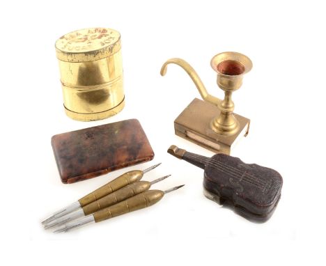
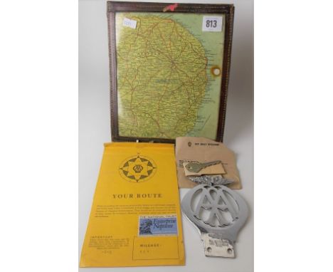
A collection of pipes, one carved with a man's head, another with a bull's head, a large carved wooden pipe with horn mouthpiece, two small briar pipes, set of darts, a pocket ashtray in the form of a violin, Acme Boy Scout Whistle and an Acme City Whistle, cheroot holder, Tea and Sugar Box, tortoiseshell effect cigarette case, AA map of London and The Home Counties and three other road maps.
Lot 715
Robert Morden (1650-1703) - 'The County of Monmouth', inscribed within a decorative cartouche, hand coloured engraved map, 14" x 16.75" - *Provenance The Steps Gallery, 15, Christmas Steps, Bristol, BS1 5BS, 11th July 1990 cost price £90; together with two further small road maps by Eman Bowen, 'Bath to Chippenham' and 'Chippenham to Hungerford' (3)
Lot 796
Carrington Bowles hand-coloured engraved map -‘New pocket map of the County of Essex, 49 x 54cm, glazed frame, together with John Ogilby hand coloured engraved road map - London to Yarmouth, Thomas Kitchin map of Suffolk, Mercator Hondius miniature map - ‘Essexiae Descriptio’ and Peter Andre ‘Plan of Colchester’. (5)
Lot 405
A LATE 18TH CENTURY FOLDED MAP BY J. MENZIES, 'A Correct Map of England With all The Principal and Cross Roads', published by Thomas Brown, Edinburgh 1792, paper backed on coarse linen, 51cm x 45cm, together with Bacon's Cycling Road Map of England and Wales, sheet No.2, printed on linen, 63cm x 85cm, a mid 18th Century Nicolao Sanson hand coloured map 'Britannicae Insulae', 52cm x 61cm and other unframed maps of the British Isles, etc (7)
Lot 411
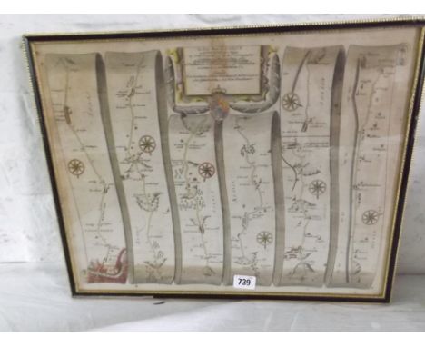
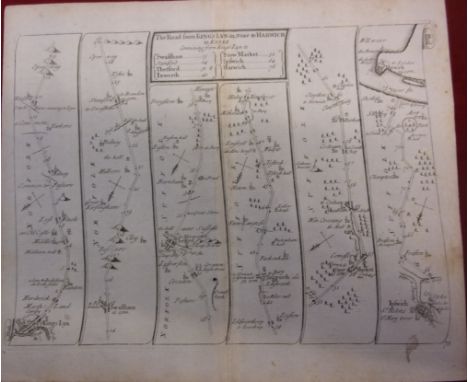
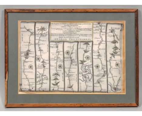
A COLLECTION OF UNFRAMED MAPS, mostly 18th and 19th Century, including 'The Continuation of The Road from London to Holyhead by John Ogilby commencing at Towcester.... To the City of Lichfield', 38.5cm x 46cm, Moll map of Staffordshire, together with several other road maps for post chaise companions, three late 18th Century plans of navigable canals, etc (parcel)
-
3964 item(s)/page