A group of motorcycle racing gear, comprising a Bellstaff blue stripe over jacket, a pair of Bellstaff leather motorcycle boots, with cream trim, a Britains road map, two pairs of leather riding gloves, a battery safer solar power trickle charger, various badges, bungey cords, etc. (a quantity)
We found 3964 price guide item(s) matching your search
There are 3964 lots that match your search criteria. Subscribe now to get instant access to the full price guide service.
Click here to subscribe- List
- Grid
-
3964 item(s)/page
Cary (J), CARY'S SURVEY OF THE HIGH ROADS FROM LONDON TO HAMPTON COURT [...] RICHMOND ON A SCALE OF ONE INCH TO A MILE : WHEREIN Every GENTLEMAN'S SEAT, situate on, or seen from the ROAD, (however distant) are laid down, with the Name of the Possessor; to which is added the number of INNS on each separate route; ALSO, the different TURNPIKE GATES, shewing The Connection which one trust has with another, 1/2 leather, marbled boards, "Explanation" and "Advertisement" page, foldout engraved "General Map" of London and environs, full-page "General Plan for explaining the different Trusts of the Turnpike Gates.", and eighty hand coloured engraved strip-maps to 40 plates, printed for J Cary, London 1790 (at fault)
KENSINGTON - Edward DAW (publisher), 'Map of the Parish of St. Mary Abbotts, Kensington, delineating its Ecclesiastical & Parochial Divisions 1879', London, Edward Daw, 1879. Large folding hand coloured engraved map extending from the Portobello Road in the north to the Fulham Road in the south, mounted on linen, approximately 108 x 76cm, with some old manuscript annotations and two old relevant manuscript notes attached at margin, worn at folds/corners, couple of inkspots, folding into original green cloth wallet (worn) lettered in gilt. A rare and detailed plan of Kensington produced during a period of great westward expansion in Victorian London
Topography, including Murray's Handbooks for Travellers Greece, 1872, 4th edn revised, 12 maps/plates/plans, mostly folding, and Syria & Palestine, 1875, new edition, numerous maps & ills including 2 folding in pockets at front and end, each org. cloth gilt; Baedeker's Guides Spain & Portugal, Northern France, Northern Italy; Ball's Alpine Guides 'Central Tyrol', 1873, folding panorama + 2 folding maps, 'Western Alps', 1863, folding panorama + 5 maps (lacks frontis map), 'Central Alps', 1866, lacks some maps, each org. cloth gilt (slightly soiled); 'Batholomew's Road Map of Scotland', circa early 1900's, seven folding coloured sheets backed onto linen, quarter inch to a mile, pub Sifton Praed & Co, in original leather case (dilapidated); John Rutter: 'Delineations of The North Western Division of the County of Somerset', London, 1829, with the 20 additional engraved plates, 4to, contemporary half leather gilt (worn); plus another similar volume on Manchester with engraved plates, 1830, plus 1 other
Collection topography, including Edward Mogg: 'Paterson's Roads; Being an Entirely Original and Accurate Description of all the Direct and Principal Cross Roads in England and Wales, with Part of the Roads of Scotland. &c', 1826 [but later, ads dated Jan. 1837], 18th edition, large engraved folding map of England & Wales (dated 1826), plus 11 engraved maps on 8 folding plates as called for, old quarter calf gilt, recased; Daniel Defoe: 'A Tour Through the Island of Great Britain. Divided into circuits or journies. interspersed with useful observations. Particularly fitted for the perusal of such as desire to travel over the Island', London, W. Strahan et al, 1778, 8th edition, 4 volumes, 2 folding engraved maps as called for, contemporary calf, later rebacked; with J. Brabner: 'The Comprehensive Gazetteer of England and Wales', William Mackenzie, circa 1895, 68 double page maps + 24 steel engraved plates, large 8vo, uniform original publisher's cloth gilt, all edges gilt; plus 6 others Inns & Taverns, coaching roads, motoring, including Hackwood: 'Inns, Ales & Drinking Customs of Old England', 1909, 1st edition, plates, original cloth gilt, Harper: 'The Newmarket, Bury, Thetford, and Cromer Road. Sport and History on an East Anglian Turnpike', 1904, 1st edition, original cloth, etc (17)
SVEN HEDIN. 'Through Asia,' US first edition, two volumes, original decorative cloth, three hundred illustrations, tape repairs to maps, Harper & Brothers, New York, 1899; 'Central Asia and Tibet: Towards the Holy City of Lassa,' two volumes, original cloth, scuffed and bumped, 420 illustrations, some foxing, Hurst and Blackett, London, 1903; 'Big Horse's Flight: The Trail of War in Central Asia,' original cloth, ink to edge of textblock, MacMillan and Co, London, 1936; 'The Silk Road,' English first edition, original cloth, 31 plates and a map, Geoge Routledge, London, 1938; 'The Wandering Lake,' English first edition, original cloth, George Routledge, 1940. (7)
(1)A large hand coloured fold out map of the Breconshire Turnpike Roads,(2) An Act For More Effectually Repairing Several Roads in Brecon, Radnor and Glamorgan. London, 1830. 28 pages. Bound with South Wales Turnpike Roads Proposed Regulations, No date or place. [1844] 23 pages bound with blank leaves one with a page of ms. notes (3) Bound with Glen, William Cunningham: The South Wales Turnpike Road Acts. London, Shaw. 1846. Fold out chart 87 pages. Bound with Single folded leaf printed Parliamentary Act 12 May 1954. 'for extending the Time limited extending the time limited for putting into execution...the act for the better Management and Control of Highways in South. All items Extremely rare(4) Evans, Henry Tobit Rebecca and her Daughters. History of the Rebecca Riots. Educational Publishing Company, Cardiff, 1910. Numbered edition copy is No. 442. The number is written and initialled by the Author. Frontispiece portrait of the author plus folding map, Chronological index, Index of Persons, General Index and List of Subscribers. A very good copy of an uncommon book.The Jeff Towns Collection of Welsh related antiquarian books
PICTURES AND PRINTS ETC, to include Lynda Kettle (British contemporary) 'The Drovers Trail Devon', a rural lane bordered by trees, signed bottom right, pastel on paper, approximate size 49cm x 49cm, a limited edition print 'The diocese of Coventry' by Christine Brown, Limited edition print 'Concorde - Queen of the skies' signed by the artist Anthony Hansard and Concorde pilot Jock Lowe, 18th Century map 'The road from London to Derby' by Emanuel Bowen 1736, three topographical prints of Matlock with receipt from Baynton-Williams of Belgravia dated 1973, Limited first day cover for the Birmingham Astronomical Society 2/100, three John Leech hunting prints etc (box and loose)
The original RS and the 'Holy Grail' to collectors of these charismatic Performance Fords.UK-supplied, right-hand drive RS1600 indicating 41,631 milesAveley-built in February 1972 and finished in Daytona YellowBare-shell rebuild commenced 2002 to standard Type 49 heavy-duty spec with full details on fileBDA engine and gearbox were fully rebuilt and upgradedRaced at Goodwood in 2006, featured on the AVO Club stand NEC, 2006Previously formed part of the highly respected Mike Bell CollectionOffered here is a very well presented Ford Escort RS 1600 built in February 1972 and first registered the following September. It was finished in Daytona Yellow and optioned with dealer-fitted contour cloth bucket driver’s seat, map light, extinguisher and alloy wheels.For a long period of time this RS formed part of the highly-regarded Mike Bell collection and was subject to a bare-shell rebuild in 2002 including a mechanical overhaul with bodyshell, engine and gearbox expertly rebuilt. The old RS then made a little bit of history by entering the first competitive event for members of the Goodwood Road Racing Club since the circuit closed in the mid ‘60s. The car also featured on the Ford AVO stand at the NEC in 2006.Overview of the restoration;Sourced from a deceased estate in 2002 from 25 years private ownershipBodyshell stripped, assessed and rebuilt with NOS panels where needed. Amazingly chassis rails, inner-wings with AVO strength plates floors and boot floors were solidProfessionally rebuilt and painted inside and out in original Daytona YellowEngine rebuilt to competition spec with uprated cam-carriers, BD3 cams and Vernier pulleys. Gearbox rebuilt new bearings, seals and synchro rings.New Minilite alloy wheels as per period comp carsStandard 3.7 ratio axle with rebuilt Salisbury LSD and Group1 half-shaftsSet up on a rolling road and peaking at 180bhp @t 6,500 rpmInspection is highly recommended and very welcome.After a long period of time dry-stored correctly in a diverse classic car collection, the car is now well presented, fully detailed, recently serviced and absolutely on-the-button. It's accompanied by a history file containing a restoration file which documents the entire process stage by stage, a wealth of related paperwork, an original Owners' Manual and its current V5C.Silverstone Auctions are fortunate to have offered a number of interesting ‘Fast Fords’ over the years including a few RS1600s. Popular and collectable for all the right reasons, this example appears solid, mechanically excellent and perhaps further value could be added with some further carefully considered detailing. SpecificationMake: FORDModel: RS1600Year: 1972Chassis Number: BFATMR10850Registration Number: TEX 969LTransmission: ManualDrive Side: Right-hand DriveOdometer Reading: 41631 MilesMake: RHDInterior Colour: BlackClick here for more details and images
Ogilby (John). The Road from London to the City of Bristol, circa 1676, uncoloured engraved strip road map, slight browning to the margins, 340 x 470 mm, together with The Road from London to Carlisle in com. Cumberland, circa 1676, uncoloured engraved strip road map, slight spotting and browning, 340 x 420 mmQty: (2)Footnote: Map numbers 10 & 37.
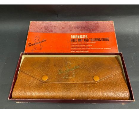
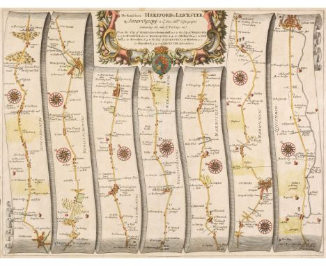
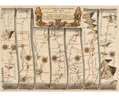
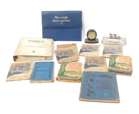
Railways. A hand-book for travellers along the London and Birmingham Railway; with the fare and time tables, &c. corrected to the present day, and portions extracted (by permission of the proprietors) from Roscoe's larger work on this railway, London: R Groombridge; Wrightson and Webb Birmingham, (1839), folding map to front, advertisements to rear, numerous wood-engraved plates, light spotting and marking, front hinge repaired, original cloth binding, yellow title label to front board, rebacked, 16mo, together with:Osborne (Edward). Osborne's London and Birmingham Railway Guide illustrated with numerous Engravings and Maps, Birmingham: E.C. & W. Osborne, (circa 1840), engraved frontispiece, numerous engraved plates, large folding map, advertisements bound to rear, lightly spotted, some leaves toned to margins, modern brown quarter morocco, spine lettered in gilt, 12mo, withRoscoe (Thomas). The London and Birmingham Railway; with the Home and Country Scenes on each side of the line; including Sketches of Kenilworth, Leamington, Warwick, Guy's Cliff, Stratford, &c., London: Charles Tilt, [1839], folding engraved map, engraved title, 16 engraved plates and one single-page engraved plan, further illustrations to text, lightly spotted, hinges cracked, bookplates to front pastedown and front free endpaper, original publisher's green cloth gilt, boards marked, extremities worn, 8vo with Coghlan (Francis). The Iron Road Book and Railway Companion; or, a Journey from London to Birmingham, containing an account of the towns, villages, mansions, &c. on each side of the line..., London: A. H. Baily & Co 1838, cartographic frontispiece, numerous engraved maps, lightly toned to margins, hinges cracked, original publisher's cloth gilt, rear joint cracked, boards faintly marked extremities rubbed, 16mo Qty: (4)
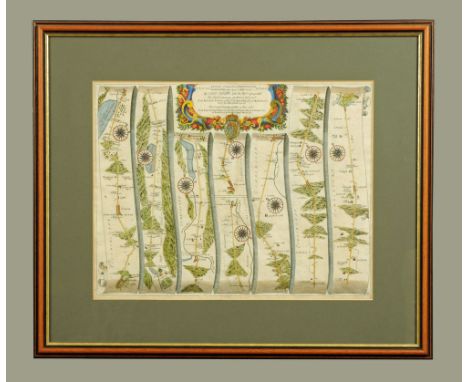
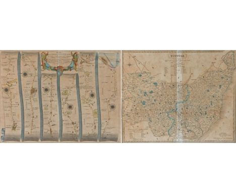
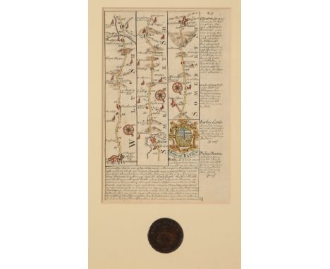
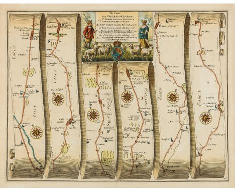
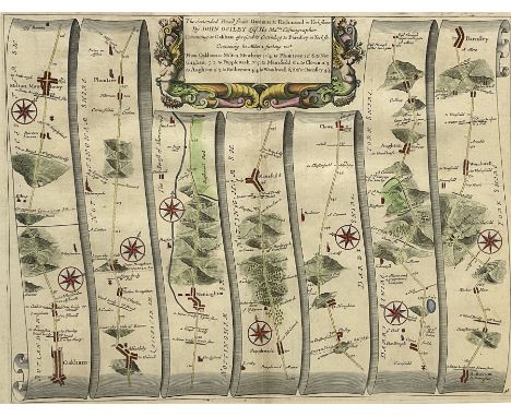
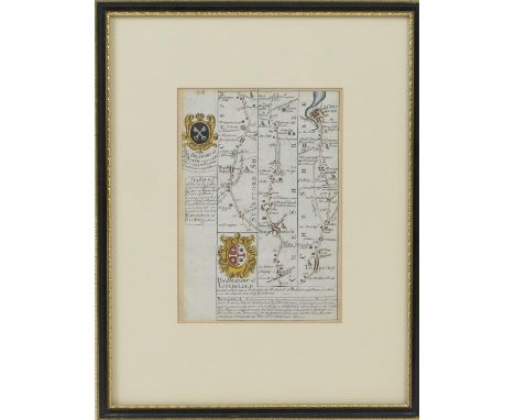
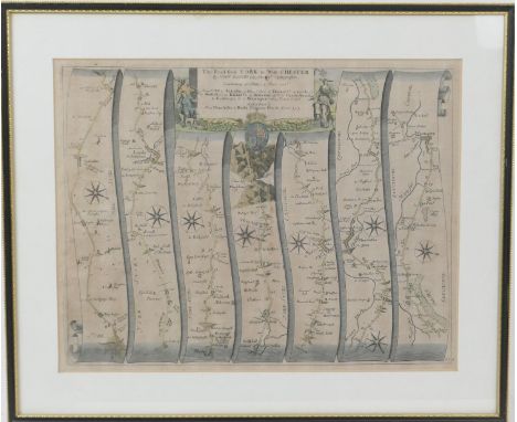
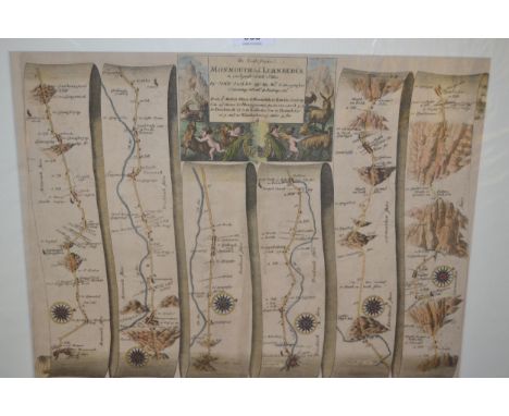
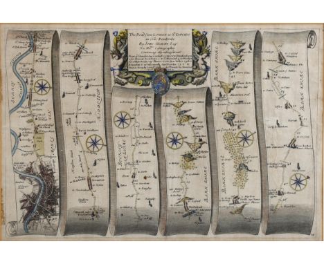
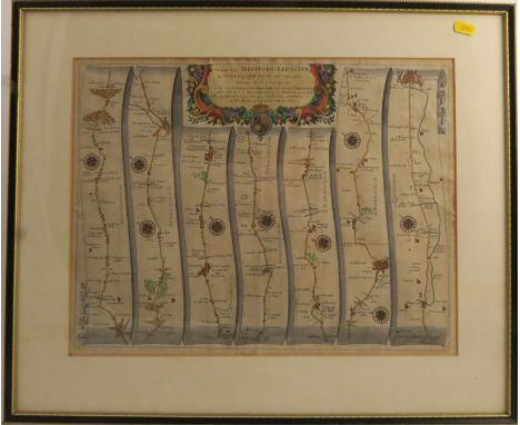
William Augustus Russel, A new and authentic history of England, from the most remote period of genuine historical evidence to the present important crisis... (London, J. Cooke, Shakespeare's -head, No. 17. Pater-Noster Row, [1777-81?]), fo., 100 engravings including frontispiece and protrais of the Kings and Queens of England, book plate for 'J. Howse 1829', bound in calf; together with a framed and coloured map engraving depicting the road from London to Barrick (2)
NO RESERVE British road maps.- Ogilby (John) The Roads from Chelmsford in Essex to St. Edmonds-Bury in Suffolk & Saffron-Walden in Essex, strip road map, engraving with hand-colouring, on thin laid paper with armorial watermark, sheet 385 x 460 mm (15 1/8 x 18 1/8 in), central vertical fold, minor splitting to fold, minor surface dirt, unframed, [1676]; together with 5 further Ogilby strip road maps, including 'London to Barstable', 'The Road from Oxford to Bristol', 'London to Harwich', 'Bristol to Exeter', and 'London to Lands-End', engravings, 3 with hand-colouring, 2 un-coloured, each approximately 370 x 450 mm (14 1/2 x 17 3/4 in), rough edges, nicks and tears, some splitting to folds, occasional spotting, browning and surface dirt, one sheet mounted on support, unframed, [c. 1676] (6)
Mediterranean.- Seale (Richard William) A correct Chart of the Mediterranean Sea, from the Straits of Gibraltar to the Levant, chart of the Mediterranean focusing on the coastlines, with inset map of The Road of Leghorn (Livorno harbor) in the upper right, engraving with hand-colouring, 350 x 725 mm (13 3/4 x 28 1/2 in), old vertical folds, repairs to some minor nicks to left edge, unframed, [circa 1745].
NO RESERVE London and River Thames.- Harris (John) The East Part of the River Thames, The West Part of the River Thames, panoramic map showing the course of the River Thames, from its spring in Gloucestershire to its estuary, engraving with original hand-colouring, on laid paper without watermark, sheet 225 x 385 mm (8 3/4 x 15 1/8 in), caeful repairs to splitting and loss, some surface dirt and browning, unframed, [1720]; together with 18 road strip maps of the London and its environs, including Weller's 'The River Thames from its Source to the Sea', 11 small road strip maps by Thomas Kitchin, and others similar, various sizes, all unframed, 18th and 19th century (19)
John Owen and Emmanuel Bowen, 'Road map from Lichfield to Chester', double-sided, hand coloured, published 1720, 17.5cm x 12cm; also Badeslade and Toms, 'A Map of Cheshire', hand coloured, published 1741, 15.5cm x 16cm; Robert Morden, 'Cheshire', hand coloured map, published early 18th century, 17cm x 22cm; Thomas Moule, 'Cheshire', hand coloured map, published 1837, 20cm x 25.5cm; G Cole and J Roper, 'Chester', hand coloured town plan, published 1805, 19cm x 24.5cm; John Cary, 'Cheshire', hand coloured map, published 1787, 22cm x 27cm (6)
John Ogilby, 'The Road from York to West Chester', hand coloured road map, published 1675, 35cm x 45cm; John Cary, 'Lancashire', hand coloured map, published 1787, 26cm x 21cm; Thomas Moule, 'Lancashire', hand coloured map, published 1837, 26.5cm x 20cm; John Roque, 'Denbigh and Flint Shire', hand coloured map, published mid 18th century, 17cm x 21cm; G Cole and J Roper, 'Norwich', hand coloured town plan, published 1807, 26cm x 20cm; Joseph Mutlow, 'A Plan of the Ellesmere Canal', hand coloured map, published 1795, 27cm x 22cm (6)
Cigarette Cards. A collection of 459 cards, all depicting maps, early-mid-20th century, an album containing sets of cigarette cards, all with maps, including 'Find your Way', issued by Lambert & Butler, 'Holidays in Britain' issued by Churchman's cigarettes, 'Sectional Cycling Maps' and 'By the Roadside' issued by Odgens, 'Sectionalised Map of London and the Home Counties' issued by J. Millhoff & Co. Ltd, 'The Counties of the British Isles' issued by John Player & Sons and 'A Road Map of Scotland' issued by Imperial Tobacco & Co, all contained in a mid-20th-century cigarette card album, oblong 4toQty: (1)
BLACK'S ROAD & RAILWAYS TRAVELLING MAP OF ENGLAND; a linen backed sectional coloured map of England and Wales, 86 x 64cm (1).Additional InformationSome light foxing and light wear along the fold lines to the map but essentially ok, the green cover with general age wear and a little bit grubby in parts.
Road atlas.- Jefferys (Thomas) Jefferys's itinerary; or travellers companion, through England, Wales, and part of Scotland, containing all the direct and principal cross roads, 104 engraved maps on 52 ff., lightly browned (the last 3ff. a little more heavily) and with some occasional spotting, otherwise generally in good crisp condition, folding into worn contemporary limp leather wallet, lacking spine, upper cover detached, oblong 4to, printed for R. Sayer and J. Bennett, Map and Print Sellers, No. 53, Fleet-Street, 1775.⁂ Rare, with six copies recorded by ESTC, and the last rare auction record in 2008.
Mogg, Edward"Paterson's Roads ... Direct and Principal Cross Roads in England and Wales with part of the Roads in Scotland ... the 18th edition ...", printed for Longman Reece Orme Brown Green & Longman, etc, folding map, frontis, creased but no loss, all maps present and the Holyhead Road plate, contemporary binding, full leather, some foxing, marbled boards, leather wallet style"Cary's Survey of the High Roads from London to Hampton Court ...", printed for J Cary engraver and map seller, no.181 Strand, July 1st 1810, coloured strip maps, some offsetting to free ep and a piece cut out of the top of the second ep, contemporary marbled calf, front hinge cracked, gilt title on pastedown to backstrip and backstrip splitting slightly, corners bumped (2)
Original vintage sports poster for 34 Vuelta Ciclista a Cataluna / 34th Edition of Catalonia Road Bicycle Race XIV Grand Prix held from 5-12 September 1954, with start in Montjuic and finish in Barcelona, the poster features a colourful map marking Barcelona, Manresa, Figueras, Puigcerda, Lerida, Tortosa, Salou, Reus, Sitges, with space to write down time for the eleven stages of the race, with advertising of Pirelli tyres, Profiden toothpaste, Canals & Nubiola wine, Puig condensed milk, Decano cognac, Batanga and Riccao chocolate. The 1954 Volta a Catalunya race was won by an Italian cyclist Walter Serena. Good condition, folds as issued, staining, creasing, small tears. Country of issue: Spain, designer: Unknown, size (cm): 83x53, year of printing: 1954
This is a very intreating collection of historical books and maps. To comprises of: Summer Tours In Scottand By David MacBrayne's Royal Mail Steamers COLUMBA JONA & 1/25 (shelf Worn some age related marks to cover pages ) The Isle of Wight: in a series of views printed in oil colours is the Victorian equivalent of a coffee-table book, published in 1874 by Thomas Nelson & Sons of London, Edinburgh & New York. I always like these collections, of which the 19th century Isle of Wight supported a huge industry, and the best of them are lusciously printed, showcasing state-of-the-art chromolithography. (Shelf Worn some age related marks to cover sheet) SLUM LIFE IN EDINBURGH OR SCENES IN ITS DARKEST PLACES BY T. B. M. WITH TWELVE ILLUSTRATIONS FROM LIFE: Edinburgh; James Thin 1891. (Shelf Worn, binder away from main spine, age related marks to pages) A collection of vantage maps and one other: Porteos Road Map of Glasgow with Black's Traveling Map of Scotland and autograph book with signatures from 1951 to 1952. Worn, cover damage, repaired as pictured.
WIKING/I.M.U/HERPA Konvolut Modellfahrzeuge und Zubehör im Maßstab 1:87, bestehend aus 2 Setzkästen aus Kunststoff, B 62 x H 50 cm, GK 1/1, (Deckel vergilbt, rs. verschmutzt), bestückt mit ca. 25 LKW und ca. 50 PKW verschiedener Hersteller (überwiegend nach 1985), dazu Straßenplan I und Gebäudebogen, je in Transportrolle, L 64 cm, 1 'Straßenbausatz' sowie 2 Bücher vun Ulrich Biene: 'Der Modell-Mythos Wiking' und 'Automodell-Faszination', dazu 2 Kataloge der Spur N von 2011/12 und 2007/08 und 1 Modellauto-Farbkarte, orig.-eingeschweißt, Lagerspuren, Zustand der Fahrzeuge nur oberflächlich geprüft.| WIKING/I.M.U/HERPA convolute model vehicles and accessories in the scale 1:87, consists of 2 plastic boxes, W 62 x H 50 cm, yc. 1/1, (cover yellowed, reverse soiled), equipped with approx. 25 trucks and approx. 50 cars from various manufacturers (mostly after 1985), with map I and building arch, each in a transport roll, L 64 cm, 1 x 'road construction kit' and 2 books by Ulrich Biene: 'Der Modell-Mythos Wiking' and 'Automodell-Faszination', plus 2 N-scale catalogs from 2011/12 and 2007/08 and 1 model car color card, originally shrink-wrapped, traces of storage, condition of the vehicles only superficially checked.
'Bacon's Cycling Road-Map of England,' sheets no. 2 and 7, printed on silk; 'Bacon's County Map and Guide,' Derbyshire, Cheshire, Warwick, Somerset, Northampton, Shropshire, Wiltshire, Oxford, North Wales, Essex, Sussex, Leicester and Rutland; With 'The Royal Road Book of England,' and another Bacon road map. (16)
JOHN OGILBY. 'The Continuation of the Road from London to the Lands-End, plate 4 and last,' engraved line map, backed on to canvas, depictions and indeed stops at St Michael's Mount, Tregoney, Saltash, Helston, Lowe, Mount Edgcombe, pen inscription to margin, toned all over, circa 1698. 38cm x 49cm
Ogilby (John). The Road from Hereford to Leicester, The Road from Huntingdon to Ipswich, The Road from London to Shrewsbury continued to Welshpool com. Montgom. in North Wales, The Continuation of the Road from London to Carlisle com. Cumbr. [and] The Continuation of the Road from Bristol to Chester commencing at Ludlow com. Shrews. and extending to Chester, [1676 or later], together five hand-coloured engraved strip road maps, each approximately 340 x 415 mm, mountedQty: (5)Footnote: The map plate numbers are: 38, 50, 57, 72 & 73,
Ogilby (John). The Road from London to Montgomery North Wales, The Road from Shrewsbury and Chester to Holywel com. Flint, The Continuation of the Road from London to St. Davids commencing at Abington com. Berks. and extending to Monmouth, The Extended Road from Oakham to Richmond in York Shire, The Road from Hereford to Leicester & The Road from Exeter to Truroe in com. Corn., [1676 or later], together six hand-coloured engraved strip road maps, each approximately 345 x 450 mm, mountedQty: (6)Footnote: The map sheet numbers are: 15, 44, 48, 69, 72 & 98
Chatwin (Bruce, 1940-1989). In Patagonia; The Viceroy of Ouidah; On the Black Hill; The Songlines, 1st editions, Jonathan Cape, 1977, 1980, 1982 & 1987, all but the third author signed presentation copies to Chatwin's near-neighbours Charles and Brenda [Tomlinson], the first inscribed in brown ink to half-title, 'For Charles and Brenda, with love, Bruce, 17 September '77'; the second similarly signed and inscribed in blue ink on title-page and dated '28 Oct. '80'; the last with a longer, but undated, signed inscription to title in blue ink, 'For Charles and Brenda, A piece of craziness, which, as you know, has a long history – and owes a lot to you. Affectionately, as always, Bruce', the first work with black and white plates from photos, a few minor marginal pencil markings, map endpapers [first issue], all original cloth in unclipped dust jackets, a little rubbed, 8vo, together with Bash?, The Narrow Road to the Deep North and other Travel Sketches (1968), inscribed by the author to Charles Tomlinson, and "Animal Style" Art from East to West (1970) inscribed by the author to Charles and Brenda Tomlinson, together with one other by ChatwinQty: (7)
Tregaskis (Richard). Guadalcanal Diary, 1st edition, New York: Random House, 1943, monochrome map endpapers, black & white illustrations, some light marginal toning, original cloth in dust jacket, covers slightly rubbed to head & foot, 8vo, together with; Hachiya (Michihiko), Hiroshima Diary, The Journal of a Japanese Physician, 1st U.K. edition: London: Victor Gollancz, 1955, some light toning, tape marks to the front & rear endpapers, original cloth in dust jackets, covers lightly rubbed, 8vo, plus Peers (William R. & Dean Brelis), Behind The Burma Road, 1st edition, London: Robert Hale, 1964, black & white illustrations, some minor spotting to the text block, original clot hin dust jacket, minor rubbing to the head & foot of the spine, 8vo, and other 1940s-60s Burma & Oriental military reference & related, mostly original cloth in dust jackets, G/VG, 8voQty: (3 shelves)

-
3964 item(s)/page