We found 3964 price guide item(s) matching your search
There are 3964 lots that match your search criteria. Subscribe now to get instant access to the full price guide service.
Click here to subscribe- List
- Grid
-
3964 item(s)/page

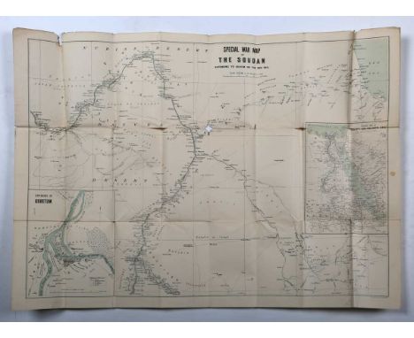
Lot 44
John Bartholomew’s Special Large Scale War Map of The Soudan, extending to Suakim on the Red Sea, 1885, folding map, 57cm x 78cm, together with Gold Coast Survey Department, Road Map (Northern Section) of the Gold Coast 1949; John Bartholomew & Son, Central & East Africa x2; and further maps of the Belgian Congo (5).
Lot 22
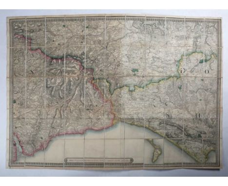
James Wyld – Country round Lyme Regis 1837, folding engraved map with hand colouring in 55 sections, linen backed, 93.5cm x 126.5cm, in its case, together with Bacon’s County Map of Suffolk; Daily Mail Motor Road Map of South East England; Philips' Cyclists' Map of the County of Sussex; Philips' Tourist Map of N & S Wales; Keen’s New Shilling Map of the Watering Places of Kent; Walker’s Suffolk; A New Map of the County of Essex divided into Hundreds by Nathaniel Coltman; Geological Sheets 341 & 342 Weymouth/Portland; and six Sifton Praed folding maps of areas around Devizes (15).
Lot 47
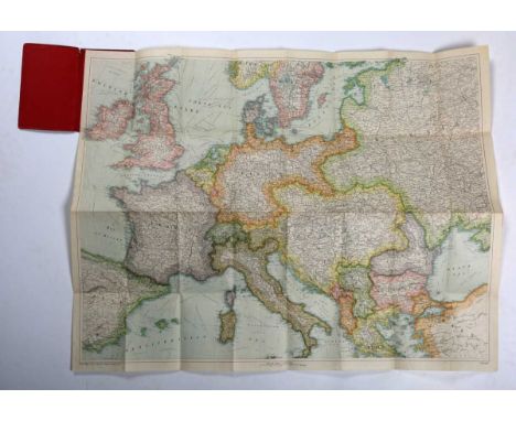
Folding maps: including Bacon’s War Map of Europe; New Orleans, Louisiana A City Map; Bacon’s New War Map of South Central Europe; War Map No. 7, Large Scale Map of the Balkan States; Stanford’s General Map of the United States; Latest Road Map and Guide to Delhi Old & New; E. Andriveau-Goujon, 2 Angleterre, depicting the mid-section of England and Wales, folding map, engraving with hand colouring, sectionalised into 33, 71.5cm x 174cm, and assorted tourist and political maps (box).
Lot 74
214 Wainwright Fells and the tarns of the Lake District Wall Map, designed by Ian Shackleton in memory of Howard Shackleton 2014, depicting all of Wainwrights 214 Lakeland Fells, over two hundred Lakeland Tarns, twenty-three Youth Hostels, the road networks and towns and villages of the area.Each fell and tarn is grid referenced and colour coded to correspond with Wainwright's Pictorial Guides, all fells are listed in height order in both feet and metres. unframed, housed an a cardboard tube.
Lot 455
A collection of 17th and 18th century copper engraved maps Nineteen Robert Morden. 'Cumberland,' uncoloured copper engraved map, centre fold, vg, 36.5cm x 43.5cm, sold by Abel Swale Awnfham & John Churchill; John Ogilby. 'The Continuation of the Road from London to the Lands End,' coloured copper engraved line map, pasted to mount measuring 29cm x 39cm; John Speed. 'Penbrookshyre described,' uncoloured copper engraved map, rolled with tape marks and nibbles, fair to good, 38cm x 55cm; William Kip after Christopher Saxton. 'Lincolniae,' uncoloured copper engraved map, rolled, tears to margin, good; With fifteen other maps and engraved plates. (19)
Lot 205
(Cornwall) A fine collection of (mostly) scarce maps Richard Blome. 'A Table of the Hundreds in the County of Cornwall,' uncoloured engraved map, centre fold, engraved view of Pentillie Castle (page 54 in Quixley & Quixley for an interesting history of James Tillie), small nibbles to edges of leaf measuring 23xm x 33cm, [published in Cosmography and Geography, Samuel Roycroft, 1693]; Louise Stanislas D'Arcy De La Rochette. 'A Modern Map of Cornwall, Drawn from an Actual Survey,' uncoloured engraved map, centre fold, 23cm x 28.5cm, some light toning but generally vg, Robert Sayer and Carington Bowles, London, 1765; Astride-Michel Perrot and Migneret. 'Cornwall,' steel engraved map, T.4 to top right corner, leaf size, 15.5cm x 9.5cm, [c.1824]; Andrew Dury & Joseph Ellis. 'Cornwall,' later coloured, 12cm x 15.5cm, [c.1764]; Thomas Kitchin & Thomas Jefferys. 'A Map of Cornwall,' coloured borders, descriptive text below engraved map, 19cm x 15.5cm, centre fold, M. Payne and M. Cooper, London, 1749; Thomas Read & John Rocque. 'Cornwall,' uncoloured, leaf measures 23cm x 24.5cm, plate number 6, T. Read, London, 1746; Van Langeren (Jacob & Simmons Matthew). 'Cornewall,' uncoloured engraved map and mileage triangle, rare, 10.5cm x 10.5cm, [c.1662]; Pieter Van Den Keere. 'Cornuwallia,' copper engraved map, latin text to verso, one tiny spot (or burn), leaf measures 9.5cm x 14.5cm, plate number 101, Amsterdamn, 1617-1676; Thomas Badeslade & Thomas William. 'A Map of Cornwall,' copper engraved map with text, centre fold, some toning, 16.5cm x 18cm, W. H. Toms, London, 1721; Emanuel Bowen. 'The Road from Exeter to Truro,' uncoloured, page number 179, strip map from Exeter to Tavistock to verso, 19.5cm x 14cm, T. Bowles, London, 1720-1765; John Gibson. 'An Accurate Map of Cornwall from an Actual Survey,' uncloured copper engraved map, some text offsetting, fold, 21cm x 26cm, J. Payne, London, 1762; William Pinnock & Joshua Archer. 'Cornwall,' stark white on black printing, leaf measures 19.5cm x 27.5cm with remnants of tape, William Edwards, 1833; Edward Langley and William Belch. 'Langley's new Map of Cornwall,' coloured steel engraved map, vignette of St Michaels Mount, leaf measures 22cm x 35cm, centre fold, Langley & Belch, London, 1818; William Borlase. 'New Map of the County of Cornwall,' uncoloured, lacks imprint, folds, [c.1754]; With three various issues by Thomas Kitchin. (17)A diverse selection. Reference Antique Maps of Cornwall and the Isles of Scilly by R.C.E. Quixley and J.M.E. Quixley (2018)
Lot 41
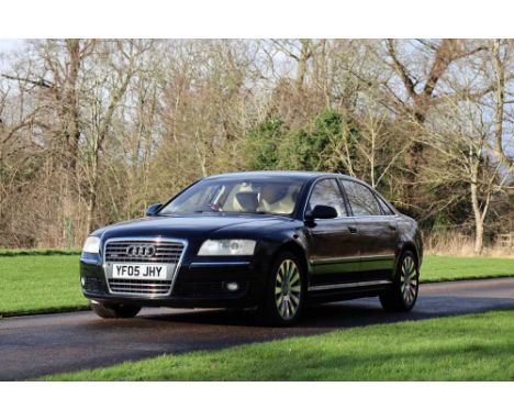
Registration No: YF05 JHY Chassis No: WAUZZZ4E05N016987 MOT: February 2026Warranted 66,000 miles from newJust four former keepers and offered from a significant private collectionRare and desirable 6.0 W12 engine variant producing 444hpAccompanied by very good service history with several from Audi main agentsThe W12 Quattro was the range-topping variant of the full-size luxury A8 saloon, with the second generation offering a W12 option (as the first had), which launched in 2005. The configuration allowed Audi to build a 12-cylinder saloon with all-wheel drive, with conventional V12 only able to facilitate rear-wheel drive configuration. Audi re-styled the A8 in 2005, giving all variants a taller, wider trapezoidal single-frame grille, with the W12 also being the first model was to be offered with LED running lights. The naturally aspirated 6.0-litre W12 delivers around 444bhp via a six-speed Tiptronic automatic transmission with paddle shift, with the W12’s maximum 428 lb ft of torque and performance figures of 5.1-second 0-62mph time, and an electronically limited 155mph top speed.Manufactured in 2005, ‘YF05 JHY’ was supplied new to its first owner on the 10th of June that year by Alexander Audi of Huddersfield. Finished in Brilliant Black paintwork, this is complemented by Cream leather interior upholstery, with a brushed aluminium dashboard and the optional Burr Walnut veneer trim. The factory specification includes Xenon headlights, front and rear parking sensors, switchable sports mode, electrically adjustable heated and cooled seats, and a Bose surround sound system. The W12 was further optioned new with electric, memory and auto-dimming mirrors, leather trimmed steering wheel, forged alloys, electric front memory comfort seats, laminated glass throughout, rear screen sun visor, and keyless entry. Offered now having covered a very modest 66,000 miles from new, the A8 has just four former keepers.Benefitting from four new tyres in 2021, new front brake pads in 2022, and a new battery early last year, the Audi is entered from a significant private collection. Supplied new two sets of keys and a history file, the documentation includes the book pack in the wallet (including the owner’s manual, operation instructions, service book, and DVD road map), a collection of invoices, MOT records, twelve month MOT, and a current V5C document. Between the service book and invoices, the A8 has a very good service history with eight services completed and the most recent having been completed at 63,649 miles. Coming to market with the original tool kit and warning triangle and two sets of keys, ‘YF05 JHY’ is a rare example of the range-topping W12 engine A8 with very modest mileage! For more information, please contact: Paul Cheetham paul.cheetham@handh.co.uk 07538 667452
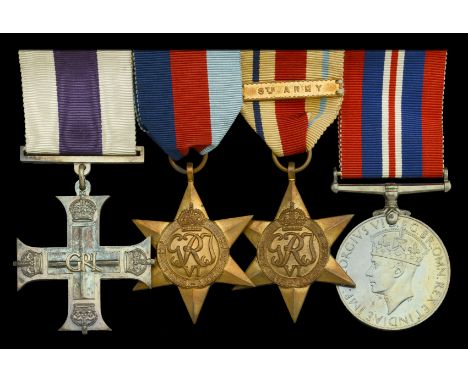
Lot 38
A Second War ‘Battle of Alamein’ M.C. group of four attributed to Lieutenant A. T. Almond, 46th (The Liverpool Welsh) Battalion, Royal Tank Regiment, who was killed in action on 28 October 1942 Military Cross, G.VI.R. reverse officially dated 1942, with Royal Mint case of issue; 1939-45 Star; Africa Star, 1 clasp, 8th Army; War Medal 1939-45; together with the named Army Council enclosure, extremely fine (4) £1,000-£1,400 --- M.C. London Gazette 5 November 1942: ‘In recognition of gallant and distinguished services in the Middle East.’ The original Recommendation, for an Immediate M.C., states: ‘During the Battle of Alamein, at about 0900 hrs on 4 September 1942, Second Lieutenant Almond’s troop was ordered forward on to an exposed position subject to a lot of enemy artillery fire. Second Lieutenant Almond’s tank receives a direct hit from a large calibre gun. The tank, which was moving at about 10 m.p.h., caught fire and ammunition exploded. Second Lieutenant Almond and his gunner climbed out on to the turret of the tank but did not leave the rank until they had extricated the driver. Second Lieutenant Almond, although ordered to evacuate his crew, returned on another tank and managed to put out the fire sufficiently to get into the driver’s seat. He then started the engine and, although burnt himself, managed to tow out another tank which had been hit. He then drove his tank back, collected his crew, and returned into action after getting the tank into fighting trim. In spite of his burns and a temporarily blinded eye, he remained in action for another 10 hors under almost continuous shell fire. The determination, bravery, and coolness under fire which this officer showed proved a fine example to the remainder of his troop and the fact that they remained in their position materially assisted the success of the action on this front.’ Arthur Thomas Almond was commissioned Second Lieutenant in the Royal Rank Regiment from 102nd O.C.T.U. on 28 December 1940, and served with the 46th (The Liverpool Welsh) Battalion during the Second World War in North Africa, using Valentine tanks. Awarded the Military Cross for his gallantry during the Battle of Alamein, he was killed in action on 28 October 1942, on which date the Battalion was in support of the 26th Australian Brigade. ‘Valentine in North Africa’ gives the following account: ‘El Alamein, 46th RTR by now were also working with the Australians, and during the main Australian thrust on the night of October 28/29 were to attack with 2/23rd Battalion and secure the road. Unfortunately, things began to go wrong from the start. The final briefing was held very late, and Colonel Clarke returned without sufficient time to give his Squadron Leaders anything more than the barest details. The attack was to get under way almost immediately, and would be delivered from a start-line which had been chosen from the map, and which had not been reconnoitred. Some of the infantry would ride on the tanks, and others in carriers. The start-line was in fact, in the middle of a minefield, and on the way to it the regiments were subjected to heavy fire which caused the infantry to drop off. Several tanks missed the minefield gaps and became casualties. The situation became extremely confused, and the enemy fire rose to a crescendo. In the light of three or four burning Valentines the anti-tank gunners were able to pick off their victims from three sides at ranges up to 1,000 yards. The attack broke down into un-coordinated assaults which took a heavy toll of both tanks and infantry. Colonel Clarke and his Intelligence Officer were badly wounded by a mortar shell, and the Regiment was taken over by Major Offord. After a night of savage fighting, Colonel Evans of 2/23rd finally ordered his battalion to dig in at 04.00, 1,000 yards in advance of the original start line, The 2/23rd had lost 29 killed, 172 wounded and 6 missing. The 46th RTR had lost all but eight of their tanks and had a high percentage of their crews killed or wounded, including all the Squadron Commanders. The casualties sustained by the 46th and 2/23rd Battalion had not been in vain. After the battle, Rommel recorded that the British tanks and infantry had succeeded in blowing a gap in his line, cutting off the 2nd Bn 125 Panzer Grenadier Regiment and a Battalion of XIth Bansagliari, who remained in Thompson’s Post, almost surrounded by their assailants, resisting all attempts to dislodge them with a ferocious determination. In addition, the 125th Regiment’s 3rd Battalion had virtually ceased to exist by next morning, the battle having raged with tremendous fury for six hours.’ Almond is buried in El Alamein War Cemetery, Egypt. Sold with a fine portrait photograph of the recipient; rank pips; Royal Tank Regiment cap badge; a miniature M.C., a leather bound Bible, the inside inscribed ‘A. T. Almond, R.T.R.’; and a copy of ‘The White Company’, by Sir Arthur Conan Doyle, with Bishop’s Stortford College Prize label affixed on the inside front cover, inscribed ‘Summer Term 1927, Form IA. Prize awarded to A. T. Almond’.
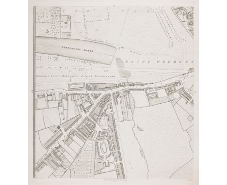
Lot 95
A plan of Knightsbridge from what Howgego describes as the 'largest and most important London map of the eighteenth century', on a scale of 26 inches to a mile. It shows Hyde Park and the Serpentine, with Knightsbridge, the Brompton Road and Sloane Street. Horwood's intention was to mark each house's number (a practice started in 1735), but this was abandoned as impractical. He started his scheme in 1790, expecting to be finished by 1792: by 1794 he was apologising to his subscribers (including George III); in 1798 he received a loan of £500 from the Phoenix Fire-Office, for whom Horwood worked as a surveyor, to finish the map. However this assistance was not enough to stop Horwood dying in poverty in 1803. Size: 56.5 x 52.5 cm. Condition: a good example. Published: London: 1794. Keywords: London, antique map, survey of London, Knightsbridge, England, Chelsea, West London, town plan, city plan, engraving, etching
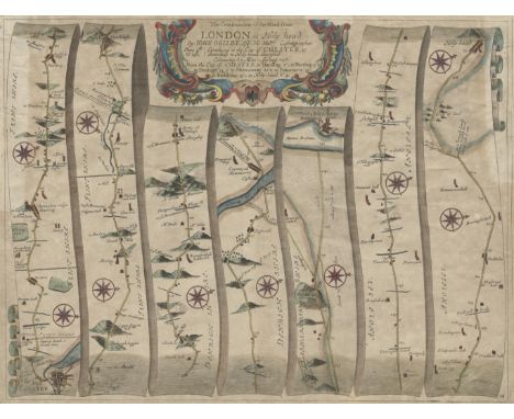
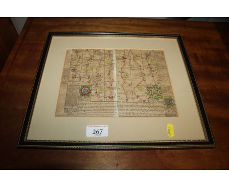
Lot 44
A highly detailed and historically significant Ogilby Road map from London to Holyhead, covering a distance of 87 miles. The map includes important locations along the route, such as Chester, Harding, Northop, Denbigh, Aberconway, Beaumaris, Bodedar, and Holyhead. The map showcases the meticulous cartographic style of John Ogilby, an influential figure in road mapping during the 17th century. Size: 36.5 x 48 cm ( 14.4 x 18.9 inches) Condition: Restoration to top left and right margins, with a small section in the top margin also restored. Keywords: Ogilby map, London to Holyhead, 17th century road map, historical cartography, John Ogilby, England road map, vintage map, travel route map, Holyhead, Chester, Denbigh, Aberconway, Beaumaris, historical restoration, county maps, England map, British isles
Lot 2073
A collection of ephemera, programmes including 1930s Cadwell Park motor racing, 1930s Grimsby & Cleethorpes Grass Track x3, other 1930s motor racing, 1939 Royal Air Force Empire Air Day, Festival of Britain, 1952 and 1953 London to Brighton Veteran Car Run, Capt. Barnards’s Air Circus programme, 1951 South Bank Exhibition, England and Wales road map, etc.
Lot 32
Cruchley (G. F.). Cruchley's County Atlas of England & Wales..., circa 1870, calligraphic title with a near-contemporary manuscript signature, index, a general map of England & Wales and 46 double-page lithographic maps (complete as list), all with contemporary outline colouring, the map of Gloucestershire backed with near-contemporary linen, contemporary manuscript county names to the verso of each map, marbled endpapers, contemporary black morocco by Bickers & Son, Leicester Square, gilt title to spine, bumped and rubbed at extremities, 8vo, together with Leigh (M. A.). Leigh's New Pocket Road-Book of England & Wales..., 1833, frontispiece of the price of posting, preface, additional decorative half-title, 55 (complete) uncoloured engraved maps, folding engraved map of England & Wales with contemporary outline colouring, index and publisher's advertisement bound at rear, near-contemporary pencil annotations to the pastedowns and endpapers, contemporary green morocco with gilt title to the upper cover, rebacked, 12mo, with Heywood (John). The Travelling Atlas of England & Wales with all the Railways & Coach Roads, Cities, Towns, Parks & Gentlemen's Seats, circa 1858, title page and index, folding lithographic map of England & Wales and 44 uncoloured double-page lithographic county maps, each with a near contemporary pencil annotation of the county name on the verso, bookseller's blindstamp to the front endpaper, near contemporary ink ownership signature and annotations to the front and rear endpaper and the rear pastedown, hinges cracked and weak, later half calf, worn and frayed, 8vo, plus Johnston (W. & A. K. publisher). The Modern County Atlas of England & Wales..., 1889, frontispiece of a lithographic map of England and Wales and 57 single and double page county maps, index of place names bound at rear, loosely inserted are a map of the railway from Preston to Blackpool and Fleetwood and a small map of the environs of Epsom, hinges cracked, publishers black and gilt red cloth spine faded and chipped, 4toQTY: (4)
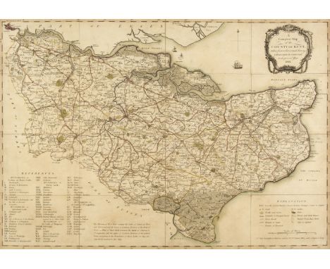
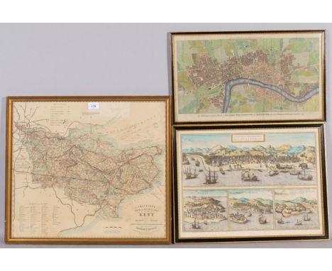
Lot 79
* Kent. A Compleat Map of the County of Kent, taken from a late actual Survey and accurately corrected to the present Year, 1801, unattributed engraved map with contemporary outline colouring, sectionalised and laid on linen, table of references, explanation key and a floriate cartouche, slight staining, 495 x 705 mm, framed and glazed, together with Greenwood (C. & J.). Map of the County of Kent from an Actual Survey made in the years 1819 & 1820, London: July 4th 1829, engraved map with contemporary wash colouring, compass rose, calligraphic cartouche, table of reference, explanation key and a floriate cartouche, very slight staining, 600 x 720 mm, with Hasted (Edward). A Map of the Hundred of Ringslow containing the Island of Thanet, Canterbury: [1778-1801], hand-coloured engraved map, old folds, 380 x 435 mm, mounted, framed and glazed, with Moule (Thomas). Isle of Thanet, circa 1848, hand-coloured engraved map, 200 x 255 mm, framed and glazed, plus Laurie (Robert & Whittle, James, publishers). Roads to East Bourne (By Uckfield) Brighthelmstone, Shoreham, Worthing, Little Hampton and Bogner..., 12th February 1806, engraved road map with contemporary outline colouring, slight staining, 300 x 255 mm, mounted, framed and glazedQTY: (5)
![Ogilby (John). The Road from Ipswich com. Suffolk to Norwich and thence to Cromer on the Sea Coast..., [1675 or later], hand-](https://cdn.globalauctionplatform.com/f54c81ac-b580-4e6f-aec7-b2650117b382/c1fe9c85-7a39-403c-9c63-b26701147d71/468x382.jpg)
Lot 89
Ogilby (John). The Road from Ipswich com. Suffolk to Norwich and thence to Cromer on the Sea Coast..., [1675 or later], hand-coloured engraved strip road map, 335 x 445 mm, together with The Road from Huntingdon to Ipswich..., [1675 or later], hand-coloured engraved strip road map, 325 x 460 mm, with The Road from London to Norwich in Norfolk [1675 or later], hand-coloured engraved strip road map, light overall toning, 355 x 420 mm, plus The Road from Kings-Lyn to Norwich continued to Yarmouth in Norfolk, [1675 or later], hand-coloured engraved strip road map, light overall toning, some creasing, torn with loss to the lower right corner, 350 x 450 mm, and The Roads from Shrewsbury and Chester to Holywell com. Flint [1675 or later], hand-coloured engraved strip road map, very slight overall toning, slight creasing 350 x 440 mm, QTY: (5)NOTE:The sheet numbers are 75, 73, 46, 76 & 98.
Lot 98
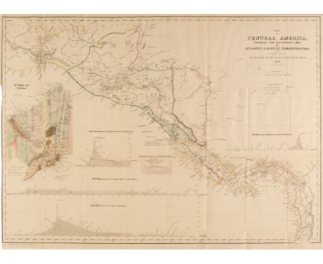
Tehuantepec Isthmus. Barnard (J.G.), Eight maps from the survey to create a trade route across the Tehuantepec Isthmus. Plan of that part of the Isthmus of Tehuantepec between the Jaltepec River and the Pacific Plains; Embracing all of the Engineering difficulties... Chart of the Entrance and Channel of the Boca-Barra... Mouth of the Coatzacoalcos River... Map of the Coatzacoalcos River... Map of the River Uspanapa... Sketch of the Mouth of the Coatzacoalcos River... Charts of the Ports of Laventosa & Salina Cruz... Map of the Isthmus of Tehuantepec embracing all Surveys of the Engineering & Hydrographic Parties and Shewing the Proposed route of the Tehuantepec Rail Road... New York & New Orleans: Tehuantepec Rail Road Company, 1847-1851, 8 uncoloured engraved & lithographic maps, sectionalised and laid on linen, some spotting and offsetting, various sizes, contained with marbled card slipcase, wornCentral America. Wyld (James), Map of Central America Shewing the Different Lines of Atlantic & Pacific Communication, London: James Wyld, 1850, folding lithographic map with contemporary hand colouring, inset geological map of the Isthmus of Panama, trimmed to printed area of the left margin, some marginal closed tears, 600 x 810 mm QTY: (2)
Lot 88
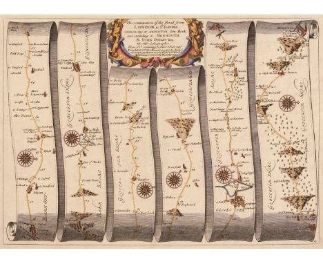
Ogilby (John). The Continuation of the Road from London to St Davids commencing at Abington Com. Berks. and extending to Monmouth [1675 or later], hand-coloured engraved strip road map, 325 x 450 mm, together with The Continuation of the Road from St Davids to Holywell [1675 or later], hand-coloured engraved strip road map, 355 x 445 mm, with The Continuation of ye Road from London to St Davids co. Pembroke [1675 or later], hand-coloured engraved strip road map, two small wormholes at the base of the central fold, central fold strengthened and repaired on verso, 335 x 445 mm, plus The Road from St Davids com. Penbroke to Holywell com. Flint [1675 or later], hand-coloured engraved strip road map, slight creasing, 355 x 450 mm, and The Continuation of the Road from London to St Davids Commencing at Monmouth & Extending to Burton Ferry [1675 or later], hand-coloured engraved strip road map, some creasing, slight fraying to the margins but not affecting the printed image, slight overall toning and dust soiling, 335 x 445 mm, with The Road from Monmouth to Llanbeder in Cardingsh. in South Wales [1675 or later], hand-coloured engraved strip road map, slight creasing, toned overall, 340 x 440 mm, plus The Road from Prestaine in Com. Radnor to Carmarthen [1675 or later], hand-coloured engraved strip road map, 315 x 440 mmQTY: (7)NOTE:Sheet numbers 15, 67, 17, 66, 16, 77 & 89 respectively.
![Ogilby (John). The Road from York to Whitby and Scarborough in Yorkshire [1675 or later], hand-coloured engraved strip road m](https://cdn.globalauctionplatform.com/f54c81ac-b580-4e6f-aec7-b2650117b382/72c116ef-75fe-4e3f-8c44-b26701147ece/468x382.jpg)
Lot 91
Ogilby (John). The Road from York to Whitby and Scarborough in Yorkshire [1675 or later], hand-coloured engraved strip road map, 330 x 445 mm, together with, The Continuation of the Road from London to Holy Head, [1675 or later], hand-coloured engraved strip road map, one pinhole affecting the printed image, 310 x 425 mm, with The Road from Bristol to Worcester, [1675 or later], hand-coloured engraved strip road map, 315 x 440 mm, plus The Road from Ferrybridge to Boroughbridge Continued to Barnard Castle in Com. Ebor. [1675 or later], hand-coloured engraved strip road map, slight creasing, 345 x 455 mm, and The Road from London to Southampton..., and to the City of Salisbury [1675 or later], hand-coloured engraved strip road map, slight creasing and staining, 320 x 470 mmQTY: (5)NOTE:Sheet numbers 100, 22, 59, 95 & 52 respectively.
![Ogilby (John). The Road from London to Montgomery North Wales [1675 or later] hand-coloured engraved strip road map, 335 x 45](https://cdn.globalauctionplatform.com/f54c81ac-b580-4e6f-aec7-b2650117b382/59819cc0-bf9d-4075-bdd3-b26701147e08/468x382.jpg)
Lot 90
Ogilby (John). The Road from London to Montgomery North Wales [1675 or later] hand-coloured engraved strip road map, 335 x 455 mm, together with The Road from Welshpool Com. Montgomery to Carnarvon in North Wales [1675 or later], hand-coloured engraved strip road map, slight creasing and staining, 335 x 420 mm, with The Road from Chester to Cardiff com. Glamorgan [1675 or later], hand-coloured engraved strip road map, 325 x 435 mm, plus The Continuation of the Road from Chester to Cardiff com. Glamorgan [1675 or later], hand-coloured engraved strip road map, slight overall toning, 340 x 440 mm, and The Road from Glocester to Montgomery North Wales [1675 or later], hand-coloured engraved strip road map, slight creasing, one small hole to the central fold, 325 x 440 mm, with The Roads from Carmarthen to Cardigan, Cardigan to Llanbeder & Llanbeder to Aberistwith in com. Cardigan [1675 or later], hand-coloured engraved strip road map, slight overall dust soiling, 335 x 440 mm, plus The Roads from Chelmsford in Essex to Maldon, Raleigh & Gravesend [1675 or later], hand-coloured engraved strip road map, slight dust soiling, 330x 430 mm, and The Road from London to Hith in com. Kent Including the Road by Maidstone [1675 or later], hand-coloured engraved strip road map, stained overall, laid on later card, long closed tear affecting the printed image, 330 x 430 mm,QTY: (8)NOTE:Sheet numbers 44, 87, 63, 64, 71, 91, 93 & 28 respectively.
Lot 664
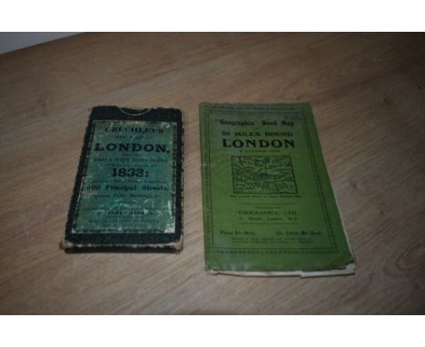
Maps. London. Two folding maps. Cruchley's New Plan of London, with the East & West India Docks, in miniature, improved to 1833: &c. London: G. Cruchley, c.1833. Linen backed, housed in card slipcase. With; 'Geographia' Road Map of 30 Miles Round London by Alexander Gross. London: Geographia, Ltd. C.1930's. Paper map, some damage to extremities. In cloth covers. (2)
Lot 269
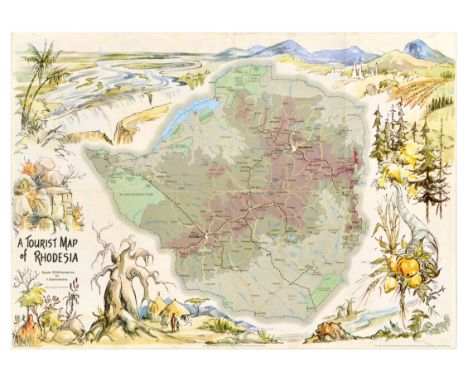
Original vintage double-sided travel poster A Tourist Map of Rhodesia with the map of the country in the centre surrounded by Victoria Falls, mountains, fields and forests, fruit and a village in the foreground, with the reverse of the poster featuring road mileage and kilometre table between Salisbury, Bulawayo and Fort Victoria with neighbouring country cities, and similar inset showing the distance to other South African locations, and smaller illustrations of a family on a picnic and various wildlife animals. Mapwork by M O Collins Ltd. Produced by the Rhodesia National Tourist Board. Printed by Government Printer Salisbury. Horizontal. Good condition, folds, tears on folds, creasing, staining, double sided. Country of issue: Zimbabwe, designer: M.O. Collins , size (cm): 42x59, year of printing: 1970s.
Lot 232
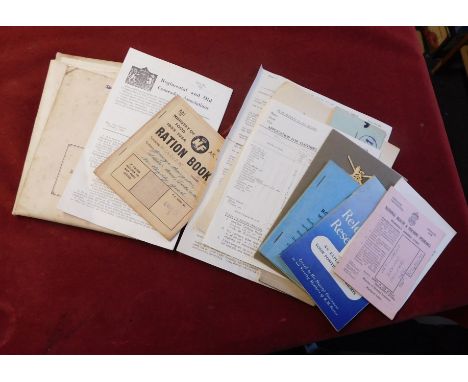
British WWII collection of ephemera to T.L. Waring and relation Sgt Eileen Wilson later Wilcock, her RAF service number 453621 Sgt E.A. Wilson, the lot includes her service number and release book, ration books, Identity Card, T.L. Waring's National Health and Pensions Insurance, Officers-Class "A" Releases, Reinstatement in Civil Employment Act, 1944 Application, Officers Application for clothing coupons, 1942 Edition of the Road Map of India etc. An excellent lot. From the estate of the late 172437 Lt T.L. Waring, 239/115 Field Regiment Royal Artillery, India Command 19th Division.
Lot 229
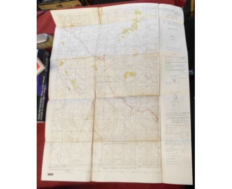
British WWII Map of Burma, First Edition (Toungoo, Mawchi Road Sheet 1), 1st Edition June 1945 Survey H.Q. Twelfth Army HIND/SEA/397, produced by Kodatrace originals, printed by 67 Rep Sect. From the estate of the late 172437 Lt T.L. Waring, 239/115 Field Regiment Royal Artillery, India Command 19th Division.
Lot 222
A selection of 19th or 20th century framed maps to include; "The Howard Vincent Map of the British Empire" printed map, framed and glazed, approx. 63cm x 55.4cm; an early to mid 19th century map of the Isle of Borneo, approx. 29cm x 25.3cm; an 18th century small map of Suffolk, circa 1750, approx. 36cm x 27.3cm (frame loose) and a small 19th century coloured printed map of Staffordshire, approx. 20.6cm x 26cm, together with a watercolour of two gentleman walking on road, by CJ Keats, signed lower left, approx. 60cm x 43.5cm. (5) Further details: some wear, minor foxing to couple; re-framing etc.
Lot 1095
Collection of Maps and Map Reference Books, including Ogilby (John), London to Holyhead, hand-coloured engraved strip road map, mounted, framed and glazed, other strip maps, a cased set of Lonon Geographical Institute linen-backed road maps of Britian, Chubb (Thomas), The Printed Maps in the Atlases of Great Britain and Ireland: A Bibliography, 1679-1870, Dawsons, 1966, reprint; The Early Maps of Scotland, two volumes, etc. (qty)
Lot 1963
John Cary (1754 - 1835)A county map of Westmoreland, watercolour tinted engraving, published by J Cary no 181 Strand, London, in card mount and wooden frame under glass, 54 x 46 cm overall[ Cary began his career as an apprentice engraver in London and set up his own business in the Strand in 1783, he became known for his maps and globes and published his atlas "The New and Correct English Atlas" in 1787. He was later commissioned to survey England's roads by the Postmaster General which led him to produce "Cary's New Itinerary" (1798), entailing a map of every major road in England and Wales. Prior to 1805 he also produced Ordnance Survey maps. ]
Lot 291
A selection of 19th Century guides and maps, including: Thorough Guides: Orkney and Shetland, 1908; Bartholomew's Road Map of Glasgow District; Geographia Vest Pocket Atlas of Central London; Airey's Railway Map of Yorkshire & District; Reynold's Large Coloured Map of London and its Suburbs; and others.
![Ogilby (John). The Road from Oxford to Coventry continued to Darby [1675 or later], hand-coloured engraved strip road map, sl](https://cdn.globalauctionplatform.com/dcdfb2a2-ff68-4e77-89d0-b23500e1190f/8abc3cc5-458e-415c-95fa-b2370105dfcd/468x382.jpg)
Lot 115
Ogilby (John). The Road from Oxford to Coventry continued to Darby [1675 or later], hand-coloured engraved strip road map, slight toning, 340 x 450 mm, together with The Continuation of the Road from York to West-Chester [1675 or later], hand-coloured engraved strip road map, 325 x 440 mm, with The Road from London to Darby [1675 or later], hand-coloured engraved strip road map, 325 x 440 mm, plus The Road from Bristol com. Glos. to West Chester [1675 or later], hand-coloured engraved strip road map, some dust soiling, very slight worming, repaired on verso, 350 x 440 mm, and The Continuation of the Road from Bristol to Chester Commencing at Ludlow com. Shrews. and extending to Chester [1675 or later], hand-coloured engraved strip road map, 345 x 455 mmQTY: (5)NOTE:Sheet numbers 82, 90, 40, 66 & 57.
![Ogilby (John). The Roads from Exeter com. Devon to Dorchester and from Plimouth to Dartmouth com. Devon [1675 or later], hand](https://cdn.globalauctionplatform.com/dcdfb2a2-ff68-4e77-89d0-b23500e1190f/e5b9d4d9-d3a0-470a-a234-b2370105e129/468x382.jpg)
Lot 117
Ogilby (John). The Roads from Exeter com. Devon to Dorchester and from Plimouth to Dartmouth com. Devon [1675 or later], hand-coloured engraved strip road map, slight dust and finger soiling, 325 x 460 mm, together with The Road from Exeter to Barnstable and thence to Ilfracomb co. Devon [1675 or later], hand-coloured engraved strip road map, slight staining, 325 x 435 mm, with The Road from London to Barnstable in Devonshire [1675 or later], hand-coloured engraved strip road map, slight staining, 365 x 445 mm, plus The Continuation of ye Road from London to Barnstable in com. Devon [1675 or later], hand-coloured engraved strip road map, 320 x 445 mm, and The Road from Bristol com. Somst. to Exeter com. Devon [1675 or later], hand-coloured engraved strip road map, slight toning, margins chipped and frayed with occasional closed tears350 x 445 mm but not affecting the printed image, QTY: (5)NOTE:Sheet numbers 94, 68, 32, 33 & 58 respectively.
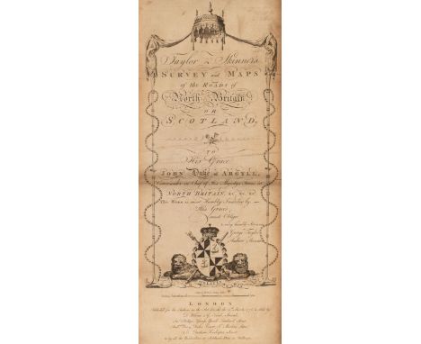
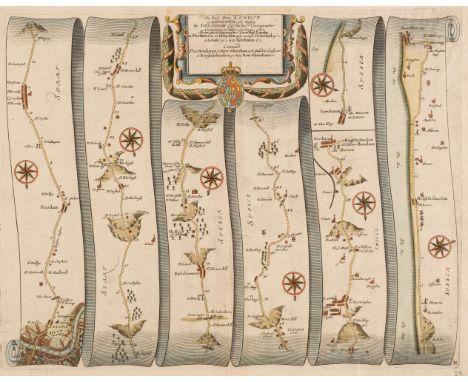
Lot 46
Taylor (George, & Skinner, Andrew). Taylor & Skinner's Survey and Maps of the Roads of North Britain, or Scotland, 1776, engraved calligraphic title with some staining and toning, two indexes and a list of the 'Stages on the Great Road', printed on the verso, 'Stages on the Great Roads' strengthened with archival tissue, lacking the general map of Scotland, 61 (complete) uncoloured engraved strip road maps, each displayed in triple columns, all but one printed back to back, old soft folds, some staining and dust soiling, last map with several marginal closed tears, all the maps strengthened on the verso with archival tissue, sheet 35 & 36 torn with substantial loss, later endpapers, bookplate of T & M James to the front pastedown, modern half morocco gilt, spine faded, oblong 4to, binding size 225 x 545 mmQTY: (1)NOTE:Sold as a collection of maps, not subject to return.
![Ogilby (John). The Road from Whitby in com Ebor. to Durham..., [1675 or later], hand-coloured engraved strip road map, some w](https://cdn.globalauctionplatform.com/dcdfb2a2-ff68-4e77-89d0-b23500e1190f/2ad5f6ce-581d-4a69-b1f6-b2370105e069/468x382.jpg)
Lot 116
Ogilby (John). The Road from Whitby in com Ebor. to Durham..., [1675 or later], hand-coloured engraved strip road map, some water staining, 335 x 450 mm, together with The Road from Carlisle com. Cumbr. to Barwick upon Tweed com. Northumbr. [1675 or later], hand-coloured engraved strip road map, 320 x 455 mm, with The Roads from Kendal in Westmerld. to Cockermouth, Egremond to the City of Carlisle in Cumberld. [1675 or later], hand-coloured engraved strip road map, slight toning, 340 x 445 mm, plus The Continuation of the Road from London to Carlisle com. Cumbr. [1675 or later], hand-coloured engraved strip road map, near contemporary ink marginalia but not affecting the printed image, 335 x 420 mmQTY: (4)NOTE:Sheet numbers 99, 62, 96 & 38.
Lot 114
Ogilby (John). The Road from London to Newhaven com. Sussex..., continued from Newhaven to New-Shoreham com. Sussex [1675 or later], hand-coloured engraved strip road map, 335 x 435 mm, together with The Road from London to Rye com. Sussex [1675 or later], hand-coloured engraved strip road map, one printer's fold, 305 x 445 mm, with The Road from Oxford to Chichester..., [1675 or later], hand-coloured engraved strip road map, slight toning, 355 x 430 mm, plus The Road from London to Chichester in com. Sussex [1675 or later], hand-coloured engraved strip road map, 325 x 445 mm, and The Road from London to Arundel com. Sussex, [1675 or later], hand-coloured engraved strip road map, one printer's fold, 320 x 445 mm, with The Road from London to the Lands End..., [1675 or later], hand-coloured engraved strip road map, slight spotting and staining, 325 x 450 mm, plus The Continuation of the Road from London to Lands End Plate 2d. [1675 or later], hand-coloured engraved strip road map, very slight spotting, 325 x 445 mmQTY: (7)NOTE:Sheet numbers 29, 31, 81, 39, 4, 25 and 26 respectively.
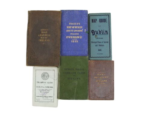
Lot 721
Irish Maps: a group of folding Maps etc., to include: *Betts's Road & Railroad Map of Ireland (fold.) hand coloured, cloth cover; *Black's Travelling Map of Ireland, folding, hand coloured in outline, cloth cover; *Fraser's Map of Dubin and its Environs including Co. Wicklow , 1855; fold. hand coloured, blue cloth; * Tramway Guide to Dublin & Suburbs," folding, ptd. wrappers; *Dublin Police Carriage Fares & Bye Laws 1918, D. 1918, cloth and one other, as a collection, w.a.f. (1)
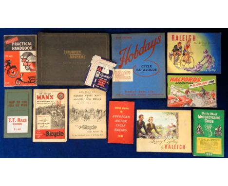
Lot 1310
Ephemera, Motorcycles and Bicycles, a selection of (34) early to mid 20thC items to include a 1960 Halfords catalogue, a 1952 Shell European Motor Cycle Racing guide, Isle of Man TT Race Edition map (1950s?), Raleigh Automatic Mark II Maintenance book, 1950s Raleigh catalogues (2), Raleigh Spare Parts List, 1957 Magic Carpet Cycling with Raleigh, Sturmey Archer catalogue (1960?), 1940 Hobdays Cycle War Edition Catalogue, 1953 mechanical Cyclists Cross Road Drill and more (gen gd)
Lot 545A
Five Maps: 1- Hondius/Jansson: Map of the fens of East Anglia- A general Plott and description of the Fennes and surrounded grounds. Amsterdam, C 1640. Hand coloured, mounted, framed & glazed; 2- Kitchin: A new improved map of Hartfordshire, C1787. Hand coloured, mounted, framed & glazed; 3- Bowen: Accurate map of Cambridgeshire Divided into its hundreds, 1791. Hand coloured, mounted, framed & glazed; 4- Saxton: Bedford Comitatus, C1610, mounted, framed & glazed; 5- Ogilby: Road from London to Flambourough Head, mounted, framed & glazed. (5)
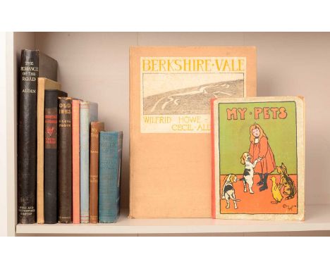
Lot 502
Cecil ALDIN (ill): The Romance of the Road. 1928, 1st. Edn. Folio, with colour plates, road maps and a large folding map in the front pocket. Covers a little spotted; Wonderland Wonders. Home Words Office, no date, 1st. Edn. With illustrations by Cecil Aldin, Louis Wain, etc. Original boards; My Pets and their ways. Henry Frowde, no date, inscribed 1910. Illustrated by Aldin and others. Pictorial boards; rubbed; inner hinges cracked. The foredge of one page torn, with small loss; Just Among Friends. Eyre And Spottiswoode, 1935, 1st. Edn. 4to. Covers rubbed, inner hinges cracked; Good+; Maeterlinck: My Dog. George Allen, 1913, 1st. Edn. 6 colour plates plus colour plate to upper cover. VG; Howe-Nurse: Berkshire Vale. Oxford, Blackwell, 1927, 1st. Edn. Folio. VG; Hayward: The Other One. Pearson, 1901, 1st. Edn. With cover design and four plates by Aldin. Lacking front blank; Fife: Scarlet Blue and Green. Macmillan, 1932, 1st. Edn. 4to. Pictorial boards gilt. Tears to spine; Old Inns. Heinemann, 1921, 1st. Edn. 4to. VG; Ratcatcher to Scarlet. Eyre and Spottiswoode, no date (1926), 1st. Edn. 4to. Rebound, preserving part of the spine and upper cover, o/w VG+ (10)
-
3964 item(s)/page