We found 3964 price guide item(s) matching your search
There are 3964 lots that match your search criteria. Subscribe now to get instant access to the full price guide service.
Click here to subscribe- List
- Grid
-
3964 item(s)/page
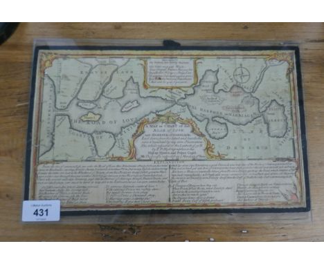

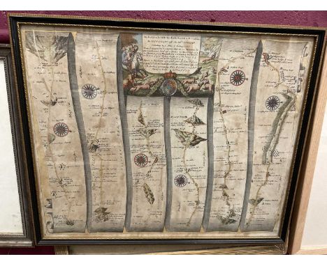
Lot 1069
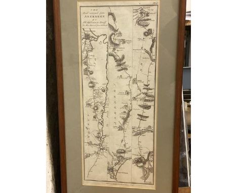
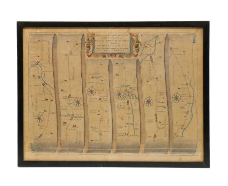
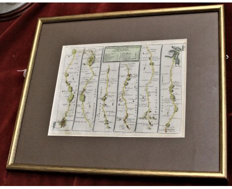
GARDNER, Thomas, 3 strip maps: The Roads from Shrewsbury and Chester to Holywell, 180mm x 280mm; The Road from York to West Chester; and The Continuation of the Road from Bristol to Chester, all c.1719. All hand coloured and in modern gilt frames. With a map of the roads from London to Aberistwith. Hand coloured, no cartographer named. (4)
Lot 221
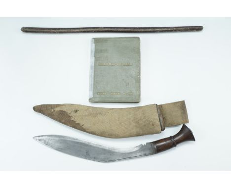
A fine Second War 1943 ‘Tunisia Campaign’ M.M. group of six awarded to Regimental Sergeant Major F. G. Findley, Royal Army Service Corps, attached No. 6 Commando, who was decorated for his actions at the assault on Djebel Azag, 6 January 1943, against troops from the elite Fallschirmjäger Regiment Barenthin Military Medal, G.VI.R. (T/5041667 W.O. Cl.3. F. G. Findley. R.A.S.C.); 1939-45 Star; Africa Star; France and Germany Star; Defence and War Medals 1939-45, good very fine (6) (6) £3,000-£4,000 --- M.M. London Gazette 23 September 1943: ‘In recognition of gallant and distinguished services in North Africa’. The original recommendation states: ‘During the withdrawal from Djebel Azag on 6 January 1943, T.S.M. Findley repeatedly showed complete disregard for his own safety by covering his section by advancing under fire and throwing grenades. I consider that T.S.M. Findley’s actions were responsible for numerous men reaching safety. Throughout the action he showed a most excellent example to his men. He is over 40 years of age and put up a remarkable performance.’ Frederick George Findley was born in Attleborough, Warwickshire, on 24 August 1902 and attested for the North Staffordshire Regiment at Lichfield in May 1921, seeing service in Gibraltar, Turkey and India before transferring to the Army Reserve in 1928. During the Second World War, Findley served in the Royal Army Service Corps attached to 6 Commando and was decorated for his actions at Djebel Azag where an attempt was made by the British 36th Brigade Group to capture the feature known to the British as Green Hill, on 5 to 7 January 1943. Commanding the Sedjanane to Mateur road in Northern Tunisia, Green Hill was held by men from Fallschirmjäger Regiment Barenthin (German Parachute Infantry) and Witzig’s Parachute Engineers who had fortified the hill with concrete machine gun emplacements, barbed wire and mines. In his report on the ‘Attack on Djebel Azag’, Captain J. A. D. Mayne, Som. L.I., describes how ‘Mand Force’ from No. 6 Commando, comprising Force HQ, No. 1 Troop (complete), 1 Section from No. 2 Troop and one partial section from No. 5 Troop (commanded by Findley) were tasked with the following objectives:
i) To capture and hold “Djebel Azag.”
ii) To assist, by supporting fire, the attack on “Greenhill” and “Si Ayed”.
iii) To establish an Observation Post for a Forward Observation Officer to cover targets on and behind ‘Greenhill” area. Hilary St. George Saunders’ narrative of this action in the Green Beret describes the struggle between No. 6 Commando and the elite German paratroops dug in on the hill: ‘On the 5th January they took part in yet another attack on Green Hill, carried out by the 36th Brigade. Headquarters with one and a half Troops occupied Point 277 to the north-west, the object being to protect the Brigade’s left flank and to harass the enemy’s rear; while a detachment made up of two Troops under Captain Mayne seized Djebel Azag, a height which commanded the main position. To do this they made a ten mile approach march over sodden country, the men carrying heavy loads of ammunition and food for forty-eight hours. They reached their positions soon after dawn and then dug in on the summit as deeply as the rocky ground would allow. Soon after midday the enemy made two attempts to attack them, but were beaten off at long range by accurate and well-sustained small arms fire. The Germans then resorted to mortars, in the handling of which they were exceptionally proficient, and the Commando began to suffer casualties but held on.
During the afternoon Mayne observed that the enemy were forming up to deliver a counter-stroke against the brigade then engaged upon the main assault of Green Hill. His messages brought artillery fire on them and the attack did not develop. At dusk his small force, which had not been reinforced, was concentrated on the summit of the hill. At dawn Mayne’s position soon became serious, for as Lieutenant Cowper and his section were moving to their daylight positions, they were attacked at close range by Germans who had crawled up during the night. Cowper was soon engaging about two companies of the enemy strongly supported by mortars which fired a very accurate barrage. The remainder of the force was now under equally severe pressure and almost completely surrounded. Captain Davies was ordered by Mayne to withdraw headquarters and then cover a general retreat of the force, a manoeuvre which he ‘carried out extremely well.’ That evening they were all back in the tunnel near Sedjenane, the men very tired but cheerful, ‘having done magnificently.’ With a loss of thirty-five of their number they had held a key position for forty eight hours against ‘first-class troops who had been put in as stiffening.’ Though the attack on Green Hill had failed, the small action fought by Mand Force, as Mayne’s detachment was called, provides a good example of what men can accomplish who have passed through Commando training. They had been isolated for two days, in a most exposed position, and subject to galling mortar fire; but they had occupied the attention of four or five times their number who might very well have been employed elsewhere.’ Findley was a parachutist who, during his para course, landed in the top of another soldier’s parachute during a training descent which caused an injury to Findley’s back (a copy of his course report is included with the papers). Post-War he was a member of the Commando Association whose records state that his last rank attained was Regimental Sergeant Major and that he also served in No. 12 Commando. He died in 1960 in Hessingford, Cornwall. Sold with the recipient’s Soldiers’ Service and Pay Book inside which is a hand traced map of Floro, Norway with important sites and German positions marked. This map is suggestive of Findley’s participation in Operation Kitbag, a raid by British Commandos of No. 6 Commando and No. 12 Commando on the town of Floro in Norway during the Second World War - ‘Kitbag’ embarked from Scapa Flow on H.M.S. Prince Charles on 9 December 1941 but after navigational difficulties the raid was eventually called off; the recipient’s Old Comrades Association of the Special Service Brigade membership booklet, signed by the recipient and dated 9 July 1943; Pay Form No. 48 for the recipient’s Military Medal Gratuity of £20; the recipient’s Service and Casualty Form (Part I) dated 9 October 1928; copied research and a photographic image of recipient in uniform.
Lot 457
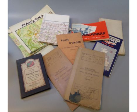
Box of assorted maps including: 'Scotland the Forth & Tay, Royal Airforce Edition, sheet 3', Stanford's Map of England and Wales, Ordnance Survey of Great Britain, 'Pianta Panoramica di Roma', 'D'Alger', Halfords accessories for road users, Mobil road map, LMS map of Europe published by the London Midland & Scottish Railway etc. (B.P. 21% + VAT)
Lot 100
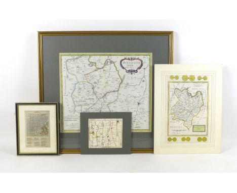
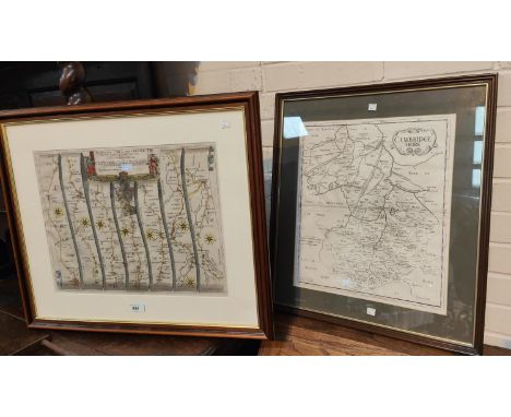
A collection of four maps, one of 'Cambridge-shire', mounted, framed and glazed, 24.7 by 19.6 cm, another of 'Huntingdon-shire' by H. Moll, mounted, 41.8 by 31.8 cm, a 'Bowles's Post-Chaise Companion' page showing the road from London to Stilton, mounted, 19.8 by 23.6 cm, and a map of Huntingdonshire from Camden's Britannia by Robert Morden, framed, mounted, and glazed 57 by 62 cm. (2)
Lot 43
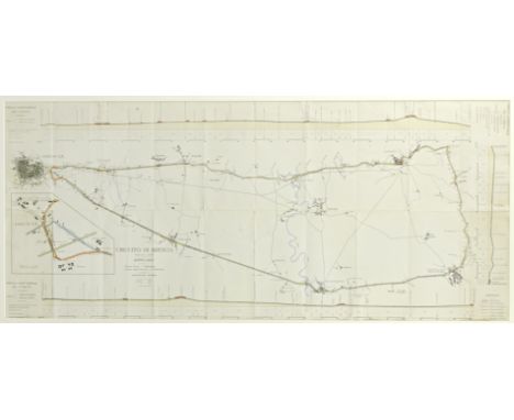
A rare 1907 Florio Cup map of the Brescia circuit, used by Wolsit driver Mark Wild,printed for the 1 September Coppa Florio and the 2 September Coppa della Velocita, with distances marked in Km and road altitude profile printed in the margins, with hand-written notes and comments, old fold marks and creases, 53 x 122, mounted, framed and glazed, the original map envelope is attached to the rear of the frame; together with two period images depicting Wild in Wolsit car '3B' at the event, each card mounted and a page from The Automotor Journal, September 7 1907, depicting an image of Wild overtaking Tomagni, together with Paul Sheldon: A Record of Grand Prix and Voiturette Racing (Volume 1 1900-1925), cover and spine detached from pages. (5)Footnotes:Wolseley prepared three cars for the Coppa Florio race in Italy, they were developed in the shortest possible time. The order for construction was given on July 1, 1907, and the cars were delivered in Italy on August 10th. Before that time the cars were extensively tested at the then brand-new Brooklands circuit. (Brooklands opened on July 7, 1907). The cars were registered under the title 'Wolsit', the Italian subsidiary of the brand. The 3rd Coppa Florio was an eight-lap race on a 'road circuit' measuring 60.51 kilometres length. The partially paved road surface was known to be very fast, but dust was a problem for both cars and drivers. Of the 34 cars that took the start, only 14 would finish. The Italians were victorious: Having led from the start Ferdinando Minoia steered his Isotta Fraschini over the finish line in 4 hours, 39 minutes and 53 second at an average speed: 104.172 kmph. Mark Wild finished in 13th place in a time of 5 hours, 54 minutes and 23 seconds.See pages 56-57 of Paul Sheldon: A Record of Grand Prix and Voiturette Racing (Volume 1 1900-1925).For further information on this lot please visit Bonhams.com
![[MAP]. Ogilby, John (Scottish, 1600-1676). 'The Road from London to Holy Head' [Towcester to Lichfield section], engraved ri](https://cdn.globalauctionplatform.com/287b5566-bf0e-4ed5-a536-aec500a7ec98/3f54630f-a7bf-44d6-b64b-af3b00dcfdff/468x382.jpg)
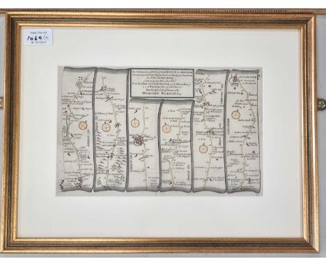
Lot 440
[MAP]. Ogilby, John (Scottish, 1600-1676). 'The Road from London to Holy Head' [Towcester to Lichfield section], engraved ribbon map, hand-coloured, 34.5cm x 44.5cm, framed and glazed. Condition Report : Generally good condition; slightly creased; minor foxing; no obvious tears or repairs; fresh colours. Condition reports are offered as a guide only and we highly recommend inspecting (where possible) any lot to satisfy yourself as to its condition.
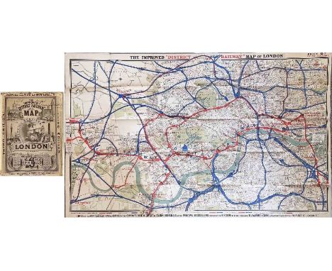
Lot 217
1884 'Improved' District Railway MAP OF LONDON, 3rd edition. A very early Underground map showing the first lines: the District, Metropolitan Railways and the Inner Circle line which was completed that year. Lines over which the District ran are shown in red, other railways in blue. Interesting overprints are the International Health Exhibition at Exhibition Road and, at South Kensington "Authorised South Western Ry West End station". Linen-backed inside cloth covers. Opens out to 42" x 26" (106cm x 66cm). Some wear & annotations on covers, the map is in very good condition. [1]
Lot 144
Cartography: Pierre Mortier, North England, hand-tinted engraving showing, Northumbria, Cumbria, Westmorland & Lancashire, 49cm x 59.5cm; and three further hand tinted maps comprising, Cambridgeshire published by Abel Swal & John Churchill, 43.5cm x 36cm; a Bristol to Weymouth road map by John Senex, 16.5cm x 22cm and The Road from Oxford to Coventry by John Ogilby, 35cm x 46cmAll framed and glazed.
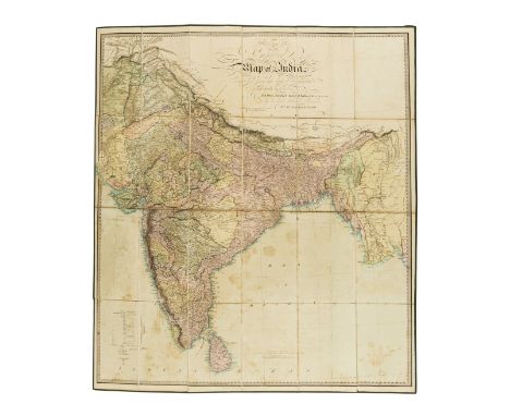
Lot 127
India.- Allen & Co. (William H.) An Improved Map of India Compiled from the latest documents, large format map of India, engraved by J. & C. Walker, with original hand-colouring, 965 x 840 mm (38 x 33 in), dissected and mounted on linen, scattered spotting and browning, some surface dirt, folding with green cloth ends, green silk edges, green cloth covered slipcase, rubbed and worn, 1841; together with Brigadier C.G. Lewis's 'Road Map of India', sixth edition, lithograph printed in colours, 1120 x 770 mm (44 x 30 1/4 in), folding into contemporary yellow boards, worn, 1945, 8vo (2)
Lot 297
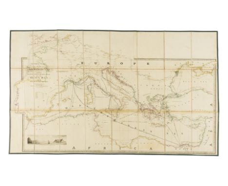
Wyld (James) General Chart of the Mediterranean Sea Including the Gulf of Venice, Archipelago and part of the Black Sea with the Steampacket routes, or 'Wyld's New Map showing the route from London to Alexandria, engraving with original hand-colouring, additional engraved sections pasted collage-style, including the west coast of Spain and the English Channel included above the title, sheet 650 x 1030 mm (25 1/2 x 40 1/2 in), some toning to sheet, scattered spotting and surface dirt, edged with green linen, folding with marbled ends into slipcase with publisher's printed label to upper panel, bumped and worn, 1844; together with 15 further mainly folding maps, including Jean Alibert's 1781 map of Paris 'Nouveau Plan Routier de la Ville et Faubourgs de Paris', three Perrier road maps, 8 various folding maps of the British Isles by Bartholomew and others, Simmon's 1851 'Map of England and Wales showing the Railways, Canals & Inland Navigation Compiled from the Ordnance Surveys and other sources', Stanford's 1863 map 'A new Map of Metropolitan Railways & Miscellaneous Improvements', and a folding strip map of various London rail bridge proposals with stamps of the 'Great Western Railway, Engineers Office, Paddington', various sizes, mainly 19th century (16)
![After John Ogilby (1600-1676), THE CONTINUATION OF THE ROAD FROM LONDON TO HOLYHEAD [plate 3] COMENCING AT THE CITY OF LICHFI](https://cdn.globalauctionplatform.com/de28c272-998a-48c0-8dc6-af23008b2074/f9948696-7a75-48dd-afb0-af25009b6a19/468x382.jpg)
Lot 219
After John Ogilby (1600-1676), THE CONTINUATION OF THE ROAD FROM LONDON TO HOLYHEAD [plate 3] COMENCING AT THE CITY OF LICHFIELD & EXTENDING TO THE CITY OF CHESTER, a strip road map on laid paper, later hand coloured, visible plate mark, 31cm x 43.7cm, framed and glazed; with three further strip road maps on laid paper after John Ogilby, THE ROAD FROM LONDON TO CARLISLE IN COM: CUMBERLAND, 33.5cm x 42cm, framed and glazed; THE ROAD FROM SHREWSBURY AND CHESTER TO HOLYWEL COM FLINT, visible plate mark, 35.5cm x 45.5cm, unframed; and THE CONTINUATION OF YE ROAD FROM LONDON TO ST DAVIDS, visible plate mark, 34cm x 45cm, unframed, pasted to later board (4)

Lot 490
1974 Ducati 750SSRegistration no. not registeredFrame no. DM750SS*075134*Engine no. 075185•One of only 401 'round cases' built•Matching numbers•Restored by Swiss engineer Ulli Rothlisberger•Only 1,070km (665 miles) recorded since restoration•Kept in private collections•Not been ridden in over 20 yearsIt was, without question, Paul Smart's famous victory at Imola in April 1972 that really put Ducati's new v-twin on the map. It was a particularly sweet occasion for hitherto un-fancied Ducati, as the Bologna factory defeated not only the race-proven Triumph Tridents of Percy Tait, John Cooper and Ray Pickrell, but also the works 750 MV Agusta of Giacomo Agostini. With such an outstanding pedigree, the 750SS was a natural choice for racing's Superbike category, and later on proved highly competitive in AMA 'Battle of the Twins' (BOTT) and club Super Street racing in the 1980s. Smart's bike was based on the 750 Sport roadster introduced that same year. The racer's cycle parts remained close to stock - even the centre stand lugs were retained! - merely being up-rated with triple Lockheed disc brakes while the engine gained desmodromic cylinder heads, high-compression pistons and stronger con-rods. When the definitive production version - the 750SS - appeared in 1974 it differed little in overall conception from the Imola '72 bikes, among the most obvious external differences being the adoption of a centre-axle fork and Brembo front brakes. The big 'Imola' fuel tank and humped racing seat both featured on the road bike, which wore a cockpit faring rather than the racer's fuller streamlining. The 750SS received rave reviews in the motorcycling press, being hailed by Cycle magazine as 'a bike that stands at the farthest reaches of the sporting world - the definitive factory-built café racer'. Today the 750SS is regarded as a true landmark model and is one of the most sought-after of all Ducatis. This Ducati 750SS, a matching-numbers example with factory correct frame and engine number stamping, it is recorded in marque specialist Ian Falloon's definitive register.The Ducati was restored by Swiss precision engineer Ulli Rothlisberger with his friend and former Ducati engineer, Hannes Jakob. Ulli did the bodywork while Hannes restored the engine. Ulli then covered 1,070 kilometres while running in the machine before placing it with his extensive motorcycle collection in 1998. He never rode it again. Photocopies of bills and invoices (in German) relating to the restoration are available. In August 2003 a sister 750SS, also restored by Ulli, was featured and advertised for sale in Classic Bike magazine. It was described by Ducati guru, the late Mick Walker, as the best he had ever seen. American fabric designer Michael Maharam contacted Ulli to make an offer. That bike had already been sold, so instead Michael bought this one, which Ulli had held back as the better of the two. The 750SS then spent 15 years in Michael's studio on the 14th floor of a block in New York as a work of art together with an old R50 BMW and various Vintage-era Bianchi racing bikes. It was never ridden.The current vendor bought the Ducati from Michael Maharam some four years ago, it being the third 750SS he has been lucky enough to own since 1976. He changed the oil and filter, cleaned out the carburettors and set up a slave fuel supply to bypass the tank (so as not to leave traces of ethanol). The bike fired on the sixth or seventh kick, after not having run for some 20 years, and settled to a perfect tick-over. It has been permanently housed in a Carcoon bubble in a heated garage since purchase and, again, never ridden.Currently fitted with a Bologna numberplate, the Ducati is offered with a photocopy of an Italian registration document from Sulmona, Abruzzo, dated 7th May 1974 (when the machine was registered AQ 26405), a Swiss Rapport d'expertise, dated 3rd December 1990, and UK HMRC custom clearance and nova paperwork dating from 2018. The Ducati does not have a US title (the American owner never registered it), nor has it been registered in the UK. A possibly once-in-a-lifetime opportunity to own an example of this iconic Ducati.Offered with keyFootnotes:All lots are sold 'as is/where is' and Bidders must satisfy themselves as to the provenance, condition, age, completeness and originality prior to bidding.For further information on this lot please visit Bonhams.com
Lot 1010
10101974 Ford Escort MkI RS2000Reg. no. TJS 184MChassis no. BFATPJ 00176Engine no. PJ00176 (According to log book)Mileage: 70,000This previously multiple award-winning Mk.1 RS2000 AVO has been with the same owner since September 2001 and has only been driven to two events in that time. The family are now ready to release the car on the market and hope that another Ford enthusiast will enjoy it and show it off to the world as was always intended.This rally derived legend comes with a vast array of history and includes all the trophies it has won in the past, one award being an AVO show win. It is said that just 3,759 (UK) cars were produced and as a result, the model achieved legendary status amongst Ford enthusiasts and rally fans alike; it was the last model to leave the famous AVO factory prior to its closing. There are now just over 600 RS2000’s left on the roads in the UK including both the Mk.I and Mk.II. Not many would dispute that the Ford Escort is one of the most successful rally cars of all time, still winning events across the world to this day in historic and modern spec. on special stages and regularities.The Escort had the classic front engine, rear drive format that so many petrolheads love. With a 100bhp, Ford Pinto nestled in a shell with a combined weight of just 915kg, you can see why these were road rally favourites.In stunning original Daytona Yellow with Ochre decals, this particular RS2000 sports a number of extras with a nod to a great era of road rallying including roll cage, map reading light, Bilstein front struts and rear shocks as well as twin Oscar spot lamps, all of which were possible options from factory, however the AVO Owners’ Club does say that it is very hard to confirm which options came with which cars off the production line. The chassis code suggests the car was made post May 1974. The car number is 00176, in the colour it sits before us today and has the correct interior trim.After a number of years in dry storage, the car has just visited a local specialist to make sure it runs as it should, including a new carburettor and a service with fresh oils and fuel. Sadly, manufacturers rarely produce homologation specials these days but in turn it makes us desire the retro rally legends that little bit more. This is a chance to own a 1970’s icon in excellent condition that you can jump in and be reminded about the golden days of UK rallying. The sale includes a quantity of history including bills and trophies as well as an old V5, but no current V5C.Estimate: £42,500 – 47,500To be auctioned along with a fantastic selection of other vehicles on October 15th at our Showell Farm site, SN15 2NU. Viewing is welcome prior to sale and all cars are sold as seen, condition reports can be requested on each lot by contacting us direct. Lots are not available to buy prior to auction. Fully illustrated catalogue is available on the Richard Edmonds Auction website. Bids can be made online, by telephone or live on site. All lots are subject to commission.Vehicles that are un-registered or on foreign plates may require Import Duty and Vat to be paid upon purchase via HMRC prior to registering with the DVLA for a UK plate, if you are not sure please ask. For classic cars over 30 years this equates to 5% Duty on the final value.
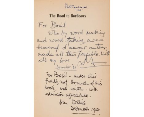
Lot 92
Freeman (C. Denis) and Douglas Cooper. The Road to Bordeaux, first edition, signed presentation inscriptions from the authors to Basil Mackenzie, 2nd Baron Amulree "Who by word making and word taking, avec beaucoup d'amour autour made all this possible" and "Under who's friendly root so much of this book was written"on half-title and with Amulree's ownership inscription to head, map endpapers, original buckram, spine darkened, shelf-lean, soiling to covers, extremities rubbed, light fraying to spine tips and corners, 8vo, Cresset Press, 1940.⁂ An association copy of classic memoir of the Second World War, based on the authors' experiences transporting wounded soldiers to Bordeaux. Amulree was a physician and friend of both authors. He began an affair with Douglas Cooper around 1948.
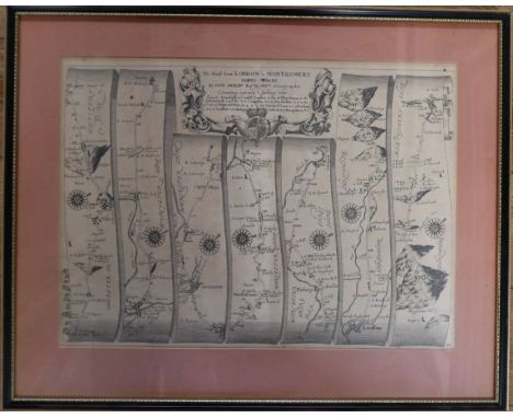
Lot 102
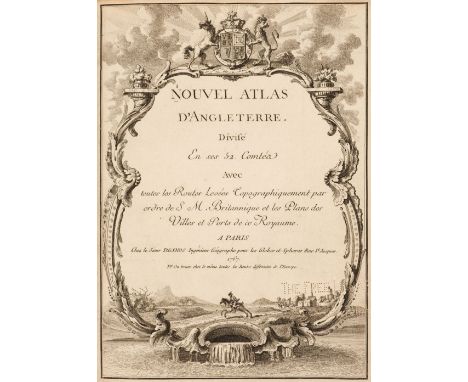
Desnos (Louis Charles & Le Rouge George Louis). Nouvel Atlas D'Angleterre. Divisé en ses 52 Comtéa avec toutes les Routes Levées Topographiquement par ordre se S M Britannique et les Plans des Villes et Ports de ce Royaume, Paris, 1767, decorative title page with library blindstamp and additional ink library stamp to verso, twelve double page engraved regional maps with contemporary outline colouring which if conjoined create a map of England & Wales, engraved title page, 'Itineraraire de Toutes Les Routes de L'Angleterre...., par Senex en 101 cartes, Paris, dated 1757, title repeated in English, introduction and list of towns, the list of towns appear to have been re-margined, 101 uncoloured engraved strip road maps all with blank versos, bound with Recueil des Villes Ports D'Angleterre Tiré des Grands plans de Rocque et du Portuland de L'Angleterre de Sr. Belin, Paris, 1766, decorative title, double-page table of explanation for an uncoloured double page engraved map of London, an engraved map of the 'Bouche de la Tamise' and sixteen engraved single sheet plans of British and Irish towns, later endpapers, bookplate of The Free Library of Philadelphia, Map Division, modern half morocco, 4toQTY: (1)NOTE:Chubb. Number 143.
Lot 112
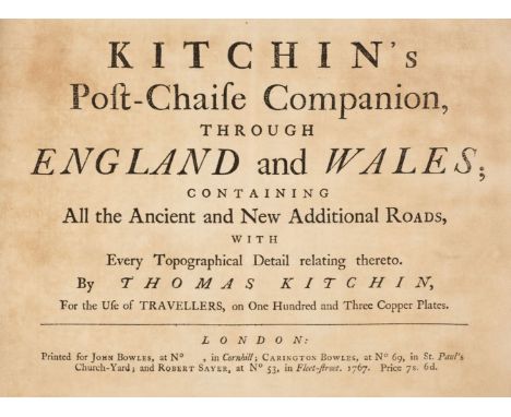
Kitchin (Thomas). Kitchin's Post-Chaise Companion through England and Wales containing all the Ancient and New Additional Roads with every Topographical Detail relating thereto..., John Bowles, Carington Bowles and Robert Sayer, 1767, title page with slight staining, index of cities and towns, table of crossroads and an uncoloured engraved general map of England & Wales, 103 (complete) uncoloured engraved strip road maps on 51 sheets, printed, back to back, slight offsetting throughout, later limp calf, oblong 8voQTY: (1)NOTE:Chubb. CXLI. A re-issue of John Senex's 'Actual Survey of all the Principal Roads of England and Wales..,' first published in 1719.
Lot 115
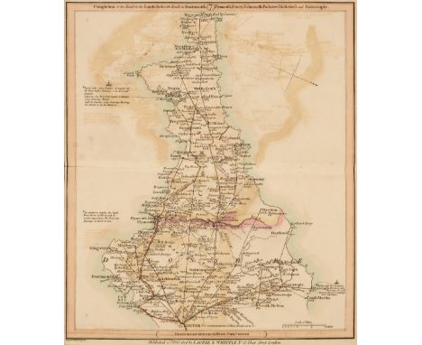
* Laurie (Robert & Whittle James, publishers). Laurie & Whittle's New Traveller's Companion Exhibiting a Complete and Correct Survey of all the Direct and Principal Cross Roads in England Wales and Scotland; as far North as Edinburgh and Glasgow...., 6th. edition, 1812, title page, advertisement, index and table of explanation all present, general map of England & Wales and twenty-five (complete) engraved road maps, all with original hand colouring, some offsetting and slight staining, marbled endpapers, hinges professionally strengthened with marbled paper, bookplate of Sir John Cox Hippisley Bart. contemporary limp morocco with a skilful re-back with gilt title and date to the spine, large 8voQTY: (1)NOTE:There is some variation in the dates at the base of the maps, with the map of England & Wales dated 1808, and the strip road maps dated 1806 except for the last map (of Scotland) dated 1809.
Lot 55
New (Charles). Life, Wanderings and Labours in Eastern Africa, 1st edition, London: Hodder and Stoughton, 1873, half-title, portrait frontispiece, 10 lithograph plates, folding maps, spotting, numerous ownership inscriptions to preliminaries, text block separated from backstrip, top right-hand corner of endpaper clipped, original green pictorial cloth gilt, worn, 8vo, together with:Laborde (M. Léon de). Journey through Arabia Petraea, to Mount Sinai, and the excavated city of Petra, the edom of the prophecies, 1st edition, London: John Murray, 1836, lithographic frontispiece, lithographic plates throughout, folding map, armorial bookplate of Richmond College Surrey, lightly spotted, front free endpaper torn with loss, original brown blindstamped cloth gilt, lacking headcap, rubbed, 8vo, withForbes (Rosita). Forbidden Road-Kabul to Samarkand, 1st edition London: Cassell and Company, 1937, inscribed by the author to front free endpaper, black and white illustrations throughout, a few spots to preliminaries, original red cloth, spine lightly faded, 8vo, with 15 others relatedQTY: (18)
Lot 338
Large collection of maps, including: road maps of France, Ireland, Midlands and Wales, 'Geographia' road Touring Map of England and Wales, RAC, 'News of The World' War map of Europe and the fighting zones, road safety map, 'Bacon's up to date map of London', Geographers' premier map of London and Suburbs, various ordinance survey maps of local interest and some foreign etc. (B.P. 21% + VAT)
Lot 295
A Second World War kukri, the scabbard having a theatre-made webbing cover and belt loop, 48 cm, (kukri devoid of markings), together with a leather covered swagger cane, a portrait photograph of its original owner, Major William Howarth, Royal Indian Artillery, a military pamphlet "Colloquial Hindustani for British Troops", and a Road Map of India, the latter inscribed and identifying routes taken by Howarth
![[MAPS] Van den Keere, Pieter (Flemish, 1571-c.1646), 'Anglesey and Carnarvan', engraved map, hand-coloured, 9cm x 12cm; Merc](https://cdn.globalauctionplatform.com/7d6d533a-b4dd-4ae0-8f27-aec500a7849f/bdf4056b-c8bf-4036-8765-af1f00b84d91/468x382.jpg)
Lot 377
[MAPS] Van den Keere, Pieter (Flemish, 1571-c.1646), 'Anglesey and Carnarvan', engraved map, hand-coloured, 9cm x 12cm; Mercator, Gerard (Flemish, 1512-1594), & Hondius, Jodocus (Flemish, 1563-1612), 'Anglesey', engraved map, 15cm x 20.5cm; Bowles, Carrington (British, 1724-1793), The Road from London to Rye, engraved strip map, hand-coloured, 14.5cm x 16cm; together with The Road from London to Portsmouth, engraved strip map, hand-coloured, 14.5cm x 16cm; also Gibson, John (British, fl.1750-d.1792), Hampshire, engraved county map, hand-coloured in outline, 11cm x 6.5cm; and another strip map after a different hand, each framed and glazed, (6).
Lot 668
Transport - Railwayana - Railway Carriage Maps & Other Railwayana/Posters etc. Box 1: Comprises 2 framed and glazed railway carriage maps. Map 1: an original by the Southern Railway of the Isle of Wight railway lines. Map 2: "Road to Southern Railway Sunshine " - inscribed Reproduced by courtesy of the British Railways Board.Also included are: a 1975 Isle of Man Steam Railway poster, plus later "The Silver Jubilee", "Child & Engine Driver" and GWR air services poster.Box 2: Various smaller items including a B.R. leather cash bag, a ticket machine, a GWR thief-proof toilet roll holder & GWR handle plus a 1970's era "Golden Hind" named train carriage board.
Lot 508B
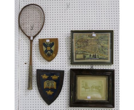
An Edinburgh University coat of arms wall plaque, together with another similar heraldic wall plaque, a framed sepia photograph of Morningside Road, framed reproduction of Braun's 1582 map of Edinburgh, a vintage badminton racquet, an EPNS beaker engraved "2000" and a cutlery canteen containing knives only (7) Condition Report:Available upon request
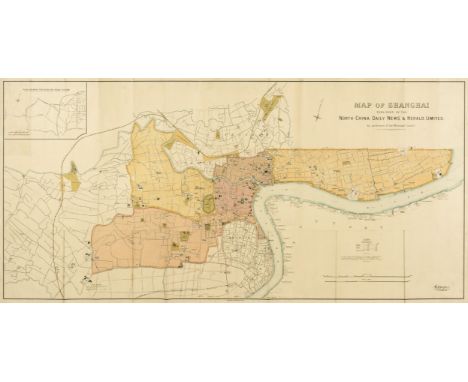
Lot 70
China.- North-China Daily News & Herald (publisher) Map of Shanghai, large English map focussing on the Shanghai International Settlement and the French Concession area, with 'Chinese City located underneath, with certain sites also identified outside of the settlement, including the Siccawei (Zikawei) Observatory and the Shanghai Jewish Club, with numerous businesses, schools, wharves, police stations, public works, and churches identified, and an inset "plan shewing the rubicon road system" in the upper left corner, lithograph printed in colours, 780 x 1540 mm (30 3/4 x 60 1/2 in), mounted on archival support, old folds with some associated splitting repaired, surface dirt, rolled, printed by Waterlow & Sons, 1918⁂ The North-China Daily News was an English-language newspaper in Shanghai, China.
Lot 44
Spanish history to include The Spanish Civil War to include:-Boyd, Alistair "The Road for Ronda", Collins 1969, photographic illustrations, ep showing map, book stamp for The Pottery Bookshop, Fuengirola, dj not price clippedAllison Peers, E."The Spanish Tragedy 1930-1936", Methuen Macauley, A R "Fabled Shore", Hamish Hamilton 1949Gregory, Walter"The Shallow Grave, a Memoir of the Spanish Civil War", Victor Gollancz 1986, photographic frontis, photographic illustrations, dj Peyre, Joseph"6 Bulls on a Sunday", Jeffrey Bles 1939, red cloth, dj not price clippedNicholson, Irene "The Liberator, a Study of Independence Movements in Spanish America", Frederick A Praeger 1969, dj Matthews, Herbert L "Half of Spain Died: a reappraisal of the Spanish Civil War", Charles Scribner's Sons 1973, photographic illustrations, red clothBorbolla, Barbara"Mantillas and Me", Herbert Jenkins 1961, library stamps, front hinge cracked, red clothCleugh, James "Spanish Fury, the Story of a Civil War", George G Harrap 1962, library stamps on tp and verso, laminated titled boards History of Spain and the Spanish Civil War to include:- Thomas, Frank "Brother Against Brother: Experiences of a British Volunteer in the Spanish Civil War", Sutton Publishing 1998, dj not price clippedGannes, Harry and Repad, Theodore"Spain in Revolt", Victor Gollancz 1936, orange limp covers, titled 'Left Book Club Edition Not for Sale to the Public'Opes, Francisco Prez "Dark and Bloody Ground", Little Brown & Co 1970 and other related volumes (3 boxes)
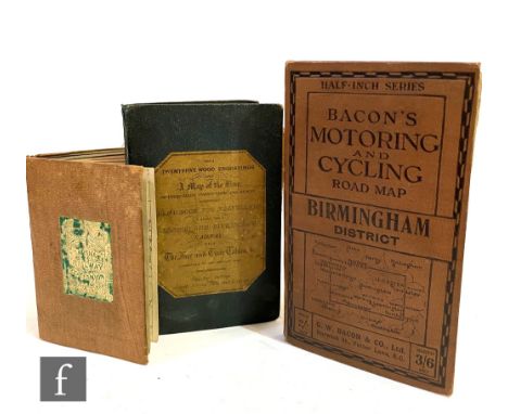
Lot 450
Bradshaw's Railway Companion, published by Bradshaw & Blacklock, Manchester, 1841, original cloth boards, frontispiece map of London detached, also 'A Hand-Book for Travellers along The London and Birmingham Railway', c. 1839 and Bacon's Motoring and Cycling Road Map, Birmingham District. (3)
Lot 523
Framed maps including, a print of an old map of the Isle of Wight in a gold frame, brown mount. A framed old map of Norfolk with Norfolk history on the back and a double sided (two visible maps) framed old Road Maps; Bristol to Weymouth and Cambridge to Coventry. VGC Buyer collects or arranges courier
![Speed (John)The Countie Pallatine of Lancaster Described and Divided into Hundreds 1610 [1676], Bassett and Chiswell, engrave](https://cdn.globalauctionplatform.com/74679034-1c74-48c3-9905-aed80108213d/d846fb74-019e-4fb1-8705-af1100ebe6fd/468x382.jpg)
Lot 351
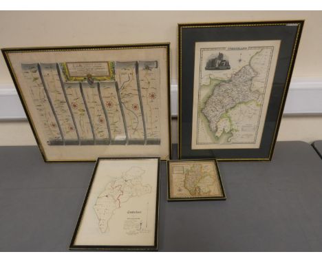
Speed (John)The Countie Pallatine of Lancaster Described and Divided into Hundreds 1610 [1676], Bassett and Chiswell, engraved map, uncoloured, framed, glazed front and rear;Bowen (Eman.), An Accurate Map of the County of Lancaster Divided into Hundreds ..., T. Bowles and John Bowles and Son .., large hand-coloured engraved map, mounted framed and glazed;[Bowen], A New Map of the Counties of Cumberland and Westmorland Divided into their respective Wards ..., 1760, T. Bowles and Rob't Sayer, large engraved map, hand-coloured in outline, framed and glazed;Ogilby (John), The Road from York to Lancaster .., no date, hand coloured road map, mounted framed and glazed (4) All with some even discolouration.Cumberland and Westmorland with an area of darker staining to the lower right edge.Bowen Lancaster, the map is not taut in the frame and has rippled slightly.No holes or tears.
Lot 357
Jansson (Jo.)Anglia Regnum, no date [c.1646], engraved map, damp staining to lower margin, framed and glazed;[Bleau (Jo.)], Westmoria Comitatus Anglice Westmorland, hand-coloured 17th century engraved map, mounted framed and glazed;Ogilby (John), The Road From Carlisle .. to Barwick upon Tweed, [late 17th cent.] engraved road map, mounted, framed and glazed;Bourne (Henry), A Plan of Newcastle upon Tyne, c. 1736, engraved map, closed tear to lower fold, mounted framed and glazed; with two others (6)
Lot 183
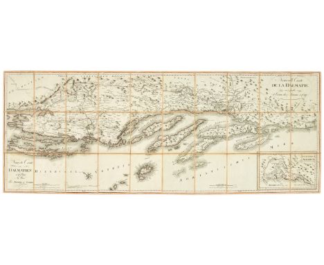
Balkans.- Adriatic Coast.- Santini (Paolo) Neueste Carte von Dalmatien in II Blätter, large folding map centred on Split, extending north west to Šibenik and the Kornati Islands, and south east to Dubrovnik, with inset map of The Bay of Kotor in the lower right, engraved map with some subtle outline hand-colouring, 480 x 1250 mm (18 7/8 x 49 1/4 in), dissected and mounted on salmon-coloured linen, ink inscription to end, with slipcase, manuscript label to spine, rubbed and worn, 8vo, Artaria et Compag., Vienna, [circa 1805]; together with a small group of other maps of the region, including G. Freytag's 'Karte des Fürstentums Albanien', a group of 11 War Office road maps of Serbia, Montenegro and Albania, presented in single blue slipcase with lid, early 20th century, and with a map of the Soviet Union, identifying Soviet projects for power stations and factories for the years 1959-1965, folding into original boards with illustrated title printed on upper cover, 8vo, mainly 20th century (4)
Lot 254
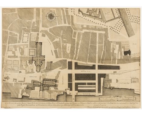
NO RESERVE London.- Lediard (Thomas) A Plan of Part of the Ancient City of Westminster, from College Street to Whitehall, and from the Thames to St. James's Park, engraved plan by Fourdrinier, on laid paper without watermark, sheet 515 x 725 mm (20 1/4 x 28 1/2 in), old folds and handling creases, minor splitting to the central right horizontal fold with associated discolouration, unframed, C. Fourdrinier & Co, [circa 1740 or slightly later]⁂ A variant engraved version of the present plan is held in the British Library, showing the finished road of Great George Street, along with the original manuscript plan which the present version corresponds to closely. The proposed Great George Street road is shown on the present map only in faint outline.
-
3964 item(s)/page