Rover manual Ten & Twelve 1945. Rover 1934-47 ‘P2’ models workshop manuals and spare parts list and lubrication chart. Morris Eight colour brochure and chart. Ford Popular ephemera. RAC folder of membership documents and international travel certificate 1957. Petrol Blow Lamps: Hints & Advice. C.W.S. Road Atlas. Quarter-Inch map of The Forth, Clyde and Tay. Ordnance Survey map East Anglia. Fougasse & McCullough A Complete Guide to the Road 1936 together with a framed colour print 'New York and Coney Island Cycle March Two-Step by E.T. Paull' (1896) and Cycling book of Maintenance.
We found 3970 price guide item(s) matching your search
There are 3970 lots that match your search criteria. Subscribe now to get instant access to the full price guide service.
Click here to subscribe- List
- Grid
-
3970 item(s)/page
John Senex - The Roads through England delineated or Ogilby's Survey Revised, Improved and Reduced to a Size Portable for the Pocket..., published John Bowles and Son, 1759, calligraphic title page, four pages of text and tables, general map of England & Wales, 101 (complete) uncoloured engraved strip road maps printed back-to-back, in later tooled vellum bindingBinding generally good, boards slightly bowed, very slight staining. A little browning to paper, contents are overall good. A few time stains throughout. P. 101 (final page) backed, strengthened with margin losses, a few tears to edges
Veteran sales brochures and ephemera,comprising Clement-Bayard Cars, for the American market, English text, ribbon tied card covers with six tipped-in sepia tone plates, large 8vo; Belsize Motor Cab 'Price list and Instruction Book', cord bound grey card covers, 32 numbered pages, 8vo; 1912 'Das Neue Phanomobil, embossed green card covers, 48 printed pages, 4to; (with two related photocopies); British School of Motoring booklet, 1914; a De Dion Bouton map Rouen-La Havre; a Carte-Guide Campbell No2 Northern France and Belgium showing Military front 1917-1918; 'Unic' road map of England and Wales 1912; and a reprint of a Stanley 1916 announcement. (Qty)Lot to be sold without reserve.For further information on this lot please visit Bonhams.com
Britain.- Bradshaw (George) Bradshaw's Map of Canals, Navigable Rivers, Rail Road &c. in the Midland Counties of England from Actual Survey, large-scale map centred on Birmingham, with decorative border and calligraphic title, engraving with bright hand-colouring, approx. 1380 x 1280 mm (54 1/4 x 50 3/8 in), dissected and mounted on linen, a clean bright impression with minor surface dirt, edged with green linen, some coming loose, folding into calf book-style slipcase, very worn, 8vo, 1830
Registration No: 758 XWB Frame No: VS5T0057985 MOT: ExemptMammoth creation by Retrospective Scooters, LondonSpecialised parts by Lino Brotto, Italian restoration master and fabricator for The Piaggio Museum.Now fully running with a V5C presentThe Vespa Six Day Racers Sei Giorni were the special Piaggio works race machines for the endurance race tournaments held back in the 1940's and early 1950's by all the big Italian two wheel manufacturers to prove that their bikes and scooters were tough and reliable. They would race them around Italy over the rough road surfaces (just after the war) and they they competed with Lambretta, but also Ducati, MV Augusta, Laverda, Moto Guzzi, Bianchi and many more. These six day racers were not any ordinary factory specification Vespa but an improved modified, strengthened and tuned scooter to combat the semi off road conditions, reliability being the key and make it to the end of that days course.This machine is an evocation of the very last version of the Sei Giorni with the 10" wheels and twin spare wheels. Retrospective Scooters of London used the chassis of a notably 1959 Douglas Vespa as the basis of the project. They actually flew to Italy to meet Lino Brotto, the famous restorer of many of the rarest Vespa models for the Piaggio factory museum. Lino provided many specialist parts needed to make a six-day racer replica and also showed them the skills required to replicate the bodywork of this special racer. The London Scooter Bodyshop undertook the mammoth task of moulding and metal fabrication of the frame into the specialist racer body shape adding special extra strength plates and leg shield shaping. Specialist parts include the long-range tank, map holder, spare wheel holders, shortened handlebars, side stand, seamless mudguard, strengthened swing arm, engine panel catches and holder, air intake and bash plates.The engine is a GS150 with an extra curved kickstart, special flywheel and cylinder cowling. We are informed that the scooter starts and runs 'like new' and is the ultimate copy of this iconic Vespa Factory racer of which there were only around 100 made. This was made with the intention to be an exact copy using the official book as a guide and copying it down to the last detail. For more information, please contact: Paul Diamond info@vintagescooters.co.uk 07768 313001
British Views and Landmarks Themed Cigarette Card Sets (23), all stored in plastic sleeves, all arms, badges, or sectional sets, Wills (6) all Borough Arms, includes series one scroll back unnumbered, Ogdens Sectional Cycling Map, Dexters Borough Arms, Stephen Mitchell, A Road Map of Scotland (50), Players (3) Ansties, (6), sectional sets, Churchmans Sectional Cycling Map, Millhoff Geographia, Lambert & Butler Find Your Way, includes Joker, all three versions, (3), F-VG, (23 Sets)
MAPS & EPHEMERA. Four small boxes, mainly folding maps, mainly early to mid 20th century; EBEL, [J. G.] An Atlas to Ebel's Traveller's Guide Through Switzerland, Samuel Leigh nd (early 19th century), 5 engraved plates (4 folding), 1 map hand coloured in outline, contemporary half calf, marbled boards, rubbed, paper label on spine, worn, rubbed, 8vo; BLACK's. Road & Railway Travelling Map of Scotland, Edinburgh nd (c. 1875), hand coloured, small 8vo; and many others later (qty)
OGILBY, John. A collection of four strip road maps: The Road from Salisbury to Campden; The Road from Glocester to Coventry; The Road from Oxford to Bristol; and The Road from Bristol to Banbury, circa 1675, each approximately 33.5cm x 44.5cm; and BELLIN, Jacques-Nicolas. Karte von der Hudsons Bay und Strasse, hand coloured engraved map, c. 1758, approx 21.3cm x 29cm, all unmounted (5)
Motoring Ephemera, approx. 30 pieces of motoring related items 19th to 21stC to include 'Motoring With Morris' UK road map, early maps (Cardiganshire, Europe), 1922 Ullswater Steam Yacht timetable, White Star Line menus, early Berkshire mileage calculator, petrol delivery notes, Shell invitations, pen and ink cartoon, advertising give-aways, 'The Worlds Railroads' published by Collins, 'An Illustrated Guide To Delhi', 1893 permission slip to visit Chatham Dock Yard, Railway Benevolent Fund charity pins and more (gen gd)
AA, O/S - A collection of maps and road atlases to include: AA 2024 large scale road atlas of Britain; O/S Landranger maps, One-inch maps and others; mounted on cloth road map of Manchester, Street Directory for Liverpool; Reading compass and others, AA badge (1945-1967) and a Bartholomew's Revised half inch contoured map of Cardigan mounted on cloth. (This does not constitute a guarantee) [L]
Ogilby (John) The Road from Oxford to Bristol,35 x 45cm together with Emanuel Bowen, 'A New and Correct Map of the Netherlands or Low Countries' 35 x 43cm, and Plan of Brussels: Brussels a large and beautiful City in the Dutchy of Brabant. c.1743. Hand coloured, mounted, framed and glazed, 38 x 48cm (3)
Robert Morden, The County of Monmouth, hand-coloured engraving sold by Abel Swale Awnsham & Iohn Churchil, 35 x 42, A New Map of Monmouthshire, map of The Road from Chester to Cardiff, three other maps, Edward J Cherry, Elizabethan Houses Holborn, etching, signed in pencil lower left, titled on artist's label verso, 16 x 17cm and Edward J Cherry, Houses of Parliament Westminster, etching, signed in pencil lower left, titled on artist's label verso, 14 x 16cm, all framed and glazed (8)
*Local Interest - After Alfred Wainwright (1907-1991, British), print, 'A Map of the County of Westmorland' with illustrations of High Cup Nick, Striding Edge, and Stock Ghyll Force, framed and under glass, measuring 53cm x 62cm, & 56cm x 64cm overall, together with an early 20th Century coloured map titled 'Pratt's High Test Map of the Great North Road' (2)
The Andy Chapman Collection1982 Laverda 981cc JotaRegistration no. LAB 521XFrame no. LAV.1000*7753*Engine no. 1000*7753*Blessed with one of the most evocative names in motorcycling history, the Jota was the bike that really put Laverda on the map. Its direct progenitor was the tuned version of the Italian firm's 3C triple - the 3C(E) - developed for production racing by the UK importer, Slater Brothers. The production Jota was both more highly tuned and quicker, its 140mph maximum making it the world's fastest road-going production motorcycle at the time of its launch for 1976. It was also pretty handy on the racetrack, winning the UK's Avon championship in 1976 and 1978 in the hands of Pete Davies. Few major changes were made to the Jota prior to 1982 when a heavily revised version was introduced, complete with a 120-degree crankshaft that made for a more even firing order than the original's 180-degree 'flat' crank. Today, the Jota is one of the most collectible of Italian classics, particularly the first '180' version. This '180' Jota comes with the all-important letter of confirmation from Slater Bros and has belonged to the vendor since 2018. Following a period of inactivity, the machine will require re-commissioning to a greater or lesser extent, or possibly more extensive restoration, before returning to the road and thus is sold strictly as viewed. Accompanying paperwork consists of sundry invoices, old/current V5C documents, and some expired MoTs.Offered with keyFootnotes:All lots are sold 'as is/where is' and Bidders must satisfy themselves as to the provenance, condition, age, completeness and originality prior to bidding.REQUEST A TRANSPORT QUOTEPlease click the link to request a transport quote from our recommended transport company, Moving Motorcycles.To request a UK or European shipping quote - Moving MotorcyclesTo request an International shipping quote - ShippioThis Lot will be auctioned on Saturday 12 October starting at 2pm GMT.For further information on this lot please visit Bonhams.com
The David Collier CollectionGalco Ducati 748cc Racing Motorcycle by Reed GalbraithRegistration no. unregisteredFrame no. noneEngine no. 750902 DM750•Commissioned from Reed Galbraith ('Galco') by David Collier in 1988•Very trick, believed c.1972, round case 750GT engine•Replica of the 1973 factory Formula 750 machine (see text)•One owner machine from new - and it has never been droppedAny motorcycle enthusiast around at the time will remember the 1972 Imola 200 when Paul Smart and Bruno Spaggiari took first and second place on their factory Ducatis, beating works machines from MV Agusta, BSA, Honda, and Triumph amongst others, as well as many top riders of the time, some of whom had turned down the invitation to ride for Ducati, a then slightly obscure Italian manufacturer. The race result was a huge shock which put Ducati firmly on the map, and from this point onwards they were regarded as genuine contenders. The 1972 Imola Ducati was a relatively lightly modified production machine, and for 1973 chief designer and technical director Fabio Taglione planned something altogether more ambitious. It featured a short stroke engine, different frame geometry, a shorter wheelbase which could be varied to suit different tracks courtesy of three different wheel spindle positions, more ground clearance, steeper forks, and a considerable weight reduction. However, by now the two stroke racing revolution was in full swing, and in the 1973 Imola race Bruno Spaggiari finished second behind the great Jarno Saarinen on a 351cc Yamaha. This was still an outstanding result for Ducati, but they recognized that the two strokes were only going to get stronger, and further development of the Formula 750 machines was abandoned. So the 1973 Imola machines represent something very special indeed in the Ducati story.One man who recognized this was David Collier. In 1988 he commissioned Reed Galbraith ('Galco') of Ravensdale near Seattle, a highly respected maker of lightweight racing Ducatis, to build a copy of the 1973 Formula 750 machines. Replicating the 1973 short stroke engine was not a realistic proposition, but a round case 750GT engine was extensively modified to make it significantly more powerful than the standard article. David tells us that the valve gear was converted to desmodromic operation, Imola cams were fitted, the inlet tracts were significantly modified to match Dell'Orto 41mm carburettors with their pump actions removed. The tracts were checked on Reed's flow meter for maximum CFM (cubic feet per minute). This radical porting required the oil feed to the cams to be modified to an external feed (like the 1973 factory short stroke engines). Twin spark plugs were fitted to reduce both flame path and ignition advance. The gear cluster was modified to 3 dog engagement, the clutch uprated, the total loss ignition system was custom made by Mistral Engineering, and the brakes are Lockheed Racing items. A number of exhaust systems were evaluated, with the currently fitted 'matched length' twin pipes giving the best results. A complete 'Imola' high level exhaust system supplied by Sid Tunstall in the USA comes with the bike.We understand that Galco frames were hand built by Reed Galbraith using TIG welded aircraft chrome-moly thin wall tubing (the Seattle area is of course a world centre of aviation expertise and technology). David tells us that that Reed Galbraith built only two 1973 replica frames. This one was left unpainted, the additional weight of paint being regarded as undesirable on a racing machine. The other frame was built into a road machine and is in a private collection of Galco twins and singles in Washington State, USA. David raced the Galco with success in northwestern USA in 1989, including first place in the vintage open class at the Seattle International Raceway. He then brought it home and campaigned it in CRMC F750 races which were hotly contested with such well known riders as Alex George, and in New Era, Kent Combine and Newmarket MCC events. He finished runner up in both the 'unlimited twins' and '750 classic twins' classes at the 1993 Newmarket Club Championships. Mick Hart was invited to ride it in some CRMC F750 races because David felt that Mick would be better able to take advantage of the Galco's superior handling, and this was borne out by results, with Mick always being the first twin home as well as achieving the odd outright win. We are told that Mick requested the current 'one down and four up' gearchange, but that it can be returned to 'one up and four down' within minutes. David advises that the Galco was easy to ride, especially in the wet, helped no doubt by its dry weight of approximately 370 lbs, and that it has never been dropped. It is accompanied by his very detailed notebook and race log which records his fastidious race preparation. He retired from racing at the end of the 1993 season, and the Galco has been stored in ideal conditions ever since. It has been recommissioned this year prior to this sale.We urge interested bidders to view the running video on our website. Such is his confidence in the machine that, subject to his health allowing it, David is happy to provide technical support and advice over the telephone to the new owner. This is a unique opportunity to acquire what David describes as 'a very special piece of kit'. It would be brilliant fun at appropriate trackdays or indeed for more competitive use, and is a thing of rare beauty. Prospective bidders should satisfy themselves as to the motorcycle's completeness and mechanical condition prior to bidding. Sold strictly as viewed.Key not requiredFootnotes:All lots are sold 'as is/where is' and Bidders must satisfy themselves as to the provenance, condition, age, completeness and originality prior to bidding.REQUEST A TRANSPORT QUOTEPlease click the link to request a transport quote from our recommended transport company, Moving Motorcycles.To request a UK or European shipping quote - Moving MotorcyclesTo request an International shipping quote - ShippioThis Lot will be auctioned on Sunday 13 October starting at 11am GMT.For further information on this lot please visit Bonhams.com
Cambridge and Huntingdon history. LAYARD (Dr) An Account of the Somersham Water in the County of Huntingdon, 1767, 8vo, half title, 31pp., modern boards; GOOCH (Rev.W) General View of the Agriculture of the County of Cambridge, 1811, 8vo, folding hand coloured map, plan, folding table, calf, rebacked; PARKINSON (R) General View of the Agriculture of the County of Huntingdon, 1813, 8vo, folding hand coloured map, folding plan, some spotting, ex library embossed stamp to first leaves, neat ink stamp to lower corner of title, half calf; An Act for repairing the road from 'Horsehsoe Corner, Godmanchester ... to Castle Street, Cambridge..' 1813, 8vo, modern boards; a small folding map by Walker, 1836; A Letter to the Freeholders of Huntingdonshire 1792, 17pp., modern boards; Description of ... Cambridge, [1790], 12mo, double page plan and 11 plates, half calf; 2 other maps of Huntingdonshire by Pigot and C. Smith (soiled), and 'Cambridge' by J W Clark, 1893, in prize binding (10)
Seven: Colour Sergeant A. A. Spooner, Queen’s Own Royal West Kent Regiment, who served throughout the Siege of Malta from June 1940 to November 1942 General Service 1918-62, 1 clasp, Palestine (6339672. Pte. A. Spooner. R.W. Kent. R.); 1939-45 Star; Africa Star; France and Germany Star; Defence and War Medals 1939-45; Army L.S. & G.C., G.VI.R., 1st issue, Regular Army (6339672 C.Sjt. A. A. Spooner. R.W. Kent. R.) nearly extremely fine (7) £160-£200 --- Arthur Albert Spooner was born on 31 August 1906 and attested for the Queen’s Own Royal West Kent Regiment at Warley in 1926. Gaining qualifications in map-reading at Guernsey and mathematics at Aldershot, he gained his 1st Class Army Certificate of Education in March 1932. Steadily promoted, he witnessed extensive service with the 2nd Battalion, his conduct being defined as ‘exemplary’. The recipient’s Army Service Record, adds: ‘This N.C.O. joined the Queen’s Own Royal West Kent Regt on 14th January 1926, and has completed 21 years’ service with the Colours. He has seen active service with the Regiment in Palestine and was present throughout the Siege of Malta. He has been a C.Q.M.S. since 1942 and has served in this unit (13th Infantry Training Centre) in that rank since 1944. He is a very loyal, conscientious and willing N.C.O., he always does his best and readily accepts responsibility. He is a quick and accurate worker and thoroughly reliable. I can recommend him for a position of trust to any future employer with the greatest confidence. 10 Jan. 1947.’ Released from service, Spooner returned home to 7 Tufton Street, Maidstone, Kent. He later took his retirement at 26, Pedlescombe Road North, St. Leonard’s on Sea, Sussex. Sold with a Royal West Kent silver shooting Medal, the reverse engraved ‘Pte. Spooner. 3rd Bn Rifle Meeting 1931 Class B. Event 4.’; and copied service record.
Senex (John). The Roads Through England Delineated or, Ogilby's Survey, revised, improved, and reduced to a size portable for the pocket..., London: John Bowles and Son, 1757, calligraphic title, preface, tables and index, general map of England & Wales, 101 (complete) uncoloured engraved strip road maps, the final map a little toned, title, preface, index, tables and the first 22 maps with the foredge strengthened in later brown tape, later endpapers, early 20th-century limp suede with blindstamped title to the upper cover, retaining silk ribbon tie, oblong 8voQTY: (1)NOTE:Chubb. CCXI
The Anthony William Walter Gass Collection, born 1918, WWII RAF Bomber Squadron in Japan, India, and China, to include a Japanese 'Hinomaru' Prayer Flag, white silk with red sun surrounded by prayers and signatures of friends and family, a traditional gift for Japanese servicemen deployed during WWII, a piece of Japanese plane shrapnel, an inscribed road map of India, a cloth patch with RAF Bomber Squadron insignia, a Royal Air Force India 1942 card, RAF service and relief book, photographs, papers, and magazine clipping on POWs. (12).
Mitchell, S(amuel) August. A Route-Book. Adapted to Mitchell’s national map of the american republic; comprising tables of the principal rail-road, steam-boat and stage routes, throughout the United States. 46 S., 1 w. Bl. Mit einer losen mehrfach gefalteten und kolorierten Karte. 12,5 x 8 cm bzw. 87,5 x 64,5 cm (Karte). Blindgeprägtes Leder d. Z. (berieben, leicht bestoßen; OInterimseinband eingebunden) mit goldgeprägtem VDeckeltitel und einer intakten Messingschließe. Philadelphia, Selbstverlag, 1846.Sabin 49714. - Der amerikanische Geograph Samuel August Mitchell (1790-1868) wurde bei seiner Arbeit als Lehrer auf die schlechte Qualität der geografischen Ressourcen, die den Lehrern zur Verfügung standen, aufmerksam und gründete nach seinem Umzug nach Philadelphia einen Verlag und gab Schulatlanten, Lehrbücher, Karten, Reiseführer u. a. heraus. - Die Karte und der Block von dem Einband gelöst, anfangs stockfleckig. Mit zeitgenössischem Besitzvermerk auf dem fl. Vorsatz. Die Karte etwas fleckig, mit mehreren hinterlegten Fehlstellen und Einrissen in frischem Kolorit.
Gentleman’s Magazine and Historical Chronicle, for January to Dec 1743; in original half leather spine intact but lacking covers, intact text. 706 pps plus index. volume thirteen. Contains description of Greenland; Irish Cattle; America; news from Sweden; register of books; Samuel Johnson's 'Debates in the Senate of Lilliput' and poems by Samuel Boyse and William Dunkin; Spanish Ships captured. and much more in its 706 pages; missing covers but spine and text intact. Gentleman’s Magazine and Historical Chronicle: 1755 January to December (including Index and Supplement), [4], 595 pages, [25], 23 engraved plates with titles (including frontispiece, 5 folding plates, Map of British and French Settlements in North America, Map of the World on Mercators Projection, Plan of the Intended New Road from Padington to Islington), folding page of shells, colour page of coach whipsnake, and much more; title page with central illustration (including engraving in text to first page of each monthly edition, tables and illustrations in text throughout), variety of subject matter (including Music, Meteorlogical Diary, Price of Corn, Poetry, Sketches, Country News, Obituaries, Taxes), covers missing but spine and text intact. Two rare issues full of interest. (2)
John Ogilby - hand coloured strip map - "The Road from London to Chichester......" 37 x 50 cm, mounted, Hand coloured engraved map of A New and Correct Map of England and Wales, From the Latest and Best Improvements, engraved for Mrs Moore's New and Complete Collection of Voyages and Travels, 22.7cm x 33cm Christopher Saxton (1540- 1610) & William Kip (1588-1635), a hand coloured engraved map of Flint, Comitatus quem Ordovices olim Incoluerunt, circa 1637 , 40cm x 33cm overall Christopher Saxton (1540- 1610) & William Kip (1588-1635), a hand coloured engraved map of Bedford, Comitatus olim pars Cathifuclanorum, circa 1607, 39.7cm x 33.3cm (4)
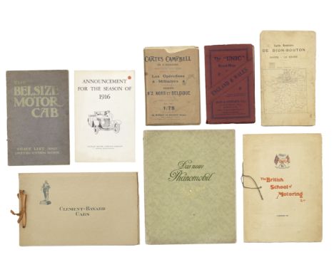
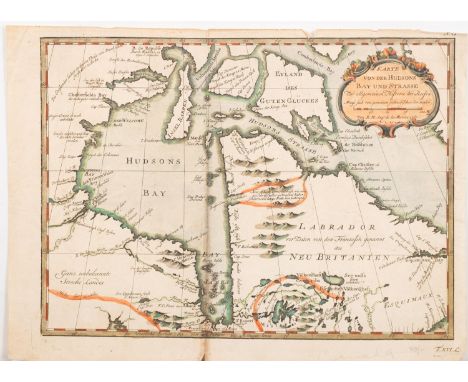
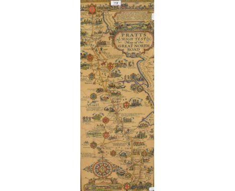
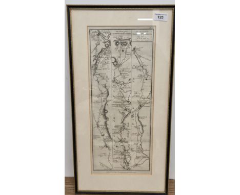
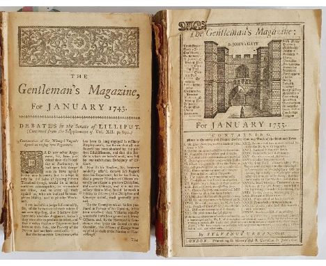
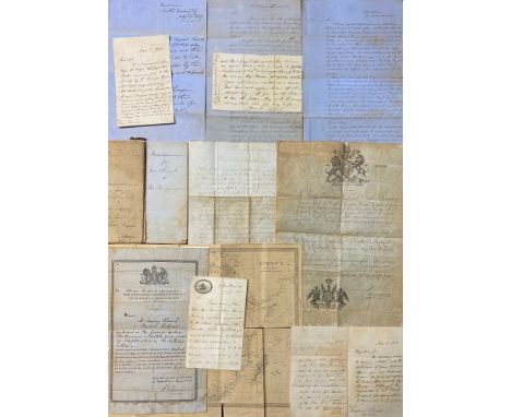
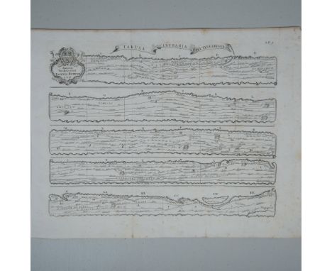
Australasia. Handbooks of New Zealand, an institutional sammelband of nine titles, comprising 1) Dadelszen (E.J. von, Registrar-General, compiler), Statistical View of Fifty Years' Progress in New Zealand, 1856-1905. Wellington: By authority: John Mackay, Government Printer, 1906, 10pp, original wrappers, 2) [Papua], [MacGregor (Sir William)], Handbook of Information for Intending Settlers in British New Guinea. Brisbane: James C. Beal, Government Printer, 1892, [vi], 34pp, folding map, damaged and repaired, bound-in ALS, original upper-wrapper only, 3) Greater Britain Exhibition, Earl's Court, London, 1899: Catalogue of Exhibits in the Queensland Court, 94pp, original wrappers, 4) Byrnes (The Hon. T. J. Byrnes, Attorney-General of Queensland), An Address, London: Wartlow and Sons Limited, 1897, 15pp, original wrappers, 5) Dadelszen (E.J. von, Registrar-General, compiler), Statistical View of Fifty Years' Progress in New Zealand, 1855-1904. Wellington: John Mackay, 1905, 10pp, original wrappers, 6) Reeves (The Hon. W.P., Agent-General for New Zealand), The Fortunate Isles (Picturesque New Zealand), Wellington: John Mackay, 1897, 24pp, plates and folding map, original wrappers, 7) Wohlmann (A.S.), The Mineral Waters and the Health Resorts of New Zealand: Part I - Rotorua, Wellington, John Mackay, 1905, 48pp, original wrappers, 8) New Zealand, magazine, s.l., s.n., n.d., & 9) Berry (The Rev. Joseph), New Zealand: At the Beginning of the Century, 1901 off-print, 73-104pp, adverts, original wrappers, the whole collection prefixed by Thomas Humphries' map of New Zealand, n.d. [late 19th c], repaired, 60.5 x 102cm, early 20th c institutional red cloth binding, their bookplates and stamps in places, 4to; Pamphlets on New Zealand, an institutional sammelband of five titles, comprising 1) Facts about New Zealand, n.d., folding map, original wrappers, 2) The Rotomahana Road Trip, Wellington, 1907, original wrappers, 3) Loughnan (R.A.), The First Gold Discoveries in New Zealand, Wellington: John Mackay, 1906, 110pp, original wrappers, 4) New Zealand: Department of Labour: Its Organization and Work, Wellington: John Mackay, 1907, 32pp, folding map, original wrappers, & 5) Handbook to the Labours Laws of New Zealand, Wellington: John Mackay, 1906, 61pp, original upper-wrapper only, with a folding letterpress table on Crown Lands and their settlements, repaired, early 20th c institutional green cloth binding, their bookplates and stamps in places, 8vo; Laurie (J.S.), The Story of Australasia [...], with a map, London: Osgood, McIlvaine & Co., 1896, ex-lib binding and some neat stamps, 8vo; Sorenson (Edward S.) & Selden (H, illustrator), Life in the Australian Backblocks, London: Whitcombe & Tombs, Limited, 1911, frontispiece, in-text illustrations, original cloth, 8vo, (4)
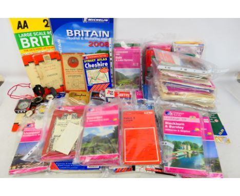
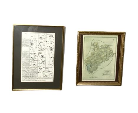
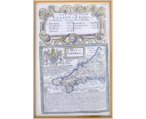
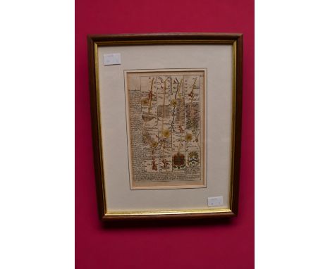
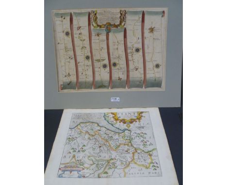
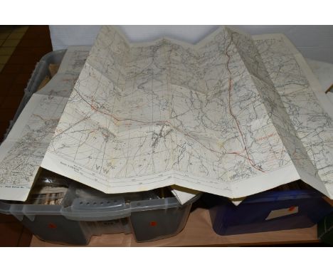
An Edwardian Pair of Cased Sets of Bartholomew's Road Maps for England and Wales and Scotland, in brown crocodile skin cases, each with brass lock and catches, initialled 'J.W' to lids, the interiors compartmentalised with linen-backed folded maps, 37 for England and Wales and 29 for Scotland (each case missing the contour map book), with measuring wheels and keys.
AFRICA & AMERICA. TRAVEL & EXPLORATION. An archive of manuscript correspondence & documents comprising: a passport for James Church to conduct a "journey of exploration in the interior of Africa", departing from the Pashalic of Tripoli to Central Africa, signed by George Frederick Herman, 11 June 1853; an uncoloured steel-engraved map of Africa published by George Cox, 1 January 1853, worn, 35 x 40cm; a passport for James F. Church to travel to Central America on the Public Service, 21 September 1857, lithographic signature of the Earl of Clarendon; an Autograph Letter Signed by Trelawny Saunders [Fellow of the Royal Geographical Society], 3 January 1855, on RGS letterhead, relaying information from Dr. Vogel & Dr. Barth [Eduard Vogel & Heinrich Barth, notable German explorers of Africa], "Macguire [John Maguire] does his utmost to assist me, and is making likewise accurate observations with the compass on the road. He is still tolerably weak and suffers greatly from erysipelas on both his feet, besides the sun has terribly burnt him in such a degree, that the skin is hanging down in pieces from his face & neck...He told me that Church had tried till the last moment to persuade him to return home likewise, and to leave me alone."; ALS by Trelawny Saunders on RGS letterhead to James Church, 17 June 1856, "The secretary wishes to know, whether with the permission of your Superior Officers, you are disposed to join the proposed expedition to Eastern Africa under Captain Burton [Sir Richard Francis Burton].", plus a note concerning Vogel's allegations of secret correspondence, ungentlemanly conduct and extortion, and another letter, 14 August 1856, indistinctly signed, "I mentioned to Captain Burton, who called here to-day, the fact of your having objected to form one of the party, and he was very sorry to be deprived of your services," and then requesting that Church visit Colonel Sykes at East India House; ALS by John Maguire, headed Kuka [capital of Bornu, Nigeria], 5 November 1856, "I thank the Lord I am still alive and likely to live to say farewell to this damnable country of filth and fanaticks...Dr Vogel left here for Wadai on the 1st day of this year from which place he has never returned and report says he was murdered two days from Wara the Capital"; ALS by George Frederick Herman, 1 June 1853, being a lengthy expedition memorandum for James Church & Edward Sweeney on 14pp, and a shorter memorandum similar, 26 July 1853, for Church & Maguire; ALS by James Church, 11 July 1856, a lengthy letter defending his own good conduct during the expedition into Central Africa, and outlining the poor conduct of others, including Dr Vogel who "spent several hours a day in company with a female who was the slave of his servant Massoud, by whom he was said to have been purchased for 80 dollars"; a manuscript copy of a character reference for James Church, Royal Engineers, 1868-69, describing his expeditions, including his role as photographer in Central America to determine the feasibility of constructing a railroad across the continent; ALS by Charles Thurston Thompson [early British photographer], 29 July 1859, attesting to James Church having studied photography under his direction; correspondence to James Church on British & Foreign Anti Slavery Society letterhead, 11 January 1856, "I have received & laid before the Committee the interesting narrative of your visit to the interior of Africa, & the Committee think it would do good were it published in our Reports. As there are statements in it, however, implicating Drs Barthe & Vogel in slave-trading, the Committee deem it desirable to have your permission to publish the same, which I therefore now solicit on their behalf." (14)
A Framed Display of Three First World War French Medals, comprising Inter-allied Victory Medal, Combatant's Cross and Commemorative War Medal, awarded to Monsieur Justin Larroque of the 125th Infantry Regiment, mounted with the citation; a First World War Parliamentary Recruiting Committee Poster "We are fighting for a worthy purpose, and we shall not lay down our arms until that purpose has been fully achieved". THE KING. MEN OF THE EMPIRE TO ARMS. GOD SAVE THE KING. Printed in red and blue, 74cm by 49cm; a Small Quantity of Ephemera, including U.S. Army Road Map of Germany, Air Raid Precautions handbooks, Aircraft Classified, Picture Post etc.
TWO BOXES OF APPROXIMATELY FOUR HUNDRED ORDNANCE SURVEY GREEN PATHFINDER AND OUTDOOR LEISURE MAPS, covering England and Wales, two 1950s Ordnance Survey road maps of Great Britain, a 1948 Geological Survey 'Ten Mile' map of Great Britain (sheet one), a 1922 Pratt's road atlas of England and Wales, etc. (s.d) (2 boxes)
TWO BOXES OF VINTAGE AND ANTIQUE MAPS, to include Ordnance Survey One-Inch, Contoured Road, Geological Survey, Town, District and Tourist maps, Bartholomew's maps, a 1918 map of German trenches in The Somme, France, an 1841 Walker's Map of North Wales, a John Bartholomew LMS map of England & Wales, A Hunt Map of England & Wales 1880, an AH Swiss Hunting Map No 7, a 1930 Map of XVII Century England, The War Office Notes on Map Reading 1939, AA, RAC and other motoring maps, Lightning Road Maps, Military Map Reading for the New Army 4th imp 1940, George Philip & Son The Navy League Sea and Air Map of the World, etc (2 boxes) (sd)
Etching print attributed from book titled Travels, or Observations Relating to Several Parts of Barbary and the Levant by Thomas Shaw. Print depicts The Peutinger Map which displays the road network of the Roman Empire. The heraldic cartouche on the top left corner reads, Auspiciis Viri Reverendi Ioannis Burton S.T.P. Issued: 18th c. Dimensions: 18"W x 13.75"HCondition: Age related wear.
Senex (John), "The Roads through England delineated, or Ogilby’s Survey, Revised, Improved and Reduced to a size Portable for the Pocket.....", Publ. John Bowles, 1762, eng. calligraphic title page, 8 pps. of text and tables, engraved map of England & Wales and 101 (complete) uncoloured engraved strip road maps, each plate impression 16.5cm x 21.5cm, printed back to back, in (depleted) soft covers, 18cm x 24.5cm
Indian Mutiny. Camp near Cawnpore [and] The Capture of Lucknow by Sir Colin Campbell, 1857, two ink and watercolour manuscript plans showing in detail the siege of Cawnpore and the capture of Lucknow by Sir Colin Campbell, very slight spotting, each 115 x 210 mm and 135 x 210 mm respectivelyQTY: (2)NOTE:Sir Colin Campbell assumed command of the Bengal Army in July 1857. He had to fight his way up the Grand Trunk Road, before arriving in Cawnpore on 3 November. The second map annotates and shows Campbell's route into Lucknow before the final siege and relief in March 1858. These maps appear to have been drawn by an eyewitness to the siege and relief of the city.
Le Rouge (George Louis). Nouvel Atlas D'Angleterre Divisé en ses 52 Comtea avec toutes les Routes Levées Topographiquement..., published by L. C. Desnos, Paris, 1767, decorative title with late 18th-century ownership signature (dated 1791) and an ink monogrammed stamp (MC), key map of the southern half of England and Wales and twelve corresponding double page regional maps, all with contemporary wash colouring, additional half-title of 'The Roads through England or Ogilby's Survey Revised, Improved and Reduced by Senex...,' title repeated in French, four pages of indices and routes, a general map of England and Wales and 101 uncoloured engraved strip road maps with blank versos, additional decorative title 'Recueil des Villes Ports D'Angleterre, published by L. C. Desnos, 1766, double-page table relating to a plan of London, reticulated double-page map of London, map of the mouth of the Thames, 26 maps and plans (on 16 sheets) of cities and ports in the British Isles, old library stamp to verso of rear endpaper, signed in pencil on the front endpaper by E. G. R. Taylor, old library book plate of Birkbeck College to the front pastedown with a typed inscription 'Presented by the Late Professor E. G. R. Taylor', the bookplate overstamped 'Sold at Sotheby's 1990', 20th-century half cloth over marbled boards, 4toQTY: (1)NOTE:Chubb. CXLIII.Professor E. G. R. Taylor was a leading 20th-century authority on maps and cartography.George Louis Le Rouge was a military engineer and cartographer. The first part of this volume is a French edition of 'An Actual Survey..., of the Principal Roads' by John Senex, which was first published in London in 1719. Published in French in 1759, the plates appear to have passed into the hands of the publisher Louis Charles Desnos. This volume is three books bound as one, each with a title page.
British Isles. Ortelius (Abraham), Angliae, Scotiae et Hiberniae sive Britannicar: Insularum Descriptio, published Amsterdam, [1573], hand-coloured engraved map orientated to the west, 345 x 500 mm, Latin text on verso, together with, Mercator (Gerard), Southern Scotland, La Seconde Table D'Ecosse (title on verso), circa 1630, hand-coloured engraved map, large margins, 350 x 455 mm, French text on verso, with, De Vaugondy (Robert), Royaume D'Irlande divisé en ses quatre Provinces et Subdivisé en Comtés, published Paris, 1750, hand-coloured engraved map, old folds, slight creasing, short split at the base of the central fold, repaired on verso, 495 x 550 mm, plus Jansson (Jan). Provincia Ultoniae The Province of Ulster, published Amsterdam, circa 1650, engraved map with contemporary hand-colouring, some creasing, adhesion scaring causing loss to the printed surface of the cartouche, central fold strengthened on verso, 385 x 490 mm, French text on verso, and Saxton (Christopher & Hole G.). Universi Derbiensis Comitatus qui olim Coritanorum suit descriptio, [1607], hand-coloured engraved map, large strapwork cartouche, mileage scale and compass rose, slight text show through, 285 x 315 mm, Latin text on verso, mounted, framed and double-glazed, with another 28 regional and road maps, town plans and county maps, including examples by or after Moule, Archer, Lewis, Dawson, Ogilby (damaged), Rapin/Basire and Owen & Bowen, seven mounted, various sizes and conditionQTY: (32)NOTE:Marcel van den Broecke. Ortelius Atlas maps, number 16 for the first item.

-
3970 item(s)/page