Affinez votre recherche
Filtered by:
- Catégorie
- Liste
- Grille
A subscription to the Price Guide is required to view results for auctions ten days or older. Click here for more information
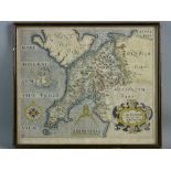

SAXTON & HOLE COLOURED & TINTED MAP of Caernarvonshire, 27 x 32 cms
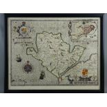
JOHN SPEED coloured & tinted map of Anglesey - Sudbury and Humble edition, good margins, glazed
JOHN SPEED coloured & tinted map of Anglesey - Sudbury and Humble edition, good margins, glazed verso, 41.5 x 53.5 cms including margins
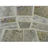
Maps (Lots 78 to 82 all unframed) - THIRTEEN MAPS OF THE COUNTIES OF WALES (four coloured and
Maps (Lots 78 to 82 all unframed) - THIRTEEN MAPS OF THE COUNTIES OF WALES (four coloured and tinted) by Saxton & Kipp, Saxton & Owen etc, all app...
NINE CIRCULAR MAPS by J LUFFMAN from a New Pocket Atlas 1803, the Counties of Wales, each map of 6
NINE CIRCULAR MAPS by J LUFFMAN from a New Pocket Atlas 1803, the Counties of Wales, each map of 6 cms diameter with legend below
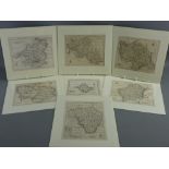
SEVEN VARIOUS UNCOLOURED BUT MOUNTED MAPS of the Counties of Wales, all approximately 16 x 20 cms
SEVEN VARIOUS UNCOLOURED BUT MOUNTED MAPS of the Counties of Wales, all approximately 16 x 20 cms
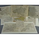
A PARCEL OF NINE MAPS OF COUNTIES OF WALES, majority uncoloured including a half sheet map of
A PARCEL OF NINE MAPS OF COUNTIES OF WALES, majority uncoloured including a half sheet map of South Wales by E BOWEN and a coloured and tinted map...
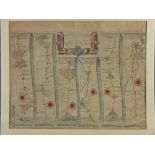
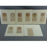
A COLOURED & TINTED ROAD MAP by JOHN OGILBY from Presteigne (Prestaine) to Carmarthen, 34 x 44 cms
A COLOURED & TINTED ROAD MAP by JOHN OGILBY from Presteigne (Prestaine) to Carmarthen, 34 x 44 cms