Filtered by:
- Catégorie
- Liste
- Grille
A subscription to the Price Guide is required to view results for auctions ten days or older. Click here for more information
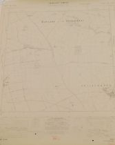

A group of Lincolnshire provincial O/S maps mainly Grantham and surrounding area, circa 1956 and 195
A group of Lincolnshire provincial O/S maps mainly Grantham and surrounding area, circa 1956 and 1958, and newer editions to include Skegness, Alf...
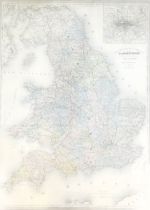
A 20thC framed map of England, in French, inscribed ABELPILOM Paris, 85cm x 61cm, framed and glaze
A 20thC framed map of England, in French, inscribed ABELPILOM Paris, 85cm x 61cm, framed and glazed.
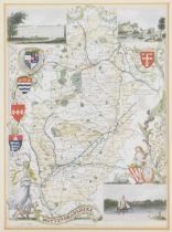
A reproduction framed map of Nottinghamshire, depicting Worksop Manor and Nottingham Castle, later c
A reproduction framed map of Nottinghamshire, depicting Worksop Manor and Nottingham Castle, later coloured, 25cm x 18cm, in gilt frame.
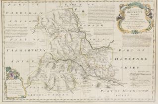
An 18thC county map of Brecknockshire, by Thomas Kitchin, with coloured emblems, 37cm x 55cm,
An 18thC county map of Brecknockshire, by Thomas Kitchin, with coloured emblems, 37cm x 55cm, framed.
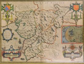
John Speede. An 18thC hand coloured map of Merionethshire, dated 1610, 39cm x 50cm, framed.
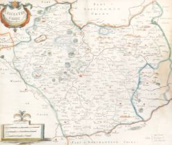
Robert Morden. A framed 19thC map of Leicestershire, hand coloured, 36cm x 40cm, framed and glazed.
Robert Morden. A framed 19thC map of Leicestershire, hand coloured, 36cm x 40cm, framed and glazed.
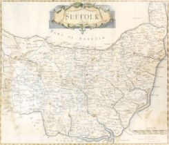
Robert Morden. A framed map of Suffolk, later coloured, 35.5cm x 42cm, framed.
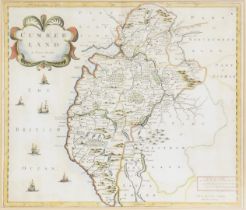
Robert Morden. A framed map of Cumberland, dated 1695, hand coloured, 37cm x 40cm, framed.
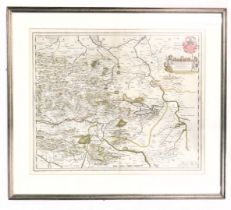
A 17thC Blaeu framed map, of Mansfelt, bearing crest, signed Anud Guihelm Blau, 43cm x 52cm, framed.
A 17thC Blaeu framed map, of Mansfelt, bearing crest, signed Anud Guihelm Blau, 43cm x 52cm, framed.