Affinez votre recherche
Filtered by:
- Sale Section
- Liste
- Grille
A subscription to the Price Guide is required to view results for auctions ten days or older. Click here for more information
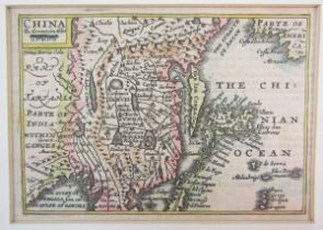

John Speed (1552-1629), pocket-sized/miniature partially coloured map of China accompanied by four
John Speed (1552-1629), pocket-sized/miniature partially coloured map of China accompanied by four same-sized pages, circa 1666, printed on both s...
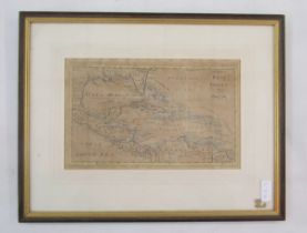
Partially hand coloured map of The West Indies, plate CCLV, inscribed 'Encyclopeadie Brittanica
Partially hand coloured map of The West Indies, plate CCLV, inscribed 'Encyclopeadie Brittanica 1797' verso, 29cm x 18.5cm exc. frame
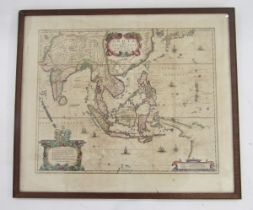
Map - Henricus Hondius (1597-1651), hand-coloured map - ‘India quae Orientalis dicitur et Insulae
Map - Henricus Hondius (1597-1651), hand-coloured map - ‘India quae Orientalis dicitur et Insulae Adiacentes’, c. 1636, 39cm x 49cm double sided f...
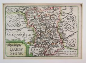
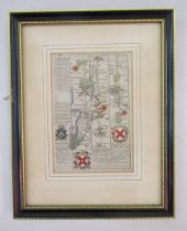
John Speed (1552-1629), pocket-sized/miniature partially coloured map of 'Darbyshire' accompanied by
John Speed (1552-1629), pocket-sized/miniature partially coloured map of 'Darbyshire' accompanied by two same-sized pages, printed on both sides a...
STRIP MAPS - Hand coloured engraved road map from London Wellen, Crayford to Gads Hill and Raynham
STRIP MAPS - Hand coloured engraved road map from London Wellen, Crayford to Gads Hill and Raynham to Rochester, by E. Brown, circa 1720, with the...

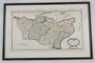
Robert Morden (1650-1703), hand coloured engraved map of Kent, 36cm x 64.5cm
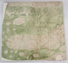
Two reproduction sections of the Gouch map, mounted on board, together with a copy of The Map of
Two reproduction sections of the Gouch map, mounted on board, together with a copy of The Map of Great Britain, circa A.D. 1360, Known as Gouch Ma...
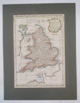
Hand coloured engraved map of A New and Correct Map of England and Wales, From the Latest and Best
Hand coloured engraved map of A New and Correct Map of England and Wales, From the Latest and Best Improvements, engraved for Mrs Moore's New and ...
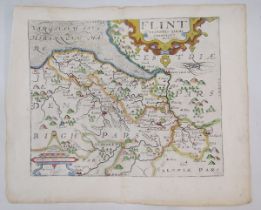
Christopher Saxton (1540- 1610) & William Kip (1588-1635), a hand coloured engraved map of Flint,
Christopher Saxton (1540- 1610) & William Kip (1588-1635), a hand coloured engraved map of Flint, Comitatus quem Ordovices olim Incoluerunt, circa...
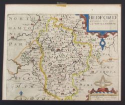
Christopher Saxton (1540- 1610) & William Kip (1588-1635), a hand coloured engraved map of Bedford, Comitatus olim pars Cathifvcanorvm, circa 1607...
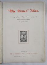
The Times Survey Atlas of the World, JG Bartholomew, 1922, two volumes (poor condition). Quantity
The Times Survey Atlas of the World, JG Bartholomew, 1922, two volumes (poor condition). Quantity loose maps including Europe, Asia, East India is...
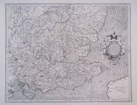
Gerhard Mercator, an engraved map of Southeast England, late 16th century or later, black and white,
Gerhard Mercator, an engraved map of Southeast England, late 16th century or later, black and white, inscribed with (in Latin) the SE Counties, pr...
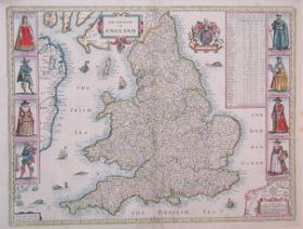
Christopher Saxton (1540-1610) and John Speed (1552-1629), engraved by Abraham Goos, Amsteloda,
Christopher Saxton (1540-1610) and John Speed (1552-1629), engraved by Abraham Goos, Amsteloda, 1646, a hand coloured engraved map of The Kingdome...
Sebastian Munster, an engraved map of England (German), on its side, titled 'Anglia Engelandt...',
Sebastian Munster, an engraved map of England (German), on its side, titled 'Anglia Engelandt...', circa 1588, 39.5cm x 32.7cm
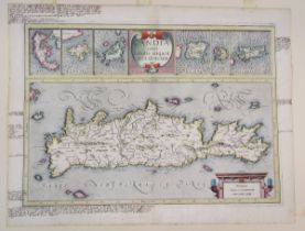
Gerard Mercator, hand coloured engraved map of Crete and Greek Islands, late 16th century or
Gerard Mercator, hand coloured engraved map of Crete and Greek Islands, late 16th century or later, showing six smaller Greek Islands, annotated i...
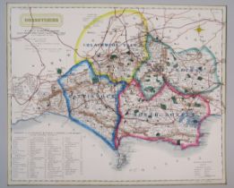
Coloured map of Dorsetshire by J. & C. Walker, listing polling places and places of foxhound
Coloured map of Dorsetshire by J. & C. Walker, listing polling places and places of foxhound meets, mounted, 39cm x 32cm

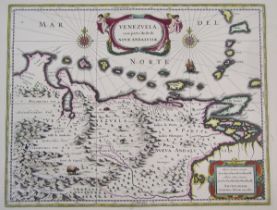
Guiljelmus Blaeuw, hand coloured engraved map of Venezuela, 17th century, inscription verso in
Guiljelmus Blaeuw, hand coloured engraved map of Venezuela, 17th century, inscription verso in French of Venezuela, 60.5cm x 51cm
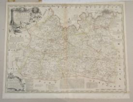
E Bowen & T. Kitchin, a partly coloured engraved map of Surrey, a double page from The Large English
E Bowen & T. Kitchin, a partly coloured engraved map of Surrey, a double page from The Large English Atlas, published by Weinreb & Douwman, circa ...
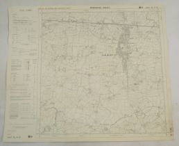
Four ordnance survey maps of Surrey: Lower Bourne, Surrey, Surrey Dockenfield, Peper Harrow, Kent
Four ordnance survey maps of Surrey: Lower Bourne, Surrey, Surrey Dockenfield, Peper Harrow, Kent Staplehurst, Bartholomew's New Reduced Survey Co...
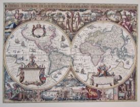
Two reproduction maps, comprising: Map of the World, possibly after Joannes Jansonius, Amsterdam,
Two reproduction maps, comprising: Map of the World, possibly after Joannes Jansonius, Amsterdam, and another after Saxton's map of SE Counties, p...