Lot 41
Ordnance Survey of Scotland:
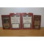
Ordnance Survey of Scotland: Complete set. 92 colour maps , each dissected into 4 sections laid on linen, with numbering tabs, preserved in...
Ordnance Survey of Scotland: Complete set. 92 colour maps , each dissected into 4 sections laid on linen, with numbering tabs, preserved in...
SIX BOXES OF BOOKS AND EPHEMERA, to include a school exercise book belonging to a George Picker, who went to Leadenham School, dated October 26th ...
Ordnance Survey of England and Wales: Complete set of the 7th Series. 190 one-inch colour maps , each dissected into 6 sections laid on li...
Two David & Charles reprints of Ordnance Survey maps illustrating Kendal, & Lancaster & Blackpool, together with two others illustrating Lancaster...
A handcoloured map of Helstone, two handcoloured maps of field boundaries in the Helston area, a copy map of the River Fal, various Helston relat...
A collection of Ordnance Survey maps, all early 20th Century examples, including Inverurie and District, Burns Country, Berks & Wilts, Barmouth & ...
A carton of assorted Ordnance Survey Maps mainly UK.
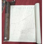
Two rolled Ordnance Survey maps from the parish of Shipmeadow, Suffolk, dated 1884, in metal canister
Box of Military, Antique Ordnance Survey and Hydrographic Office Nautical/Maritime Navigation Maps
Ordnance Survey maps: to include 'Somerset'
An Ordnance Survey Map, Sheet SD37, illustrating Cartmel Sands and surrounding area, scale 1:25,000, framed and under glass, measuring 45cm x 55cm...
20th Century English School. "Map of London" edition of 1920, Sheet K, Map, Published by Ordnance Survey Office, unframed, 24" x 36" (61 x 91.5cm)
A small selection of vintage Ordnance Survey maps and similar covering Britain and Europe.
A collection of 1991 Ordnance Survey Bicentenary Stamp Issue First Day Covers, Limited Edition of 1000, specially franked and stamped, all with ha...
Maps (2) including a Kelly's Map of Lincolnshire and an Ordnance Map of Great & Little Massingham