Reserve not met No Image Lot 660 Speed, John 1627 England, Wales, Scotland and Ireland with fronttispiece, distance tables and 63 660Speed, John 1627 England, Wales, Scotland and Ireland with fronttispiece, distance tables and 63 Unique Auctions Speed, John 1627 England, Wales, Scotland and Ireland with fronttispiece, distance tables and 63 maps - has a tear to page on Caernavonshire - a v... Add to watchlist Timed
Reserve not met No Image Lot 212 Bowen 290 Yrs Old Detailed Road Map Whitby to Durham Newcastle North East. 212Bowen 290 Yrs Old Detailed Road Map Whitby to Durham Newcastle North East. William George Title: Bowen 290 Yrs Old Detailed Road Map Whitby to Durham Newcastle North East. Description: Bowen 290 Yrs Old Detailed Road Map ... Add to watchlist Timed
No Image Lot 837 John Speed 17th century engraved map of Africa 837John Speed 17th century engraved map of Africa Reeman Dansie John Speed 17th century engraved map of Africa, engraved by Abraham Goos, English text verso, plate 40 x 52cm Add to watchlist Live
No Image Lot 1386 TWO LEATHER CASES OF JOHNSTONS THREE MILES TO INCH MAPS, ONE CONTAINING MAPS OF SCOTLAND AND THE 1386TWO LEATHER CASES OF JOHNSTONS THREE MILES TO INCH MAPS, ONE CONTAINING MAPS OF SCOTLAND AND THE JS Fine Art Auctioneers & Valuers TWO LEATHER CASES OF JOHNSTONS THREE MILES TO INCH MAPS, ONE CONTAINING MAPS OF SCOTLAND AND THE OTHER OF ENGLAND AND WALES Add to watchlist Live
No Image Lot 846 John Speed 17th century engraved map - Britain as it was Devided in the Tyme of the English Saxons 846John Speed 17th century engraved map - Britain as it was Devided in the Tyme of the English Saxons Reeman Dansie John Speed 17th century engraved map - Britain as it was Devided in the Tyme of the English Saxons especially during their Heptarchy, sold by Bass... Add to watchlist Live
No Image Lot 831 John Speed - 17th century engraved map - The Kingdom of China 831John Speed - 17th century engraved map - The Kingdom of China Reeman Dansie John Speed - 17th century engraved map - The Kingdom of China, sold by Baskett and Chiswell, English text verso, plate 40 x 51cm Loss to margins... Add to watchlist Live
Reserve not met No Image Lot 53 Jan Huygen Van & Hendrik Floris Van Langren: 53Jan Huygen Van & Hendrik Floris Van Langren: Sworders Timed Jan Huygen Van & Hendrik Floris Van Langren: LINSCHOTEN, Deliniantur in hac tabula, Orae Maritimae Abexiae, freti Mecani; al Maris Rubri; Ara... Add to watchlist Timed
No Image Lot 832 John Speed - 17th century engraved map of Asia 832John Speed - 17th century engraved map of Asia Reeman Dansie John Speed - 17th century engraved map of Asia, sold by Baskett and Chiswell, with English text verso, plate 40 x 51cm Add to watchlist Live
No Image Lot 844 John Speed - 17th century engraved Map of America, dated 1626 (but 1676 844John Speed - 17th century engraved Map of America, dated 1626 (but 1676 Reeman Dansie John Speed - 17th century engraved Map of America, dated 1626 (but 1676), sold by Baskett and Chiswell, pen inscriptions to margin, English text v... Add to watchlist Live
No Image Lot 840 John Speed -17th century engraved map of British Isles 840John Speed -17th century engraved map of British Isles Reeman Dansie John Speed 17th century engraved map of The British Isles, English text verso, plate 41 x 50cm Add to watchlist Live
No Image Lot 835 John Speed - 17th century map of Europ and the chiefe Cities contayned therin ... 835John Speed - 17th century map of Europ and the chiefe Cities contayned therin ... Reeman Dansie John Speed - 17th century engraved map of Europ and the chiefe Cities contayned therin ..., pen inscriptions to the margins, English text verso, p... Add to watchlist Live
No Image Lot 89 JOHN SPEED coloured 1610 copper engraved map - entitled in cartouche 'Caermarden, Both Shyre and 89JOHN SPEED coloured 1610 copper engraved map - entitled in cartouche 'Caermarden, Both Shyre and Rogers Jones & Co JOHN SPEED coloured 1610 copper engraved map - entitled in cartouche 'Caermarden, Both Shyre and Town described', with inset plan of Carmarthen to... Add to watchlist Live
Reserve not met No Image Lot 41 Ordnance Survey of Scotland: 41Ordnance Survey of Scotland: Sworders Timed Ordnance Survey of Scotland: Complete set. 92 colour maps , each dissected into 4 sections laid on linen, with numbering tabs, preserved in... Add to watchlist Timed
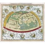
No Image Lot 1039 WORLD MAP -- "PTOLEMEISCH GENERAL TAFEL / die halbe Kugel der Welt begreiffende". (Basel 1039WORLD MAP -- "PTOLEMEISCH GENERAL TAFEL / die halbe Kugel der Welt begreiffende". (Basel Burgersdijk & Niermans WORLD MAP -- "PTOLEMEISCH GENERAL TAFEL / die halbe Kugel der Welt begreiffende". (Basel, c. 1590). Handcold. woodcut double-page map from S. Muns... Add to watchlist Live
No Image Lot 928 BELARUS -- MANUSCRIPT MAP of the Belarusian city of Polotsk. (1786). Plan of 928BELARUS -- MANUSCRIPT MAP of the Belarusian city of Polotsk. (1786). Plan of Burgersdijk & Niermans BELARUS -- MANUSCRIPT MAP of the Belarusian city of Polotsk. (1786). Plan of Polotsk drawn on blueish paper by Ivan Abramovich (?), cold. by hand,... Add to watchlist Live
No Image Lot 93 THE OARSMANS AND ANGLERS MAP OF THE THAMES 93THE OARSMANS AND ANGLERS MAP OF THE THAMES Dreweatts 1759 THE OARSMANS AND ANGLERS MAP OF THE THAMES Mounted, framed and glazed 175 x 14cm overall Add to watchlist Live
No Image Lot 119 London. Reynolds' Large Coloured Map of London and another 119London. Reynolds' Large Coloured Map of London and another Catherine Southon Auctioneers & Valuers London. Reynolds' Large Coloured Map of London and its Suburbs with visitors Guide, Street Directory Views etc. first an engraved folding map wit... Add to watchlist Live
No Image Lot 838 John Speed 17th century engraved map of The Romane Empire 838John Speed 17th century engraved map of The Romane Empire Reeman Dansie John Speed 17th century engraved map of The Romane Empire, English text verso, plate 41 x 50cm Add to watchlist Live
Reserve not met No Image Lot 43 FOLIO SOCIETY, Limited Edition: 43FOLIO SOCIETY, Limited Edition: Sworders Timed FOLIO SOCIETY, Limited Edition: QUEEN MARY ATLAS. Two Volumes. Folio Society, 2005. Limited Edition No. 581 of 1000 . Folio, Bound in full c... Add to watchlist Timed
Reserve not met No Image Lot 67 MAP OF TURKEY: 67MAP OF TURKEY: Sworders Timed MAP OF TURKEY: Ortelius, Abraham: Turcici Imperii Descriptio . London, 1606, English text to rear (A rare English edition, only 300 were printe... Add to watchlist Timed
No Image Lot 475 A QUANTITY OF 17TH, 18TH AND 19TH CENTURY WELSH AND ENGLISH MAPS, to include a John Speed map of 475A QUANTITY OF 17TH, 18TH AND 19TH CENTURY WELSH AND ENGLISH MAPS, to include a John Speed map of Richard Winterton Auctioneers A QUANTITY OF 17TH, 18TH AND 19TH CENTURY WELSH AND ENGLISH MAPS, to include a John Speed map of Wales with counties either side circa 1610, John ... Add to watchlist Live
No Image Lot 549 A selection of Indian related engravings and maps including "Plan of the Cantonment of Ootacamund 549A selection of Indian related engravings and maps including "Plan of the Cantonment of Ootacamund Truro Auction Centre A selection of Indian related engravings and maps including "Plan of the Cantonment of Ootacamund 1841"; pen and ink sketch of a balcony scene; a ... Add to watchlist Live
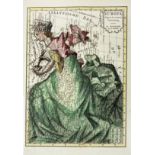
No Image Lot 918 ALLEGORICAL MAP -- (EUROPA REGINA, Queen Europe). (Basel, H. Petri, 1588). Plain allegorical 918ALLEGORICAL MAP -- (EUROPA REGINA, Queen Europe). (Basel, H. Petri, 1588). Plain allegorical Burgersdijk & Niermans ALLEGORICAL MAP -- (EUROPA REGINA, Queen Europe). (Basel, H. Petri, 1588). Plain allegorical woodcut map from S. Munster's 'Cosmographey', German ... Add to watchlist Live
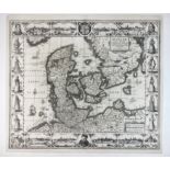
No Image Lot 936 DENMARK -- "DANIAE REGNI TYPUM". (Amst.), J. Janssonius, 1629. Plain engr. map incorporating 936DENMARK -- "DANIAE REGNI TYPUM". (Amst.), J. Janssonius, 1629. Plain engr. map incorporating Burgersdijk & Niermans DENMARK -- "DANIAE REGNI TYPUM". (Amst.), J. Janssonius, 1629. Plain engr. map incorporating 8 city views (incl. Copenhagen, Helsingør, Lubeck, an... Add to watchlist Live
No Image Lot 940 EASTERN EUROPE -- POLAND -- "ZAMOSCIUM, Nova Poloniæ civitas, (…)". (Cologne, Braun & Hogenberg, 161 940EASTERN EUROPE -- POLAND -- "ZAMOSCIUM, Nova Poloniæ civitas, (…)". (Cologne, Braun & Hogenberg, 161 Burgersdijk & Niermans EASTERN EUROPE -- POLAND -- "ZAMOSCIUM, Nova Poloniæ civitas, (…)". (Cologne, Braun & Hogenberg, 1617/18). Engr. view of Zamosc. 337 x 495 mm. (Ma... Add to watchlist Live
No Image Lot 393 One packet: Mixed architectural plan and maps of Norfolk interest, to include: Hethersett, 393One packet: Mixed architectural plan and maps of Norfolk interest, to include: Hethersett, Keys Fine Art Auctioneers One packet: Mixed architectural plan and maps of Norfolk interest, to include: Hethersett, Wroxham, Carbrooke, Trunch etc Add to watchlist Live
No Image Lot 412 John Speed (British,1552-1629) Cumberland, handcoloured engraved map, circa 1627, 42x53cm, framed 412John Speed (British,1552-1629) Cumberland, handcoloured engraved map, circa 1627, 42x53cm, framed Keys Fine Art Auctioneers John Speed (British,1552-1629) Cumberland, handcoloured engraved map, circa 1627, 42x53cm, framed and glazed. Add to watchlist Live
No Image Lot 339 DEVON. Speed, John. 339DEVON. Speed, John. Bearnes Hampton & Littlewood DEVON. Speed, John. Devonshire with Excester Described, an engraved county map, hand coloured, to be sold by Bassett & Chiswell (1676 edn.), in a ... Add to watchlist Live
No Image Lot 124 London. Fraser's Panoramic Plan of London, 124London. Fraser's Panoramic Plan of London, Catherine Southon Auctioneers & Valuers London. Fraser's Panoramic Plan of London, London, 1831, James Fraser, a steel engraved folding map dissected in fifteen sections and backed on ... Add to watchlist Live
No Image Lot 117 Bowles's Reduced New Pocket Plan of the Cities of London and Westminster 117Bowles's Reduced New Pocket Plan of the Cities of London and Westminster Catherine Southon Auctioneers & Valuers London. Bowles's Reduced New Pocket Plan of the Cities of London and Westminster, with the Borough of Southwark, exhibiting the New Buildings to 1... Add to watchlist Live
Reserve not met No Image Lot 5 Walker (J & C): 5Walker (J & C): Sworders Timed Walker (J & C): A Geological Map of England and Wales. Published by Charles Knight for the SDUK, 1843. Hand-coloured, mounted, framed and gla... Add to watchlist Timed
Reserve not met No Image Lot 42 Ordnance Survey of England and Wales: 42Ordnance Survey of England and Wales: Sworders Timed Ordnance Survey of England and Wales: Complete set of the 7th Series. 190 one-inch colour maps , each dissected into 6 sections laid on li... Add to watchlist Timed
No Image Lot 845 John Ogilby - rare engraved Map of Carolina, 1672 845John Ogilby - rare engraved Map of Carolina, 1672 Reeman Dansie John Ogilby - rare engraved Map of Carolina, 1672 - "A New Discription of Carolina By Order of the Lords Proprietors" from Ogliby's, America; unc... Add to watchlist Live
No Image Lot 1023 J Blaeu - hand coloured map of Norfolk, c1650. Framed and glazed. 1023J Blaeu - hand coloured map of Norfolk, c1650. Framed and glazed. Reeman Dansie J Blaeu, hand coloured map of Norfolk, c1650. 38cm x 50cm, framed and glazed. Add to watchlist Live
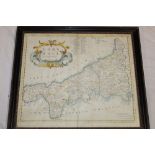
No Image Lot 537 A 17th century hand coloured map of Cornwall by Robert Morden, 537A 17th century hand coloured map of Cornwall by Robert Morden, Truro Auction Centre A 17th century hand coloured map of Cornwall by Robert Morden, framed and glazed Add to watchlist Live
No Image Lot 919 ALLEGORICAL MAP -- "EUROPA Volgens de nieuwste Verdeeling". Haarlem, F. Bohn, (1794). Cont 919ALLEGORICAL MAP -- "EUROPA Volgens de nieuwste Verdeeling". Haarlem, F. Bohn, (1794). Cont Burgersdijk & Niermans ALLEGORICAL MAP -- "EUROPA Volgens de nieuwste Verdeeling". Haarlem, F. Bohn, (1794). Cont. handcold. allegorical engr. map. 237 x 167 mm. (Left b... Add to watchlist Live
No Image Lot 120 Thames. Ravenstein's Oarsmen's and Anglers Map of the River Thames 120Thames. Ravenstein's Oarsmen's and Anglers Map of the River Thames Catherine Southon Auctioneers & Valuers Thames. Ravenstein's Oarsmen's and Anglers Map of the River Thames from its source to London Bridge a concertina style folding map backed on line... Add to watchlist Live
No Image Lot 123 London. Mogg's Stranger's Guide Through London and entirely New Plan. .....' 123London. Mogg's Stranger's Guide Through London and entirely New Plan. .....' Catherine Southon Auctioneers & Valuers London. Mogg's Stranger's Guide Through London and entirely New Plan. .....' steel engraved dissected folding map with hand colouring in twelve s... Add to watchlist Live
No Image Lot 122 London. Wyld's New Map of London, 1877 122London. Wyld's New Map of London, 1877 Catherine Southon Auctioneers & Valuers London. Wyld's New Map of London, 1877 London, James Wyld, 1876, an engraved dissected map in forty sections backed on linen with some colouring,... Add to watchlist Live
No Image Lot 116 London. Tallis's Illustrated Plan of London and Its Environs, 1851 116London. Tallis's Illustrated Plan of London and Its Environs, 1851 Catherine Southon Auctioneers & Valuers London. Tallis's Illustrated Plan of London and Its Environs, in commemoration of the Great Exhibition of Industry of All Nations 1851 a steel en... Add to watchlist Live
No Image Lot 1550 "Map of the County of Cumberland", print, originally published 1821 and 1822 by C & J Greenwood, 1550"Map of the County of Cumberland", print, originally published 1821 and 1822 by C & J Greenwood, Laidlaw Auctioneers & Valuers "Map of the County of Cumberland", print, originally published 1821 and 1822 by C & J Greenwood, London, 13 Regent Street, 20th Century, in mould... Add to watchlist Live
No Image Lot 1340 A COLLECTION OF LARGE SCALE ORDINANCE SURVEY AND OTHER MAPS. 1340A COLLECTION OF LARGE SCALE ORDINANCE SURVEY AND OTHER MAPS. JS Fine Art Auctioneers & Valuers A COLLECTION OF LARGE SCALE ORDINANCE SURVEY AND OTHER MAPS. Add to watchlist Live
Reserve not met No Image Lot 12 SCOTLAND (4 Maps): 12SCOTLAND (4 Maps): Sworders Timed SCOTLAND (4 Maps): Collins, Captain Greenvile: The East Coast of Scotland with the Isles of Orkney and Shetland . c.1693, hand-coloured and mou... Add to watchlist Timed
Reserve not met No Image Lot 13 Collection of Maps 13Collection of Maps Sworders Timed Collection of Maps including: Hertfordshire, 1840 and c.1880; Devonshire, c.1748 ; Cambridgeshire , c.1818 ; Bedfordshire; Isle of Thanet, ... Add to watchlist Timed
No Image Lot 517 SIX BOXES OF BOOKS AND EPHEMERA, to include a school exercise book belonging to a George Picker, who 517SIX BOXES OF BOOKS AND EPHEMERA, to include a school exercise book belonging to a George Picker, who Richard Winterton Auctioneers SIX BOXES OF BOOKS AND EPHEMERA, to include a school exercise book belonging to a George Picker, who went to Leadenham School, dated October 26th ... Add to watchlist Live
No Image Lot 836 John Speed, 17th century engraved map of Bermuda 836John Speed, 17th century engraved map of Bermuda Reeman Dansie John Speed 17th century engraved map of Bermuda, sold by Baskett and Chiswell, plate 40 x 53cm, English text verso Add to watchlist Live
No Image Lot 848 R W Seale, 18th century engraved map of North America and West Indies and another 848R W Seale, 18th century engraved map of North America and West Indies and another Reeman Dansie R W Seale, 18th century engraved map of North America and West Indies, Circa 1747, and Map of South America, both 38 x 48cm (plate) Add to watchlist Live
No Image Lot 204 A Kelly's Directory of Devon and Cornwall with maps 1926 and Kelly's Directory of Cornwall 1939 (20 204A Kelly's Directory of Devon and Cornwall with maps 1926 and Kelly's Directory of Cornwall 1939 (20 Truro Auction Centre A Kelly's Directory of Devon and Cornwall with maps 1926 and Kelly's Directory of Cornwall 1939 (20 Add to watchlist Live
No Image Lot 424 JOHN SPEED, BRITISH, 1552 - 1629, ENGRAVING WITH HAND COLOURING Titled ‘The Kingdome of England’ 424JOHN SPEED, BRITISH, 1552 - 1629, ENGRAVING WITH HAND COLOURING Titled ‘The Kingdome of England’ Swan Fine Art JOHN SPEED, BRITISH, 1552 - 1629, ENGRAVING WITH HAND COLOURING Titled ‘The Kingdome of England’ map, with drawn societal figures and detailed ca... Add to watchlist Live
No Image Lot 250 MOUNTAINEERING. 250MOUNTAINEERING. Bearnes Hampton & Littlewood MOUNTAINEERING. Whymper, Edward, Scrambles Amongst the Alps in the Years 1860-69, London: John Murray 1893, 4th edition, folding maps and plates, ... Add to watchlist Live
No Image Lot 363 SPEED, John. 363SPEED, John. Bearnes Hampton & Littlewood SPEED, John. Devonshire with Excester Described, published by John Sudbury & George Humble 1623, hand coloured map, Exeter shown in an inset to on... Add to watchlist Live
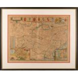
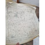
No Image Lot 330 [DEVON] BLAEU, Joan. 330[DEVON] BLAEU, Joan. Bearnes Hampton & Littlewood [DEVON] BLAEU, Joan. Devonia vulgo Devon-Shire, hand coloured map, 1645 or later, latin text, f&g, 40cm x 52cm; together with MORDEN, Robert. Devo... Add to watchlist Live
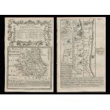
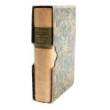
No Image Lot 326 [ATLAS] COLE and ROPER. Nightingale, Joseph. 326[ATLAS] COLE and ROPER. Nightingale, Joseph. Bearnes Hampton & Littlewood [ATLAS] COLE and ROPER. Nightingale, Joseph. English Topography: or, a series of … Counties of England and Wales. Accompanied by a Map of each Cou... Add to watchlist Live
No Image Lot 363A SPEED, John. 363ASPEED, John. Bearnes Hampton & Littlewood SPEED, John. Kent, with her Cities and Earles described and observed, hand coloured map with inset plans of Rochester and Canterbury, English text... Add to watchlist Live
No Image Lot 125 London. A plan of London and its Environs shewing the Boundaries, 125London. A plan of London and its Environs shewing the Boundaries, Catherine Southon Auctioneers & Valuers London. Lewis, (Samuel) A plan of London and its Environs shewing the Boundaries, shewing the Boundaries of the Cities of London and Westminster, ... Add to watchlist Live
No Image Lot 118 A New and Correct Plan of London, Westminster and Southwark, 118A New and Correct Plan of London, Westminster and Southwark, Catherine Southon Auctioneers & Valuers London. A New and Correct Plan of London, Westminster and Southwark, with several additional Improvements, not in any former Survey an engraved d... Add to watchlist Live
No Image Lot 127 London. Cruchley's New Plan of London improved to 1830 127London. Cruchley's New Plan of London improved to 1830 Catherine Southon Auctioneers & Valuers London. Cruchley's New Plan of London improved to 1830 an engraved dissected map in thirty six sections, backed on linen and with hand colouring,... Add to watchlist Live
No Image Lot 2117 A quantity of assorted 20thC Bartholomew road maps to include Cambridge, Dorset, New Forest, Sussex, 2117A quantity of assorted 20thC Bartholomew road maps to include Cambridge, Dorset, New Forest, Sussex, Claydon Auctioneers Ltd A quantity of assorted 20thC Bartholomew road maps to include Cambridge, Dorset, New Forest, Sussex, Warwickshire, Merseyside, Norfolk, English La... Add to watchlist Live
No Image Lot 2111 Map: An 18thC map of Gloucestershire with hand colouring, titled An Accurate Map of the Counties 2111Map: An 18thC map of Gloucestershire with hand colouring, titled An Accurate Map of the Counties Claydon Auctioneers Ltd Map: An 18thC map of Gloucestershire with hand colouring, titled An Accurate Map of the Counties of Gloucester and Monmouth Divided into their Res... Add to watchlist Live
Reserve not met No Image Lot 29 Bowen, E: 29Bowen, E: Sworders Timed Bowen, E: An Accurate map of Cambridgeshire divided into its hundreds. c.1760. Mounted, framed and glazed. Glass broken , 52 x 70cm.; Morden... Add to watchlist Timed


![[DEVON] BLAEU, Joan.](https://portal-images.azureedge.net/auctions-2024/bearne10150/images/9bf08fd8-a4c6-4b36-a926-b15000fc8d1a.jpg?w=155&h=155)
![[ATLAS] COLE and ROPER. Nightingale, Joseph.](https://portal-images.azureedge.net/auctions-2024/bearne10150/images/4bd431a9-b8cb-49bb-9b6a-b15000fc8b3f.jpg?w=155&h=155)