15
17th Century: Map of Leinster by Johannis Blaeu Engraved hand-coloured map of Leinster by Johannis

Description
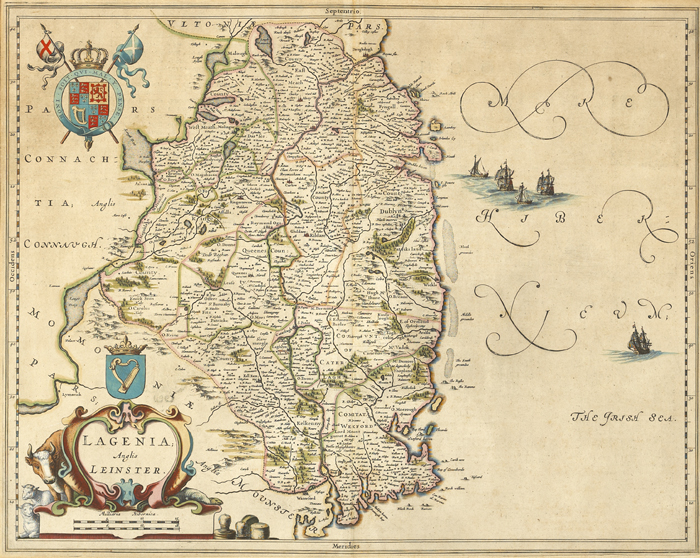
17th Century: Map of Leinster by Johannis Blaeu Engraved hand-coloured map of Leinster by Johannis Blaeu titled `Lagenia; Anglis Leinster`. Framed. 17 by 21in., 42.5 by 52.5cm.
Auction Details
Shipping
T&Cs & Important Info
Ask seller a question
17th Century: Map of Leinster by Johannis Blaeu Engraved hand-coloured map of Leinster by Johannis Blaeu titled `Lagenia; Anglis Leinster`. Framed. 17 by 21in., 42.5 by 52.5cm.
History, Literature & Collectibles
Sale Date(s)
Venue Address
Freemasons Hall
Molesworth Street
Dublin 2
Ireland
General delivery information available from the auctioneer
The buyer will be responsible for all removal, storage and insurance charges in respect of any lot which has not been collected within fourteen days of the date of sale.
Important Information
Buyer's Premium 20.23% + VAT (25% including VAT)
Shipping:
Whytes do not handle this themselves but will recommend a suitable company who can collect your purchases on your behalf and pack and despatch them to you once they have been paid for.