
Refine your search
Sale Section
Remove filterEstimate
Category
- Jewellery (179)
- Oil, Acrylic paintings & Mixed Media (148)
- Furniture (134)
- Silver & Silver-plated items (119)
- Ceramics (100)
- Prints (77)
- Watercolours (76)
- Collectables (67)
- Maps (61)
- Clocks (34)
- Glassware (33)
- Chinese Works of Art (29)
- Sculpture (22)
- Watches & Watch accessories (20)
- Kitchenalia (16)
- Japanese Works of Art (14)
- Taxidermy & Natural History (13)
- Metalware (12)
- Carpets & Rugs (11)
- Drawings & Pastels (11)
- Salvage & Architectural Antiques (11)
- Lighting (10)
- Models, Toys, Dolls & Games (10)
- Arms, Armour & Militaria (8)
- Books & Periodicals (7)
- Textiles (6)
- Barometers (5)
- Coins (5)
- Ethnographica & Tribal Art (5)
- Photographs (3)
- Scientific Instruments (3)
- Musical Instruments & Memorabilia (2)
- Stamps (2)
- Writing Instruments (2)
- Classic Cars, Motorcycles & Automobilia (1)
- Indian Works of Art (1)
- Tools (1)
- Wines & Spirits (1)
Filtered by:
- Sale Section
- List
- Grid
A subscription to the Price Guide is required to view results for auctions ten days or older. Click here for more information
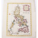

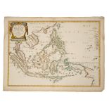
Thomas Kitchin (1718-1784), hand-coloured map - ‘A new map of the Philippine Islands drawn from the
Thomas Kitchin (1718-1784), hand-coloured map - ‘A new map of the Philippine Islands drawn from the best authorities’, 1760, 24cm x 18cm.Condition...
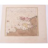
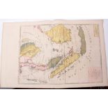
Johannes Van Keulen (1654-1715), hand-coloured map - ‘Junkseilon’ (Phuket), circa 1700, 24cm x 27cm.
Johannes Van Keulen (1654-1715), hand-coloured map - ‘Junkseilon’ (Phuket), circa 1700, 24cm x 27cm.Condition report: two small worm holes in area...
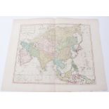
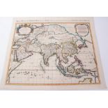
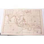
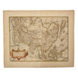
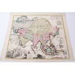
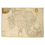
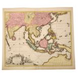
Thomas Kitchin (1718-1784), hand-coloured map - ‘Asia and its several Islands and Regions according
Thomas Kitchin (1718-1784), hand-coloured map - ‘Asia and its several Islands and Regions according to their most approved divisions, with Captain...
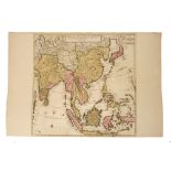
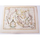
Guillaume de L’Isle (1675-1726), hand-coloured map - ‘Carte des indes et de la Chine’, ‘Chez
Guillaume de L’Isle (1675-1726), hand-coloured map - ‘Carte des indes et de la Chine’, ‘Chez Mortier qui vend ausi les grandes cartes de St Sanson...
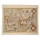
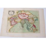
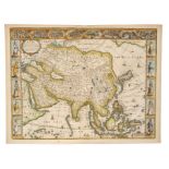
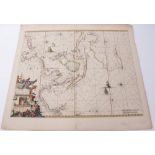
Gulliaume de L’Isle (1675-1726), hand-coloured map - ‘Asia divisa in Imperial Regna & Status’
Gulliaume de L’Isle (1675-1726), hand-coloured map - ‘Asia divisa in Imperial Regna & Status’ Covens & Mortier, 1730 49cm x 58cm.Condition report:...
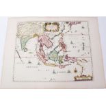
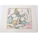
Jan Huygen Van Linschoten (1563-1610), hand-coloured map - ‘Insulae Moluccae’ 1598, ‘imprinted in
Jan Huygen Van Linschoten (1563-1610), hand-coloured map - ‘Insulae Moluccae’ 1598, ‘imprinted in London by John Wolfe, graven by Robert Beckit’, ...
Jan Huygen Van Linschoten (1563-1610), hand-coloured map - ‘Exacta & Accurata Delineatio cum Orarum
Jan Huygen Van Linschoten (1563-1610), hand-coloured map - ‘Exacta & Accurata Delineatio cum Orarum Maritimarum tum Etiam Locorum Terrestrium quae...
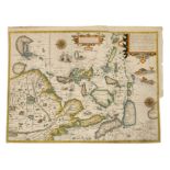
Pietrus Kaerius & Pieter van den Keere (1571-1646), two hand-coloured maps, Latin text description
Pietrus Kaerius & Pieter van den Keere (1571-1646), two hand-coloured maps, Latin text description verso - ‘China’ (Mercator-Hondius 1606); ‘Insul...
Gerhard Mercator (1512-1594), hand-coloured map - ‘India Orientalis’ (J. Hondius 1609), French text
Gerhard Mercator (1512-1594), hand-coloured map - ‘India Orientalis’ (J. Hondius 1609), French text verso, 36cm x 48cmCondition report: tape repai...
Gerhard Mercator (1512-1594), hand-coloured map - ‘insulae India Orientalis’ (J. Hondius 1609),
Gerhard Mercator (1512-1594), hand-coloured map - ‘insulae India Orientalis’ (J. Hondius 1609), French text verso, 35cm x 46cm.Condition report: m...
Sir Robert Dudley (1574-1649) engraved chart ‘Carta particolare del Isole Di Jave’, 47 x 72cm
Sir Robert Dudley (1574-1649) engraved chart ‘Carta particolare del Isole Di Java’, 47 x 72cmCondition report: some time staining otherwise ok .....
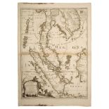
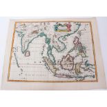
Pierre Mortier (1661-1711), hand-coloured map - ‘lLe Royaume de Siam auec les Royaumes qui luy font
Pierre Mortier (1661-1711), hand-coloured map - ‘lLe Royaume de Siam auec les Royaumes qui luy font tributaries et les Isles de Sumatra Andemaon e...
Pierre Mortier (1661-1711), hand-coloured map - ‘Carte des Coates de L’Asie sue L’Ocean‘ - ‘Partie
Pierre Mortier (1661-1711), hand-coloured map - ‘Carte des Coates de L’Asie sue L’Ocean‘ - ‘Partie Orientalis de L’Asie sur Ocean’ (two leafs join...
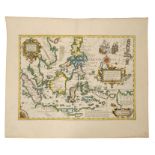
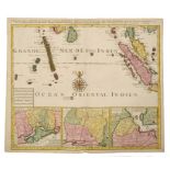
Pierre Mortier (1661-1711), hand-coloured map - ‘Carte Generale des Indies Orientales’, 38cm x 47cm.
Pierre Mortier (1661-1711), hand-coloured map - ‘Carte Generale des Indies Orientales’, 38cm x 47cm.Condition report: browning to periphery otherw...
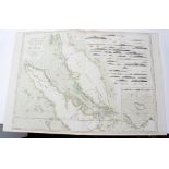
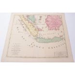
W & L Mount, T & T Page, late 18th Century, hand-coloured map - ‘A New and Correct Chart of the
W & L Mount, T & T Page, late 18th Century, hand-coloured map - ‘A New and Correct Chart of the Straits of Malacca’, 1753, across three sheets (no...
Robert Morden (d. 1703), three hand-coloured miniature maps - ‘Isles of Sonde’; ‘Philippine Islands’; ‘Molucca Isles’ each with accompanying Engli...
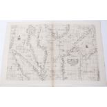
Thomas Jeffries (c. 1710-1771) hand-coloured chart Straits of Malacca & Singapor’. 1778, 85 x 63cm
Thomas Jeffries (c. 1710-1771) hand-coloured chart Straits of Malacca & Singapor’. 1778, 85 x 63cmCondition report: minor stains generally good ....
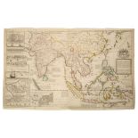
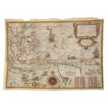
Herman Moll (d. 1732), large hand-coloured map -‘A map of East Indies.... to Ye Directors of Ye Hon.
Herman Moll (d. 1732), large hand-coloured map -‘A map of East Indies.... to Ye Directors of Ye Hon.ble United East-India Company’, 1717, 62cm x 1...
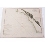
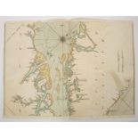
William Nicholson (Nichelsen), 18th century, hand-coloured chart - ‘A plan of the Bay on the South
William Nicholson (Nichelsen), 18th century, hand-coloured chart - ‘A plan of the Bay on the South West Side of Pulo Auore, surveyed by William Ni...
Jean Baptister Nolin (1657-1725), engraved map - ‘Les Royaumes qui luy font Tributaires, et les
Jean Baptister Nolin (1657-1725), engraved map - ‘Les Royaumes qui luy font Tributaires, et les Isles de Sumatra, Andemaon, etc.’1687, 62cm x 46cm...
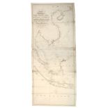
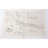
John William Norie (1722-1843), engraved map - ‘A new chart of The China Sea & East India Archipelago’, published 1821, 154cm x 62cmCondition repo...
John William Norie (1722-1843), engraved map - ‘A new chart of The Straits of Malacca and Singapore’, published 1820, 62cm x 92cm.Condition report...
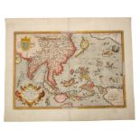
Abraham Ortelius (1527-1598), hand-coloured map - ‘Indiae Orientalis Insuralarum que Adiacientium
Abraham Ortelius (1527-1598), hand-coloured map - ‘Indiae Orientalis Insuralarum que Adiacientium Typus’, 1587, French text verso, 35cm x 49cm.Con...
Abraham Ortelius (1527-1598), engraved map - ‘Erythraei Sive Rubri Maris Periplus’, 1597, 37cm x
Abraham Ortelius (1527-1598), engraved map - ‘Erythraei Sive Rubri Maris Periplus’, 1597, Latin text verso, 37cm x 48cm.Condition report: Pin hole...
Abraham Ortelius (1527-1598) engraved map - ‘Asiae Nova Descriptio’, circa 1570, 38cm x 50cm.
Abraham Ortelius (1527-1598) engraved map - ‘Asiae Nova Descriptio’, circa 1570, 38cm x 50cm.Condition report: Browning to periphery, some time st...
Sir Robert Dudley (1574-1649) engraved chart ‘Carta Partcolare Della Malacca con la Costa..’47 x
Sir Robert Dudley (1574-1649) engraved chart ‘Carta Partcolare Della Malacca con la Costa..’47 x 76cmCondition report: Minor time staining and cre...
Joachim Ottens (17th / 18th century), hand-coloured map - ‘Le Royaume de Siam.... Sumatra, Andermon’, 1756, 49cm x 56cm.Condition report: Minor ti...
Joachim Ottens (17th / 18th century), set of three (of four) hand-coloured maps - ‘Partie de la
Joachim Ottens (17th / 18th century), set of three (of four) hand-coloured maps - ‘Partie de la Nouvelle Grande Carte des Indies Orientales’ ‘...M...
Nicolas Sanson (1600-1667), hand-coloured map - ‘Asia Vetus’, dated 1667, 41cm x 57cmCondition report: A few stains to margins, minor creases ......
Nicolas Sanson (1600-1667), hand-coloured map - ‘Les Isles Philippines, Molucques et de la Sonde’,
Nicolas Sanson (1600-1667), hand-coloured map - ‘Les Isles Philippines, Molucques et de la Sonde’, dated 1654, 39cm x 56cmCondition report: losses...
Nicolas Sanson (1600-1667), hand-coloured map - ‘L’Asie devisee en des Principales Parties Scavoir..
Nicolas Sanson (1600-1667), hand-coloured map - ‘L’Asie devisee en des Principales Parties Scavoir - La Turquie, En Asie, L’Arabie, La Peres, L’In...
Pieter Schenk (1645-1715), hand-coloured map - ‘Asiae in Tabula Geographica Delineatio’, 1700, 52cm
Pieter Schenk (1645-1715), hand-coloured map - ‘Asiae in Tabula Geographica Delineatio’, 1700, 52cm x 58cm.Condition report: couple of tape repair...
John Speed (1552-1629), hand-coloured map - ‘Asia’ dated 1626, English text verso, 40cm x 52cm.
John Speed (1552-1629), hand-coloured map - ‘Asia’ dated 1626, English text verso, 40cm x 52cm.Condition report: Tape repair to lower edge, staini...
John Speed (1552-1629), hand-coloured map - ‘A new map of East India’, 1676, English text verso,
John Speed (1552-1629), hand-coloured map - ‘A new map of East India’, 1676, English text verso, 39cm x 49cm.Condition report: Generally good cond...
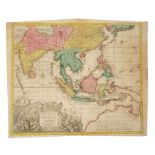
George Matthaus Seutter (1678-1757), hand-coloured map - ‘India Orientalis cum Adjecentibus Insulis
George Matthaus Seutter (1678-1757), hand-coloured map - ‘India Orientalis cum Adjecentibus Insulis Nova Delineatione’, 1760, 49cm x 57cm.Conditio...
John Senex (d.1740), hand-coloured map - ‘A New Map of India and China’, 1721, 50cm x 59cmCondition report: various tape repairs addressing tears ...
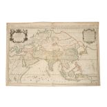
John Senex (d.1740), large hand-coloured map - ‘Asia’ - dedicated to Sir George Markham Baronet,
John Senex (d.1740), large hand-coloured map - ‘Asia’ - dedicated to Sir George Markham Baronet, 1714, 68cm x 96cmCondition report: tape repairs t...
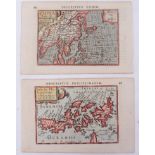
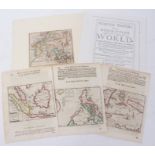
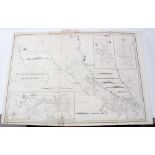
Isaak Tirion (d.1769), group of four small maps - ‘Nieuwe Kaart van de Filippinische, Ladrones...’;
Isaak Tirion (d.1769), group of four small maps - ‘Nieuwe Kaart van de Filippinische, Ladrones...’; ‘Isole Filippine, Laddones e Moluccos’; ‘Nieuw...
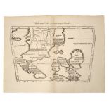
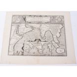
Gaspar and Melchior Treschel (16th century), two uncoloured woodblock maps - ‘Tabula Inde’; ‘Tabula
Gaspar and Melchior Treschel (16th century), two uncoloured woodblock maps - ‘Tabula Inde’;‘Tabula Nova Indiae Orientalis & Meridionalis’, from Pt...
Giacomo Cantelli da Vignola (1643-1695), hand-coloured map - ‘Isole Dell India’, dated 1693, 45cm x
Giacomo Cantelli da Vignola (1643-1695), hand-coloured map - ‘Isole Dell India’, dated 1693, 45cm x 59cmCondition report: Replaced element top rig...
Nicolas Vischer (1618-1679), hand-coloured map - ‘Indiae Orientalis’, after Petrum Schenk, 1690,
Nicolas Vischer (1618-1679), hand-coloured map - ‘Indiae Orientalis’, after Petrum Schenk, 1690, 47cm x 57cm.Condition report: seam is strengthene...
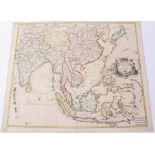
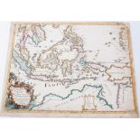
Edward Wells (1667-1727), hand-coloured map - ‘A New Map of the East Indies’, 1700, 36cm x 50cm
Edward Wells (1667-1727), hand-coloured map - ‘A New Map of the East Indies’, 1700, 36cm x 50cmCondition report: Losses to margins left side (beyo...
Frederick de Wit (1610-1698), hand-coloured map - ‘Indiarum Orientalium...Oost Indien’, 1680, 45cm
Frederick de Wit (1610-1698), hand-coloured map - ‘Indiarum Orientalium...Oost Indien’, 1680, 45cm x 55cmCondition report: losses to baseof seam, ...
Frederick de Wit (1610-1698), hand-coloured map - ‘Asiae Tabula’, 1680, 49cm x 58cm.Condition report: Tear to foot of margin, a few smaller tears ...
Pedro de Murillo Velarde (1696-1753), engraved map - ‘Carte Hydrografica Y Chorographica de la
Pedro de Murillo Velarde (1696-1753), engraved map - ‘ Carta Hydrographica y Chorographica delas Yslas Filipinas Dedicada al Rey Nuestro Señor Por...
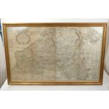
Herman Moll (1654-1732) hand coloured engraved map - A Most Exact Map of Flanders or Austrian Netherlands, from his Large Atlas 1710, 52 x 102cm, ...
Emanuel Bowen map of Essex
Emanuel Bowen (1693-1767) hand coloured engraved map of Essex, 54cm x 73cm, glazed frame
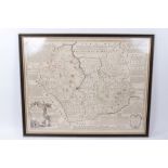
Johannes Blaeu (1599-1643) ‘hand-coloured engraving ‘Essexia omitatus, published Amsterdam, circa
Johannes Blaeu (1599-1643) ‘hand-coloured engraving ‘ Essexia omitatus , published Amsterdam, circa 1648, 43 x 54cm, glazed frame
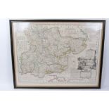
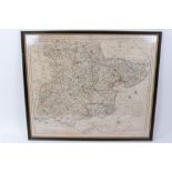
Emanuel Bowen (1693-1767) hand coloured engraved map of Leistershire and Rutland, 54cm x 69cm,
Emanuel Bowen (1693-1767) hand coloured engraved map of Leistershire and Rutland, 54cm x 69cm, glazed frame
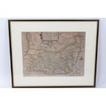
Christopher Saxton & William Kip , hand-coloured engraved map - ‘Suffolciae’, circa 1637, 27.5 x 37.
Christopher Saxton & William Kip , hand-coloured engraved map - ‘Suffolciae’, circa 1637, 27.5 x 37.5cm, glazed frame ...[more]
Carrington Bowles hand-coloured engraved map -‘New pocket map of the County of Essex, together with
Carrington Bowles hand-coloured engraved map -‘New pocket map of the County of Essex, 49 x 54cm, glazed frame, together with John Ogilby hand colo...
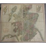
John Cary hand coloured folding map of Scotland, 1811, total size 93 x 108cm, in original marbled card sleeve
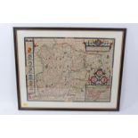
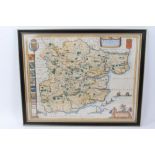
John Speed (1552-1629) 17th century hand coloured map ‘Essex’, described and dated Anno 1662, 37 x 51cm, glazed frame
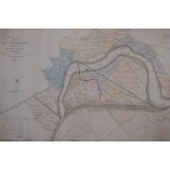
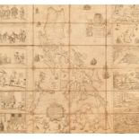
Local interest map: Norfolk, Kings Lynn - 'Plan of the Eau Brink River and part of the River Ouse with the proposed New Bridge, Public Roads and D...
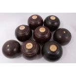
Set of four 19th century lignum vitae bowls by Jaques & Sons, London, numbered 1501, Bias no. 3, each with bone roundel initialled SB and tooled o...
Victorian folk art novelty money box - Wee Maggie is no a fool, she puts her money in her stool’
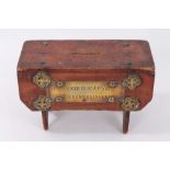
Victorian folk art novelty pine money box, raised on stile ends, with brass mounts and plaque engraved ‘Wee Maggie is no a fool, she puts her mone...
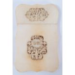
Ivory card case
19th century Cantonese carved ivory card case, of shaped cartouche form, both faces with two shaped reserves, relief carved with figures and pagod...
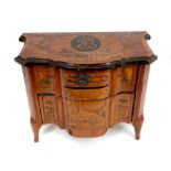
Late 18th century Continental marquetry inlaid miniature commode, of arc-en-arbalete form, the top centred by initialled oval cartouche, with two ...
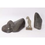
Richard Mteki (b1947) carved Zimbabwean Shona stone sculpture, mask and leaf, signed, 22cm high, together with another by Albert Mamvura (1954-197...
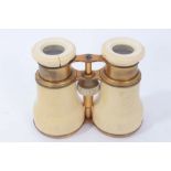
Pair of mid 19th century ivory and brass opera glasses, adjusting on a thread