Filtered by:
- Sale Section
- List
- Grid
A subscription to the Price Guide is required to view results for auctions ten days or older. Click here for more information
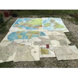

Collection of maps, most cotton backed. Philips large school maps. Europe, Great Britain and
Collection of maps, most cotton backed. Philips large school maps. Europe, Great Britain and World, other maps dated 1817-18 sections of Great Bri...
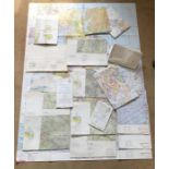
Large collection of early to mid 20thC ordinance survey maps of UK areas, mainly London and South
Large collection of early to mid 20thC ordinance survey maps of UK areas, mainly London and South England, Bartholomew's and Bacons cotton backs, ...
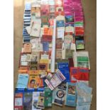
Collection of Airways route maps, British Isles, Europe, one of Ontario, two Royal Air Force
Collection of Airways route maps, British Isles, Europe, one of Ontario, two Royal Air Force Flight Information publications British Isles, Large ...
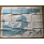
Poster print map, Polar Regions, Air Ministry Educational Productions Ltd, Sheet 2, 16 square fold
Poster print map, Polar Regions, Air Ministry Educational Productions Ltd, Sheet 2, 16 square fold creases. 101 w x 76cms.
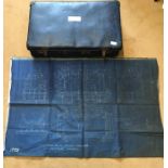
Early 20thC possibly WW I aircraft printed cotton plan drawing of engine, possible cooling cylinder,
Early 20thC possibly WW I aircraft printed cotton plan drawing of engine, possible cooling cylinder, number 1010. 115 w x 74cms h together with a ...
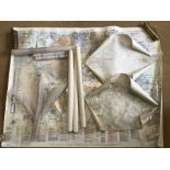
Various maps including Aeronautical Chart of South England and Wales, two 1931 maps of Orpington,
Various maps including Aeronautical Chart of South England and Wales, two 1931 maps of Orpington, plan drawings for Westerham bypass and a large p...