Filtered by:
- Sale Section
- List
- Grid
A subscription to the Price Guide is required to view results for auctions ten days or older. Click here for more information
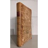
![Andrew Reid & Sons [publisher]. A History of Northumberland, 15 volumes, Newcastle-Upon-Tyne,](https://portal-images.azureedge.net/auctions-2021/srdom10167/images/eb89acd4-717f-4948-b296-acef00fca41b.jpg?w=155&h=155)

Andrew Reid & Sons [publisher]. A History of Northumberland, 15 volumes, Newcastle-Upon-Tyne,
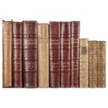
Andrew Reid & Sons [publisher]. A History of Northumberland, 15 volumes, Newcastle-Upon-Tyne, 1983-1940, numerous monochrome illustrations & maps,...
Ashmole (Elias). The Antiquities of Berkshire, 3 volumes, W. Mears and J. Hooke, 1723, printed title to each volume, lacking portrait of the autho...
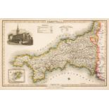
Badeslade (Thomas & William Henry Toms). Chorographia Britanniae. Or a set of Maps of all the Counties in England and Wales, London, 1742, engrave...
![Barrett (William). The History and Antiquities of the City of Bristol ..., [1789], and others](https://portal-images.azureedge.net/auctions-2021/srdom10167/images/db193d45-5eac-4cb3-86ff-acfc00ddd5c0.jpg?w=155&h=155)
Barrett (William). The History and Antiquities of the City of Bristol ..., [1789], and others
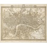
Barrett (William). The History and Antiquities of the City of Bristol ..., Bristol: William Pine, [1789], folding engraved map, with short closed ...
Bickham (George). The British Monarchy or, A New Chorographical Description of all the Dominions Subject to the King of Great Britain: Comprehendi...
Camden (William). Brittania: or, a Chorographical Description of the Flourishing Kingdoms of England, Scotland and Ireland, and the Islands Adjace...
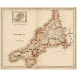
Cruchley (G.F., publisher). Cruchley's County Atlas of England & Wales shewing all the Railways & Stations with their names, also the Turnpike Roa...
Depping. (George Bernhard). L'Angleterre ou Description historique et topographique du Royaume-Uni de la Grand-Bretagne, six volumes, 3rd edition,...
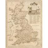
Dodsley (Robert & John Cowley). The Geography of England: Done in the Manner of Gordon's Geographical Grammar, 1st edition, London: Printed for R....
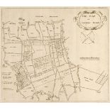
Dugdale (William). The History of Imbanking and Draining of divers Fens and Marshes, both in Foreign Parts and in this Kingdom, and of improvement...
Ellis (John). Ellis's English Atlas: or, a compleat chorography of England and Wales: in fifty-four maps. Containing more particulars than any oth...
![Fisher, Son & Co. Fisher's County Atlas of England and Wales, [1845]](https://portal-images.azureedge.net/auctions-2021/srdom10167/images/b9fe2f22-426d-422d-8ba9-acf0011fd6ce.jpg?w=155&h=155)
Fisher, Son & Co. Fisher's County Atlas of England and Wales. Compiled from authentic surveys, and corrected to the present time. With a topograph...
Geological map. Geological Survey of England and Wales, Sheet 24, Yorkshire, Ordnance Map Office, Southampton, 1854, Geological Information publis...
Grose (Francis). The Antiquities of England and Wales, 8 vols., London: Hooper & Wigstead, circa 1797, engraved frontispiece and title to each, 56...
Hall (Sidney). [A New British Atlas Comprising a series of 54 Maps, Constructed from the most recent Surveys, published Chapman & Hall, 1834 or la...
Hodgson (John). A History of Northumberland, part 2 vols. 1-3 & part 3 vols. 1-3, Newcastle 1820-40
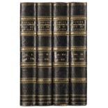
Hodgson (John). A History of Northumberland, in three Parts, (comprising Part I, Part II volumes 1-3 & Part III volumes 1-3), Newcastle 1820-40, 5...
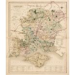
Lewis (Samuel). [An Atlas comprising Maps of the Several Counties, divided into Unions and of the Islands of Guernsey, Jersey and Man; with a Map ...
Lewis (Samuel). A Topographical Dictionary of England, 4 volumes, London: S. Lewis and Co., 1831, folding engraved plan of London, 44 engraved map...

Morris & Co. Commercial Directory and Gazetteer of Somersetshire with Bristol, Nottingham, Hounds Gate, 1872, numerous advertisements, original ma...
Ormerod (George). The History of the County Palatine and City of Chester, 2nd edition, revised and enlarged by Thomas Helsby, 3 volumes in 6, Lond...
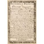
Owen (John & Bowen Emanuel). Britannia Depicta or Ogilby Improv'd..., 4th edition, Thomas Bowles 1731, printed title, four leaves containing an in...
Pigot (James). Composite British Atlas, London: James Pigot, circa 1832, 42 engraved maps, hand-coloured in outline, including folding map titled ...
Pilkington (James). A View of the Present State of Derbyshire; with an account of its most remarkable antiquities, 2 volumes, 2nd edition, Derby &...
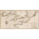
Russell (P. & Owen Price). England Displayed. Being a New, Complete, and Accurate Survey and Description of the Kingdom of England, and Principali...

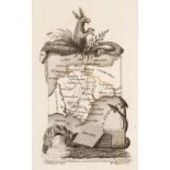
Sacheverell (William). An Account of the Isle of Man, its inhabitants, language, soil, remarkable curiosities..., 1st edition, J. Hartley, 1702, a...

Seyer (Samuel). Memoirs Historical and Topographical of Bristol and Its Neighbourhood, 2 volumes, Bristol, printed for the author by John Mathew G...
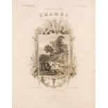
Tombleson, (William & Fearnside William Gray). Tombleson's Thames, Tombleson & Co. & Creuzbaner & Co. circa 1850, lacking title page but retaining...
Walker (J. & C.) British Atlas, Comprising separate Maps of every County in England, each Riding in Yorkshire and North & South Wales, showing the...
Wallis (James). Wallis's New British Atlas containing a Complete Set of County Maps, divided into hundreds in which are carefully delineated all t...
![Wallis (James). Wallis's New Pocket Edition of the English Counties, c.1812-[14]](https://portal-images.azureedge.net/auctions-2021/srdom10167/images/0f9307a1-609d-40d6-85a7-acf0011fdbd8.jpg?w=155&h=155)
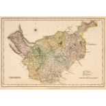
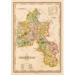
Wallis (James). Wallis's New Pocket Edition of the English Counties or Travellers Companion in which are carefully laid down all the Direct & Cros...
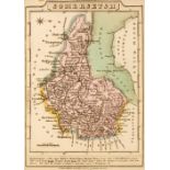
Wallis (James). Wallis's New Pocket Edition of the English Counties or Travellers Companion in which are carefully laid down all the Direct & Cros...