Refine your search
Sale Section
Remove filter- Books (19)
- Private collection of maps (1)
Estimate
Category
Remove filter- Maps (40)
Filtered by:
- Sale Section,
- Category
- List
- Grid
A subscription to the Price Guide is required to view results for auctions ten days or older. Click here for more information
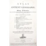

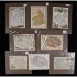
An Atlas of Antient Geography; by Mons D'Anbille, twelve maps, Richard Holmes Laurie No 53 Fleet
An Atlas of Antient Geography; by Mons D'Anbille, twelve maps, Richard Holmes Laurie No 53 Fleet Street, 1821, 56cm high
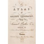
An Atlas of Ancient Geography by Samuel Butler, London, published by Longman, Hurst, Rees, Orme &
An Atlas of Ancient Geography by Samuel Butler, London, published by Longman, Hurst, Rees, Orme & Brown, 1822
Robert Morden, 17th Century, The County of Monmouth, 42cm x 35cm
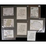
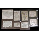
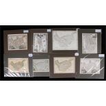
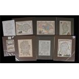
Mixed maps, to include Monmouthshire, Derbyshire, Moll map of Britain, England poem, Road map
Mixed maps, to include Monmouthshire, Derbyshire, Moll map of Britain, England poem, Road map Plymouth to Dartmouth, Robert Morden South Wales and...
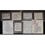
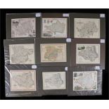
Two maps of Worcestershire, two maps of Norfolk, one drawn by Creighton, engraved by Walker, two
Two maps of Worcestershire, two maps of Norfolk, one drawn by Creighton, engraved by Walker, two maps of Hampshire and two maps of Southampton, (8)
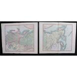
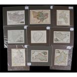
John Cary, A New Map of The Russian Empire, 1799, double sheets, London published by J. Cary
John Cary, A New Map of The Russian Empire, 1799, double sheets, London published by J. Cary Engraver & Map Seller, No 181 Strand, 62cm x 53cm, (2)
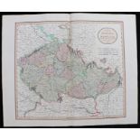
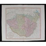
John Cary, A New Map of Bohemia and Moravia, 1801, London published by J. Cary Engraver & Map
John Cary, A New Map of Bohemia and Moravia, 1801, London published by J. Cary Engraver & Map Seller, No 181 Strand, 62cm x 53cm
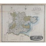
Coloured map of Essex, vignette to the corner "Map of the County of Essex, from an actual survey
Coloured map of Essex, vignette to the corner "Map of the County of Essex, from an actual survey made in the year 1824. By C & I Greenwood, publis...
Map of Kent by J. & C. Walker, map of the southern part of Scotland, a double map of Devon and
Map of Kent by J. & C. Walker, map of the southern part of Scotland, a double map of Devon and Cornwall, a map of Northumberland by H. Moll, four ...
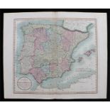
John Cary, A New Map of Spain and Portugal, 1801 London published by J. Cary Engraver & Map Seller, No 181 Strand, 62cm x 53cm
Two maps of Sussex, one by T. Kitchin, two maps of England and Wales, map of Yorkshire by John
Two maps of Sussex, one by T. Kitchin, two maps of England and Wales, map of Yorkshire by John Cary engraver, map of North America, map of Lancash...
Three maps of Middlesex by Cole & Roper (2) and Thomas Moule, three maps of Monmouthshire by
Three maps of Middlesex by Cole & Roper (2) and Thomas Moule, three maps of Monmouthshire by Thomas Kitchin & Thomas Moule (2), two maps of Northa...
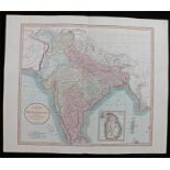
John Cary, A New Map of Hindoostan, 1806, London published by J. Cary Engraver & Map Seller, No
John Cary, A New Map of Hindoostan, 1806, London published by J. Cary Engraver & Map Seller, No 181 Strand, 62cm x 53cm
Three maps of Suffolk by Oddy, Moule & Cary, three maps of Berkshire by Moule (2) & Kitchin, two
Three maps of Suffolk by Oddy, Moule & Cary, three maps of Berkshire by Moule (2) & Kitchin, two maps of Middlesex by Moule, (8)
Two maps of South Wales and map of North Wales, map of Europe according to the treaties of Vienna
Two maps of South Wales and map of North Wales, map of Europe according to the treaties of Vienna and Paris 1815, map of France, map of the Nether...
Map of Jersey drawn by Creighton, engraved by Walker, map of Shropshire, map of Guernsey, map of
Map of Jersey drawn by Creighton, engraved by Walker, map of Shropshire, map of Guernsey, map of Lancashire, map of Gloucestershire, two maps of W...
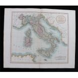
John Cary, A New Map of Italy including the islands of Sicily, Sardinia and Corsica, 1799, London
John Cary, A New Map of Italy including the islands of Sicily, Sardinia and Corsica, 1799, London published by J. Cary Engraver & Map Seller, No 1...
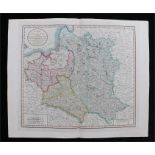
John Cary, A New Map of Poland and the Grand Duchy of Lithuania, 1799, London published by J. Cary
John Cary, A New Map of Poland and the Grand Duchy of Lithuania, 1799, London published by J. Cary Engraver & Map Seller, No 181 Strand, 62cm x 53...
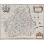
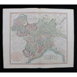
Jan Jansson, 17th Century map, Northumbria Cumberlandia Et Dunelmensis, hand coloured map, 47cm x
Jan Jansson, 17th Century map, Northumbria Cumberlandia Et Dunelmensis, hand coloured map, 47cm x 35cm
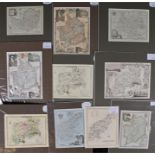
Six maps of Buckinghamshire by Cole & Roper, Creighton & Lewis (3), Thomas Moule (2), three maps
Six maps of Buckinghamshire by Cole & Roper, Creighton & Lewis (3), Thomas Moule (2), three maps of Berkshire by Creighhton & Lewis, Thomas Moule ...
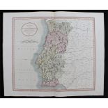
John Cary, A New Map of The Kingdom of Portugal, 1801, London published by J. Cary Engraver & Map
John Cary, A New Map of The Kingdom of Portugal, 1801, London published by J. Cary Engraver & Map Seller, No 181 Strand, 62cm x 53cm
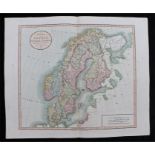
John Cary, A New Map of Sweden, Denmark and Norway, 1801, London published by J. Cary Engraver & Map
John Cary, A New Map of Sweden, Denmark and Norway, 1801, London published by J. Cary Engraver & Map Seller, No 181 Strand, 62cm x 53cm
Two maps of Oxfordshire by Creighton & Kitchin, two maps of England & Wales, map of Yorkshire, map
Two maps of Oxfordshire by Creighton & Kitchin, two maps of England & Wales, map of Yorkshire, map of Berkshire by J. & C. Walker, map of Kent by...
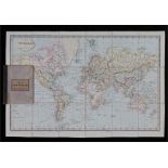
Laurie's map of the world on Mercators projection, the folding map of book form, the interior
Laurie's map of the world on Mercators projection, the folding map of book form, the interior cover with inscription dated 1857
Six maps of Cheshire by Creighton, Kitchin, Moule, & Oddy map of Lincolnshire by Moule, plan of
Six maps of Cheshire by Creighton, Kitchin, Moule, & Oddy map of Lincolnshire by Moule, plan of Boston Lincolnshire, (8)
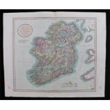
John Cary, A New Map of Ireland, 1799, London published by J. Cary Engraver & Map Seller, No 181
John Cary, A New Map of Ireland, 1799, London published by J. Cary Engraver & Map Seller, No 181 Strand, 62cm x 53cm
Four maps of Cornwall by Morden, Creighton & Fullarton, two maps of Derbyshire by Kitchin (2), two
Four maps of Cornwall by Morden, Creighton & Fullarton, two maps of Derbyshire by Kitchin (2), two maps of Suffolk by Chapman & Hall and Kitchin,...
Jan Jansson map of Durham, circa 1641, Episcopatus Dunelmensis Vulgo The Bishoprike Of Durham,
Jan Jansson map of Durham, circa 1641, Episcopatus Dunelmensis Vulgo The Bishoprike Of Durham, hand coloured, 51cm x 43cm
Map of Sussex, with details of the road from London to Arundel to the top section, three maps of
Map of Sussex, with details of the road from London to Arundel to the top section, three maps of Wiltshire, one with depiction of Salisbury Cathed...
Four maps of Kent by Kitchin (2), Fullerton & Oddy, two maps of Northumberland by Kitchin, Cole &
Four maps of Kent by Kitchin (2), Fullerton & Oddy, two maps of Northumberland by Kitchin, Cole & Roper, two maps of Rutlandshire, map of Oxfordsh...
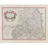
John Cary, A New Map of Piedmont the Duchies of Savoy and Milan; and the Republic of Genoa, 1799,
John Cary, A New Map of Piedmont the Duchies of Savoy and Milan; and the Republic of Genoa, 1799, London published by J. Cary Engraver & Map Selle...
Four maps of Durham by Lewis, Moule, Fullerton & Cary, two maps of Essex by Cary & Oddy, two maps of
Four maps of Durham by Lewis, Moule, Fullerton & Cary, two maps of Essex by Cary & Oddy, two maps of Hertfordshire by Moule & Cary, a map of Dorse...
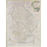
Emanuel Bowen (British, 1694-1767): A map of Lincolnshire divided into its Wapontakes, printed for
Emanuel Bowen (British, 1694-1767): A map of Lincolnshire divided into its Wapontakes, printed for Laurie & Whittle, hand coloured, 54cm x 73cm
John Cary, A New Map of Hungary, Transylvania and Croatia, 1799, London published by J. Cary
John Cary, A New Map of Hungary, Transylvania and Croatia, 1799, London published by J. Cary Engraver & Map Seller, No 181 Strand, 62cm x 53cm
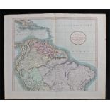
John Cary, A New Map of South America, 1807, London published by J. Cary Engraver & Map Seller, No
John Cary, A New Map of South America, 1807, London published by J. Cary Engraver & Map Seller, No 181 Strand, 62cm x 53cm
Four maps of Surrey by Robert Morden, published by Fullerton, published by Oddy & engraved by J.
Four maps of Surrey by Robert Morden, published by Fullerton, published by Oddy & engraved by J. Roper, two maps of Middlesex by Thomas Kitchin &...
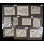
Four maps of Norfolk by Fullarton, Kitchin, Moule & Oddy, two maps of Leicestershire by Moule &
Four maps of Norfolk by Fullarton, Kitchin, Moule & Oddy, two maps of Leicestershire by Moule & Kitchin, two maps of Northumberland by Moule & Odd...
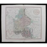
John Cary, A New Map of the Circle of Bavaria, 1799, London published by J. Cary Engraver & Map
John Cary, A New Map of the Circle of Bavaria, 1799, London published by J. Cary Engraver & Map Seller, No 181 Strand, 62cm x 53cm
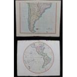
John Cary, The Western Hemisphere, 1799 London published by J. Cary Engraver & Map Seller, No 181
John Cary, The Western Hemisphere, 1799 London published by J. Cary Engraver & Map Seller, No 181 Strand, 62cm x 53cm, together with another by Jo...
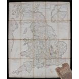
A new map of the roads of Great Britain for 1787 London published by Wm. Taden, with marbled
A new map of the roads of Great Britain for 1787 London published by Wm. Taden, with marbled effect slip case, the map formed from twenty linen ba...