Keine Abbildung Los 368 Joule's Stone Ales 'Stone Ale Britain's Best Bottled Beer' adverting display card, 24cm x 31.5cm. On 368Joule's Stone Ales 'Stone Ale Britain's Best Bottled Beer' adverting display card, 24cm x 31.5cm. On Leighton Hall Auctions Joule's Stone Ales 'Stone Ale Britain's Best Bottled Beer' adverting display card, 24cm x 31.5cm. On easel back, of local Stone, Staffordshire br... Auf die Merkliste Live
Keine Abbildung Los 394 A History of the Highlands and of the Highland Clans by James Browne, parts 3 7 8 9 10 13 14 out 394A History of the Highlands and of the Highland Clans by James Browne, parts 3 7 8 9 10 13 14 out Leighton Hall Auctions A History of the Highlands and of the Highland Clans by James Browne, parts 3 7 8 9 10 13 14 out of 22 (7). Paper covers distressed, part 9 conta... Auf die Merkliste Live
Keine Abbildung Los 424 Framed antique map of Staffordshire by T. Kitchen, hand coloured, 18xm x 23cm. 424Framed antique map of Staffordshire by T. Kitchen, hand coloured, 18xm x 23cm. Leighton Hall Auctions Framed antique map of Staffordshire by T. Kitchen, hand coloured, 18xm x 23cm. Auf die Merkliste Live
Keine Abbildung Los 425 Framed antique 'A New Map of Staffordshire' By John Cary, Engraver, 1806, 55cm x 49cm. 76cm x 69cm 425Framed antique 'A New Map of Staffordshire' By John Cary, Engraver, 1806, 55cm x 49cm. 76cm x 69cm Leighton Hall Auctions Framed antique 'A New Map of Staffordshire' By John Cary, Engraver, 1806, 55cm x 49cm. 76cm x 69cm in frame. Auf die Merkliste Live
Keine Abbildung Los 470 A collection of framed antique maps including Montgomeryshire, 1607, Shropshire, 1610 by Christopher 470A collection of framed antique maps including Montgomeryshire, 1607, Shropshire, 1610 by Christopher Leighton Hall Auctions A collection of framed antique maps including Montgomeryshire, 1607, Shropshire, 1610 by Christopher Saxton & engraved by William Hole with anothe... Auf die Merkliste Live
Keine Abbildung Los 471 A collection of framed antique maps of Staffordshire by Robert Morden, 1685, Christopher Saxton & 471A collection of framed antique maps of Staffordshire by Robert Morden, 1685, Christopher Saxton & Leighton Hall Auctions A collection of framed antique maps of Staffordshire by Robert Morden, 1685, Christopher Saxton & William Kip, 1637, Richard Blome, 1673 together ... Auf die Merkliste Live
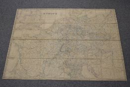
Mindestpreis nicht eingehalten Keine Abbildung Los 511 Folding Map. Wyld, James - Post Map of Europe. London: 1845. Coloured in outline, dissected in 40 511Folding Map. Wyld, James - Post Map of Europe. London: 1845. Coloured in outline, dissected in 40 1818 Auctioneers Folding Map. Wyld, James - Post Map of Europe. London: 1845. Coloured in outline, dissected in 40 sections. Depicts roads, railways and sea-routes... Auf die Merkliste Timed
Mindestpreis nicht eingehalten Keine Abbildung Los 596 Scandinavia. History and topography. A small selection, includes guides and maps, and Anson, W. S. 596Scandinavia. History and topography. A small selection, includes guides and maps, and Anson, W. S. 1818 Auctioneers Scandinavia. History and topography. A small selection, includes guides and maps, and Anson, W. S. W. [ed.] - Asgard and the Gods. London: Swan So... Auf die Merkliste Timed
Mindestpreis nicht eingehalten Keine Abbildung Los 600 Folding Map. W. & A. K. Johnston's New Map of Scotland on scale of three miles to inch. Sheet 16 - 600Folding Map. W. & A. K. Johnston's New Map of Scotland on scale of three miles to inch. Sheet 16 - 1818 Auctioneers Folding Map. W. & A. K. Johnston's New Map of Scotland on scale of three miles to inch. Sheet 16 - Shetland Islands. (1) Auf die Merkliste Timed
Mindestpreis nicht eingehalten Keine Abbildung Los 624 Folding Maps. Four titles: Bacon's New Commercial & Reference Chart of the British Isles (c.1910); 624Folding Maps. Four titles: Bacon's New Commercial & Reference Chart of the British Isles (c.1910); 1818 Auctioneers Folding Maps. Four titles: Bacon's New Commercial & Reference Chart of the British Isles (c.1910); Ordnance Survey Map of Roman Britain; Ordnance ... Auf die Merkliste Timed
Mindestpreis nicht eingehalten Keine Abbildung Los 663 World History. A reproduction of Adams Syn-Chronological Chart or Map of History. Master Books 663World History. A reproduction of Adams Syn-Chronological Chart or Map of History. Master Books 1818 Auctioneers World History. A reproduction of Adams Syn-Chronological Chart or Map of History. Master Books edition: 2007. Large Fold-out format - extends to 2... Auf die Merkliste Timed
Mindestpreis nicht eingehalten Keine Abbildung Los 120 A printed map of Chester dated c1600, 61cm x 48cm overall, sold together with a printed map of old 120A printed map of Chester dated c1600, 61cm x 48cm overall, sold together with a printed map of old 1818 Auctioneers A printed map of Chester dated c1600, 61cm x 48cm overall, sold together with a printed map of old Lancaster, (2) Auf die Merkliste Timed
Mindestpreis nicht eingehalten Keine Abbildung Los 217 A vintage poster of Her Majesty Queen Elizabeth, L51cm, sold together with various maps 217A vintage poster of Her Majesty Queen Elizabeth, L51cm, sold together with various maps 1818 Auctioneers A vintage poster of Her Majesty Queen Elizabeth, L51cm, sold together with various maps Auf die Merkliste Timed
Mindestpreis nicht eingehalten Keine Abbildung Los 692 A 'FUJIYAMA' HANDSCROLL Japan, 19th century 692A 'FUJIYAMA' HANDSCROLL Japan, 19th century Bonhams A 'FUJIYAMA' HANDSCROLL Japan, 19th century Depicting 19 individual views of Fujiyama, ink and colour on paper. 1280cm (504in) long. Footnotes: 日本... Auf die Merkliste Timed
Keine Abbildung Los 530 Great Britain OHMS envelope cancelled with Southampton Machine Slogan cancel posted to O.C. Air HQ 530Great Britain OHMS envelope cancelled with Southampton Machine Slogan cancel posted to O.C. Air HQ James & Sons Auctioneers Great Britain OHMS envelope cancelled with Southampton Machine Slogan cancel posted to O.C. Air HQ RAF Habbaniya Iraq. Oval military Admin Ordnanc... Auf die Merkliste Live
Keine Abbildung Los 3500 END OF SALE, THANK YOU FOR YOUR BIDDING. OUR NEXT SALE IS ON THE WEDNESDAY 11TH AND THURSDAY 12TH 3500END OF SALE, THANK YOU FOR YOUR BIDDING. OUR NEXT SALE IS ON THE WEDNESDAY 11TH AND THURSDAY 12TH Ashley Waller Auctioneers END OF SALE, THANK YOU FOR YOUR BIDDING. OUR NEXT SALE IS ON THE WEDNESDAY 11TH AND THURSDAY 12TH JUNE Auf die Merkliste Live
Keine Abbildung Los 501 Victorian embroidered map, depicting 'Palestine in the Time of Our Saviour', done by Evangeline 501Victorian embroidered map, depicting 'Palestine in the Time of Our Saviour', done by Evangeline Lockdales Victorian embroidered map, depicting 'Palestine in the Time of Our Saviour', done by Evangeline Molyneux, April 27th 1866, 38cm x 46cm approx. Auf die Merkliste Live
Mindestpreis nicht eingehalten Keine Abbildung Los 226 A Framed Georgian ? Linen Good Sized Fragment incorporating Deer and Swans. H 32cm x W 77.5cm 226A Framed Georgian ? Linen Good Sized Fragment incorporating Deer and Swans. H 32cm x W 77.5cm Phixius Auctions A Framed Georgian ? Linen Good Sized Fragment incorporating Deer and Swans. H 32cm x W 77.5cm Auf die Merkliste Timed