


Title: Bournemouth & Swanage, Cloth Backed Antique 1919 Engineering Map. Description: Bournemouth & Swanage, Cloth Backed Antique 1919...
Collectables Auctions
Explore an enormous array of collectables auctions on the UK's leading online auction marketplace. Browse models, toys, dolls, games, arms, armour, militaria, books & periodicals, sporting equipment & memorabilia, musical instruments, stamps, coins, classic cars & motorcycles, camera & camera equipment, wines & spirits, maps, religious items & folk art, banknotes, entertainment memorabilia, and more. With so many reputable auction houses selling on the saleroom, you can find the collectables auctions you're looking for and more. Use tools like watch lists, auction alerts, filters, and more to speed up your search and compete in live and timed auctions. Place winning bids on the items that match your criteria and get your next collectable on the saleroom.
Popular categories
Musical Instruments & Memorabilia
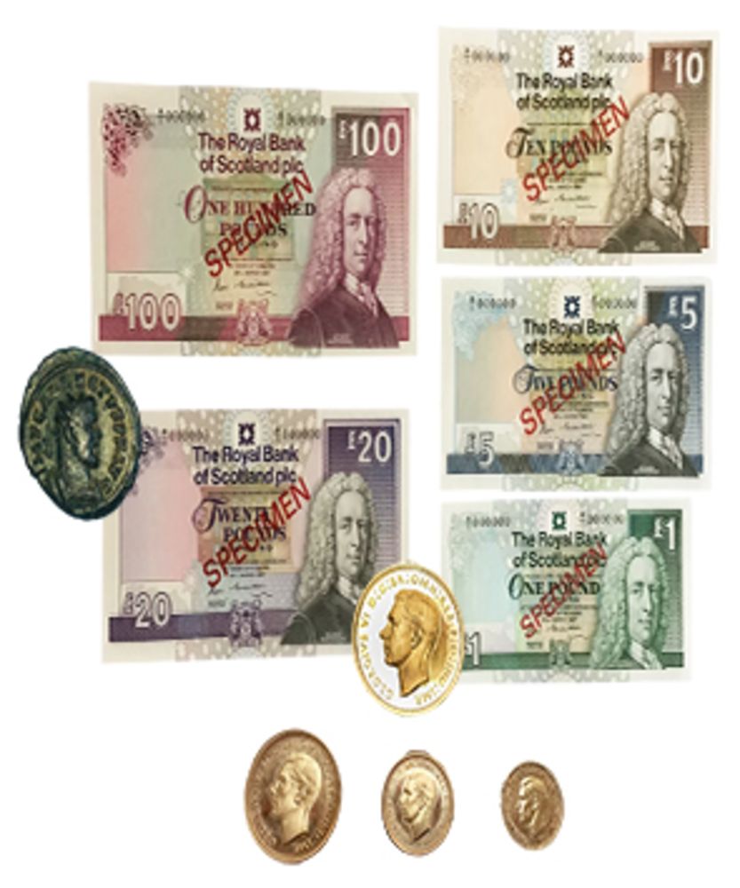
Bank Notes
Cameras & Photography Equipment
Entertainment Memorabilia
Kitchenalia
Toys & Games
Railwayana
Religious Items & Folk Art
Scientific Instruments
Writing Instruments
Sports Memorabilia & Equipment Auctions
Collectable Stamps
Tools
Taxidermy
Arms, Armour & Militaria
Vintage Wine & Spirits
Featured auctions
Upcoming auctions


617 item(s)
Filtered by:
- Category
- List
- Grid
-
617 item(s)/page

Lot 829
WEST INDIES -- "OCCIDENTALIS AMERICAE PARTIS, vel, earum Regionum quas Christophorus Columbus primu
WEST INDIES -- "OCCIDENTALIS AMERICAE PARTIS, vel, earum Regionum quas Christophorus Columbus primu[m] detexit (…)". (Frankfurt a/M.), Th. de Bry,...

INDIA. ARROWSMITH, Aaron. Hindoostan, London: R.H.Laurie 1851, hand-coloured engraved map, sectionalised and laid on linen, occasional spotting an...

Lot 1150
ERIC SLATER (BRITISH, 1896-1963)
ERIC SLATER (BRITISH, 1896-1963) A Sussex Mill signed and titled 'Eric Slater' (lower margin) woodcut 23.5 x 34cm ARR Provenance Private ...

Lot 297
MAP, CHURCHILL. Dunkirk to Berlin June, 1940 - July, 1945 Journeys Undertaken By The Rt. Honble.
MAP, CHURCHILL. Dunkirk to Berlin June, 1940 - July, 1945 Journeys Undertaken By The Rt. Honble. Winston S. Churchill..., London: George Philip & ...

COLLINS, Captain Greenvile. Great Britain's Coasting Pilot. In Two Parts. Being a new and Exact Survey of the Sea-Coast of England and Scotland fr...

‡ PHAREODUS TESTIS (KNIGHTIA EOCAENA) Medium Eocene 50 m.a White River FMT Kemmerer Wyoming 51cm high, 86cm wide ...

Lot 294
KNIPE, James Alexander.
KNIPE, James Alexander. Geological & Mineralogical Map of England & Wales, with Parts of Scotland, Ireland & France...3rd edition, London: J.A.Kni...

Lot 281
EGYPT. WYLD, James.
EGYPT. WYLD, James. Map of the Nile District between Assouan & Khartoom (Wylde's Military Staff Map, Wylde's Egyptian Series No. 13), London: Jame...

JULIAN CHICHESTER, a 'Tassia' lamp, green colourway glass, on lucite base, 62.5cm high (1) Condition Report: Overall domestic wear a...

Lot 48
Johann Babtiste Homann (1664 - 1724, Nürnberg) - Landkarte Kaspisches Meer und Kamtschatka, um 1720
Johann Babtiste Homann (1664 - 1724, Nuremberg) - Map of the Caspian Sea and Kamchatka, c. 1720Mare Caspium altera Kamtzadaliam seu Terram Jedso. ...

Lot 282
ELLIS, John. Ellis's English Atlas: or, a Compleat Chorography of England and Wales: in Fifty Maps..
ELLIS, John. Ellis's English Atlas: or, a Compleat Chorography of England and Wales: in Fifty Maps..., London: Robert Sayer et al. 1768, title, 49...

COLLECTION OF WWII AVIATION MAPS, comprising of a number of aviation and military related maps, mainly comprising Ordnance Survey Aeronautical m...

Lot 216
BORLASE, William.
BORLASE, William. Observations on the Antiquities Historical and Monumental, of the County of Cornwall..., 1st edition, Oxford: W. Jackson 1754, t...

Lot 312
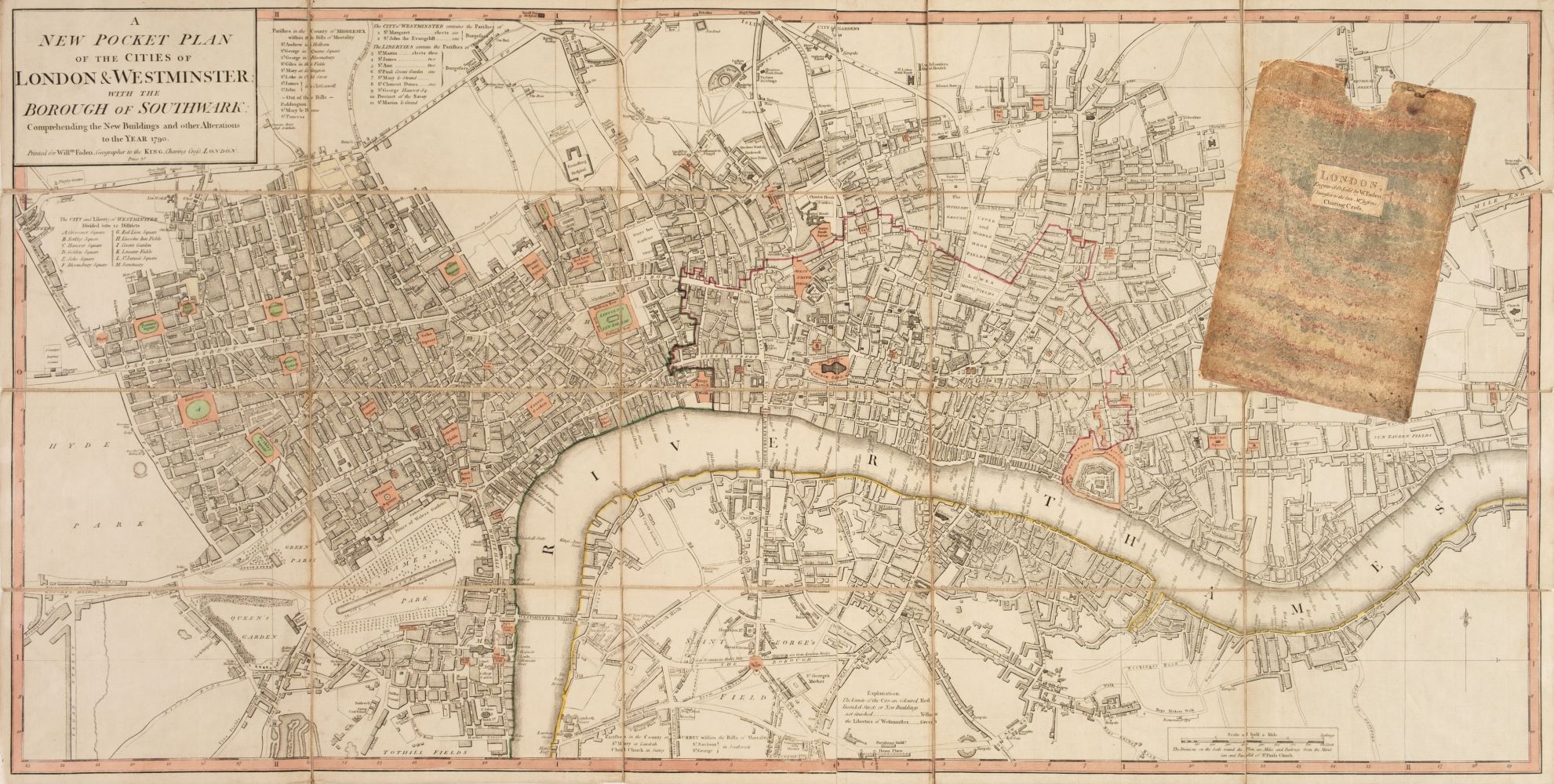
STANFORD, Edward.
STANFORD, Edward. Stanford's two inch map of London and its environs, Municipal Edition, London: Edward Stanford Ltd., nd, coloured map, with addi...

Lot 235
Quantity of various One-Inch & Ordnance Survey maps - various places in the UK ALL USED UNCHECKED
235Quantity of various One-Inch & Ordnance Survey maps - various places in the UK ALL USED UNCHECKED
Quantity of various One-Inch & Ordnance Survey maps - various places in the UK ALL USED UNCHECKED

MAPS -- "AVRUPA, ASYA ve AFRIKA (…)". (Istanbul?), State Printing Office Matbaa-i Amire, dated 1254 (=1838/1839). Printed map of the (Holy) Ottoma...

Lot 305
AFTER WILLIAM FADEN, 1749 - 1836, A HAND COLOURED PRINT MAP Titled ‘A Chart of Antilles or Charibbee
AFTER WILLIAM FADEN, 1749 - 1836, A HAND COLOURED PRINT MAP Titled ‘A Chart of Antilles or Charibbee or Caribs Islands with the Virgin Isles’, in ...

BERKSHIRE. KIP, Johannes, after Knyff, Leonard. Hamstead Marshall in the County of Bercks, one of the Seats of the Rt Hon'ble William Lord Craven....

Lot 278
DEVON. GREENWOOD, C. & J.
DEVON. GREENWOOD, C. & J. Map of the County of Devon, from an actual survey made in the years 1825 & 1826, London: Greenwood & Co. 1829, hand-colo...

Lot 290
HAMPSHIRE. SPEED, John.
HAMPSHIRE. SPEED, John. Hantshire described and devided, Thomas Bassett & Richard Chiswell [1676], hand coloured engraved map, inset town plan of ...

Lot 4169
GEORGE PHILLIPS AND SONS, Phillips School Room Map of the World, on Mercators projection, showing..
GEORGE PHILLIPS AND SONS, Phillips School Room Map of the World, on Mercators projection, showing.., 1963, issued by the London Geographical Inst...

HAACK GOTHA, Map of London, scale 1:10,000, paper on linen, printed to the margin, Veb Hermann Haak, Geographisch-Kartographische Astalt Gotha/Le...

Lot 130
AN AUSTRALIAN GEOGRAPHIC GLOBE.
AN AUSTRALIAN GEOGRAPHIC GLOBE.

EARLY ORIGINAL MAP OF ANGLESEY, APPROXIMATELY 24 x 35cm reasonable used condition

Lot 132
Two boxes containing various vintage Ordnance Survey maps, to include Loch Lomond, Bradford,
Two boxes containing various vintage Ordnance Survey maps, to include Loch Lomond, Bradford, Bolton ect, over 100

Lot 190
Two boxes containing various Ordnance Survey maps of the UK, to include Preston and Blackpool,
Two boxes containing various Ordnance Survey maps of the UK, to include Preston and Blackpool, Askrigg & Settle and Selkirk, over 100 maps

Lot 290
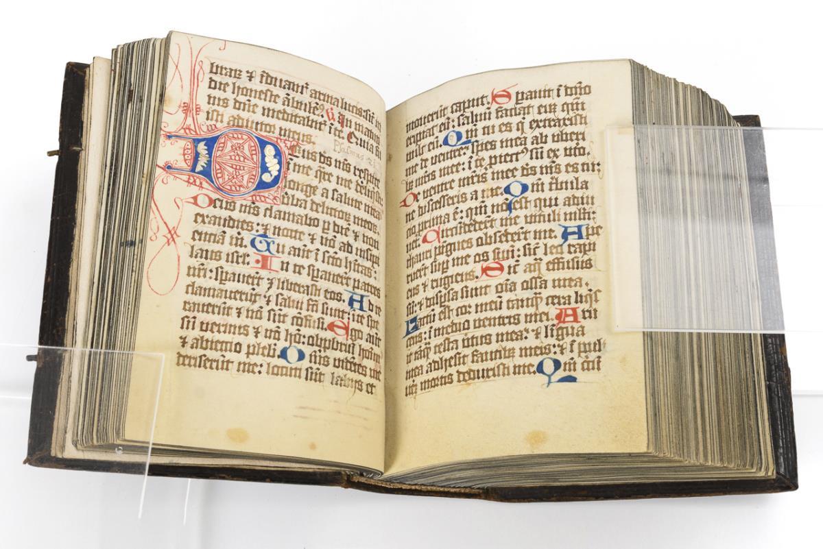
Illuminated manuscript of Noah's Ark Indo-Persian with text to the sides, 21cm x 30cm There is
Illuminated manuscript of Noah's Ark Indo-Persian with text to the sides, 21cm x 30cm There is some staining, and a heavier stain i...

Lot 330
GIBRALTAR. Garrison Orders, July 1829 to Nov 1829, manuscript on paper, c.127 leaves, contemp.
GIBRALTAR. Garrison Orders, July 1829 to Nov 1829, manuscript on paper, c.127 leaves, contemp. calf scuffed, cracked to joints (tape repairs), 13....

SOMERSET. CRUCHLEY, George Frederick. Cruchley's Road and Railway Map of the County of Somerset, London & Edinburgh: Gall & Inglis, f&g, 50.5cm x ...

Lot 462
A large Early 20th Century Irish advertising poster. With the map of Belfast District and local
A large Early 20th Century Irish advertising poster. With the map of Belfast District and local businesses. Circa 1915-1918. Issue 2158. J. W. Har...

Lot 524
Thomas Hodgson, a map of Westmorland, London, W R Gardener, 1828, engraved and watercolour tinted,
Thomas Hodgson, a map of Westmorland, London, W R Gardener, 1828, engraved and watercolour tinted, dissected and laid on cotton, in calf book-f...

Lot 408
A group of Second World War Ordnance Survey revision and other military maps of Great Britain
A group of Second World War Ordnance Survey revision and other military maps of Great Britain

Lot 525
"Map of the County of Westmorland from an Actual Survey made in The Years 1822 & 1823 by C & J
"Map of the County of Westmorland from an Actual Survey made in The Years 1822 & 1823 by C & J Greenwood. Most Respectfully Dedicated to the Nobil...

Lot 191
Two views of the Holy sites of Islam : the Masjid al-Haram at Mecca and the Masjid al-Nabawi at M...
Two views of the Holy sites of Islam : the Masjid al-Haram at Mecca and the Masjid al-Nabawi at Medina, India, early 20th century, Opaque p...

Lot 2417
A large antique map of Worcester.
A large antique map of Worcester.


Rare Antique Georgian Cartographer’s Étui, Navigation Map Drafting Kit, Original 1760-1790 together with the Captain Hook Magnifier with original ...

A group of 7 blue binders holding various ordnance survey maps of Great Britain, (7)

Lot 793
EASTERN EUROPE -- POLAND -- "POLONIA ET SILESIA". (Amst., Mercator/Hondius, around or before
EASTERN EUROPE -- POLAND -- "POLONIA ET SILESIA". (Amst., Mercator/Hondius, around or before 1595). Plain engr. map. 345 x 457 mm. -- Added: COLLE...

Lot 1805
19th Century School - 'On the Nile near Siout' (1875), watercolour, monogrammed and dated lower
19th Century School - 'On the Nile near Siout' (1875), watercolour, monogrammed and dated lower right, 23 x 16 cm; together with a map of Africa b...

ATLASES. BUTLER, Samuel. An Atlas of Ancient Geography, London: Longman & Co., nd, 22 double-page engr. maps, hand-coloured in outline, contemp. i...

Lot 238
DE LA BECHE, Henry T.
DE LA BECHE, Henry T. Report on the Geology of Cornwall, Devon and West Somerset, London: Longman et al. 1839, hand-coloured engr. folding map to ...

Lot 10
FASHION.
FASHION. Journal des Demoiselles, vingt-huitième année, Paris: Bureau du Journal 1860, 24 hand-coloured engraved plates, 2 folding monochrome plat...

NORTHERN COUNTIES. MORDEN, Robert. Three hand-coloured engraved maps [1695 or later]: Northumberland, 43cm x 36.5cm; Cumberland, 37.5cm x 43.5cm; ...
![BRITISH ISLES. A group of seven C18th maps: ANDRÉ, Pierre [Peter Andre] (engr.](https://portal-images.azureedge.net/auctions-2025/bearne10187/images/8091396d-f513-4538-8fd7-b2ca00cf3b57.jpg?w=155&h=155)
BRITISH ISLES. A group of seven C18th maps: ANDRÉ, Pierre [Peter Andre] (engr.) after BONNE, Rigobert. Isles- Britanniques; contenant les Royaumes...

Mangalore Series of Object Lesson Charts: Indian Scenaries (Printed in Germany), vintage educational items, published by the Basel Mission Press a...

A 1950'S "TOWN" CREATION COAT STYLED BY HELEN VAN VLIET.

Lot 1649
5 black and gilt framed maps incl. street plan of St. Neots, 1635 map of the British Isles by Willem
5 black and gilt framed maps incl. street plan of St. Neots, 1635 map of the British Isles by Willem & Johan Blaeu, similar map of Middlesex, Lanc...

An 18th century map of Worcester, showing the Digliss and Pitchcroft, J.Doharty 1741

Lot 797
A tin of J Huthart & Co Hosiers & General Drapers of Carlisle Superior Pins, late 19th / early
A tin of J Huthart & Co Hosiers & General Drapers of Carlisle Superior Pins, late 19th / early 20th Century, 11 cm x 7 cm x 2.5 cm

A framed map, and a gilded leaf and slate artwork.

Lot 339
Abraham Ortelius (1527-1598) 1601 Original Copperplate map of Burgundy Details to the reverse side
Abraham Ortelius (1527-1598) 1601 Original Copperplate map of Burgundy Details to the reverse side of the map. Frame- 47.5x60cm

Lot 58
Newly renovated, not yet on the market holiday home in Anglesey Located on the inland coast in
Newly renovated, not yet on the market holiday home in Anglesey Located on the inland coast in Anglesey, Wales. This 2 bed bungalow would be avai...

Lot 120
A large quantity of early 20th century Ordnance Survey maps, to include Carmarthen, St. David's &
120A large quantity of early 20th century Ordnance Survey maps, to include Carmarthen, St. David's &
A large quantity of early 20th century Ordnance Survey maps, to include Carmarthen, St. David's & Cardigan, Brecon & Llandovery, Abergavenny, Glou...

North Eastern Railway Plans & Sections Session 1889, Sheet No 1 & 2, Railway No 2, No 3, Additional Lines, Land to be Taken, Land on Blyth and Tyn...

1967 coloured print of Saxton's Map of Somerset, 1575 by Taylowe Limited. Framed and glazed, measuring approx. 53.5cm x 65.5cm.

SOUTH AMERICA -- "A NEW AND ACCURATE MAP of Peru and the Country of the Amazones, drawn from the most authentick French maps &c. and regulated by ...

SOUTH AMERICA -- "AMERICA MERIDIONALIS". (Amst., J. Hondius, 1619). Engr. map of South-America, cold. by hand, w. inset view of Cusco. 364 x 498 m...

Lot 348
A large framed Elizabeth II silver map of Great Britain, the large silver panel having an engraved
A large framed Elizabeth II silver map of Great Britain, the large silver panel having an engraved map of Great Britain with county borders and th...