We found 85712 price guide item(s) matching your search
There are 85712 lots that match your search criteria. Subscribe now to get instant access to the full price guide service.
Click here to subscribe- List
- Grid
-
85712 item(s)/page


Lot 167
PU RU (1896 - 1963) MOUNTAIN LANDSCAPE China, undated. 81 x 25 cm. Ink and colours on paper. Hanging scroll, brocade mounting. Inscription: "The shadows of the poplars and willows caress the long bank, the spring waves reach the fishing boat. The sun will soon set, a light wind blows, carrying the fragrance of flowers from the opposite bank." Signed: Pu Ru. Oval seal before the inscription: Qing nanji. Seal after the inscription: Pu Ru Provenance: Collection of a Czechoslovak journalist. Obtained from master Liu Jintao in Beijing in the late 1950s. Reserve price: 220,000


Lot 46
Cecil Galbally RHA (1911-1995) FISHING BOATS AT KINSALE, CORK oil on board signed lower right; titled on reverse; with Victor Waddington label also on reverse 12 by 15.25in., 30 by 38.125cm. L Victor Waddington Gallery, Dublin;Private collection Contained in original Waddington frame. For further reading on this Dublin born artist see Snoddy p.177-179.

Lot 60
Nano Reid (1900-1981) SALMON FISHING ON THE BOYNE, c.1950 oil on panel signed lower left; with exhibition label affixed on reverse 24 by 48in., 60 by 120cm. L James Adam & Sons, 29 March 1995, lot 36 as Fishermen;Private collection Nano Reid and Gerard Dillon`, Highlanes Gallery, Drogheda, 6 November to 10 January 2009 (loaned by present owner) Ed., Coulter, Dr. Riann and NicGhabhann, Niamh, Nano Reid and Gerard Dillon Curated by Riann Coulter, Highlanes Gallery, Drogheda, 2009 (edition of 1,000), p.16-17 (illustrated) Salmon Fishing on the Boyne is an extremely important work within Nano Reid`s oeuvre. It is both a scene of everyday life in mid-century Ireland and a valuable historical record of a particular time and place. Born in Drogheda in 1905, Nano Reid studied and worked in Dublin, London and Paris before she eventually settled back in her home town. During the 1950s Reid painted several works inspired by Drogheda including Where the Ships Unload, Old Town by the River and the large mural she painted for her family`s pub. That mural, now in the Drogheda Municipal Collection and on display in the Highlanes Gallery, is stylistically similar to Salmon Fishing on the Boyne and dates from the same period c. 1950.Although Salmon Fishing on the Boyne was not intended to be documentary and includes the Modernist distortions of scale and perspective that were typical of Reid`s work in this period, it still constitutes a valuable record of a traditional way of life. For centuries salmon fishing was an important source of food and revenue for those who lived along the Boyne. There were around forteen fishing stations on the river and while it is difficult to identify the exact location of this scene, it may be an area of the river bank close to the town centre, which is known as The Ramparts. According to Leo Boyle, Boyne salmon fishermen had a particular method of working which involved two men. One man stayed on shore holding a rope attached to the net, while the other rowed out into the river with the other end of the net. Once the whole net was spread out, the boatman rowed back to shore and the two men pulled the net to shore, trapping fish as it went.(1) In Reid`s painting the catch has been hauled in. Two fishermen are inspecting (or mending) the net, while a third man pulls a rope through the water. Two small row boats are moored nearby and more can be seen across the river. The chimney-like structures on the far shore resemble the lime kilns that were a historic feature of this area. Despite the years that she spent in Dublin, Reid always attributed her initial interest in art to Drogheda and the Boyne. In 1974 she told the journalist Martin Dillon, What started me off was an interest in the prehistoric Irish remains. An interest grew up around all that and the natural thing was to paint it. ... I looked around me more and painted what appealed to me in an emotional way. The thing is I have to have a subject that I feel about and the only ones I feel about are those places (Boyne Valley). There is no use in trying to paint a place I have no feeling for. The essence of a place is very important to me.(2) In addition to its subject matter, Salmon Fishing on the Boyne is successful in purely formal terms. The composition is unusual but balanced and there are notable formal elements such as the group of swans, whose dynamic bobbing is echoed and emphasised through the reflections in the river and the hatching of the fishing net. Curves flow through the composition from the outline of the shore to the boats, nets, rope and men`s baggy trousers. The shape of the boats echoes the fish and the fishermen`s flat caps. The warm palette dominated by yellows, pinks and blues, contradicts those critics who have condemned Reid`s use of earthy greens and browns in later paintings including Cave of the Firbolg (Collection Arts Council of Ireland). Ultimately, Salmon Fishing on the Boyne proves that, despite being so firmly rooted in a particular place, Reid could produce work of universal appeal.Dr Riann CoulterApril 20141 Leo Boyle, Salmon Fishing on the Boyne River, A Brief Synopsis of the Boyne River Salmon Fishery, www.patburnsphotography.net, accessed 16/4/2014.2 Nano Reid interviewed by Martin Dillon, BBC Northern Ireland, 1974. Transcript, Reid Archive, Highlanes Gallery, Drogheda.


Lot 802
A framed and coloured etching of Canterbury Cathedral by Edouard Sharland signed in pencil - 43 cm x 24 cm along with an original etching - on the Oise near Auvers by John Fullwood F.S.A. - 16 cm x 24 cm and a pen and ink of Fishing boats and nets drying signed T. Ralli Scaramanga Martigues 1898 - 20 cm x 29.5 cm

Lot 154
Autograph - Ernest Hemingway and Fidel Castro printed card showing a graphic illustration of the famous meeting between Hemingway and Castro in 1960^ one of a limited edition of 10 (this being number 3) signed by both Hemmingway and by Castro to base. It is dated May 20th 1960. This has been consigned by a vendor who has spent a considerable number of years in Cuba and who obtained it in Havana some years ago. He has stated to us that on obtaining the item he took it to an expert in Canada who tested the paper and verified that it was correct for the period. He also verified that the paper used was expensive and difficult to print on - particularly in Cuba where paper is hard to come by. A total of 10 cards only were produced^ each signed. The event depicted was a fishing tournament which Hemingway organised and Castro won. It was one of the few times the two ever met^ and the date of the tournament was five days before this print is dated. The print is based on a famous original photograph.
![[Lot of 5] Nova Orbis Tabula, in Lucem Edita [and] Novissima et Accuratissima Septentrionalis ac Meridionalis Americae Descr](http://lot-images.atgmedia.com/SR/36385/2906594/9-201458131834_468x382.jpg)
Lot 9
[Lot of 5] Nova Orbis Tabula, in Lucem Edita [and] Novissima et Accuratissima Septentrionalis ac Meridionalis Americae Descriptio... [and] Totius Africae... [and] Accuratissima Totius Asiae Tabula... [and] Nova et Accurate ... Europae Descriptio This is a matching set of maps of the world and continents by noted Dutch map publisher, Frederick de Wit. Size varies slightly. A. Nova Orbis Tabula, in Lucem Edita. This is one of the most attractive double-hemispherical world maps of the late seventeenth century. The corners are filled with images of the seasons, the zodiac, and the elements, all combined within four well-composed vignettes. At top left is a personification of Spring, who also represents Virgo, with the element of Air billowing her robes. The bull of Taurus and the ram of Aries are shown to the right. The top right vignette represents Autumn, with the shore in the background illustrating the element Water. A putti holds a crab representing Cancer, and another holds the lion of Leo. The twins of Gemini flank the inset of the North Pole at top. The lower left scene presents Summer and Earth with a wine-imbibing Bacchus and a scene of drunkenness The signs for Scorpio and Libra are held by two followers, while Sagittarius gallops in the background. Winter holds court in the final vignette, with the element of Fire shown to the left. Aquarius is represented by a child pouring water into a basin. A group of raucous children in the background hold a goat representing Capricorn and a fishing pole with the double fish of Pisces. In North America, the Great Lakes appear as one large semi-circle with an open western end, and the island of California is shown on the Briggs model with a flat northern coast, and a portion of Anian appears in the Pacific Northwest. South America has the mythical L. Parime astride the equator, with the imaginary golden city of Manoa on its shores. Asia displays a Japan with an oversized Iedso (Hokkaido) shown on the map of the Western Hemisphere. A partial coastline for Australia is shown, and both New Zealand and Tasmania are indicated by only one stretch of coastline. The inset of the North Pole shows Hudson Bay with two southern bays, and the inset of the South Pole is nearly blank save for the very tip of South America and Tierra del Fuego. This is the second plate with cherubs in the cusps and the appearance of Nova Guinea and Quiri Regio in the western hemisphere. Ref: Shirley #451. Condition: There are some stains in the southern hemisphere, a few minor creases, and a professionally repaired 1"" tear east of Brazil.B. Novissima et Accuratissima Septentrionalis ac Meridionalis Americae Descriptio, Multis Locis Recentibus Aucta et Correcte Divisa in Omnes Partes Hodiernas. This is the seventh state of this great map of the Americas, originally engraved circa 1675, and updated with the addition of New Guinea, the Solomon Islands, and Quiri Regio, Fretum Aniani and Terra Esonis. While the decorative features follow Visscher, the cartography is largely based on Sanson. California is an Island, the Great Lakes are open-ended in the west, and the R. del Norte flows from a large western lake and empties into the sea between the mainland and California, labeled Mare Vermio. In South America, the mythical lakes of Parime Lacus and Xarayes are shown, along with vignettes of a battle scene and a village in the Brazilian interior. The pictorial title cartouche contains scenes of gold panning, hunting and a native chief standing beneath an umbrella. The only change De Wit made was that the chief is standing on the left rather than on the right as in Visscher`s composition. The top cartouche depicts angels struggling with a devil for the soul of a Native American. Ref: Burden #465; McLaughlin #49, Tooley (America) p.120 #33. C. Totius Africae Accuratissima Tabula, Denuo Correcte Revisa, Multis Locis Aucta, in Partes tam Maiores quam Minores Divisa. The information contained in this beautiful map of the African continent is typical of the late 17th Century. The Nile appears according to the ancient pattern of Ptolemy, arising from the two lakes of Zaire and Zafflan. De Wit`s depiction of the southeastern coast includes numerous deep inlets and several rivers and lakes at the southern tip not seen on other maps of the period. The kingdom of Monomotapa extends as far south as the Rio de Infante and there are few names in the interior of the Cape. The fictitious N. I. de Sta. Helena appears in the South Atlantic. The interior is decorated with elephants, ostriches, monkeys, lions and rhinoceros, and seven small ships sail in the oceans. The well-engraved title cartouche features Moors and Africans with a child seated on an elephant and two lions perched atop the cartouche. This popular map was copied by several other cartographers including Danckerts and De Ram. This is the fifth state. Ref: Betz #114.5; Norwich #48. Condition: There is a professionally repaired tear that enters 2"" into cartouche at bottom, and a few tiny abrasions.D. Accuratissima Totius Asiae Tabula in Omnes Partes Divisa, de Novo Correcta, ac in Lucem Edita. This handsome, large map of the continent and East Indies shows the extent of European knowledge of the region. It is vividly rendered with good detail throughout the south and south east, due to the surveys of the Dutch East India Company, while northern and central Asia is filled mostly with mountains, deserts and forests. The work of the Jesuit missionaries is reflected in the well-documented region of China. The large title cartouche includes a busy scene including traders with their exotic cargo. Ref: Yeo #59. Condition: There is a professionally repaired tear that extends from the centerfold to the Black Sea, and a chip in the bottom left corner has been repaired, with image expertly replaced in facsimile.E. Nova et Accurate Divisa in Regna et Regiones Praecipuas Europae Descriptio. Finely engraved large map of Europe with the characteristic detail of this prominent Dutch cartographer. It is richly ornamented with a variety of ships sailing the seas, a compass rose, a sea monster, Europa shown riding Zeus in the form of a bull, and several putti holding the title banner aloft. Condition: Several tears adjacent to the centerfold (between 1"" and 2"" in length) have been archivally repaired. There are a few small abrasions, and some small chips and tears in blank margins have also been archivally repaired. There are some bluish shadows that appear throughout the map that are caused by our scanner, and do not appear on the map. All maps are in full original color on watermarked paper with light to moderate soiling, and professionally repaired centerfold separations at bottom. See description above for additional details. 19.2 W x 22.7 H Wit, Frederick de 1690

Lot 112
Part of North America; Containing Canada, the North Parts of New England and New York; with Nova Scotia and Newfound Land. From Sr. Robert with Improvements This beautifully engraved copper plate map, after Didier Robert de Vaugondy, describes the Maritimes and New England with an inset of the Great Lakes and course of the Mississippi River. The title is enclosed in a decorative cartouche. This is the first state of this map with the notes on fishing boundaries intact. 8.1 W x 11.5 H Barrow, John (Sir) 1759

Lot 245
Map Showing the General Location of the Natural Oyster Grounds of Maryland This colorful chart details oyster fishing beds throughout Chesapeake Bay and part of Chincoteague Bay in remarkably fine detail. The map locates Washington, D.C., Annapolis, Baltimore and Philadelphia in street grid pattern. It locates areas where oyster gathering is authorized, and by which method, as shown by the color coded key at upper left. By the 1870`s, Maryland`s oyster fields were becoming severely depleted, which led to oyster management efforts in the form of laws and regulations. This informative map is from one of the reports of that effort. The map is clean and bright and near fine with just a few tiny splits at fold intersections. Issued folding. 35 W x 22 H U.S. Government, 1893

Lot 430
To the Honourable Sr. Ralph Delaval Kt. Vice Admirall of the Red This Is Most Humbly Dedicated & Presented by Capt. Greenvile Collins Hydrographer to the King This elegant chart of the southeast coast of England spans from the Firth of Forth (here called Edinbrough Frith) down to Kent, and extends across the North Sea to show part of the coast of the Netherlands. There is little to no inland detail, but counties, towns, and cities, including a prominent London, are identified along the coasts. The chart shows good navigational detail, with soundings, fishing banks, shoals, and rocks depicted. A compass rose at the center of the chart orients north to the right and a coat-of-arms appears in England. Neptune and the allegorical female representation of Earth flank the decorative title/dedication cartouche.In 1681 Capt. Greenville Collins (fl.1669-1694) an officer in the Royal Navy was appointed by the Admiralty to make a complete survey of the coasts of Great Britain. Prior to this date the charts used by English mariners were copies of Dutch charts that had many inaccuracies. The task of surveying the entire coasts was formidable and took about 7 years, at the end of which only 46 surveys were finally used in an atlas titled ""Great Britain`s Coasting-Pilot Being a New and Exact Survey of the Sea-Coast of England,"" which was first published in 1693. There is light soiling, a few minute worm holes that are only visible when held up to light, and scattered foxing mostly concentrated in the blank margins. 17.6 W x 22.1 H Collins, Capt. Greenvile 1693
![[Lot of 2] Perth Kinross [and] Argyle This appealing pair of miniature maps focuses on Perth Kinross and Argyle, regions and](http://lot-images.atgmedia.com/SR/36385/2906594/446-20145813736_468x382.jpg)
Lot 446
[Lot of 2] Perth Kinross [and] Argyle This appealing pair of miniature maps focuses on Perth Kinross and Argyle, regions and former counties of Scotland. The Perth Kinross map is embedded in an elaborate illustration featuring a bolt of cloth, bird, waterfall, and fish (the area is known for its salmon and trout fishing). Within the map itself, towns, rivers, mountains, and a lake are identified. Engraved by Thierry. The Argyle map is surrounded by depictions of a waterfall, mallet, fishing net, sheep`s head, and bolts of cloth, and shows the string of islands that make up the region. Engraved by Migneret. Maps by Perrot are described by King as ""the most decorative miniature maps of the nineteenth century."" Size varies slightly. Each map has light scattered foxing. There are remnants of hinge tape on the verso of the Perth Kinross map. 4.3 W x 2.8 H Perrot, Aristide Michel 1823

Lot 454
This Chart of Kingsale Harbour Is Humbly Dedicated and Presented to the Right Honble Sr. Robert Southwell... This handsome chart focuses on a portion of County Cork in southwest Ireland, where the River Bandon meets the Bay of Old Head. The fishing village of Kinsale is prominently featured as a dense cluster of buildings in the shadow of Compass Hill. Across the River Bandon is an Old Fort, with a new, larger fort depicted down the river, past Summers Cove. Various other coves are located along the coast, as are sites of interest such as the lighthouse at Old Head, Fishing Pallace, Ruines of a Forte, and Lord Courcyes House. Within the water there are numerous soundings and hazards, as well as a compass rose capped with a fleur-de-lis that radiates rhumb lines and orients north to the lower right corner. Cannons and flags jut from an elaborate cartouche flanked by putti that encloses a dedication to Sir Robert Southwell. Engraved by J. Harris. In 1681 Capt. Greenville Collins (fl.1669-1694) an officer in the Royal Navy was appointed by the Admiralty to make a complete survey of the coasts of Great Britain. Prior to this date the charts used by English mariners were copies of Dutch charts that had many inaccuracies. The task of surveying the entire coasts was formidable and took about 7 years, at the end of which only 46 surveys were finally used in an atlas titled ""Great Britain`s Coasting-Pilot Being a New and Exact Survey of the Sea-Coast of England,"" which was first published in 1693. Nice impression and color with light soiling and a printer`s crease adjacent to the centerfold. There are remnants of hinge tape in the blank margins on recto. 17.6 W x 22.3 H Collins, Capt. Greenvile 1693

Lot 711
Opkomts, Midden, en Geen Eynde van den door Trapte Jan Lauw This engraving is from the important account of one the most infamous financial meltdowns in history, known as the Mississippi Bubble incident. The central vignette depicts John Law taking leave of the Dukes of Orleans and Bourbon in Paris. A medallion with a portrait of Law appears at top, surrounded by spider webs, snakes, thorns, and fishing rods. Sixteen additional vignettes show scenes from John Law`s career.John Law, a Scottish financier, established the Banque Generale (central bank) in France. He was then granted control of Louisiana and founded the Compagnie de la Louisiane d`Occident, in 1717. Law developed an elaborate plan to exploit the fabulous resources of the region, which quickly gained popularity and people rushed to invest, not just in France, but throughout Europe. This resulted in the development of several other overseas companies, such as the English South Sea Company and a number of smaller companies in the Dutch Republic. The share prices rose dramatically in a frenzy of speculation. In 1720 the bubble burst; speculators cashed in, caused a run on the shares, and the company went bankrupt. As a consequence of the failure, confidence in other similar companies failed, and thousands of individual investors across Europe were ruined.See also lot 7 for a portrait of John Law. A fine impression with a few faint spots and a small abrasion in sky of central vignette. Backed in Japanese tissue to repair a few tears in blank margins. 11.3 W x 14.7 H Anon., 1720


Lot 3092
FISHING. The Salmon and Trout Magazine. London: 1928-1938. 10 vols. only, 4to (234 x 179mm.) Occasional plates and illustrations. (Some light browning or soiling, slightly affected by damp.) Near contemporary cloth, some original wrappers bound-in (extremities lightly bumped). Note: this run is lacking the volume for 1932.

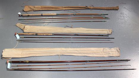
Lot 3099
FISHING. William SCROPE. Days and Nights of Salmon Fishing in the Tweed second edition. London: 1854. 8vo (253 x 146mm.) 2 hand-coloured lithographic plates, occasional uncoloured illustrations. (Some spotting to plates and adjacent leaves.) Original cloth (worn, lower cover detached). And fourteen others relating to fishing (15).


-
85712 item(s)/page